
Why Neckartal zwischen Benningen und Großingersheim mit angrenzenden Gebieten stands out
The protected landscape is best known for its terraced vineyards along the Neckar river and the picturesque Neckar river bend (Neckarknie) that frames the valley between Benningen and Großingersheim. Its combination of riverine countryside, traditional viticulture, and accessible recreational scenery gives it a strong identity as a classic Swabian Neckar valley landscape.
Neckartal zwischen Benningen und Großingersheim mit angrenzenden Gebieten history and protected-area timeline
The protected landscape was designated on 21 February 1985 through a formal ordinance issued by the Untere Naturschutzbehörde (Lower Nature Protection Authority) at the Landratsamt Ludwigsburg. This legal designation under the protected-area framework of Baden-Württemberg recognized the area as a Landschaftsschutzgebiet with the designation number 1.16.038, later referenced as 1.18.047 in the state's protected-area register.
Its creation reflected growing recognition during the late twentieth century that the cultural countryside of the middle Neckar valley, with its long-standing vineyards and riverside scenery, required formal protection against landscape-degrading changes. The ordinance's stated purpose was to preserve the original character of the area, secure its ecological functions, and maintain its suitability as a nearby recreation space for local communities. Documentation of the area was later compiled in the publication "Landschaftsschutzgebiete im Kreis Ludwigsburg," issued by the Landesanstalt für Umwelt, Messungen und Naturschutz Baden-Württemberg.
Neckartal zwischen Benningen und Großingersheim mit angrenzenden Gebieten landscape and geographic character
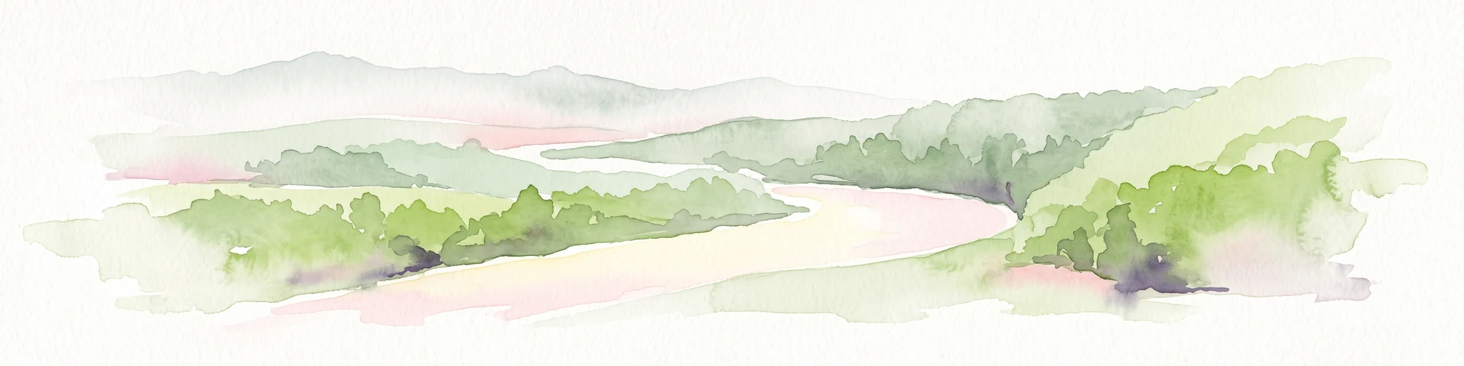
The defining physical feature of the protected area is a pronounced Nagar river bend, or Neckarknie, where the Neckar swings through the countryside southeast of Großingersheim and continues toward Benningen am Neckar. Within a relatively compact stretch, the valley transitions between riverbank flats, gentle slopes, and the rising terrain that marks the edges of the Neckarbecken natural region.
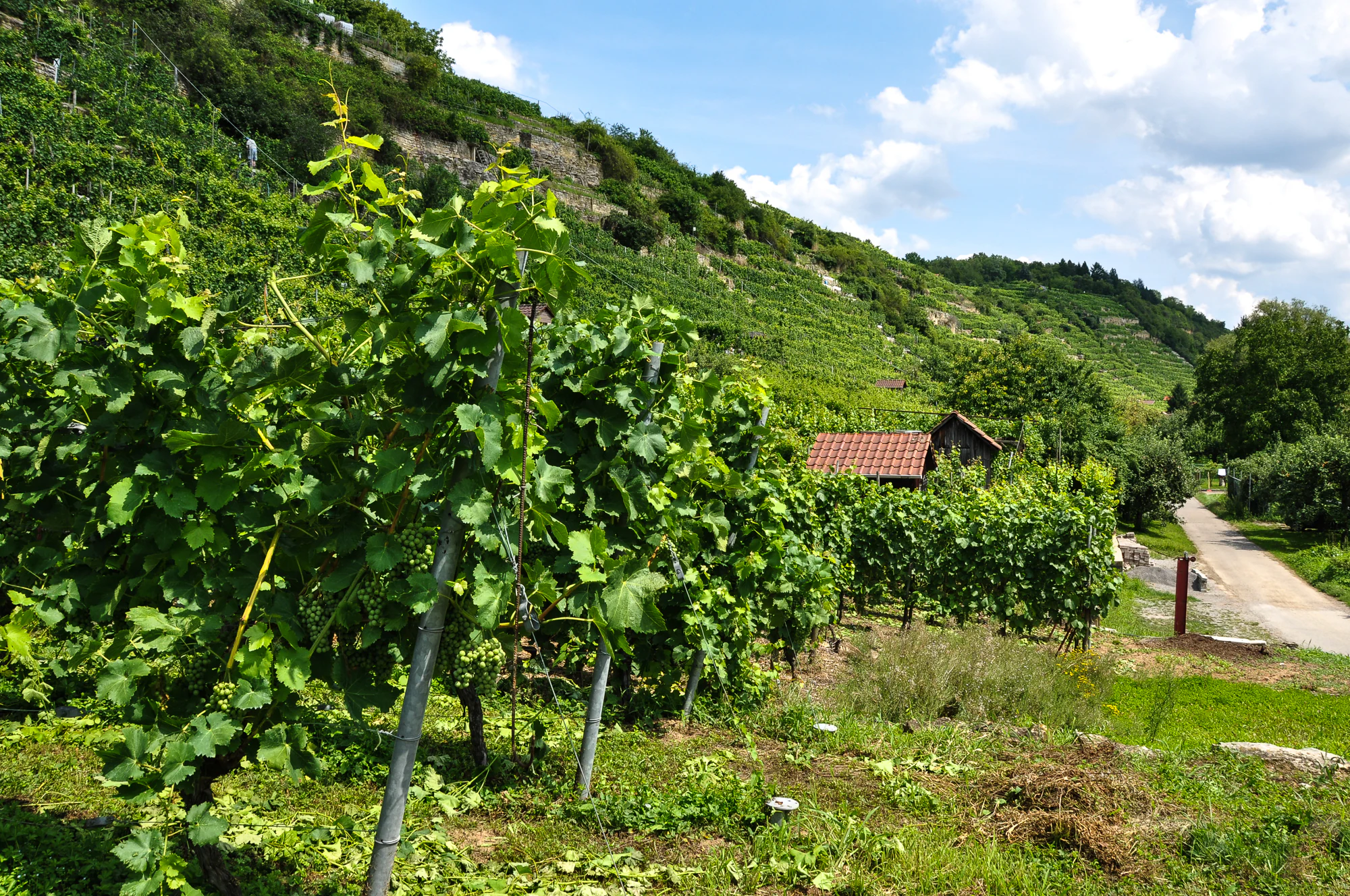
Vineyards form the most visually prominent element of the scenery, historically terraced into the valley slopes above the Neckar and continuing to define the agrarian landscape today. Between these cultivation patches, smaller areas of meadow, orchard, riparian vegetation, and woodland fragments create a layered mosaic of land cover. The river itself, with its floodplain edges and adjacent paths, provides an open visual corridor through the center of the protected area.
This combination of geometric vineyard patterns, soft river-valley topography, and accessible riverside paths gives the area a distinctly Swabian character. It is a working cultural landscape rather than a wild or remote one, yet its visual rhythm and ecological diversity are precisely the qualities that justified its formal protection.
Neckartal zwischen Benningen und Großingersheim mit angrenzenden Gebieten ecosystems, habitats, and plant life
Ecologically, the protected area functions as a representative example of the mixed-use countryside of the middle Neckar valley. The mosaic of vineyards, meadows, hedgerows, orchards, riparian zones, and small woodlands supports a varied community of native plant and animal species typical of southern German riverine landscapes.
The riverbanks of the Neckar itself form an important ecological element, with their transitional habitats between aquatic and terrestrial environments. Smaller water features, side valleys feeding into the Neckar, and the sloping vineyard edges further increase habitat diversity within the area. This habitat complexity, rather than any single dominant ecosystem type, is what gives the protected area its ecological identity.
Neckartal zwischen Benningen und Großingersheim mit angrenzenden Gebieten wildlife and species highlights
The varied habitats of the Neckartal between Benningen and Großingersheim support the native fauna typical of warm, dry, mixed-use countryside in the Neckar basin. Vineyard edges, meadow strips, orchard areas, and riverside vegetation together provide foraging, nesting, and shelter opportunities for a range of bird species, small mammals, and insects adapted to traditional Swabian agricultural landscapes.
The river and its immediate banks add an aquatic dimension, supporting wildlife communities associated with the flowing water and its banks. The overall wildlife value of the area lies less in any single flagship species and more in the maintained presence of a working traditional countryside that continues to function as habitat for native species.
Neckartal zwischen Benningen und Großingersheim mit angrenzenden Gebieten conservation status and protection priorities
Conservation significance lies in the long-term preservation of a traditional Swabian river valley cultural landscape within a region experiencing increasing suburban and infrastructural pressure from the greater Stuttgart area. By formal designation as a Landschaftsschutzgebiet, the area gains protection against disruptive changes that could fragment its mosaic of vineyards, meadows, and riverside habitats.
The protection framework specifically targets visual and ecological coherence: maintaining the original character of the landscape, preserving habitat for native flora and fauna, keeping the area ecologically functional in relation to the natural balance of the valley, and ensuring it remains a healthy nearby recreation space for residents. As an IUCN Category V protected area, it represents a conservation approach that integrates the safeguarding of a working landscape with its continued traditional use.
Neckartal zwischen Benningen und Großingersheim mit angrenzenden Gebieten cultural meaning and human context
The Neckar valley around Benningen, Marbach, and Freiberg has a long cultural identity tied to viticulture, riverside trade, and the literary heritage of the region, with nearby Marbach being famous as the birthplace and archive home of Friedrich Schiller. The protected landscape itself reflects generations of agricultural shaping of the valley slopes into productive vineyards and orchards, embodying the enduring relationship between local communities and the Neckar.
Traditional land-management practices, including the maintenance of vineyard terraces, orchard meadows (Streuobstwiesen), and small-scale farming on the valley edges, continue to define the cultural context of the area. These practices are recognized both as living heritage and as integral components of the habitat diversity that justifies the area's protected status.
Top sights and standout views in Neckartal zwischen Benningen und Großingersheim mit angrenzenden Gebieten
The protected area's standout qualities are its picturesque Neckarknie, its sweeping terraced vineyards, and its accessible riverside scenery that anchors a working cultural landscape. As a formally designated Landschaftsschutzgebiet, it offers a preserved example of how traditional Swabian viticulture, mixed countryside, and the Neckar's natural setting can coexist within a protected framework that still welcomes public enjoyment.
Another defining highlight is its role as a nearby recreational landscape (Naherholungsgebiet) for the densely populated municipalities of the Landkreis Ludwigsburg, providing a green and visually coherent counterpoint to suburban development pressures from the Stuttgart metropolitan region.
Best time to visit Neckartal zwischen Benningen und Großingersheim mit angrenzenden Gebieten
Late spring through early autumn is generally the most rewarding period to experience this Neckar valley landscape. In late spring and early summer, the vegetation across meadows, vineyards, and riverside paths is at its most lush, and orchard trees and wildflowers contribute color to the countryside.
Late summer and early autumn align with the grape harvest season along the valley slopes, when vineyards are at their most visually active and the surrounding communities celebrate the agricultural cycle. Winter visits tend to be quieter and offer clearer long-distance views across the bare valley contours, though the leafless season reveals more of the underlying land-use patterns shaped by centuries of cultivation.