
Mori Atlas logo
Protected areaNissum Fjord

Understanding the ecological boundaries, lagoon basins, and dune terrain of this vital wetland habitat

Nissum Fjord Protected Area: A Mapping of Coastal Lagoons and Dune Landscapes in Western Denmark

(Natura 2000 site no. 65 Nissum Fjord)

Nissum Fjord represents a significant brackish lagoon system located along the western coast of Region Midtjylland. This protected area encompasses an 11,000 hectare mosaic of shallow water basins, shifting dune barriers, and rare freshwater lake environments. The geography is defined by the tension between the North Sea's active dune systems and the sheltered, nutrient-rich wetlands that serve as a critical staging ground for migratory waterbirds and diverse coastal flora.

coastal lagoonbrackish lagoonwetland reserveRamsar siteNatura 2000bird protection area
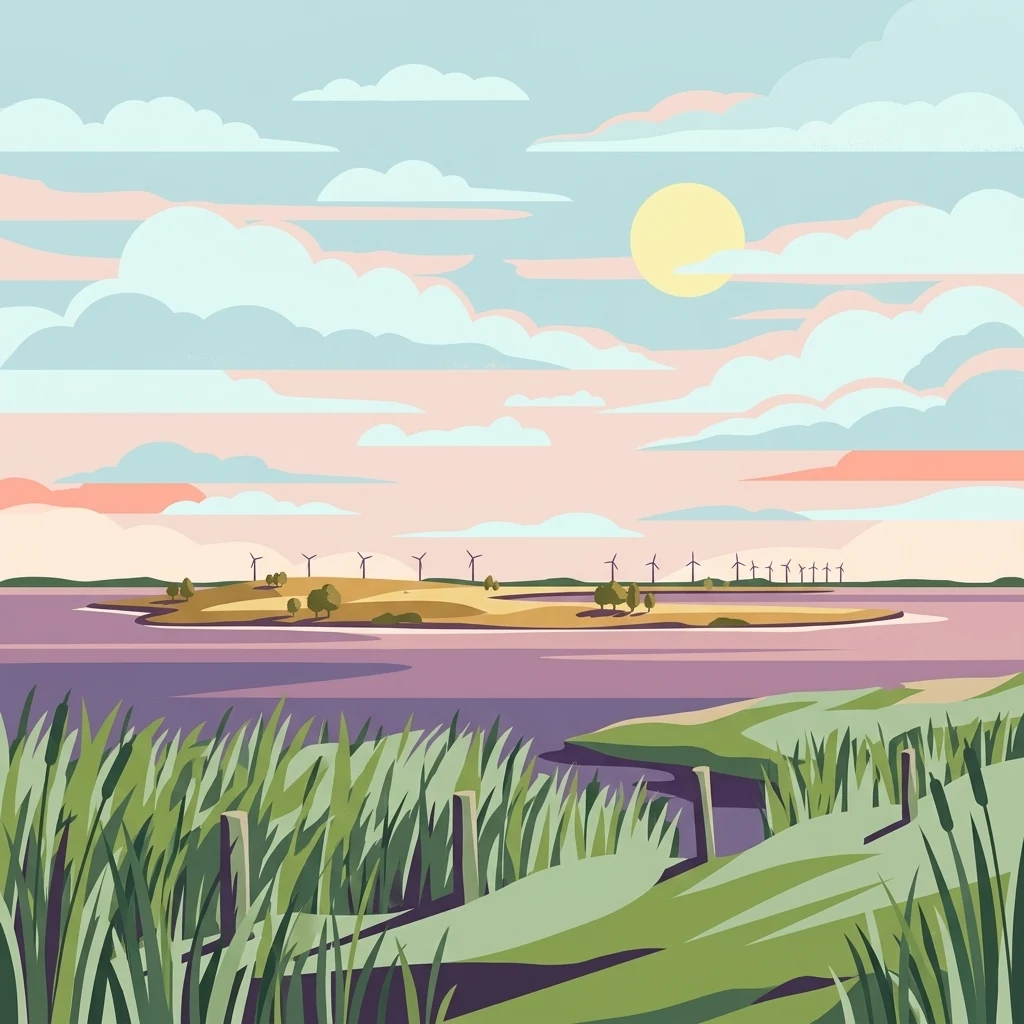
A flat-style digital illustration of a calm, purple-toned lagoon with grassy banks in the foreground and a distant island with wind turbines under a soft sunrise or sunset sky.

Nissum Fjord

Protected area

Park overview

Structured park overview, official facts, and landscape profile for Nissum Fjord

Nissum Fjord park facts, protected area profile, and essential visitor context

Review the core facts for Nissum Fjord, including designation, size, terrain, visitor scale, habitats, and operating context in one park-focused overview.

About Nissum Fjord

Nissum Fjord is a protected coastal wetland complex on the western side of central Jutland, in the municipalities of Lemvig and Holstebro. Although called a fjord, it is in ecological terms a brackish lagoon, lying behind a long, narrow spit of dunes called Bøvling Klit, which separates it from the open waters of the North Sea. A tidal sluice at the fishing village of Torsminde controls the exchange of water between the lagoon and the sea, giving the fjord its characteristically variable salinity and very shallow depths.

The lagoon system covers a wide area and is divided into three main basins referred to as the outer fjord (Yderfjord and Bøvling Fjord), the middle fjord, and the inner basin near Felsted Kog. Water depths are remarkably shallow throughout, with an average of only about one meter and maximum depths of roughly two to two and a half meters, which makes the lagoon exceptionally productive for aquatic vegetation and small fish species.

A network of streams flows into the lagoon, including Ramme Å, Fåre Mølleå, Flynder Å, Damhus Å, and the larger Storå, which also supports a regionally important salmon population. Inland from the lagoon, the protected area includes several notable lake basins. Indfjorden is a brackish lake of about 229 hectares south of Bøvlingbjerg, while Byn, Søndersund, and Tang Sø are smaller shallow lakes each surrounded by narrow belts of meadow and important for their rare aquatic plant communities. The small uninhabited island of Fjandø, covering about 40 hectares, lies in the southwestern part of the fjord near the Nørre Fjand peninsula.

The site is integrated into both Danish and European conservation frameworks. It is a Natura 2000 habitat area and bird protection area, a designated Ramsar wetland of international importance, and a national wildlife reserve in which the entire lagoon and surrounding land areas are protected for resting and breeding waterfowl. Together, these designations make Nissum Fjord a key reference site for understanding Danish coastal lagoon ecology and bird migration along the western flyway.

Quick facts and research context for Nissum Fjord

Nissum Fjord is a Natura 2000 site located in Region Midtjylland, spanning both Lemvig and Holstebro municipalities on the western coast of central Jutland in Denmark. The protected area covers approximately 10,967 hectares, of which about 6,430 hectares form the brackish lagoon itself. The site is simultaneously classified as habitat area H58, bird protection area F38, and a Ramsar wetland, with a Natura 2000 plan adopted in 2011 guiding its ongoing management.

Protection and recognition

Documented Natura 2000 and Ramsar designations for this protected landscape

Nissum Fjord Protection Status and International Recognition Data

Nissum Fjord holds documented protection status supported by official Natura 2000 networks and Ramsar wetland records. Structured conservation data outlines the established mixed protection scope and international recognition sources associated with the site.
Park context

Deeper park guide and search-rich context for Nissum Fjord

Nissum Fjord history, landscape, wildlife, and travel context

Explore Nissum Fjord through its history, landscape character, ecosystems, wildlife, conservation priorities, cultural context, and seasonal travel timing in a structured park guide built for atlas discovery and search intent.

Why Nissum Fjord stands out

Nissum Fjord is best known for being one of the most important wetland and bird reserves on Denmark's western coast. Its shallow brackish lagoon, backed by an unbroken dune tongue, creates a sheltered staging ground for migratory swans, geese, and ducks, and supports breeding colonies of waders and terns. Beyond its birdlife, the site is recognized for the diversity of coastal and dune habitats it protects, including grey-green dunes, dune heath, sea buckthorn dune scrub, freshwater Lobelia lakes, wet and dry heathland, and species-rich meadows. This combination of lagoon, dunes, heaths, and inland lakes within a single protected boundary gives the area its distinctive ecological identity.
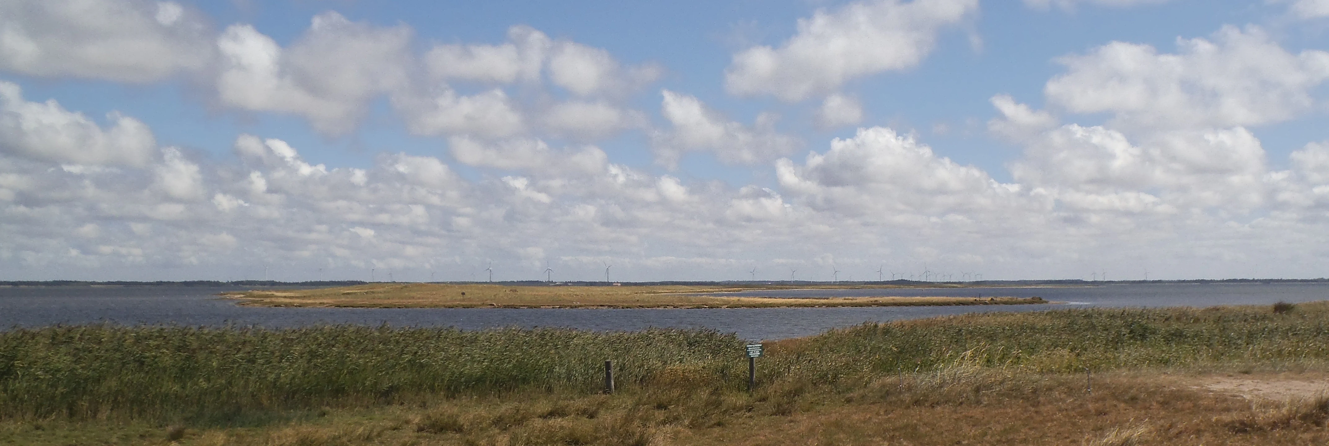
A wide view of a low lying island called Fjando surrounded by the water of Nissum Fjord, with tall grasses in the foreground and a cloudy blue sky above.
Fjando island situated within the calm waters of Nissum Fjord.

Nissum Fjord history and protected-area timeline

The natural setting of Nissum Fjord has shaped the surrounding communities for centuries, with traditional land uses centered on grazing salt meadows, fishing through the Torsminde sluice, and small-scale agriculture along the fen edges. Several formal nature conservation steps established the modern protection of the area.

The earliest significant protection came in 1975, when an area of about 230 hectares north of Indfjorden, along the eastern edge of Bøvling Fjord and known as Krogsted Enge, was placed under conservation order. The purpose of this designation was to prevent the extensive embankment and drainage of meadows, recognizing their value for botany, birdlife, and landscape character.

In 1984, two further nature reserves were established. The first protects some 655 hectares north and south of Torsminde, covering Bøvling Klit and the adjacent Holmen area, with the explicit aim of safeguarding the birdlife of the dunes and lagoon shore. The second, also in 1984, protects three small areas totalling about 15.8 hectares on the Nørre Fjand peninsula at the southern end of the fjord, combining archaeological interests with limits on summerhouse development on its heather-covered and plantation areas.

In 2011, a coordinated Natura 2000 plan was adopted for the site, covering both Lemvig and Holstebro municipalities, with binding action plans developed by the municipalities and the Danish Nature Agency. This plan is coordinated with the water plan for the main catchment 1.4 Nissum Fjord and has been continued and refined in subsequent planning periods.

Nissum Fjord landscape and geographic character

The landscape of Nissum Fjord is defined by the contrast between open water and a curving wall of sand. The narrow dune tongue of Bøvling Klit runs along the western edge of the lagoon, separating it from the North Sea and giving the inland shore a sheltered, lagoon-like character. Behind this dune line, the terrain transitions inland from sandy shore ridges and dune slacks into broader meadows, heaths, and plantation edges.

The dune system itself is highly structured, encompassing embryo and shifting dunes further seaward, grey-green fixed dunes, dune heath, sea-buckthorn dune scrub, and dune slacks where moisture collects. Moving eastward, the scenery shifts from sand to wet meadows, reedbeds, and the fen-like surroundings of the smaller inland lakes. Heathland habitats, both wet and dry, appear on the better-drained sandy soils, while the immediate shores of the lagoon include shingle beach ridges and annual strandline vegetation.

The fjord occupies three connected basins, each only a meter or two deep, giving the water surface a calm, lake-like appearance that contrasts with the active dune front facing the sea. The small island of Fjandø and the Nørre Fjand peninsula break up the otherwise smooth shoreline in the southwest, while rivers such as Storå and Flynder Å enter the lagoon across flat, low-lying meadows. Streams that never reach the sea create additional elements of the landscape through small Lobelia-type clear-water lakes and nutrient-rich pond systems, producing a layered mosaic of lagoon, dune, fen, and inland lake environments.

Nissum Fjord ecosystems, habitats, and plant life

The ecological character of Nissum Fjord arises from the proximity of saline, brackish, and freshwater habitats within a single protected landscape. The lagoon itself is classified as a coastal lagoon habitat, supporting submerged aquatic vegetation that benefits from its shallow, sunlit waters. Along the shore, beach ridges, annual strandline plant communities, and perennial salt meadows form a graded transition from open water to terrestrial habitat.

Inland from the dunes, the protected area preserves a sequence of dry and wet habitats, including grey-green dunes, dune heath dominated by heather communities, sea-buckthorn dune thickets, and dune slacks. Further from the coast, dry heath, wet heath, acidic grassland, periodically wet meadows, and rich fen communities contribute to a layered vegetation profile that shifts with soil moisture and distance from the sea.

The freshwater lakes inside the site are among its ecologically most distinctive elements. Indfjorden is a sizeable brackish lake, while Byn, Søndersund, and Tang Sø are smaller shallow lakes hosted in sand-dominated catchments. Byn in particular is nationally important for rare submerged aquatic plants, with a significant number of red-listed and yellow-listed species and unique populations of plants such as syllblad and water-pepper water-crowfoot. Several lake habitat types are represented, including oligotrophic Lobelia lakes, stonewort lakes, shallow nutrient-rich lakes, and small rivers, supporting a wide gradient of aquatic plant communities.

Nissum Fjord wildlife and species highlights

Nissum Fjord lies on the western flyway along Denmark's west coast, making it a major staging and resting site for migratory birds. In spring and autumn the lagoon hosts large flocks of dabbling ducks, especially wigeon, mallard, and teal, many of which concentrate in the quieter Bøvling Fjord. Swans and geese are also prominent, with mute swan, whooper swan, tundra swan, pink-footed goose, barnacle goose, and light-bellied brent goose all recorded as visitors.

The site is equally important for breeding birds. Protected breeding species include bittern, marsh harrier, spotted crake, pied avocet, Kentish plover, dunlin, ruff, sandwich tern, common tern, Arctic tern, and little tern. Coastal waders such as the black-tailed godwit use the meadows around the lagoon, while shelduck, pintail, goosander, and red-breasted merganser are among the waterfowl that make seasonal use of the protected waters.

In addition to birds, Nissum Fjord hosts a number of protected fish and mammal species tied to its aquatic systems. Fish species of conservation interest include sea lamprey, brook lamprey, river lamprey, twaithe, and Atlantic salmon, the latter supported by an active stocking program in the Storå river system. The site also supports otter, an important freshwater mammal indicator, and the aquatic plant water soldier, which together illustrate the broader biodiversity value of the lagoon, its streams, and its inland lake habitats.

Nissum Fjord conservation status and protection priorities

Nissum Fjord carries one of the strongest conservation profiles of any Danish coastal wetland. It is designated as a Natura 2000 habitat area and bird protection area, classified as internationally important under the Ramsar Convention on Wetlands, and declared a national wildlife reserve covering the entire fjord and adjacent land areas around Bøvling Fjord, Torsminde Tangen, Fjandø, and Felsted Kog. These overlapping layers of protection reflect the site's significance for both European biodiversity policy and international waterbird conservation.

Inside the Natura 2000 area, a wide range of habitats is listed as requiring active conservation, including lagoon, beach ridges, annual strandline vegetation, perennial salt meadows, dune habitats of multiple types, dune heath, dune scrub, dune slacks, inland dunes with woody and grassy vegetation, clear-water lakes, and various fen, meadow, and woodland types. Species of community interest such as sea lamprey, brook lamprey, river lamprey, twaithe, salmon, otter, and water soldier are also covered by the designation, requiring protective measures to maintain their populations.

Management of the area combines habitat protection with active species programs. A regulated fishing closure applies to the entire lagoon, while catch quotas for recreational angling apply in the Storå river system to safeguard Atlantic salmon, which is supported by annual stocking. Together with three statutory nature conservation orders, a Natura 2000 plan adopted in 2011 and coordinated with the water plan for catchment 1.4 Nissum Fjord, the framework aims to maintain the breeding and staging function of the site for waterbirds, protect its rare plant communities, and preserve a coherent mosaic of coastal, dune, and freshwater habitats in one of western Denmark's most ecologically important regions.

Nissum Fjord cultural meaning and human context

The cultural context of Nissum Fjord is tied to the long interaction between local communities and a low-lying, productive coastal landscape. Salt meadows around the lagoon have traditionally been used for grazing, while the sluice-controlled connection to the North Sea at Torsminde has shaped fishing livelihoods for generations. Small settlements such as Torsminde, Fjand, and the inland villages near Indfjorden and Nees reflect a way of life organized around the rhythms of the lagoon, the dune barrier, and the streams that feed into the fjord.

The conservation orders themselves reflect this cultural layering. The 1975 protection of Krogsted Enge was motivated not only by natural values but also by the desire to prevent a dramatic transformation of the rural landscape through embankment and drainage. Similarly, the 1984 protection of the Nørre Fjand peninsula recognized both the archaeological interest of the area and the need to limit summerhouse development, preserving a balance between traditional land use and modern pressures that remains central to how the Nissum Fjord region is understood today.

Top sights and standout views in Nissum Fjord

Nissum Fjord brings together four strong points of distinction: a large shallow brackish lagoon, an unbroken dune barrier on the west coast of Jutland, nationally important bird habitats, and a connected system of rare inland lakes. The site functions simultaneously as a Ramsar wetland, a Natura 2000 habitat and bird protection area, and a national wildlife reserve, placing it among the most strongly protected coastal areas in Denmark.

The protected lakes Byn and Indfjorden add an unusual botanical dimension, with rare submerged aquatic plant communities that have national significance, while the surrounding heath, meadow, and dune habitats create a near-complete mosaic of western Jutland coastal environments within a single area.

Best time to visit Nissum Fjord

Nissum Fjord changes markedly through the year. Spring and autumn migration bring the largest concentrations of waterfowl, with thousands of dabbling ducks, swans, and geese using the lagoon and meadows as staging areas along the western flyway. In late spring and early summer, breeding terns, waders, and marshland species become more visible in the quieter basins and around the dune slacks.

Summer offers the lushest experience of the meadows, reedbeds, and dune heath, with full vegetation cover and active breeding bird displays. Winter can be quieter for visitors but brings large flocks of swans and geese to the inland parts of the protected area, particularly in milder weather. Overall, spring and autumn are the strongest periods for bird-focused visits, while summer rewards visitors interested in dune landscapes and meadow vegetation.

Monthly climate preview

Long-term representative point measurements tracking monthly temperature and precipitation rhythm

Nissum Fjord Climate Normals and Measured Annual Temperature Patterns

Nissum Fjord records long-term monthly temperature and precipitation normals derived from representative coordinate sampling across the region. Reviewing the complete twelve-month climatology profile reveals detailed thermal ranges and moisture distribution patterns.
Annual mean9 °C
2 °C17 °C
Jan
Feb
Mar
Apr
May10°
Jun14°
Jul16°
Aug17°
Sep14°
Oct11°
Nov
Dec
Warmest month
August

16.9 °C

Coolest month
February

2.4 °C

Wettest month
October

3.3 mm/day

Driest month
April

1.6 mm/day

Park location guide

Geography guide, regional context, and park location map for Nissum Fjord

Nissum Fjord park geography, regions, and map view in Denmark

Understand where Nissum Fjord sits in Denmark through a broader geographic reading of the surrounding landscape, nearby location context, and its mapped position within the national park landscape.

How Nissum Fjord fits into Denmark

Denmark is a constitutional monarchy and Nordic country in Northern Europe. It is the southernmost of the Scandinavian countries, bordering Germany to the south, Norway to the north, and Sweden to the southwest. The country consists of the Jutland peninsula and an archipelago of islands, with Copenhagen as its capital and largest city. Denmark has a population of over 6 million and is characterized by flat, arable land, sandy coasts, and a temperate climate.

Wider geography shaping Nissum Fjord in Denmark

Denmark occupies the Jutland peninsula and roughly 406 islands in Northern Europe. It is situated between the North Sea to the west and the Baltic Sea to the east. The country borders Germany to the south and is connected to Sweden via the Øresund Bridge. Denmark is predominantly flat terrain with low elevation, the highest point being Møllehøj at 170.86 meters.

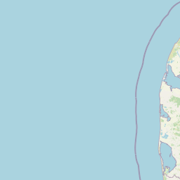
Map view of Nissum Fjord

Use this park location map to pinpoint Nissum Fjord in Denmark, understand its exact geographic position, and read its mapped placement within the surrounding landscape more clearly.

Pigeon | © OpenStreetMap contributors

Location context for Nissum Fjord

Region Midtjylland
Recorded earthquake history

Explore Historical Earthquake Records Associated with Nissum Fjord

Review the recorded history of seismic activity in the vicinity of the Nissum Fjord protected area. This catalogue, powered by MoriAtlas, provides access to geolocated earthquake events to help you better understand the historical seismic context of this significant Danish wetland landscape.

Nissum Fjord Earthquake Records

Catalogued events

2 events

Strongest magnitude

Magnitude 3.8

Most recent event

Sep 16, 2018

This history includes earthquakes recorded inside the park or within 50 km of its borders

Explore protected area views, brackish waters, and wetland environments across western Jutland

Nissum Fjord Landscape Photos and Scenery: Visualizing the Coastal Lagoon and Dune Habitats

Visual records capture the striking contrast between open brackish water and the curving dune barrier separating the lagoon from the North Sea. Detailed photography reveals local wetland habitats, low-lying meadows, and diverse coastal terrain within the protected boundary.

A wide view of a low lying island called Fjando surrounded by the water of Nissum Fjord, with tall grasses in the foreground and a cloudy blue sky above.

Park atlas

Compare regional wetland reserves and coastal nature habitats across western Jutland

Parks Near Nissum Fjord and Surrounding Protected Coastal Landscapes

Browsing parks near Nissum Fjord reveals connected wetland reserves, dune systems, and coastal habitats across the surrounding region. Extending the geographic comparison helps trace broader protected landscapes and regional ecological patterns beyond a single lagoon.
Nature reserveRegion Midtjylland
1.1 km away#1 closest

South

Husby Sø og Nørresø Nature Reserve: Protected Wetland Landscape in Region Midtjylland

Coastal plain geography and shallow lake habitat mapping

Situated in the coastal landscape of Region Midtjylland, Husby Sø og Nørresø represents a critical nature reserve defined by two interconnected shallow lakes. The protected area features extensive reedswamp margins, bog vegetation, and a human-modified marine foreland, hosting high aquatic plant diversity that remains central to the region's conservation identity.

Area
3.52 km²
Established
2011
Relief
Lowland
Climate
Temperate
Protected areaRegion Midtjylland
10 km away#2 closest

South

Kimmelkær Landkanal: Mapped Protected Area and Regional Geography in Midtjylland

A rare aquatic habitat within the Ringkøbing Fjord water system.

Focusing on a narrow canal corridor, Kimmelkær Landkanal serves as a vital protected area for threatened aquatic species. Its geography is characterized by soft sandy sediments and a distinct parallel channel structure, connecting small watercourses to the larger wetland ecosystems of the Stadil Fjord catchment area.

Area
0.03 km²
Established
2011
Relief
Lowland
Scope
Terrestrial
Protected areaDenmark
About 12 km away#3 closest

South

Natura 2000 area no. 66 Stadil Fjord og Vest Stadil Fjord Coastal Wetland Complex

Protected lagoon and dune landscape in western Jutland, Denmark.

Natura 2000 area no. 66 Stadil Fjord og Vest Stadil Fjord comprises a significant coastal lagoon system, encompassing shallow brackish waters, reed beds, and surrounding dune heaths. This protected area supports a high degree of botanical diversity and provides essential habitat for various bird species, serving as a primary example of Denmark's complex hydrological and coastal geography.

Area
69.03 km²
Relief
Lowland
Climate
Temperate
Access
Easy access
Nature reserveCentral Denmark Region
About 14 km away#4 closest

Southeast

Heder og klitter på Skovbjerg Bakkeø, Idom Å og Ormstrup Hede Nature Reserve Atlas and Map

Mapping glacial moraine and inland dune landscapes in the Central Denmark Region

The protected area surrounding Heder og klitter på Skovbjerg Bakkeø, Idom Å og Ormstrup Hede comprises extensive inland dunes and heathlands anchored by a Saalian moraine hill island. This site serves as a crucial ecological link, featuring restored riparian stream habitats and rare forest remnants that provide deep insight into Denmark’s post-glacial geological development.

Area
22.14 km²
Established
1985
Relief
Lowland
Scope
Terrestrial
Protected areaDenmark
15 km away#5 closest

North

Nissum Bredning Protected Area: Geography and Coastal Mapping in Denmark

Shallow bay ecosystems, glacial cliffs, and Limfjorden sand flats.

Nissum Bredning is a broad, low-lying basin in western Denmark known for its extensive shallow sand flats, including Fjordgrund and Gåseholm. The protected area encompasses a diverse coastal mosaic of brackish lagoons, salt meadows, and the distinctive Toftum Bjerge glacial cliff. This geography offers a clear view into the intersection of active North Sea currents and sheltered inland fjord environments.

Area
200 km²
Relief
Lowland
Climate
Temperate
Access
Easy access
A pale watercolor landscape painting of a quiet fjord with soft green and pink marshy vegetation in the foreground and rolling hills in the background.
Protected areaRegion Midtjylland
23 km away#6 closest

South

Ringkøbing Fjord og Nymindestrømmen: Coastal Lagoon and Protected Wetland Geography

A vast Danish wetland complex in Region Midtjylland.

Ringkøbing Fjord og Nymindestrømmen defines the Danish west coast through its unique combination of brackish lagoons, salt meadows, and dune belts. This protected area integrates the Skjern Å river delta and the freshwater-lagoon chain of Nymindestrømmen, creating an internationally significant habitat for diverse waterbirds and migratory species across its multi-layered terrain.

Area
276.84 km²
Relief
Lowland
Climate
Temperate
Scope
Mixed
Protected areaRegion Midtjylland
About 23 km away#7 closest

Northeast

Natura 2000-område nr. 62 Veno, Veno Sund: Protected Coastal and Marine Landscape Map

Regional geography and protected coastal habitat overview

Analyze the protected area characteristics of Natura 2000-område nr. 62 Veno, Veno Sund, where shallow brackish sound meets dune heaths and calcareous grasslands. This site provides essential habitat for waders and marine mammals within the broader Limfjorden ecosystem in Region Midtjylland.

Area
29.26 km²
Established
2011
Relief
Lowland
Climate
Temperate
A soft watercolor painting depicting a flat, open coastal landscape with rolling, pale-colored dunes in the distance and muted green grasses in the foreground against a white background.
Protected areaDenmark
27 km away#8 closest

North

Agger Tange Protected Area: Coastal Peninsula and Wetland Geography in Northwestern Denmark

Mapping the North Sea and Limfjorden interface

Agger Tange is a significant coastal landform in northwestern Denmark, characterized by its exposed western dunes and sheltered eastern salt marshes. This protected landscape documents the dramatic influence of storm surges on the Jutland coast, resulting in a complex network of lagoons and tidal flats that support critical bird habitats.

Area
24 km²
Established
1984
Relief
Lowland
Scope
Mixed

Common questions about visiting, size, designation, and location context for Nissum Fjord

Nissum Fjord FAQs for park facts, access, geography, and protected area context

Find quick answers about Nissum Fjord, including protected-area facts, park geography, trail and visitor context, and how the park fits into its surrounding country and regional landscape.
MoriAtlas Explorer

Continue Your Protected Areas Search Across the Global Atlas

Deepen your exploration by continuing the structured search for national parks and protected areas worldwide. Utilize the comprehensive filtering capabilities to compare different conservation landscapes and refine your understanding of global park geography. Discover more about the distribution and characteristics of protected natural areas.

Global natural geography