
Streams
Park geography
Analyzing the physical boundaries, elevation, and terrain characteristics of this protected mountain region.
Geographic Profile of North Cascades National Park in the State of Washington, United States
This geographic profile examines the terrain and administrative scope of North Cascades National Park. Discover documented boundary dimensions covering 2042 square kilometers, elevation data ranging from 120 meters to 2810 meters, and a diverse range of mountain, glacial, and forest landscape features found across the region.
Related tags
Alpine WildernessGlaciersOld-Growth ForestMountain PeaksWilderness
Rugged mountain wilderness with the most extensive glacial system in the contiguous United States
North Cascades National Park
North Cascades National Park is a vast protected wilderness in northwestern Washington State, encompassing over 500,000 acres of the North Cascades mountain range. The park is bisected by the Skagit River and consists of northern and southern sections, separated by Ross Lake National Recreation Area. This remote and rugged landscape features the most extensive glacial system in the contiguous United States, with over 300 glaciers cascading through steep valleys and craggy peaks that rise nearly 9,000 feet from valley floors to summits. The park preserves one of the highest biodiversity ecosystems found in any American national park, with eight distinct life zones supporting thousands of plant and animal species across its dramatic elevation range.
- Location
- United States of America
- Park type
- National park
- Established
- 1968
- Area
- 2,042.3 km²
- Highest point
- 2,810 m
Location overview
Geographic placement and national boundary mapping in Washington
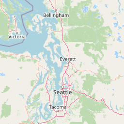
Geographic Mapping of North Cascades National Park in Washington
North Cascades National Park is located within Washington in the United States of America. Records confirm its administrative boundaries contain no transboundary, coastal, island, or marine territories.
- Countries
- United States of America
- Regions
- Washington
- Primary location
- Washington
- Geographic setting
- Inland
Boundary and coordinates
Interactive boundary geometry and calculated geographic measurements
North Cascades National Park Boundary Map and Spatial Extent
Mapped park outlines provide spatial context for the protected area and its surrounding terrain. Derived measurements illustrate total area coverage, geographic span, and coordinate limits without implying legal survey precision.
- Boundary area
- 2,031.5 km²
- Boundary perimeter
- 356.1 km
- Northernmost point
- 49.0009° N
- Southernmost point
- 48.3696° N
- Easternmost point
- 120.6328° W
- Westernmost point
- 121.6391° W
- Geographic centre
- 48.7114° N, 121.2059° W
- North–south span
- 70.2 km
- East–west span
- 74.1 km
Elevation and terrain
Vertical range data and recorded natural features across the protected landscape
North Cascades National Park Terrain and Elevation Summary
Recorded elevation records outline a vertical range spanning from one hundred twenty meters to two thousand eight hundred ten meters across the mountain terrain. Associated cards detail recorded peaks, glaciers, and streams located within the protected boundary.
- Minimum elevation
- 120 m
- Maximum elevation
- 2,810 m
- Highest point
- 2,810 m
Selected named natural features
Streams
Scramble Creek
Peaks
Argyros
2,484 m
Peaks
West McMillan Spire
2,438 m
Peaks
Sahale Mountain
2,646 m
Glaciers
Perdition Glacier
Environmental setting
Temperate mountain relief, dominant forest cover, and major water presence
North Cascades National Park Environmental Classifications and Physical Setting
Recorded classifications group mountainous relief, temperate forest cover, and glacial water features into interpretive categories for the terrain. Structured entries connect these physical attributes to related atlas destinations and geographic contexts.
- Relief
- Mountain
- Climate
- Temperate
- Water
- Major water bodies
- Forest cover
- Dense forest cover
- Seasonality
- Strongly seasonal
Landscape features
Mountains · Valleys · Cliffs · Forest · Grassland · Lakes · Rivers · Glacier
Habitat types
Temperate coniferous forest · Montane forest · Alpine meadow · Lacustrine habitat · Riverine habitat · Glacial habitat · Tundra habitat
Park atlas
Browse adjacent national park geography and surrounding protected landscapes within the North Cascades region.
Discover Related National Parks and Protected Areas Surrounding North Cascades National Park in Washington State
After exploring North Cascades National Park, browse a curated list of national parks and significant protected areas located nearby in the Pacific Northwest region. Compare these diverse conservation landscapes, map their geographic spread, and trace connections across alpine wilderness, glacial terrain, and old-growth forest ecosystems.

Wildlife reserveWashington
Park boundaries overlap#1 closest
South

Glacier Peak Wilderness: Mapping the Volcanic and Glaciated Geography of Washington State
A detailed look at one of the most remote volcanic reserves in the Cascade Range.
Defined by the presence of an isolated stratovolcano and extensive glacial systems, Glacier Peak Wilderness represents a significant protected area within the Washington Cascades. This overview details the rugged landscape, from the deeply incised river valleys of the Chiwawa and Suiattle to the high-alpine rock and ice environment at the peak summit, providing essential geographic context for this roadless wilderness.
- Area
- 2,290.75 km²
- Established
- 1960
- IUCN
- Ib
- Relief
- Mountain
Protected landscapeChelan County
Park boundaries overlap#2 closest
Southeast
Lake Chelan National Recreation Area: Protected Geography and North Cascades Map
Glacial terrain and remote mountain valleys in Chelan County
Lake Chelan National Recreation Area protects a rare transition of alpine environments and river-carved valleys in north-central Washington. The terrain is dominated by the long, deep waters of the lake and the steep ridges of the North Cascades, creating an isolated habitat for wild landscapes and historic inland communities. Explore the physical boundaries and topographic features that define this rugged recreation area.
- Area
- 250.74 km²
- Established
- 1968
- IUCN
- V
- Visitors
- 38.2K annual
Wildlife reserveWashington
Park boundaries overlap#3 closest
Southeast
Lake Chelan-Sawtooth Wilderness: Geographic Atlas and Protected Landscape Overview
North Cascades Wilderness in Washington State
Located in the north-central Cascade Range of Washington, this protected wilderness area contains 63 glacial lakes and extensive alpine terrain. The region offers a complex landscape of cirques, subalpine meadows, and forested valleys that connect directly to the larger North Cascades protected network. Use this atlas to examine its mountainous geography and defined conservation boundaries.
- Area
- 619.4 km²
- Established
- 1984
- IUCN
- Ib
- Relief
- Mountain

Protected landscapeWashington
Park boundaries overlap#4 closest
South
Mount Baker, Snoqualmie National Forest: Mapped Geography and Protected Landscape Analysis
Exploratory atlas of Washington's primary Cascade Range wilderness
Delve into the structural geography of Mount Baker, Snoqualmie National Forest. This protected area corridor serves as a major ecological transition zone between the Puget Sound lowlands and the interior Cascades, characterized by extensive glaciers, wild river systems, and iconic stratovolcanoes that define the regional landscape of Washington state.
- Area
- 6,978 km²
- Established
- 1974
- Relief
- Mountain
- Climate
- Alpine

Wildlife reserveWashington
Park boundaries overlap#5 closest
West
Mount Baker Wilderness: Mapped Volcanic Peaks and Glacial Geography in Washington State
Protected wilderness boundaries in the Northern Cascades
Mount Baker Wilderness encompasses a vast mountain landscape characterized by an active stratovolcano and significant permanent snowfields. The terrain features a vertical gradient from dense west side conifer forests to exposed alpine summits, creating a distinct ecological corridor connected to neighboring protected areas in the Pacific Northwest.
- Area
- 485.58 km²
- Established
- 1984
- IUCN
- Ib
- Relief
- Mountain

Protected landscapeWashington
Park boundaries overlap#6 closest
Southeast
Okanogan, Wenatchee National Forest: A Comprehensive Look at Washington's Protected Mountain Landscapes
Mapping ecological gradients and wilderness boundaries across the eastern Cascade Range
Spanning from the moist coniferous forests of the western Cascades to the arid plateaus of the Okanogan, this massive national forest protects an unmatched diversity of terrain. Explore the intricate geography of river-carved valleys, glacial cirques, and remote wilderness areas that characterize this critical environmental corridor in the Pacific Northwest.
- Area
- 6,066.33 km²
- Established
- 1911
- Visitors
- 397K annual
- Relief
- Mountain

Protected landscapeWashington
Park boundaries overlap#7 closest
Southeast
Ross Lake National Recreation Area: A Glacial Reservoir Landscape in Washington
Mapping the Skagit River and North Cascades alpine corridor
Located in the heart of Washington, Ross Lake National Recreation Area preserves a unique landscape of connected reservoirs and deep, glacier-cut valleys. This protected area acts as a vital geographic link within the North Cascades, offering access to high-altitude peaks, riverine forests, and the distinct turquoise waters of Diablo Lake.
- Area
- 475.81 km²
- Established
- 1968
- IUCN
- V
- Visitors
- 998K annual

State or regional parkBritish Columbia
6.9 km away#8 closest
Northeast

E. C. Manning Provincial Park: A Comprehensive Geographic Atlas and Protected Area Overview
Mountainous terrain and ecological transitions in southern British Columbia
Spanning the cross section of the Canadian Cascades, E. C. Manning Provincial Park preserves a high-elevation landscape of wildflowers, glacial valleys, and mountain ridges. The protected area links temperate coastal rainforests with the arid interior, providing a study in regional hydrology and subalpine ecology defined by the Hozameen Range and the northern reaches of the Pacific Crest Trail.
- Area
- 836.71 km²
- Established
- 1941
- IUCN
- II
- Visitors
- 1.1M annual
MoriAtlas Explorer
Continue Your Exploration of North Cascades National Park's Geography and Protected Lands
Deepen your understanding of North Cascades National Park by exploring its precise mapped boundaries and the surrounding regional geography. This destination within MoriAtlas provides essential context for appreciating the park's protected landscape identity. Continue your atlas exploration to uncover how this significant national park fits into the broader geographic tapestry of Washington and beyond.
Browse next
Global natural geography
Explore related park routes
Explore MoriAtlas Global ParksBrowse All MoriAtlas ParksGlobal Park Map DiscoveryMoriAtlas: Browse All CountriesBrowse All MoriAtlas ContinentsNational Park Environment AtlasGrand Canyon National Park AtlasYellowstone National Park AtlasYosemite National Park Atlas and GeographySerengeti National Park AtlasGalápagos National Park Protected LandscapeBanff National Park Geography and AtlasKruger National Park Atlas EntryUluṟu-Kata Tjuṯa National Park AtlasExplore Uluru-Kata Tjuta National Park GeographyPlitvice Lakes National Park AtlasFiordland National Park Protected LandscapeGreat Smoky Mountains National Park AtlasAfghanistan National Parks and Protected AreasAlbania National Parks and Protected AreasAlgeria National Parks and Protected AreasAmerican Samoa National Parks and Protected AreasAndorra National Parks and Protected AreasAngola National Parks and Protected AreasAntarctica National Parks and Protected AreasAntigua and Barbuda Park List