
Trip Timing Orientation
Choosing the Best Time to Visit the North York Moors National Park
Deciding on the best time to visit the North York Moors National Park requires balancing the pull of high-summer landscapes against the practical realities of a climate defined by elevation and coastal exposure. There is no single universal window for a perfect visit, as the ideal timing shifts significantly depending on whether your priority is the iconic, purple-hued heather bloom, the extended daylight required for long-distance hiking, or the quieter, more contemplative atmosphere of the shoulder seasons.
The heather bloom and high-summer trade-offs
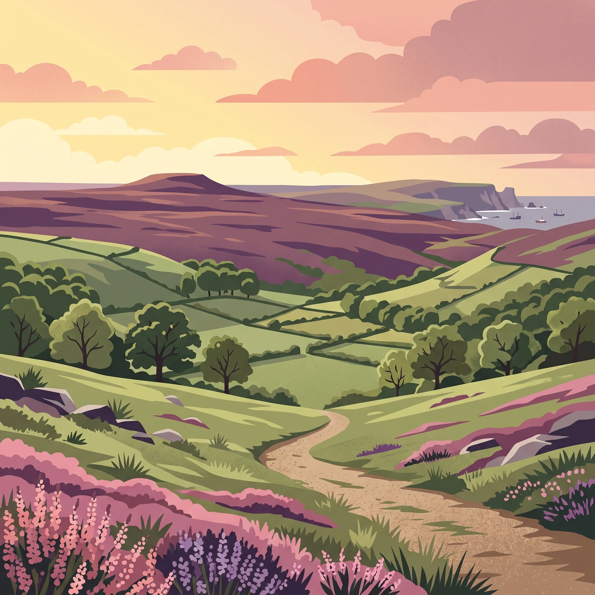
For many travellers, the most distinct experience is seeing the expansive heather moorland in full colour. This phenomenon typically occurs in late summer, creating a vibrant display across the high plateau. While this period offers the peak of the park's visual identity, it is also when you are most likely to encounter other visitors on popular trails. The trade-off for these long, bright days is that the elevation makes the moors prone to sudden shifts in weather, even during the warmest months. The park remains inherently cooler than the surrounding lowlands, and visitors should be prepared for the reality that summer in the North York Moors is rarely synonymous with consistent, intense heat.
Navigating the shoulder season advantages
Those who prefer to avoid peak crowds often find the shoulder months to be a superior alternative. During spring and early autumn, the landscape retains much of its charm, and the temperatures are often well-suited for active exploration. While the daylight hours are shorter than those found in June or July, the cooler, crisp air often provides better visibility for enjoying the dramatic North Sea coastline and the deeply incised valleys. Rainfall patterns remain a persistent factor throughout the year in this region, and those choosing these quieter periods should expect a higher likelihood of damp, misty conditions that are part of the local character. By shifting your visit away from the mid-summer peak, you gain access to a more tranquil experience, though you must accept the increased variability in daily weather and the potential for cooler temperatures that require more versatile layering.
The role of landscape and geography in trip timing
Your choice of timing is also shaped by the park's varied terrain. The difference between the exposed coastal cliffs and the sheltered, wooded dales is significant. In the colder months, the high moors can experience freezing temperatures and challenging winds, making the lower-lying valleys a more inviting prospect. Conversely, in the height of summer, the high ground offers a breeze that provides relief during warmer spells. Recognizing that the North York Moors is not a uniform environment allows you to choose dates that align with the specific type of landscape you hope to traverse, rather than relying on a generalized forecast.
Seasonal Planning
Best Times to Visit the North York Moors for Different Priorities
Peak Moorland Bloom and Warmth
The window from late July through August offers the warmest average temperatures for the park, with mean daily temperatures reaching their annual peak. This period is the primary choice for visitors looking to experience the iconic purple heather in bloom, which defines the visual character of the high plateaus. While these months provide the most daylight for long-distance hiking on the Cleveland Way or traversing the dales, they are also associated with higher average rainfall levels compared to the drier spring months. Travelers choosing this window should prioritize flexibility, as the coastal and upland weather remains dynamic even at the height of summer.
The Drier Shoulder Seasons
For those who prioritize walking conditions over the specific aesthetic of the heather, May and June represent distinct advantages. During these months, the park experiences some of its lowest average precipitation levels alongside steadily increasing daylight hours. May, in particular, offers a balance of moderate temperatures and a landscape transitioning into full spring growth, often providing clearer visibility for the coastal cliffs and moorland vistas. This period is well-suited for visitors who wish to avoid the peak heat of late summer while benefiting from the longest days of the year, which approach 17 hours in June. The trade-off is that the signature heather bloom will not yet be visible, as the landscape is dominated by the greens of the valley pastures and woodland foliage.
The Atmospheric Autumn Transition
September serves as a unique bridge period that retains much of the late-summer warmth while experiencing a gradual shortening of daylight. The heather bloom often persists into the early part of this month, offering a final opportunity for those who missed the mid-August peak. As the month progresses, the park experiences a rise in wind speeds and a noticeable shift in light, which many visitors find ideal for photography. By October, the climate shifts toward cooler temperatures and higher precipitation, signaling a transition into the late-autumn phase. This period is recommended for visitors who prefer a quieter environment and are prepared for the characteristic variability of Yorkshire weather, which often involves quick shifts between sunshine and mist across the high moorland.
Annual Climate Overview
North York Moors Weather and Climate by Month
The Annual Temperature Progression and Seasonal Shifts
Understanding the climate of the North York Moors requires looking beyond the broad classification of a UK national park. The temperature profile follows a distinct bell curve that dictates the practical comfort level for outdoor activity. From the coldest annual point in January, where average daily minimums often dip below freezing, to the summer peak in July and August, the temperature swing is meaningful. While mid-summer days frequently see maximums hovering around 23 degrees Celsius, these figures are climate normals, not localized forecasts. Visitors should anticipate that the open nature of the high moorland plateau, with its average elevation, often results in real-feel temperatures lower than the reported mean, especially when cloud cover or coastal influences from the nearby North Sea come into play.
Precipitation Patterns and Humidity Trends
Rainfall in the Moors is a persistent presence rather than a seasonal event, but its intensity and frequency fluctuate across the year. The climate data indicates that while the park remains relatively humid throughout all twelve months, the months from October through January exhibit the highest humidity levels, frequently exceeding 90 percent. This corresponds with a period where the landscape can become particularly saturated. Conversely, the spring months of April and May represent the driest phase in the annual cycle. While the total precipitation volume does not necessarily drop to extreme lows, the reduction in frequency compared to the wetter autumn and winter months offers a more reliable window for extended outdoor exploration. It is essential to remember that these averages represent regional trends, and the park’s complex geography, including deep dales and elevated plateaus, can cause significant localized variation in rain and visibility.
The Relationship Between Daylight and Wind Exposure
Daylight duration acts as a primary constraint for logistics in the North York Moors. The variation is stark, swinging from roughly 7 hours of daylight in December to nearly 17 hours during the solstice in June. This daylight discrepancy significantly alters the viable window for long-distance hikes on trails like the Cleveland Way. As daylight wanes significantly from September through November, the planning required for safe navigation increases. This reduction in daylight often coincides with an increase in wind speeds, which are at their most persistent during the winter months. Even in the height of summer, the exposure on the high plateau means that wind is rarely absent. While wind speeds are lower on average during the warmer months of June and July, the combination of elevation and proximity to the coast ensures that wind chill is a factor worth considering for any trip, regardless of the calendar month. These long-term normals provide a baseline for what to expect, yet they serve as a guide for typical conditions rather than a guarantee for any specific date.
Seasonal dynamics
Annual weather phases and seasonal transitions in the North York Moors
The seasonal rhythm of the North York Moors is defined less by dramatic, sudden shifts and more by gradual transitions between distinct environmental phases. While the calendar suggests four traditional seasons, the local reality is better understood as a series of wind-driven and light-sensitive windows that dictate how the moorland plateau and coastal cliffs respond to the North Sea influence.
The Ascending Light and Drier Spring
From late April through June, the park enters its most stable phase for navigation and outdoor activity. This period is defined by a significant increase in daylight, which extends to nearly 17 hours by late June, and a distinct reduction in wind intensity compared to the winter months. Visitors will notice the landscape beginning to stir as the moisture levels in the ground begin to recede, providing a window where the deeply incised dales are more accessible for extended walks. This phase stands in direct contrast to the preceding winter period, offering the most consistent conditions of the year for those prioritizing extensive exploration of the high moorland plateau.
The Peak Bloom and Summer Wind Patterns
July and August mark the height of the park's biological activity, centered on the iconic heather bloom. During these months, temperatures reach their annual peak, though the influence of the North Sea ensures that coastal areas and high ridges remain temperate rather than stifling. This is not a static summer, however. As August transitions into September, visitors may observe a subtle shift in the air, with winds beginning to increase in strength as the atmospheric conditions move toward the autumnal transition. While these months offer the longest days, the weather remains susceptible to sudden cloud cover and localized precipitation, which are characteristic of the elevated topography.
The Autumnal Transition and Shortening Days
By mid-September, the park shifts into a period of atmospheric cooling and accelerating light loss. This transition phase is marked by a return to more volatile weather patterns, where the contrast between the warmer valleys and the cooling, exposed moors becomes more pronounced. Precipitation frequency begins to rise through October and November, and the relative humidity climbs steadily toward the winter maximums. This period is defined by a mood shift, as the purple heather fades and the woodlands take on a more rugged appearance. It is a critical window for visitors to expect greater variability in daily conditions compared to the relative stability of the early summer months.
The Winter Phase and High-Altitude Exposure
From November through March, the park enters its most challenging environmental phase. This period is characterized by the shortest daylight hours, reaching a minimum in December, and the most consistent wind exposure across the plateau. The combination of high relative humidity, often exceeding 90 percent, and lower temperatures creates a landscape where trail conditions can change rapidly. While the park does not adhere to a rigid snow season, the elevated nature of the terrain means that frost and icy conditions are regular features of the winter experience. This phase represents the most significant departure from the milder, more accessible months and requires a different approach to activity planning and terrain selection.
Seasonal Experiences
What Visiting the North York Moors is Like Throughout the Year
Moorland Rhythms and the Heather Bloom
The most defining experience of the North York Moors, the vast expanse of heather turning a deep purple in late summer, is inextricably linked to the biological cycle of Calluna vulgaris. This spectacle, typically most vibrant in August, transforms the high, exposed plateau into a sea of colour. Visitors planning their trip around this phenomenon should note that the peak intensity relies on the specific rainfall and temperature trends of the preceding months. While the purple bloom is the hallmark of late summer, the experience of the high moorland changes significantly in the cooler, shoulder months. In early spring, the landscape is defined by the starkness of the peat and the emergence of life, while the autumn transition brings a different, muted palette that appeals to those seeking solitude rather than the mid-summer crowds.
Accessing the Deep Dales and Ancient Woodlands
The park's sheltered dales, such as Farndale and the Esk Valley, provide a stark experiential contrast to the wind-swept moorland plateau. In spring, these areas are often sought for the carpeting of wild daffodils in the valleys, a delicate event that is highly sensitive to the local temperature variations of late March and April. The ancient, sessile oak woodlands, particularly in the southwest of the park, offer a degree of shelter from the winds that frequently buffet the open plateau. These forested regions provide a more consistent experience throughout the year, as the dense canopy provides protection during the windier, cooler months of late autumn and winter. Unlike the open moorland, which is significantly impacted by daylight duration and wind speed, these woodland trails remain visually and physically engaging even when the days are shorter, provided the ground conditions are managed appropriately.
Coastal Dynamics and Fossil Exploration
The Jurassic coastline serves as an outdoor laboratory for fossil hunters, with iconic locations like Robin Hoods Bay and Ravenscar offering continuous interest regardless of the month. However, the experience of exploring these cliffs is heavily influenced by the seasonal shift in wind speeds and tide patterns. While summer offers the benefit of longer daylight hours for lengthy walks along the Cleveland Way, the cooler months provide a different perspective on the coastal geology. Visitors should recognize that the coastal climate is rarely stable; the wind speeds recorded throughout the year necessitate flexible planning. Exploring the fossil-rich exposures is less about the season and more about respecting the tidal cycle, which remains the primary constraint for safe access to the beach-level cliffs. Whether visiting in the milder, drier windows of late spring or the more volatile autumn months, the coastal experience remains anchored in the interaction between the high-energy North Sea and the fragile Jurassic rock layers.
Visitor Priorities
Optimizing Your North York Moors Visit Based on Travel Priorities
Prioritizing Extended Daylight for Long Distance Hikes
For travellers whose primary objective is to cover significant distances on trails such as the Cleveland Way or the Lyke Wake Walk, the months of May, June, and July are the most advantageous. During this period, the park experiences its peak daylight duration, reaching approximately 16.8 hours in June. This extended light provides a critical margin of safety and flexibility, allowing for longer daily excursions without the risk of navigating uneven moorland terrain in the dark. While these months offer the best light, the trade-off is the natural moisture of the moorland, which remains, even in the driest statistical windows. Hikers should anticipate that even on clear days, ground conditions can be soft and uneven, requiring footwear that is both stable and water-resistant regardless of the monthly precipitation averages.
Seeking Milder Temperatures and Drier Paths
Visitors who prioritize comfort and drier ground conditions should look toward the late spring and early summer transition, specifically May and June. During these months, the park experiences lower average wind speeds,dipping toward 4.6 m/s in June,and higher maximum temperatures that typically reach 19 to 22 degrees Celsius. This window represents the best balance between rising ambient warmth and the relatively lower probability of sustained rainfall compared to the wetter autumn months. The trade-off for this preference is the cooling effect of the North Sea breeze, which is particularly pronounced along the coastal cliffs. Even when the inland dales are warm, temperatures near the coastline can drop sharply, requiring layers that can be adjusted rapidly to account for this microclimate shift.
Capturing the Iconic Heather Bloom
For those drawn specifically to the purple-hued landscape of the heather bloom, August is the most reliable timeframe. This visual transformation of the high plateau is a distinct environmental event rather than a general seasonal feature. Choosing August necessitates an acceptance of higher visitor interest and more variable weather patterns compared to the preceding months. By August, the average rainfall begins to climb slightly compared to the spring months, and the wind speeds begin their gradual increase as the transition toward autumn begins. Travellers aiming for this peak experience must balance the visual payoff against the increased likelihood of encountering mist or coastal fog, which can significantly limit visibility across the moors.
Navigating the Autumnal Shift for Photography
September and October offer a unique period for those prioritizing mood and atmospheric changes over pure warmth or daylight duration. As the daylight shortens, the angle of the sun changes, creating softer, prolonged golden hours that are highly valued for photography. The temperature begins to decline, and the wind frequency increases, bringing a more rugged character to the landscape. The trade-off during this season is the reduction in usable daylight for extensive hiking, and an increased risk of sudden weather changes. Visitors choosing this period should prioritize activities that can be completed within the 10 to 12-hour daylight windows, focusing on shorter, more intensive excursions rather than long-distance trekking.
Access and Logistics
Seasonal Access and Practical Planning for North York Moors
Navigating Moorland Terrain and Coastal Routes
Practical movement through the North York Moors depends heavily on your choice of transport and the time of year. While the park features an extensive network of nearly 1,400 miles of public rights of way, the physical accessibility of these routes varies significantly based on ground conditions. The upland plateaus, particularly the high heather moorland, remain susceptible to rapid weather changes. Planning a visit requires acknowledging that while these paths are legally accessible throughout the year, personal safety and comfort are dictated by the seasonal climate patterns previously discussed. If you are planning long-distance treks, such as segments of the Cleveland Way, always verify the status of trails through official park channels before your departure, especially during the wetter winter months or after significant rainfall.
Seasonal Transit and Road Considerations
Road access to the park is generally open year-round, but specific sections require caution during peak periods and winter weather. High-traffic periods, such as summer weekends and bank holidays, can lead to significant congestion on key arterial roads like the A170. Drivers should be aware that the A170 contains a steep scarp slope at Sutton Bank, which has strictly enforced restrictions for caravans and heavy vehicles. These vehicles must avoid this route to prevent safety hazards and operational disruptions. Regardless of the season, check local travel updates and official highway advisories, as incidents or extreme weather events can trigger temporary diversions or road closures that are not reflected in static maps.
Public Transport and Seasonal Services
Public transport options for reaching and traversing the park are available, but their frequency and routes often shift with the seasons. Major rail connections converge on York, with regional lines serving towns such as Malton, Scarborough, and the Esk Valley route, which provides unique access to moorland villages. In addition to standard public bus services that operate along the coastal and southern fringes, seasonal transport initiatives like the Moorsbus offer extended access to interior locations from May through September. Because schedules for these services are subject to annual revisions, service cancellations, or modifications based on demand, you must verify the latest timetables and route maps through the official operators before committing to a transit-dependent itinerary.
Verifying Site Access and Operational Status
Many of the park’s cultural and heritage sites, including visitor centres at Danby and Sutton Bank, operate on schedules that may change based on the time of year. While the open landscape itself is largely accessible, individual facilities, private heritage attractions, and managed sites within the park boundaries maintain their own opening arrangements. Never assume a facility is open based on historical travel guides or outdated web content. Always confirm the current opening status, potential booking requirements for parking or tours, and any active service alerts through the relevant authority’s official website or designated visitor information portals before travelling.
Safety and Preparation
Seasonal Weather Hazards and Packing for the North York Moors
Navigating Moorland Weather Variability
Preparation for the North York Moors depends on acknowledging the rapid transitions typical of an upland plateau. While climate normals suggest moderate temperature ranges, the landscape is subject to sudden changes in wind speed and visibility, particularly on the high ridges and the exposed North Sea coastline. Because the park features significant elevation changes between the sheltered dales and the high moorland, conditions at sea level or within a woodland valley may be significantly different from those at exposed summits. Visitors should consistently check official weather forecasts and local alerts before setting out, as long-term climatic averages provide only a broad backdrop rather than a specific daily outlook.
Preparing for Exposure and Wind
The most critical factor for physical comfort and safety in the park is the consistent presence of wind. Average wind speeds remain notably persistent throughout the year, with higher values common during the autumn and winter months. Because the heather-covered plateau offers minimal natural shelter, layers are essential to manage thermal regulation. Planning should prioritize wind-resistant outer layers that can be adjusted as you move between the open, unsheltered high ground and the protective, dense woodlands of the limestone belt. Clothing choices that function well in static conditions are often insufficient for the sustained exposure of a day-long trek along the Cleveland Way or across the exposed cliff tops near Boulby.
Seasonal Daylight and Terrain Management
Daylight is a primary planning constraint, especially during the winter months when the duration of usable light drops significantly. Even during late autumn or early spring, the combination of shorter days and high humidity can affect the underfoot conditions on traditional rights of way. While the park maintains an extensive network of trails, these paths can become saturated after periods of consistent precipitation. Ensuring that your planned route duration aligns with the available daylight hours is a key safety measure. If you are exploring the heritage sites or remote dales, remember that terrain can be steep and uneven, requiring footwear with adequate support for variable, unpaved surfaces.
Essential Readiness for Remote Areas
When exploring the more isolated areas of the national park, self-sufficiency is a standard expectation. Mobile phone reception can be inconsistent in the deep valleys and on remote stretches of the moors, so rely on physical maps and compass navigation rather than digital signals alone. It is also standard practice to inform someone of your planned route and expected return time. Secure all valuables inside your vehicle before parking at trailheads, as standard crime prevention advice for rural areas remains applicable. Always consult official park resources for current path conditions, local road closures, and specific warnings before travelling, as these provide the most accurate assessment of the terrain as it stands today.
Trip decision guide
How to select the ideal time for your North York Moors visit
Selecting the best time for your visit requires a clear assessment of your personal tolerance for weather variability against your desire to experience specific moorland aesthetics. Because this landscape is defined by its exposed high plateau and maritime influence, there is no single ideal window that guarantees both dry conditions and optimal scenery. Instead, you must weigh the competing priorities of daylight length, vegetation cycles, and the potential for rapid weather shifts that characterize the northern English climate.
Aligning Travel Dates with Priorities
If your primary goal is to witness the iconic purple heather bloom across the high ground, your window is constrained to the latter half of August. This period offers the classic visual identity of the park but requires you to accept the trade-off of potentially higher visitor numbers at key heritage sites and access points. Conversely, those prioritizing extensive walking and daylight for exploration will find May and June more suitable. These months provide the most favorable climate profile regarding precipitation and wind, offering a structural advantage for hikers who need stable footing and predictable coastal access.
If you prefer a quieter environment, the shoulder months of late spring and early autumn allow you to bypass the peak summer pressure. September, in particular, often maintains a balance of moderate daylight and manageable wind speeds, making it a strong choice for those interested in photography or atmospheric, lower-light landscapes. However, you must be prepared for the reality that the moorland transition into autumn can bring a quick change in temperature and ground conditions, requiring a flexible approach to your itinerary.
Finalizing Your Decision
Before committing to your dates, evaluate your comfort with the park's inherent unpredictability. A successful visit hinges on accepting that climate normals provide only a baseline of expectation, not a promise of daily conditions. Regardless of which season you select, the landscape remains subject to shifting North Sea weather that can alter local visibility and access with little notice. Always prioritize the verification of current trail status, road restrictions, and official alerts through local park authorities before you travel. By basing your choice on the specific environmental trade-offs between your preferred season and the potential for weather-related challenges, you can align your trip with the conditions that best suit your personal goals.