
Mori Atlas logo
Regional parkNorthern Pegasus Bay

Tracing the mapped boundaries of beaches, dunes, and the Ashley Rakahuri Estuary network.

Northern Pegasus Bay Regional Park: Coastal Geography and Protected Landscapes in Canterbury

Northern Pegasus Bay serves as a vital protected area along the Canterbury coastline, extending from the Waimakariri River to the northern reaches beyond Amberley. This regional park encompasses a complex landscape of mixed sand and pebble beaches, active dune systems, and tidal river mouths. The area is defined by the Ashley Rakahuri Estuary, which provides a critical habitat for native seabirds and migratory shorebirds within the larger South Island geographic context.

regional parkcoastal parkbeachdunesestuaryriver mouth
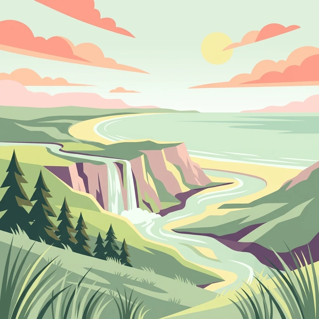
A stylized flat illustration of a coastal park with a waterfall cascading from grassy cliffs onto a beach where a river meets the sea, under a soft sunrise or sunset sky.

Northern Pegasus Bay

Regional park

Park overview

Structured park overview, official facts, and landscape profile for Northern Pegasus Bay

Northern Pegasus Bay park facts, protected area profile, and essential visitor context

Review the core facts for Northern Pegasus Bay, including designation, size, terrain, visitor scale, habitats, and operating context in one park-focused overview.

About Northern Pegasus Bay

Northern Pegasus Bay is a coastal regional park on the eastern edge of Canterbury, in New Zealand's South Island. Managed by Environment Canterbury, it covers the northern portion of Pegasus Bay, an arc-shaped stretch of coast framed by the Waimakariri River to the south and the Ashley River / Rakahuri estuary to the north. The park encompasses a suite of small beachside communities and settlements, including Kairaki, The Pines Beach, Woodend, Waikuku, Leithfield, and Amberley, all linked by the long ribbon of shoreline, dunes, and estuarine habitat that defines the reserve.

The landscape of the park is heavily shaped by coastal processes. Long sandy and pebbly beaches give way to dynamic dune systems, while several river mouths, including the Waimakariri, Kowai, Ashley / Rakahuri, and Waipara, punctuate the shoreline and contribute sediments that continually reshape the coast. Since the 1980s, erosion of the mixed sand and gravel beaches has been a notable environmental trend, and heavy rainfall events have further heightened concerns about coastal change and its consequences, including effects on shellfish such as tuatua in the bay.

Ecologically, the park's estuarine areas, particularly the Ashley Rakahuri Estuary, are its standout feature. The estuary is recognized as one of the South Island's east coast's most important bird sites, supporting breeding colonies of native seabirds and serving as a feeding and resting area for both resident shorebirds and long-distance migratory species. The surrounding dune fields and beaches add further habitat value, providing nesting and foraging space for a range of coastal birds.

Recreation is closely interwoven with the park's identity. Patrolled surfing beaches at Waikuku, Pegasus Town, and Woodend attract summer visitors, while surfcasting, whitebaiting, salmon fishing, and boat or kayak fishing make use of the sheltered bay conditions. A network of tracks connects beach communities inland, and controlled areas support land sailing and picnicking. The park is also a place where environmental management has become increasingly active, with bylaw changes over recent years refining where vehicles, dogs, horses, and drones can operate to protect dune health, estuarine wildlife, and public safety.

Quick facts and research context for Northern Pegasus Bay

Northern Pegasus Bay is a regional park in Canterbury, on the east coast of New Zealand's South Island, operated by Environment Canterbury. It stretches north from the Waimakariri River mouth to the Ashley River / Rakahuri estuary and includes beaches and dunes at Kairaki, The Pines Beach, Woodend, Waikuku, Leithfield, and Amberley. The park protects a long chain of sandy and pebbly beaches, river outlets, dune fields, and the ecologically important Ashley Rakahuri Estuary, recognized as a major bird area on the South Island east coast. Recreation is central to its use, with surf lifesaving, land sailing, fishing, and cycling all permitted under specific rules that reflect the area's growing environmental management focus.

Protection and recognition

Documented conservation status and official international recognition records

Northern Pegasus Bay Protection Status and Designated Management Scope

Northern Pegasus Bay maintains a documented mixed protection scope detailing current conservation governance and administrative status. Official records outline international recognition frameworks and management classifications associated with the protected landscape.

Protection details

Protection scope
Mixed
Transboundary protection
No
Park context

Deeper park guide and search-rich context for Northern Pegasus Bay

Northern Pegasus Bay history, landscape, wildlife, and travel context

Explore Northern Pegasus Bay through its history, landscape character, ecosystems, wildlife, conservation priorities, cultural context, and seasonal travel timing in a structured park guide built for atlas discovery and search intent.

Why Northern Pegasus Bay stands out

Northern Pegasus Bay is best known for the Ashley Rakahuri Estuary, a regionally important habitat and bird area on the South Island's east coast. The estuary supports breeding colonies of spotted shags and white-fronted terns, as well as threatened native shorebirds such as banded dotterels, pied stilts, black-billed gulls, and the endangered wrybill. Beyond the estuary, the park's long, mixed sand and gravel beaches, dune systems, and river mouths define its coastal character.
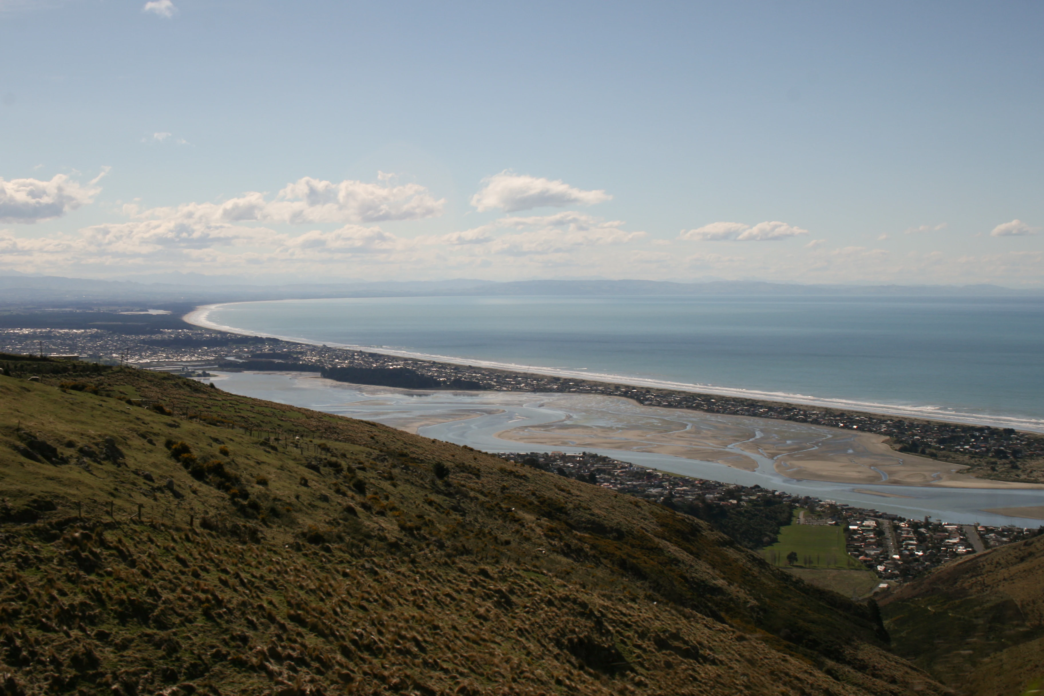
A wide, high-angle landscape shot looking down from a grassy hillside onto a long sandy coastline, an estuary with channels, and the ocean under a clear sky.
A high-angle view looking over Pegasus Bay with the New Brighton spit visible along the coast.

Northern Pegasus Bay history and protected-area timeline

Northern Pegasus Bay's modern history is closely tied to long-term coastal change and evolving public use of the beach. Since the 1980s, the mixed sand and gravel beaches along this part of Pegasus Bay have experienced ongoing erosion, a pattern that, combined with heavy rainfall events, has affected local marine life including tuatua shellfish in the bay.

Management of the park has gradually tightened in response to environmental and public safety concerns. The Waimakariri District Council bylaw governing the area was updated in 2016 to restrict vehicles, horse riders, and dogs, with the aim of improving public safety, reducing nuisance, and protecting the environment. The following year the bylaw was amended again to restrict drone usage, in part to safeguard sensitive bird populations in the estuaries.

In November 2018, extra enforcement patrols were introduced after incidents of four-wheel-drive vehicles causing destruction to beach areas. A University of Canterbury study published in November 2020 found that vehicles on Northern Pegasus Bay beaches had a significant impact on the environment and on other beach users, although dune health had improved after permits for vehicle access were introduced. By early 2021, Environment Canterbury had responded to multiple breaches of the park bylaw and issued warnings about recreational driving near settlements such as The Pines Beach. Together, these developments mark a shift toward more active and scientifically informed management of the regional park.

Northern Pegasus Bay landscape and geographic character

The landscape of Northern Pegasus Bay is defined by a long, curving coastline of mixed sand and gravel beaches backed by dune systems and crossed by several active river mouths. From the Waimakariri River in the south to the Waipara River beyond Amberley in the north, the shoreline is shaped by a constant exchange of sediment between rivers, dunes, and the sea. Pebble and sand beaches alternate along the coast, and the gradual reshaping of these beaches through erosion has been visible since the 1980s.

A key feature of the park is the Ashley Rakahuri Estuary, where the Ashley River meets the sea in a broad tidal system fringed by dunes and low-lying estuarine terrain. Smaller river mouths, including the Kowai and Waipara, contribute further variety to the coastal form, each with its own outlet, channel, and associated dune margins. Inland from the beach communities of Kairaki, The Pines Beach, Woodend, Waikuku, Leithfield, and Amberley, the coastal lowlands give way to the rural hinterland of north Canterbury.

Northern Pegasus Bay ecosystems, habitats, and plant life

Northern Pegasus Bay protects a connected series of coastal habitats that together form an important ecological corridor along the South Island's east coast. Sandy and pebbly beaches, stabilised and mobile dune systems, river mouths, and estuaries each contribute different ecological conditions, ranging from exposed intertidal zones to sheltered brackish and brackish-freshwater areas.

The Ashley Rakahuri Estuary is the ecological centrepiece. As one of the major bird sites on the South Island's east coast, it supports a mix of resident breeding bird colonies and seasonal migrant populations. Surrounding dune and beach habitats provide nesting grounds and feeding areas for a range of coastal bird species, while the river mouths and tidal flats offer rich foraging conditions. The combination of estuarine, dune, and beach habitats gives the park a layered ecological character, with overlapping zones supporting different groups of birds and other coastal wildlife throughout the year.

Northern Pegasus Bay wildlife and species highlights

Wildlife in Northern Pegasus Bay is dominated by birdlife, reflecting the park's estuarine and coastal identity. The Ashley Rakahuri Estuary regularly hosts breeding colonies of spotted shags, known in Māori as pārekareka, and white-fronted terns, or kahawai, both of which use the estuary as a significant South Island east coast site.

Other native bird species found in the reserve include banded dotterels and pied stilts, which favour the open beach and estuarine margin habitats, as well as black-billed gulls (tarāpuka) and black-fronted terns (tarapiroe). The endangered wrybill, a specialist braided-river and estuary bird unique to New Zealand, is also recorded in the reserve. Beyond resident species, the park receives seasonal migrations of shorebirds from beyond the region, including grey-tailed tattlers, whimbrels, eastern curlews, bar-tailed godwits, and red knots.

These migratory arrivals link the park to flyways across the Asia-Pacific region and reinforce its status as a site of broader conservation significance. The wildlife values of the reserve are a key reason behind restrictions on activities such as drone use and horse access in sensitive estuarine areas.

Northern Pegasus Bay conservation status and protection priorities

Northern Pegasus Bay holds clear conservation significance for its estuarine and coastal bird habitats, with the Ashley Rakahuri Estuary recognised as a major bird site on the South Island's east coast. The estuary's combination of feeding, roosting, and breeding habitat for resident and migratory shorebirds gives the park value well beyond its local recreation role.

Conservation management has become increasingly active over the past decade. Erosion of the mixed sand and gravel beaches since the 1980s has affected both the physical environment and species such as tuatua in the bay. Bylaw changes in 2016 and 2017 tightened controls on vehicles, dogs, horses, and drones, partly to address beach and dune damage. Research from the University of Canterbury published in 2020 found that vehicle use had a significant environmental impact, while noting that dune health improved after permits for vehicle access were required. Drone and microlight restrictions in and around the Ashley / Rakahuri and Saltwater Creek estuaries reflect the priority given to protecting sensitive bird populations in the reserve.

Northern Pegasus Bay cultural meaning and human context

The Māori names woven into Northern Pegasus Bay's wildlife and place naming, such as pārekareka for spotted shags, kahawai for white-fronted terns, tarāpuka for black-billed gulls, and tarapiroe for black-fronted terns, reflect the long-standing presence of Māori knowledge and naming in describing the coastal environment of this part of Canterbury. The bilingual name Ashley River / Rakahuri likewise signals the dual cultural heritage of the landscape, where the original Māori name Rakahuri sits alongside the later English form of the river.

Top sights and standout views in Northern Pegasus Bay

Northern Pegasus Bay's standout qualities lie in the combination of long, mixed sand and gravel beaches, dynamic dunes, and estuarine habitat along a single stretch of Canterbury coast. Among these, the Ashley Rakahuri Estuary is the clear ecological highlight, recognised as a major South Island east coast bird site supporting breeding colonies and migratory shorebirds.

The park also stands out for the way it pairs active recreation with environmental management. Patrolled surf beaches, surfcasting, whitebaiting, land sailing, and a network of cycling tracks all coexist with a layered bylaw regime covering vehicles, drones, dogs, and horses. This balance of public use and ecological protection, refined through research and enforcement over recent years, makes the park a distinctive example of contemporary Canterbury coastal management.

Best time to visit Northern Pegasus Bay

Northern Pegasus Bay is shaped by a temperate coastal climate, with summer bringing warmer sea temperatures and increased activity along the beaches, including surf lifesaving patrols at Waikuku, Pegasus Town, and Woodend. Summer is also the most active period for land sailing, picnicking, and general beach recreation, while whitebaiting is permitted seasonally at river mouths during the whitebait season, subject to permit rules at the Ashley River mouth.

Spring and autumn offer quieter conditions, with migratory shorebirds present in the estuarine areas and a generally calmer atmosphere along the beaches. The cooler months see fewer visitors but can highlight the dynamic nature of the coastline, particularly given the long-running coastal erosion and changing weather conditions that affect the bay.
Monthly climate preview

Long-term representative records of annual temperature and precipitation rhythm

Northern Pegasus Bay Climate Normals and Monthly Temperature Patterns

Representative coordinate sampling records the annual temperature and precipitation rhythm for Northern Pegasus Bay across twelve distinct monthly cycles. Examining the complete monthly climate normals reveals detailed long-term averages for average temperatures and precipitation rates.
Annual mean11 °C
6 °C17 °C
Jan17°
Feb17°
Mar15°
Apr12°
May
Jun
Jul
Aug
Sep
Oct11°
Nov13°
Dec16°
Warmest month
January

17.4 °C

Coolest month
July

5.7 °C

Wettest month
June

2.7 mm/day

Driest month
February

2 mm/day

Park location guide

Geography guide, regional context, and park location map for Northern Pegasus Bay

Northern Pegasus Bay park geography, regions, and map view in New Zealand

Understand where Northern Pegasus Bay sits in New Zealand through a broader geographic reading of the surrounding landscape, nearby location context, and its mapped position within the national park landscape.

How Northern Pegasus Bay fits into New Zealand

New Zealand is an island nation in the southwestern Pacific Ocean comprising two main islands and numerous smaller islands. Located east of Australia across the Tasman Sea, it features varied topography with the Southern Alps running along the South Island and volcanic terrain on the North Island. The country was settled by Maori people between 1280 and 1350, followed by European exploration beginning in 1642, and became a Dominion in 1907 before gaining full independence in 1947.

Wider geography shaping Northern Pegasus Bay in New Zealand

New Zealand lies in the southwestern Pacific Ocean, east of Australia across the Tasman Sea. The country consists of two main islands, the North Island and South Island, plus over 600 smaller islands. The North Island features volcanic plateaus and hills while the South Island is dominated by the Southern Alps mountain range. The country has a long coastline and is surrounded by the Pacific Ocean.

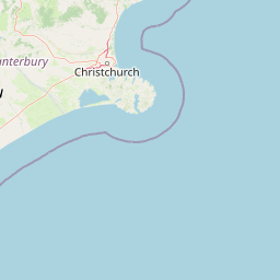
Map view of Northern Pegasus Bay

Use this park location map to pinpoint Northern Pegasus Bay in New Zealand, understand its exact geographic position, and read its mapped placement within the surrounding landscape more clearly.

Pigeon | © OpenStreetMap contributors

Location context for Northern Pegasus Bay

Canterbury Region

Visual reference guide to coastal terrain, estuarine habitats, and protected shorelines

Northern Pegasus Bay Landscape Photography, Scenery, and Coastal Views

Visual documentation captures the dynamic coastal landscapes and estuarine habitats that define Northern Pegasus Bay. Examining protected area imagery reveals shifting dune systems, river mouths, and key shorebird environments along the Canterbury coast.

A wide, high-angle landscape shot looking down from a grassy hillside onto a long sandy coastline, an estuary with channels, and the ocean under a clear sky.

Park atlas

Compare regional protected areas and connected coastal habitats across Canterbury

Explore Other Parks Near Northern Pegasus Bay And Surrounding Coastal Landscapes

Browsing other protected areas near Northern Pegasus Bay reveals connected coastal environments and diverse estuarine habitats along the east coast. Comparing these regional reserves provides broader geographic context for coastal landforms and bird nesting sites across Canterbury.
Regional parkCanterbury Region
About 16 km away#1 closest

Southwest

Waimakariri River Regional Park: Geography and Protected Landscape Atlas for Canterbury

Braided river corridors and wetland habitats in the Canterbury Region

Waimakariri River Regional Park encompasses a significant managed corridor along the Waimakariri River, featuring an intricate mix of braided riverbeds, saltmarshes, and reforested land. This profile details the park topography, highlighting its role in regional flood management and its varied natural terrain across the Canterbury Plains, providing a clear geographic view of its multi-use protected boundaries.

Area
150 km²
Relief
Lowland
Access
Easy access
Scope
Terrestrial
A horizontal watercolor illustration showing a calm bay surrounded by rolling hills and soft greenery, with faint mountains in the background.
Marine protected areaNew Zealand
About 64 km away#2 closest

South

Akaroa Marine Reserve: Protected Harbour Geography and Marine Map

Volcanic coastal terrain and no-take zone boundaries

Located on the Banks Peninsula, Akaroa Marine Reserve represents a vital marine protected area within a deeply indented volcanic harbour. The reserve offers a unique look at the contrast between inner harbour mudflats and outer rocky reefs, serving as an essential case study for marine conservation and coastal geography in New Zealand.

Area
5.12 km²
Established
2014
IUCN
Ia
Relief
Lowland
A watercolor illustration of a rolling green coastal landscape with hills and cliffs meeting the sea, depicted in soft pastel tones against a white background.
Marine protected areaCanterbury
About 65 km away#3 closest

Southeast

Pōhatu Marine Reserve: Mapping Coastal Conservation and Protected Marine Landscapes in Canterbury

A vital marine protected area on the Banks Peninsula coastline

The Pōhatu Marine Reserve serves as a critical no-take zone within the volcanic crater landscape of Canterbury. Its geography consists of sheltered inlets, steep cliff faces, and rich reef systems that support diverse fish biomass and protected nesting sites for native penguin colonies. The area remains a primary example of integrated coastal wildlife conservation on the Banks Peninsula.

Area
2.153 km²
Established
1999
Relief
Upland
Climate
Temperate
National parkNew Zealand
About 72 km away#4 closest

Northwest

Arthur's Pass National Park: Dramatic Alpine Protected Landscape in the Southern Alps

Explore the unique geography and mapped boundaries of this South Island national park.

Arthur's Pass National Park, a substantial protected area within New Zealand's Southern Alps, presents a compelling focus for geographic and atlas exploration. Characterized by dramatic alpine terrain shaped by ancient glacial forces, the park exhibits a striking ecological contrast between its drier eastern beech forests and wetter western rainforests. Users can delve into the mapped park boundaries and understand the regional landscape context of this unique protected area, making it a key destination for understanding New Zealand's natural geography.

Area
1,184.7 km²
Established
1929
IUCN
II
Relief
Mountain
A soft watercolor illustration featuring a panoramic view of rolling green hills, distant mountains, a meandering stream, and wildflowers in the foreground.
Protected landscapeSouth Island
About 81 km away#5 closest

West

Craigieburn Forest Park: Protected Alpine Landscape and Southern Alps Geography

High country terrain from beech forests to alpine ridges.

Situated along the eastern flanks of the Southern Alps, Craigieburn Forest Park offers a complex mountain geography that serves as both a recreational hub and an ecological restoration zone. The area features a clear transition from beech-clad valley floors and glacial terraces to wide tussock basins and craggy summits, providing a detailed look at the diverse natural terrain of the Canterbury region.

Area
446.948 km²
Established
1967
Relief
Mountain
Climate
Alpine
Protected landscapeCanterbury
About 87 km away#6 closest

Northwest

Lake Sumner Forest Park: Geography and Protected Landscape Atlas for Canterbury

Mountainous river valleys and remote beech forests

Spanning over 100,000 hectares of the Canterbury high country, Lake Sumner Forest Park stands as a prime example of New Zealand's protected backcountry. This mapping resource details the park's river-carved terrain, subalpine fringes, and its role as a connective wilderness area between major South Island mountain ranges.

Area
1,051 km²
Relief
Mountain
Climate
Temperate
Access
Moderate access
Marine protected areaCanterbury
About 114 km away#7 closest

Northeast

Hikurangi Marine Reserve: Protected Marine Geography and Submarine Canyon Systems

Exploring the coastal reefs and deep trench environments of Canterbury

Hikurangi Marine Reserve represents a core protected landscape within the New Zealand marine atlas. Centered on the Kaikoura Canyon, the reserve features a sharp transition from rocky shoreline reefs to deep-sea environments that support a high density of cetaceans and seabirds. This map-focused profile examines the physical boundaries and unique oceanographic conditions that define this essential no-take marine zone.

Area
104.16 km²
Established
2014
IUCN
Ia
Relief
Lowland
National parkNew Zealand
About 115 km away#8 closest

North

Nelson Lakes National Park: Alpine Geography and Glacial Lakes Atlas

Explore New Zealand's protected mountain terrain and natural landscapes.

Nelson Lakes National Park provides a deep dive into a dramatic alpine environment situated at the northern edge of New Zealand's Southern Alps. This national park is characterized by its striking glacial lakes, Rotoiti and Rotoroa, and the extensive mountain ranges that surround them, offering a rich context for understanding protected land distribution. Explore the park's mapped geography, its distinct beech forest ecosystems, and the rugged natural terrain that makes it a significant feature within the broader South Island landscape.

Area
1,018.8 km²
Established
1956
IUCN
II
Relief
Mountain

Common questions about visiting, size, designation, and location context for Northern Pegasus Bay

Northern Pegasus Bay FAQs for park facts, access, geography, and protected area context

Find quick answers about Northern Pegasus Bay, including protected-area facts, park geography, trail and visitor context, and how the park fits into its surrounding country and regional landscape.
MoriAtlas Explorer

Continue Your Protected Areas Search Across the Global Atlas

Deepen your exploration by continuing the structured search for national parks and protected areas worldwide. Utilize the comprehensive filtering capabilities to compare different conservation landscapes and refine your understanding of global park geography. Discover more about the distribution and characteristics of protected natural areas.

Global natural geography