
Mori Atlas logo
Nature reserveOberwaldsee von Dietesheim

A distinct geological mosaic of former basalt quarries and dry grasslands in the Hessen region

Oberwaldsee von Dietesheim Nature Reserve: Mapped Geography and Protected Landscape Analysis

(Naturschutzgebiet Oberwaldsee von Dietesheim)

Oberwaldsee von Dietesheim sits on the Steinheim Terrace within the Untermain lowlands, representing a unique intersection of flooded quarry basins and rare sandy dry-grassland habitats. This protected nature reserve serves as an ecologically significant refuge for amphibians and invertebrates amidst the dense metropolitan corridor of the Rhine-Main region. Our geographic data provides a clear view of the site boundaries, the intricate microtopography shaped by past basalt extraction, and the surrounding woodland terrain that defines this southern Hessian protected area.

nature reserveNaturschutzgebietformer basalt quarriesflooded quarriesmixed woodlanddry grassland
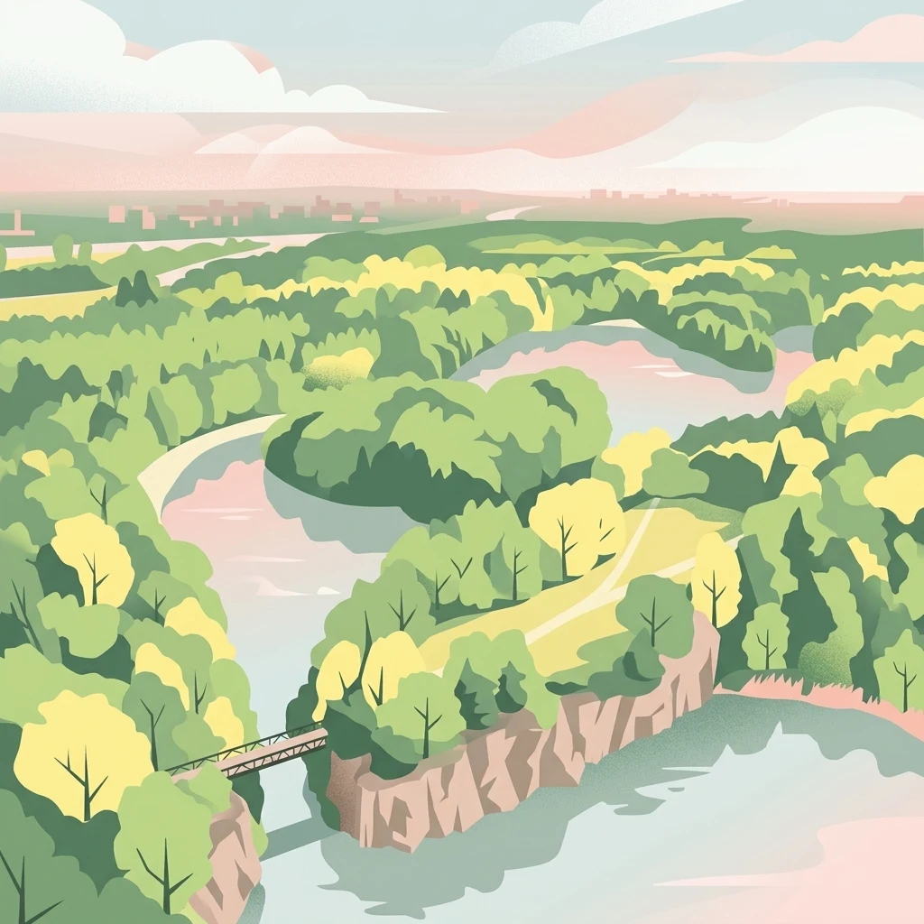
An illustration of a nature reserve featuring a lake, rocky cliffs, dense green trees, a bridge, and a soft, pastel-colored sunset sky.

Oberwaldsee von Dietesheim

Nature reserve

Park overview

Structured park overview, official facts, and landscape profile for Oberwaldsee von Dietesheim

Oberwaldsee von Dietesheim park facts, protected area profile, and essential visitor context

Review the core facts for Oberwaldsee von Dietesheim, including designation, size, terrain, visitor scale, habitats, and operating context in one park-focused overview.

About Oberwaldsee von Dietesheim

Oberwaldsee von Dietesheim is one of more than thirty nature reserves in the Landkreis Offenbach and one of several small protected sites that together preserve a network of semi-natural habitats in the densely settled Rhine-Main metropolitan area. It sits southeast of the Dietesheim quarter of Mühlheim am Main, on low ground above the Main river valley, and surprises visitors expecting only flat farmland with a compact mosaic of woodland, meadow, and flooded quarry pits.

The historical core of the landscape is geological. The present-day lakes are not natural lakes at all but disused basalt quarries that filled with groundwater after extraction ended. This industrial past shaped the relief of the Steinheim Terrace, creating small cliffs, terraces, embankments, and water-filled basins that have since matured into a varied mosaic of dry, sunny, and damp habitats within a small area. The 1985 habitat survey that preceded the reserve's designation highlighted this structural complexity together with the site aesthetic value as reasons for protection.

Ecologically, the reserve is managed primarily for threatened species of birds and amphibians. Forest stands, open sandy dry grassland, lakeshore belts, and patches of meadow each contribute a different layer to the site's biodiversity, and the contrast between warm open ground and shaded woodland is one of its defining features. The protected area is also embedded in the wider Natura 2000 framework, which underlines its role in maintaining habitat connectivity in the region.

The Oberwaldsee von Dietesheim today serves as a quiet example of how small, locally protected sites in heavily urbanized western Germany can carry disproportionate ecological weight: even at just over 33 hectares, the reserve plays an outsized role for threatened breeding birds, amphibians, and rare dry-grassland invertebrates in southern Hesse.

Quick facts and research context for Oberwaldsee von Dietesheim

Oberwaldsee von Dietesheim lies in the Landkreis Offenbach in Hesse, Germany, within the city limits of Mühlheim am Main southeast of the Dietesheim quarter. Its coordinates place it on the Steinheim Terrace in the Untermainebene natural region, at an elevation between roughly 110 and 120 meters above sea level.

The site covers about 33.48 hectares and was formally designated as a nature reserve (Naturschutzgebiet) in 1989, with the lower nature conservation authority of the Landkreis Offenbach as its responsible administrator. It carries the official NSG identifier 1438015, is recorded in the World Database on Protected Areas under WDPA ID 164905, and forms part of the Natura 2000 network under site code 6510. Its lakes are not natural water bodies but former basalt quarries that have filled with water over time.

Protection and recognition

Examine documented protected area designation records and governance scope

Oberwaldsee von Dietesheim Protection Status and International Recognition

Oberwaldsee von Dietesheim maintains structured protection entries tied to verified global conservation databases. Verified administrative parameters and official designation records provide transparent context for the protected area.

Protection details

WDPA ID
164905
Park context

Deeper park guide and search-rich context for Oberwaldsee von Dietesheim

Oberwaldsee von Dietesheim history, landscape, wildlife, and travel context

Explore Oberwaldsee von Dietesheim through its history, landscape character, ecosystems, wildlife, conservation priorities, cultural context, and seasonal travel timing in a structured park guide built for atlas discovery and search intent.

Why Oberwaldsee von Dietesheim stands out

Oberwaldsee von Dietesheim is best known for the unusual combination of former basalt quarries, open sandy dry grassland, and mixed woodland on a low terrace of the Untermain plain, a habitat mosaic that is described as unique within the southern Hessian part of the Rhine-Main region. The reserve is also recognized for the breeding bird community of its lake shores and forest interior and for the warm-loving dry-grassland invertebrates, especially butterflies and wild bees, that colonize its open sandy areas.
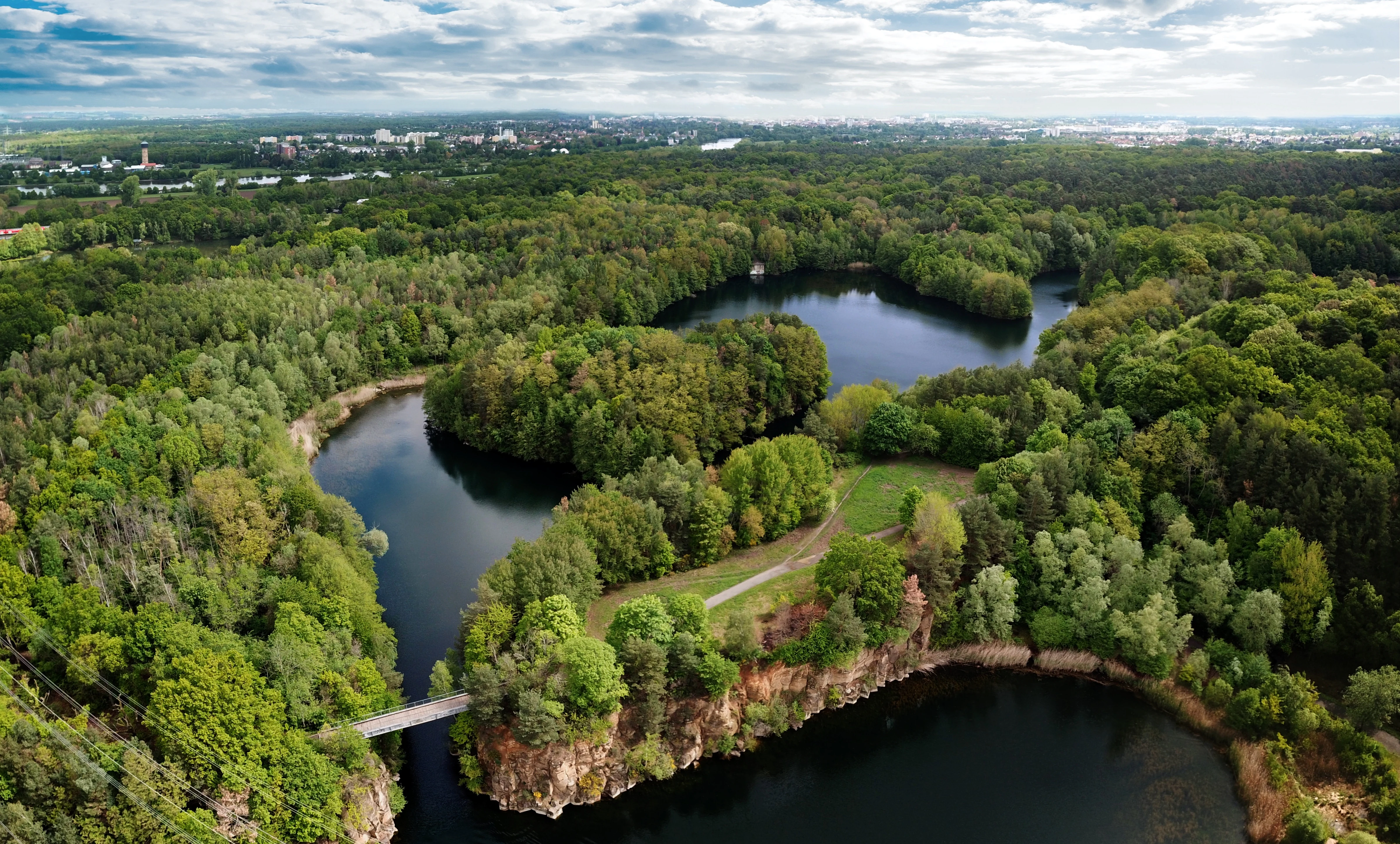
Aerial view of a nature reserve featuring dark blue lakes separated by forested land and rocky cliffs, with a pedestrian bridge connecting a landmass.
Aerial view of the Oberwaldsee and surrounding nature reserve, featuring cliffs and walking trails.

Oberwaldsee von Dietesheim history and protected-area timeline

The modern Oberwaldsee von Dietesheim nature reserve is the product of two overlapping histories: the industrial extraction of basalt on the Steinheim Terrace, and the late-twentieth-century expansion of formal habitat protection in Hesse. The lakes that now define the site are former basalt quarries whose pits filled naturally with water after mining ceased, and the resulting terrain of woodland, meadow, and flooded basins gradually developed its ecological character over decades.

In 1985, a systematic habitat survey (Biotopkartierung) of the area concluded that the site was worthy of nature reserve status on geological, landscape-aesthetic, zoological, and botanical grounds. The survey also documented ongoing damage: unauthorized recreational use by visitors, and the afforestation of existing sandy dry-grassland areas, both of which were identified as significant disturbances to the site's conservation values.

These findings led directly to the formal designation of the Oberwaldsee von Dietesheim as a Naturschutzgebiet in 1989, with the explicit aims of safeguarding and developing habitat for endangered plants, breeding birds, and amphibians, and of preventing further encroachment. The reserve's later integration into the Natura 2000 network extended its protection beyond purely national designation.

Oberwaldsee von Dietesheim landscape and geographic character

The reserve lies on the Steinheim Terrace, part of the broader Untermainebene natural region, a stretch of low ground along the Main river near the eastern edge of the Frankfurt metropolitan area. Although the surroundings are largely flat and agriculturally dominated, the site itself has a noticeably varied microtopography for southern Hesse.

The defining landforms are the flooded former basalt quarries. Their quarry walls and benches produce small cliffs, embankments, and basin edges that interrupt the otherwise gentle slope of the terrace. Between these water-filled pits lie stretches of mixed deciduous woodland, narrow meadow clearings, and patches of open sandy ground, producing a tight alternation of dry, sunny, and damp environments over a very short distance. The combination of this geological inheritance with the surrounding woodland is repeatedly described in regional surveys as a locally distinctive landscape feature of the Rhine-Main lowlands.

Oberwaldsee von Dietesheim ecosystems, habitats, and plant life

Ecologically, Oberwaldsee von Dietesheim is shaped by the close coexistence of dry and moist habitats in a small area. The most distinctive element is its open sandy dry grassland, locally described as Sandmagerrasen, which is increasingly rare in southern Hesse due to both abandonment and inappropriate afforestation. These warm, sun-exposed patches support a community of heat-loving plants and invertebrates that contrasts sharply with the cooler, damper forest interior.

Surrounding the dry grasslands and lakes is a patchwork of mixed deciduous woodland, damp meadow, and shoreline vegetation. The mosaic produces a striking ecological gradient: from sun-baked open sand through shrub-rich edge habitats into shaded forest and finally to the open water and reed belts of the quarry lakes. It is this layering, rather than any single habitat type, that gives the reserve its conservation significance in the Untermain lowlands.

Oberwaldsee von Dietesheim wildlife and species highlights

The reserve's birdlife is one of its most frequently cited conservation assets. In the forest interior, notable species include the Black Kite, Wryneck, Lesser Spotted Woodpecker, Green Woodpecker, Black Woodpecker, Red-backed Shrike, and Golden Oriole. The shoreline vegetation of the quarry lakes is used by waterbirds such as Little Grebe, Great Crested Grebe, and Tufted Duck as breeding habitat.

The dry grasslands are particularly important for invertebrates. A wide range of warmth-loving butterflies and solitary wild bees colonize the open sandy areas, and the Gatekeeper butterfly (Pyronia tithonus) is described as locally common here, despite being restricted to only a few warm, dry localities across the broader Rhine-Main area. Amphibians are also highlighted as a key target group for the reserve's protection efforts, alongside the breeding birds.

Oberwaldsee von Dietesheim conservation status and protection priorities

Conservation management at Oberwaldsee von Dietesheim is anchored in its 1989 designation as a category IV IUCN Habitat/Species Management Area, meaning that ongoing intervention rather than strict non-intervention is part of its protection regime. The original protection rationale combined geological, landscape-aesthetic, zoological, and botanical arguments, and placed particular weight on safeguarding threatened breeding birds and amphibians.

The reserve's history shows that active management is central to its value: the 1985 habitat survey specifically flagged afforestation of open dry grassland and unauthorized recreational use as pressures requiring reversal. Later inclusion in the Natura 2000 network (site 6510) broadened the legal framework for preserving the habitat mosaic and its species. Today, the area functions as a small but well-protected refuge within a heavily populated urban region, contributing to connectivity between scattered protected sites across the Landkreis Offenbach.

Top sights and standout views in Oberwaldsee von Dietesheim

The reserve's strongest distinguishing features are the chains of flooded former basalt quarries that define its lakes, the rare sandy dry-grassland patches that punctuate the woodland, and the close interweaving of breeding bird, amphibian, and invertebrate habitats within a compact area. It is one of the few places in the southern Rhine-Main region where Pyronia tithonus and a suite of woodpeckers, shrikes, and warblers can be found in such close proximity.

Its value is reinforced by its formal protection history, stretching from 1989 as a Naturschutzgebiet to its current role within Natura 2000, and by its position as a green enclave within the densely built-up Untermain corridor between Frankfurt, Offenbach, and Hanau.

Best time to visit Oberwaldsee von Dietesheim

The reserve's character shifts meaningfully with the seasons, in line with its mix of woodland, dry grassland, and water. Spring is the most active period for breeding birds and amphibians on and around the quarry lakes, when waterbird display and amphibian movement in the wetlands are at their peak. Early summer brings warmth to the sandy dry-grassland areas and makes the butterfly and wild bee communities easiest to observe.

Late summer and early autumn extend the window for warm-loving invertebrates, while autumn broadens the woodland character with changing foliage. Winter tends to be quieter, but the open water of the quarry lakes still supports visible waterfowl. As a small, low-lying reserve near a populated urban area, the site is best appreciated at quieter times of day, when breeding bird activity and reptile movement along the dry edges are most pronounced.

Monthly climate preview

Long-term representative monthly temperature and precipitation data for Hessen

Oberwaldsee von Dietesheim Climate Normals and Annual Temperature Rhythm

Representative coordinate records show average monthly temperatures ranging from near-freezing winter lows to warm summer peaks alongside steady precipitation distributions. Examining the complete twelve-month climatology profile provides deeper analytical insight into the specific environmental normals of this protected area.
Annual mean10 °C
0 °C21 °C
Jan
Feb
Mar
Apr10°
May14°
Jun18°
Jul21°
Aug20°
Sep15°
Oct10°
Nov
Dec
Warmest month
July

20.6 °C

Coolest month
January

0.2 °C

Wettest month
July

2.2 mm/day

Driest month
April

1.4 mm/day

Park location guide

Geography guide, regional context, and park location map for Oberwaldsee von Dietesheim

Oberwaldsee von Dietesheim park geography, regions, and map view in Germany

Understand where Oberwaldsee von Dietesheim sits in Germany through a broader geographic reading of the surrounding landscape, nearby location context, and its mapped position within the national park landscape.

How Oberwaldsee von Dietesheim fits into Germany

Germany is a federal republic in Western and Central Europe with a population of over 83 million across sixteen constituent states. It is Europe's largest economy by nominal GDP and a major global exporter and importer. The capital is Berlin, and the country borders Denmark, Poland, Czech Republic, Austria, Switzerland, France, Luxembourg, Belgium, and the Netherlands.

Wider geography shaping Oberwaldsee von Dietesheim in Germany

Germany is located in Western and Central Europe, spanning 357,022 km². It borders Denmark to the north, Poland and the Czech Republic to the east, Austria and Switzerland to the south, and France, Luxembourg, Belgium, and the Netherlands to the west. The country has coastlines on the Baltic Sea and North Sea to the north, with the Alps located in the southern region.

Map view of Oberwaldsee von Dietesheim

Use this park location map to pinpoint Oberwaldsee von Dietesheim in Germany, understand its exact geographic position, and read its mapped placement within the surrounding landscape more clearly.

Pigeon | © OpenStreetMap contributors

Location context for Oberwaldsee von Dietesheim

Hessen

Visual exploration of flooded quarries, dry grassland habitats, and forest terrain

Oberwaldsee von Dietesheim Photos and Protected Landscape Scenery

Visual documentation captures the varied microtopography, flooded basalt pits, and mixed woodland environments defining the protected reserve. Photographic records reveal the unique habitat mosaic and distinct landforms characteristic of the Untermain lowlands.

Aerial view of a nature reserve featuring dark blue lakes separated by forested land and rocky cliffs, with a pedestrian bridge connecting a landmass.

Park atlas

Compare regional nature reserves and adjacent lowland landscapes

Parks Near Oberwaldsee von Dietesheim and Surrounding Protected Areas

Visitors exploring Oberwaldsee von Dietesheim can browse nearby protected areas and adjacent lowland nature reserves across the surrounding region. Regional park comparison reveals connected ecological corridors and diverse habitat mosaics throughout the Untermain plain.
Watercolor illustration of a soft rolling landscape with grassy fields, scattered trees, and rolling hills in shades of green and yellow.
Nature reserveHessen
About 0.8 km away#1 closest

Southeast

Amerikafeld und Schindkaute bei Steinheim: Nature Reserve and Protected Grassland Map

Rare sand dry grassland habitat within the Hessen metropolitan region.

Amerikafeld und Schindkaute bei Steinheim is a protected nature reserve in Hanau that shelters scarce sand dry grasslands. The terrain, defined by ice-age sandy deposits, remains an important ecological island, maintaining an open steppe-like character through historic grazing practices in a landscape otherwise dominated by urban growth.

Area
16 km²
Established
1995
Nature reserveLandkreis Offenbach
About 1.7 km away#2 closest

Southwest

Mayengewann von Lämmerspiel: Nature Reserve and Protected Landscape in Landkreis Offenbach

Oak woodlands and rare orchid meadows within the Rhine-Main landscape

Examine the geography of Mayengewann von Lämmerspiel, a significant nature reserve characterized by its mosaic of old oak forest and moist grassland. This site acts as an ecological refuge in Landkreis Offenbach, safeguarding rare species such as the fen violet, adder's-tongue fern, and multiple orchid varieties within a carefully managed protected boundary.

Area
0.067 km²
Established
1985
IUCN
IV
Relief
Lowland
A horizontal watercolor painting showing a stylized, layered forest scene in muted green, pink, and yellow tones on a white background.
Nature reserveHesse
About 2.7 km away#3 closest

South

Lauternsee bei Klein-Auheim Nature Reserve: Geography and Protected Bog Landscape

A historic high terrace habitat within the Hesse woodland region.

Lauternsee bei Klein-Auheim represents a specialized Flachmoor habitat that emerged from a former river channel of the Main. This nature reserve serves as an important ecological anchor in the lower Main valley, protecting essential wetlands, amphibian populations, and unique marsh plant communities within an expansive forest setting.

Established
1987
A wide watercolor illustration depicting a green wetland landscape with reed beds, grasses, and distant hills under a pale sky.
Nature reserveHessen
About 5 km away#4 closest

South

Gräbenwäldchesfeld von Hausen: Nature Reserve and Protected Wetland Landscape Geography

Mapping rare meadow ecosystems in the Hessen region

Gräbenwäldchesfeld von Hausen functions as a critical protected nature reserve, safeguarding species-rich wet meadows and moisture-dependent flora in the town of Obertshausen. This atlas entry details the site's role within the Landkreis Offenbach, focusing on the preservation of reed beds and marsh landscapes amidst a predominantly urbanized terrain.

Area
0.054 km²
Established
1990
IUCN
IV
Relief
Lowland
Nature reserveHesse
About 6.7 km away#5 closest

South

Im Woog von Hainstadt Nature Reserve: Regional Geography and Protected Landscape Atlas

Mapping floodplain habitats in the Lower Main plain of Hesse

Im Woog von Hainstadt is a structurally diverse nature reserve located in Hainstadt, Germany. The site protects a compact floodplain mosaic consisting of deciduous woodland, wet meadows, and dry grasslands on a former river meander. Adjacent to the Wildpark Alte Fasanerie, the reserve functions as a biodiversity hotspot, offering essential habitat within the developed eastern Lower Main plain landscape.

Area
0.142 km²
Established
1992
Relief
Lowland
Climate
Temperate
Watercolor painting of a green wetland landscape with trees, grasses, and distant rolling hills on a white background.
Nature reserveHessen
About 7.2 km away#6 closest

Southwest

Erlensteg von Bieber Nature Reserve: Geographic Map and Protected Habitat Overview

Compact wetland and forest mosaic in the Hessen region

Erlensteg von Bieber preserves a rare concentration of habitat types within a small footprint. From its moist floodplain meadows and sedge wetlands to its drier forest glades and fallow fields, this reserve showcases vital conservation management in the Rhine-Main area of Germany.

Area
0.752 km²
Established
1996
IUCN
IV
A soft watercolor painting of a pond with reeds in the foreground and a tree-lined bank in the background, set against a pale, washed-out sky.
Nature reserveHesse
About 8.2 km away#7 closest

Northwest

Enkheimer Ried Nature Reserve: Geographic Overview and Protected Area Boundaries

Wetland landscape analysis within the Hesse region of Germany

Enkheimer Ried functions as a distinct nature reserve and wetland anchor near Frankfurt. This entry examines its spatial composition, including the central Riedteich pond and the Tränkebach floodplain, providing a clear geographic context for this ecologically rich conservation site in the heart of the Rhine-Main urban environment.

Area
0.282 km²
Established
1973
IUCN
IV
Relief
Lowland
A pale, horizontal watercolor painting showing a grassy floodplain, scattered deciduous trees, a gentle path or stream winding through the center, and a soft, pastel-toned sky.
Nature reserveHessen
About 8.5 km away#8 closest

Southeast

Pechgraben bei Klein-Krotzenburg Nature Reserve in the Hessen Protected Landscape Network

A preserved mosaic of ancient floodplain terrain and wetland habitats.

Located in the Offenbach district, this nature reserve protects a rare post-glacial flood channel of the Main river. The site exhibits a diverse landform mosaic, ranging from near-natural broadleaf forests to expansive sedge marshes. It functions as a critical protected geography for regional species, maintaining its ecological character against the surrounding agricultural and residential development of the Lower Main valley.

Area
0.341 km²
Established
1998
IUCN
IV
Relief
Lowland

Common questions about visiting, size, designation, and location context for Oberwaldsee von Dietesheim

Oberwaldsee von Dietesheim FAQs for park facts, access, geography, and protected area context

Find quick answers about Oberwaldsee von Dietesheim, including protected-area facts, park geography, trail and visitor context, and how the park fits into its surrounding country and regional landscape.
MoriAtlas Explorer

Continue Your Protected Areas Search Across the Global Atlas

Deepen your exploration by continuing the structured search for national parks and protected areas worldwide. Utilize the comprehensive filtering capabilities to compare different conservation landscapes and refine your understanding of global park geography. Discover more about the distribution and characteristics of protected natural areas.

Global natural geography