
Mori Atlas logo
Protected landscapeOglala National Grassland

Tracing the mapped boundaries of prairie uplands and dramatic badlands formations in the Great Plains

Oglala National Grassland: An Atlas of Nebraska Protected Landscapes and Geological Terrain

Oglala National Grassland represents a unique protected landscape in the far northwest corner of Nebraska, spanning nearly 95,000 acres of shortgrass prairie and deeply eroded badlands. This area serves as a critical geographic study of the Pierre Shale exposure, showcasing banded sedimentary layers and iconic toadstool-shaped hoodoo formations. Beyond its distinct geological terrain, the grassland preserves a complex intersection of Paleoindian archaeological sites and expansive habitats within the northern Great Plains.

national grasslandshortgrass prairiebadlandsPine RidgePierre ShaleToadstool Geologic Park
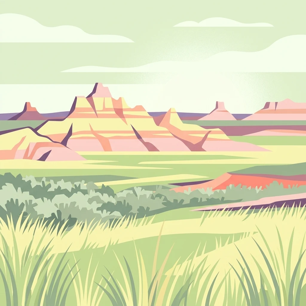
A digital illustration of layered badlands rock formations rising above a vast, flat prairie landscape with grasses in the foreground.

Oglala National Grassland

Protected landscape

Park overview

Structured park overview, official facts, and landscape profile for Oglala National Grassland

Oglala National Grassland park facts, protected area profile, and essential visitor context

Review the core facts for Oglala National Grassland, including designation, size, terrain, visitor scale, habitats, and operating context in one park-focused overview.

About Oglala National Grassland

Oglala National Grassland occupies a striking transition zone in northwest Nebraska where the relatively flat High Plains break against the Pine Ridge escarpment, giving rise to a landscape of rolling shortgrass prairie interspersed with deeply eroded canyons, fossil-rich badlands, and scattered ponderosa-covered buttes. Grasslands of this kind once covered vast areas of the central Great Plains, and the Oglala unit preserves a substantial remnant of that original ecosystem within a federally protected framework. The result is a working landscape that simultaneously supports grazing, wildlife habitat, recreation, and scientific study.

Administratively, Oglala National Grassland is one of the smaller National Grasslands in the United States and is managed by the U.S. Forest Service as part of the broader Nebraska National Forests and Grasslands complex, which also includes the Nebraska National Forest, the Samuel R. McKelvie National Forest, the Buffalo Gap National Grassland, and the Fort Pierre National Grassland. Day-to-day management is coordinated from common offices in Chadron, Nebraska, and the nearest community serving visitors is Crawford. The grassland sits along the borders with South Dakota and Wyoming, placing it at the heart of the northern Great Plains region.

Ecologically, the area stands out for its unusually rich overlap of prairie, badlands, and riparian habitats. Shortgrass prairie communities dominate the uplands, while cottonwood, green ash, and peachleaf willow line the drainages. The grassland lies within the native historic range of the American bison, and broader grassland wildlife such as pronghorn, mule deer, white-tailed deer, elk, bighorn sheep on Round Top, wild turkey, coyote, and sharp-tailed grouse still occur here. More than one hundred bird species and roughly fifty mammal species have been documented on the unit.

The grassland is also a landscape of deep human history. It contains the Hudson-Meng Bison Kill, an active archaeological site used by Paleoindian hunters thousands of years ago, and the Warbonnet Battlefield Monument, which commemorates an 1876 engagement of the era of the Lakota wars. Sites like Toadstool Geologic Park and the surrounding badlands expose layers of Pierre Shale along with Eocene and Piacenzian volcanic ash deposits, giving geologists and visitors a rare window into the deep time of the Great Plains. Together, these qualities make Oglala National Grassland a uniquely layered place where prairie ecology, geology, and Native and frontier history meet.

Quick facts and research context for Oglala National Grassland

Oglala National Grassland is one of a small number of National Grasslands in the United States, and it lies in the remote northwest corner of Nebraska along the South Dakota and Wyoming borders. It is managed by the U.S. Forest Service and covers approximately 94,520 acres of shortgrass prairie, badlands, and rimrock country in Sioux and Dawes counties. The nearest town is Crawford, and the unit is co-administered with other Nebraska National Forests and Grasslands from offices in Chadron.

The grassland is distinctive within Nebraska for being the only region in the state where the Pierre Shale is exposed, giving rise to its distinctive badlands topography and fossil-bearing formations such as those in Toadstool Geologic Park. It also preserves decadal-scale layers of Eocene and Piacenzian volcanic ash in its geological record, supports native bison range, and contains archaeological and military-historical sites including the Hudson-Meng Bison Kill and the Warbonnet Battlefield Monument.

Protection and recognition

Examine the documented conservation framework and territorial management scope

Oglala National Grassland Protection Status and Terrestrial Area Scope

Oglala National Grassland maintains a documented terrestrial protection scope within the national conservation inventory. Verified management records outline the formal administrative boundaries and established protected-area classifications.

Protection details

Protection scope
Terrestrial
Transboundary protection
No
Park context

Deeper park guide and search-rich context for Oglala National Grassland

Oglala National Grassland history, landscape, wildlife, and travel context

Explore Oglala National Grassland through its history, landscape character, ecosystems, wildlife, conservation priorities, cultural context, and seasonal travel timing in a structured park guide built for atlas discovery and search intent.

Why Oglala National Grassland stands out

Oglala National Grassland is best known for its dramatic Pine Ridge badlands carved out of soft Pierre Shale, especially in and around Toadstool Geologic Park near Crawford, where toadstool-shaped rock formations and richly fossilized layers have made the area a regionally famous destination. The grassland is also recognized as a stronghold of shortgrass prairie wildlife, including native bison range and over one hundred bird species, as well as for its archaeological and historical sites such as the Hudson-Meng Bison Kill and the Warbonnet Battlefield Monument of 1876. The combination of open prairie, deeply eroded badlands, exposed geological formations, and a rich mix of grassland and rimrock habitats gives the area a strong identity distinct from the more forested parts of western Nebraska. It is one of the few places where the geological, paleontological, ecological, and human history of the northern Great Plains can be experienced in a single landscape.
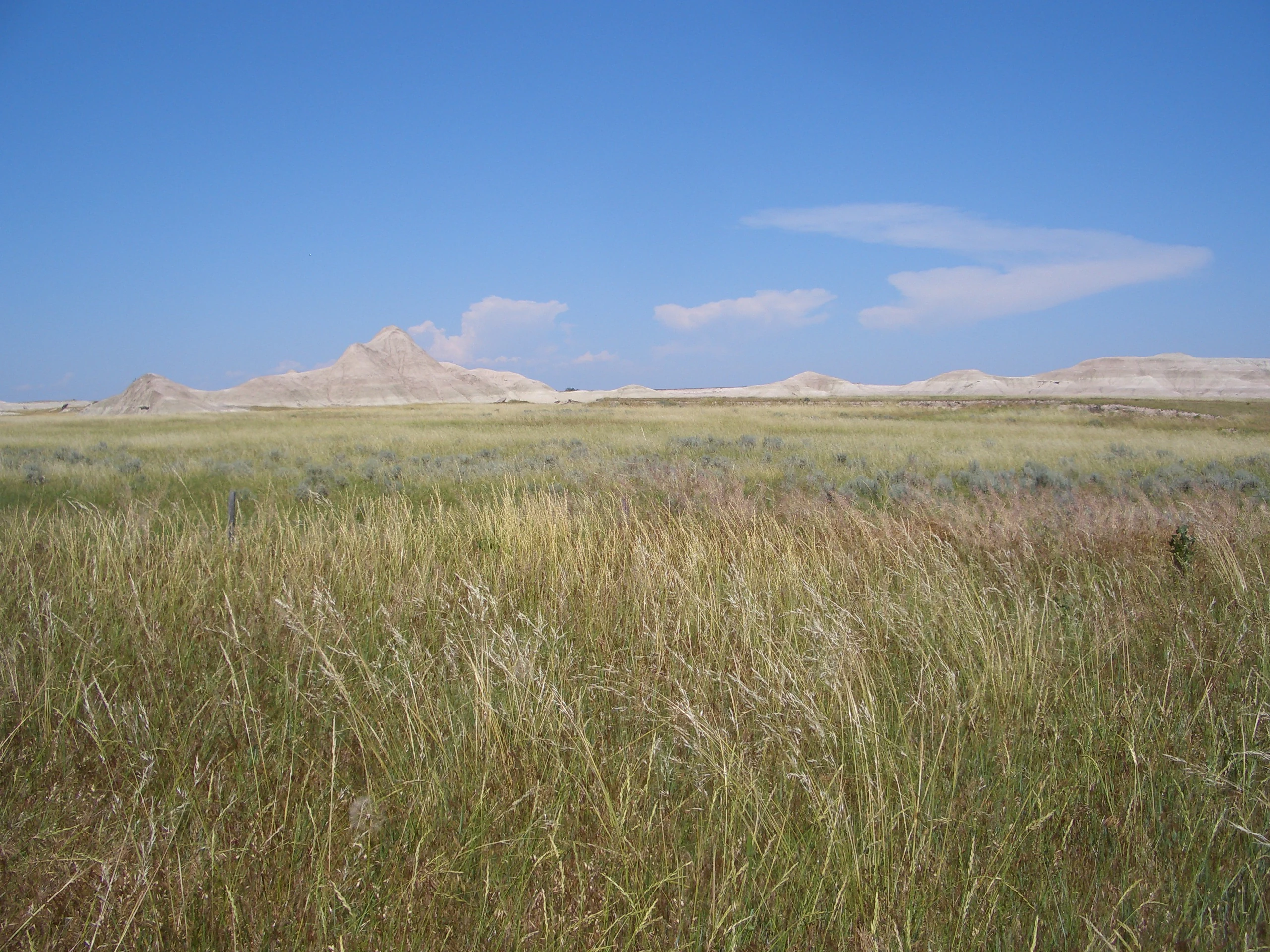
A vast expanse of golden and green tall grasses under a clear blue sky, with arid, light-colored rocky badlands in the distance.
A wide view of the shortgrass prairie and badlands formations at Oglala National Grassland.

Oglala National Grassland history and protected-area timeline

The landscape that is now Oglala National Grassland has a long human history that stretches back to the Paleoindian period, when large bison herds grazed the northern Plains and hunters used sites such as the Hudson-Meng Bison Kill, now an ongoing archaeological excavation within the grassland. In more recent centuries the area was home to the Lakota and other Plains peoples, including the Oglala, from whom the grassland takes its name. The 1876 Battle of Warbonnet Creek, commemorated today by the Warbonnet Battlefield Monument on Montrose Road, marked one episode in the broader conflicts of that era that reshaped the region.

During the early twentieth century the land was largely homesteaded and grazed, with the characteristic pattern of settlement, drought, and abandonment that affected much of the Great Plains. After decades of land use change, the federal government began acquiring and consolidating parcels here as part of the broader program that established the National Grasslands. The grassland was officially designated and incorporated into the system of National Grasslands managed by the U.S. Forest Service, becoming one of the small handful of such units in the country.

In the 1930s the Civilian Conservation Corps undertook much of the early physical development of the area, building around one hundred ponds and a few reservoirs to support livestock and improve range conditions. Subsequent decades brought additional infrastructure including the Agate, Bordgate, and Rock Bass reservoirs, expanded archaeological work at the Hudson-Meng site, and the formal protection of landmarks such as Toadstool Geologic Park. Today the grassland is managed alongside the Nebraska and Samuel R. McKelvie National Forests and the Buffalo Gap and Fort Pierre National Grasslands, continuing a long tradition of federal stewardship of this northwestern Nebraska landscape.

Oglala National Grassland landscape and geographic character

The landscape of Oglala National Grassland is defined by a striking contrast between open upland and deeply eroded lowlands. Much of the terrain is gently rolling shortgrass prairie sweeping north toward the South Dakota and Wyoming borders, but where the prairie meets the breaks of the Pine Ridge, the ground falls away into a network of badlands that is one of the most dramatic in Nebraska. These badlands are concentrated especially in and around Toadstool Geologic Park near Crawford and Whitney, where erosion of the soft Pierre Shale has produced toadstool-capped rock formations, banded sedimentary layers, and a moon-like terrain of ridges and gullies.

Geologically, the grassland sits on Pierre Shale that is unique in the state for its exposure at the surface, and the regional stratigraphy also includes volcanic ash deposits from the Eocene and Piacenzian periods. These ash layers, preserved in the profiles of eroded hills, contribute to the banded appearance of many badlands exposures and are a key feature for geologists studying the deep history of the Great Plains. The combined effect of Pierre Shale bedrock, layered ashfalls, and semi-arid climate has produced a terrain of soft, easily eroded slopes studded with harder caprocks that shelter the iconic mushroom-shaped hoodoos.

Around the badlands, the grassland broadens into more typical shortgrass prairie uplands interrupted by wooded draws and riparian corridors. Deciduous trees such as eastern cottonwood, green ash, and peachleaf willow trace the drainages, while the rougher badlands ridges provide habitat for raptors and other cliff-nesting species. Scattered reservoirs such as the Agate, Bordgate, and Rock Bass reservoirs dot the landscape, serving both as water sources for wildlife and as focal points for visitors exploring the unit.

Oglala National Grassland ecosystems, habitats, and plant life

Oglala National Grassland protects an unusually rich intersection of shortgrass prairie, badlands, and riparian habitat types within a relatively compact footprint. The uplands carry classic northern Great Plains shortgrass prairie communities dominated by hardy bunch grasses adapted to the semi-arid climate, while the breaks and drainages add a wooded component that is absent from much of the surrounding plains. This mix of grassland, shrub, woodland, and eroded rock creates a mosaic of microhabitats that supports disproportionately high biodiversity for an area of its size.

The climate of the grassland is semi-arid, with light precipitation and strongly variable temperatures that favor drought-tolerant prairie species while still allowing bursts of seasonal growth and wildflower display in wetter years. The exposed Pierre Shale and layered ash deposits create thin, eroding soils that often limit dense plant cover, but the very instability of these substrates encourages a diverse community of small herbaceous plants, shrubs, and hardy grasses adapted to disturbance. Riparian zones along streams and around the constructed reservoirs concentrate cottonwood, green ash, and peachleaf willow forests that contrast sharply with the open prairie above.

Ecologically, the grassland sits at a crossroads between mountain forest, prairie, and badlands ecosystems, and this position is reflected in both its plant and animal communities. Native plant communities have been heavily shaped by extensive grazing history, but also by the natural patterns of erosion and fire that define the Great Plains. The combination of protected status, varied topography, and ongoing management means that Oglala remains one of the more ecologically diverse grassland units in the National Grassland system.

Oglala National Grassland wildlife and species highlights

Wildlife is a defining feature of Oglala National Grassland, where over one hundred bird species and roughly fifty mammal species have been documented across the mix of prairie, badlands, and riparian habitat. The unit lies within the native historical range of the American bison, and although the landscape is no longer dominated by vast herds, bison remain symbolically and ecologically central to its identity. Today the grassland supports healthy populations of more familiar Great Plains mammals, including mule deer and white-tailed deer, pronghorn, elk, bighorn sheep on the prominent outcrop known as Round Top, wild turkey, and coyote. Sharp-tailed grouse maintain scattered leks, or traditional dancing grounds, in the remaining prairie.

The grassland is also recognized as an important area for raptors and grassland-nesting birds. Sensitive and notable species documented here include the fringed myotis bat, black-tailed prairie dog, swift fox, ferruginous hawk with one to three active nests per year, northern harrier, long-billed curlew with several colonies in pastures, burrowing owl, migrating American peregrine falcon, short-eared owl, loggerhead shrike, McCown's longspur, chestnut-collared longspur, and the northern leopard frog. These species reflect the grassland's role as breeding, migratory, and wintering habitat for birds that depend on remaining tracts of native prairie.

Riparian areas and reservoirs such as Agate, Bordgate, and Rock Bass add a further wildlife dimension, concentrating waterfowl, shorebirds, and the deciduous-forest species that use the cottonwood and ash galleries along streams. The Hudson-Meng Bison Kill site also provides an unusual bridge between modern wildlife conservation and the deep paleontological history of bison in the region, reminding visitors that the grasslands here have been shaped by bison and their hunters for thousands of years.

Oglala National Grassland conservation status and protection priorities

As one of the country's designated National Grasslands, Oglala is part of a federal system specifically designed to conserve representative examples of America's native grassland heritage while keeping the land working for grazing, wildlife, and public enjoyment. Its conservation significance lies in part in its unusual geology: the grassland protects the only exposure of the Pierre Shale in Nebraska, along with layered Eocene and Piacenzian volcanic ash deposits, making it an important reference site for understanding the geological history of the northern Great Plains.

Biologically, the unit is significant for safeguarding a sizable tract of shortgrass prairie and the associated mosaic of badlands, riparian woodland, and rimrock habitats that support bison range, pronghorn, ground-nesting grassland birds, and a wide variety of other species. The presence of sensitive species such as ferruginous hawk, long-billed curlew, chestnut-collared longspur, swift fox, and northern leopard frog gives the area particular importance within regional conservation planning for prairie-dependent wildlife.

Culturally and paleontologically, the grassland protects nationally significant heritage resources including the Hudson-Meng Bison Kill, an active archaeological excavation, and the Warbonnet Battlefield Monument commemorating the 1876 Battle of Warbonnet Creek. Long-term management by the U.S. Forest Service, including the legacy of Civilian Conservation Corps-built ponds and reservoirs, has shaped the area into a working conservation landscape where grazing, recreation, and ecological preservation are integrated rather than treated as opposing goals.

Oglala National Grassland cultural meaning and human context

The cultural context of Oglala National Grassland is deeply rooted in the heritage of the northern Great Plains. The grassland takes its name from the Oglala Lakota, one of the bands of the Lakota people whose historical homeland includes the region where Nebraska, South Dakota, and Wyoming now meet. Long before the area became a National Grassland, it was part of the seasonal ranges used by Plains peoples who followed bison herds and maintained complex relationships with the prairie and badlands environments.

This deeper history is preserved and investigated at the Hudson-Meng Bison Kill, an archaeological site within the grassland where excavations have uncovered evidence of large-scale Paleoindian bison hunting thousands of years ago. The site is significant not only for its scientific value but also for the way it connects the deeper Indigenous past of the region to the later history of the Lakota and their neighbors.

The more recent frontier and military history of the area is represented by the Warbonnet Battlefield Monument, which commemorates the 1876 Battle of Warbonnet Creek, an engagement associated with the Lakota wars of that era. Together, the grassland's Indigenous heritage, its Paleoindian archaeological record, and its 19th-century frontier history give Oglala a layered cultural identity that complements its natural and geological significance.

Top sights and standout views in Oglala National Grassland

Oglala National Grassland's top highlights include the otherworldly Toadstool Geologic Park, where pink and gray badlands of eroded Pierre Shale form a maze of toadstool-capped hoodoos near Crawford; the active Hudson-Meng Bison Kill archaeological site, a window into Paleoindian life on the Plains; and the Warbonnet Battlefield Monument, which marks the site of an 1876 engagement between U.S. forces and Lakota fighters. The grassland's network of reservoirs, including Agate, Bordgate, and Rock Bass, and its mix of shortgrass prairie and Pine Ridge badlands round out a landscape that rewards both scenic drives and more focused exploration of its wildlife and geological features.

Best time to visit Oglala National Grassland

Oglala National Grassland takes on very different characters through the year, and the best experience depends on what a visitor hopes to see. Late spring and early summer bring active prairie growth, blooming wildflowers, and good conditions for spotting grassland birds and pronghorn on the open uplands, while the long daylight hours of summer are well suited to hiking and exploring Toadstool Geologic Park and the surrounding badlands. Cooler fall months often bring sharp visibility, migratory raptors and waterfowl, and a russet tone to the grasses, while winter can blanket the landscape in snow and dramatically emphasize the ridgelines and badlands.

Because the climate is semi-arid and temperature variation is strong, visitors should be prepared for hot summer days, chilly nights, and the possibility of sudden weather changes regardless of season. The transitional seasons of late spring and fall tend to offer the most comfortable combination of scenery and wildlife activity for general exploration, while summer is ideal for those primarily interested in geology and shortgrass prairie botany, and late fall through early spring tends to favor visitors interested in winter wildlife and quieter landscape photography.
Monthly climate preview

Examine long-term temperature ranges and monthly precipitation patterns across representative terrain

Oglala National Grassland Climate Normals and Annual Temperature Rhythm

Representative coordinates record measured monthly averages spanning sub-zero winter minimums to warm summer highs alongside distinct precipitation fluctuations. Reviewing the complete twelve-month climatology profile reveals broader multi-year weather patterns across the protected landscape.
Annual mean10 °C
-2 °C25 °C
Jan-2°
Feb-1°
Mar
Apr
May14°
Jun20°
Jul25°
Aug23°
Sep18°
Oct
Nov
Dec-2°
Warmest month
July

24.6 °C

Coolest month
January

-2.4 °C

Wettest month
May

2.5 mm/day

Driest month
January

0.3 mm/day

Park location guide

Geography guide, regional context, and park location map for Oglala National Grassland

Oglala National Grassland park geography, regions, and map view in United States of America

Understand where Oglala National Grassland sits in United States of America through a broader geographic reading of the surrounding landscape, nearby location context, and its mapped position within the national park landscape.

How Oglala National Grassland fits into United States of America

The United States of America is a federal presidential republic and one of the world's largest countries by area and population. It consists of 50 states across a vast territory spanning multiple time zones, with its capital in Washington, D.C. and largest city in New York City. The nation has a diverse economy, influential political system, and significant cultural and military presence globally.

Wider geography shaping Oglala National Grassland in United States of America

The United States occupies a vast territory in North America, bordered by Canada to the north and Mexico to the south. The 48 contiguous states stretch from the Atlantic to the Pacific Ocean, while Alaska occupies the northwestern region and Hawaii is an archipelago in the Pacific. The country encompasses diverse terrain including the Rocky Mountains, Appalachian Mountains, Great Plains, and extensive river systems.

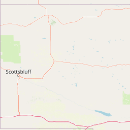
Map view of Oglala National Grassland

Use this park location map to pinpoint Oglala National Grassland in United States of America, understand its exact geographic position, and read its mapped placement within the surrounding landscape more clearly.

Pigeon | © OpenStreetMap contributors

Location context for Oglala National Grassland

Nebraska
Recorded earthquake history

View the Historical Earthquake Catalogue for Oglala National Grassland

Examine the recorded seismic history associated with the Oglala National Grassland landscape through this structured catalogue. MoriAtlas provides clear access to historical earthquake data, enabling researchers and visitors to review past seismic occurrences near this protected Nebraska grassland.

Oglala National Grassland Earthquake History

Catalogued events

9 events

Strongest magnitude

Magnitude 4

Most recent event

Mar 26, 2021

This history includes earthquakes recorded inside the park or within 50 km of its borders

Explore the unique terrain, exposed geological formations, and shortgrass prairie habitats.

Oglala National Grassland Photos and Scenery: Visualizing the Badlands Landscape

Visual documentation captures the dramatic erosion patterns and toadstool hoodoos defining the protected landscape of Oglala National Grassland. Studying these field images reveals the complex geological character and raw terrain of the northern Great Plains.

A vast expanse of golden and green tall grasses under a clear blue sky, with arid, light-colored rocky badlands in the distance.

Park atlas

Compare regional badlands, shortgrass prairies, and connected conservation areas.

Exploring Parks Near Oglala National Grassland and Surrounding Protected Landscapes

Visitors comparing Oglala National Grassland can examine other protected areas across the surrounding northern plains and Pine Ridge region. Analyzing adjacent national grasslands and nearby forests reveals broader geological patterns and regional biodiversity.
A watercolor painting showing a rolling landscape with green hills, patches of coniferous forest, and a soft, hazy sky.
Protected landscapeNebraska
About 39 km away#1 closest

East

Nebraska National Forest: Geographic Context and Protected Landscape Boundaries

Mapped terrain across Sandhills and Pine Ridge districts.

This protected landscape is defined by its unusual dual-district structure, encompassing both the historic tree-planting experiments in the central Sandhills and the rugged, native pine-covered canyons of the Pine Ridge. Discover how these distinct environmental zones create a unique ecological footprint within the broader Nebraska geography through detailed map-based insights.

Area
574.1 km²
Established
1908
Relief
Upland
Climate
Temperate
National parkCuster County
57 km away#2 closest

North

Wind Cave National Park: A National Park with Distinct Protected Landscape and Geographic Identity

Explore the mapped terrain and regional context of this US protected area.

Wind Cave National Park represents a key protected area within Custer County, offering users a deep dive into its unique geography and landscape characteristics. As a designated national park in the United States, its mapped boundaries provide crucial context for understanding its ecological and geological significance. This MoriAtlas entry facilitates detailed exploration, focusing on the protected land's identity and its role within the wider regional geography and natural landscape.

Area
136.97 km²
Established
1903
IUCN
II
Visitors
489.4K annual
Protected landscapeWyoming
62 km away#3 closest

Northwest

Thunder Basin National Grassland: A Protected Landscape in the Wyoming Powder River Basin

Mapping the prairie and sagebrush mosaic of northeastern Wyoming

Thunder Basin National Grassland is a sprawling, federally protected territory in northeastern Wyoming that functions as a critical ecotone between the Great Plains and the Rocky Mountain region. Its landscape is characterized by wide-open vistas, intricate sedimentary bluffs, and diverse habitats shaped by natural disturbance patterns and ongoing grassland management. This record outlines the geography, terrain features, and protected boundaries that define this essential segment of the American West.

Area
2,215.65 km²
Established
1960
Relief
Upland
Climate
Arid
National parkSouth Dakota
71 km away#4 closest

Northeast

Badlands National Park: South Dakota's Premier National Park for Atlas Exploration

Explore mapped terrain and protected landscape boundaries.

Badlands National Park stands as a key protected area within the geography of South Dakota, offering a distinct natural landscape for detailed atlas exploration. This National Park's unique terrain and mapped boundaries provide crucial context for understanding regional geography and conservation landscapes. Engage with structured information that highlights the park's geographic identity, making it an essential destination for those seeking to map and comprehend protected natural areas.

Area
982.4 km²
Established
1939
IUCN
II
Visitors
1M annual
A pale, minimalist watercolor illustration of a wide, open grassy landscape with soft rolling hills in the background and light green vegetation in the foreground.
Protected landscapeSouth Dakota
About 72 km away#5 closest

Northeast

Buffalo Gap National Grassland: Regional Geography and Protected Prairie Boundaries

Mapping the vast grasslands of southwestern South Dakota

Spanning across four counties in southwestern South Dakota, Buffalo Gap National Grassland serves as a premier example of a working Great Plains landscape. The region is defined by its immense scale, where undulating mixed-grass prairie transitions into striking, chalky badlands. This area is recognized for its vital conservation role, including successful species recovery programs, and stands as a foundational feature of the regional geological and ecological map.

Area
2,410.77 km²
Established
1960
Relief
Upland
Climate
Temperate
National parkCherry County
171 km away#6 closest

East

Samuel R. McKelvie National Forest: Mapping Nebraska's Sandhills Protected Landscape

An atlas view of rolling dune grasslands and forest mosaics in Cherry County.

Located in the heart of Cherry County, Samuel R. McKelvie National Forest presents a distinct landscape where prairie grasses meet planted pine islands. This overview examines the forest's placement within the Sandhills region, highlighting its role as a protected grassland unit near the shores of Merritt Reservoir and the Snake River corridor.

Area
469.76 km²
Established
1971
Relief
Upland
Climate
Temperate
A soft watercolor painting of a wide, rolling grassy landscape with a pale sky and hints of a treeline in the distance.
Protected landscapeColorado
199 km away#7 closest

South

Pawnee National Grassland: Protected Landscape and Great Plains Atlas

Shortgrass prairie and geologic remnants in Colorado.

Pawnee National Grassland represents a significant protected area within northeastern Colorado, spanning vast semiarid plains and striking erosional formations known as the Pawnee Buttes. This atlas overview details the park boundaries, regional drainage systems of the South Platte River basin, and the ecological value of these native grass communities and scarp woodlands.

Area
781.3 km²
Established
1960
Relief
Upland
Climate
Arid
A horizontal watercolor painting showing a range of purple and reddish-toned mountains in the distance, behind rolling green fields and a pale pinkish waterway in the foreground.
Protected landscapeColorado
245 km away#8 closest

Southwest

Roosevelt National Forest: Mapping Wilderness and Protected Landscapes in Northern Colorado

Regional geography, river corridors, and alpine mountain terrain

Roosevelt National Forest encompasses a significant protected landscape across Larimer, Boulder, Gilpin, and Jefferson counties. The forest features a complex terrain of deep canyons, forested plateaus, and protected wilderness areas that form a scenic buffer along the eastern side of the Continental Divide and Rocky Mountain National Park.

Area
3,293.33 km²
Established
1902
Relief
Mountain
Climate
Subpolar

Common questions about visiting, size, designation, and location context for Oglala National Grassland

Oglala National Grassland FAQs for park facts, access, geography, and protected area context

Find quick answers about Oglala National Grassland, including protected-area facts, park geography, trail and visitor context, and how the park fits into its surrounding country and regional landscape.
MoriAtlas Explorer

Continue Your Protected Areas Search Across the Global Atlas

Deepen your exploration by continuing the structured search for national parks and protected areas worldwide. Utilize the comprehensive filtering capabilities to compare different conservation landscapes and refine your understanding of global park geography. Discover more about the distribution and characteristics of protected natural areas.

Global natural geography