

Mori Atlas logo
Wildlife reserveOlango Island Wildlife Sanctuary

Mapping the ecological intersection of intertidal flats, mangrove forests, and migratory bird pathways

Olango Island Wildlife Sanctuary: A Critical Coastal Protected Landscape and Migratory Flyway Hub

Olango Island Wildlife Sanctuary serves as a primary protected habitat for migratory shorebirds traversing the East Asian-Australasian Flyway. Located in the Central Visayas region of the Philippines, this site encompasses extensive tidal flats, mangrove ecosystems, and seagrass beds that support high concentrations of birdlife and diverse marine species. The sanctuary offers a unique look at low-lying coralline geography and the intricate reef-lagoon systems defining this coastal cluster.

wetlandsmigratory birdsshorebirdsmangrovesseagrass bedscoral reefs
A flat vector-style illustration of a tropical coastal wetland with mangroves, shallow water, and palm trees under a pale sun.

Olango Island Wildlife Sanctuary

Wildlife reserve

Park overview

Structured park overview, official facts, and landscape profile for Olango Island Wildlife Sanctuary

Olango Island Wildlife Sanctuary park facts, protected area profile, and essential visitor context

Review the core facts for Olango Island Wildlife Sanctuary, including designation, size, terrain, visitor scale, habitats, and operating context in one park-focused overview.

About Olango Island Wildlife Sanctuary

The Olango Island Wildlife Sanctuary is a protected tidal-flat ecosystem located at the heart of the Olango Island Group, a cluster of seven low islands and islets in the Central Visayas of the Philippines. Olango Island itself lies just 5 kilometers east of Mactan Island, separated from it by the Hilutangan Channel and from Bohol Island to the east by the Olango Channel. This geographic position places the island between the Cebu Strait to the south and the Camotes Sea to the north, embedding it within a marine environment shaped by reef flats, tidal channels, and sheltered coastal waters.

The sanctuary itself spans about 920 hectares of tidal flat, surrounded by a much larger reef flat-lagoon system that extends the ecological context across roughly 4,480 hectares. Within this broader system are sandy beaches, rocky shorelines, inshore flats, seagrass beds, coral reefs, mangrove forests, mudflats, and salt marsh habitat. Olango's mangroves are the most extensive in Cebu province, and the offshore corals host scores of marine species, contributing to the island's strong reputation among both birdwatchers and divers.

The protected area's significance extends well beyond its borders because of its role on the East Asian-Australasian Flyway. Roughly 97 species of birds have been recorded on the island, of which 48 are migratory. These include species of global conservation concern such as the Chinese egret, the Asiatic dowitcher, the eastern curlew, and the red knot. The combination of abundant food resources, sheltered tidal flats, and relatively low levels of disturbance makes Olango a major refueling and wintering site during the long annual migration between northern breeding grounds and southern wintering areas.

In addition to its natural significance, the sanctuary is embedded in a working coastal landscape. Local residents depend on fishing, seaweed farming, shellcraft, and small-scale tourism for their livelihoods, and the islands lie under the joint administration of Lapu-Lapu City and the municipality of Cordova. The sanctuary's designation has helped anchor a regional identity that links biodiversity protection, sustainable livelihoods, and the cultural life of the island's barangays.

Quick facts and research context for Olango Island Wildlife Sanctuary

Olango Island Wildlife Sanctuary is located in the Central Visayas, in the Philippines, about 5 kilometers east of Mactan Island off the coast of Cebu. The protected area covers roughly 920 hectares of tidal flats at the center of the Olango Island Group, which consists of Olango Island and six satellite islets.

The sanctuary was proclaimed a protected area in 1992 under Philippine Presidential Proclamation No. 903 and was designated a Ramsar Wetland of International Importance on July 1, 1994, making it the first such site in the country. It is recognized as one of the most important stopover and wintering sites along the East Asian-Australasian Flyway, with around 97 bird species recorded, including 48 migratory species.

Protection and recognition

Examine the designated protection history and Ramsar recognition details for Olango Island Wildlife Sanctuary.

Olango Island Wildlife Sanctuary Protection Status and International Recognition

Olango Island Wildlife Sanctuary maintains a mixed protection scope established through its 1994 designation. Official records assemble documented conservation status and international Ramsar wetland recognition for analytical reference.

International recognition

Protection details

Protection scope
Mixed
Designated year
1994
Transboundary protection
No
Core area
9.2 km²
Park context

Deeper park guide and search-rich context for Olango Island Wildlife Sanctuary

Olango Island Wildlife Sanctuary history, landscape, wildlife, and travel context

Explore Olango Island Wildlife Sanctuary through its history, landscape character, ecosystems, wildlife, conservation priorities, cultural context, and seasonal travel timing in a structured park guide built for atlas discovery and search intent.

Why Olango Island Wildlife Sanctuary stands out

Olango is best known for being the most important migratory bird refuge in the Philippines, sitting at the intersection of one of the world's major shorebird flyways. The sanctuary's intertidal flats and surrounding mangroves provide roosting and feeding habitat for tens of thousands of migratory waterbirds each year, including species that travel from the far northern reaches of East Asia to as far south as Australia and New Zealand. The site is also recognized for its unusually high diversity of coastal habitats compressed into a small, low-lying island setting. Mangrove, seagrass, salt marsh, mudflat, sandflat, and offshore coral reef habitats all converge around Olango, producing a rich mosaic that supports both seabirds and shorebirds, as well as a wide range of marine life.
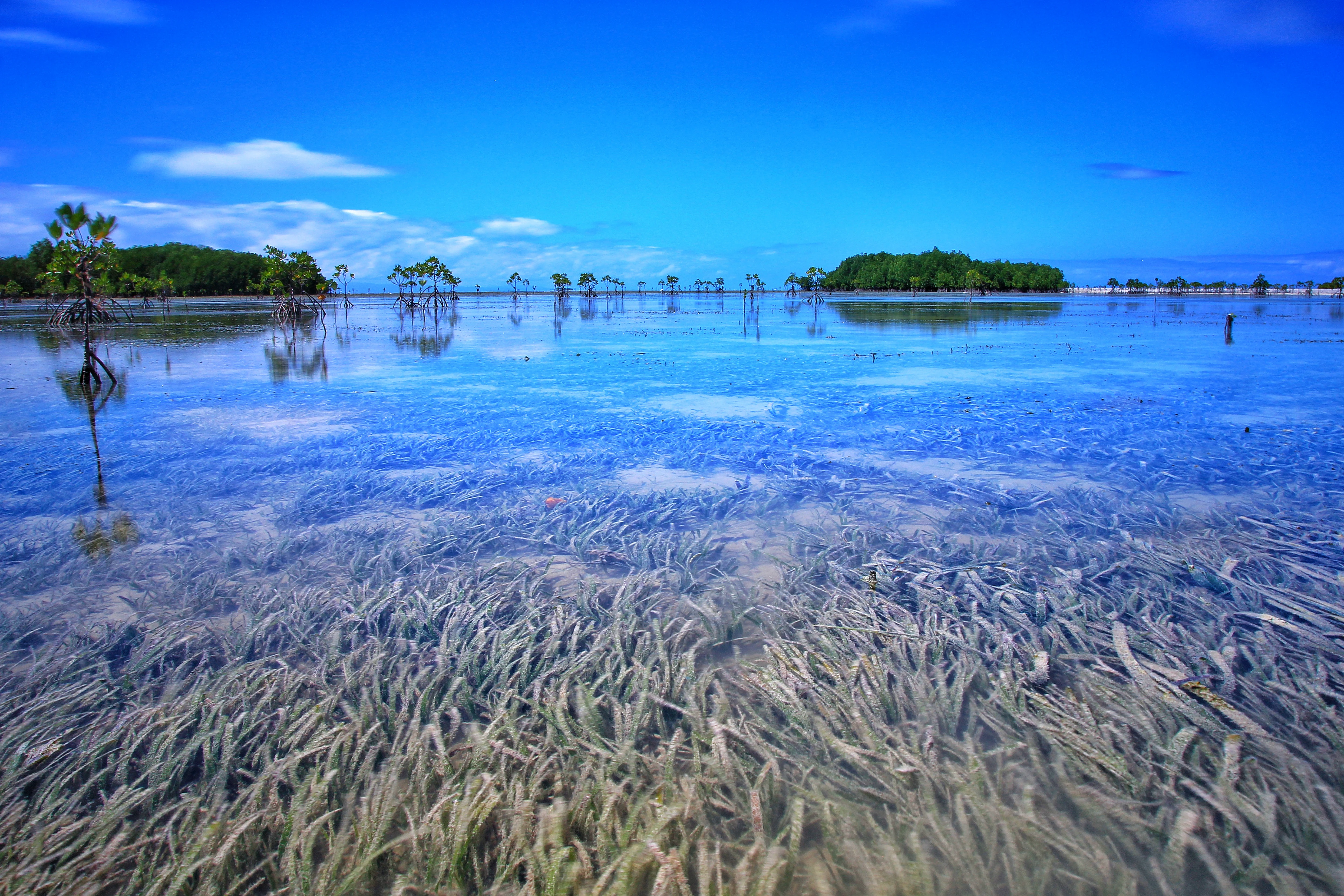
A wide angle view of a shallow wetland area with clear water over seagrass beds, reflecting a blue sky, with scattered mangrove trees in the distance.
Shallow tidal flats at Olango Island Wildlife Sanctuary, showcasing extensive seagrass beds under a clear sky.

Olango Island Wildlife Sanctuary history and protected-area timeline

The formal protection of the Olango tidal flats began in 1992, when Philippine President Corazon Aquino signed Presidential Proclamation No. 903 on May 14 of that year, declaring approximately 1,020 hectares of tidal flats on Olango Island a protected area. This proclamation laid the institutional foundation for the later establishment of the Olango Island Wildlife Sanctuary as a recognized conservation site.

The sanctuary's international profile grew quickly. On July 1, 1994, Olango was inscribed on the Ramsar List of Wetlands of International Importance, becoming the first Philippine wetland to receive this designation. The Ramsar recognition placed Olango within a global network of wetlands recognized for their ecological character and their importance to waterbirds, in particular those species migrating along the East Asian-Australasian Flyway.

Over the decades since, the sanctuary has remained a focal point for bird conservation, community-based coastal management, and educational activity in the Central Visayas. Its designation as the country's first Ramsar site has given the area a special place in Philippine environmental history and helped shape coastal management practices across the region.

Olango Island Wildlife Sanctuary landscape and geographic character

The landscape of the Olango Island Group is defined by its low elevation, its encircling sea, and its extensive intertidal zone. The islands rise no more than about 10 meters above sea level, producing a profile of gently rolling terrain rather than dramatic relief. The defining feature of the central area is a vast tidal flat, on which the 920-hectare wildlife sanctuary is situated.

Surrounding the islands is one of the most extensive reef flat-lagoon systems in the Central Visayas. Sandy beaches, rocky shorelines, inshore flats, seagrass beds, coral reefs, mangrove forest, mudflats, and salt marsh grass create a layered coastal landscape that shifts with the tides. Fringing reefs, including a steep reef wall on the western side and a sloping reef on the eastern coast, frame the islands and shape underwater topography that has given Olango a strong reputation for diving as well as birdwatching.

Geologically, the islands are formed of raised coral reefs overlying the Plio-Pleistocene Carcar Formation and Quaternary alluvium. The Carcar Formation is a porous coralline limestone marked by small sinkholes, pitted grooves, and branching pinnacles, while alluvial deposits dominate coastal areas in the form of calcareous sands mixed with shell fragments. Together, these features produce the shallow, sediment-rich substrates that underpin the area's ecological richness.
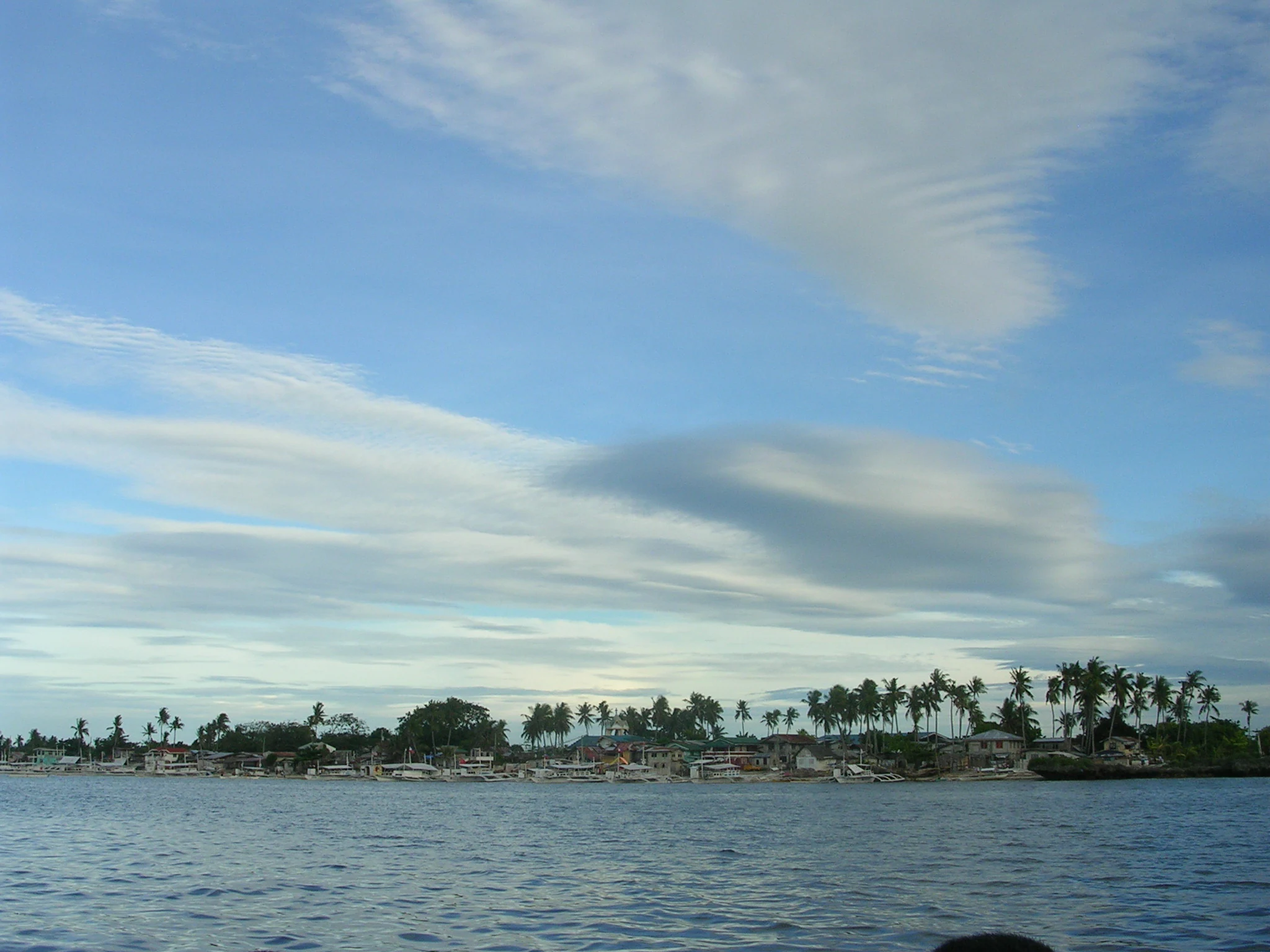
A wide view of a low-lying island covered in palm trees and scattered buildings, seen from across calm, open water under a blue sky with streaky clouds.
A coastal view of Olango Island as seen from the surrounding waters.

Olango Island Wildlife Sanctuary ecosystems, habitats, and plant life

Olango's ecological identity is rooted in the convergence of multiple coastal habitats within a small geographic area. Mangrove forest, seagrass beds, coral reefs, mudflats, sandflats, and salt marsh vegetation form an interconnected system rather than isolated patches. The mangroves of Olango are the most extensive in Cebu province, creating sheltered habitat for fish, crustaceans, and invertebrates that in turn feed larger predators and foraging shorebirds.

The seagrass beds and tidal flats support rich communities of benthic invertebrates, providing the food base for migratory and resident shorebirds. The offshore coral reefs host diverse reef fish, soft corals, and larger marine life, including occasional sightings of sharks and pelagic species along the drop-offs. Salt marsh plants stabilize sediments in the upper intertidal zone, while rocky shorelines add structural complexity to the coastal fringe.

This mosaic supports both resident species and seasonal visitors. The island's vegetation pattern, combined with the sheltered location between Mactan and Bohol, makes the area relatively protected from strong monsoon winds and surf, contributing to a more stable habitat environment. The result is an ecosystem in which marine productivity, intertidal habitat, and birdlife reinforce one another, giving the sanctuary a strong ecological cohesion.
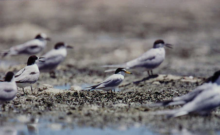
A group of terns with white bodies and black capped heads standing on a sandy and rocky tidal flat.
A flock of terns congregating on the tidal flats of Olango Island Wildlife Sanctuary.

Olango Island Wildlife Sanctuary wildlife and species highlights

The Olango Island Wildlife Sanctuary is most famous for its birdlife, particularly the migratory shorebirds that use the island as a stopover and wintering site on the East Asian-Australasian Flyway. Recorded bird species total roughly 97, of which 48 are migratory. These include globally recognized shorebirds such as the Chinese egret, the Asiatic dowitcher, the eastern curlew, the black-tailed godwit, and the red knot, alongside numerous plovers, sandpipers, and terns such as the little tern.

The sanctuary's value to migratory birds lies in its combination of abundant food supply and safe roosting habitat. The tidal flats provide foraging opportunities during low tide, while elevated areas and mangrove fringes offer secure resting sites. Because the island supports both northward and southbound migrations, bird activity is concentrated in the cooler months when northern-breeding species are on the move.

Beyond birds, the surrounding reef and lagoon systems host a wide range of marine fauna. Divers visiting sites such as Mabini Point, Baring, and Santa Rosa report encounters with grey reef sharks, tuna, barracuda, jacks, snappers, sweetlips, and schooling reef fish. The combination of forest, flat, and reef gives the area a layered wildlife profile that extends well beyond its bird-centric identity.
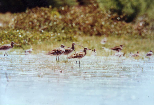
A group of Far Eastern Curlews, which are medium-sized wading birds with long, down-curved bills, standing and foraging in shallow water on a tidal flat, with grassy vegetation in the background.
A flock of Far Eastern Curlews foraging in the tidal flats of Olango Island Wildlife Sanctuary.

Olango Island Wildlife Sanctuary conservation status and protection priorities

The Olango Island Wildlife Sanctuary sits at the intersection of national and international conservation frameworks. Declared a protected area in 1992 and recognized as a Ramsar Wetland of International Importance in 1994, it carries both Philippine protected-area status and global recognition for its wetland values. As the first Ramsar site in the Philippines, it plays a flagship role in the country's wetland conservation efforts.

The sanctuary's conservation importance lies chiefly in its function as a refuge for migratory waterbirds along the East Asian-Australasian Flyway, one of the most threatened flyways in the world. Loss of intertidal habitat elsewhere along the flyway has made well-protected sites like Olango increasingly vital for species that depend on a network of stopover sites to complete their annual migrations. The presence of multiple species of conservation concern, including the Chinese egret and the eastern curlew, gives the sanctuary regional and global significance.

Marine habitat conservation complements the bird-focused identity of the site. Mangrove protection, seagrass preservation, and reef management are all part of the broader ecological picture. The sanctuary's protected status also intersects with community-based coastal management in Lapu-Lapu City and Cordova, where fishing, seaweed farming, shellcraft, and small-scale tourism continue alongside conservation goals.

Olango Island Wildlife Sanctuary cultural meaning and human context

The Olango Island Group has long been a home for coastal communities whose livelihoods are closely tied to the surrounding sea. Traditional occupations on the island include fishing, shellcraft, aquarium fish collection, seaweed farming, boat operation, and rainfed farming, reflecting a deep integration with the marine and intertidal resources that the sanctuary was later established to protect.

The administrative geography of the islands reflects this cultural and historical layering. Olango and several of its satellite islets fall under the city of Lapu-Lapu, while others, including Gilutongan and Nalusuan, fall under the municipality of Cordova. This shared jurisdiction shapes the way conservation, tourism, and community development interact across the islands. Barangays such as Baring, Sabang, Santa Rosa, Tingo, and Talima represent the long-standing human presence on Olango itself.

In recent decades, tourism has added a new layer to local life. The sanctuary has become a focal point for eco-tourism, birdwatching, and dive-related activities, creating new income sources alongside traditional fisheries. The ongoing relationship between residents and the protected area gives Olango a strong community-based dimension, with conservation outcomes shaped by the daily decisions of coastal households as much as by national policy.
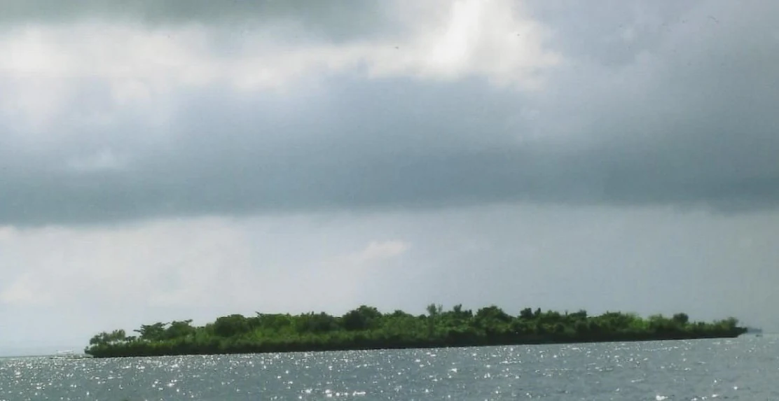
A small, low-lying island covered in dense green vegetation sits in the middle of calm water under a cloudy, overcast sky.
A view of Caohagan Island, located within the Olango Island Group.

Top sights and standout views in Olango Island Wildlife Sanctuary

Olango Island Wildlife Sanctuary stands out as a compact, information-dense protected area where migratory bird importance, coastal habitat diversity, and community life converge. The sanctuary's identity rests on a handful of notable qualities.

It is the Philippines' first Ramsar Wetland of International Importance, recognized for its critical role in supporting migratory shorebirds along one of the world's major flyways. It hosts the largest known concentration of migratory birds in the country, with around 97 bird species, including a long list of international visitors such as Chinese egrets, Asiatic dowitchers, eastern curlews, and red knots. It contains one of the most extensive reef flat-lagoon systems in the Central Visayas, with mangroves, seagrass beds, coral reefs, and salt marsh forming a continuous ecological mosaic. And it is embedded in a living coastal landscape, surrounded by communities whose fishing, farming, and tourism traditions remain closely tied to the waters and tidal flats that the sanctuary protects.

Best time to visit Olango Island Wildlife Sanctuary

The most rewarding period to experience the sanctuary's birdlife is during the northern winter months, when migratory shorebirds from Siberia, northern China, and Japan are present in large numbers. Bird activity is typically strongest from around July to November, aligning with the southward movement of birds heading toward wintering grounds in Australia and New Zealand and with their subsequent northward return.

The broader regional climate is tropical monsoon, with a short dry season from roughly February through April and a longer wet season dominating the rest of the year. Daytime temperatures throughout the year generally range between the low 20s and low 30s Celsius, with high humidity. Because the dry season is mild and the wet season rarely disrupts bird activity or coastal access dramatically, the sanctuary offers year-round appeal, with the migrant season providing the most distinctive birdwatching experience.

Monthly climate preview

Long-term temperature ranges and monthly precipitation distributions across representative coordinates

Olango Island Wildlife Sanctuary Climate Normals and Annual Weather Patterns

Representative coordinate records show measured annual temperature and precipitation shifts across twelve recorded periods for Olango Island Wildlife Sanctuary. Reviewing the complete monthly climate profile provides deeper context for long-term meteorological normals without relying on live forecasts.
Annual mean27 °C
26 °C29 °C
Jan26°
Feb26°
Mar27°
Apr28°
May29°
Jun28°
Jul27°
Aug27°
Sep27°
Oct27°
Nov27°
Dec26°
Warmest month
May

28.7 °C

Coolest month
January

25.8 °C

Wettest month
October

7.3 mm/day

Driest month
April

2.3 mm/day

Park location guide

Geography guide, regional context, and park location map for Olango Island Wildlife Sanctuary

Olango Island Wildlife Sanctuary park geography, regions, and map view in Philippines

Understand where Olango Island Wildlife Sanctuary sits in Philippines through a broader geographic reading of the surrounding landscape, nearby location context, and its mapped position within the national park landscape.

How Olango Island Wildlife Sanctuary fits into Philippines

The Philippines, officially the Republic of the Philippines, is an archipelagic nation in Southeast Asia comprising approximately 7,641 islands categorized into three main geographical divisions: Luzon, Visayas, and Mindanao. Located in the western Pacific Ocean, it shares maritime borders with Taiwan, Japan, Palau, Indonesia, Malaysia, Vietnam, and China. Manila serves as the capital city, while Quezon City is the most populated city, both within Metro Manila.

Wider geography shaping Olango Island Wildlife Sanctuary in Philippines

The Philippines is an archipelagic nation in Southeast Asia, positioned in the western Pacific Ocean. Its islands are bounded by the South China Sea to the west, Philippine Sea to the east, and Celebes Sea to the south. The country shares maritime borders with Taiwan to the north, Japan to the northeast, Palau to the east and southeast, Indonesia to the south, Malaysia to the southwest, Vietnam to the west, and China to the northwest.

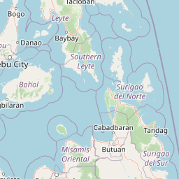
Map view of Olango Island Wildlife Sanctuary

Use this park location map to pinpoint Olango Island Wildlife Sanctuary in Philippines, understand its exact geographic position, and read its mapped placement within the surrounding landscape more clearly.

Pigeon | © OpenStreetMap contributors

Location context for Olango Island Wildlife Sanctuary

Central Visayas

Visual exploration of intertidal flats, mangroves, and coastal habitats

Olango Island Wildlife Sanctuary Photos and Landscape Scenery

Protected area imagery reveals the intricate terrain and diverse coastal habitats of Olango Island Wildlife Sanctuary. Examining these visual records helps researchers understand the environmental character of the tidal flats and surrounding marine ecosystems.

A wide angle view of a shallow wetland area with clear water over seagrass beds, reflecting a blue sky, with scattered mangrove trees in the distance.

A flock of white egrets wading in shallow, reflective water at a tidal flat.

A wide view of a low-lying island covered in palm trees and scattered buildings, seen from across calm, open water under a blue sky with streaky clouds.

A group of terns with white bodies and black capped heads standing on a sandy and rocky tidal flat.

A group of Far Eastern Curlews, which are medium-sized wading birds with long, down-curved bills, standing and foraging in shallow water on a tidal flat, with grassy vegetation in the background.

A large flock of small sandpiper birds wading and foraging in shallow water on a tidal flat.

A small, low-lying island covered in dense green vegetation sits in the middle of calm water under a cloudy, overcast sky.

Park atlas

Compare regional wetland reserves and coastal habitats across the Central Visayas

Parks Near Olango Island Wildlife Sanctuary and Surrounding Protected Landscapes

Continue geographic discovery by comparing Olango Island Wildlife Sanctuary with other notable protected areas across the surrounding coastal region. Evaluating adjacent wetland reserves and marine habitats provides broader context for regional conservation networks.
National parkCebu
About 50 km away#1 closest

West

Guadalupe Mabugnao Mainit Hot Spring National Park: Protected Landscape and Watershed Geography

Explore hot springs, caves, and mapped terrain in Cebu.

Guadalupe Mabugnao Mainit Hot Spring National Park is a protected national park in Cebu, Philippines, recognized for its significant watershed function and unique natural features. Spanning forested highland terrain within the Mantalongon mountain range, the park protects natural hot springs, explored cave systems such as Cave Lorett, and river networks vital to local water supply. Its identity as a protected landscape offers rich opportunities for geographic exploration, mapping its boundaries, and understanding its role within the regional natural terrain and conservation efforts.

Area
0.575 km²
Established
1972
IUCN
V
Relief
Mountain
Marine protected areaVisayas
About 59 km away#2 closest

West

Tañon Strait Protected Seascape: Marine Geography and Protected Landscape Analysis

An expansive marine passage located within the central Visayas island group.

As the largest marine protected area in the Philippines, the Tañon Strait Protected Seascape represents a complex aquatic geography spanning 160 kilometres. Its protected waters serve as a vital corridor for marine biodiversity, linking the northern Visayan Sea to the southern Bohol Sea. This resource provides a detailed look at the strait's maritime boundaries, coastal ecosystems, and the distinct underwater terrain that defines this critical conservation zone.

Area
5,000 km²
Established
1998
IUCN
V
Scope
Marine
Protected landscapeBohol
About 63 km away#3 closest

South

Rajah Sikatuna Protected Landscape: Mapping the Limestone Forest of Bohol, Philippines

A vital protected area of karst ridges and endemic forest habitats

Rajah Sikatuna Protected Landscape sits as a premier natural landmark in southern Bohol. This area is defined by its extensive karst topography, significant cave systems, and expansive limestone forests. It serves as an essential ecological anchor for the province, offering a unique perspective on the island's diverse upland geography and natural mountain systems.

Area
104.526 km²
Established
1987
IUCN
V
Relief
Mountain
A soft watercolor painting of a coastal landscape with green rolling hills, distant faint mountains, and light water reflections.
Protected landscapeLeyte
About 72 km away#4 closest

Northeast

Cuatro Islas Protected Landscape/Seascape: Leyte Marine and Island Geography Exploration

Detailed protected area atlas for the Camotes Sea island group

The Cuatro Islas Protected Landscape/Seascape is a notable Philippine conservation zone consisting of four distinct islands including Apid, Mahaba, Digyo, and Himokilan. This geographic profile details the diverse terrain, ranging from uplifted former coral reefs to coral sand islets, while providing a clear understanding of the surrounding marine ecosystem and its role in regional conservation.

Area
125 km²
Established
2000
Scope
Mixed
A horizontal watercolor painting showing a soft, hazy landscape with a body of water in the foreground, grassy banks, and rolling hills in the distance.
National parkCentral Visayas
About 78 km away#5 closest

South

Panglao Island Protected Seascape: Geographic Atlas and Marine Park Boundaries

A vital protected marine zone in Central Visayas

The Panglao Island Protected Seascape acts as a key site for studying tropical marine biodiversity and karst-driven coastal geography in the Philippines. Spanning the waters around Panglao Island, this protected area features a mosaic of coral reefs, white sand beaches, and offshore limestone islets that provide essential habitats for thousands of mollusk and crustacean species.

Area
91.12 km²
Established
2018
Relief
Mixed relief
Scope
Mixed
A watercolor painting featuring soft green hills in the midground and faint, pale purple mountain silhouettes in the background against a white backdrop.
National parkNegros Occidental
About 102 km away#6 closest

West

Mount Kanlaon Natural Park: Mapping the Volcanic Heart of Negros Island Protected Lands

A comprehensive geographic overview of volcanic terrain and rainforest habitats.

Mount Kanlaon Natural Park protects a defining massif in the Western Visayas, blending active volcanic features with some of the most intact tropical rainforests remaining on Negros Island. This geographic record maps the transition from steep, high-elevation ridges to lower-altitude forest boundaries, providing context on its importance as a refuge for threatened endemic wildlife and a significant center for regional biodiversity conservation.

Area
248.54 km²
Established
1934
Relief
Mountain
Scope
Terrestrial
National parkPhilippines
About 113 km away#7 closest

Northeast

Kuapnit Balinsasayao National Park: Philippines Old-Growth Forest and Endemic Wildlife Atlas

Explore protected landscape boundaries and mountainous terrain on Leyte Island.

Kuapnit Balinsasayao National Park stands as a key protected area within the Philippines, distinguished by its mature old-growth forests and its critical role in conserving endemic bird species unique to the Eastern Visayas. Located on Leyte Island within the mountainous terrain of the Anonang-Lobi Mountain Range, the park's protected landscape identity is central to understanding its geographic significance. This park offers a valuable entry point for exploring the mapped natural features and conservation importance of protected areas across the Philippine archipelago.

Area
3.64 km²
Established
1937
IUCN
V
Relief
Mountain
Wildlife reserveNegros Occidental
About 124 km away#8 closest

West

Ilog-Hilabangan Watershed Forest Reserve: Geography and Protected Forest Boundaries

A vital wildlife reserve and watershed landscape in Negros Occidental

This protected area covers a vast expanse of lowland and montane tropical forest in the heart of Negros Island. By regulating the headwaters of major rivers and maintaining a secure habitat for threatened endemic species, the reserve acts as a fundamental component of the regional geography and biodiversity network in the Western Visayas.

Area
102.11 km²
Established
1990
Relief
Mountain
Scope
Terrestrial

Common questions about visiting, size, designation, and location context for Olango Island Wildlife Sanctuary

Olango Island Wildlife Sanctuary FAQs for park facts, access, geography, and protected area context

Find quick answers about Olango Island Wildlife Sanctuary, including protected-area facts, park geography, trail and visitor context, and how the park fits into its surrounding country and regional landscape.
MoriAtlas Explorer

Continue Your Protected Areas Search Across the Global Atlas

Deepen your exploration by continuing the structured search for national parks and protected areas worldwide. Utilize the comprehensive filtering capabilities to compare different conservation landscapes and refine your understanding of global park geography. Discover more about the distribution and characteristics of protected natural areas.

Global natural geography