Mori Atlas logo
Protected areaPampa Tholar de las Vicuñas

A municipal integrated management area spanning the diverse terrain of the Potosí high plains.

Pampa Tholar de las Vicuñas Protected Area: Mapping High-Altitude Andean Puna Landscapes

(Área de Manejo Integrado Municipal Pampa Tholar de las Vicuñas)

Pampa Tholar de las Vicuñas is a high-altitude protected area in the Potosí department of Bolivia, defined by expansive puna grasslands, seasonal lagoons, and rugged mountain ridges. Spanning roughly 58,480 hectares across non-contiguous eastern and western life systems, the reserve serves as a critical corridor for vicuña populations and traditional community-based conservation. Its geography ranges from 3,200 to 4,700 meters in elevation, creating a distinctive Andean terrain characterized by thola shrublands and hardy cushion plants.

punahigh-altitudevicuña conservationAndean camelidsintegrated management areacommunity-based conservation

Pampa Tholar de las Vicuñas

Protected area

Park overview

Structured park overview, official facts, and landscape profile for Pampa Tholar de las Vicuñas

Pampa Tholar de las Vicuñas park facts, protected area profile, and essential visitor context

Review the core facts for Pampa Tholar de las Vicuñas, including designation, size, terrain, visitor scale, habitats, and operating context in one park-focused overview.

About Pampa Tholar de las Vicuñas

Pampa Tholar de las Vicuñas is a high-altitude protected landscape in the department of Potosí, Bolivia, dedicated to safeguarding the biodiversity, water resources, and cultural heritage of the southern puna. Stretching across roughly 58,480 hectares, the area lies on the Andean altiplano and in adjacent mountain ranges, where elevations range from about 3,200 to 4,700 meters above sea level. It is divided into two non-contiguous segments, the eastern and western life systems, each shaped by its own combination of plains, foothills, mountains, and human settlement.

The reserve is defined as a Municipal Integrated Management Area, a designation that allows for the protection of natural values while supporting the sustainable use of natural resources by local communities. In the eastern segment, eight communities inhabit plains, foothills, and piedmont areas, while in the western segment a smaller population lives among more rugged mountains and ridges. Together they form the social and economic backbone of the management scheme, built around the Regional Association of Vicuña Managing Communities of Villazón (ARCMV Villazón).

Ecologically, Pampa Tholar belongs to the semi-arid to arid puna, a tough and treeless high-elevation environment dominated by tough bunch grasses, cushion plants, thorny shrubs, and cacti adapted to cold nights, intense sunlight, and limited rainfall. Within this environment, the area sustains important populations of vicuña, Andean condor, suri (lesser rhea), and a wide variety of puna plants such as thola, ichu, churqui, cortadera, yareta, cardón, and kepu.

What truly sets the area apart, however, is the relationship between people and vicuña. The reserve was the outcome of a long grassroots effort led by local herding families to protect the species from poaching and habitat loss, and to organize the sustainable harvest of its valuable fiber. Today, the area combines habitat conservation, community-based wildlife management, and a live cultural tradition, making it a notable example of community-driven conservation in the Bolivian Andes.

Quick facts and research context for Pampa Tholar de las Vicuñas

Pampa Tholar de las Vicuñas is located in the province of Modesto Omiste, within the municipality of Villazón, in the southern Bolivian department of Potosí, near the border with Argentina. It sits in the puna semi-arid to arid ecoregion, generally between 3,200 and 4,700 meters above sea level, and covers approximately 58,480 hectares across two non-contiguous zones.

It is a municipal-level integrated management area (Área de Manejo Integrado Municipal), one of four protected areas in Potosí and the only one in Villazón. Created in 2018 through Municipal Law 81/2018, it is administered by the Autonomous Municipal Government of Villazón and managed on the ground by the Regional Association of Vicuña Managing Communities of Villazón (ARCMV Villazón).

Protection and recognition

Review documented terrestrial protection scope and international recognition records.

Pampa Tholar de las Vicuñas Protection Status and Designated Area Facts

Pampa Tholar de las Vicuñas holds a registered terrestrial protection scope within the global conservation database. Documented management records compile available designation history and official recognition data for structural geographic analysis.

Protection details

Protection scope
Terrestrial
Transboundary protection
No
Park context

Deeper park guide and search-rich context for Pampa Tholar de las Vicuñas

Pampa Tholar de las Vicuñas history, landscape, wildlife, and travel context

Explore Pampa Tholar de las Vicuñas through its history, landscape character, ecosystems, wildlife, conservation priorities, cultural context, and seasonal travel timing in a structured park guide built for atlas discovery and search intent.

Why Pampa Tholar de las Vicuñas stands out

The reserve is best known for protecting one of the most important vicuña populations in southern Bolivia, with an estimated population of nearly 14,000 animals in recent years. It combines strict habitat protection with a communal management system in which families capture, shear, and release vicuñas once a year, a traditional practice called chaku, and commercialize the high-value fiber internationally. The area is also recognized for its scenic puna landscapes of rolling plains, foothills, ridges, mountains, and seasonal lagoons, and for sheltering emblematic high-altitude species such as the Andean condor and the lesser rhea of the puna (suri).
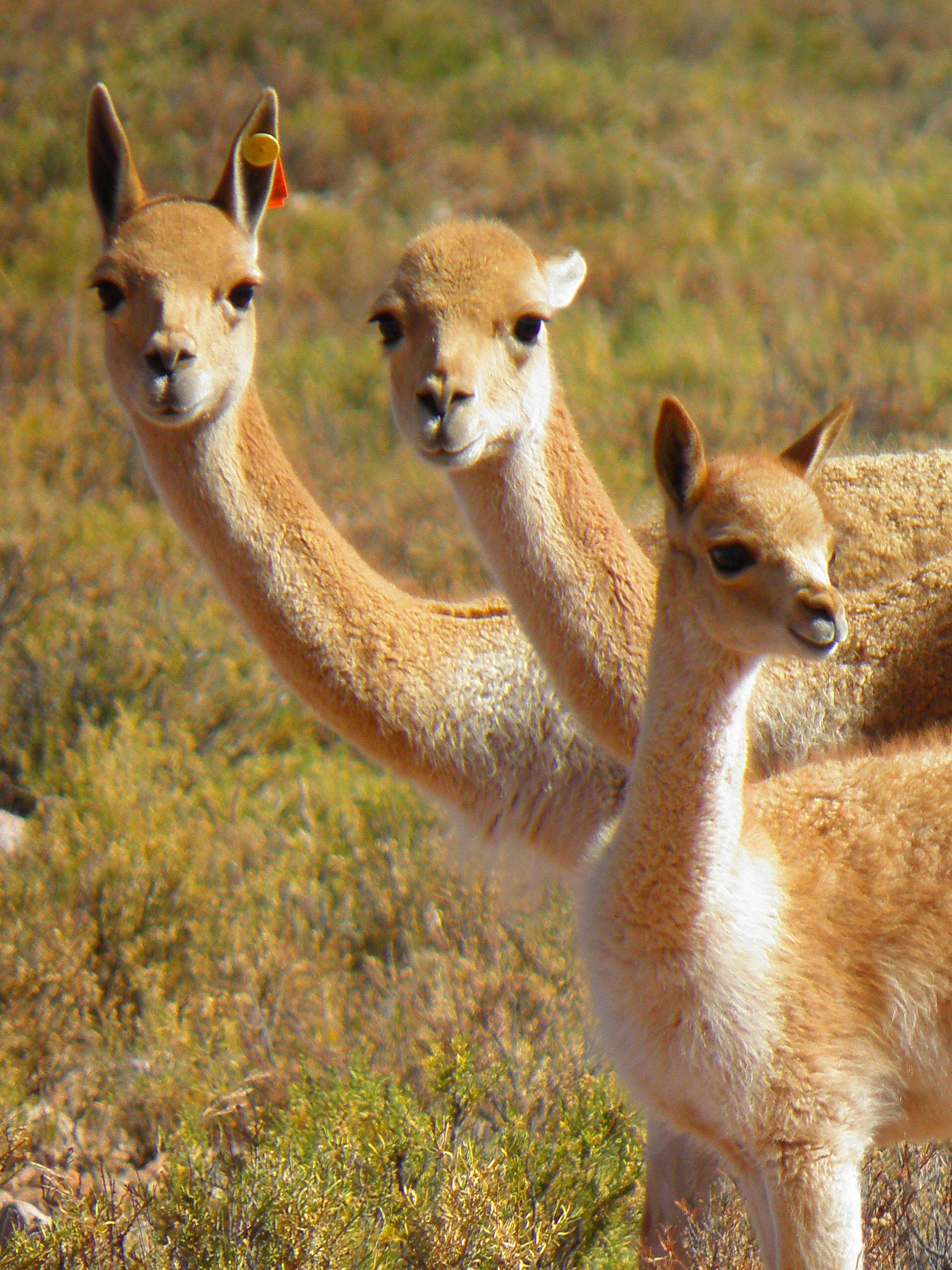
Three vicuñas with golden brown coats standing close together in arid, low-lying brush, one featuring a small orange ear tag.
A small family group of vicuñas in the wild in the Puna ecoregion.

Pampa Tholar de las Vicuñas history and protected-area timeline

The protection of Pampa Tholar de las Vicuñas is closely tied to the story of how local communities came together to defend a fragile puna ecosystem and the southern vicuña population that depends on it. Between 2006 and 2008, in the municipality of Villazón, local leaders and former councilor Lourdes Llanos worked to organize herding families into what would become the Regional Association of Vicuña Managing Communities of Villazón. In those early years the community performed the first manual shearing of vicuñas, a technique known locally as chaku, and conducted a first census that counted roughly 2,000 vicuñas in the area.

By 2017, the vicuña population had grown to approximately 11,000 individuals, and the association had become a credible community institution. That same year, a census and management plan set the path toward formal protection, and in 2018 the Autonomous Municipal Government of Villazón declared the area protected through Municipal Law 81/2018, creating the Área de Manejo Integrado Municipal Pampa Tholar de las Vicuñas. The new reserve was conceived specifically to conserve biodiversity, landscapes, and water resources, while supporting the sustainable use of vicuña fiber and the regional ecosystem services that local families depend on.

The initial push to create the area was supported by the Biocultura y Cambio Climático project, financed by Swiss Cooperation in Bolivia and implemented by the local non-profit organization PROMETA. Since then, the area has continued to be shaped by annual vicuña censuses carried out under the Shared Responsibility Vicuña Agenda (ARCO Vicuña) of the municipal government. The trajectory from a handful of skeptical families in the mid-2000s to an association of 130 families managing more than 13,000 vicuñas by 2024 reflects a remarkable community-led conservation story in the Bolivian puna.

Pampa Tholar de las Vicuñas landscape and geographic character

Pampa Tholar de las Vicuñas sits in the transitional zone between the Altiplano and the Eastern Cordillera foothills, where the Andean plateau gives way to a mosaic of high plains, foothills, and rugged mountain ranges. Elevations climb from around 3,200 meters in the lower fringes of the area to approximately 4,700 meters along the highest peaks, giving the landscape a distinctly layered feel of sweeping flats framed by serrated ridges.

The eastern life system of the area is dominated by broad plains broken by rolling foothills and gentle piedmont slopes, with eight communities distributed across this varied terrain. The western life system is more compact and rugged, with steeper mountains, exposed ridges, and only one community settled in this harsher environment. Together, the two non-contiguous segments of the reserve create a continuous ecological and cultural territory across what would otherwise be isolated patches of puna.

Seasonal lagoons dot parts of the reserve, providing key water sources for wildlife and forming part of the puna hydrological network. Cold-dry winds, intense ultraviolet radiation, sparse vegetation cover, and frost-prone nights give the area an austere, high-altitude character. Vegetation appears in dense stands of thola shrubs and ichu bunch grasses, interrupted by stands of churqui, cushions of yareta, flowering cortadera, scattered cacti, and cushion-shaped plant communities adapted to the hard soil and dry climate. The result is a remote, open, and visually striking Andean landscape typical of the southern Bolivian puna.
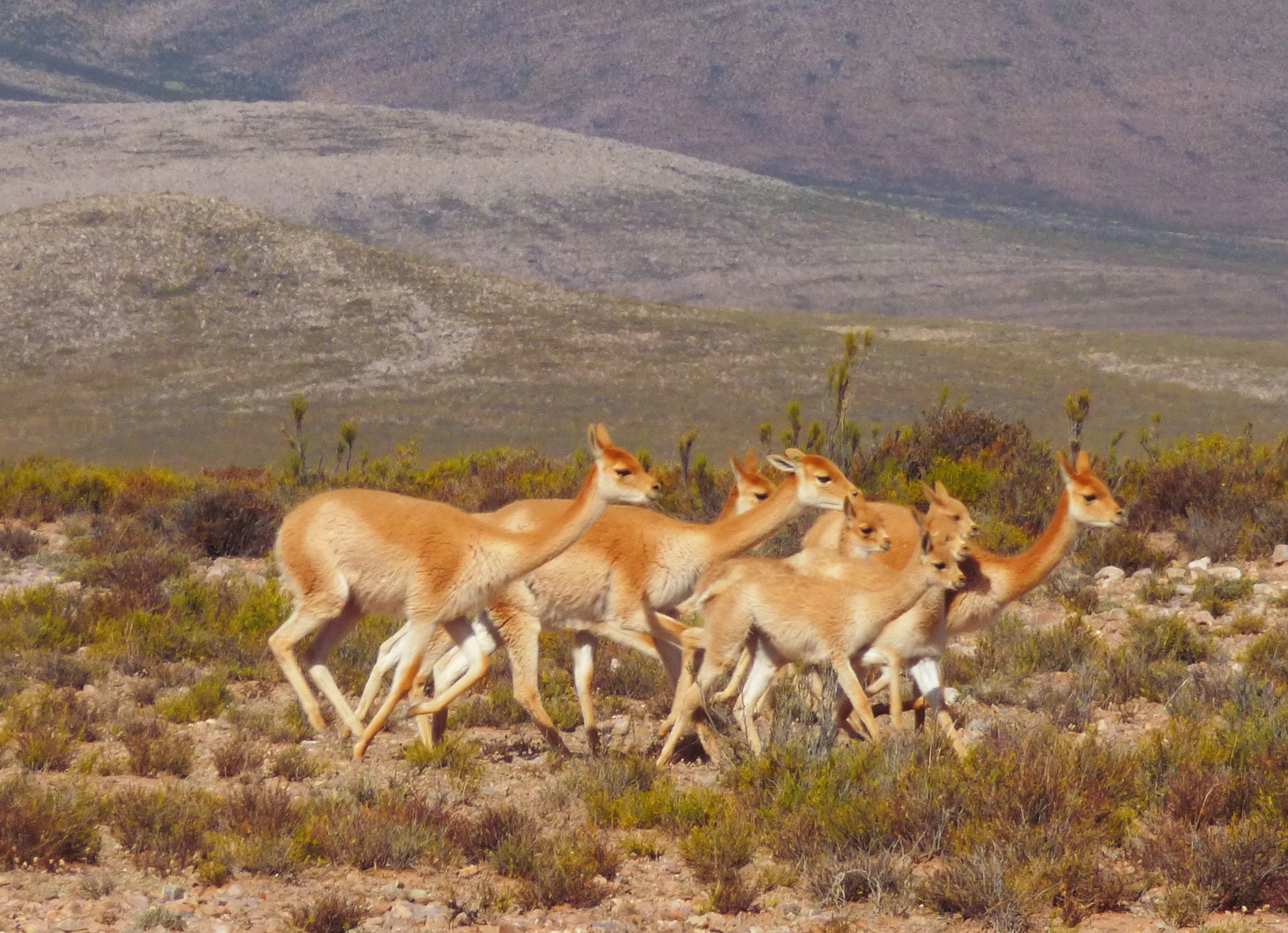
A group of six light brown vicuñas walking together through sparse, dry scrubland against a background of rolling arid hills.
A small family group of vicuñas traversing the arid landscape of the Pampa Tholar de las Vicuñas.

Pampa Tholar de las Vicuñas ecosystems, habitats, and plant life

The ecosystems protected by Pampa Tholar de las Vicuñas belong to the semi-arid to arid puna, one of the harshest and most specialized high-altitude environments in South America. The vegetation here is shaped by extreme daily temperature swings, low annual rainfall, intense sunlight, and shallow or rocky soils. The dominant plant communities form the structural backbone of the landscape and play a key role in stabilizing soils, feeding camelids, and hosting a wide range of puna wildlife.

Thola (Baccharis incarum) is one of the most characteristic shrubs, often forming dense, resin-scented stands that provide shelter and forage across the plains and foothills. Ichu, or paja brava (Stipa ichu), is the dominant bunch grass and is closely associated with grazing systems and soil protection. Churqui (Prosopis ferox) appears as a thorny leguminous tree in dry valley and foothill settings, while cortadera, yareta, cardón, and kepu add botanical diversity across rocky outcrops, cushion-forming patches, and exposed slopes.

Hydrology is another defining element of the ecological character of the area. Seasonal lagoons, small wetlands, and the broader watershed provide essential water sources for fauna and support the hydrological regime that local communities rely on. Conserving this combination of plant communities, water sources, and functional ecological processes is one of the central objectives of the protected area, ensuring that the puna can continue to support vicuñas and other emblematic species.
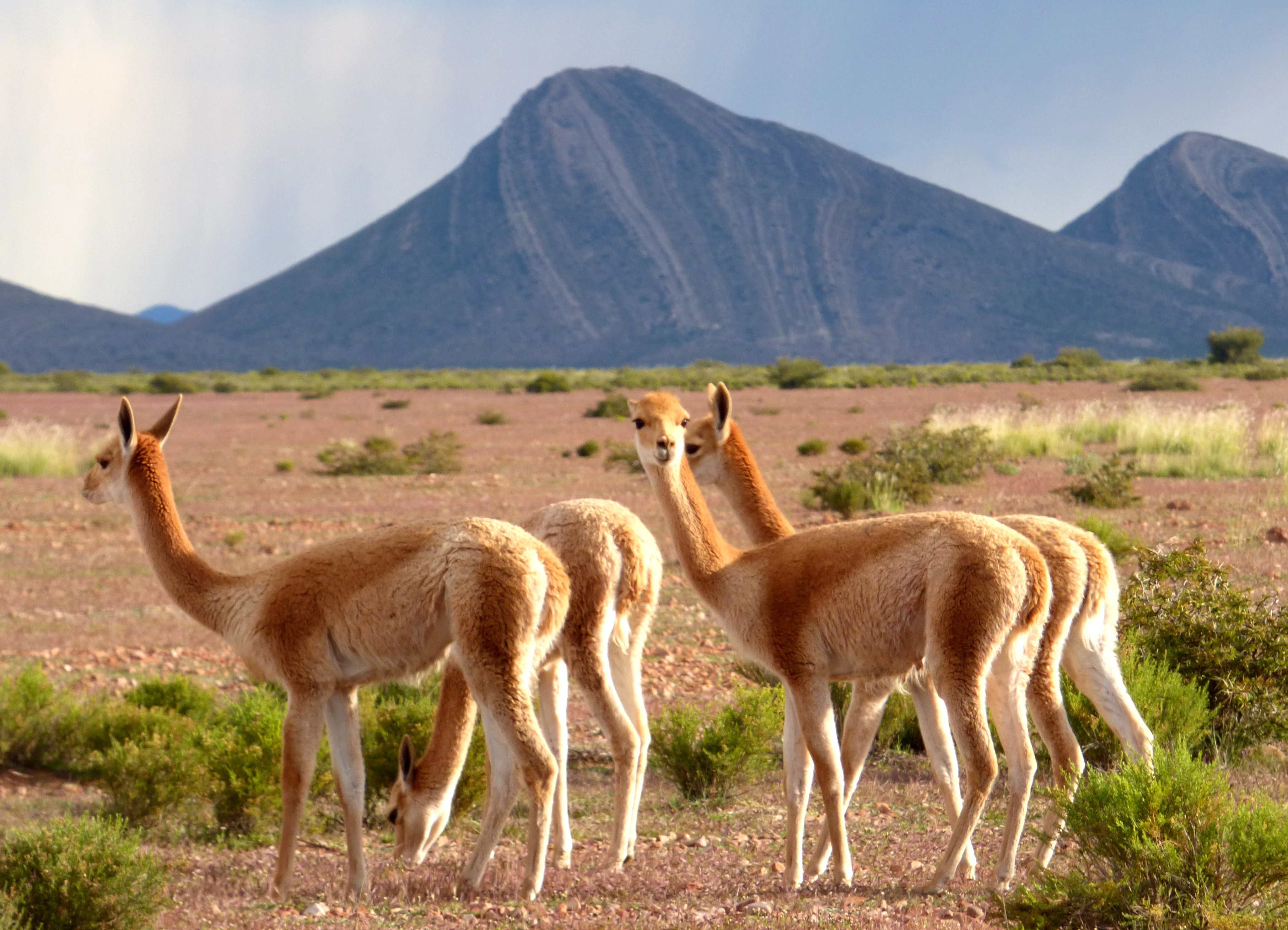
A group of light-brown vicuñas grazing in a sparse, dry, arid landscape with dark, rounded mountains in the background.
A small group of vicuñas grazing in the high-altitude landscape of Pampa Tholar de las Vicuñas.

Pampa Tholar de las Vicuñas wildlife and species highlights

Wildlife at Pampa Tholar de las Vicuñas is shaped by the harshness and openness of the puna, with species adapted to high altitudes, sparse vegetation, and long seasonal cycles. The most emblematic resident is the vicuña (Vicugna vicugna), a wild South American camelid whose numbers have grown dramatically in the area thanks to decades of community-based protection and management. From an initial count of around 2,000 animals in 2008, recent censuses register nearly 14,000 individuals, with population structure dominated by stable family groups made up of a male, a female, and their young.

The Andean condor (Vultur gryphus), classified as vulnerable, soars over the ridges and high cliffs of the area, while the suri or lesser rhea of the puna (Rhea pennata), classified as endangered, roams the most open plains as one of the reserve's most sensitive species. Seasonal lagoons and their surroundings provide habitat for wading birds and waterfowl typical of the high Andes, contributing to the area's birdlife diversity across both life systems.

At the broader ecological level, vicuñas function as key grazers that help maintain the structure of puna grasslands. Their selective grazing interacts with the rich matrix of thola, ichu, and other vegetation in ways that influence plant composition, soil cover, and habitat for smaller fauna. Protecting these wildlife communities is central to the rationale of the reserve and to the identity of the area as an Andean conservation landscape.
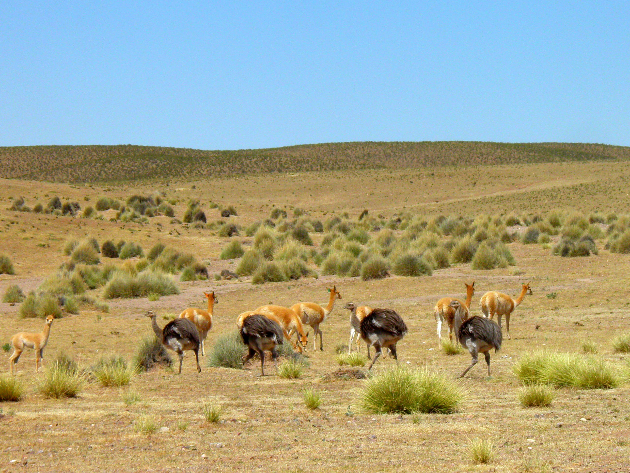
A group of vicuñas and flightless suri birds in an arid, grassy, high-altitude desert landscape under a clear blue sky.
A mixed group of vicuñas and suris foraging in the high Andean puna landscape.

Pampa Tholar de las Vicuñas conservation status and protection priorities

Pampa Tholar de las Vicuñas was created with a clear conservation mandate: to preserve the biodiversity, landscapes, and water resources of the southern puna, and to safeguard the ecological processes that sustain local communities. Its declaration as a protected area responded directly to growing threats such as soil erosion, illegal hunting of vicuñas, and the expansion of the agricultural frontier, all of which were degrading the region's ecosystems and undermining traditional livelihoods.

The reserve's conservation model is distinctive because it combines strict habitat protection with the regulated, communal use of vicuña fiber. Each year, members of the Regional Association of Vicuña Managing Communities of Villazón participate in coordinated capture, manual shearing, and release operations known locally as chaku. This practice allows the population to continue growing while generating economic value that is invested back into local communities, creating a direct link between conservation outcomes and human wellbeing.

Beyond vicuña management, the area plays an important role in protecting hydrological functions, maintaining genetic resources of wild camelids, and providing refuge for endangered and vulnerable species such as the suri and the Andean condor. The combination of municipal-level protection, community-based management, and ongoing census and monitoring under ARCO Vicuña makes Pampa Tholar a notable example of integrated conservation in the Bolivian puna.

Pampa Tholar de las Vicuñas cultural meaning and human context

The cultural identity of Pampa Tholar de las Vicuñas is deeply tied to the herding and fiber traditions of the Andean puna. The vicuña, once a threatened species, is a cornerstone of local identity and economy, and the practice of shearing wild vicuñas (chaku) has long been part of the regional heritage. The protected area formalizes and reinforces this relationship, giving legal recognition to a traditional activity that connects people with the high-altitude landscapes they inhabit.

Local families, gathered into community-based managing organizations, are the protagonists of the area's conservation story. Around 130 families are members of the Regional Association of Vicuña Managing Communities of Villazón and derive income from the sale of vicuña fiber, which is marketed to buyers in Italy and Argentina. Alongside this fiber economy, communities continue to cultivate vegetables, legumes, grains, tubers, and fruits, and to produce handicrafts that reflect traditional knowledge of the puna environment.

The intertwined relationship between Andean livelihoods, communal organization, and wildlife management gives the area a strong cultural dimension that reaches beyond simple protected-area status. It is a place where biodiversity conservation and rural cultural heritage are actively maintained together.

Top sights and standout views in Pampa Tholar de las Vicuñas

Pampa Tholar de las Vicuñas combines high-altitude puna ecosystems with one of Bolivia's most successful community-led vicuña conservation programs. Its 58,480 hectares of arid puna protect vicuñas, Andean condors, and suros, while sustaining seasonal lagoons, ichu grasslands, and thola shrublands that anchor the regional hydrological and ecological balance.

The reserve also stands out for its institutional design: a municipal integrated management area created in 2018 but built on more than a decade of grassroots organization, communal shearing traditions, and partnerships with conservation NGOs. Its annual vicuña census, stable family groups, and growing population of nearly 14,000 animals make it a flagship example of how Andean communities can protect and benefit from a wild camelid species at the same time.

Best time to visit Pampa Tholar de las Vicuñas

Pampa Tholar de las Vicuñas sits in a cold, semi-arid high-altitude environment where seasonal patterns strongly influence both landscape and wildlife character. The dry season, generally associated with the southern hemisphere winter and early spring months, tends to bring clearer skies, lower temperatures, and drier, more open terrain. This period can be favorable for observing large mammals such as vicuña and suri across the plains, as animals concentrate around available water and forage.

The wet season, by contrast, brings more variable weather, occasional storms, and greener grasslands, which can enhance the visual richness of the puna and increase bird activity around seasonal lagoons. Travelers interested in high-altitude landscapes, photogenic Andean wildlife, and traditional puna scenery will find that shoulder periods between dry and wet seasons often offer a balanced mix of clear visibility and ecological dynamism. Given the high elevation of the area, visitors should be prepared for cold temperatures, strong winds, and intense sunlight regardless of season.

Monthly climate preview

Long term temperature and precipitation patterns across twelve months at high elevation

Pampa Tholar de las Vicuñas Climate Normals and Annual Weather Rhythms

Representative coordinate measurements record steady thermal shifts and distinct monthly precipitation variations across the protected landscape. Examining the complete twelve month climate profile reveals full statistical records for researchers tracking high altitude environmental baselines.
Annual mean9 °C
4 °C12 °C
Jan12°
Feb11°
Mar11°
Apr
May
Jun
Jul
Aug
Sep
Oct11°
Nov12°
Dec12°
Warmest month
December

12.3 °C

Coolest month
July

4.1 °C

Wettest month
January

4.4 mm/day

Driest month
July

0.2 mm/day

Park location guide

Geography guide, regional context, and park location map for Pampa Tholar de las Vicuñas

Pampa Tholar de las Vicuñas park geography, regions, and map view in Bolivia

Understand where Pampa Tholar de las Vicuñas sits in Bolivia through a broader geographic reading of the surrounding landscape, nearby location context, and its mapped position within the national park landscape.

How Pampa Tholar de las Vicuñas fits into Bolivia

Bolivia, officially the Plurinational State of Bolivia, is a landlocked country in central South America. It features diverse geography including the Andean mountain range, Amazonian plains, Gran Chaco, and the Pantanal wetland. The country has a population of approximately 11.4 million and is administratively divided into nine departments, with La Paz as the seat of government and Sucre as the constitutional capital.

Wider geography shaping Pampa Tholar de las Vicuñas in Bolivia

Bolivia is located in central South America, bordered by Brazil to the north and east, Paraguay to the southeast, Argentina to the south, Chile to the southwest, and Peru to the west. The country is divided between a western Andean region and tropical lowlands to the east and north. It includes the Amazonian plain, Gran Chaco, temperate valleys, the high-altitude Altiplano plateau, and part of the Pantanal wetland along its eastern border.

Map view of Pampa Tholar de las Vicuñas

Use this park location map to pinpoint Pampa Tholar de las Vicuñas in Bolivia, understand its exact geographic position, and read its mapped placement within the surrounding landscape more clearly.

Pigeon | © OpenStreetMap contributors

Location context for Pampa Tholar de las Vicuñas

Potosí

Visual reference for high altitude puna habitats and protected Andean terrain

Pampa Tholar de las Vicuñas Photos and Landscape Scenery

Visual documentation captures the high altitude puna landscapes, rolling foothills, and expansive grasslands that define the protected area. Photographic records reveal the stark terrain, seasonal lagoons, and natural habitat features characteristic of the southern Bolivian highlands.

Three vicuñas with golden brown coats standing close together in arid, low-lying brush, one featuring a small orange ear tag.

A large flock of white and grey birds in flight over a small, reflective lagoon in an arid, mountainous landscape, with several camelids standing near the water's edge.

A group of six light brown vicuñas walking together through sparse, dry scrubland against a background of rolling arid hills.

A group of light-brown vicuñas grazing in a sparse, dry, arid landscape with dark, rounded mountains in the background.

A group of vicuñas and flightless suri birds in an arid, grassy, high-altitude desert landscape under a clear blue sky.

Park atlas

Compare adjacent highland ecosystems and regional puna conservation areas

Parks Near Pampa Tholar de las Vicuñas and Surrounding Protected Landscapes

Browsing other protected areas near Pampa Tholar de las Vicuñas reveals the broader geographic spread of southern Bolivian high plains and mountain reserves. Comparing these neighboring habitats highlights unique Andean terrain patterns, high-altitude grasslands, and regional conservation approaches.
Wildlife reserveTarija Department
About 58 km away#1 closest

Northeast

Tajzara Wildlife Reserve: Geographic and Landscape Overview of the Tarija Basin

High-altitude wetlands and saline lagoons in the Bolivian Andes

Tajzara Wildlife Reserve stands as a critical high-altitude wetland complex within the Tarija Department. This protected landscape sustains life across saline lake beds, seasonal pools, and marshy margins, functioning as a vital refuge for migratory waders and flamingo populations in the harsh, arid climate of the Bolivian Altiplano.

Area
13 km²
Established
1999
Relief
Highland
Climate
Alpine
A soft watercolor painting depicting gentle, rolling hills and plains in muted shades of green, yellow, and violet.
Natural monumentSud Chichas
About 60 km away#2 closest

North

Área protegida municipal Ecoparque Encantado: Geographic Atlas and Natural Monument Overview

Mapped canyon landscapes and dry valley geography in the Sud Chichas province.

Analyze the topographic features of Área protegida municipal Ecoparque Encantado, a protected municipal monument in southern Bolivia. This area captures the dramatic transition between high-altitude puna grasslands and warm inter-Andean dry valleys. Learn about the geological history of the Tupiza Formation, the preservation of endemic vegetation, and the specific terrain dynamics that define this unique canyon-rich protected landscape.

Area
38.2 km²
Established
2015
IUCN
III
Relief
Mountain
A watercolor painting of a simplified, abstract landscape with rolling hills in shades of green, yellow, and muted pink against a white background.
Protected landscapeTarija
About 63 km away#3 closest

Northeast

Parque natural y área de manejo integrado El Cardón: Geography and Protected Area Atlas

High-altitude puna landscapes and cactus diversity in Tarija, Bolivia.

Spanning the high-altitude plateaus of southern Bolivia, this protected area features a unique mosaic of arid terrain, specialized cactus ecosystems, and vital wildlife corridors. The landscape provides a deep look into the puna and pre-puna geography of the Tarija department, including significant archaeological sites and thriving populations of wild vicuñas within a dramatic, high-elevation Andean environment.

Area
300.56 km²
Established
2003
Relief
Mountain
Climate
Arid
Watercolor illustration showing a pale green rural landscape with rolling hills, scattered trees, a winding path or stream, and small buildings in the distance
Biosphere reserveBolivia
About 79 km away#4 closest

Northeast

Reserva Biológica de la Cordillera de Sama: Protected Mountain Landscapes of Southern Bolivia

High-Andean biosphere reserve featuring lagoons, dunes, and ancient pathways.

Reserva Biológica de la Cordillera de Sama encompasses a vast elevation range from dry inter-Andean valleys to the 4,700-meter peaks of the Cordillera Oriental. This reserve protects the endorheic Tajzara basin, where seasonal lagoons and sand dunes contrast with relict forests and steep mountain ravines. Its geography offers a complex mosaic of ecosystems, providing essential water sources and specialized habitat for endemic fauna within the southern Bolivian highlands.

Area
1,085 km²
Established
1991
Relief
Mountain
Climate
Alpine
National parkArgentina
About 97 km away#5 closest

Southeast

Baritú National Park National Park: Mapped Protected Landscapes in Argentina's Geography

Understand the natural terrain and geographic setting of this Argentinian park.

Baritú National Park represents a distinct national park entity within Argentina, crucial for understanding the country's protected landscapes and regional geography. This page provides specific atlas-level detail on its mapped boundaries and the surrounding natural terrain. Explore Baritú National Park as a key geographic feature contributing to the broader understanding of conservation areas across South America, grounded in factual, map-oriented discovery.

Area
720 km²
Established
1974
IUCN
II
Relief
Mountain
A soft watercolor illustration of a river flowing through a lush landscape with gentle green hills in the distance.
Wildlife reserveTarija
About 126 km away#6 closest

East

Reserva nacional de flora y fauna de Tariquía: Atlas and Geographic Protected Area Overview

Montane cloud forest and subandean river valleys in Tarija

This wildlife reserve preserves the most intact stands of Yungas Tucumano-Boliviano forest in Bolivia. Featuring a dramatic vertical zonation from foothill selva to high-elevation pine woodlands, the area serves as a primary hub for ecological research and conservation in the rugged landscapes of Tarija near the Argentine border.

Area
2,468.7 km²
Established
1989
Relief
Mountain
Climate
Subtropical
A soft watercolor painting depicting a wide, pale landscape with rolling hills, a central body of water with pinkish tones, and muted green vegetation.
Wildlife reservePotosí
About 153 km away#7 closest

West

Reserva nacional de fauna andina Eduardo Abaroa: Protected Area and Andean Terrain Map

High-altitude volcanic landscapes and flamingo wetlands in Potosí, Bolivia.

The Reserva nacional de fauna andina Eduardo Abaroa represents one of the most distinctive protected landscapes in the Andes. Spanning across the Altiplano, the terrain encompasses geothermal geyser fields at Sol de Mañana, dramatic volcanic summits like Licancabur, and specialized mineral lagoons. This protected area offers a look at extreme environmental adaptation, where high-altitude desert formations meet rare, nutrient-rich wetlands that sustain significant populations of Andean, James's, and Chilean flamingos.

Area
7,147.45 km²
Established
1973
IUCN
IV
Visitors
152.9K annual
National parkArgentina
About 183 km away#8 closest

Southeast

Calilegua National Park: Mapped Protected Landscape in Argentinian Geography

Explore the national park's boundaries and regional terrain.

Calilegua National Park represents a vital protected landscape within Argentina's extensive geography. This detail page provides an atlas-focused view, highlighting the park's specific geographic setting and its importance as a national park. Understand its mapped terrain and how it fits within the broader conservation context of South America. This resource is crafted for in-depth geographic discovery and map-based analysis of the park's protected area features.

Area
763.06 km²
Established
1979
IUCN
II
Relief
Mountain

Common questions about visiting, size, designation, and location context for Pampa Tholar de las Vicuñas

Pampa Tholar de las Vicuñas FAQs for park facts, access, geography, and protected area context

Find quick answers about Pampa Tholar de las Vicuñas, including protected-area facts, park geography, trail and visitor context, and how the park fits into its surrounding country and regional landscape.
MoriAtlas Explorer

Continue Your Protected Areas Search Across the Global Atlas

Deepen your exploration by continuing the structured search for national parks and protected areas worldwide. Utilize the comprehensive filtering capabilities to compare different conservation landscapes and refine your understanding of global park geography. Discover more about the distribution and characteristics of protected natural areas.

Global natural geography