Mori Atlas logo
State or regional parkParc naturel départemental de l'Estéron

Explore the geography and riverine terrain of this departmental park in the Alpes-Maritimes

Parc naturel départemental de l'Estéron: A Protected River Valley and Regional Landscape

Parc naturel départemental de l'Estéron is a protected landscape located within the Alpes-Maritimes department of France. Spanning the valley where the Estéron River flows, this site offers a unique perspective on Pre-Alpine geography and riparian habitat. The park holds a distinct role as a green corridor between the communes of Roquestéron and La Roque-en-Provence, serving as an essential part of the broader regional network of natural areas.

departmental natural parkriver valleyMediterranean landscapePre-AlpsAlpes-Maritimeswild river

Parc naturel départemental de l'Estéron

State or regional park

Park overview

Structured park overview, official facts, and landscape profile for Parc naturel départemental de l'Estéron

Parc naturel départemental de l'Estéron park facts, protected area profile, and essential visitor context

Review the core facts for Parc naturel départemental de l'Estéron, including designation, size, terrain, visitor scale, habitats, and operating context in one park-focused overview.

About Parc naturel départemental de l'Estéron

The Parc naturel départemental de l'Estéron is a departmental-scale protected natural area in the Alpes-Maritimes, established in the early 2010s to provide public access to a scenic stretch of the Estéron River valley. Although it covers only around twenty hectares, it acts as a key point of contact between visitors and one of the most ecologically rich river corridors in the inland Côte d'Azur hinterland, just a short distance from the city of Nice.

The park lies within two communes, Roquestéron and La Roque-en-Provence, which face each other across the Estéron River and reflect the older political and cultural boundary between the former County of Nice and the Kingdom of France. The geography of the site is shaped by the narrow river valley itself: rocky Mediterranean hillsides, riverbank vegetation, and the changing water levels of a freer flowing mountain stream. Pedestrian paths inside the park make it easy to reach the water's edge, something that is often difficult along more developed stretches of the regional river system.

By being nested inside the larger Parc naturel régional des Préalpes d'Azur, the Estéron departmental park adds value to a wider network of protected landscapes that aims to safeguard the natural and rural heritage of the southern French Pre-Alps. In this context, the park is less a destination in itself than a focal point for discovering the biodiversity, hydrology, and history of the Estéron valley within a recognized regional framework. Its role becomes even more relevant after 2018, when the Estéron was designated a "Sauvage River," confirming its high ecological status among French watercourses.

Quick facts and research context for Parc naturel départemental de l'Estéron

The Parc naturel départemental de l'Estéron covers about twenty hectares in the Alpes-Maritimes department, within the Provence-Alpes-Côte d'Azur region of southeastern France. It is owned and managed by the Conseil départemental des Alpes-Maritimes and is open to the public.

The park straddles the communes of Roquestéron and La Roque-en-Provence and sits inside the larger Parc naturel régional des Préalpes d'Azur. Its central natural feature is the Estéron River, which the park follows as it approaches the river Var. The park was inaugurated in August 2011, making it a relatively recent addition to the departmental network of natural spaces, and it has come to prominence alongside the 2018 "Sauvage River" recognition of the Estéron itself.

Protection and recognition

Terrestrial conservation framework, management scope, and verified recognition data

Parc naturel départemental de l'Estéron Protection Status and Designation Records

Documented protection status records for Parc naturel départemental de l'Estéron outline terrestrial conservation scope and official management frameworks. Verified recognition sources clarify international standing and administrative designation history across the protected area.

Protection details

Protection scope
Terrestrial
Transboundary protection
No
Park context

Deeper park guide and search-rich context for Parc naturel départemental de l'Estéron

Parc naturel départemental de l'Estéron history, landscape, wildlife, and travel context

Explore Parc naturel départemental de l'Estéron through its history, landscape character, ecosystems, wildlife, conservation priorities, cultural context, and seasonal travel timing in a structured park guide built for atlas discovery and search intent.

Why Parc naturel départemental de l'Estéron stands out

The park is known primarily for its riverside setting along the Estéron, one of the wildest rivers in the Alpes-Maritimes, and for its place within the broader Préalpes d'Azur regional natural park. The combination of a small, accessible departmental park with a recognized wild river corridor gives the site its distinctive identity. It also stands out because of its cross-border geography: the old frontier between the County of Nice and the Kingdom of France once ran along the Estéron, splitting the former settlement of La Rocca into Roquestéron on the Niçois side and La Roque-en-Provence on the French side. This historical layering adds a human and cultural dimension to what is otherwise a compact natural park focused on walking trails and riverbank landscapes.
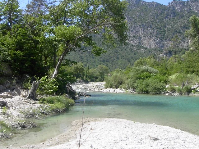
A wide view of a turquoise river flowing through a forested valley with steep rocky slopes in the background.
The Esteron River winding through the Parc naturel départemental de l'Estéron.

Parc naturel départemental de l'Estéron history and protected-area timeline

The Parc naturel départemental de l'Estéron is a recent creation. It was inaugurated in August 2011, with the Conseil départemental des Alpes-Maritimes acting as the owner and managing authority. Its establishment reflects a broader trend in the department of creating publicly accessible green spaces along rivers and in the inland hill country, complementing the larger-scale protection provided by the regional natural park.

The landscape around the park carries a much older history. The Estéron River was officially chosen in 1760 as the border between the County of Nice, then part of the Duchy of Savoy, and the Kingdom of France. The little medieval settlement of La Rocca, which straddled the river, was split by this new political divide and eventually disappeared, replaced by two distinct communes: Roquestéron on the Niçois bank and La Roque-en-Provence on the French side. The departmental park today stretches across both of these successor communes, preserving the geographic continuity of the valley while marking the place where two modern municipalities meet.

A further milestone in the history of the Estéron valley came in 2018, when the river was labeled a "Rivière Sauvage" (Sauvage River), underscoring its ecological quality and its importance for biodiversity. This recognition enhanced the park's role as a public gateway to one of the most environmentaly significant streams in the Alpes-Maritimes.

Parc naturel départemental de l'Estéron landscape and geographic character

The landscape of the park is shaped by the Estéron River valley in the hinterland of the Côte d'Azur. The terrain consists of steep Mediterranean hillsides descending toward a narrow watercourse, with rocky outcrops, sun-exposed slopes, and shaded riparian corridors along the riverbanks. The two communes that host the park, Roquestéron and La Roque-en-Provence, face each other across the water, giving the site a strongly valley-centered character.

The Estéron itself is the dominant landscape element. As a Pre-Alpine stream, it alternates between calmer pools, riffles, and faster sections depending on the season, and its banks are lined with characteristic Mediterranean riverside vegetation. The hillside vegetation around the valley belongs to the typical mosaic of the inland Alpes-Maritimes, with mixtures of scrubland, evergreen forests, and exposed rocky ground typical of the Pre-Alps. The relatively short, walking-friendly trails within the park allow visitors to experience both the vertical relief of the valley and the more intimate, river-level scenery where the Estéron runs before joining the river Var.

Parc naturel départemental de l'Estéron ecosystems, habitats, and plant life

Ecologically, the park revolves around the Estéron River and the habitats that surround it. The valley supports typical Mediterranean Pre-Alpine ecosystems, ranging from dry slopes covered in scrub and garrigue to more humid bands of riparian woodland along the river. These contrasting environments in close proximity are a defining feature of the Estéron valley and explain why the river itself has been recognized for its ecological value.

The broader classification of the Estéron as a "Sauvage River" reflects the presence of a relatively undisturbed hydrosystem, with natural flow patterns, good water quality, and a functioning riverside habitat. Within the park's twenty hectares, this translates into accessible sections of riverbank where vegetation can be observed up close and where wildlife associated with the stream finds refuge. The park sits entirely within the perimeter of the Parc naturel régional des Préalpes d'Azur, which strengthens its ecological role as part of a wider network of protected natural areas in the southern Pre-Alps.

Although the surface area is modest, the park's contribution to nature conservation comes from its pedes­trian access to the river and from its role as a publicly managed window onto an otherwise wild valley. It illustrates how small departmental sites can support regional biodiversity goals when they focus on key landscape features like a recognized wild river.

Parc naturel départemental de l'Estéron wildlife and species highlights

The Estéron valley is known for hosting wildlife typical of southern Pre-Alpine and Mediterranean river systems. The river and its banks provide habitat for aquatic species, invertebrates, and fish adapted to clear, well-oxygenated water, while the surrounding slopes and scrubland support the broader Mediterranean fauna of the Alpes-Maritimes hinterland.

Birdlife associated with the riverside and scrub mosaic is a significant presence, including species that thrive in the mix of rocky cliffs, shrubs, and water found in such valleys. The protected regional context of the Parc naturel régional des Préalpes d'Azur reinforces the importance of the area as a refuge for the native fauna of the inland Côte d'Azur.

The very recognition of the Estéron as a "Sauvage River" in 2018 underlines that the wildlife value of the watercourse is exceptional at the regional level. The departmental park concentrates on giving visitors a chance to encounter this riverside nature in a controlled and accessible way, although detailed data on individual species is associated more with the broader river and the regional park than with the twenty hectares of the park itself.

Parc naturel départemental de l'Estéron conservation status and protection priorities

From a conservation standpoint, the Parc naturel départemental de l'Estéron is significant because it sits along a river that has been officially recognized as a "Sauvage River" since 2018, indicating high ecological quality and limited artificial modification of the watercourse. The park's management by the Conseil départemental des Alpes-Maritimes places it within a public framework intended to preserve and showcase natural assets of the department.

Its inclusion inside the perimeter of the Parc naturel régional des Préalpes d'Azur is a defining part of its conservation profile. Regional natural parks in France apply integrated protection measures for biodiversity, landscapes, and traditional land use, and the Estéron park contributes to the network of accessible, publicly managed sites that support the regional park's broader mission. Together, these layers of protection, departmental, regional, and the river's own status, give the site more weight than its modest size would suggest.

The park also has a conservation role that goes beyond strict nature protection: by allowing pedestrian access to the riverbank through marked trails, it reduces informal trampling across the wider valley and offers a model for how small protected sites can channel public interest in wild rivers into structured, low-impact recreation and environmental awareness.

Parc naturel départemental de l'Estéron cultural meaning and human context

The Estéron valley carries a layered cultural history that is closely tied to its geography. The river once formed a political frontier between two sovereign entities, and the human settlements on its banks have evolved around that border. The 1760 decision to make the Estéron the boundary between the County of Nice and the Kingdom of France divided the old settlement of La Rocca, leading to its decline and the emergence of two new communes: Roquestéron on the Niçois side and La Roque-en-Provence on the French side.

Today, those two communes host the departmental park, and the cultural imprint of the old border remains visible in the intertwined identities of the riverside villages. The area reflects the long-standing cultural connections between the Niçois hinterland and the broader French territory to the west, an interface that has shaped local architecture, dialects, and rural traditions. The park provides a setting where this shared valley identity can be encountered alongside its natural features.

This human context complements the natural significance of the site. Visitors approaching the Estéron through the park encounter both a recognized wild river and a valley where history, borders, and settlement patterns have followed the course of the water for centuries.

Top sights and standout views in Parc naturel départemental de l'Estéron

The highlights of the park center on its riverside location, its cross-border valley geography, and its place within the regional natural park of the Pre-Alps. Direct pedestrian access to the Estéron via well-marked trails is one of its strongest attractions, allowing visitors to experience a "Sauvage River" in a safe and structured way.

The small size of the park makes it easy to explore, while its rich setting, the upstream valley, the riparian habitats, the dramatic hillside scenery, and the historic Roquestéron and La Roque-en-Provence communes, give the visit depth. The combination of departmental, regional, and river-level recognition makes it a notable, if compact, destination in the Alpes-Maritimes.

Best time to visit Parc naturel départemental de l'Estéron

The park's character shifts with the seasons in ways typical of Mediterranean river valleys. Spring tends to bring higher water levels in the Estéron and richer green vegetation along the banks, while early summer offers warm, dry conditions suitable for walking the trails and enjoying the open landscape. Late summer and early autumn are usually the driest and most stable periods for accessing the riverbank and observing the valley in its most sun-exposed state.

The regional climate of the Alpes-Maritimes hinterland means winters are generally mild, although river flow can increase, and certain trails may become less comfortable. The most rewarding seasonal windows for appreciating both the wild river atmosphere and the Mediterranean hill scenery are spring, when the valley is refreshed by new flows and fresh foliage, and autumn, when the light is softer and the riverside and hillside colors become more pronounced.

Monthly climate preview

Measured monthly temperature ranges and precipitation normals for a representative park coordinate

Parc naturel départemental de l'Estéron Climate and Long-Term Weather by Month

Long-term data records outline the measured annual temperature and precipitation rhythm across twelve recorded intervals at a representative elevation of 1274.91 meters within Parc naturel départemental de l'Estéron. Detailed monthly climate normals provide full context on temperature variations and precipitation distributions across the entire recorded sequence.
Annual mean9 °C
-1 °C19 °C
Jan-1°
Feb
Mar
Apr
May11°
Jun16°
Jul19°
Aug19°
Sep14°
Oct
Nov
Dec
Warmest month
July

19.2 °C

Coolest month
January

-0.7 °C

Wettest month
November

3.6 mm/day

Driest month
July

0.9 mm/day

Park location guide

Geography guide, regional context, and park location map for Parc naturel départemental de l'Estéron

Parc naturel départemental de l'Estéron park geography, regions, and map view in France

Understand where Parc naturel départemental de l'Estéron sits in France through a broader geographic reading of the surrounding landscape, nearby location context, and its mapped position within the national park landscape.

How Parc naturel départemental de l'Estéron fits into France

France is a unitary semi-presidential republic and one of the world's largest economies. It borders Belgium, Luxembourg, Germany, Switzerland, Italy, Monaco, Andorra, and Spain, with a maritime border to the United Kingdom. The country is known for its cultural influence, art, cuisine, and political history spanning centuries.

Wider geography shaping Parc naturel départemental de l'Estéron in France

France is located in Western Europe. Metropolitan France extends from the Rhine to the Atlantic Ocean and from the Mediterranean Sea to the English Channel and North Sea. The country borders Belgium, Luxembourg, Germany, Switzerland, Italy, Monaco, Andorra, Spain, and has a maritime border with the United Kingdom.

Map view of Parc naturel départemental de l'Estéron

Use this park location map to pinpoint Parc naturel départemental de l'Estéron in France, understand its exact geographic position, and read its mapped placement within the surrounding landscape more clearly.

Pigeon | © OpenStreetMap contributors

Location context for Parc naturel départemental de l'Estéron

Alpes-MaritimesProvence-Alpes-Côte d'Azur
Recorded earthquake history

Review Historical Earthquake Records for Parc naturel départemental de l'Estéron

Examine the catalogued seismic history associated with the valley geography of Parc naturel départemental de l'Estéron. MoriAtlas provides a structured view of recorded epicentre data, allowing for deeper exploration of regional seismic patterns across the Pre-Alpine landscape.

Parc naturel départemental de l'Estéron Earthquake History

Catalogued events

47 events

Strongest magnitude

Magnitude 4.4

Most recent event

Mar 18, 2025

This history includes earthquakes recorded inside the park or within 50 km of its borders

Explore photographic records of Mediterranean hillsides, wild river corridors, and protected riparian habitats.

Visualizing Parc naturel départemental de l'Estéron: Landscape, Scenery, and River Valley Views

Visual documentation captures the steep terrain, sun-exposed slopes, and shaded riverbanks defining the valley environment. Photographic records provide clear reference value for understanding the regional topography and protected natural character of the protected area.

A wide view of a turquoise river flowing through a forested valley with steep rocky slopes in the background.

Park atlas

Compare nearby river valleys, Mediterranean hill country, and connected regional reserves

Parks Near Parc naturel départemental de l'Estéron and Surrounding Protected Landscapes

Browse protected areas and river corridors situated near Parc naturel départemental de l'Estéron across the Alpes-Maritimes hinterland. Comparing adjacent Pre-Alpine terrain provides deeper geographic context for regional conservation networks.
A soft watercolor illustration depicting a panoramic view of rolling green hills under a pale, warm sky with distant mountains.
State or regional parkProvence-Alpes-Côte d'Azur
About 13 km away#1 closest

Southeast

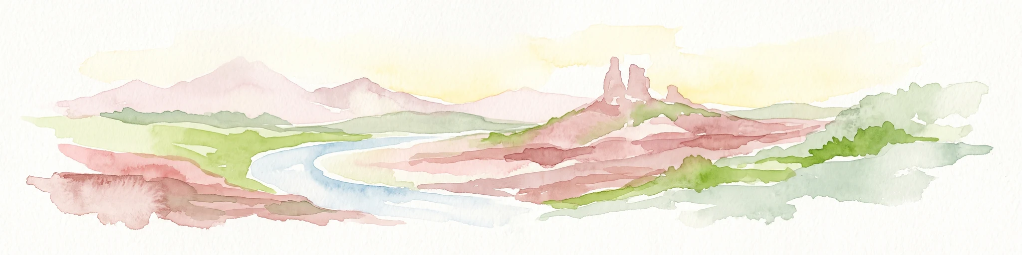
Parc naturel départemental du Plan des Noves: Protected Landscapes and Regional Geography

Upland limestone plateau in the French Baous massif

Covering 904 hectares above the town of Vence, this park features a unique combination of Mediterranean woodlands, open pastoral mosaics, and historic agricultural terraces. The terrain serves as a vital ecological corridor, recognized for its birdlife and reptiles, while its elevation offers expansive vistas across the surrounding regional geography from the coast to the high mountain summits.

Area
9.04 km²
Established
1987
Relief
Upland
Scope
Terrestrial
A watercolor illustration showing a landscape with red rock formations, green vegetation, and a winding blue river.
Nature reserveProvence-Alpes-Côte d'Azur
About 24 km away#2 closest

Northwest

Réserve naturelle régionale des gorges de Daluis: Red Rock Canyon and Geological Atlas

Protected canyon landscape in Provence-Alpes-Côte d'Azur

Defined by its vivid red pelite cliffs, Réserve naturelle régionale des gorges de Daluis functions as a significant protected canyon system. The terrain preserves rare mineralogy and diverse microhabitats, ranging from river-carved walls to upland slopes that support unique regional biodiversity in the Alpes-Maritimes.

Area
10.82 km²
Established
2012
IUCN
IV
Relief
Mountain
Marine protected areaFrance
26 km away#3 closest

Southeast

Sanctuaire Pelagos Marine Protected Area: Mediterranean Geography and Seascape

A transboundary conservation zone spanning 87,500 square kilometers.

Sanctuaire Pelagos represents a unique collaborative effort in marine conservation across the Mediterranean. Spanning the waters between France, Italy, and Monaco, this protected maritime area is defined by its deep-sea canyons and nutrient-rich currents that sustain diverse cetacean populations. Its immense scale and international governance make it a focal point for understanding Mediterranean marine biodiversity and environmental policy.

Area
87,500 km²
Established
1999
IUCN
IV
Relief
Lowland
Watercolor painting of a park landscape with a foreground pond, grassy areas, and rolling hills in the background.
State or regional parkProvence-Alpes-Côte d'Azur
27 km away#4 closest

South

Parc de Vaugrenier: Regional Protected Area and Archaeological Landscape in France

Wetland habitats and historic trails in Alpes-Maritimes

Parc de Vaugrenier protects a diverse hundred-hectare expanse between Antibes and Villeneuve-Loubet. Its terrain bridges Mediterranean woodland and lush freshwater meadows, distinguished by a rare collection of exotic trees and remnants of the ancient Via Julia Augusta. This park provides a quiet geographic contrast to the surrounding coastal urbanization of the French Riviera.

Area
1 km²
Established
1995
Visitors
500K annual
Relief
Lowland
Watercolor illustration of a mountainous landscape featuring a river, rolling hills, and green vegetation
National parkFrance
28 km away#5 closest

North

Mercantour National Park: Mapped Alpine Protected Landscape and Regional Geography

Explore France's dramatic Alps, park boundaries, and unique ecotones.

Mercantour National Park stands as a premier protected area within the French Alps, distinguished by its remarkable geographic diversity and ecological significance. This national park encompasses mountainous terrain featuring dramatic peaks, deep glacial valleys, and a unique ecotone where Mediterranean and Alpine ecosystems converge. MoriAtlas facilitates a detailed atlas-style exploration of Mercantour National Park, highlighting its mapped protected boundaries, varied natural landscapes, and its pivotal role in regional geography and conservation efforts.

Area
679 km²
Established
1979
IUCN
II
Visitors
800K annual
Watercolor painting of distant purple hills and foreground pine trees in soft washes of green, yellow, and red on a white background.
State or regional parkProvence-Alpes-Côte d'Azur
About 28 km away#6 closest

Southeast

Parc naturel départemental du Vinaigrier: Protected Limestone Landscapes near Nice

Regional state park with diverse Mediterranean woodland ecosystems

Parc naturel départemental du Vinaigrier offers a dense, 25 hectare mosaic of limestone plateaus and slopes near the Mediterranean coast. Its landscape is defined by traditional dry stone terraces and a rare flowering ash forest, creating a significant ecological bridge between the urban expansion of Nice and the hilly interior of the Alpes-Maritimes.

Area
0.25 km²
Established
1980
IUCN
IV
A digital illustration of a valley featuring jagged mountain peaks, a waterfall, a winding river, and pine forests in the foreground.
Marine protected areaMonaco
About 36 km away#7 closest

East

Larvotto and Portier Coastal Reserve: Marine Protected Area and Coastal Habitat Atlas

Mapped marine refuge along the dense Monaco shoreline.

The Larvotto and Portier Coastal Reserve represents a distinct marine protected area in Monaco, featuring significant seagrass meadows and transplanted rocky habitats. This coastal zone acts as an essential refuge for Mediterranean biodiversity, providing a rare example of structured marine conservation embedded within a highly developed urban landscape.

Area
0.23 km²
A soft watercolor painting of a coastal landscape with rolling hills, distant mountains, and green vegetation against a light sky.
Marine protected areaProvence-Alpes-Côte d'Azur
About 40 km away#8 closest

South

Parc maritime départemental Estérel-Théoule: Marine Protected Area and Coastal Geography

A vital Mediterranean corridor along the French Riviera coast

This marine protected area preserves a unique underwater mosaic where rocky shallows, sandy patches, and Posidonia seagrass meadows converge. Located offshore from the Estérel massif, the site provides a continuous conservation corridor between inland natural spaces and the Mediterranean Sea, offering insight into the littoral environment of the French Riviera.

Area
3.5 km²
Water
Water-dominated
Season
Seasonal

Common questions about visiting, size, designation, and location context for Parc naturel départemental de l'Estéron

Parc naturel départemental de l'Estéron FAQs for park facts, access, geography, and protected area context

Find quick answers about Parc naturel départemental de l'Estéron, including protected-area facts, park geography, trail and visitor context, and how the park fits into its surrounding country and regional landscape.
MoriAtlas Explorer

Continue Your Protected Areas Search Across the Global Atlas

Deepen your exploration by continuing the structured search for national parks and protected areas worldwide. Utilize the comprehensive filtering capabilities to compare different conservation landscapes and refine your understanding of global park geography. Discover more about the distribution and characteristics of protected natural areas.

Global natural geography