
Mori Atlas logo
State or regional parkParc naturel départemental du Plan des Noves

Mapping the Mediterranean upland habitats and historic pastoral landscapes of southeastern France

Parc naturel départemental du Plan des Noves: A Protected Plateau in the Baous Massif

The Parc naturel départemental du Plan des Noves protects a 904-hectare limestone plateau within the Baous massif of Provence-Alpes-Côte d'Azur. This protected area preserves a rich mosaic of Mediterranean oak groves, pastoral ground, and traditional dry-stone features such as restanques and bories. From its vantage points, the geography stretches from the Mediterranean coast to the high peaks of the Mercantour, documenting a significant intersection of ecological habitats and prehistoric archaeology.

departmental nature parkMediterranean uplandBaous massifoak woodlanddry-stone terracespastoral landscape
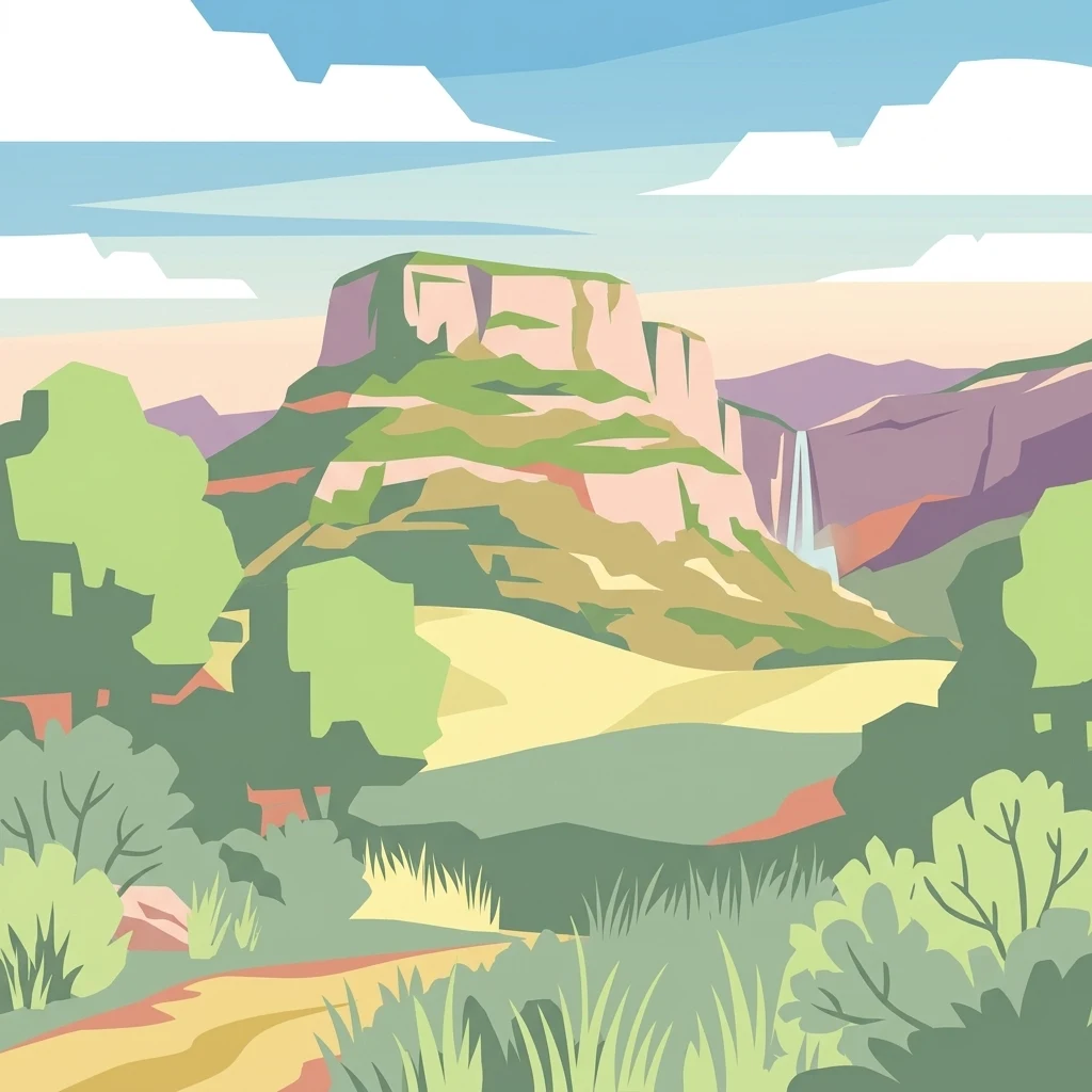
A flat-style digital illustration depicting a prominent plateau or mesa rising above a grassy landscape, with a waterfall cascading down a nearby cliff, framed by stylized trees and shrubs in the foreground.

Parc naturel départemental du Plan des Noves

State or regional park

Park overview

Structured park overview, official facts, and landscape profile for Parc naturel départemental du Plan des Noves

Parc naturel départemental du Plan des Noves park facts, protected area profile, and essential visitor context

Review the core facts for Parc naturel départemental du Plan des Noves, including designation, size, terrain, visitor scale, habitats, and operating context in one park-focused overview.

About Parc naturel départemental du Plan des Noves

The Parc naturel départemental du Plan des Noves is one of the departmental nature parks of the Alpes-Maritimes, a category of protected site managed at the French department level. It occupies a broad plateau in the Baous massif, a set of limestone ridges in the southern Pre-Alps that frame the hinterland of Nice and the Var valley. Perched above the Col de Vence and the town of Vence, the park functions as a transition zone between the densely settled Côte d'Azur lowlands and the higher peaks of the Maritime Alps.

Ecologically, the park's value lies in the finely mixed character of its habitats. Oak groves, stands of wild rose and blackthorn, ancient walnut trees, and open pastoral land together form a mosaic that supports a wide variety of wildlife, particularly passerine birds, reptiles, and insects. Roughly 125 bird species have been recorded within the site. The park's environmental importance has been formally recognized at the European level through its inclusion in the Natura 2000 network, a designation reserved for habitats and species that require coordinated conservation across member states.

Beyond its natural significance, the park also embodies a layered human history. Archaeological traces, including circular tumuli from the Bronze Age, point to early use of the plateau for burial and settlement, while the dry-stone terraces, known locally as restanques, and the small stone shelters, or bories, attest to the agricultural and pastoral activities that shaped the area in the 18th and 19th centuries. The departmental authority has deliberately limited site development in order to preserve this combined natural and cultural heritage, allowing traditions such as pastoralism and small-scale beekeeping to continue. The views from the plateau stretch from the Mediterranean coastline northward to the high summits of the Mercantour National Park, giving the park a particularly striking visual identity within the broader Préalpes d'Azur regional park.

Quick facts and research context for Parc naturel départemental du Plan des Noves

The Parc du Plan des Noves is a departmental nature park located in the Alpes-Maritimes, in the Provence-Alpes-Côte d'Azur region of southeastern France. It lies on a plateau of about 904 hectares in the Baous massif, overlooking the Col de Vence and the town of Vence, and is part of the wider Parc naturel régional des Préalpes d'Azur. The land was acquired by the department in 1987.

Ecologically, the park is recognized for its diversity of Mediterranean habitats and is classified as a Natura 2000 site at the European level, with around 125 bird species recorded alongside notable reptile and insect populations. The landscape also preserves traces of long-standing human activity, from Bronze Age burial tumuli to 18th- and 19th-century agricultural terraces and traditional shepherd huts.

Protection and recognition

Examine documented terrestrial protection scope and official recognition details for Parc naturel départemental du Plan des Noves.

Parc naturel départemental du Plan des Noves Protection Status and Terrestrial Designation Records

Comprehensive protected area records outline the terrestrial conservation framework and administrative boundaries established for Parc naturel départemental du Plan des Noves. Structured designation data provides clear insight into the official management scope governing this protected natural landscape.

Protection details

Protection scope
Terrestrial
Transboundary protection
No
Park context

Deeper park guide and search-rich context for Parc naturel départemental du Plan des Noves

Parc naturel départemental du Plan des Noves history, landscape, wildlife, and travel context

Explore Parc naturel départemental du Plan des Noves through its history, landscape character, ecosystems, wildlife, conservation priorities, cultural context, and seasonal travel timing in a structured park guide built for atlas discovery and search intent.

Why Parc naturel départemental du Plan des Noves stands out

The Plan des Noves is best known for its combination of sweeping views, from the Mediterranean coast to the peaks of the Mercantour, and its richly varied Mediterranean habitats on a single upland plateau. It stands out for its oak-and-thorn thickets, old walnut trees, and open pastoral mosaics that support diverse birdlife, reptiles, and insects, all recognized under the European Natura 2000 framework. It is also distinctive for the way ancient and more recent human history remains visible in the landscape, from Bronze Age circular tumuli to the dry-stone terraces, or restanques, and traditional stone shepherd huts known as bories, which together reflect continuous interaction between people and the Baous uplands.
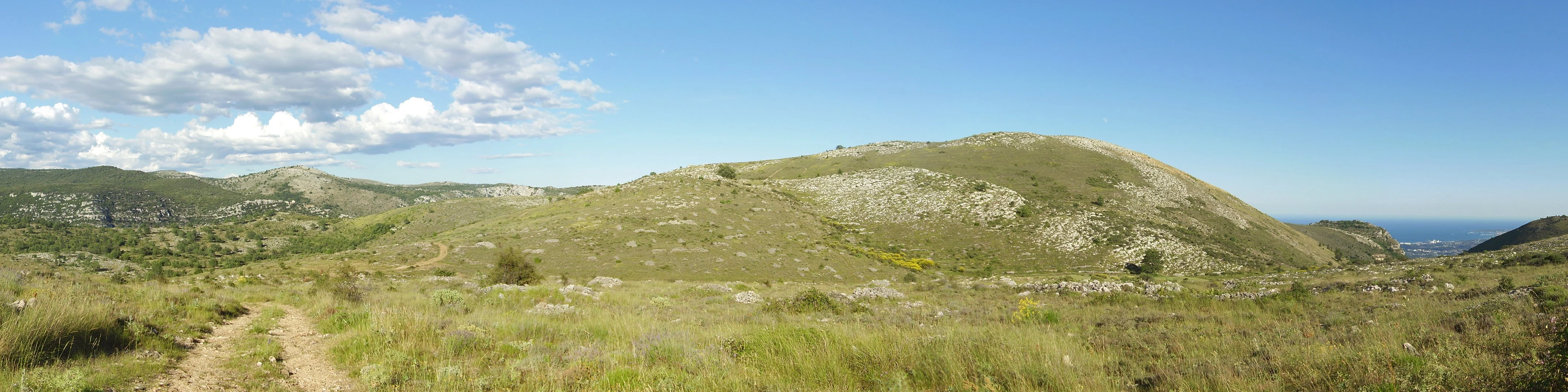
A wide panoramic shot of rolling grassy hills under a clear blue sky, with a dirt trail visible in the left foreground.
Panoramic view of the rolling hills and natural landscape in Parc naturel départemental du Plan des Noves.

Parc naturel départemental du Plan des Noves history and protected-area timeline

The Plan des Noves site was acquired in 1987 by the Conseil départemental des Alpes-Maritimes, the local governmental authority responsible for the department, marking the formal beginning of its protection as a departmental nature park. Management has since been shaped by the desire to keep human intervention light, so that the existing natural and cultural character of the plateau could be maintained.

The landscape itself carries a much deeper human history. Circular tumuli from the Bronze Age indicate that the plateau was used as a place of burial in prehistory. In the 18th and 19th centuries, farmers worked the slopes and built extensive dry-stone terraces, the restanques typical of Mediterranean agriculture, while shepherds constructed small stone huts, or bories, to watch over their flocks. These older rural practices have continued in modified form, with pastoralism and small-scale beekeeping still playing a role in maintaining the open habitats that give the park its current ecological character. The site was later integrated into the wider Parc naturel régional des Préalpes d'Azur, reinforcing its position within a broader regional network of protected Mediterranean landscapes.

Parc naturel départemental du Plan des Noves landscape and geographic character

The park lies on a broad limestone plateau within the Baous massif, a series of limestone ridges that rise inland from the Côte d'Azur. Its roughly 904 hectares of upland terrain sit above the Col de Vence and overlook the town of Vence, creating a setting where open ground, wooded patches, and rocky edges alternate across the same elevation band.

The defining feature of the Plan des Noves landscape is the contrast between wide, exposed panoramas and the intimate texture of its slopes and terraces. Stone-built agricultural terraces, or restanques, line parts of the terrain, marking centuries of farming adaptation to the Mediterranean climate, while scattered bories, the small dry-stone shepherd huts of the south of France, dot the plateau as isolated landmarks. From the higher points of the park, the view extends south toward the Mediterranean coast and north toward the high summits of the Mercantour, compressing a large vertical span into a single horizon.

Parc naturel départemental du Plan des Noves ecosystems, habitats, and plant life

Ecologically, the Plan des Noves is shaped by its position on a Mediterranean upland plateau, where climate, soils, and long human management have produced a varied mosaic of habitats rather than any single dominant ecosystem. Oak woodlands form a structural element of the vegetation, interspersed with dense thickets of wild rose (églantier) and blackthorn (prunellier), while old walnut trees scattered across the open ground record the rural past of the site.

This mosaic character is central to the park's biodiversity. The mixture of woodland, shrubby edge habitats, and open pastoral land creates the conditions needed for a large community of small passerine birds, as well as notable reptile and insect populations. The combination of habitat diversity and relatively low-intensity land use has earned the site recognition within the European Natura 2000 network, a designation that underlines its value as a refuge for species and habitat types that depend on traditional Mediterranean landscapes being kept alive rather than being abandoned or intensively developed.

Parc naturel départemental du Plan des Noves wildlife and species highlights

Wildlife at Plan des Noves is closely tied to the park's mosaic of oak groves, thorny shrub thickets, open ground, and old walnut trees. Approximately 125 bird species have been recorded in the park, with passerines strongly represented thanks to the abundance of edge habitats and shrub cover that support nesting, feeding, and seasonal stopover use.

Reptiles and insects benefit from the same combination of sun-exposed rocky areas, low vegetation, and traditional agricultural structures such as dry-stone walls and terraces. The persistence of pastoral land use, combined with limited site development, has helped maintain the habitat continuity that these groups require, and it is this sustained habitat quality, rather than any single flagship species, that gives the park its ecological interest within the wider Préalpes d'Azur region.

Parc naturel départemental du Plan des Noves conservation status and protection priorities

The Plan des Noves is protected as a departmental nature park under the authority of the Conseil départemental des Alpes-Maritimes, and it is also part of the regional Parc naturel régional des Préalpes d'Azur, placing it within a layered network of French and European conservation instruments. Its most significant formal recognition is its classification as a Natura 2000 site, a European designation for areas of high nature conservation value that host threatened habitats or species and require coordinated long-term management.

The conservation approach at the park emphasizes restraint: development has been deliberately limited, infrastructure is minimal, and traditional land uses such as pastoralism and small-scale beekeeping are encouraged as part of a working landscape rather than a strictly protected reserve. This strategy reflects the understanding that the mosaic of habitats and the species they support at Plan des Noves are themselves the product of long interaction between people and the Mediterranean uplands, so conservation here means maintaining those interactions as much as protecting species directly.

Parc naturel départemental du Plan des Noves cultural meaning and human context

The cultural dimension of Plan des Noves is rooted in long-standing rural life on the Baous uplands. Circular tumuli from the Bronze Age show that the plateau was already a place of significance in prehistory, while the dry-stone terraces built by farmers and the small stone shepherd huts known as bories point to more recent agricultural and pastoral traditions that shaped the visible landscape.

These older practices are not treated simply as relics; pastoralism and small-scale beekeeping continue on the site, and the departmental management framework explicitly maintains them as active land uses. The park therefore carries a layered cultural identity in which prehistoric funerary monuments, 18th- and 19th-century agricultural terraces, and contemporary low-intensity land use coexist within a single protected setting, framing the natural value of the site as inseparable from its human history.

Top sights and standout views in Parc naturel départemental du Plan des Noves

Among the most distinctive features of the Plan des Noves are its sweeping viewshed from the Mediterranean coast to the Mercantour peaks, the rich mosaic of Mediterranean habitats that earned it Natura 2000 status, and the network of Bronze Age tumuli, dry-stone terraces, and bories that record continuous human presence on the plateau. Together, these qualities position the park as a compact example of how Mediterranean upland ecosystems, traditional rural practices, and prehistoric traces can be protected together within a single departmental site.

Best time to visit Parc naturel départemental du Plan des Noves

The park is best experienced in the milder seasons, when temperatures on the upland plateau are comfortable for walking and the Mediterranean habitats are most clearly visible: spring, when shrubby edges bloom and many bird species are at their most active, and autumn, when cooler conditions, softer light, and continued pastoral activity make the open ground and terraces especially atmospheric. Summer visits are possible but can be hot on exposed terrain, while winter brings cooler, quieter conditions and crisper views across to the coast and the Alps. As with any natural area, bird activity, wildflower display, and general scenery vary with the seasons rather than being fixed to specific calendar windows.

Monthly climate preview

Long-term temperature and precipitation averages for this protected landscape

Parc naturel départemental du Plan des Noves Climate and Weather by Month

Representative coordinate records show measured monthly temperature variations alongside recorded precipitation averages across the year. Examining the full twelve-month profile provides complete historical context for long-term climate patterns at this elevation.
Annual mean9 °C
-1 °C19 °C
Jan-1°
Feb
Mar
Apr
May11°
Jun16°
Jul19°
Aug19°
Sep14°
Oct
Nov
Dec
Warmest month
July

19.2 °C

Coolest month
January

-0.7 °C

Wettest month
November

3.6 mm/day

Driest month
July

0.9 mm/day

Park location guide

Geography guide, regional context, and park location map for Parc naturel départemental du Plan des Noves

Parc naturel départemental du Plan des Noves park geography, regions, and map view in France

Understand where Parc naturel départemental du Plan des Noves sits in France through a broader geographic reading of the surrounding landscape, nearby location context, and its mapped position within the national park landscape.

How Parc naturel départemental du Plan des Noves fits into France

France is a unitary semi-presidential republic and one of the world's largest economies. It borders Belgium, Luxembourg, Germany, Switzerland, Italy, Monaco, Andorra, and Spain, with a maritime border to the United Kingdom. The country is known for its cultural influence, art, cuisine, and political history spanning centuries.

Wider geography shaping Parc naturel départemental du Plan des Noves in France

France is located in Western Europe. Metropolitan France extends from the Rhine to the Atlantic Ocean and from the Mediterranean Sea to the English Channel and North Sea. The country borders Belgium, Luxembourg, Germany, Switzerland, Italy, Monaco, Andorra, Spain, and has a maritime border with the United Kingdom.

Map view of Parc naturel départemental du Plan des Noves

Use this park location map to pinpoint Parc naturel départemental du Plan des Noves in France, understand its exact geographic position, and read its mapped placement within the surrounding landscape more clearly.

Pigeon | © OpenStreetMap contributors

Location context for Parc naturel départemental du Plan des Noves

Provence-Alpes-Côte d'Azur

Photographic records of limestone terrain, oak groves, and upland vistas across the Baous massif

Visualizing Parc naturel départemental du Plan des Noves: Landscapes and Scenery

Visual records capture the distinctive topography, oak woodlands, and open pastoral mosaics of Parc naturel départemental du Plan des Noves. Detailed imagery illuminates the limestone plateau terrain, traditional stone structures, and wide regional panoramas.

A wide panoramic shot of rolling grassy hills under a clear blue sky, with a dirt trail visible in the left foreground.

Park atlas

Compare regional nature reserves, upland terrain, and protected landscapes across southeastern France

Parks Near Parc naturel départemental du Plan des Noves and Surrounding Protected Areas

Browsing other protected areas near Parc naturel départemental du Plan des Noves reveals connected upland habitats and limestone ridges across the Baous massif. Extending the geographic comparison helps trace regional conservation patterns and diverse Mediterranean ecosystems.
State or regional parkAlpes-Maritimes
About 13 km away#1 closest

Northwest

Parc naturel départemental de l'Estéron: Riverside Geography in Alpes-Maritimes

A departmental park focusing on the wild Estéron River corridor

Located in the hinterland of the Côte d'Azur, Parc naturel départemental de l'Estéron provides a protected environment focused on the Estéron river valley. Its geography encompasses sun-exposed Mediterranean hillsides and riparian zones, reflecting the intersection of mountain terrain and historic cross-border heritage in the Alpes-Maritimes department.

Area
0.2 km²
Established
2011
Scope
Terrestrial
Water
Major water bodies
Marine protected areaFrance
About 13 km away#2 closest

Southeast

Sanctuaire Pelagos Marine Protected Area: Mediterranean Geography and Seascape

A transboundary conservation zone spanning 87,500 square kilometers.

Sanctuaire Pelagos represents a unique collaborative effort in marine conservation across the Mediterranean. Spanning the waters between France, Italy, and Monaco, this protected maritime area is defined by its deep-sea canyons and nutrient-rich currents that sustain diverse cetacean populations. Its immense scale and international governance make it a focal point for understanding Mediterranean marine biodiversity and environmental policy.

Area
87,500 km²
Established
1999
IUCN
IV
Relief
Lowland
Watercolor painting of a park landscape with a foreground pond, grassy areas, and rolling hills in the background.
State or regional parkProvence-Alpes-Côte d'Azur
About 14 km away#3 closest

South

Parc de Vaugrenier: Regional Protected Area and Archaeological Landscape in France

Wetland habitats and historic trails in Alpes-Maritimes

Parc de Vaugrenier protects a diverse hundred-hectare expanse between Antibes and Villeneuve-Loubet. Its terrain bridges Mediterranean woodland and lush freshwater meadows, distinguished by a rare collection of exotic trees and remnants of the ancient Via Julia Augusta. This park provides a quiet geographic contrast to the surrounding coastal urbanization of the French Riviera.

Area
1 km²
Established
1995
Visitors
500K annual
Relief
Lowland
Watercolor painting of distant purple hills and foreground pine trees in soft washes of green, yellow, and red on a white background.
State or regional parkProvence-Alpes-Côte d'Azur
About 18 km away#4 closest

East

Parc naturel départemental du Vinaigrier: Protected Limestone Landscapes near Nice

Regional state park with diverse Mediterranean woodland ecosystems

Parc naturel départemental du Vinaigrier offers a dense, 25 hectare mosaic of limestone plateaus and slopes near the Mediterranean coast. Its landscape is defined by traditional dry stone terraces and a rare flowering ash forest, creating a significant ecological bridge between the urban expansion of Nice and the hilly interior of the Alpes-Maritimes.

Area
0.25 km²
Established
1980
IUCN
IV
A digital illustration of a valley featuring jagged mountain peaks, a waterfall, a winding river, and pine forests in the foreground.
Marine protected areaMonaco
About 28 km away#5 closest

East

Larvotto and Portier Coastal Reserve: Marine Protected Area and Coastal Habitat Atlas

Mapped marine refuge along the dense Monaco shoreline.

The Larvotto and Portier Coastal Reserve represents a distinct marine protected area in Monaco, featuring significant seagrass meadows and transplanted rocky habitats. This coastal zone acts as an essential refuge for Mediterranean biodiversity, providing a rare example of structured marine conservation embedded within a highly developed urban landscape.

Area
0.23 km²
A soft watercolor painting of a coastal landscape with rolling hills, distant mountains, and green vegetation against a light sky.
Marine protected areaProvence-Alpes-Côte d'Azur
About 30 km away#6 closest

South

Parc maritime départemental Estérel-Théoule: Marine Protected Area and Coastal Geography

A vital Mediterranean corridor along the French Riviera coast

This marine protected area preserves a unique underwater mosaic where rocky shallows, sandy patches, and Posidonia seagrass meadows converge. Located offshore from the Estérel massif, the site provides a continuous conservation corridor between inland natural spaces and the Mediterranean Sea, offering insight into the littoral environment of the French Riviera.

Area
3.5 km²
Water
Water-dominated
Season
Seasonal
Watercolor illustration of a mountainous landscape featuring a river, rolling hills, and green vegetation
National parkFrance
About 31 km away#7 closest

North

Mercantour National Park: Mapped Alpine Protected Landscape and Regional Geography

Explore France's dramatic Alps, park boundaries, and unique ecotones.

Mercantour National Park stands as a premier protected area within the French Alps, distinguished by its remarkable geographic diversity and ecological significance. This national park encompasses mountainous terrain featuring dramatic peaks, deep glacial valleys, and a unique ecotone where Mediterranean and Alpine ecosystems converge. MoriAtlas facilitates a detailed atlas-style exploration of Mercantour National Park, highlighting its mapped protected boundaries, varied natural landscapes, and its pivotal role in regional geography and conservation efforts.

Area
679 km²
Established
1979
IUCN
II
Visitors
800K annual
A watercolor illustration showing a landscape with red rock formations, green vegetation, and a winding blue river.
Nature reserveProvence-Alpes-Côte d'Azur
About 38 km away#8 closest

Northwest

Réserve naturelle régionale des gorges de Daluis: Red Rock Canyon and Geological Atlas

Protected canyon landscape in Provence-Alpes-Côte d'Azur

Defined by its vivid red pelite cliffs, Réserve naturelle régionale des gorges de Daluis functions as a significant protected canyon system. The terrain preserves rare mineralogy and diverse microhabitats, ranging from river-carved walls to upland slopes that support unique regional biodiversity in the Alpes-Maritimes.

Area
10.82 km²
Established
2012
IUCN
IV
Relief
Mountain

Common questions about visiting, size, designation, and location context for Parc naturel départemental du Plan des Noves

Parc naturel départemental du Plan des Noves FAQs for park facts, access, geography, and protected area context

Find quick answers about Parc naturel départemental du Plan des Noves, including protected-area facts, park geography, trail and visitor context, and how the park fits into its surrounding country and regional landscape.
MoriAtlas Explorer

Continue Your Protected Areas Search Across the Global Atlas

Deepen your exploration by continuing the structured search for national parks and protected areas worldwide. Utilize the comprehensive filtering capabilities to compare different conservation landscapes and refine your understanding of global park geography. Discover more about the distribution and characteristics of protected natural areas.

Global natural geography