
Mori Atlas logo
Protected landscapeParc naturel des Hauts-Pays

Examining the watershed terrain, forest mosaics, and botanical diversity of this Franco-Belgian border region

Parc naturel des Hauts-Pays: A Comprehensive Geographic Portrait of a Walloon Protected Landscape

Parc naturel des Hauts-Pays stands as a significant protected landscape within the Province de Hainaut, characterized by its upland watershed position between the Scheldt and Meuse basins. This area encompasses a rich tapestry of broadleaf forests, including the Bois de Colfontaine and Bois d'Angre, alongside deeply incised river valleys and rocky promontories like the Caillou-qui-Bique. It serves as an essential botanical refuge for species at the northern fringe of the Sambre-Meuse trough, preserving a traditional bocage environment that remains distinct from the surrounding urbanized sectors.

natural parkWalloniaHainautNatura 2000broadleaf forestriver valley
A digital illustration of a vertical waterfall cascading down a cliff face into a river winding through a forest and meadow at sunset.

Parc naturel des Hauts-Pays

Protected landscape

Park overview

Structured park overview, official facts, and landscape profile for Parc naturel des Hauts-Pays

Parc naturel des Hauts-Pays park facts, protected area profile, and essential visitor context

Review the core facts for Parc naturel des Hauts-Pays, including designation, size, terrain, visitor scale, habitats, and operating context in one park-focused overview.

About Parc naturel des Hauts-Pays

The Parc naturel des Hauts-Pays is one of the recognized natural parks of the Walloon Region and one of a network of more than a dozen such parks across southern Belgium. It lies in the western part of the province of Hainaut, immediately adjacent to the French border near Mons and Valenciennes, and across from the French Parc naturel régional de l'Avesnois. The park covers roughly 15,700 hectares and is home to around 21,000 residents, distributed across parts of six communes: Honnelles, Quiévrain, Dour, Colfontaine, Frameries, and Quévy.

Geographically, the park occupies a section of the watershed divide between Belgium's two principal drainage basins, the Scheldt and the Meuse. To the north and west, waters flow toward the Scheldt via the Haine river; to the south and east, waters drain into the Meuse via the French course of the Sambre. This watershed ridge, along with the Haine valley around 160 meters in elevation at the border, is what gives the area its designation as Hauts-Pays, an upland that contrasts with the lower industrial landscapes and mining country of the Borinage just to the east.

The territory can be seen as two upland halves divided by the Bois de Colfontaine, the park's principal forest mass. To the west lies the Haut-Pays de Roisin, and to the east the watershed summits around Blaregnies and Sars-la-Bruyère. Forests, fast-flowing rivers, waterfalls, deep wooded valleys, rocky promontories, and small villages nestled into valleys or perched on plateau edges combine to create a landscape very different from what most residents of nearby urban centers are used to.

The park is formally classified under the UICN's Category V (protected landscape or seascape), which emphasizes the integration of human rural land use with natural values. A large portion of its territory is also designated as a European Natura 2000 area under the name Haut-Pays des Honnelles, adding a layer of European habitat protection to the regional designation. Together these statuses capture the park's role as both a living rural landscape and a refuge area of national ecological importance.

Quick facts and research context for Parc naturel des Hauts-Pays

The Parc naturel des Hauts-Pays was officially recognized by the Walloon Government on 20 July 2000, with its management commission appointed in early 2002. It is classified as a natural park (UICN Category V: protected landscape or seascape) and is registered in the World Database on Protected Areas under WDPA ID 386139. A significant portion of its territory, the Haut-Pays des Honnelles, carries additional protection as a Natura 2000 site under European Union habitat and species legislation.

The park lies in the province of Hainaut, Wallonia, beside the French border and across from the French Parc naturel régional de l'Avesnois. The name Hauts-Pays refers to its position on the watershed ridge rather than to true highland terrain: the Haine valley sits around 160 meters in elevation where it reaches the border, while the local uplands form the top of the divide between the two great Belgian river basins.

Protection and recognition

Documented conservation records and official protected area data sources

Parc naturel des Hauts-Pays Protection Status and International Recognition

Parc naturel des Hauts-Pays maintains structured records within global protected area databases to track official conservation standing. Reference entries compile verified designation metrics and administrative parameters for comprehensive geographic analysis.

Protection details

WDPA ID
386139
Park context

Deeper park guide and search-rich context for Parc naturel des Hauts-Pays

Parc naturel des Hauts-Pays history, landscape, wildlife, and travel context

Explore Parc naturel des Hauts-Pays through its history, landscape character, ecosystems, wildlife, conservation priorities, cultural context, and seasonal travel timing in a structured park guide built for atlas discovery and search intent.

Why Parc naturel des Hauts-Pays stands out

The Parc naturel des Hauts-Pays is best known for its broadleaf forest mosaics, including the Bois d'Angre and the Bois de Colfontaine, and for the deeply incised river valleys of the Grande Honnelle and its tributaries. Fast-flowing streams, small waterfalls, and rocky promontories such as the Caillou-qui-Bique give the area a landscape character very different from the surrounding Borinage and the open plains of the Haine valley. It is also recognized as a botanical refuge of national importance, hosting some of the last Belgian stations of plant species such as Euphorbia dulcis and Luzula forsteri, as well as abundant populations of calcareous orchids. The combination of extensive meadows, pollarded willows, thorny hedgerows, and remnant bocage gives the park both ecological richness and a distinctive traditional rural landscape.
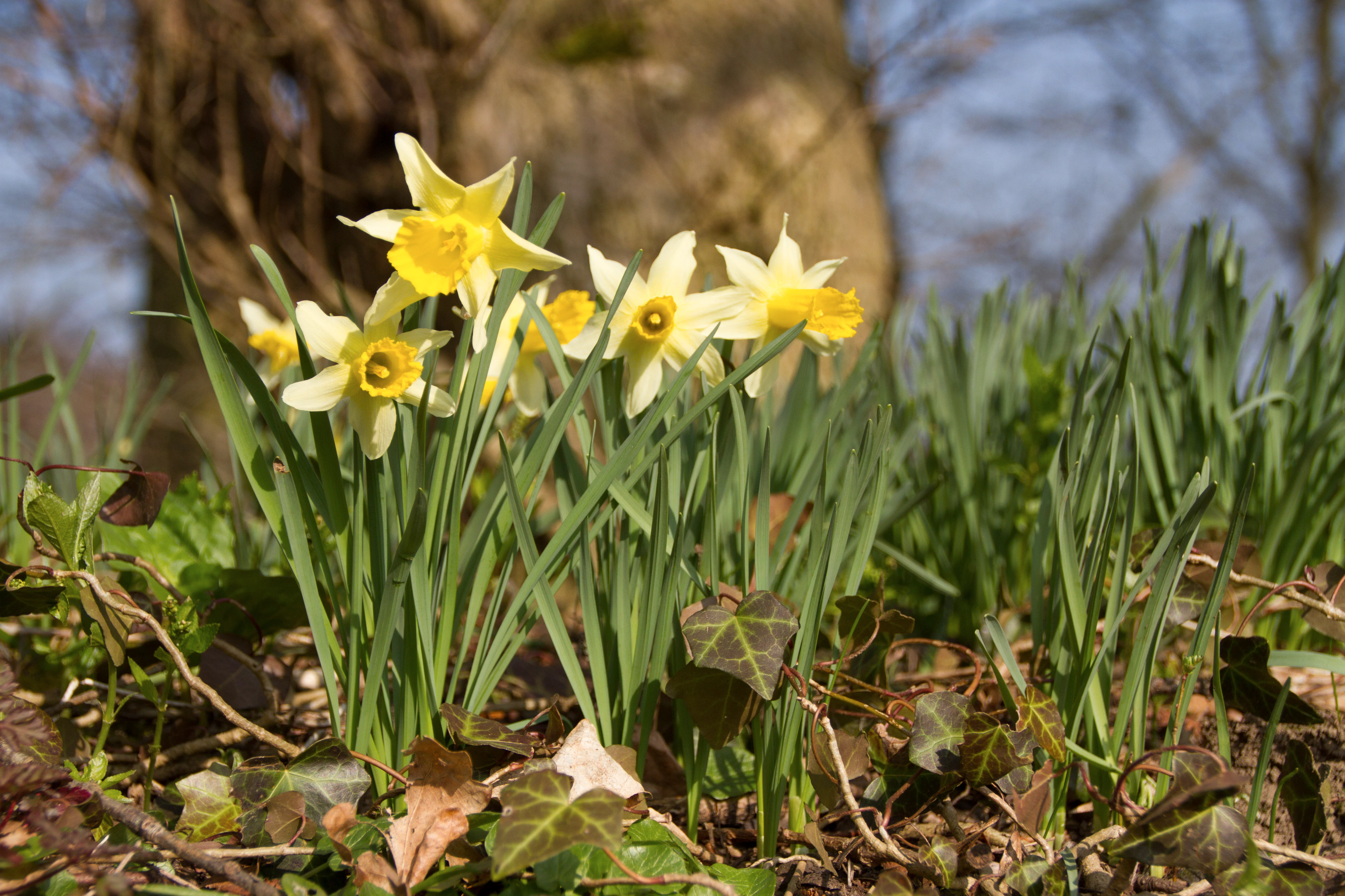
A cluster of yellow and white wild daffodils growing in a woodland setting with green grass and fallen leaves in the foreground.
Wild daffodils blooming at the Caillou qui bique site in the Parc naturel des Hauts-Pays.

Parc naturel des Hauts-Pays history and protected-area timeline

The Parc naturel des Hauts-Pays was formally recognized by the Walloon Government on 20 July 2000. Its management commission was then designated on 8 February 2002 and installed on 18 April 2002 by the Walloon Minister José Happart, marking the beginning of active park management under an independent commission structure.

The recognition came within the broader framework of natural park policy in the Walloon Region, which has progressively built up a network of more than a dozen natural parks across southern Belgium. The Hauts-Pays joined this network as a park dedicated to the protection of a particular type of landscape: a forested, watershed-based upland with traditional bocage and extensive meadows.

At a European level, parts of its territory were later designated as a Natura 2000 area under the Haut-Pays des Honnelles designation, aligning regional protection with the European Union's network of protected sites. The park's work has since expanded into areas such as bocage restoration, invasive species management, public education, rural tourism, and landscape planning advice to local municipalities.

Parc naturel des Hauts-Pays landscape and geographic character

The landscape of the Parc naturel des Hauts-Pays is unusually varied for its region and unusually intact, with no large industrial zones or high-voltage power lines crossing its territory. Against the backdrop of the lower, heavily urbanized Borinage and the Haine valley, the park stands out as a patchwork of forests, valleys, meadows, and traditional villages.

Two main forest masses dominate the terrain: the Bois de Colfontaine to the center and east, and the Bois d'Angre to the west, the latter associated with the Grande Honnelle river and its wooded valley. Between them lie the Haut-Pays de Roisin in the west and the watershed summits around Blaregnies and Sars-la-Bruyère in the east. The area includes deeply incised river valleys, fast-flowing streams, small waterfalls, jagged promontories such as the Caillou-qui-Bique, and small villages either tucked into valley bottoms or set on plateau edges.

Rural architecture in the park largely reflects the traditional building style of the Tournaisis region, with many older structures that have been restored in recent decades, often by owners coming from outside the area. The combination of extensive meadows, pollarded willows along field edges, hedgerows, forest patches, and rocky outcrops gives the park a strong sense of an historic bocage landscape that has survived largely intact on this part of the Franco-Belgian border.
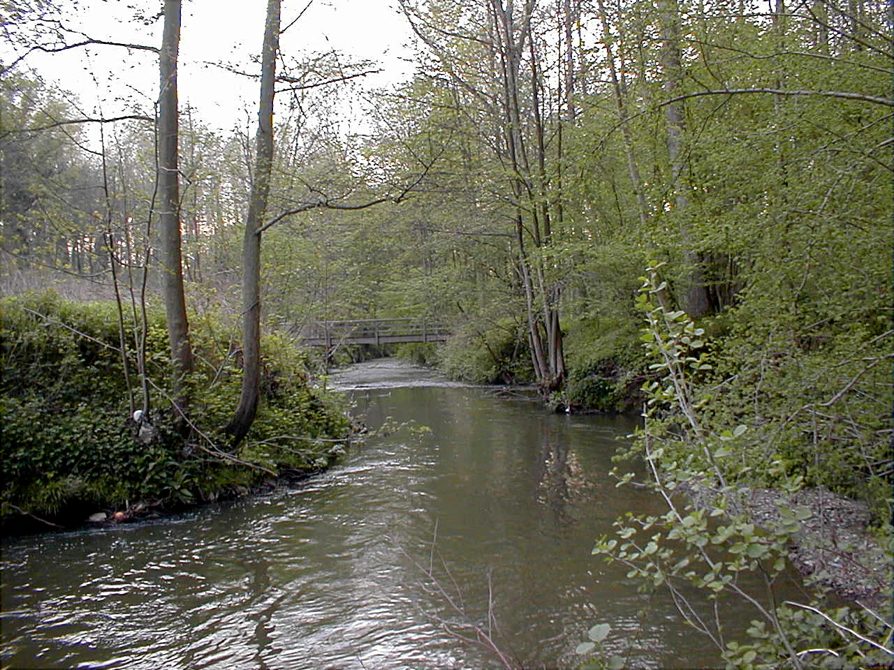
A small river flows through a dense forest with trees lining both banks and a distant footbridge visible in the background.
The Grande Honnelle river flowing through the woodland landscape of the Caillou qui Bique site.

Parc naturel des Hauts-Pays ecosystems, habitats, and plant life

Ecologically, the Parc naturel des Hauts-Pays occupies a transitional position on the northern fringe of the Sambre-Meuse trough, a zone that for many plant and animal species represents their last Belgian refuge north of the Sambre and Meuse rivers. As a result, the park is of disproportionate national importance for biodiversity despite its modest size.

Habitats within the park range from broadleaf forests such as the Bois d'Angre and the Bois de Colfontaine to fast-flowing river and brook corridors, waterfalls, cliff and promontory habitats, calcareous grasslands, wet meadows, and relict bocage with pollarded willows and thorny hedgerows. The calcareous substrates support particularly rich orchid communities, while the wet meadows and hedgerow networks continue to harbor a fauna that has largely vanished from the surrounding industrial and agricultural regions.

The park's ecological value is acknowledged at the European level through the Natura 2000 designation Haut-Pays des Honnelles, covering a significant share of its territory. At the regional level it is recognized as an area hosting sites of very high biological value, sometimes of national importance for particular species.
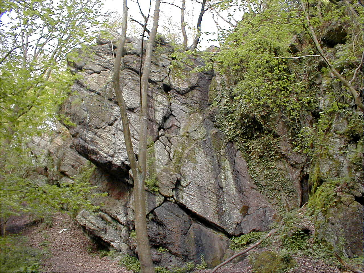
A large, rugged, moss-covered rock formation surrounded by dense green trees and foliage in a forest setting.
The Caillou qui bique rock formation, a notable geological site within the Parc naturel des Hauts-Pays.

Parc naturel des Hauts-Pays wildlife and species highlights

Although the source documents for the park lean more heavily on botanical than on zoological detail, the wildlife profile of the Hauts-Pays is shaped by the same habitat mosaic that supports its flora: woodland, fast-flowing rivers, rocky outcrops, calcareous grasslands, and extensivel traditional bocage.

The park's agricultural heritage, in particular traditional hay meadows, wet meadows with pollarded willows, and thorny hedgerows, still supports a fauna that has largely disappeared from surrounding areas. These landscape elements provide habitat for insects, birds, and small mammals dependent on extensive, low-intensity land use.

The forests, rivers, and promontories of the park, combined with its location on the Belgian-French border and its Natura 2000 protection, give the Hauts-Pays a regional role as one of the few remaining areas where the typical rural fauna of the Sambre-Meuse region still persists at meaningful population levels.
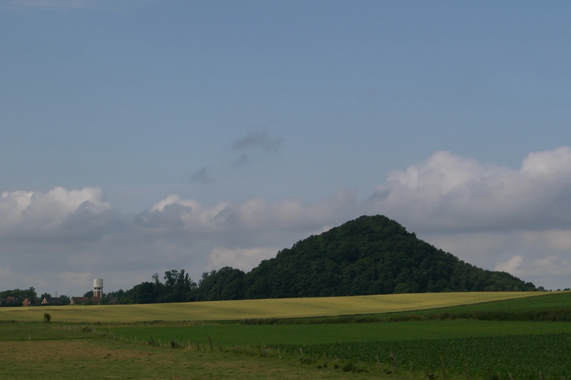
A conical, forest-covered spoil tip rising from green and yellow agricultural fields under a partly cloudy sky.
A view of the Noirchain spoil tip in the Parc naturel des Hauts-Pays, showing the reclaimed industrial hill amidst agricultural fields.

Parc naturel des Hauts-Pays conservation status and protection priorities

The Parc naturel des Hauts-Pays has a layered conservation status. At the regional level, it is officially recognized as a natural park of the Walloon Region, classified under the IUCN's Category V as a protected landscape where human land use and natural values are managed together. The park is recorded in the World Database on Protected Areas under WDPA ID 386139.

At the European level, a significant part of its territory has been designated as a Natura 2000 site under the name Haut-Pays des Honnelles, tying the park into the broader European network of protected areas and giving its habitats formal legal protection under EU nature directives.

Active conservation efforts include monitoring of key species, placement of nest boxes, restoration of bocage hedgerows, support for a teaching apiary, mapping of natural heritage, and management of invasive plant species. The park also plays an advisory role on landscape and planning matters, contributing to the protection of the area's visual and built heritage through landscape charters and input into local planning decisions. Education and outreach, through school programs, themed walks, exhibitions, and on-site interpretation at the Maison du Parc, support the long-term social base for conservation in the area.

Parc naturel des Hauts-Pays cultural meaning and human context

Beyond its natural significance, the Parc naturel des Hauts-Pays carries a strong cultural identity rooted in the rural traditions of the Tournaisis. Many of the buildings scattered across the park's villages are older structures built in the traditional regional style, and the patchwork of hay meadows, wet meadows, pollarded willows, and thorny hedgerows represents a historic bocage landscape that has been preserved largely intact on this part of the border.

Communities within the park include six communes and several smaller villages and former communes such as Baisieux, Audregnies, Blaugies, Wihéries, Petit-Dour, Elouges, Sars-la-Bruyère, Noirchain, Eugies, Angre, and Angreau. Local cultural life is supported by the park through themed gastronomic walks highlighting local producers, cultural events, sports events, and heritage-focused activities that connect residents and visitors with the area's rural traditions.

The park also has an important symbolic function: as a green counterpoint to the heavily urbanized Borinage and the densely populated Haine valley, it serves as a recognizable regional landscape of identity for residents of nearby Mons, Valenciennes, and the surrounding conurbations.

Top sights and standout views in Parc naturel des Hauts-Pays

Standout features of the Parc naturel des Hauts-Pays include the Bois d'Angre and the wooded valley of the Grande Honnelle, the central Bois de Colfontaine, and the dramatic Caillou-qui-Bique promontory. These forest and river landscapes anchor a regional identity very different from that of the surrounding mining and industrial areas.

At the ecological level, the park's most distinctive asset is its role as a refuge for plant species at the northern limit of the Sambre-Meuse trough, including Euphorbia dulcis, Luzula forsteri, and rich populations of calcareous orchids such as Neottia nidus-avis, Cephalanthera damasonium, Platanthera chlorantha, Ophrys apifera, Ophrys insectifera, Orchis purpurea, Orchis mascula, and Dactylorhiza fuchsii.

For visitors and residents alike, the park offers roughly 300 kilometers of signposted walks through high-quality rural landscapes, themed walks linking local food producers and artisans, school and extracurricular education programs, and a network of Natura 2000 and Walloon-level protections that combine to make the Hauts-Pays one of the most ecologically distinctive protected landscapes in the Franco-Belgian border region.

Best time to visit Parc naturel des Hauts-Pays

The Parc naturel des Hauts-Pays is a year-round rural protected landscape in a temperate northwestern European setting. Spring is typically the most rewarding season for visitors interested in wildflowers and orchids, as calcareous grasslands and forest floors come into bloom and the rivers run full.

Summer brings lush forest cover, ideal conditions for walking the park's extensive signposted trail network, and active outdoor programming including themed walks and local events. Autumn offers dramatic forest color across the Bois d'Angre and Bois de Colfontaine, while winter brings quieter conditions and an emphasis on landscape structure, woodland, and village heritage, with rivers and waterfalls often at their most visible against bare surroundings.

Monthly climate preview

Track representative long-term monthly temperature and precipitation patterns across the protected landscape

Parc naturel des Hauts-Pays Climate Normals and Annual Temperature Rhythm

Representative coordinate records for Parc naturel des Hauts-Pays document a steady annual rhythm, ranging from mean winter minimums below freezing to warm summer maximums near thirty degrees Celsius with consistent monthly precipitation. Detailed monthly climate normals expand on this baseline data to provide a comprehensive twelve-month profile of regional temperature and moisture variations.
Annual mean10 °C
2 °C18 °C
Jan
Feb
Mar
Apr
May13°
Jun16°
Jul18°
Aug18°
Sep15°
Oct11°
Nov
Dec
Warmest month
July

18.1 °C

Coolest month
January

2.5 °C

Wettest month
December

2.6 mm/day

Driest month
April

1.5 mm/day

Park location guide

Geography guide, regional context, and park location map for Parc naturel des Hauts-Pays

Parc naturel des Hauts-Pays park geography, regions, and map view in Belgium

Understand where Parc naturel des Hauts-Pays sits in Belgium through a broader geographic reading of the surrounding landscape, nearby location context, and its mapped position within the national park landscape.

How Parc naturel des Hauts-Pays fits into Belgium

Belgium is a parliamentary constitutional monarchy and federal state in Northwestern Europe. Located in the Low Countries, it borders the Netherlands, Germany, Luxembourg, France, and the North Sea. The country has three autonomous regions and three official languages, with Brussels as both the capital and largest city. Belgium is a founding member of the European Union and hosts its de facto capital in Brussels.

Wider geography shaping Parc naturel des Hauts-Pays in Belgium

Belgium occupies a coastal lowland region in Northwestern Europe known as the Low Countries. It is bordered by the Netherlands to the north, Germany to the east, Luxembourg to the southeast, France to the south, and the North Sea to the west. The country also shares a maritime boundary with the United Kingdom to the northwest.

Map view of Parc naturel des Hauts-Pays

Use this park location map to pinpoint Parc naturel des Hauts-Pays in Belgium, understand its exact geographic position, and read its mapped placement within the surrounding landscape more clearly.

Pigeon | © OpenStreetMap contributors

Location context for Parc naturel des Hauts-Pays

Province de HainautWallonie

Explore photographic records of broadleaf forest mosaics, incised river valleys, and rare botanical habitats.

Parc naturel des Hauts-Pays Photos and Scenery: Visualizing Protected Landscapes

Photographic documentation reveals the distinct terrain and diverse protected habitats spanning the Franco-Belgian border region. Visual records capture the broadleaf canopies of the Bois de Colfontaine, fast-flowing streams, and traditional bocage ecosystems.

A cluster of yellow and white wild daffodils growing in a woodland setting with green grass and fallen leaves in the foreground.

A sign for the Maison du Parc naturel des Hauts-Pays mounted on a red brick wall, featuring green graphics of people, a bird, and a church silhouette, with green and dark text.

A small river flows through a dense forest with trees lining both banks and a distant footbridge visible in the background.

A large, rugged, moss-covered rock formation surrounded by dense green trees and foliage in a forest setting.

A conical, forest-covered spoil tip rising from green and yellow agricultural fields under a partly cloudy sky.

Park atlas

Compare surrounding regional geography and connected protected landscapes

Explore Protected Areas and Parks Near Parc Naturel des Hauts-Pays

Browse other protected areas and natural parks located near Parc naturel des Hauts-Pays in the Franco-Belgian border region. Examining these adjacent conservation lands provides broader geographic context for the surrounding watershed topography and forest terrain.
A wide watercolor illustration showing a calm river reflecting pink and yellow hues, bordered by green trees and vegetation on both banks.
Nature reserveHauts-de-France
About 10 km away#1 closest

West

Réserve naturelle régionale du bois d'Encade: Protected Woodland and Quarry Mosaic

Regional Nature Reserve in the Hauts-de-France river valley.

Spanning a compact stretch of the Hogneau valley, this nature reserve protects diverse habitats including fern-rich rock crevices and mature forest stands. The site represents a crucial ecological stepping stone that provides refuge for numerous bird, bat, and invertebrate species within a heavily cultivated agricultural corridor of northern France.

Area
0.021 km²
Established
2001
IUCN
IV
Relief
Lowland
A pale, soft watercolor painting showing a rolling landscape with gentle green hills, grassy foreground, and distant hazy ridges under a white sky.
Nature reserveHauts-de-France
About 11 km away#2 closest

Southwest

Réserve naturelle régionale de la carrière des Nerviens, Protected Nature Reserve and Habitat Mosaic

Regional landscape context in Hauts-de-France, France

Spanning approximately three hectares, this nature reserve in the Hauts-de-France region serves as a dense habitat mosaic formed on former quarry lands. The site preserves regionally protected orchid species and rare plant formations through focused conservation management, offering a compelling look at post-industrial ecological succession and calcareous flora.

Area
0.031 km²
Established
2009
IUCN
IV
Relief
Lowland
Protected areaNord
About 15 km away#3 closest

West

Vallées de la Scarpe et de l'Escaut Protected Landscape Geography and Map Context

Wetland mosaic, subsidence lakes, and river floodplains in Nord

Examine the physical geography of the Scarpe and Escaut Valleys, a premier wetland site in northern France. The protected area features a mosaic of marshes, wet meadows, and mining-subsidence lakes that provide vital habitats for migratory waterbirds and support carbon storage through rare alkaline peatlands.

Area
276.22 km²
Established
2020
Relief
Lowland
Scope
Terrestrial
Nature reserveHauts-de-France
About 15 km away#4 closest

South

Réserve naturelle régionale de Pantegnies: Protected Landscape and Regional Map Overview

A managed nature reserve in the Hauts-de-France region

Réserve naturelle régionale de Pantegnies covers 37 hectares of protected terrain near Pont-sur-Sambre. This IUCN Category IV site serves as a vital anchor for regional biodiversity management, offering a clear case study in the preservation of northern French landscapes through formal regional nature reserve status.

Area
0.37 km²
Established
2013
IUCN
IV
Scope
Terrestrial
A watercolor painting of a pastoral landscape featuring a grassy foreground with a small pool of water, a line of trees, and soft hills in the background.
Protected landscapeHainaut
About 23 km away#5 closest

Northwest

Parc naturel des Plaines de l'Escaut: Geographic Overview of the Hainaut Protected Area

Scheldt valley wetlands, forested ridges, and historical landscape estates.

Located in the Hainaut province of Belgium, Parc naturel des Plaines de l'Escaut protects a complex mosaic of lowlands and heritage sites. This area integrates wetlands, heathland openings, and castle estates within a heavily humanized region. Learn about its role as a cross-border protected entity and its contribution to the pan-European ecological network through its varied terrain and water-dominated geography.

Area
465 km²
Established
1996
IUCN
V
Relief
Lowland
A watercolor painting showing a soft, panoramic landscape with green hills in the distance, a meandering stream in the foreground, and grassy banks with subtle pink floral highlights.
Nature reserveHauts-de-France
About 25 km away#6 closest

South

Réserve naturelle régionale des Prairies du Val de Sambre: Regional Nature Reserve Atlas

Wetland floodplain meadows in the middle Sambre valley

The Réserve naturelle régionale des Prairies du Val de Sambre protects essential wet grassland habitats in northern France. Spanning approximately 49 hectares along the canalised Sambre, this protected area maintains traditional meadow systems that support wetland-dependent species; it represents a key junction in the regional landscape between the Mormal forest and Thiérache bocage.

Area
0.494 km²
Established
2012
IUCN
IV
Protected areaHauts-de-France
About 36 km away#7 closest

Southwest

Neuvilly Protected Area: Geography, Mapped Boundaries, and Regional Landscape Context

A detailed geographic overview of protected lands in Hauts-de-France.

Gain insights into the Neuvilly protected area through detailed mapping and geographic analysis. This resource provides a clear breakdown of the site footprint and its place within the Hauts-de-France landscape, ensuring a structured understanding of its ecological boundaries and regional significance for mapping and environmental study.

Area
0.193 km²
Established
1990
Climate
Temperate
Scope
Terrestrial
Nature reserveHauts-de-France
About 41 km away#8 closest

Southeast

Réserve naturelle régionale des monts de Baives: Protected Limestone and Calcareous Landscapes

Ecological geography and regional conservation map context

Encompassing roughly 19 hectares, the Réserve naturelle régionale des monts de Baives protects a specialized ecosystem at the edge of the Ardennes foothills. The site is recognized for its south-facing limestone slopes, orchid-rich grasslands, and historical quarry habitats that support regional bat colonies and unique botanical species.

Area
0.188 km²
Established
1996
IUCN
IV
Relief
Upland

Common questions about visiting, size, designation, and location context for Parc naturel des Hauts-Pays

Parc naturel des Hauts-Pays FAQs for park facts, access, geography, and protected area context

Find quick answers about Parc naturel des Hauts-Pays, including protected-area facts, park geography, trail and visitor context, and how the park fits into its surrounding country and regional landscape.
MoriAtlas Explorer

Continue Your Protected Areas Search Across the Global Atlas

Deepen your exploration by continuing the structured search for national parks and protected areas worldwide. Utilize the comprehensive filtering capabilities to compare different conservation landscapes and refine your understanding of global park geography. Discover more about the distribution and characteristics of protected natural areas.

Global natural geography