
Mori Atlas logo
National parkParque nacional Arequita

Explore the volcanic geography, cave networks, and native hill ecosystems of this Uruguayan national park.

Parque nacional Arequita in Lavalleja Department: A Mapped Protected Natural Landscape

Parque nacional Arequita stands as a significant protected natural area within the Lavalleja Department of southeastern Uruguay. Dominated by the volcanic mass of Cerro Arequita, the landscape features dramatic basalt formations, underground cave systems, and a rich mosaic of native ombu woodlands and grasslands. These protected lands serve as a critical component of the Santa Lucía river basin watershed, representing a distinct intersection of geological heritage and ecological preservation in the Uruguayan interior.

national parkvolcanic hillcavessierrasombú woodlandnative grasslands
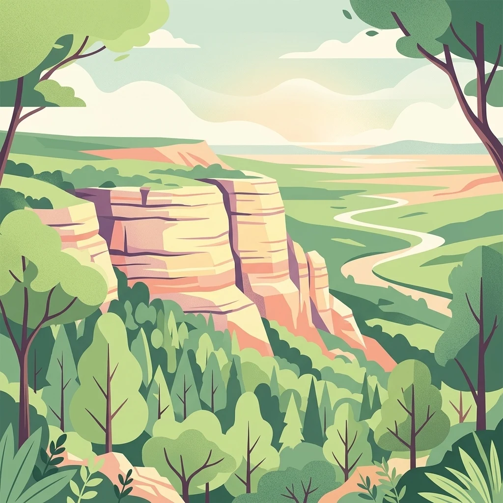
An illustration depicting a scenic valley with a winding river, bordered by steep, light-colored rocky cliffs and lush green trees under a soft, hazy sky.

Parque nacional Arequita

National park

Park overview

Structured park overview, official facts, and landscape profile for Parque nacional Arequita

Parque nacional Arequita park facts, protected area profile, and essential visitor context

Review the core facts for Parque nacional Arequita, including designation, size, terrain, visitor scale, habitats, and operating context in one park-focused overview.

About Parque nacional Arequita

Parque nacional Arequita is a protected natural area in the interior hills of southeastern Uruguay, established to safeguard one of the country's most distinctive geological landmarks and the ecosystems that surround it. Although it joined Uruguay's national system of protected areas only in 2024, the cerro at its heart has been a familiar landmark and local destination for generations, and its inclusion in the national park network reflects long-standing recognition of its geological, ecological, and cultural value.

The park lies in the department of Lavalleja, in a region characterized by rolling sierras, rocky outcrops, and a mix of woodland and pasture. Cerro Arequita dominates the protected area, rising to about 230 meters above sea level and standing out clearly in the surrounding terrain. A second prominent hill, Cerro del Cuervo, lies nearby and is also part of the park. Together these elevations give the protected area an unusually dramatic profile for this part of Uruguay, where most landscapes are gently undulating.

Arequita's significance goes far beyond scenery. The park lies within the broader Santa Lucía river basin, the main source of drinking water for a large share of Uruguay's population. Its ecosystems, which range from ombú groves and hillside forests to grasslands and small streams, contribute to the health of this strategic watershed.

The park is also a site of strong cultural and educational relevance for the region. Coordination of the area falls to Uruguay's Ministry of Environment, working alongside local communities to promote sustainable ecotourism, environmental education, and stewardship of the cerro's caves and uplands. As one of Uruguay's newest national parks, Arequita marks a meaningful expansion of formal protection in the country's interior sierras.

Quick facts and research context for Parque nacional Arequita

Parque nacional Arequita lies in the Lavalleja department of southeastern Uruguay, near the city of Minas. It covers roughly 560 hectares of hilly terrain dominated by Cerro Arequita and the adjacent Cerro del Cuervo.

The park was officially created on 13 November 2024 through Presidential Decree No. 306/024, becoming part of Uruguay's Sistema Nacional de Áreas Protegidas. Its conservation importance is closely tied to the Santa Lucía river basin, a key watershed for the country's drinking water supply, and to the volcanic geology of the central hill where the famous Arequita caves are located.

Protection and recognition

Examine documented terrestrial conservation frameworks and designation records.

Parque nacional Arequita Protection Status and Designated Area History

Territorial governance records for Parque nacional Arequita outline official protection status established in 2024. Structured conservation metrics compile documented management scope and designation timelines for ongoing geographic analysis.

Protection details

Protection scope
Terrestrial
Designated year
2024
Transboundary protection
No
Park context

Deeper park guide and search-rich context for Parque nacional Arequita

Parque nacional Arequita history, landscape, wildlife, and travel context

Explore Parque nacional Arequita through its history, landscape character, ecosystems, wildlife, conservation priorities, cultural context, and seasonal travel timing in a structured park guide built for atlas discovery and search intent.

Why Parque nacional Arequita stands out

Parque nacional Arequita is best known for Cerro Arequita itself, an isolated volcanic hill formed of basalt that has stood above the Uruguayan landscape for roughly 120 million years. The cerro is famous for its caves, known locally as the grutas del Arequita, which are among the most visited geological curiosities in the department of Lavalleja. Beyond the hill, the park is recognized for its ecological diversity within a compact area. Ombú woodland, rocky hillside forests, native grasslands, and small watercourses coexist here, and the park plays a role in protecting ecosystems associated with the Santa Lucía river basin, one of Uruguay's most important freshwater systems.
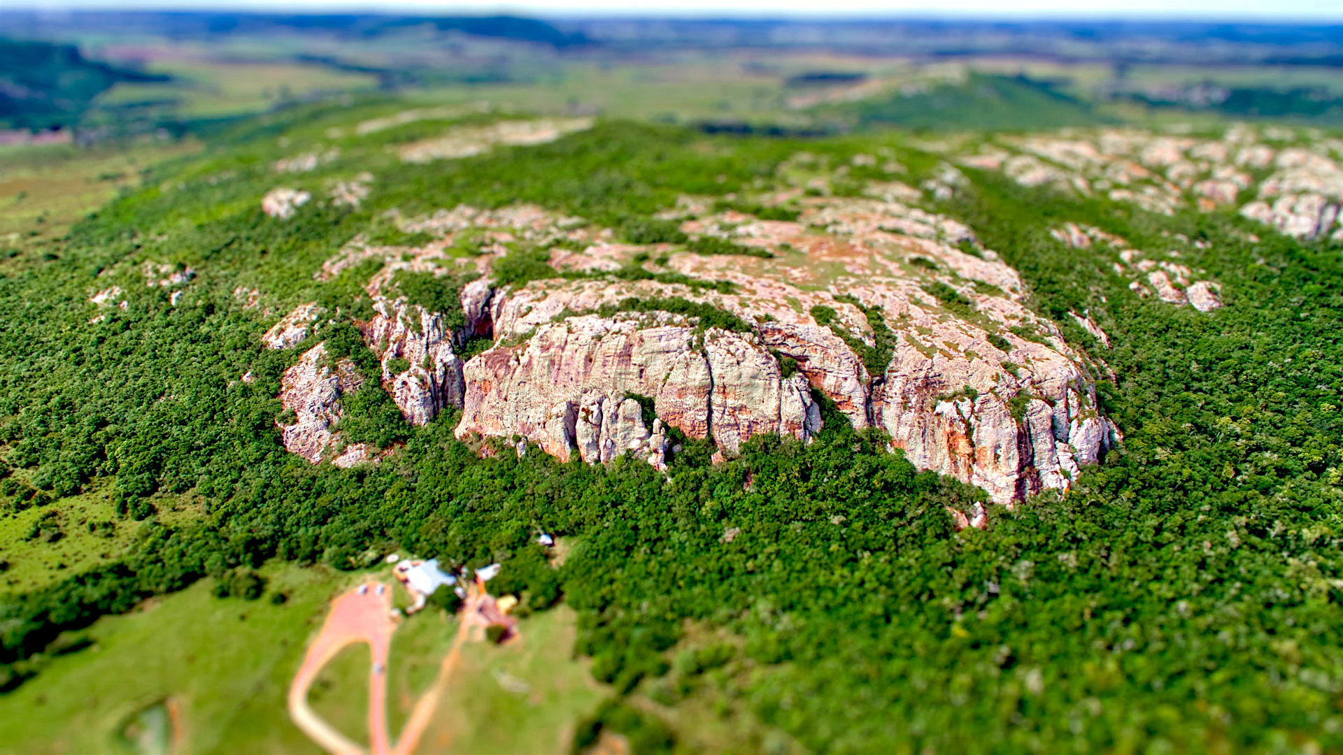
A high-angle aerial view of a large, craggy volcanic rock formation covered in patches of forest, rising above green fields in a rural landscape.
Aerial view of the prominent volcanic Cerro Arequita surrounded by dense native forest and rolling terrain.

Parque nacional Arequita history and protected-area timeline

The hill now known as Cerro Arequita has been part of the cultural and natural identity of the Lavalleja region for generations. Its caves, called the grutas del Arequita, are a long-standing point of interest in southeastern Uruguay, drawing visitors interested in the unusual volcanic geology of the site. Until recent years, however, the area did not enjoy the formal status and protection of a national park, even though its value for conservation, education, and local identity was widely recognized.

A turning point came on 13 November 2024, when the Uruguayan government officially established Parque nacional Arequita through Presidential Decree No. 306/024. The creation of the park integrated Cerro Arequita and Cerro del Cuervo into Uruguay's Sistema Nacional de Áreas Protegidas, anchoring them within a national framework for conservation. The decree highlighted the strategic importance of the area for protecting ecosystems linked to the Santa Lucía river basin, a vital source of drinking water for the country.

Following its designation, management of the park was placed under the coordination of the Ministry of Environment, with plans emphasizing sustainable ecotourism, community engagement, and environmental education. The establishment of the park reflects a deliberate effort to formalize protection around a landscape that had long been valued informally, while also strengthening conservation in one of Uruguay's most important watersheds.

Parque nacional Arequita landscape and geographic character

The landscape of Parque nacional Arequita is shaped above all by Cerro Arequita, a volcanic hill formed of basalt that rises to about 230 meters above sea level. Estimated to have originated around 120 million years ago, the cerro has resisted erosion while the surrounding terrain has worn down, leaving it as a clear landmark on the horizon of the Lavalleja department. A second elevation, Cerro del Cuervo, forms part of the same protected area and adds further topographic relief.

The interior of the cerro holds one of the park's most distinctive features: the grutas del Arequita, a network of underground formations within the volcanic rock. These caves give the landscape a rare geological character in the Uruguayan context and have long drawn visitors curious about the region's natural history.

Around the hills, the terrain softens into a mosaic of rocky slopes, native woodland pockets, and open grasslands typical of Uruguay's sierras. Small streams tied to the Santa Lucía basin thread through the lower elevations, reinforcing the link between the park's dramatic geological core and the broader watershed that sustains much of the country's drinking water supply.

Parque nacional Arequita ecosystems, habitats, and plant life

Within its relatively compact footprint, Parque nacional Arequita supports a notable diversity of ecosystems. The protected area includes stands of ombú trees, a signature species of the Uruguayan landscape, as well as hillside forests adapted to the rocky, well-drained slopes of the sierras. These wooded patches contrast with surrounding open grasslands, creating a varied mosaic of habitats that supports a wide range of plant and animal life.

The park also includes fresh water features linked to the Santa Lucía basin, including small streams and associated riparian vegetation. Protecting these watercourses and their margins is a central element of the park's ecological role, since the Santa Lucía river system is one of the most important watersheds in Uruguay. The combination of rocky uplands, woodland, grassland, and water creates transitional zones where species typical of very different environments can come together within a single protected area.

Parque nacional Arequita wildlife and species highlights

Although detailed wildlife inventories for the new park are still developing, the combination of ombú groves, hillside forests, native grasslands, and water features provides habitat for a representative cross-section of Uruguay's interior fauna. Small mammals typical of the sierras, common native birds, and reptiles associated with rocky outcrops and grasslands can be expected across the park's varied terrain.

The mosaic of habitats also gives the park value for species that move between woodland and open country, as well as those that depend on the streams and riparian vegetation tied to the Santa Lucía basin. As Parque nacional Arequita matures under national park management, it is poised to become an increasingly important site for understanding and protecting the wildlife of southeastern Uruguay.

Parque nacional Arequita conservation status and protection priorities

The conservation importance of Parque nacional Arequita rests on three overlapping pillars: geology, biodiversity, and water resources. The cerro is a rare example of ancient volcanic landform in Uruguay and hosts underground cave systems that are themselves worth protecting. Surrounding the cerro, the park safeguards a rich mosaic of native ecosystems, including ombú woodland, hillside forest, and native grasslands that together represent an important share of the region's biodiversity.

Crucially, the park lies within the Santa Lucía river basin, a strategic watershed that supplies drinking water to a large portion of Uruguay. By protecting ecosystems that filter water, stabilize soils, and maintain riparian habitat, the park contributes to the long-term integrity of this water supply. Recognition as a national park under Uruguay's protected areas system, coordinated by the Ministry of Environment, gives the area a formal management framework that includes sustainable ecotourism and environmental education as key tools for long-term stewardship.

Parque nacional Arequita cultural meaning and human context

Cerro Arequita and its caves have long been part of the cultural landscape of the Lavalleja department. The grutas del Arequita are a familiar destination for residents and visitors from across the region, and the cerro itself functions as a local landmark that anchors place identity in this part of southeastern Uruguay.

The establishment of the national park reflects a growing recognition of the cerro's significance beyond tourism, including its ecological role and its place in the country's water supply system. By linking conservation with community engagement and environmental education, the park's management approach seeks to reinforce the cerro's cultural importance while ensuring its long-term protection.

Top sights and standout views in Parque nacional Arequita

Among the standout features of Parque nacional Arequita are the dramatic profile of Cerro Arequita, one of the oldest and most distinctive volcanic landforms in the region; the grutas del Arequita, a network of caves that gives the park its strongest visitor draw; and the ecological mosaic of ombú woodland, hillside forest, native grasslands, and small streams that surround the cerro.

Together these features make the park a compact but unusually rich site where geology, biodiversity, and watershed protection converge in a single protected landscape in southeastern Uruguay.

Best time to visit Parque nacional Arequita

As a recently established park in Uruguay's southeastern sierras, Parque nacional Arequita can be appreciated throughout much of the year, with each season offering a different character. Spring and early summer tend to bring milder temperatures, green vegetation, and active wildlife, making them a comfortable time for exploring the cerro and the surrounding trails.

Autumn offers softer light over the rocky landscape and a quieter atmosphere. Winter brings cooler weather but also clearer views across the sierras and a chance to experience the caves and surrounding woodland in a more subdued setting. Because the park's value lies in scenery, geology, and ecological diversity rather than in seasonal extremes, visitors generally benefit from choosing conditions that match the kind of experience they seek, rather than a fixed peak season.
Monthly climate preview

Long-term monthly temperature and precipitation patterns across the representative coordinate

Parque nacional Arequita Climate Normals and Annual Temperature Rhythm

Representative coordinate measurements reveal measured annual temperature variations and steady precipitation rates throughout the year at Parque nacional Arequita. Analyzing monthly climate normals provides deeper context regarding long-term thermal conditions and precipitation averages across the protected area.
Annual mean16 °C
9 °C22 °C
Jan22°
Feb22°
Mar20°
Apr16°
May13°
Jun10°
Jul
Aug11°
Sep12°
Oct15°
Nov17°
Dec21°
Warmest month
January

22.5 °C

Coolest month
July

9 °C

Wettest month
February

3.8 mm/day

Driest month
December

2.9 mm/day

Park location guide

Geography guide, regional context, and park location map for Parque nacional Arequita

Parque nacional Arequita park geography, regions, and map view in Uruguay

Understand where Parque nacional Arequita sits in Uruguay through a broader geographic reading of the surrounding landscape, nearby location context, and its mapped position within the national park landscape.

How Parque nacional Arequita fits into Uruguay

Uruguay is a unitary presidential republic located in southeastern South America. It covers approximately 176,215 km² and has a population of nearly 3.5 million people. The capital and largest city is Montevideo, where roughly 2 million people live in the metropolitan area. Uruguay gained independence between 1825 and 1828 following territorial disputes involving Portugal, Spain, Brazil, and the United Provinces of the Río de la Plata.

Wider geography shaping Parque nacional Arequita in Uruguay

Uruguay is situated in the southeastern part of South America, bordering Argentina to its west and southwest, Brazil to its north and northeast, the Río de la Plata estuary to the south, and the Atlantic Ocean to the southeast. The terrain consists primarily of rolling plains and low hills, with the highest point being Cerro Catedral at approximately 514 meters. The country has several rivers including the Uruguay River, Paraná River, and Negro River.

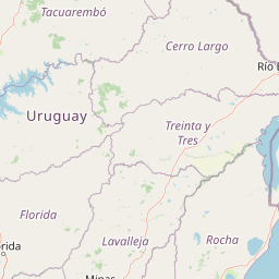
Map view of Parque nacional Arequita

Use this park location map to pinpoint Parque nacional Arequita in Uruguay, understand its exact geographic position, and read its mapped placement within the surrounding landscape more clearly.

Pigeon | © OpenStreetMap contributors

Location context for Parque nacional Arequita

Lavalleja Department

Explore photographic views of volcanic hills, native woodlands, and protected terrain.

Parque nacional Arequita Photos and Landscape Scenery Visual Guide

Visual documentation reveals the distinctive volcanic terrain, rocky outcrops, and native woodland mosaics defining Parque nacional Arequita. Photographic records help researchers and visitors examine the protected landscape features and geological formations of the interior hill country.

A high-angle aerial view of a large, craggy volcanic rock formation covered in patches of forest, rising above green fields in a rural landscape.

Park atlas

Compare regional geology, native woodlands, and neighboring hill country protected areas

Explore Parks Near Parque nacional Arequita and Surrounding Protected Landscapes

Browse other parks near Parque nacional Arequita to examine related geological formations and regional hill country ecosystems across southeastern Uruguay. Comparing nearby protected landscapes expands regional geographic context beyond individual volcanic elevations.
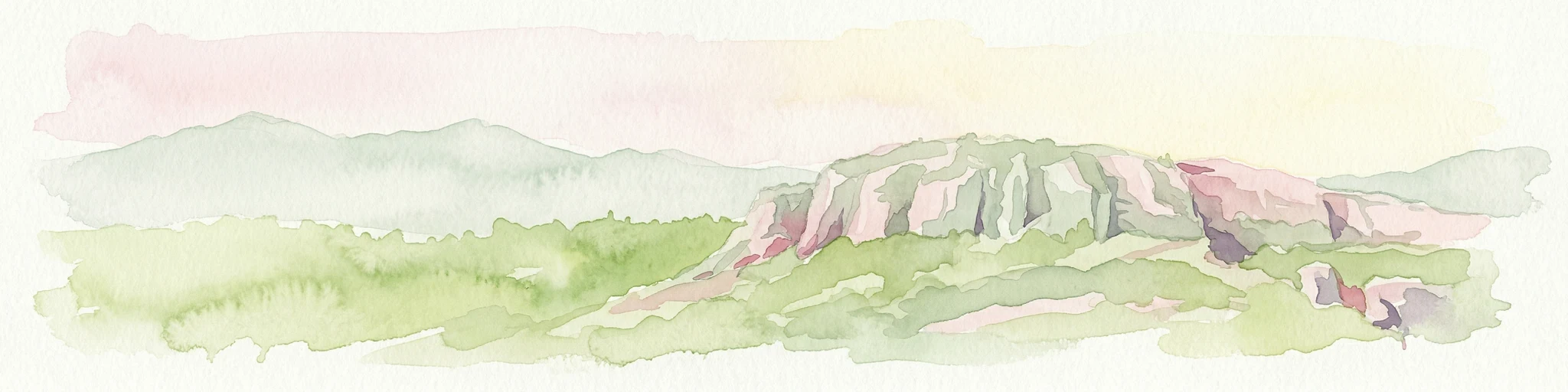
Watercolor painting showing a hill with green landscape and distant mountains
National parkUruguay
About 0 km away#1 closest

Southwest

Arequita National Park: Uruguay's National Park Protected Landscape and Geography

Mapped boundaries and regional natural terrain context for a key protected area.

Delve into Arequita National Park, a designated national park contributing to Uruguay's protected land inventory. This resource explores the park's unique geographic setting, its mapped boundaries, and its significance within the natural landscape of the Southern Cone. Gain structured insight into its role as a protected area and its contribution to the regional geography of South America.

Scope
Terrestrial
Water
No major water
Wildlife reserveMaldonado
About 84 km away#2 closest

Southeast

Area de manejo de habitats y/o especies Laguna Garzon: Wildlife Reserve and Coastal Atlas

Mapped wetlands and Atlantic coastal landscapes in Maldonado, Uruguay.

The Area de manejo de habitats y/o especies Laguna Garzon protected area features a unique mosaic of interconnected lagoons and dune-backed shorelines. This coastal wildlife reserve offers a significant geographic study of wetland habitats and their interaction with the Atlantic maritime zone, providing essential context for understanding Uruguay's southeastern coastal terrain.

Established
2014
Water
Water-dominated
A soft watercolor painting showing an island surrounded by water, with distant green hills on the horizon under a light-colored sky.
National parkMaldonado
About 88 km away#3 closest

Southeast

Parque nacional Isla e islote de Lobos y su entorno sumergido: Protected Area Atlas

Mapping the oceanic terrain and rocky coastal landscapes of Uruguay

This resource provides a detailed geographic overview of Parque nacional Isla e islote de Lobos y su entorno sumergido. Explore the composition of this protected marine environment, which spans both rugged island terrain and extensive submerged rocky formations within the Atlantic waters of Maldonado.

Area
40 km²
Established
2024
Relief
Lowland
Climate
Temperate
A horizontal watercolor illustration showing a shallow lagoon with soft green, yellow, and grey tones depicting vegetation, water, and distant low hills against a white background.
Protected landscapeRocha Department
About 90 km away#4 closest

Southeast

Laguna de Rocha Protected Landscape: Mapping Coastal Uruguay and its Dynamic Wetland Geography

Explore the unique barrier lagoon system and diverse coastal habitats of Rocha Department.

Laguna de Rocha functions as a vital coastal lagoon and wetland complex in southeastern Uruguay. Characterized by its shallow water and temporary sandbar breaches, the area supports a distinct mosaic of habitats, including dunes, reedbeds, and mudflats. Its status as a biosphere reserve and Important Bird Area underscores the ecological importance of this regional geography in providing a sanctuary for migratory waterbirds along the Atlantic coast.

Area
220 km²
Established
2010
Relief
Lowland
Climate
Temperate
A watercolor painting showing stylized, rolling hills in shades of purple, green, yellow, and soft pink against a white background.
National parkCanelones Department
About 95 km away#5 closest

Southwest

Isla de Flores National Park: Geographic Map and Protected Landscape Overview

Tidal island geography within the Río de la Plata estuary.

Located in the Canelones Department, Isla de Flores National Park represents a significant protected maritime area. Its landscape consists of a low-lying island reaching only two meters above sea level, featuring a protected maritime buffer that supports the integrity of this historic Río de la Plata site. Examine the mapped boundaries and the unique interplay between the estuary currents and this shifting coastal terrain.

Area
0.31 km²
Established
2018
Relief
Lowland
Climate
Temperate
A watercolor painting of a wetland scene showing green, marshy areas and gentle, rolling hills in the background with soft brushwork.
Protected landscapeMontevideo
About 111 km away#6 closest

Southwest

Humedales de Santa Lucía Protected Landscape: Geography and Mapped Wetland Boundaries in Uruguay

A dynamic tidal freshwater system located near the Montevideo riverfront

Humedales de Santa Lucía is a significant protected landscape spanning the departments of San José, Canelones, and Montevideo. This managed wetland ecosystem is defined by the interaction between freshwater river discharge and the brackish tidal influence of the Río de la Plata estuary, creating a unique riparian mosaic of channels, islands, and marshlands important to local waterbird populations.

Area
865.17 km²
Established
2015
Relief
Lowland
Access
Easy access
Protected landscapeRocha
About 129 km away#7 closest

East

Paisaje protegido Laguna de Castillos: Mapped Geography and Protected Landscape Features

Coastal lagoon and native woodland terrain in Rocha, Uruguay

Investigate the geographic profile of Paisaje protegido Laguna de Castillos, an essential protected area in Rocha. This terrain features the largest continuous ombú forest in the country alongside shallow coastal lagoon waters and complex wetland habitats that support a high diversity of native waterfowl.

Area
82.64 km²
Established
2020
Relief
Lowland
Climate
Subtropical
A stylized digital illustration of yellow and peach-toned sand dunes under a soft blue sky, with small patches of green grass in the foreground.
National parkRocha
About 135 km away#8 closest

East

Parque nacional Cabo Polonio: Coastal Geography and Marine Protected Area Atlas

Examining dune systems, coastal lagoons, and marine habitats

Analyze the geography of Parque nacional Cabo Polonio, a protected area in Uruguay's Rocha region. This atlas entry details the mosaic of transverse dunes, interdunal wetlands, rocky outcrops, and oceanic islands that define this significant coastal-marine protected landscape.

Area
258.2 km²
Established
2009
Relief
Lowland
Climate
Subtropical

Common questions about visiting, size, designation, and location context for Parque nacional Arequita

Parque nacional Arequita FAQs for park facts, access, geography, and protected area context

Find quick answers about Parque nacional Arequita, including protected-area facts, park geography, trail and visitor context, and how the park fits into its surrounding country and regional landscape.
MoriAtlas Explorer

Continue Your Protected Areas Search Across the Global Atlas

Deepen your exploration by continuing the structured search for national parks and protected areas worldwide. Utilize the comprehensive filtering capabilities to compare different conservation landscapes and refine your understanding of global park geography. Discover more about the distribution and characteristics of protected natural areas.

Global natural geography