Mori Atlas logo
Nature reservePasoh Forest Reserve

Mapping the protected boundaries and forest dynamics of a globally significant dipterocarp research site

Pasoh Forest Reserve: A Defined Lowland Tropical Nature Reserve in Peninsular Malaysia

Pasoh Forest Reserve encompasses 2,450 hectares of lowland dipterocarp forest in Peninsular Malaysia, serving as a critical scientific reference for tropical rainforest dynamics. The reserve features a protected 600 hectare core area surrounded by a managed buffer zone, standing in sharp contrast to the adjacent palm oil plantations and selectively logged forests. This site maintains one of the world's most influential forest monitoring plots, providing foundational data on tree species composition and long-term ecological turnover.

tropical rainforestlowland dipterocarp forestforest dynamics plotlong-term ecological researchPeninsular Malaysiabuffer zone reserve

Pasoh Forest Reserve

Nature reserve

Park overview

Structured park overview, official facts, and landscape profile for Pasoh Forest Reserve

Pasoh Forest Reserve park facts, protected area profile, and essential visitor context

Review the core facts for Pasoh Forest Reserve, including designation, size, terrain, visitor scale, habitats, and operating context in one park-focused overview.

About Pasoh Forest Reserve

Pasoh Forest Reserve occupies a strategic mid-latitude position in Peninsular Malaysia, far enough from the coast to avoid mangrove and peat influences, but still well within the equatorial lowland zone where dipterocarp forests reach their highest diversity. The reserve sits near Simpang Pertang, deep in the rolling terrain of Negeri Sembilan, and serves both as a protected ecological reference and as a hub for tropical forest science.

The ecological value of Pasoh lies in its structural and compositional representation of lowland dipterocarp forest. Dipterocarps are a family of tall, emergent tropical trees that dominate many Southeast Asian forests, and Pasoh contains a full cross-section of that habitat, including species with valuable timbers that have been heavily exploited elsewhere. Its 2,450 hectare footprint, with a 600 hectare core and a surrounding buffer, was deliberately designed to maintain a relatively intact forest system amid a landscape increasingly shaped by commercial agriculture and selective logging. Today the reserve is bordered on three sides by oil palm plantations, while the fourth boundary meets forest that has been selectively logged, giving it a strong role as a living control site for studying how lowland rainforest functions under nearby human pressure.

The reserve's global significance goes well beyond its size. The forest dynamics plot established there in 1987 marked a shift toward long-term, plot-based ecology in Southeast Asia, where every tree above a defined diameter is mapped, identified to species, and remeasured on a regular cycle. Three full censuses of the plot have been completed, and the resulting dataset has become one of the most heavily cited tropical forest datasets in the world. Researchers at Pasoh have used this platform to investigate processes such as recruitment, mortality, species coexistence, and the influence of masting events, while also providing comparative reference data for similar plots established in other tropical regions through the Forest Global Earth Observatory network.

For wider audiences, Pasoh stands as a reminder that some of the most scientifically valuable protected areas are not necessarily the largest or the most scenically dramatic, but those that preserve a representative forest type long enough to allow the slow processes of tropical ecology to be measured and understood.

Quick facts and research context for Pasoh Forest Reserve

Pasoh Forest Reserve lies in the interior lowlands of Negeri Sembilan in Peninsular Malaysia, near Simpang Pertang and within roughly an hour and a half drive of Kuala Lumpur by straight-line distance. It is formally designated as a nature reserve and covers about 2,450 hectares, of which 600 hectares form an inner core area inside a buffer ring.

The reserve protects lowland dipterocarp forest typical of the Malay Peninsula, receiving on average about two meters of rainfall per year. It is best known as the home of a 50 hectare forest dynamics plot established in 1987, where repeated full censuses of every tree have produced one of the most detailed long-term ecological datasets for any tropical rainforest in the world.

Protection and recognition

Documented terrestrial protection scope and official recognition details

Pasoh Forest Reserve Protection Status and International Recognition Data

Pasoh Forest Reserve maintains a documented terrestrial protection scope without imported international recognition sources or transboundary status. Official records outline the baseline conservation designation and management framework governing this protected area.

Protection details

Protection scope
Terrestrial
Transboundary protection
No
Core area
6 km²
Park context

Deeper park guide and search-rich context for Pasoh Forest Reserve

Pasoh Forest Reserve history, landscape, wildlife, and travel context

Explore Pasoh Forest Reserve through its history, landscape character, ecosystems, wildlife, conservation priorities, cultural context, and seasonal travel timing in a structured park guide built for atlas discovery and search intent.

Why Pasoh Forest Reserve stands out

Pasoh Forest Reserve is best known for its 50 hectare forest dynamics plot, one of the earliest and most influential large-scale tropical forest monitoring sites established by the Forest Research Institute Malaysia, the Smithsonian Tropical Research Institute, and the Center for Tropical Forest Science (now ForestGEO). The plot has been fully recensused multiple times, recording roughly 340,000 individual trees belonging to around 800 species, and has become a cornerstone reference site for understanding tree diversity, turnover, and mortality in Southeast Asian lowland rainforests. Beyond its research fame, Pasoh is recognized as a representative fragment of Peninsular Malaysian lowland dipterocarp forest, one of the most species-rich yet most heavily logged tropical forest formations on Earth.

Pasoh Forest Reserve history and protected-area timeline

Pasoh Forest Reserve was originally established as a forestry reserve safeguarding lowland dipterocarp forest in Peninsular Malaysia, a forest type that faced widespread commercial exploitation for timber throughout the twentieth century. Its protected status preserved a tract of forest that would otherwise have been at risk from logging, mining, and conversion to plantation agriculture, the same pressures that historically surrounded it on three sides.

The reserve entered a new phase of significance in 1987, when a 50 hectare forest dynamics plot was established within it as a collaboration between the Forest Research Institute Malaysia, the Center for Tropical Forest Science, and the Smithsonian Tropical Research Institute. This plot was one of the first of its kind in Southeast Asia and was designed to monitor every tree above a specified diameter through repeated censuses. The first census began in 1989, and three full censuses of the tree population have since been carried out, building an unusually detailed record of how a lowland dipterocarp forest changes over decades.

Over time, Pasoh became linked into broader global networks for tropical forest research, including ForestGEO, which coordinates comparable long-term plots around the world. Although the surrounding landscape has continued to face logging and mining pressure, the reserve itself has remained a stable reference point for the scientific community studying Malaysian and Southeast Asian tropical forests.

Pasoh Forest Reserve landscape and geographic character

The landscape of Pasoh Forest Reserve is defined by the gentle, rolling lowland terrain typical of the interior of Peninsular Malaysia, far from the coast but still within the equatorial zone where tropical rainfall is abundant. Elevations are modest, and the topography supports continuous closed-canopy forest rather than open plains or dramatic ridges. The surface is shaped by long-term weathering of the regional geology, producing deep, relatively fertile soils that contribute to the vigor of the dipterocarp trees that dominate the canopy.

A defining visual feature of Pasoh is the contrast between its forested interior and its surroundings. To three sides, the reserve is bordered by oil palm plantations, presenting a stark boundary between tall, complex native rainforest and the orderly rows of a single commercial crop. To the remaining side, the reserve adjoins a continuation of dipterocarp forest that has been selectively logged, blurring the edge between fully protected and partly disturbed forest.

Rainfall at Pasoh is consistently high, averaging roughly two meters per year across the recorded record, with annual totals ranging between about 1,700 and 3,100 millimeters. This abundance of moisture, combined with relatively stable temperatures throughout the year, sustains a dense, multilayered canopy and supports the growth of very large emergent trees, particularly dipterocarps, that rise above the general canopy layer and become visible landmarks of the forest skyline.

Pasoh Forest Reserve ecosystems, habitats, and plant life

Ecologically, Pasoh Forest Reserve represents lowland dipterocarp forest in one of its most characteristic regional expressions. The dipterocarps are especially prominent in the canopy and emergent layers, with their tall, straight trunks and broad crowns forming the architectural backbone of the forest. Below them, multiple subordinate layers of smaller trees, palms, shrubs, and herbaceous plants create the layered vertical structure typical of mature Southeast Asian rainforest, often described as the most structurally complex terrestrial habitat on Earth.

The reserve's 2,450 hectares include a tightly protected 600 hectare core ringed by a buffer zone. This configuration was designed to shield the inner forest from edge effects, such as wind damage, desiccation, and invasive species, that can degrade narrow forest patches. The very high rainfall, averaging roughly two meters a year, sustains the continuously humid microclimate that tropical plants and animals depend on, while the deep soils and stable seasonal climate allow extraordinarily high tree diversity to be maintained within a relatively small area.

Beyond its tree communities, the reserve supports a full suite of tropical lowland rainforest habitats, including shaded forest interior, small gaps opened by fallen trees, streamside vegetation, and transitional edges along its boundaries. Together these habitats underpin the exceptionally high species richness that has been documented inside the research plot, and they make Pasoh an important reference site for understanding the ecology of lowland dipterocarp forest generally, not just a local curiosity.

Pasoh Forest Reserve wildlife and species highlights

Wildlife at Pasoh Forest Reserve is rooted in the broader fauna of Peninsular Malaysian lowland dipterocarp forest, which is among the most biodiverse terrestrial systems in the world. The continuous canopy, abundant fruit and seed production, and dense understory support a wide range of mammals, birds, reptiles, amphibians, and insects, although the reserve is more often discussed in the scientific literature for its tree communities than for individual charismatic species.

The mass fruiting events, or mast years, characteristic of dipterocarps in this region create natural pulses of food availability that shape animal populations and behavior across the wider landscape. Such events drive temporary concentrations of frugivorous birds, mammals such as various forest ungulates and primates typical of the peninsula, and swarms of insects that feed on fallen or ripening fruits. Stream-side and pool habitats within the reserve also provide important breeding and foraging habitat for amphibians and aquatic invertebrates, particularly during wetter periods when rainfall is at its highest.

Pasoh Forest Reserve conservation status and protection priorities

Conservation significance lies at the heart of Pasoh Forest Reserve's identity. By protecting one of the last substantial lowland dipterocarp forest blocks in a region where such forests have been extensively logged and converted to plantation agriculture, the reserve safeguards both an ecologically important habitat type and the genetic resources of dominant tree species that are otherwise under threat. Its configuration, with an inner 600 hectare core and outer buffer, is a deliberate design intended to maintain ecosystem integrity against the backdrop of oil palm plantations and selectively logged forest on the surrounding edges.

From a scientific conservation perspective, Pasoh's contribution goes beyond physical protection. The 50 hectare forest dynamics plot and its repeated full censuses have produced an unusually long and well-resolved record of how a lowland dipterocarp forest changes over time. This record now serves as a worldwide reference for understanding natural rates of tree turnover, species coexistence, recruitment, and mortality, all of which are central to anticipating how similar forests will respond to logging, climate change, and fragmentation.

The reserve is also heavily used to support the work of international forest-monitoring networks coordinated under the Forest Global Earth Observatory. By linking Pasoh's data to comparable plots elsewhere, researchers and conservation planners can place the future of Malaysian lowland dipterocarp forest within a broader tropical context, making the reserve not just a local protected area but an important node in global tropical forest science.

Pasoh Forest Reserve cultural meaning and human context

Pasoh Forest Reserve does not have a widely documented cultural or indigenous heritage dimension in publicly available sources. The region around Simpang Pertang, in the interior of Negeri Sembilan, has a long history of rural Malay communities and agriculture, but the reserve as a scientific and forestry site is generally framed by its ecological and research roles rather than by strong cultural associations. For this reason, cultural context is limited in the available material and is not expanded further.

Top sights and standout views in Pasoh Forest Reserve

A 50 hectare forest dynamics plot at the heart of the reserve, one of the earliest and most influential long-term tropical forest monitoring plots in the world. Roughly 340,000 trees from around 800 species have been recorded in that single plot across successive censuses.

A protected 600 hectare core area inside a 2,450 hectare reserve, deliberately ringed by a buffer zone and bordered by a landscape of oil palm plantations and selectively logged dipterocarp forest.

A globally representative sample of Peninsular Malaysian lowland dipterocarp forest, with consistently high rainfall supporting dense multilayered rainforest.

Direct involvement in the Forest Global Earth Observatory network, linking Pasoh's long-term dataset to comparable tropical forest plots across multiple continents.

Best time to visit Pasoh Forest Reserve

Pasoh is a lowland equatorial site with relatively little seasonal variation in temperature, but its character does shift with rainfall patterns across the year. Periods of lower rainfall tend to offer easier walking conditions and denser concentration of animal activity around remaining fruiting trees, while wetter periods bring lush, vibrant forest conditions at the cost of heavier rain, muddier trails, and higher leech and insect activity.

For visitors primarily interested in observing the forest as a setting, periods following major mast fruiting events, when dipterocarps drop huge quantities of seeds, can be particularly rewarding, as the forest floor becomes alive with fallen fruits and the animals that feed on them. Most visits to Pasoh, however, are research-oriented, and timing is more often chosen for sampling logistics than for traditional tourism seasons.

Monthly climate preview

Long-term representative records for monthly temperature and precipitation rhythms

Pasoh Forest Reserve Climate Normals and Annual Temperature Patterns

Pasoh Forest Reserve experiences a steady multi-decade temperature range alongside measured monthly precipitation variations sampled from representative coordinate data. Reviewing the complete twelve-month climatology profile provides deeper analytical insight into long-term thermal and rainfall cycles.
Annual mean26 °C
25 °C27 °C
Jan25°
Feb25°
Mar26°
Apr27°
May27°
Jun27°
Jul26°
Aug26°
Sep26°
Oct26°
Nov26°
Dec25°
Warmest month
May

27.3 °C

Coolest month
January

24.9 °C

Wettest month
December

10 mm/day

Driest month
February

4.6 mm/day

Park location guide

Geography guide, regional context, and park location map for Pasoh Forest Reserve

Pasoh Forest Reserve park geography, regions, and map view in Malaysia

Understand where Pasoh Forest Reserve sits in Malaysia through a broader geographic reading of the surrounding landscape, nearby location context, and its mapped position within the national park landscape.

How Pasoh Forest Reserve fits into Malaysia

Malaysia is a federal constitutional monarchy located in Southeast Asia. The country consists of 13 states and three federal territories, divided by the South China Sea into Peninsular Malaysia on the Indochinese Peninsula and East Malaysia on the island of Borneo. With a population of over 34 million, it achieved independence from Britain in 1957 and became a modern federation in 1963. The country is recognized for its multicultural population, tropical climate, and significant economic role in the region.

Wider geography shaping Pasoh Forest Reserve in Malaysia

Malaysia occupies a strategic position in Southeast Asia, split by the South China Sea into two distinct regions. Peninsular Malaysia lies on the Indochinese Peninsula, sharing a land border with Thailand to the north and maritime borders with Singapore, Vietnam, and Indonesia. East Malaysia occupies the northern portion of Borneo, sharing land borders with Brunei and Indonesia, and maritime borders with the Philippines and Vietnam. The country's terrain includes coastal plains, mountain ranges such as the Titiwangsa in the peninsula, and extensive tropical rainforests.

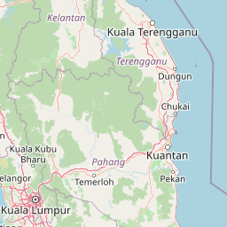
Map view of Pasoh Forest Reserve

Use this park location map to pinpoint Pasoh Forest Reserve in Malaysia, understand its exact geographic position, and read its mapped placement within the surrounding landscape more clearly.

Pigeon | © OpenStreetMap contributors
Park atlas

Compare lowland tropical rainforests and regional conservation landscapes

Other Parks Near Pasoh Forest Reserve and Protected Areas in the Surrounding Region

Browsing other parks near Pasoh Forest Reserve reveals the broader ecological spread of lowland tropical rainforests across Peninsular Malaysia. Extending regional comparison helps evaluate connected protected landscapes and regional forest dynamics.
State or regional parkSelangor
About 78 km away#1 closest

Northwest

Selangor State Park: Protected Rainforest and Geological Landscape Discovery

Highland water catchment and quartz ridge geography in Selangor

Selangor State Park forms a massive block of continuous tropical rainforest serving as the principal water supply for the Klang Valley. This protected area features rugged slopes, diverse river basins, and the dramatic 14-kilometer Klang Gates Quartz Ridge. Use this map-integrated record to understand the park's critical role in regional hydrological regulation and its significance as a research-anchored highland ecosystem.

Area
914.41 km²
Established
2007
Relief
Highland
Climate
Tropical
Nature reserveSelangor
About 80 km away#2 closest

West

Kuala Langat North Forest Reserve: Mapped Boundaries and Ecological Terrain Overview

Ancient lowland peat swamp geography in Selangor, Malaysia

Kuala Langat North Forest Reserve is an ecologically vital peat swamp remnant that shelters a range of endemic species within its 8,000 year old forest canopy. Located in the lowland terrain of Selangor, the reserve exists as a critical forest island surrounded by a matrix of development. This overview provides mapped context for the reserve's internal landscape and its role as a protected area within the shifting geography of the Klang Valley.

Area
9.576 km²
Established
1927
Relief
Lowland
Climate
Tropical
Wildlife reserveMalacca
About 81 km away#3 closest

Southwest

Tanjung Tuan Wildlife Reserve: Coastal Geography and Forested Cape Mapping

Coastal dipterocarp forest and raptor sanctuary in Malacca.

This forested coastal cape is an essential protected landscape situated along the Strait of Malacca. Characterized by its dense lowland dipterocarp forest, rocky headlands, and offshore islets, the reserve provides a crucial ecological connection for migratory birds and preserves a rich history of colonial maritime navigation and defense. Its geography offers a compact view of diverse coastal environments, ranging from mangrove fringes to the elevated ridge of Batu Putih.

Area
0.607 km²
Established
1921
Relief
Upland
Climate
Tropical
Nature reserveSelangor
About 82 km away#4 closest

Northwest

Templer Park: Protected Hill Forest Reserve and Landscape Geography in Selangor, Malaysia

Mature forest canopy and tropical stream terrain

Templer Park preserves a critical patch of mature lowland and hill forest within Selangor. Featuring multi-tiered waterfalls, shaded riverbanks, and limestone caves, the reserve supports high biological interest including rare endemic species. Its mapped boundaries reflect an essential green refuge amidst regional development, offering a window into the natural forest geography north of Kuala Lumpur.

Area
12.14 km²
Established
1954
Relief
Upland
Climate
Tropical
Wildlife reservePahang
About 83 km away#5 closest

North

Tengku Hassanal Wildlife Reserve: Protected Forest and Mountain Geography in Pahang

Mapping a vast lowland dipterocarp forest sanctuary.

Spanning over 600 square kilometers, Tengku Hassanal Wildlife Reserve stands as a core protected area within Pahang. Its landscape includes riverine valleys and the steep montane terrain of the Benom Complex, supporting unique biodiversity and active wildlife conservation. This overview traces the park's geographic footprint and its role as an ecological corridor within the broader Titiwangsa mountain system.

Area
605.52 km²
Established
1923
Relief
Mountain
Climate
Tropical
A soft watercolor painting of a serene lake scene with rolling hills in the background, green vegetation along the banks, and pale pink blooms, likely lotus flowers, in the water.
Biosphere reservePahang
About 84 km away#6 closest

Northeast

Chini Lake Biosphere Reserve: Protected Freshwater Geography in Pahang, Malaysia

Examining the interconnected lake basins and tropical wetland terrain

Chini Lake is an essential protected freshwater system in Pahang, Malaysia, comprising a series of twelve connected lake basins and tropical forest margins. This landscape is a recognized UNESCO Biosphere Reserve, characterized by seasonal lotus blooms, peat-influenced wetlands, and deep cultural connections to the indigenous Jakun communities. Discover the geography and environmental context of this river-fed ecosystem.

Area
50.85 km²
Established
2019
Relief
Lowland
Climate
Tropical
National parkJohor
About 103 km away#7 closest

Southeast

Endau-Rompin National Park: Ancient Tropical Rainforest Protected Landscape in Johor, Malaysia

Explore unique mapped geography and ancient geological features.

Endau-Rompin National Park in Johor, Malaysia, is a testament to Earth's ancient history, housing tropical rainforests built upon geological formations around 248 million years old. This protected area offers a detailed look at rugged mountainous terrain, vital river systems, and a diverse mapped landscape, crucial for understanding regional geography and conservation. Its status as one of the oldest rainforest complexes makes it a significant site for exploring the planet's prehistoric natural heritage and protected land distribution.

Area
870 km²
Established
1993
IUCN
II
Relief
Mountain
A watercolor painting showing a winding river flowing through green wetlands and forests with distant rolling hills.
Nature reserveSelangor
About 135 km away#8 closest

West

Kuala Selangor Nature Park: Mapping the Coastal Wetland and Forest Mosaic of Selangor

A Managed Nature Reserve at the Selangor River Estuary

Kuala Selangor Nature Park represents a key protected landscape in Malaysia, where secondary forest meets an intricate system of estuarine wetlands. This atlas provides a detailed look at the park, focusing on the interplay between its freshwater ponds, mangrove fringes, and the coastal bunds that govern the habitat. It serves as an essential site for understanding coastal restoration and wetland ecology in the region of Selangor.

Area
2.4 km²
Established
1987
Relief
Lowland
Climate
Tropical

Common questions about visiting, size, designation, and location context for Pasoh Forest Reserve

Pasoh Forest Reserve FAQs for park facts, access, geography, and protected area context

Find quick answers about Pasoh Forest Reserve, including protected-area facts, park geography, trail and visitor context, and how the park fits into its surrounding country and regional landscape.
MoriAtlas Explorer

Continue Your Protected Areas Search Across the Global Atlas

Deepen your exploration by continuing the structured search for national parks and protected areas worldwide. Utilize the comprehensive filtering capabilities to compare different conservation landscapes and refine your understanding of global park geography. Discover more about the distribution and characteristics of protected natural areas.

Global natural geography