
Mori Atlas logo
Protected landscapePfinzgau

Discover the geographic boundaries, woodlands, and orchard meadows of this vital southwestern German landscape.

Pfinzgau Protected Landscape: Mapping the Traditional Cultural Terrain of the Kraichgau Region

(Landschaftsschutzgebiet „Pfinzgau“)

Pfinzgau serves as a significant protected landscape spanning much of the Pfinztal municipality within the Karlsruhe district of Baden-Württemberg. This area provides a refined look at the Kraichgau, a hilly transition zone situated between the Black Forest and the Odenwald. The geography consists of a structured mosaic including near-natural mixed forests, traditional orchard meadows known as Streuobstwiesen, and essential stream corridors along the Pfinz valley. By safeguarding these green wedges, the protected area maintains the regional identity against urban growth while supporting ecological connectivity through hedges, ponds, and historic quarry hollows.

protected landscapecultural landscapeKraichgaumixed forestorchard meadowsStreuobstwiesen
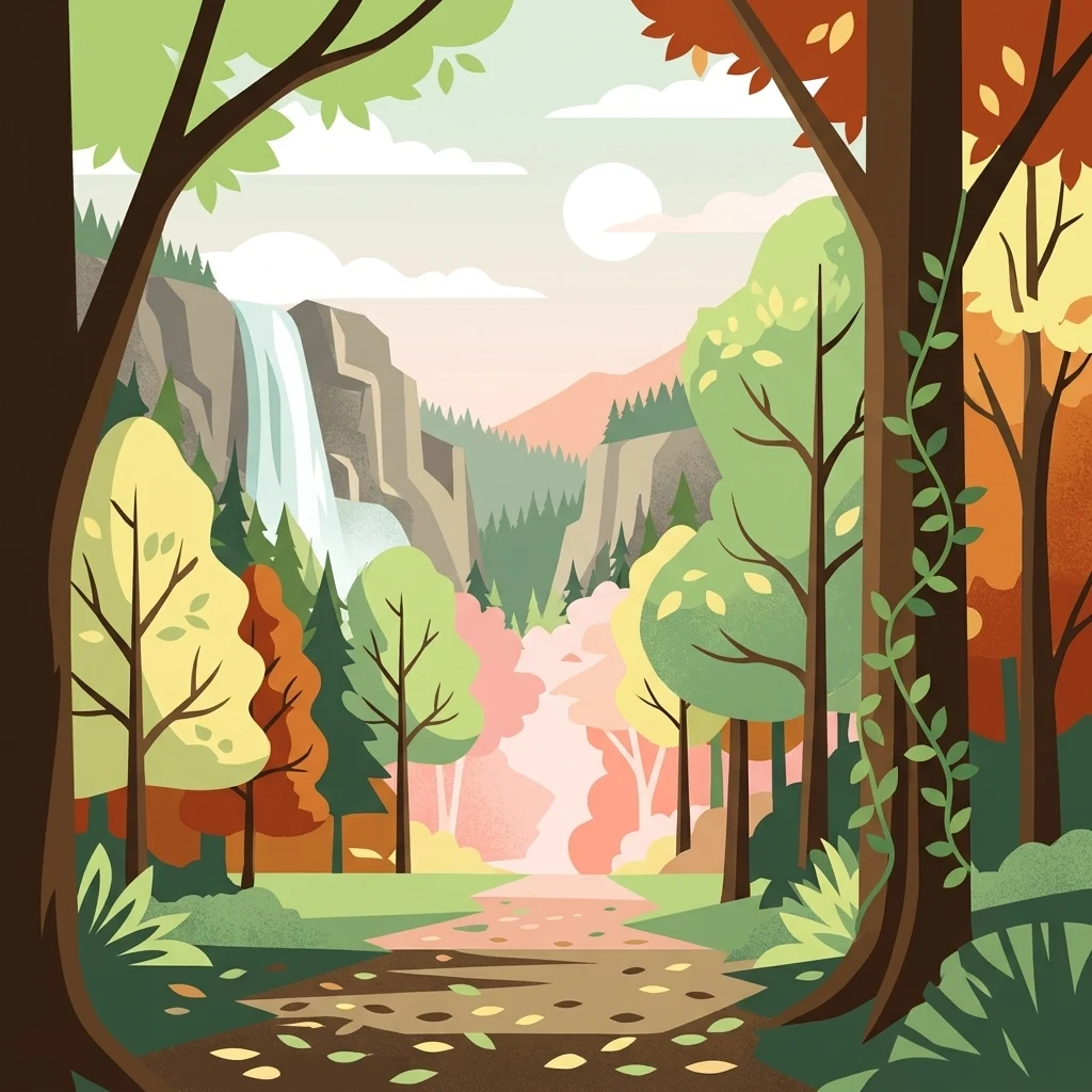
A colorful, flat-style vector illustration showing a view through trees into a mountain valley. A waterfall descends a rocky cliff on the left, and a path lined with fallen leaves winds through the center of a lush, wooded area with varied autumn and spring-like foliage.

Pfinzgau

Protected landscape

Park overview

Structured park overview, official facts, and landscape profile for Pfinzgau

Pfinzgau park facts, protected area profile, and essential visitor context

Review the core facts for Pfinzgau, including designation, size, terrain, visitor scale, habitats, and operating context in one park-focused overview.

About Pfinzgau

Pfinzgau is a large protected landscape in Baden-Württemberg, Germany, covering most of the municipality of Pfinztal in the Karlsruhe district. Although the German Schutzgebietskategorie V designation is often translated as a "protected landscape," it does not describe a semi-wilderness preserve; instead, it recognises a working cultural landscape with high ecological, scenic and recreational value.

Administered by the Karlsruhe district office under a regulation issued on 7 November 1991, the area protects a finely balanced mosaic of land use. The natural region is the Kraichgau, a gently rolling landscape of cultivated hills and small valleys that lies between the Black Forest to the west and the Odenwald to the east. Within this setting, the Pfinz valley provides a structuring axis for the protected territory.

The landscape is built around four core elements. First, woodland: Pfinzgau safeguards a substantial share of the municipality's near-natural forest, valued both for biodiversity and for its protective function for soil, water and the local climate. Second, traditional orchards: extensive Streuobstwiesen remain a defining feature of the area, valued as ecologically rich, extensively managed cultural land. Third, stream corridors: the Pfinz and its tributaries create ecologically and climatically valuable floodplain habitats, supported by riparian woodland and grassland. Fourth, small structural elements: field hedges, hollow ways, ponds, abandoned quarries and the open green spaces between settlement areas all add to the ecological complexity and visual character of the area.

Local communities rely on Pfinzgau not only for ecological preservation but also as a nearby escape for walking, cycling and other forms of outdoor recreation. The designation explicitly recognises this function, alongside the protection of the traditional cultural landscape against fragmentation and unwanted development.

Quick facts and research context for Pfinzgau

Pfinzgau is a designated protected landscape of about 21.5 square kilometres, administered by the Karlsruhe district office and located within the municipality of Pfinztal in Baden-Württemberg. The area was formally designated on 7 November 1991 under the IUCN Category V framework for protected landscapes.

Its conservation focus is on naturally composed forests, traditional orchard meadows, field hedges, hollow ways, ponds and the ecologically valuable stream corridors of the Pfinz valley. The protected landscape also functions as a near-natural recreation area for surrounding communities.

Protection and recognition

Terrestrial protected area records and international recognition metrics

Pfinzgau Protection Status and Documented Conservation Scope

Pfinzgau maintains a documented terrestrial protection scope governed by official conservation frameworks and spatial databases. Comprehensive records outline the established designation boundaries, management classification, and international recognition data for the terrain.

Protection details

Protection scope
Terrestrial
Transboundary protection
No
WDPA ID
323669
Park context

Deeper park guide and search-rich context for Pfinzgau

Pfinzgau history, landscape, wildlife, and travel context

Explore Pfinzgau through its history, landscape character, ecosystems, wildlife, conservation priorities, cultural context, and seasonal travel timing in a structured park guide built for atlas discovery and search intent.

Why Pfinzgau stands out

Pfinzgau is best known for preserving an extensive, traditional Kraichgau cultural landscape in which woodlands, orchards, fields and stream corridors coexist in close proximity. Its largest single asset is a network of near-natural forests recognised for their ecological function and their role as a local recreation space. The protected landscape is also notable for its abundance of Streuobstwiesen, the traditional extensively managed orchards that define the rural identity of the region. Together with small-scale landscape features such as field hedges, hollow ways, ponds and disused quarries, these orchards give the area a finely structured and ecologically rich mosaic recognised even outside the region.
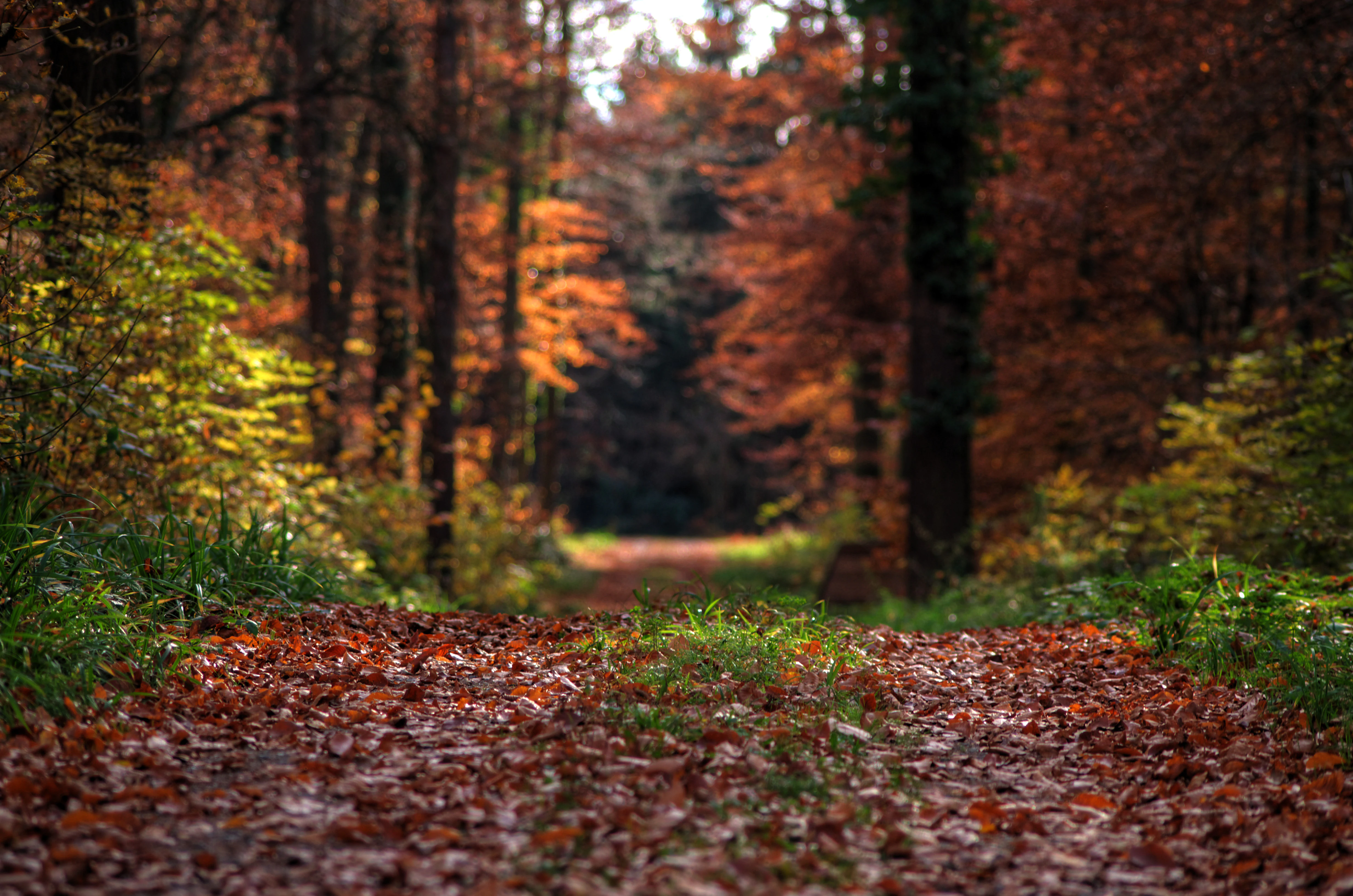
A low-angle view of a dirt path covered in fallen autumn leaves, leading into a dense forest with orange and brown foliage.
Autumn foliage along a path in the Pfinzgau protected area.

Pfinzgau history and protected-area timeline

The protected landscape of Pfinzgau was formally designated on 7 November 1991 by the Karlsruhe district office (Landratsamt Karlsruhe) through a formal Schutzgebietsverordnung. The designation brought together a range of land uses under a single conservation framework, with the explicit aim of preserving the cultural and ecological character of the Pfinztal municipality.

The protection order emerged from a long-running regional concern with the gradual loss of traditional orchard meadows, the fragmentation of woodlands and small landscape features, and creeping development pressure on the open spaces between settlements. By consolidating these interests into a single protected area, the district administration created a tool for coordinating land use across nearly the entire municipal area.

While Pfinzgau itself was formalised in 1991, the landscape it protects has much older roots. The mosaic of orchards, fields, hedges, hollow ways and forest patches reflects centuries of traditional small-scale farming, and the Streuobstwiesen in particular represent a centuries-old regional land-use tradition that continues to define the visual identity of the Kraichgau.

Pfinzgau landscape and geographic character

The landscape of Pfinzgau is shaped by the gentle topography of the Kraichgau and the linear incision of the Pfinz valley. Rolling hills alternate with small flat floodplain sections, creating the varied relief typical of this transitional region between the Black Forest and the Odenwald.

From a visual standpoint, the protected area is a stitched cultural landscape rather than a uniform natural area. Woodlands close off horizons in some sections; orchards open them up in others; and the Pfinz and its tributaries thread narrow green corridors through the surrounding agricultural land. Small but visually striking features such as sunken hollow ways, field hedges, ponds and old quarry hollows add detail to the scenery.

The openness of the landscape between individual built-up areas is itself a protected feature, maintaining so-called "green wedges" (Grünzäsuren) that visually separate the different communities within Pfinztal and prevent them from merging into a single sprawl.

Pfinzgau ecosystems, habitats, and plant life

Ecologically, Pfinzgau is best understood as a mosaic rather than a single habitat. Its forest patches are described in the protection order as having naturally composed species mixtures, meaning they retain many of the characteristics of regionally adapted woodland rather than intensively managed timber stands. These woods fulfil important functions for the broader landscape, including protection of water, soil and the local microclimate.

Around and between the woodlands, the traditional orchard meadows (Streuobstwiesen) form a second major habitat layer. Managed extensively, they support a wide variety of insects, birds and other organisms and are widely regarded as one of the most biodiverse traditional land-use forms in southern Germany. Field hedges, sunken ways, ponds and abandoned quarries further increase structural diversity and supply additional habitat niches.

The stream corridors of the Pfinz and its tributaries create a third core habitat layer. The protection order places particular emphasis on preserving and developing the riparian woodland along these waterways, as well as the associated grassland. Together these wetter areas contribute to the area's ecological value and help link the drier woodland and orchard habitats across the landscape.

Pfinzgau wildlife and species highlights

Although the German source does not list individual species, the mosaic character of Pfinzgau and its traditional orchard meadows make it a habitat-rich area for typical Kraichgau wildlife. The near-natural forests support the usual range of woodland species associated with mixed deciduous forests in southwestern Germany, while the extensive orchard meadows are well known across the region as important habitat for insects, cavity-nesting birds and other small fauna.

The stream corridors of the Pfinz and its tributaries, together with their associated riparian woodland, create additional habitat for wildlife linked to wetter conditions, including amphibians, stream-side invertebrates and birds that hunt or nest along watercourses. Field hedges, sunken ways and old quarry hollows add further habitat complexity for reptiles, small mammals and insects.

The specific conservation logic of the protection order, which emphasises near-natural species composition, structural diversity and the preservation of ecologically valuable landscape elements, points to wildlife being treated as an integral part of the area's identity rather than as a separate management target.

Pfinzgau conservation status and protection priorities

Pfinzgau's conservation significance lies primarily in its scale and integration. By covering most of the municipal area of Pfinztal, it bundles a large number of traditionally used but ecologically valuable lands into a single framework, raising their profile and protection status.

The designation specifically aims to safeguard near-natural forests, retain and develop traditional orchard meadows, preserve structurally important landscape features such as hedges, sunken ways, ponds and disused quarries, and protect the ecologically valuable floodplains along the Pfinz and its tributaries. It also seeks to keep the green spaces between individual communities open, preventing settlement areas from merging and degrading the visual and ecological coherence of the landscape.

At a broader scale, Pfinzgau contributes to the patchwork of protected landscapes in the Karlsruhe district, where numerous similar areas protect fragments of the traditional Kraichgau cultural landscape. Together, these designations help maintain regional ecological connectivity and protect the cultural identity of the Kraichgau as a distinctive landscape between the Black Forest and the Odenwald.

Pfinzgau cultural meaning and human context

The Pfinzgau protected landscape is closely tied to the rural identity of the Kraichgau region and the municipality of Pfinztal. The traditional orchard meadows in particular are a hallmark of the local cultural landscape, valued both as a feature of regional identity and as a link to centuries-old land-use traditions.

The area also reflects long-standing patterns of small-scale settlement. The protected landscape explicitly supports keeping the open green spaces between the various communities of Pfinztal open, maintaining the visual and functional separation of these villages and preserving the patchwork character that defines the local geography.

For residents of nearby towns in the Karlsruhe district, Pfinzgau functions as a nearby landscape for walking, cycling and informal outdoor recreation, embedding the protected area into everyday regional life rather than treating it as a distant reserve.

Top sights and standout views in Pfinzgau

Pfinzgau's strongest points of distinction are its size, its traditional orchard meadows, and its mosaic of forest, stream corridors and small-scale landscape features. It is unusually large for a protected landscape around a single municipality, which means it can preserve not only a few valuable sites but also the relationships between them.

The traditional Streuobstwiesen, the near-natural mixed forests, the ecologically valuable Pfinz floodplain, and the small features such as field hedges, sunken ways, ponds and old quarries together form a coherent, finely structured landscape that is hard to replicate elsewhere in the region. The protected area's dual function, ecological preservation on one side and everyday outdoor recreation for the local population on the other, is another defining aspect of its identity.

Best time to visit Pfinzgau

Because Pfinzgau is a working cultural landscape rather than a remote wilderness reserve, it can be experienced throughout much of the year. Spring brings blossoming orchard meadows and fresh green vegetation across the fields and woodlands, while early summer offers the deepest greens in the forests and along stream corridors. Autumn is particularly notable for the colour of the deciduous forests and the harvest atmosphere in the surrounding agricultural land.

Winter visits emphasise the structure of the landscape, with hedges, sunken ways, ponds and open meadows becoming more visible once leaves have fallen. Because the protected area is so closely tied to local recreation, the level of activity on paths and trails tends to rise on weekends and during the warmer months, while quieter visits are generally possible in the colder seasons or at off-peak times.

Monthly climate preview

Long-term representative averages for temperature and monthly precipitation

Pfinzgau Climate Normals and Annual Temperature Rhythm

Historical coordinate data outlines the measured annual temperature spread and monthly precipitation totals across Pfinzgau. Analyzing the complete twelve-month climatology profile provides deeper insight into long-term environmental patterns.
Annual mean9 °C
0 °C20 °C
Jan
Feb
Mar
Apr
May13°
Jun17°
Jul20°
Aug19°
Sep15°
Oct10°
Nov
Dec
Warmest month
July

19.6 °C

Coolest month
January

-0 °C

Wettest month
May

2.7 mm/day

Driest month
April

1.7 mm/day

Park location guide

Geography guide, regional context, and park location map for Pfinzgau

Pfinzgau park geography, regions, and map view in Germany

Understand where Pfinzgau sits in Germany through a broader geographic reading of the surrounding landscape, nearby location context, and its mapped position within the national park landscape.

How Pfinzgau fits into Germany

Germany is a federal republic in Western and Central Europe with a population of over 83 million across sixteen constituent states. It is Europe's largest economy by nominal GDP and a major global exporter and importer. The capital is Berlin, and the country borders Denmark, Poland, Czech Republic, Austria, Switzerland, France, Luxembourg, Belgium, and the Netherlands.

Wider geography shaping Pfinzgau in Germany

Germany is located in Western and Central Europe, spanning 357,022 km². It borders Denmark to the north, Poland and the Czech Republic to the east, Austria and Switzerland to the south, and France, Luxembourg, Belgium, and the Netherlands to the west. The country has coastlines on the Baltic Sea and North Sea to the north, with the Alps located in the southern region.

Map view of Pfinzgau

Use this park location map to pinpoint Pfinzgau in Germany, understand its exact geographic position, and read its mapped placement within the surrounding landscape more clearly.

Pigeon | © OpenStreetMap contributors

Location context for Pfinzgau

Baden-Württemberg

Visualizing traditional orchards, mixed woodlands, and river valleys across the protected landscape

Pfinzgau Landscape Photography and Protected Area Scenery

Visual records capture the finely structured cultural landscape of Pfinzgau through rolling hills, traditional orchards, and wooded stream corridors. Examining these protected area photos reveals the distinct terrain and habitat mosaics that define the Kraichgau region.

A low-angle view of a dirt path covered in fallen autumn leaves, leading into a dense forest with orange and brown foliage.

Park atlas

Compare connected cultural reserves and nearby natural terrain across the transition zone.

Explore Protected Areas Near Pfinzgau and Surrounding Regional Landscapes

Browsing parks near Pfinzgau reveals how traditional orchards and rolling woodlands connect to wider regional protected landscapes. Comparing these neighboring conservation areas provides deeper context on the diverse natural geography shaping southwestern Germany.
A watercolor landscape illustration showing a gently winding water feature through low-lying marshy vegetation with distant rolling hills.
Protected landscapeBaden-Württemberg
About 7.3 km away#1 closest

Northwest

Füllbruch-Vokkenau Protected Landscape: Geographic Profile and Regional Map Context

Wetland mosaic and flood-retention geography in Baden-Württemberg

This protected landscape in Karlsruhe encompasses a distinct lowland floodplain forest, merging traditional orchard meadows with structured wet woodland terrain. The area is defined by its role in regional flood management for the Pfinz river, creating a unique intersection of protected natural habitat and active hydraulic infrastructure within the historical Kinzig-Murg lowland channel.

Area
4.313 km²
Established
1988
IUCN
V
Protected landscapeBaden-Württemberg
About 7.7 km away#2 closest

Northwest

Weingartener Wiesental Protected Landscape: Geography and Meadow Valley Overview

Historic irrigation heritage in the Baden-Württemberg region.

The Weingartener Wiesental provides a clear example of a managed meadow valley landscape, featuring an extensive network of historical irrigation ditches and a surviving aqueduct. Situated within the Hardtebenen natural region, this protected area serves as an ecological buffer and a window into the traditional land management practices characteristic of the Kinzig-Murg-Rinne river corridor.

Area
1.109 km²
Established
1991
IUCN
V
Relief
Lowland
Protected landscapeBaden-Württemberg
About 8 km away#3 closest

East

Wössinger Waldwiesen: A Protected Landscape in the Kraichgau Region of Baden-Württemberg

Mapped valley meadows and stream corridor geography

Wössinger Waldwiesen is a compact protected landscape located in the Baden-Württemberg region of Germany. The area provides a significant example of Kraichgau valley geography, blending orchard meadows with the headwaters of the Walzbach stream. This protected territory focuses on maintaining diverse meadow habitats and transitioning former conifer stands into structured, native broadleaf forest ecosystems.

Area
0.056 km²
Established
1988
IUCN
V
Relief
Upland
Protected landscapeBaden-Württemberg
About 13 km away#4 closest

South

Grafenhausener Kirschengau: Protected Landscape and Regional Geography in Baden-Wurttemberg

Orchard meadows and Arnbach stream valley terrain.

Spanning 137 hectares near Birkenfeld, the Grafenhausener Kirschengau preserves a vital cultural and ecological mosaic in the Kraichgau uplands. This protected landscape combines calcareous grasslands, wooded slopes, and riparian gallery forest, offering a detailed glimpse into the region's traditional land-use history and geological heritage.

Area
1.366 km²
Established
1983
IUCN
V
Relief
Upland
Watercolor painting showing a stylized, soft landscape with gentle green hills, a light-colored central valley area, and muted mountain silhouettes in the background.
Protected landscapeBaden-Württemberg
About 13 km away#5 closest

Southeast

Gengenbachtal und Dolinenlandschaft südlich Göbrichen: Protected Landscape and Karst Geography

Geographic profile of the Enzkreis district in Baden-Württemberg

This protected area captures the contrast between the wooded Gengenbach stream valley and the doline-studded meadows of the Kraichgau. By preserving these distinct meadow and karst habitats, the landscape provides a clear window into the geological transition between the Black Forest and the surrounding plateaus of southwestern Germany.

Area
3.398 km²
Established
1952
IUCN
V
Protected landscapeBaden-Württemberg
About 16 km away#6 closest

Southwest

Waldteil bei der Lochmühle Protected Landscape and Riparian Forest Map and Regional Context

A protected woodland remnant in the Baden-Württemberg forefield landscape.

Waldteil bei der Lochmühle represents a significant protected forest parcel within the Ortenau-Bühler Vorberge, known for its priority alder and ash floodplain habitat. The site demonstrates the importance of small stream-side forest corridors as ecological refuges amidst the agricultural matrix of northern Baden-Württemberg, while housing a protected individual elm tree as a natural monument.

Area
0.013 km²
Established
1962
IUCN
V
Nature reserveBaden-Württemberg
About 17 km away#7 closest

South

Eyach oberhalb Neuenbürg Nature Reserve: Mapped Geography and Protected Area Context

A diverse habitat mosaic in the northern Black Forest highlands

The Eyach oberhalb Neuenbürg nature reserve protects an intricate valley system that cuts through the northern Black Forest. This site is defined by its rich variety of forest, grassland, and rocky habitats clustered across steep hillsides and plateau surfaces. The data highlights the essential land cover and topographical features that sustain this protected area within the Baden-Württemberg regional landscape, offering a precise look at its ecological configuration and physical boundaries.

Area
3.219 km²
Established
2019
Relief
Mountain
Climate
Temperate
Watercolor painting of a tranquil wetland landscape with soft green vegetation and a calm water body, reflecting the floodplain environment of the Rhine river.
Nature reserveLandkreis Germersheim
About 18 km away#8 closest

Northwest

Hördter Rheinaue Nature Reserve: Landscape and Geographic Context in Landkreis Germersheim

Examining the hydrology and floodplain forest of the German Rhine.

Hördter Rheinaue serves as a critical node in the Palatinate Rhine floodplains, preserving a vast mosaic of willow and poplar forests alongside stable hardwood stands. Analyze the mapped terrain shaped by centuries of river activity, including the meandering Michelsbach and associated oxbow systems that define this essential protected corridor in western Germany.

Area
8.18 km²
Established
1966
IUCN
IV
Relief
Lowland

Common questions about visiting, size, designation, and location context for Pfinzgau

Pfinzgau FAQs for park facts, access, geography, and protected area context

Find quick answers about Pfinzgau, including protected-area facts, park geography, trail and visitor context, and how the park fits into its surrounding country and regional landscape.
MoriAtlas Explorer

Continue Your Protected Areas Search Across the Global Atlas

Deepen your exploration by continuing the structured search for national parks and protected areas worldwide. Utilize the comprehensive filtering capabilities to compare different conservation landscapes and refine your understanding of global park geography. Discover more about the distribution and characteristics of protected natural areas.

Global natural geography