

Mori Atlas logo
Nature reservePhongolo Nature Reserve

Tracing the convergence of Lebombo mountain ridges, Zululand lowveld, and freshwater dam ecosystems

Phongolo Nature Reserve: An Atlas of Protected Landscapes and Geographic Boundaries in KwaZulu-Natal

Phongolo Nature Reserve sits at the intersection of the Zululand lowveld and the Lebombo Mountain escarpment in northern KwaZulu-Natal. As South Africa's oldest formally protected area, it encompasses a unique geographic profile where the expansive Pongolapoort Dam meets steep rhyolite slopes and dense bushveld plains. This protected footprint offers a layered topography that supports distinct avian habitats and serves as a critical link within the broader regional conservation network.

lowveldLebombo MountainsImportant Bird AreaPongolapoort Damhistoric reserveBig Five

Phongolo Nature Reserve

Nature reserve

Park overview

Structured park overview, official facts, and landscape profile for Phongolo Nature Reserve

Phongolo Nature Reserve park facts, protected area profile, and essential visitor context

Review the core facts for Phongolo Nature Reserve, including designation, size, terrain, visitor scale, habitats, and operating context in one park-focused overview.

About Phongolo Nature Reserve

Phongolo Nature Reserve sits in northern KwaZulu-Natal, where the Phongolo River is impounded by the Pongolapoort Dam to form one of South Africa's largest inland bodies of water. The protected area extends from the dam shoreline eastward across the base and slopes of the Lebombo Mountains up to the international border with Eswatini. Together with the adjacent privately managed Pongola Game Reserve, the area forms a substantial wildlife landscape in a region otherwise dominated by agriculture.

First proclaimed as the Pongola Game Reserve by President Paul Kruger in 1894, Phongolo lays claim to being the oldest formally protected reserve in South Africa and one of the oldest on the African continent. Its early history is closely tied to colonial-era politics. At a time when unregulated hunting was rapidly depleting game in the Lowveld, the reserve was established to halt that decline, while the Transvaal Republic also hoped to use the route northward as a potential outlet to the sea. The British annexation of Tongaland in 1895 removed that coastal access, but the hunting-protection rationale survived.

The reserve suffered heavily during the Second Boer War and afterwards, when many of its remaining game populations were deliberately killed in an attempt to eradicate the tsetse fly and the sleeping sickness it carried. The later construction of the Pongolapoort Dam, completed in 1973, transformed the area again, inundating an estimated 17,000 hectares of the historic reserve and forming Lake Jozini. A portion of the surviving land was re-proclaimed as a nature conservation area in 1979, taking roughly the present-day shape of Phongolo Nature Reserve.

Today, Phongolo is run by Ezemvelo KZN Wildlife in partnership with neighbouring landholders and traditional communities, with the broader objective of building a large, ecologically and socio-economically viable Big Five reserve. This collaborative model extends into the proposed Nsubane Pongola Transfrontier Conservation Area with Eswatini. The reserve is set within the Phongolo floodplain ecosystem, the largest in South Africa, and connects ecologically downstream to Ndumo Game Reserve, a Ramsar Wetland of International Importance.

Quick facts and research context for Phongolo Nature Reserve

Phongolo Nature Reserve lies in the uPhongolo Local Municipality of northern KwaZulu-Natal, in the Zululand District Municipality near the town of Pongola. It is managed by Ezemvelo KZN Wildlife under South Africa's National Environmental Management: Protected Areas Act and carries formal Important Bird Area status from BirdLife South Africa.

The reserve falls within a warm, arid climate zone with a mean annual temperature of around 21°C and predominantly summer rainfall averaging about 617 mm. It sits within a malaria area, is bordered to the east by the Lebombo Mountains marking the natural boundary with Eswatini, and forms the southernmost natural limit for several African species, including the African tigerfish and Burchell's starling. Its dam-centred position at the head of the Phongolo floodplain ecosystem makes it a key node in the wider conservation landscape of KwaZulu-Natal.

Protection and recognition

Explore documented terrestrial protection parameters and conservation governance scope.

Phongolo Nature Reserve Protection Status and International Recognition Data

Phongolo Nature Reserve maintains a defined terrestrial protection status within its regional conservation framework. Recorded parameters outline the official management scope and designation history for geographic evaluation.

Protection details

Protection scope
Terrestrial
Transboundary protection
No
Park context

Deeper park guide and search-rich context for Phongolo Nature Reserve

Phongolo Nature Reserve history, landscape, wildlife, and travel context

Explore Phongolo Nature Reserve through its history, landscape character, ecosystems, wildlife, conservation priorities, cultural context, and seasonal travel timing in a structured park guide built for atlas discovery and search intent.

Why Phongolo Nature Reserve stands out

Phongolo Nature Reserve is best known as the oldest formally protected nature reserve in South Africa, first proclaimed in 1894, and as the protected area encircling the Pongolapoort Dam at the southern end of the Lebombo Mountains. The combination of large dam shoreline, rocky Lebombo escarpment, and adjoining Zululand Lowveld gives it a layered landscape that includes open water, exposed mudflats, dense bushveld, and high-altitude forests all within a single reserve. The reserve is also widely recognised for its wildlife profile, including breeding herds of African elephant, a substantial population of white rhinoceros in the Golela section, reintroduced black rhinoceros, and abundant hippopotamus and Nile crocodile in the dam. Its bird diversity, formally recognised through Important Bird Area status, and the fact that it marks the southernmost natural limit for species such as the African tigerfish and Burchell's starling add a strong biogeographical dimension to its identity.

Phongolo Nature Reserve history and protected-area timeline

Phongolo's history begins in 1894, when President Paul Kruger of the South African Republic formally proclaimed the Pongola Game Reserve in what was then the Transvaal. The reserve was created principally to curb uncontrolled hunting in a region where game populations were being rapidly depleted, but it also reflected the political ambition of securing an outlet to the sea for the landlocked republic. That broader geopolitical aim was short-lived: the British annexation of Tongaland in April 1895 cut off the route to the coast, leaving the reserve focused on its core conservation purpose.

The protected area fell into severe disruption during the Second Boer War (1899 to 1902), when conflict devastated the wider region. In the years that followed, much of the remaining wildlife was slaughtered in an effort to eliminate the tsetse fly, which transmitted trypanosomiasis, or sleeping sickness, to people and livestock. By the mid-twentieth century, the reserve had been substantially diminished in both area and ecological function.

The next major change came with the construction of the Pongolapoort Dam on the Phongolo River, begun in 1960 and completed in 1973. The dam was built primarily to supply irrigation water for sugarcane and cotton plantations on the Makhatini Flats, and its rising waters inundated roughly 17,000 hectares of the original reserve. A portion of the remaining land was re-proclaimed as a nature conservation area in 1979, taking the form that constitutes today's Phongolo Nature Reserve.

In the modern era, the reserve has become part of a cross-border conservation landscape. Together with the adjoining Pongola Game Reserve and the proposed Nsubane Pongola Transfrontier Conservation Area with Eswatini, it sits within a wider effort to restore the ecological functioning of the Phongolo floodplain, including controlled flood releases intended to mimic the natural hydrology that supports the downstream Ndumo Game Reserve.

Phongolo Nature Reserve landscape and geographic character

The landscape of Phongolo Nature Reserve is defined by the meeting of three distinct physical environments: a large freshwater impoundment at its heart, a gently sloping lowveld to the west, and a sharp eastern escarpment rising into the Lebombo Mountains.

The Pongolapoort Dam, also called Lake Jozini, is the feature from which much of the reserve's character derives. When full, the dam surface lies at roughly 130 metres above sea level. Much of its shoreline has a steep profile, particularly along the eastern side where the mountains descend toward the water, but sections of the western shore slope more gently and expose mudflats when water levels drop. The Phongolo River feeds the dam from the north-west and exits southward through the Pongola Gorge, an ancient cleft cut through the Lebombo range.

Geologically, the western portion of the reserve sits on basite of the uMfolozi River Formation, producing clay-rich soils across the lowveld plain. The eastern portion is marked by a rocky escarpment of rhyolite of the Jozini Formation, climbing to the reserve boundary at the summit of the Lebombo range at approximately 598 metres above sea level. The combination of lowveld flats and steep mountain slopes produces a compact but varied topography within a relatively small area, with associated differences in soils, drainage, and vegetation patterns.

Phongolo Nature Reserve ecosystems, habitats, and plant life

The vegetation of Phongolo Nature Reserve falls within the Zululand Lowveld classification, dominated by acacia bushveld that slopes gently towards the dam and the Phongolo River. Across this lowveld base, several more specific habitats are recognised, each shaped by soil, slope, and exposure.

The lower-lying Golela veld is a distinctive vegetation type found within the reserve and provides important breeding habitat for the rare suni antelope. The Lebombo mountain slopes in the eastern part of the reserve support species-rich forests, including populations of rare cycads such as Encephalartos ngoyanus and Encephalartos lebomboensis. Together with the neighbouring Ubombo Mountain Nature Reserve, this escarpment protects one of the highest densities and diversities of endemic cycad species in KwaZulu-Natal.

Open grassland dominated by Themeda triandra grassveld occurs in places, scattered with knobthorn and marula trees across the broader landscape. Aquatic vegetation in the dam itself is generally poorly developed, in part because fluctuating water levels discourage the establishment of more permanent plant communities. As a whole, the reserve functions as an important ecological corridor between the dam, the Lebombo range, and the lands that connect to the larger Phongolo floodplain and downstream reserves.

Phongolo Nature Reserve wildlife and species highlights

Phongolo supports roughly 60 mammal species and a much larger avifauna, concentrated around the rich mix of dam, lowveld, and escarpment habitats. The reserve is home to two breeding herds of African elephant, and the Golela section contains more than 40 white rhinoceros, which form the focus of guided rhino tracking walks. Black rhinoceros have also been reintroduced, and other large mammals include African buffalo, leopard, spotted hyena, giraffe, blue wildebeest, Burchell's zebra, Cape mountain zebra, greater kudu, impala, nyala, waterbuck, common reedbuck, mountain reedbuck, common warthog, and the diminutive suni. Hippopotamus and Nile crocodile are abundant in the dam, and the African rock python is also present.

The reserve's birdlife is one of its defining features, with more than 300 recorded species and formal Important Bird Area recognition from BirdLife South Africa. The dam and its associated wetlands have historically supported breeding populations of pink-backed pelican, one of only two known sites in South Africa, as well as yellow-billed stork. Important raptor and vulture populations include resident white-backed vulture, lappet-faced vulture, and white-headed vulture, with Cape vulture occasionally observed and peregrine falcon, bateleur, martial eagle, tawny eagle, and African marsh harrier also present. The reserve marks the southernmost natural range limit of several species, including Burchell's starling, magpie shrike, Rudd's apalis, and Neergaard's sunbird.

The Phongolo River system supports at least 25 indigenous fish species. The African tigerfish, a protected species, reaches the southernmost point of its natural distribution in the dam and downstream river, making Phongolo a well-known destination for tiger fishing. Other species include Mozambique tilapia, redbreast tilapia, sharptooth catfish, silver catfish, and various barbs. Close to 100 reptile and amphibian species are also recorded within the reserve.

Phongolo Nature Reserve conservation status and protection priorities

Phongolo Nature Reserve is managed by Ezemvelo KZN Wildlife under South Africa's National Environmental Management: Protected Areas Act, with formal Important Bird Area designation from BirdLife South Africa. It is one node in a much larger regional conservation effort that includes the Phongolo floodplain, the downstream Ndumo Game Reserve (a Ramsar Wetland of International Importance), and the proposed Nsubane Pongola Transfrontier Conservation Area with neighbouring Eswatini.

The reserve plays a distinctive role because it sits at the southern end of the Lebombo range and protects a transition zone between lowveld and escarpment habitats, including important cycad populations and breeding habitat for the suni. Reintroductions of black rhinoceros, ongoing monitoring of breeding elephant herds, and the presence of a sizeable white rhinoceros population in the Golela section make it an important site for the conservation of large mammals in KwaZulu-Natal.

Several conservation pressures are evident. Artificial fluctuations in dam water levels have destroyed nesting habitat for pelicans and storks by killing the trees they depended on. Fertiliser runoff from adjacent sugarcane plantations contributes to eutrophication and blue-green algal blooms in the north-western part of the dam during early winter. Invasive alien plants, including Parthenium hysterophorus, Hydrilla verticillata, and Chromolaena odorata, affect parts of the reserve. The drift of elephants across reserve boundaries into neighbouring properties, particularly during drought, also complicates management.

Cooperative conservation involving private landowners, traditional communities holding land through the Ingonyama Trust, and government conservation services is central to the reserve's longer-term ambition: the establishment of a large, ecologically and socio-economically viable Big Five reserve across the broader Pongola landscape. Raptors and vultures in the reserve are monitored annually as part of wider aerial surveys of Zululand.

Phongolo Nature Reserve cultural meaning and human context

The reserve's cultural context is closely bound up with the broader socio-political history of northern KwaZulu-Natal. Land under communal tenure, administered via the Ingonyama Trust, adjoins the reserve, and tribal communities are recognised partners in the cooperative conservation model that shapes its present-day management. The river from which the reserve takes its name, Phongolo, derives from isiZulu and means "trough", a reference to the long, deep pools with steep sides that characterise much of the watercourse.

The reserve also carries a strong colonial-era legacy. Its original 1894 proclamation as the Pongola Game Reserve by President Paul Kruger of the South African Republic was tied to the political ambitions of the landlocked Transvaal state, including the desire for an outlet to the Indian Ocean via Tongaland. The British annexation of Tongaland in 1895 foreclosed that route, but it left the reserve with a foundational identity as a colonial-era protected area that has survived successive political transitions.

In the post-apartheid period, Phongolo has been reshaped into a multi-stakeholder conservation area that explicitly links ecological goals with the socio-economic priorities of surrounding communities. The proposed transfrontier initiative with Eswatini adds a regional layer to this cultural context, framing the Lebombo border not as a barrier but as a corridor for shared natural and cultural heritage.

Top sights and standout views in Phongolo Nature Reserve

Phongolo Nature Reserve combines South Africa's oldest reserve history with a strikingly varied landscape: a major inland dam, Lebombo escarpment forests, and Zululand Lowveld bushveld all within a single protected footprint. It is a stronghold for elephant, white rhinoceros, and reintroduced black rhinoceros, while the dam and its floodplain host exceptional diversity of birds, including breeding populations of several threatened or range-restricted species.

Its position at the southern end of the Lebombo range, its role as the southernmost natural limit for the African tigerfish, and its formal Important Bird Area status give Phongolo a distinctive biogeographical identity. The reserve is also a working example of cross-border and community-inclusive conservation, linking protected areas in KwaZulu-Natal, Eswatini, and the broader Phongolo floodplain ecosystem.

Best time to visit Phongolo Nature Reserve

Phongolo's climate is warm and arid, with most rainfall arriving in the summer months between November and March and a mean annual temperature of around 21°C. Game viewing tends to be most rewarding in the drier winter period, when animals concentrate around the dam and remaining water sources and visibility across the bushveld improves. Wildlife activity around the lake and Phongolo River is also influenced by fluctuating water levels, which periodically expose mudflats and concentrate waterbirds.

Birding is productive through much of the year, although summer brings the heightened activity of migrant species and breeding colonies. Regardless of season, visitors should be aware that the reserve lies within a malaria area, and appropriate prophylaxis and mosquito protection are advisable when planning a visit.

Monthly climate preview

Long-term monthly temperature and precipitation rhythm for KwaZulu-Natal

Phongolo Nature Reserve Climate Normals and Annual Temperature Patterns

Phongolo Nature Reserve records measured long-term averages spanning monthly mean temperatures from 16.61 degrees Celsius to 24.59 degrees Celsius alongside variable precipitation rates. Reviewing the complete twelve-month climate profile reveals comprehensive variations in temperature ranges and rainfall patterns across the sampled coordinate.
Annual mean21 °C
17 °C25 °C
Jan25°
Feb25°
Mar24°
Apr21°
May19°
Jun17°
Jul17°
Aug18°
Sep21°
Oct22°
Nov23°
Dec24°
Warmest month
January

24.6 °C

Coolest month
July

16.6 °C

Wettest month
December

4.3 mm/day

Driest month
June

0.5 mm/day

Park location guide

Geography guide, regional context, and park location map for Phongolo Nature Reserve

Phongolo Nature Reserve park geography, regions, and map view in South Africa

Understand where Phongolo Nature Reserve sits in South Africa through a broader geographic reading of the surrounding landscape, nearby location context, and its mapped position within the national park landscape.

How Phongolo Nature Reserve fits into South Africa

South Africa is the southernmost country in Africa, spanning 1.22 million km² with a population of over 63 million. The country operates with three capital cities, Pretoria (executive), Cape Town (legislative), and Bloemfontein (judicial), and is renowned for its biodiversity, national parks, and multicultural society.

Wider geography shaping Phongolo Nature Reserve in South Africa

South Africa occupies the southernmost region of Africa, with coastline along both the Atlantic Ocean to the west and the Indian Ocean to the east. The interior features elevated plateaus including the Highveld, with the Drakensberg escarpment marking the eastern highlands. The country shares borders with Namibia, Botswana, Zimbabwe, Mozambique, Eswatini, and Lesotho.

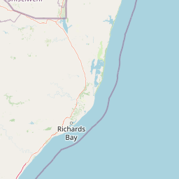
Map view of Phongolo Nature Reserve

Use this park location map to pinpoint Phongolo Nature Reserve in South Africa, understand its exact geographic position, and read its mapped placement within the surrounding landscape more clearly.

Pigeon | © OpenStreetMap contributors

Location context for Phongolo Nature Reserve

KwaZulu-Natal
Park atlas

Compare regional reserves, neighboring terrain, and connected wildlife habitats

Other Parks Near Phongolo Nature Reserve and Surrounding Protected Landscapes

Visitors exploring Phongolo Nature Reserve can continue browsing related protected areas across the surrounding Zululand Lowveld and Lebombo range. Comparing nearby reserves reveals shared ecological traits, regional topography shifts, and connected wildlife corridors.
Wildlife reserveKwaZulu-Natal
About 57 km away#1 closest

Northeast

Ndumo Game Reserve: Geographic Atlas and Protected Landscape Overview

Wetlands and riverine ecosystems of Maputaland, KwaZulu-Natal

Ndumo Game Reserve represents a distinct protected landscape where the Pongola and Great Usutu rivers shape a dense mosaic of pans, floodplains, and sand forests. As a Ramsar site, this compact wildlife reserve serves as an essential case study in regional geography and the conservation of riverine corridors along the Mozambique border.

Area
102 km²
Established
1924
Relief
Lowland
Climate
Subtropical
Wildlife reserveKwaZulu-Natal
About 60 km away#2 closest

West

Ithala Game Reserve: Mapping the Protected Landscape and Ancient Geology of KwaZulu-Natal

A rugged wilderness reserve defined by dramatic escarpment and river valley topography.

Ithala Game Reserve represents a critical protected area in South Africa where deep river valleys meet the high-altitude grasslands of the Ngotshe Mountains. Its topography provides a unique study in vertical relief, featuring exposed sandstone cliffs and dolerite spires. The reserve serves as a prime example of ecological diversity within the region, combining ancient geological formations with a successfully reestablished mosaic of bushveld, savanna, and forest habitats.

Area
296.53 km²
Established
1973
IUCN
IV
Relief
Mountain
Protected areaKwaZulu-Natal
About 64 km away#3 closest

East

Lake Sibaya Protected Area: Mapping the Freshwater Heart of the KwaZulu-Natal Coast

Freshwater wetlands and coastal dune forest topography

Lake Sibaya encompasses the largest freshwater basin in South Africa, defined by its position near the Maputaland coast. The landscape represents a significant freshwater interface between coastal dune forests and the Indian Ocean, serving as an important protected study site for catchment ecosystems, water-bird habitats, and regional hydrological diversity.

Area
64 km²
Established
1991
Relief
Lowland
Climate
Subtropical
Protected areaKwaZulu-Natal
About 88 km away#4 closest

East

Kosi Bay Protected Area: Mapped Geography and Coastal Lake Systems in KwaZulu-Natal

Coastal lake geography and protected wetland boundaries

Kosi Bay forms a complex wetland chain in KwaZulu-Natal, characterized by four linked lakes and a clear estuary mouth. The terrain transitions from coastal dunes and sandy beaches to mangrove-lined channels and Maputaland forest, providing a rich study of regional water systems and protected land boundaries.

Established
1991
Water
Water-dominated
Season
Year-round
Nature reserveKwaZulu-Natal
About 97 km away#5 closest

South

Hluhluwe, Imfolozi Park Nature Reserve: Detailed Protected Area and Regional Geography

Explore mapped boundaries and landscape context in KwaZulu-Natal.

Hluhluwe, Imfolozi Park, designated as a nature reserve, offers a distinct protected landscape within KwaZulu-Natal, South Africa. This entity page provides an atlas-focused view, emphasizing the park's mapped boundaries and its contribution to the region's protected area network. Understand its geographic setting and unique landscape character through structured data, essential for any explorer keen on mapping protected lands.

Area
960 km²
Established
1895
Relief
Mountain
Climate
Subtropical
National parkEswatini
About 121 km away#6 closest

North

Hlane Royal National Park: Eswatini's Vast Protected Savanna Woodland Landscape

Mapped geography and protected area context in northeastern Eswatini.

Delve into Hlane Royal National Park, Eswatini's most extensive protected territory, a prime example of lowland bushveld savanna. This national park is defined by its expansive woodland terrain, dotted with ancient trees and seasonal water pans, creating a dynamic landscape. It is an essential component for understanding the regional geography and the distribution of protected areas within Southern Africa, offering significant opportunities for landscape exploration.

Area
300 km²
IUCN
VI
Relief
Lowland
Climate
Subtropical
Wildlife reserveKwaZulu-Natal
About 128 km away#7 closest

Southwest

Babanango Game Reserve: Exploring Geographic Boundaries and Rewilding Landscapes

Protected wildlife habitats in central KwaZulu-Natal

Centrally positioned in the White Umfolozi River valley, Babanango Game Reserve serves as a model for large-scale biodiversity restoration. Its terrain features a mix of mistbelt grasslands, thornveld, and river frontage supported by ancient geological structures. The reserve preserves both ecological integrity and cultural heritage near historic sites, reflecting a shift toward community-led conservation in modern South African landscape management.

Area
200 km²
Established
2017
Relief
Mixed relief
Climate
Subtropical
Wildlife reserveKwaZulu-Natal
About 139 km away#8 closest

South

Thula Thula Private Game Reserve: Protected Wildlife Habitats and Geography

Bushveld and riverine geography in the KwaZulu-Natal Zululand corridor

Thula Thula Private Game Reserve features a unique intersection of bushveld habitats and river systems within South Africa. This reserve provides important protected land for elephants, rhinoceros, and over 350 avian species. It remains a key geographic entity for understanding the Royal Zulu Biosphere and the conservation history of the northeastern KwaZulu-Natal region.

Area
45 km²
Established
1911
Scope
Terrestrial

Common questions about visiting, size, designation, and location context for Phongolo Nature Reserve

Phongolo Nature Reserve FAQs for park facts, access, geography, and protected area context

Find quick answers about Phongolo Nature Reserve, including protected-area facts, park geography, trail and visitor context, and how the park fits into its surrounding country and regional landscape.
MoriAtlas Explorer

Continue Your Protected Areas Search Across the Global Atlas

Deepen your exploration by continuing the structured search for national parks and protected areas worldwide. Utilize the comprehensive filtering capabilities to compare different conservation landscapes and refine your understanding of global park geography. Discover more about the distribution and characteristics of protected natural areas.

Global natural geography