
Mori Atlas logo
Protected areaPike National Forest

Tracing the elevation transitions, granite formations, and alpine ridges of central Colorado

Pike National Forest: A Comprehensive Mapping of Protected Landscapes in the Colorado Front Range

Pike National Forest serves as a defining natural corridor in the heart of the Colorado Rockies, encompassing a vast range of terrain from foothill woodlands to exposed alpine summits. This protected area acts as the primary setting for the iconic Pikes Peak, featuring distinctive pink granite geology, deep canyons, and critical watersheds like the South Platte River. The landscape provides a complex mosaic of ecosystems, including montane forests and subalpine ridges, which collectively anchor the regional identity of the central Front Range.

Front RangeRocky MountainsPikes Peakmontane forestsubalpine forestalpine terrain
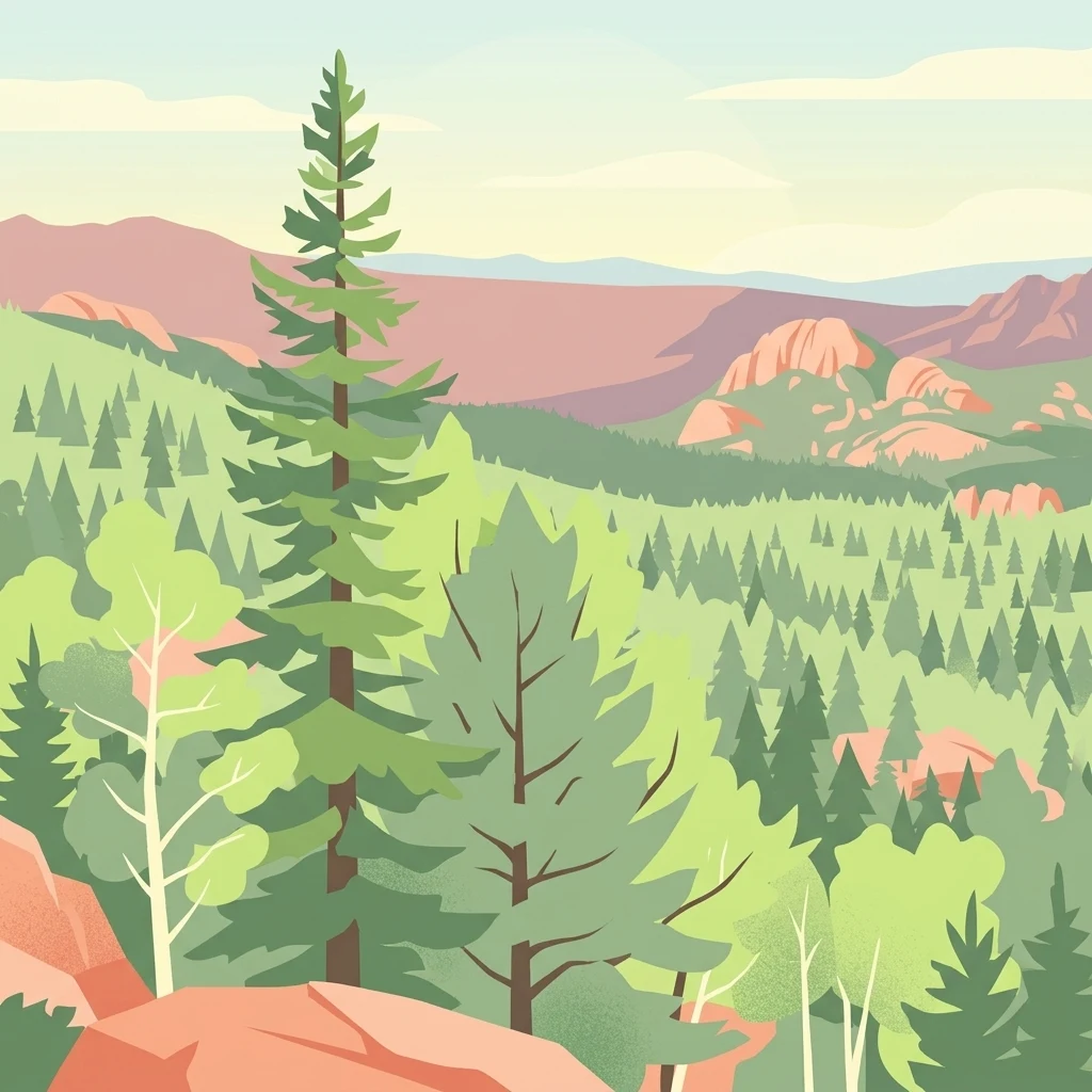
A stylized illustration showing a dense evergreen forest with aspen trees and rocky, mountainous terrain in the background.

Pike National Forest

Protected area

Park overview

Structured park overview, official facts, and landscape profile for Pike National Forest

Pike National Forest park facts, protected area profile, and essential visitor context

Review the core facts for Pike National Forest, including designation, size, terrain, visitor scale, habitats, and operating context in one park-focused overview.

About Pike National Forest

Pike National Forest occupies a central position in the Colorado Front Range, stretching west from the outskirts of Colorado Springs into the high country surrounding Pikes Peak and beyond. The forest was established in February 1892 and takes its name from Zebulon Pike, the early American explorer whose name is also attached to the famous fourteener that anchors the region. Today it is managed by the U.S. Forest Service within a broader administrative complex that includes San Isabel National Forest and the Comanche and Cimarron National Grasslands.

Geographically, the forest covers portions of Clear Creek, Teller, Park, Jefferson, Douglas, and El Paso counties, encompassing foothills, montane forests, subalpine terrain, and high alpine zones. Its principal drainage systems are the South Platte River and Fountain Creek, while Rampart Reservoir provides a significant artificial lake within its boundaries. The underlying geology of much of the area is dominated by the coarse, pink-to-orange Pikes Peak granite, a defining geological signature of the region.

From a recreation and conservation perspective, Pike National Forest plays an outsized role in the outdoor life of the Colorado Front Range. It contains three officially designated wilderness areas, offers extensive opportunities for hiking, camping, and scenic driving, and serves as an important wildlife habitat corridor, all within relatively close reach of Colorado Springs and other Front Range population centers.

Quick facts and research context for Pike National Forest

Pike National Forest is located in the Front Range of central Colorado, spanning portions of Clear Creek, Teller, Park, Jefferson, Douglas, and El Paso counties. The forest was established in February 1892 and is managed by the U.S. Forest Service as part of a combined administrative unit with San Isabel National Forest and Comanche and Cimarron National Grasslands, headquartered in Pueblo, Colorado.

It encompasses roughly 1.1 million acres of mountain terrain including the slopes and surrounding wildlands of Pikes Peak, and shares three designated wilderness areas with the broader National Wilderness Preservation System. Rampart Reservoir is one of the largest artificial bodies of water within the forest, while the South Platte River and Fountain Creek serve as its principal drainage systems.

Protection and recognition

Documented terrestrial protection scope, designation context, and conservation metrics

Pike National Forest Protection Status and International Recognition Data

Pike National Forest maintains a documented terrestrial protection scope within the global protected area registry. Structured designation records outline the management framework and international recognition status associated with the terrain.

Protection details

Protection scope
Terrestrial
Transboundary protection
No
WDPA ID
2705047
Park context

Deeper park guide and search-rich context for Pike National Forest

Pike National Forest history, landscape, wildlife, and travel context

Explore Pike National Forest through its history, landscape character, ecosystems, wildlife, conservation priorities, cultural context, and seasonal travel timing in a structured park guide built for atlas discovery and search intent.

Why Pike National Forest stands out

Pike National Forest is best known for framing the Pikes Peak region of the Colorado Front Range, encompassing the slopes, approach routes, and scenic highlands around one of the most famous mountains in the American West. The forest is also notable for its striking geological foundation, with much of its bedrock formed from the distinctive pink-to-orange Pikes Peak granite. The forest is further distinguished by its elevation-driven landscape diversity, spanning foothill zones near the plains all the way to high alpine ridges, and by its integration of popular wilderness areas such as Lost Creek, Mount Evans, and Buffalo Peaks. Combined with its proximity to major Front Range cities, it serves as both a backcountry escape and a defining natural landmark of central Colorado.
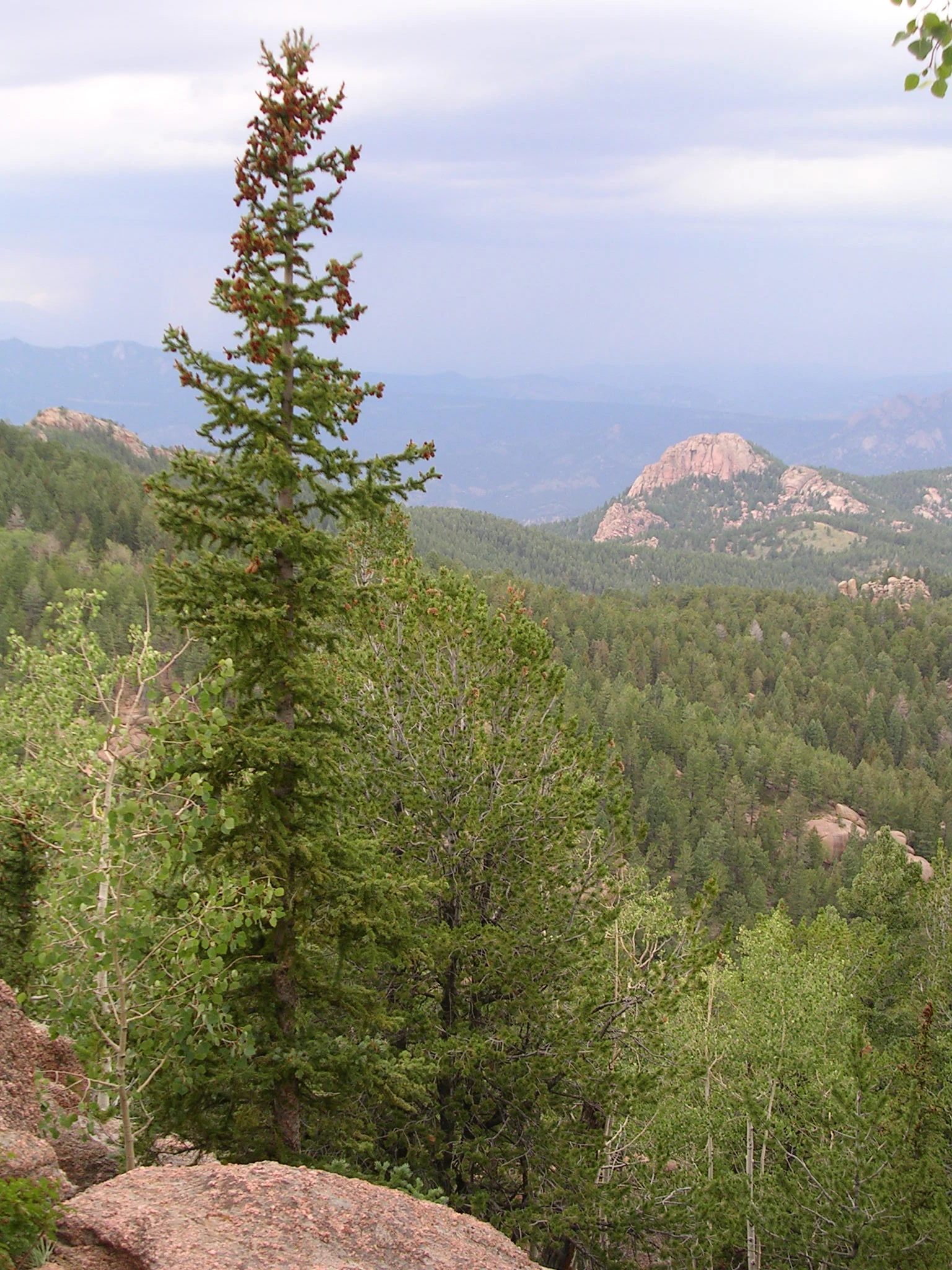
A tall conifer tree stands in the foreground, with a vista of dense pine forests and rocky mountain peaks in the background under a cloudy sky.
A scenic view of the forested mountain slopes in Pike National Forest.

Pike National Forest history and protected-area timeline

Pike National Forest was formally established in February 1892 as part of the early wave of forest reserves created in the American West. Its creation marked official federal recognition of the ecological and resource value of the mountainous terrain west of Colorado Springs, including the slopes around what would become one of the most iconic peaks in the United States.

Over the following century, the forest became deeply embedded in the outdoor identity of central Colorado. It was folded into a wider U.S. Forest Service management structure that also covers San Isabel National Forest and the Comanche and Cimarron National Grasslands, with administrative headquarters located in Pueblo, Colorado. Local ranger district offices serve the area from Colorado Springs, Fairplay, and Morrison.

The modern era of the forest has been heavily shaped by wildfire. Following the massive Hayman Fire of 2002 and the Waldo Canyon Fire of 2012, major reclamation efforts have been undertaken to restore damaged landscapes. Among these, a partnership involving the National Arbor Day Foundation and several university bookstores supported a large-scale replanting project to rehabilitate forest stands affected by historical fires.

Pike National Forest landscape and geographic character

The landscape of Pike National Forest is defined by the dramatic vertical transition of the Colorado Front Range. Lower elevations consist of foothill woodlands and rugged canyons, gradually giving way to dense montane forests and then to open subalpine and alpine zones near the highest ridges. Pikes Peak itself acts as the centerpiece of this terrain, towering above the surrounding forest and creating the region’s most recognizable skyline feature.

Much of the bedrock throughout the forest is composed of the coarse, pink-to-orange Pikes Peak granite, lending the rocky outcrops, cliffs, and exposed ridgelines a distinctive warm hue. This geological signature is visible across high open areas and along exposed slopes where vegetation thins out. The forest also contains dramatic erosional features, deep canyons, and high mountain valleys shaped by glacial and fluvial processes over time.

Water plays a significant role in shaping the forest’s terrain. The South Platte River and Fountain Creek serve as the major drainage systems, while Rampart Reservoir adds a substantial artificial lake feature to the landscape. These waterways have cut valleys and basins through the granite terrain, producing a mix of meadowed bottomlands, forested slopes, and rocky high-country settings.

Pike National Forest ecosystems, habitats, and plant life

Ecologically, Pike National Forest spans a wide gradient of Rocky Mountain ecosystems. Its lower elevations support dry montane forests dominated by ponderosa pine, Douglas-fir, and other drought-adapted species, while mid-elevation zones transition into denser mixed-conifer and aspen groves. Higher still, the forest gives way to classic subalpine forests of Engelmann spruce and subalpine fir before opening into exposed alpine tundra near the highest peaks.

This elevation-driven ecological layering creates rich habitat diversity across the forest. South-facing slopes tend to be warmer and drier, favoring open forest and shrub communities, while north-facing slopes and drainage bottoms support denser, moister vegetation patterns. Rocky meadows, exposed ridgelines, and canyon environments each contribute distinct habitat conditions within the broader forest mosaic.

Because of this ecological variety, the forest plays an important role in supporting both resident and seasonally mobile wildlife populations. The mix of forest types, elevation zones, and water features makes it a productive landscape for native fauna and a meaningful piece of the broader Rocky Mountain ecosystem network.

Pike National Forest wildlife and species highlights

Wildlife in Pike National Forest reflects the diversity of the forest’s elevation gradient and Rocky Mountain ecosystems. Mid-elevation forests and meadows support healthy populations of mule deer and elk, both of which are closely associated with montane and subalpine habitats in Colorado. Black bear are also present in suitable forest habitat across the area, particularly in zones with dense cover and varied food resources.

Higher elevation terrain, including the alpine and subalpine zones around Pikes Peak and the wilderness areas, supports smaller mammals such as bighorn sheep in rocky terrain and marmots and pikas in talus and alpine meadow environments. Predators such as mountain lions and bobcats range through portions of the forest as part of the larger regional food web.

The forest’s streams, creeks, and reservoir environments also support a range of birdlife, from montane forest songbirds to raptors such as hawks and eagles that use the open ridges and canyon corridors for hunting and nesting. This combination of forest, meadow, ridge, and aquatic habitats gives Pike National Forest a varied and ecologically meaningful wildlife profile.

Pike National Forest conservation status and protection priorities

Pike National Forest holds strong conservation significance as one of the large forested landscapes protecting the Front Range of the Rocky Mountains. Its mix of montane, subalpine, and alpine ecosystems, combined with its extensive wilderness areas, helps maintain ecological connectivity and habitat continuity for species that depend on intact high-country environments.

Three officially designated wilderness areas lie within or partially within the forest, contributing directly to the National Wilderness Preservation System. These wilderness zones, including Lost Creek, Mount Evans, and Buffalo Peaks, provide higher levels of protection and preserve some of the least-developed stretches of the regional landscape.

The forest has also been at the center of major post-fire restoration efforts. Following the Hayman Fire of 2002, which burned more than 138,000 acres of forest and ranch land, and the Waldo Canyon Fire of 2012, large-scale reclamation projects were launched to restore vegetation and stabilize damaged watersheds. Partnerships with organizations such as the National Arbor Day Foundation have supported extensive replanting work, reflecting the forest’s ongoing role as a focal point for landscape-scale conservation in the region.

Top sights and standout views in Pike National Forest

Pike National Forest stands out for its role in framing the Pikes Peak region, one of the most recognizable scenic corridors in the American West. Its expansive protected terrain, combined with the iconic presence of Pikes Peak itself, gives the forest a uniquely central position in Colorado’s outdoor identity.

Equally important is the forest’s ecological diversity, which spans the entire elevation range of the Front Range, from foothill woodlands to exposed alpine ridges. The presence of multiple designated wilderness areas, distinctive Pikes Peak granite geology, and significant water features such as Rampart Reservoir add layers of interest that make the forest more than just a green backdrop to a famous mountain.

Best time to visit Pike National Forest

Pike National Forest is highly seasonal in character, and the experience of visiting shifts dramatically with elevation and time of year. Summer brings the most accessible conditions across the forest, with warm days, cool nights, and snow-free trails at most elevations, making it the primary window for high-country hiking, camping, and scenic travel.

Fall is a quieter and visually striking period, as montane and subalpine forests turn with seasonal color against the granite backdrop, although weather becomes more variable into late autumn. Winters are snowy and cold across most of the forest, with deep snowpack at higher elevations, and offer very different conditions for visitors interested in winter travel. Spring remains a shoulder season, often wet and unpredictable, but gradually opens up trails, wildflowers, and watercourses as the snowpack recedes.
Monthly climate preview

Track representative monthly temperature and precipitation patterns across the conservation landscape.

Pike National Forest Climate Normals and Long Term Temperature Rhythms

Long term climate data for Pike National Forest records measured monthly temperature variations and precipitation averages from NASA power climatology. Reviewing the complete twelve month profile provides deeper insight into annual weather patterns across this high elevation coordinate.
Annual mean4 °C
-7 °C17 °C
Jan-7°
Feb-6°
Mar-1°
Apr
May
Jun14°
Jul17°
Aug16°
Sep11°
Oct
Nov-2°
Dec-7°
Warmest month
July

17.1 °C

Coolest month
January

-7 °C

Wettest month
July

2 mm/day

Driest month
December

0.6 mm/day

Park location guide

Geography guide, regional context, and park location map for Pike National Forest

Pike National Forest park geography, regions, and map view in United States of America

Understand where Pike National Forest sits in United States of America through a broader geographic reading of the surrounding landscape, nearby location context, and its mapped position within the national park landscape.

How Pike National Forest fits into United States of America

The United States of America is a federal presidential republic and one of the world's largest countries by area and population. It consists of 50 states across a vast territory spanning multiple time zones, with its capital in Washington, D.C. and largest city in New York City. The nation has a diverse economy, influential political system, and significant cultural and military presence globally.

Wider geography shaping Pike National Forest in United States of America

The United States occupies a vast territory in North America, bordered by Canada to the north and Mexico to the south. The 48 contiguous states stretch from the Atlantic to the Pacific Ocean, while Alaska occupies the northwestern region and Hawaii is an archipelago in the Pacific. The country encompasses diverse terrain including the Rocky Mountains, Appalachian Mountains, Great Plains, and extensive river systems.

Map view of Pike National Forest

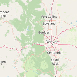
Use this park location map to pinpoint Pike National Forest in United States of America, understand its exact geographic position, and read its mapped placement within the surrounding landscape more clearly.

Pigeon | © OpenStreetMap contributors

Location context for Pike National Forest

Colorado
Recorded earthquake history

Review the Historical Earthquake Catalogue for Pike National Forest

Examine historical seismic records and epicentre data for events located near Pike National Forest. This catalogue provides a transparent look at recorded earthquake activity in the surrounding Colorado Rockies without assessing future hazard or risk.

Pike National Forest Earthquake History

Catalogued events

11 events

Strongest magnitude

Magnitude 4.3

Most recent event

Oct 17, 2025

This history includes earthquakes recorded inside the park or within 50 km of its borders

Explore photographic records of granite outcrops, alpine ridges, and montane forests.

Pike National Forest Photos and Scenery: Visualizing Front Range Landscapes

Visual documentation captures the rugged elevation gradient of Pike National Forest, stretching from foothill woodlands to exposed subalpine ridges. Examining these protected landscapes reveals the granite geology, diverse habitats, and iconic mountain scenery defining central Colorado.

A tall conifer tree stands in the foreground, with a vista of dense pine forests and rocky mountain peaks in the background under a cloudy sky.

A view through a car side window of golden aspen trees in autumn, with the vehicle side mirror visible in the foreground.

Park atlas

Compare regional mountain terrain and connected wilderness boundaries across the Front Range.

Other Parks Near Pike National Forest and Surrounding Protected Areas

Browsing other parks near Pike National Forest reveals the broader ecological spread of the Colorado Rockies. Comparing these adjacent protected landscapes provides essential context on regional elevation gradients and granite geology.
Watercolor painting of reddish granite rock outcrops surrounded by green forest and distant hazy mountain ridges.
Wildlife reserveColorado
Mapped location lies within the park boundary#1 closest

Northwest

Lost Creek Wilderness: A Mapped Atlas of Granite Formations and Protected Colorado Terrain

Exploratory mapping of central Colorado mountain foothills

Lost Creek Wilderness represents a significant protected corridor within the Pike National Forest of Colorado. The region is characterized by an unusual density of granite spires, arches, and domes, providing a distinct contrast to typical alpine landscapes. By examining the mapped boundaries and natural features of this wildlife reserve, users can better understand the unique hydrographic and geological systems that define this notable section of the Rocky Mountains.

Area
484.8 km²
Established
1980
IUCN
Ib
Relief
Mountain
A watercolor painting showing purple and white mountain peaks rising above green rolling hills and meadows in a wide panoramic format
Protected areaColorado
Park boundaries overlap#2 closest

Northwest

Mount Evans Wilderness: Alpine Landscapes and Protected Geography in Colorado

Glacial cirques and high-altitude wilderness ecosystems.

Mount Evans Wilderness offers a premier look at the Colorado Front Range, defined by its dramatic relief, sheer cliff lines, and extensive glacial history. This entry examines the wilderness as a protected zone that transitions from montane forests to tundra, providing a reference for high-elevation mountainous geography within the United States.

Area
301.09 km²
Established
1980
IUCN
Ib
Relief
Mountain
Watercolor painting of a serene mountain landscape featuring rolling hills, coniferous trees, and a lake in the foreground, rendered in light pastel tones.
Protected landscapeColorado
Park boundaries overlap#3 closest

South

San Isabel National Forest: Geographic Overview and Protected Mountain Landscape Atlas

Central Colorado alpine terrain and designated wilderness areas

Spanning eleven counties in central Colorado, San Isabel National Forest serves as a cornerstone of the Southern Rocky Mountains. The forest landscape is dominated by the Sawatch and Sangre de Cristo ranges, offering a unique atlas of alpine tundra, dense coniferous forests, and high-altitude peaks that define the character of the region. This protected area provides a vital habitat and a vast, rugged environment characterized by volcanic formations like the Spanish Peaks and glacial geological features.

Area
4,533.42 km²
Established
1902
Relief
Mountain
Climate
Alpine
Protected landscapeColorado
About 0.1 km away#4 closest

Northwest

White River National Forest: Mapping the Protected Landscapes and High Country of Central Colorado

Regional geography, wilderness boundaries, and mountain terrain data

Spanning from the high alpine tundra of the Sawatch Range to the volcanic plateaus of the Flat Tops, White River National Forest represents a significant protected area in the American West. This detail presents the geographic footprint, forest landscape, and complex mountain terrain that define this vital Colorado territory.

Area
9,251 km²
Established
1902
Relief
Mountain
Climate
Alpine
Wildlife reserveColorado
14 km away#5 closest

Northwest

Eagles Nest Wilderness: Alpine Geography and Protected Landscape of the Colorado Gore Range

High-mountain protected area in the White River National Forest

Spanning the southern Gore Range, Eagles Nest Wilderness represents a core protected landscape in Colorado characterized by high-elevation peaks, glacial cirque lakes, and extensive backcountry trail networks. Its geography bridges the gap between deep coniferous forests and exposed alpine tundra, maintaining significant ecological and historical value within the mountainous terrain of Eagle and Summit Counties.

Area
546.79 km²
Established
1976
IUCN
Ib
Relief
Mountain
A horizontal watercolor painting showing layers of pale green and soft pink mountain ridges behind a foreground of simple green and purple evergreen tree shapes.
Wildlife reserveColorado
18 km away#6 closest

West

Mount Massive Wilderness: A Protected Alpine Landscape in the Colorado Sawatch Range

High-altitude wilderness geography and Continental Divide terrain.

Mount Massive Wilderness represents a critical protected landscape in the central Colorado Rockies, encompassing glacially carved valleys, alpine tundra, and the second-highest peak in the state. This wilderness area provides a window into the rugged vertical relief and subalpine ecosystems that define the high-altitude geography surrounding Leadville, anchored by the iconic Sawatch Range and Continental Divide.

Area
123.6 km²
Established
1980
IUCN
Ib
Relief
Mountain
Wildlife reserveColorado
18 km away#7 closest

West

Holy Cross Wilderness: Mapped Alpine Landscapes and Colorado Protected Areas

Glacial valleys and high-country geography in the Sawatch Range

Discover the geographic layout of the Holy Cross Wilderness, a vital protected area in central Colorado. This resource details the rugged Sawatch Range environment, from high alpine lake basins to the iconic northern couloirs of its namesake mountain, offering a clear view of the park boundaries and surrounding high-country terrain.

Area
496.94 km²
Established
1980
IUCN
Ib
Relief
Mountain
A horizontal watercolor painting showing a range of purple and reddish-toned mountains in the distance, behind rolling green fields and a pale pinkish waterway in the foreground.
Protected landscapeColorado
26 km away#8 closest

North

Roosevelt National Forest: Mapping Wilderness and Protected Landscapes in Northern Colorado

Regional geography, river corridors, and alpine mountain terrain

Roosevelt National Forest encompasses a significant protected landscape across Larimer, Boulder, Gilpin, and Jefferson counties. The forest features a complex terrain of deep canyons, forested plateaus, and protected wilderness areas that form a scenic buffer along the eastern side of the Continental Divide and Rocky Mountain National Park.

Area
3,293.33 km²
Established
1902
Relief
Mountain
Climate
Subpolar

Common questions about visiting, size, designation, and location context for Pike National Forest

Pike National Forest FAQs for park facts, access, geography, and protected area context

Find quick answers about Pike National Forest, including protected-area facts, park geography, trail and visitor context, and how the park fits into its surrounding country and regional landscape.
MoriAtlas Explorer

Continue Your Protected Areas Search Across the Global Atlas

Deepen your exploration by continuing the structured search for national parks and protected areas worldwide. Utilize the comprehensive filtering capabilities to compare different conservation landscapes and refine your understanding of global park geography. Discover more about the distribution and characteristics of protected natural areas.

Global natural geography