
Trip Timing Fundamentals
When Is the Best Time to Visit Poás Volcano National Park?
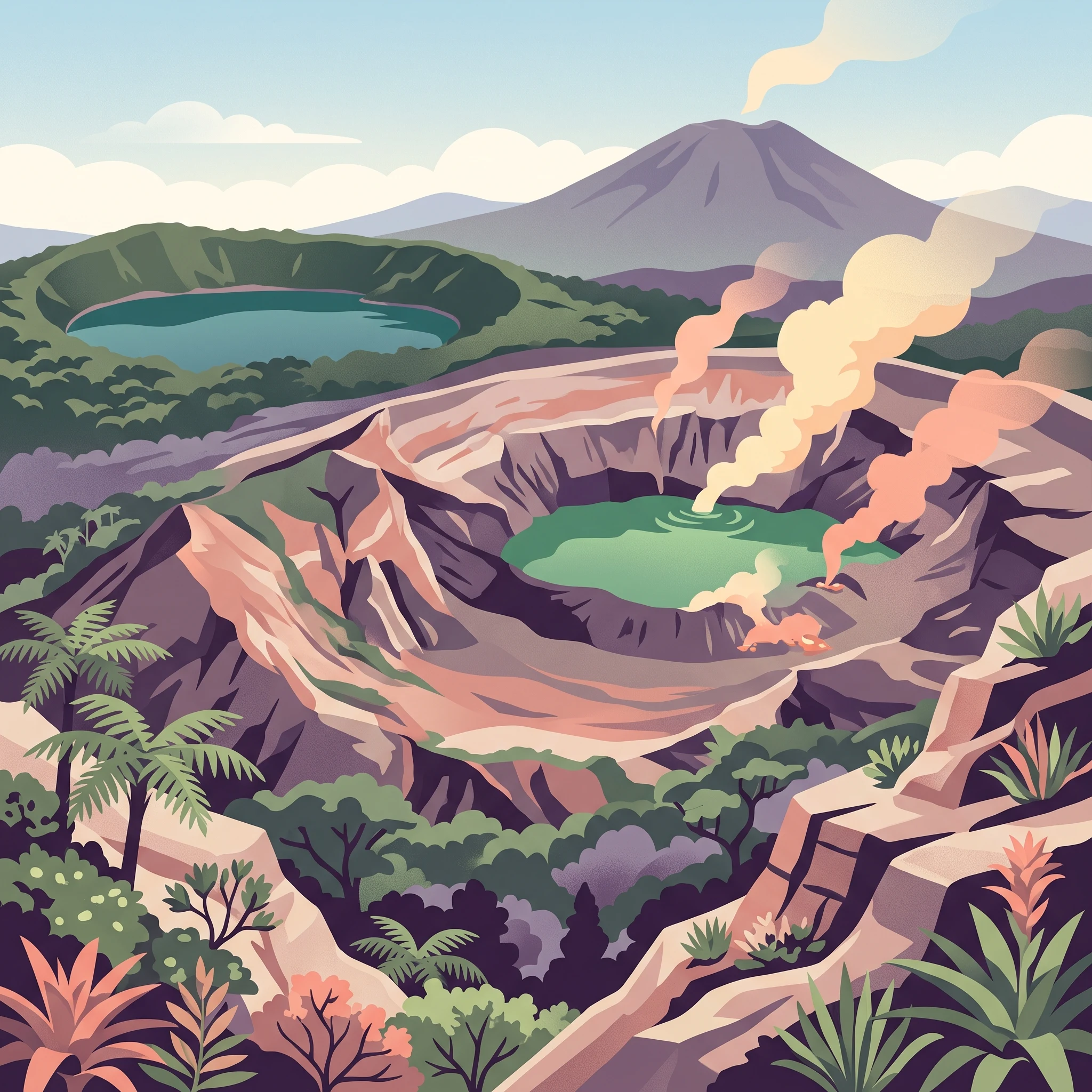
Deciding when to visit Poás Volcano National Park hinges primarily on the interplay between volcanic clarity and the cloud forest environment. While the park is accessible throughout the year, the most effective window for clear, unobstructed views of the active crater falls between December and April. During these drier months, lower precipitation levels and reduced cloud density increase the likelihood of seeing the crater lake and geothermal activity clearly, a key priority for most visitors heading to this high-altitude destination. If you prioritize volcanic visibility, scheduling your trip during these months provides the most consistent opportunity to witness the steaming, sulfur-rich landscape in detail.
Balancing Visibility with Atmospheric Character
The trade-off for visiting during the clearer, drier season is a shift in the landscape's aesthetic. Because Poás Volcano National Park protects a vibrant, high-altitude cloud forest, the lush, mist-covered appearance of the trails and vegetation is often at its most dramatic during the wetter months from May through November. Visitors during this period may encounter more frequent cloud cover and intermittent rain, which can temporarily obscure the crater. However, this moisture is exactly what sustains the dense, green ecosystem surrounding the dormant Botos crater and the surrounding volcanic slopes. Many travellers find that the atmospheric, often moody quality of the cloud forest adds a layer of depth to the visit that compensates for occasional crater obscuration.
Understanding Elevation and Daily Patterns
Beyond seasonal shifts, your daily timing at the park is as significant as your choice of month. Regardless of the time of year, mornings typically offer the most favorable conditions for observation. The park's elevation, reaching 2,700 meters, creates a dynamic microclimate where solar heating throughout the day often triggers rapid cloud formation. This process can cause the volcano to disappear behind a blanket of mist by midday, even during the historically drier months. This consistent daily pattern makes early-day arrival the most reliable strategy for viewing, as it allows you to engage with the volcanic terrain before the thermal activity of the afternoon begins to influence the local cloud cover.
Ultimately, there is no single month that guarantees perfect conditions, but your choice should reflect whether your primary goal is the high-contrast view of the active geothermal vent or the immersive, damp experience of the cloud forest in its most verdant state. Understanding these competing priorities helps in managing expectations for your visit, ensuring that whether you travel in the peak of the dry season or the height of the rainy months, you are prepared for the specific environment the volcano presents.
Seasonal Comparison
Best Months for Viewing the Poás Volcano Crater
Dry Season: December to April for Maximum Visibility
The most reliable period for clear views of the active crater and the emerald waters of Lake Botos spans from December through April. During these months, lower precipitation averages, which range from under 1 mm to approximately 2 mm per day, significantly reduce the likelihood of heavy cloud cover that frequently blankets the summit. Travelers prioritizing photography, long-range geological viewing, and hiking the exposed ridge trails often prefer this window. The trade-off for these clearer skies is the increased intensity of direct solar radiation and the requirement to plan visits during the early morning hours, as atmospheric conditions can shift quickly even during the driest months.
The Transitional Phase: May and November
May and November serve as transitional periods that bridge the climatic extremes. In May, the arrival of increased moisture signals the shift toward the wetter part of the year, while November often sees a gradual decline in the most intense precipitation experienced during the peak rainy months. These windows are characterized by moderate cloud cover and variable weather. For visitors, this can result in a more unpredictable experience where crater views might be available intermittently throughout a single morning. These months are often quieter, providing an alternative for those who wish to avoid the peak tourism levels associated with the drier season while accepting the risk of obscured views.
The Wetter Months: June to October
From June through October, the park experiences its highest levels of precipitation, with values peaking in September and October at over 7 to 8 mm per day. Humidity levels regularly climb above 85 percent, and the constant cloud forest mist often settles directly over the volcanic rim. While this period is less suitable for those whose primary goal is witnessing the active crater from a distance, it offers a different experience for those interested in the lush, moss-covered cloud forest vegetation and the dramatic, moody aesthetic of a misty volcanic landscape. Visitors during these months should anticipate frequent rainfall and must be prepared for trails that are consistently damp, though the cooler temperatures remain relatively stable throughout the year. The primary trade-off is a high likelihood of complete cloud-induced obstruction at the crater rim, requiring a flexible schedule and an acceptance that the volcanic features may not be visible on any given day.
Annual Climate Overview
Monthly Weather and Climate Trends at Poás Volcano National Park
Annual Shifts in Temperature and Humidity
Visitors often perceive the climate at Poás through the lens of altitude, where cooler temperatures create a stark contrast with the tropical lowlands of Costa Rica. Based on historical climate normals, the thermal environment remains relatively stable throughout the year, yet subtle fluctuations significantly influence the comfort of a high-altitude visit. Average daily temperatures generally hover in the low-to-mid 20s Celsius, with the warmest period occurring between March and May. During these months, daytime maximums can reach over 33 degrees Celsius in the surrounding region, though the specific microclimate at the park summit is tempered by its elevation and consistent cloud cover.
Humidity patterns show a clearer divergence between the seasons. During the drier months of December through April, relative humidity levels drop to their annual lows, falling below 70 percent in several months. This lower moisture content often correlates with improved clarity in the air, a factor that directly impacts the ability to view the volcanic crater. Conversely, from June through October, relative humidity levels climb steadily, often exceeding 85 to 90 percent. This persistent saturation contributes to the lush, vibrant character of the surrounding cloud forest but frequently results in the dense, lingering mist that defines the wet-season experience.
Rainfall Patterns and Seasonal Transitions
Rainfall is the most defining characteristic of the annual climate cycle, dictating the operational character of the park's trails and viewing areas. The data identifies a significant transition around May, marking the onset of more frequent precipitation. While the early months of the year see minimal rainfall, typically less than one millimeter per day, the volume of precipitation rises sharply as the year progresses. By September and October, daily rainfall averages reach their peak, often exceeding 7 or 8 millimeters per day. These months are characterized by frequent, often sustained, downpours that saturate the volcanic landscape.
It is essential for travelers to recognize that these figures represent long-term climate normals rather than daily forecasts. Local weather at the crater rim can shift rapidly due to topographic influences, meaning a clear morning can transition into a rainy afternoon regardless of the month. The patterns provided offer a reliable guide for understanding the broader environmental context, but they do not account for the high-frequency variability inherent to an active volcanic environment.
Daylight Hours and Wind Exposure
Daylight availability at this latitude remains relatively consistent throughout the year, with a slight variation of roughly one hour between the shortest days in December and the longest days in June. While this range is less extreme than at higher latitudes, the impact on a visit is noticeable for those planning early morning arrivals. The park's peak hours for visitor activity align with these daylight variations, yet the limiting factor for most remains the early accumulation of clouds rather than the total amount of available light.
Wind speeds remain modest on average, typically staying below 2 meters per second throughout the year. However, the exposed nature of the volcanic rim can make even moderate breezes feel significant to visitors standing at high altitudes. The most consistent wind patterns are observed during the drier, clearer months when stable atmospheric conditions prevail. During the wetter months, wind is often less a factor than the heavy, persistent precipitation and the dense cloud banks that settle into the crater, illustrating the transition from a windswept mountain top to a rain-drenched tropical forest.
Seasonal Climate
Understanding Seasonal Weather Patterns at Poás Volcano National Park
Defining the Dry and Wet Phases of the High Altitude Environment
While the region is often generalized as having a simple binary climate, the high altitude of the Poás crater area creates a distinct shift in environmental conditions throughout the year. The most reliable window for visitors is the dry season, which generally extends from December through April. During these months, precipitation levels drop significantly, often falling below 2 millimeters per day. The lower humidity and reduced cloud cover during this phase provide the clearest atmospheric conditions, which are critical for observing the geothermal activity within the crater. Visitors during this time will notice more consistent, crisp morning views, although the high-elevation wind patterns remain a constant factor.
Navigating the Transitional Months
Transition periods serve as the atmospheric bridges between the dry and wet extremes and often present the most variable weather. May acts as the primary transition into the rainy phase, where humidity begins to climb steadily from its March and April lows, often exceeding 80 percent. Conversely, November marks the start of the return to drier, clearer conditions. These transition months do not guarantee a specific type of weather, but they typically represent a departure from the sustained consistency of the dry season. For those planning trips during these windows, it is essential to prepare for rapid shifts in cloud cover, where a clear morning can quickly become engulfed in thick mist as moisture rises from the lower forested slopes.
The Rainy Phase and Cloud Forest Dynamics
From June through October, the park enters its most intense period of precipitation. During this time, daily rainfall averages frequently peak, reaching over 8 millimeters per day in October. Humidity levels are at their highest, often hovering near 90 percent. While this creates a challenging environment for those prioritized solely on long-range crater visibility, it is the peak time for witnessing the cloud forest at its most vibrant. The moisture sustains the dense, green vegetation surrounding Lake Botos and creates an atmospheric, often ethereal experience. During this phase, the volcanic landscape takes on a different character, with steam vents appearing more pronounced against the cool, damp air. Travelers should anticipate that mid-day fog and heavy mist are standard occurrences during these months, regardless of the early morning conditions. Because the park elevation influences these microclimates, temperatures remain cool throughout the year, with little seasonal variance in the thermometer, meaning the real shift is defined almost entirely by the moisture and cloud ceiling rather than traditional seasonal temperature swings.
Seasonal Experiences
What Visiting Poás Volcano National Park is Like Through the Year
Navigating Crater Rim Visibility and Geothermal Activity
The primary draw of the park is the main active crater, and the experience of visiting this site is inherently tied to the interplay between volcanic gas emissions and daily meteorological conditions. During the drier, lower-humidity months from December to April, the absence of frequent storm cycles often allows for clearer, extended views into the crater floor. Visitors during these months are more likely to observe the bubbling acid lake and active steam vents without the heavy shroud of low-hanging clouds. Conversely, from June through October, the higher humidity and increased daily rainfall characteristic of the rainy season often lead to rapid fog formation. While this can temporarily obscure the crater, it also highlights the raw, otherworldly nature of the geothermal landscape, where steam from vents contrasts sharply with cool, mist-laden air. Because volcanic conditions are dynamic, these patterns serve as probabilities rather than guarantees, requiring visitors to remain flexible regardless of the time of year.
Walking the High-Altitude Cloud Forest Trails
The experience of exploring the park's secondary features, such as the trail to Laguna Botos, changes significantly with the seasonal precipitation cycle. In the drier months, the trails are typically firmer, making the trek to the ancient, dormant Botos crater more predictable. The surrounding cloud forest, while always lush, exhibits a different character during this time as the foliage remains dense but the undergrowth is less saturated.
As the rainy season peaks between September and October, the cloud forest ecosystem becomes notably more vibrant. The increased moisture supports the mosses, epiphytes, and ferns that define the park's dwarf forest environment. Walking through these areas during the wetter months provides an immersive encounter with the high-altitude climate that supports such specialized biodiversity. However, these conditions require more deliberate movement, as paths can become muddy and the temperature drops can feel more pronounced due to high relative humidity. Regardless of the season, the high altitude means that even on sunny days, the park's temperature remains cool, and the rapid shift in conditions,from clear skies to dense mist,is a fundamental part of the Poás experience. Visitors should view the seasonal shift not as a change in site access, but as a change in the aesthetic and atmospheric presentation of the volcanic terrain.
Visitor Priorities
Optimizing Your Poás Volcano Visit Based on Personal Interests and Travel Goals
Choosing the Ideal Window for Clear Crater Views and Photography
If your primary motivation is to capture the most consistent and unobstructed views of the active crater, focusing your visit on the drier months between December and April is your most effective strategy. During this period, lower relative humidity levels, which can drop below 65 percent in March, correspond with a significant reduction in daily rainfall to less than one millimeter per day. This drier environment minimizes the persistence of dense, low-hanging clouds that frequently obscure the crater floor. The trade-off for this visual clarity is a higher frequency of visitors during the same optimal window, as clear weather conditions draw more people to the park. For the best balance of visibility and thinner crowds, consider scheduling your visit for early December or late April, where you can often secure favorable conditions before or after the peak tourist demand.
Prioritizing Milder Temperatures and Comfortable Walking Conditions
While the park maintains a relatively stable temperature profile throughout the year, those seeking the most comfortable walking weather should look toward the transition months or the cooler start of the year. January and December offer some of the lowest average minimum temperatures, sitting around 17 degrees Celsius, which provides a crisp, refreshing climate for hiking the trail to Lake Botos. If you find high heat challenging, avoid the late dry season in March and April, when average maximum temperatures can climb to over 33 degrees Celsius at the lower elevations, making uphill walking feel significantly more taxing. Keep in mind that as you ascend toward the summit, the temperature drops naturally, but the solar intensity remains high in the cloudless, dry months, necessitating sun protection even when the air feels cool.
Emphasizing the Lush Cloud Forest Experience
Travelers who prefer a more atmospheric and vibrant landscape will find the rainy season, specifically from June through October, to be the superior period for their priorities. While the main volcanic crater may be obscured by mist or clouds for large portions of the day, the high-altitude cloud forest flourishes during this time. Precipitation levels rise steadily, peaking in October with over eight millimeters of rain per day, which sustains the dense greenery and moss-covered vegetation that defines the region. Choosing to visit during these months means accepting the high probability that the active crater will not be visible at any given moment. In return, you experience the park in its most pristine, humid state, characterized by frequent rainfall that keeps the trails damp and the forest canopy lush. This period is less about wide-angle vistas and more about immersive, tactile exploration of the highland ecology, providing a distinct, quiet alternative to the high-visibility focus of the drier season.
Access and Logistics
Seasonal Access, Permits, and Planning for Poás Volcano National Park
Navigating Access and Road Infrastructure
Reaching the park involves navigating high-altitude terrain, as the entrance lies approximately 45 kilometers northwest of San José. The ascent from the Central Valley takes travelers through diverse landscapes, including coffee plantations, pasturelands, and dense forest segments. Several established routes, such as those passing through the towns of Fraijanes, San Pedro de Poás, or Varablanca, connect the park to the wider Alajuela region.
Because road conditions can fluctuate due to weather, seismic activity, or regional maintenance, travelers should always confirm the current status of these access routes before departing. While local business hubs along these paths offer amenities and resources, they are not indicators of the park's immediate operating status. You must verify road accessibility with official national park authorities or local transit resources shortly before your trip to ensure that the route remains open and safe for your specific vehicle.
Requirements for Park Entry and Reservations
Entry to the park is strictly regulated and requires advanced planning. Admission is typically managed through an online ticketing system, which is the sole channel for securing entry. Relying on walk-in tickets at the gate is rarely advisable, as the park often operates under capacity limits to ensure safety and preserve the fragile environment.
Before you finalize your travel dates, consult the official website of the Sistema Nacional de Áreas de Conservación (SINAC) to check for current permit requirements, reservation availability, and mandatory entry windows. Policies regarding online-only ticket purchases and pre-booked time slots are subject to change. Always confirm the specific documentation needed for entry, as physical printouts or digital confirmations may be required at the checkpoint.
Managing Operational Uncertainty
Operational capacity and physical access can be interrupted by the volcano's internal activity. Because Poás is a dynamic, active system, the management team may restrict access to the crater rim or the entire park area if volcanic gas emissions or seismic events exceed safety thresholds.
When planning your visit, recognize that any itinerary based on climate averages,such as the favorable clear-sky conditions typical of the dry season,is secondary to the real-time safety protocols in place. Check the park's official social media channels and administrative websites for live alerts on closure notices or restricted zones. If you are traveling via guided bus or private tour, ensure the operator has a clear protocol for communication in the event of a sudden closure. Since refunds for entry fees can be complex, verify the current policy on cancellations or scheduling adjustments with the official issuing authority before completing your purchase.
Safety and Preparation
Seasonal Weather Hazards and Packing for Poás Volcano
Navigating High-Altitude Weather Shifts
Preparation for the park centers on the reality of a high-altitude cloud forest where conditions can shift rapidly regardless of the calendar month. While long-term climate normals indicate a clearer, drier window from December through April and a more humid, precipitation-heavy period from June through October, these patterns should be viewed as general seasonal markers rather than guarantees. Visitors often find that the most significant environmental variable is the transition from morning sun to afternoon cloud cover and mist, which can occur on any day of the year.
Because the elevation impacts ambient temperatures, layered clothing remains the most effective strategy for comfort. The high-altitude environment often feels significantly cooler than lower, coastal areas of Costa Rica, especially when wind conditions increase or solar radiation is blocked by passing clouds. Wearing moisture-wicking base layers topped with a versatile, water-resistant outer shell allows you to adjust to the temperature fluctuations that define this highland terrain. Footwear should prioritize grip and stability, as trail surfaces throughout the park and around the crater rim can become damp or slick due to the consistent humidity characteristic of the region.
Preparing for Volcanic Environments
Visiting an active crater necessitates awareness of shifting air quality. Volcanic activity, such as gas emissions or steam venting, can be influenced by wind speed and direction. Official guidance often dictates duration limits for time spent at observation points, and these safety protocols are strictly enforced to protect visitors from sulfurous gases. You should always monitor onsite signage and follow the instructions provided by park staff immediately, as these directives are based on real-time atmospheric readings and geological monitoring that supersede any seasonal planning document. If you have known respiratory sensitivities, it is advisable to check the most current information from the park authority and consult your personal physician before your visit to ensure you are appropriately prepared for potential exposure to volcanic particulate or gases.
Seasonal Considerations for Gear and Planning
Packing for a visit during the wetter months of May through November requires increased attention to gear protection. High relative humidity and frequent rainfall necessitate waterproof covers for cameras, electronics, and personal belongings. Conversely, during the drier months when solar intensity can be higher, standard sun protection remains necessary despite the cooler air temperatures. Since the park is situated at a significant elevation, the sun can be intense even when the air feels crisp. Before departure, confirm your specific entry time and verify the current operational status of all trails, as volcanic activity may occasionally necessitate the temporary closure of specific areas. Always prioritize official alerts provided by the park administration, as these represent the only definitive source for daily access requirements and safety precautions.
Final Planning Decisions
Choosing the Best Time to Visit Poás Volcano National Park for Your Needs
Deciding when to visit this high-altitude volcanic site requires a candid look at your travel goals. Because the park is defined by an active crater and a cloud forest environment, the weather directly dictates your ability to see the central feature versus your capacity to enjoy the atmospheric, rain-fed landscape. There is no single universal date for every traveler, but you can identify the right window by prioritizing what you value most in your experience.
Prioritizing Crater Visibility
If your primary goal is to observe the active crater and the geothermal activity at the summit, focus your planning on the drier months from December through April. These months offer the lowest precipitation averages and the highest probability of clear, unobstructed views. Keep in mind that high-altitude weather is volatile, and even within the dry season, low-hanging clouds can move in quickly to obscure the view. Choosing this window minimizes the statistical likelihood of persistent rainfall, but it does not provide a guarantee of perfectly clear skies.
Embracing the Cloud Forest Experience
If you prefer a lush, vibrant environment and are less concerned with perfectly clear views, the months between May and November provide a different, equally compelling experience. This period sees increased moisture, which feeds the unique flora of the cloud forest and creates a dramatic, misty atmosphere that contrasts sharply with the raw, barren look of the volcanic peaks during the dry season. While these months often bring significant precipitation, the trade-off is a park that feels alive, verdant, and physically cooler.
Finalizing Your Decision
Once you have weighed these seasonal trade-offs, remember that your choice must be anchored in flexibility. Local climate normals describe historical patterns, but they do not serve as daily forecasts. Regardless of when you choose to go, check for current official park updates, temporary closures due to volcanic activity, and required permit reservations before booking travel. Relying on current conditions rather than annual averages ensures that you maintain a realistic expectation for your visit, helping you adapt to the natural fluctuations of the mountain environment.