
Mori Atlas logo
Nature reservePohlbachtal bei Adolfseck

Mapped brook valley ecosystems, historic Roman Limes landscapes, and protected mosaic habitats

Pohlbachtal bei Adolfseck Nature Reserve in the Western Hintertaunus Region of Hessen, Germany

(Naturschutzgebiet Pohlbachtal bei Adolfseck)

Pohlbachtal bei Adolfseck represents a significant nature reserve in the western Hintertaunus of Hessen, encompassing the headwaters and upper course of the Pohlbach. This protected landscape preserves a dense mosaic of wet meadows, managed fish ponds, and regenerating deciduous mixed woodland. Beyond its ecological function, the valley serves as a documented historical zone where remnants of the Roman Limes and seventeenth century earthworks integrate with current conservation efforts to define the local terrain.

brook valleynature reservehabitat mosaicwet meadowdeciduous mixed forestfish ponds
An artistic, flat-style illustration of a valley landscape at sunset. In the foreground, there is a grassy meadow, a bare tree, and a wooden bench next to a trail sign. In the midground, a stream winds through the valley between forested slopes. In the background, large rocky mountains rise under a pastel sky with a visible sun.

Pohlbachtal bei Adolfseck

Nature reserve

Park overview

Structured park overview, official facts, and landscape profile for Pohlbachtal bei Adolfseck

Pohlbachtal bei Adolfseck park facts, protected area profile, and essential visitor context

Review the core facts for Pohlbachtal bei Adolfseck, including designation, size, terrain, visitor scale, habitats, and operating context in one park-focused overview.

About Pohlbachtal bei Adolfseck

Pohlbachtal bei Adolfseck is a compact nature reserve nestled in the wooded hills of the western Hintertaunus, just north of the village of Adolfseck. Although it covers only about 22 hectares, the reserve captures a complete little hydrological story: the Pohlbach rises within its boundaries, meanders through a narrow floodplain, and then continues southward to join the Aar, which flows eventually toward the Lahn, the Rhine, and the North Sea. The valley's location on the northern side of the Hunsrück-Taunus uplands places it firmly within the Rhein-Taunus Nature Park, an area that already attracts visitors for its forested ridges and quiet stream valleys.

The reserve is a textbook example of the kind of small, focused habitat protection typical of the German Naturschutzgebiet system. Rather than showcasing a grand landscape, Pohlbachtal concentrates on preserving a fine-grained mosaic of wet and dry habitats that depend on careful ongoing management. Stream-side sections, waterlogged meadows, and adjacent slopes each receive a distinctive treatment, from extensive mowing to active conversion of conifer-dominated stands into multi-layered deciduous mixed forest. The result is a protected area whose value comes from ecological detail rather than scale.

For travelers in the region, the Pohlbachtal sits within easy reach of the Taunus ridge towns such as Bad Schwalbach and offers a tranquil complement to nearby historic sites. The compact size of the reserve, combined with its cultural surroundings, makes it an attractive destination for visitors interested in brook valley ecology, woodland transitions, and small-scale German nature reserves.

Quick facts and research context for Pohlbachtal bei Adolfseck

Pohlbachtal bei Adolfseck is a designated nature reserve in the Rheingau-Taunus-Kreis, Hesse. It was designated on 10 December 1990, covering about 22.57 hectares at elevations between roughly 280 and 400 meters. The site protects the source and upper valley of the Pohlbach stream and lies within the western Hintertaunus natural area and the Rhein-Taunus Nature Park. Its official identifier (Kennung) is 1439028, with WDPA ID 165016, and it is classified as IUCN Category IV, a Habitat/Species Management Area.

Protection and recognition

Examine documented protection records and official conservation designations.

Pohlbachtal bei Adolfseck Protection Status and Official International Designations

Pohlbachtal bei Adolfseck conservation data compiles documented protection status records and associated administrative designations. Structured records provide clear reference points for evaluating official protected area management frameworks.

Protection details

WDPA ID
165016
Park context

Deeper park guide and search-rich context for Pohlbachtal bei Adolfseck

Pohlbachtal bei Adolfseck history, landscape, wildlife, and travel context

Explore Pohlbachtal bei Adolfseck through its history, landscape character, ecosystems, wildlife, conservation priorities, cultural context, and seasonal travel timing in a structured park guide built for atlas discovery and search intent.

Why Pohlbachtal bei Adolfseck stands out

The reserve is best known for protecting the near-natural source area of the Pohlbach and the surrounding mosaic of wet meadows, fallow grasslands, scrub, and woodland. It is recognized for combining floodplain habitats, small protected fish ponds, and slopes where forest is being managed toward more structurally diverse deciduous mixed woodland. The valley's setting, alongside traces of the Roman Limes and a Thirty Years' War earthwork, adds a cultural dimension to its ecological profile.
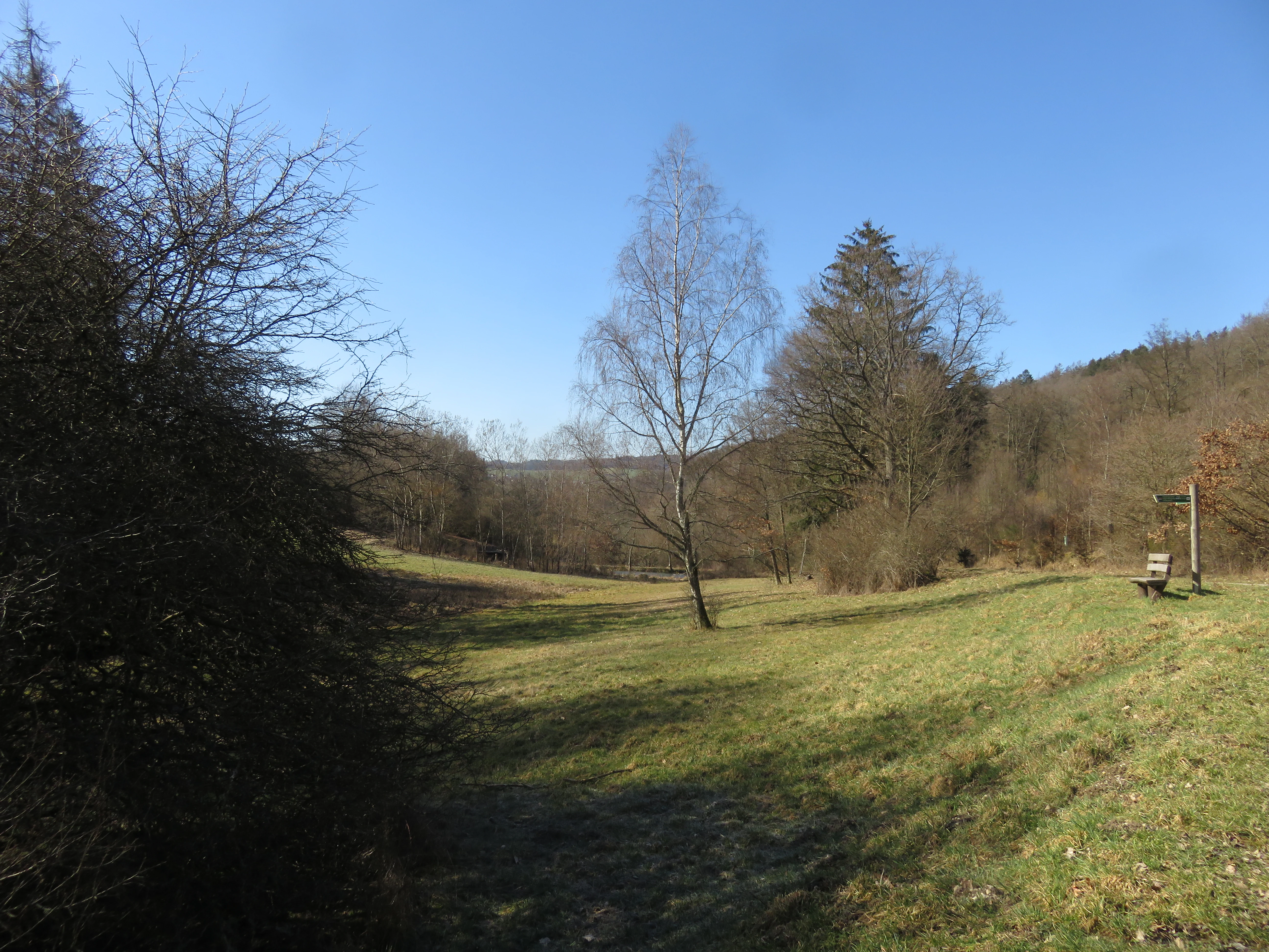
A green valley meadow in the Pohlbachtal nature reserve with deciduous trees, a central birch tree, and a wooden bench on the right.
A view of the open meadow and forest edges within the Pohlbachtal near Adolfseck.

Pohlbachtal bei Adolfseck history and protected-area timeline

The valley's cultural layers stretch back nearly two thousand years. During the Roman period, the Obergermanisch-Raetischer Limes, the frontier line of the Roman empire in Upper Germania, ran along the Pohlbachtal. The small fort known as Kleinkastell Adolfseck guarded the line at the point where the Pohlbach flows into the Aar, downstream of the present-day reserve. The setting of the Limes along the sheltered valley illustrates how strategic and topographical considerations aligned with the natural contours of the Taunus foothills.

Later, during the Thirty Years' War, the Schanze Adolfseck, a defensive earthwork, was built higher up the slope above the valley. This fortification draws a line from the Roman frontier into the early modern conflicts that shaped this part of Hesse. Although these historical features lie at the edges of the protected area, they form part of the cultural backdrop against which the modern nature reserve was later established.

The area's modern environmental history began on 10 December 1990, when Pohlbachtal bei Adolfseck was officially designated as a nature reserve. The move formally recognized the ecological value of the Pohlbach source area and its surrounding habitats, marking the beginning of structured conservation management for the valley. Since then, the reserve has been managed to preserve and optimize its mosaic of meadows, ponds, and woodland, situating it within the broader network of protected areas in the Rheingau-Taunus-Kreis.

Pohlbachtal bei Adolfseck landscape and geographic character

The reserve occupies a small but well-defined stretch of the western Hintertaunus, a low mountain range that rises between the Rhine and the Lahn. Elevations within the protected area range from about 280 to 400 meters, producing gentle slopes that frame a narrow brook valley. The Frankenberg, reaching 416 meters, rises to the north of the valley and gives the landscape an enclosing, sheltered feel. Steep wooded slopes and meadow openings alternate along the course of the Pohlbach, producing the typical Taunus pattern of forested ridges intersected by quiet stream valleys.

The hydrological backbone of the landscape is the Pohlbach itself. The brook rises in the upper part of the reserve and runs roughly one kilometer before leaving the protected area, after which it passes under the Bundesstraße 54 and joins the Aar. Downstream from there, the water system links ultimately to the Lahn, the Rhine, and the North Sea. Although these downstream connections are not the focus of the reserve, they situate the small Pohlbach within a much larger drainage basin.

Human touches are visible within this natural setting without dominating it. Historically managed fish ponds sit within the valley, some preserved as legally protected biotopes and others kept in low-intensity use. Together with the floodplain meadows, hillside scrub, and the wooded slopes above, these features create a mosaic that feels half-cultural, half-wild, reflecting centuries of low-intensity rural land use in the Taunus foothills.

Pohlbachtal bei Adolfseck ecosystems, habitats, and plant life

Pohlbachtal bei Adolfseck is a mosaic-style reserve, defined less by a single habitat than by the interplay between several. Its core is the floodplain of the young Pohlbach, where wet meadows and brook-side vegetation establish a humid base layer. Moving upslope, drier conditions take over, and the vegetation transitions into a patchwork of extensively used meadows, abandoned grassland now managed by periodic mowing, scrub communities, and forest stands. This graded gradient from wet to dry within a very small area is one of the reserve's defining ecological characteristics.

Conservation management is tailored to this variation. The meadows along the floodplain are kept under extensive use to maintain their botanical diversity, while overgrown former grasslands undergo regular maintenance cuts to prevent them from being entirely lost to shrubs. The forested portions of the reserve are being actively converted into more structurally diverse deciduous mixed woodland with uneven age classes, increasing habitat complexity for woodland species. The fish ponds scattered through the valley are partly retained in traditional use and partly protected as biotopes, adding still-water habitat to the predominantly flowing-water character of the area.

By bringing brook, ponds, floodplain, slope grassland, and multi-layered woodland together in a compact setting, the reserve achieves a level of ecological complexity that belies its modest size. Its IUCN category IV, Habitat/Species Management Area, designation reflects exactly this approach: targeted management to maintain and develop a particular set of habitats and species rather than a broad wilderness preservation.

Pohlbachtal bei Adolfseck wildlife and species highlights

The wildlife profile of Pohlbachtal bei Adolfseck is shaped by the close coexistence of flowing water, ponds, wet meadows, and structurally varied woodland. Brook-side and pond habitats support amphibian and aquatic invertebrate communities typical of small, near-natural Taunus streams. Periodic pond margins and waterlogged meadows act as breeding and foraging grounds for these groups, while the surrounding scrub and hedgerow transitions provide shelter and food for a range of small mammals, insects, and breeding birds.

The mixed deciduous forest being developed in and around the reserve increases habitat value for woodland fauna over time. As forest stands shift away from uniform conifers toward uneven, multi-layered deciduous mixtures, opportunities grow for cavity-nesting birds, bats, and woodland invertebrates. The reserve's mosaic character, with open and shaded habitats in close proximity, also benefits edge-loving species that rely on transitions rather than single habitat types.

While the available documentation does not enumerate specific species, the conservation framework strongly suggests that the reserve is intended to support typical Taunus brook-valley fauna, including amphibian populations tied to the ponds and wet meadows, woodland birds linked to the developing deciduous stands, and pollinator communities that depend on the extensively managed flower-rich meadows.

Pohlbachtal bei Adolfseck conservation status and protection priorities

The reserve's conservation purpose is explicitly defined around preserving and enhancing the near-natural state of the brook valley and its adjacent slopes. The statutory goal is to maintain what local planners describe as a mosaic-like arrangement of used and unused grassland of varying site moisture, interspersed with woodland and scrub. This mosaic is seen as both an ecological asset in itself and a buffer for the more sensitive brook and pond habitats at the valley floor.

Management measures under this conservation framework include extensive use of the existing meadows, regular maintenance cuts on abandoned grassland to prevent total shrub encroachment, and active conversion of forested parts of the reserve into multi-layered deciduous mixed woodland. Fish ponds in the valley are partially maintained for traditional use, while others, together with the upper brook valley, are legally secured as biotopes to conserve their biological value.

The site's classification as an IUCN Category IV Habitat/Species Management Area reinforces this active management approach. Rather than a strict non-intervention reserve, Pohlbachtal bei Adolfseck is a place where targeted stewardship keeps the landscape in a desired ecological condition. Within the broader network of nature reserves in the Rheingau-Taunus-Kreis, it represents a focused contribution to protecting small brook-valley ecosystems and the associated habitat mosaics characteristic of the western Hintertaunus.

Pohlbachtal bei Adolfseck cultural meaning and human context

Although the protected area is small, its cultural setting adds depth to its ecological story. The valley's alignment with the Roman Limes, running along the course of the Pohlbach, marks it as part of a significant Roman frontier landscape, with the small fort of Kleinkastell Adolfseck guarding the line where the brook meets the Aar. This connection gives the reserve an unusual layered identity: a piece of active habitat conservation set within a landscape rich in Roman and early modern history.

The Schanze Adolfseck, a defensive earthwork built during the Thirty Years' War above the valley, anchors the area in another turning point of European history. The nearby villages of Adolfseck and Breithardt, parts of Bad Schwalbach and Hohenstein respectively, also reflect long-standing rural settlement patterns in the Taunus, where small farming communities have coexisted with stream valleys and forested slopes for centuries.

The traditional fish ponds maintained in parts of the valley add a further cultural layer, reflecting older patterns of rural land use in which valley floors were shaped by humans for centuries. Today, these ponds are managed in a way that preserves both their cultural landscape role and their ecological value as part of the reserve's biotope network.

Top sights and standout views in Pohlbachtal bei Adolfseck

Pohlbachtal bei Adolfseck stands out for the clarity of its habitat mosaic, made up of a near-natural brook source area, floodplain meadows, managed fish ponds, and actively developing deciduous mixed forest. The reserve's small size, combined with detailed and ongoing management, makes it a strong example of focused German Naturschutzgebiet practice. Its location in the western Hintertaunus, within the Rhein-Taunus Nature Park, places visitors at the meeting point of Taunus ridge country and a quieter network of protected valleys.

What also sets the reserve apart is its historical setting, with traces of the Roman Limes and a Thirty Years' War earthwork on the same slopes that now shelter wet meadows and woodland. For visitors interested in ecological detail and cultural landscape, the area offers a compact experience in which nature protection, traditional land use, and deep historical layers come together within just a few square kilometers.

Best time to visit Pohlbachtal bei Adolfseck

The reserve's character shifts meaningfully with the seasons. Late spring and early summer are especially rewarding for meadow flora and for observing the contrast between flower-rich extant meadows and older fallow grassland being restored. The transitional period between spring and summer tends to bring the fullest display of vegetation along both the floodplain and the slopes.

Autumn, with cooler, wetter weather, often highlights the stream-side and pond habitats, when amphibians and water-level dynamics become more visible. Winter brings a stripped-back, structural view of the valley, where the contours of the floodplain, the slopes, and the surrounding ridges, including the Frankenberg to the north, are easier to read. For walkers and naturalists, the cooler and quieter months can also offer more peace in this compact reserve.

Monthly climate preview

Long-term representative measurements for temperature and precipitation rhythms

Pohlbachtal bei Adolfseck Climate Normals and Annual Temperature Patterns

Representative coordinates record long-term temperature variation alongside steady daily precipitation values across the sampled climatology period. Examining the complete monthly record clarifies the underlying climate normals and thermal distributions across the protected landscape.
Annual mean9 °C
0 °C20 °C
Jan
Feb
Mar
Apr
May13°
Jun17°
Jul20°
Aug19°
Sep15°
Oct
Nov
Dec
Warmest month
July

19.6 °C

Coolest month
January

-0.1 °C

Wettest month
July

2.2 mm/day

Driest month
April

1.5 mm/day

Park location guide

Geography guide, regional context, and park location map for Pohlbachtal bei Adolfseck

Pohlbachtal bei Adolfseck park geography, regions, and map view in Germany

Understand where Pohlbachtal bei Adolfseck sits in Germany through a broader geographic reading of the surrounding landscape, nearby location context, and its mapped position within the national park landscape.

How Pohlbachtal bei Adolfseck fits into Germany

Germany is a federal republic in Western and Central Europe with a population of over 83 million across sixteen constituent states. It is Europe's largest economy by nominal GDP and a major global exporter and importer. The capital is Berlin, and the country borders Denmark, Poland, Czech Republic, Austria, Switzerland, France, Luxembourg, Belgium, and the Netherlands.

Wider geography shaping Pohlbachtal bei Adolfseck in Germany

Germany is located in Western and Central Europe, spanning 357,022 km². It borders Denmark to the north, Poland and the Czech Republic to the east, Austria and Switzerland to the south, and France, Luxembourg, Belgium, and the Netherlands to the west. The country has coastlines on the Baltic Sea and North Sea to the north, with the Alps located in the southern region.

Map view of Pohlbachtal bei Adolfseck

Use this park location map to pinpoint Pohlbachtal bei Adolfseck in Germany, understand its exact geographic position, and read its mapped placement within the surrounding landscape more clearly.

Pigeon | © OpenStreetMap contributors

Location context for Pohlbachtal bei Adolfseck

Hessen

Visualizing the brook valley, wetland habitats, and western Hintertaunus terrain

Pohlbachtal bei Adolfseck Photos and Protected Area Landscape Views

Visual documentation captures the natural brook source area, floodplain meadows, and mixed woodland that define the protected landscape. Examining these field photographs reveals the close relationship between riparian habitats and historical remnants in the region.

A green valley meadow in the Pohlbachtal nature reserve with deciduous trees, a central birch tree, and a wooden bench on the right.

Park atlas

Compare adjacent brook valleys and regional nature reserves across the western Hintertaunus.

Parks Near Pohlbachtal Bei Adolfseck and Surrounding Protected Landscapes

Explore protected areas near Pohlbachtal bei Adolfseck to examine similar brook valleys, wet meadows, and forested ridge terrain. Comparing adjacent nature reserves reveals broader ecological patterns and regional conservation networks throughout the western Hintertaunus.
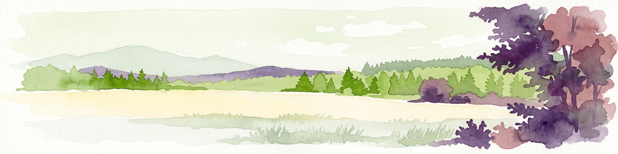
A horizontal watercolor painting depicting a soft-focus landscape with rolling green hills, distant light-yellow mountains, and forested slopes.
Protected landscapeHesse
About 6.6 km away#1 closest

Southeast

Naturpark Rhein-Taunus: Mapped Protected Landscapes and Geographic Features in Hesse

Discover the forests, river valleys, and cultural sites of this significant German nature park.

Naturpark Rhein-Taunus encompasses 81,000 hectares of forested ridges and valley systems in the Taunus low mountain range. The area is defined by its near-natural woodland, including the extensive Hinterlandswald, and its unique integration with the Roman Limes and the Rhine wine region, offering a distinct study in protected area geography.

Area
810 km²
Established
1968
Relief
Mountain
Climate
Temperate
A horizontal watercolor illustration of a natural valley scene, featuring an open meadow in the foreground, forest edges in the midground, and rolling hills in the background.
Nature reserveHesse
About 10 km away#2 closest

South

Rechtebachtal bei Georgenborn Nature Reserve: Geographic Profile and Protected Landscape

A mapped stream valley ecosystem in the Hesse Taunus foothills

The Rechtebachtal bei Georgenborn nature reserve protects a two-part valley corridor along the Rechtebach stream near Georgenborn and Martinsthal. This site preserves rare habitat mosaics of meadows and woodland that characterize the transitional zone between the Taunus highlands and the Rhine valley, offering a distinct study in regional conservation geography.

Area
0.185 km²
Established
1989
IUCN
IV
Relief
Upland
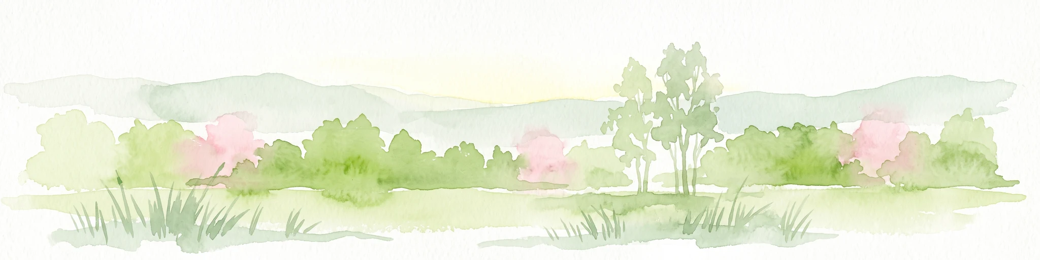
A watercolor illustration of a landscape with green meadows, flowering bushes, and distant rolling hills on a white background.
Nature reserveHesse
About 10 km away#3 closest

Southeast

Rabengrund von Wiesbaden: Mapping Protected Landscapes and Habitats in Hesse

Nature reserve and FFH site in the Taunus foothills

Rabengrund von Wiesbaden serves as a distinct protected valley system characterized by a compact coexistence of acid grasslands, reedbeds, and orchid-rich meadows. Managed as both a nature reserve and a Natura 2000 site, this area provides a rare window into the historical cultural landscape of the Taunus region. The site offers essential insight into small-scale habitat diversity near the urban core of the Hessian state capital.

Area
0.791 km²
Established
1988
IUCN
IV
Relief
Upland
A watercolor painting showing a soft, atmospheric landscape with a river flowing through green hills and gentle, misty mountains.
Nature reserveRhineland-Palatinate
About 15 km away#4 closest

Southeast

Inselrhein Nature Reserve, Rhineland-Palatinate: A Geographic and Protected-Area Atlas

River islands, floodplain forests, and Upper Rhine wetlands

Inselrhein features a chain of natural river islands and side channels forming a critical wetland habitat. The terrain transition from soft-wood to hardwood forest communities creates a layered landscape. Examine the protected boundaries and geographic significance of this river corridor between Mainz and Bingen, documented within the Rhineland-Palatinate atlas.

Relief
Lowland
Climate
Temperate
Access
Easy access
Scope
Terrestrial
Watercolor painting of a misty river landscape with green trees, reeds, and soft hills in the background.
Nature reserveHesse
About 16 km away#5 closest

South

Niederwallufer Bucht Nature Reserve: Rhine Floodplain Landscape and Geographic Context

Protected riparian habitat in the state of Hesse

Niederwallufer Bucht represents a key example of a conserved Rhine riverbank environment. This nature reserve protects a delicate mix of soft-wood forests, sheltered backwater bays, and riparian meadows. By maintaining these wetlands against the backdrop of the heavily settled Rheingau, the site provides a vital node of ecological continuity and a clear look at floodplain terrain within central Germany.

Area
0.13 km²
Established
2000
IUCN
IV
A horizontal watercolor painting of a river landscape with lush green trees, grasses, and a winding waterway under a soft light.
Nature reserveHessen
About 17 km away#6 closest

South

Mariannenaue Nature Reserve: Protected River Island Geography and Landscape Atlas

Rhine river island and floodplain forest in Hessen, Germany.

Mariannenaue serves as a prominent example of a protected inland island in the Upper Rhine. Its geography encompasses a complex mix of veteran floodplain forest, still-water habitats, and centuries-old vineyard cultivation. This detail page provides insights into the park boundaries, the surrounding riverine terrain, and the ecological network that connects this site to the broader Rheingau landscape.

Area
1.96 km²
Established
1972
Relief
Lowland
Climate
Temperate
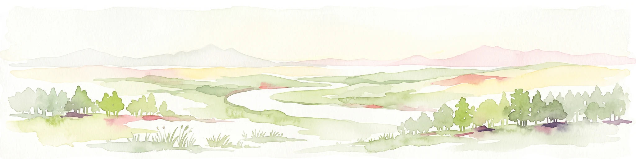
A wide watercolor illustration showing a winding river flowing through a green floodplain with scattered trees and pale pink and purple hills in the distance.
Nature reserveHesse
About 18 km away#7 closest

Southeast

Rettbergsaue Nature Reserve: Geography and Protected Landscapes in the Rhine Valley

A vital river island ecosystem and floodplain forest in Hesse.

Rettbergsaue serves as an essential riverine habitat in the Upper Rhine. This nature reserve, characterized by its alluvial woodland and riparian meadows, offers a detailed study of sediment-formed islands and the interplay between main-channel water flow and sheltered side-arm environments within the state of Hesse.

Area
0.68 km²
Established
1978
Relief
Lowland
Climate
Temperate
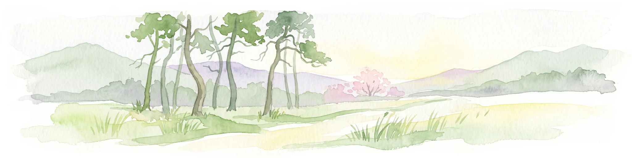
A soft watercolor painting of a forest landscape with slender trees, green grass, and distant rolling hills against a pale, warm sky.
Nature reserveRhineland-Palatinate
About 19 km away#8 closest

South

Lennebergwald Nature Reserve: Mapped Geography and Protected Forest Landscapes in Germany

Rhineland-Palatinate woodland and dry forest ecosystem analysis

Analyze the Lennebergwald nature reserve through its geological and ecological profile. This protected area in Rhineland-Palatinate showcases a rare inland sand forest structure, linking together pine and oak stands with vital dry grassland habitats that form a critical ecological mosaic in central Germany.

Area
8 km²
Established
1996
Relief
Lowland
Climate
Temperate

Common questions about visiting, size, designation, and location context for Pohlbachtal bei Adolfseck

Pohlbachtal bei Adolfseck FAQs for park facts, access, geography, and protected area context

Find quick answers about Pohlbachtal bei Adolfseck, including protected-area facts, park geography, trail and visitor context, and how the park fits into its surrounding country and regional landscape.
MoriAtlas Explorer

Continue Your Protected Areas Search Across the Global Atlas

Deepen your exploration by continuing the structured search for national parks and protected areas worldwide. Utilize the comprehensive filtering capabilities to compare different conservation landscapes and refine your understanding of global park geography. Discover more about the distribution and characteristics of protected natural areas.

Global natural geography