
Mori Atlas logo
Wildlife reserveRéserve nationale de faune de la pointe de l'Est

A mapped barrier spit mosaic of parabolic dunes, salt marshes, and lagoons in the Gulf of Saint Lawrence

Réserve nationale de faune de la pointe de l'Est: Coastal Protected Landscape in Quebec

Réserve nationale de faune de la pointe de l'Est stands as a protected coastal wildlife reserve located at the northeastern tip of the Magdalen Islands in Quebec. This atlas entry details the geographic composition of the site, which features a complex array of sand dunes, barrier-spit beaches, freshwater wetlands, and tidal lagoons. The protected area serves as a critical stopover for migratory shorebirds and supports distinctive dune ecology within the larger context of Atlantic Canada.

national wildlife areaMagdalen IslandsGulf of Saint LawrenceAtlantic barrier spitcoastal dunesparabolic dune
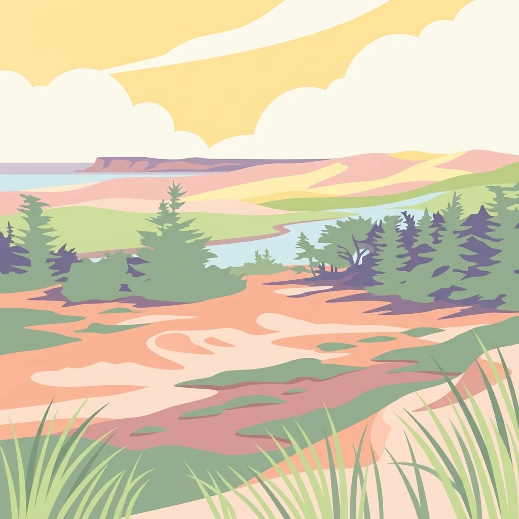
A stylized vector illustration of a landscape featuring green conifer trees, grassy dunes, a winding body of water, and distant hills under a cloudy sky.

Réserve nationale de faune de la pointe de l'Est

Wildlife reserve

Park overview

Structured park overview, official facts, and landscape profile for Pointe-de-l'Est National Wildlife Area

Pointe-de-l'Est National Wildlife Area park facts, protected area profile, and essential visitor context

Review the core facts for Pointe-de-l'Est National Wildlife Area, including designation, size, terrain, visitor scale, habitats, and operating context in one park-focused overview.

About Pointe-de-l'Est National Wildlife Area

The Pointe-de-l'Est National Wildlife Area sits at the far northeastern edge of the Magdalen Islands, occupying a barrier spit named Pointe de l'Est that connects Grosse Île and Grande Entrée Island. Geologically, the entire Magdalen archipelago belongs to the Maritimes Basin, where ancient metasedimentary and volcanic rocks were uplifted by massive salt deposits. Over millennia, marine erosion released sand and gravel from these rocks, and wind reshaped them into the dunes, beach ridges, and tombolos that dominate the landscape today.

The reserve's terrain is defined by an extraordinary coastal mosaic: active and stabilized sand dunes, heathlands, salt marshes, freshwater marshes, large barrier beaches, and two significant lagoons. Clarke Bay, the northernmost lagoon, is influenced by tidal flow, while the Étang de l'Est is only occasionally inundated during the highest tides. At the southern edge of Clarke Bay lies a vast parabolic dune, a leading example of aeolian dune morphology in North America, slowly reshaped by prevailing winds and short-beach grasses.

The climate of the Magdalen Islands is the mildest in Quebec, with smaller seasonal temperature swings than inland regions. Average annual temperature sits near 4.4°C, January averages around -6.3°C, and July averages near 16.6°C. Annual precipitation is approximately 898 mm, with a frost-free season of about 160 days. Tidal amplitude in the area is unusually low, around 60 cm, making this part of the Gulf of Saint Lawrence unique in its near-amphidromic tidal character.

Ecologically, the reserve shelters a rare combination of boreal and maritime flora. Its plant communities range from pioneer beach species through dune grasses, heaths dominated by crowberry and bearberry, and stunted white spruce and balsam fir krummholz forests, to freshwater and brackish marshes rich in sedges, rushes, and yellow pond lilies. Carnivorous plants such as purple pitcher plant and round-leaved sundew grow in sphagnum peatlands. The site is also home to a fox population, snowshoe hare, red squirrel, and a smaller community of other island mammals.

For visitors, the reserve offers about 8 km of interpreted hiking trails, guided tours through the partner organization La Salicorne, and access to viewpoints overlooking the dunes, lagoons, and Atlantic horizon. Designated trails also permit ATV use, while regulated migratory bird hunting remains permitted under specific conditions. The reserve's combination of accessibility, ecological richness, and dramatic coastal scenery makes it one of Quebec's premier natural destinations for birdwatchers, educators, and outdoor enthusiasts.

Quick facts and research context for Pointe-de-l'Est National Wildlife Area

Pointe-de-l'Est National Wildlife Area is one of eight National Wildlife Areas located in Quebec, administered by the Canadian Wildlife Service, a branch of Environment and Climate Change Canada. It was established on April 27, 1978, following land acquisitions made between 1975 and 1977, and was expanded in 1992 with the addition of 62 hectares.

The reserve lies at the northeastern end of the Magdalen Islands archipelago in the Gulf of Saint Lawrence. Its territory includes a barrier spit complex of about 724 hectares of protected land, with an additional 258 hectares of adjacent federal land. The area is recognized as a nationally significant site for shorebird migration and waterfowl breeding within the Atlantic flyway.

Protection and recognition

Documented terrestrial protection scope, management records, and database identifiers

Protection Status and International Recognition for Réserve nationale de faune de la pointe de l'Est

Terrestrial protection status, management scope, and official international recognition records anchor this detailed profile of Réserve nationale de faune de la pointe de l'Est. Verified database identifiers and conservation frameworks provide structured context for exploring the protected area.

Protection details

Protection scope
Terrestrial
Transboundary protection
No
WDPA ID
555704272
Park context

Deeper park guide and search-rich context for Pointe-de-l'Est National Wildlife Area

Pointe-de-l'Est National Wildlife Area history, landscape, wildlife, and travel context

Explore Pointe-de-l'Est National Wildlife Area through its history, landscape character, ecosystems, wildlife, conservation priorities, cultural context, and seasonal travel timing in a structured park guide built for atlas discovery and search intent.

Why Pointe-de-l'Est National Wildlife Area stands out

Pointe-de-l'Est is best known for protecting a mosaic of sand dunes, lagoons, and beaches that serve as a critical stopover for migratory shorebirds and seabirds along the Atlantic coast. Among its most celebrated features is an exceptionally large parabolic dune near the south of Clarke Bay, considered one of the most important of its kind in North America. The reserve is also recognized for its rich breeding bird colonies, including Common and Arctic Terns nesting on a small islet in the Étang le Flat Sand. Its dune-and-wetland mosaic, combined with the surrounding marine habitat of the Gulf of Saint Lawrence, gives the site outstanding value for bird conservation and coastal ecological research.
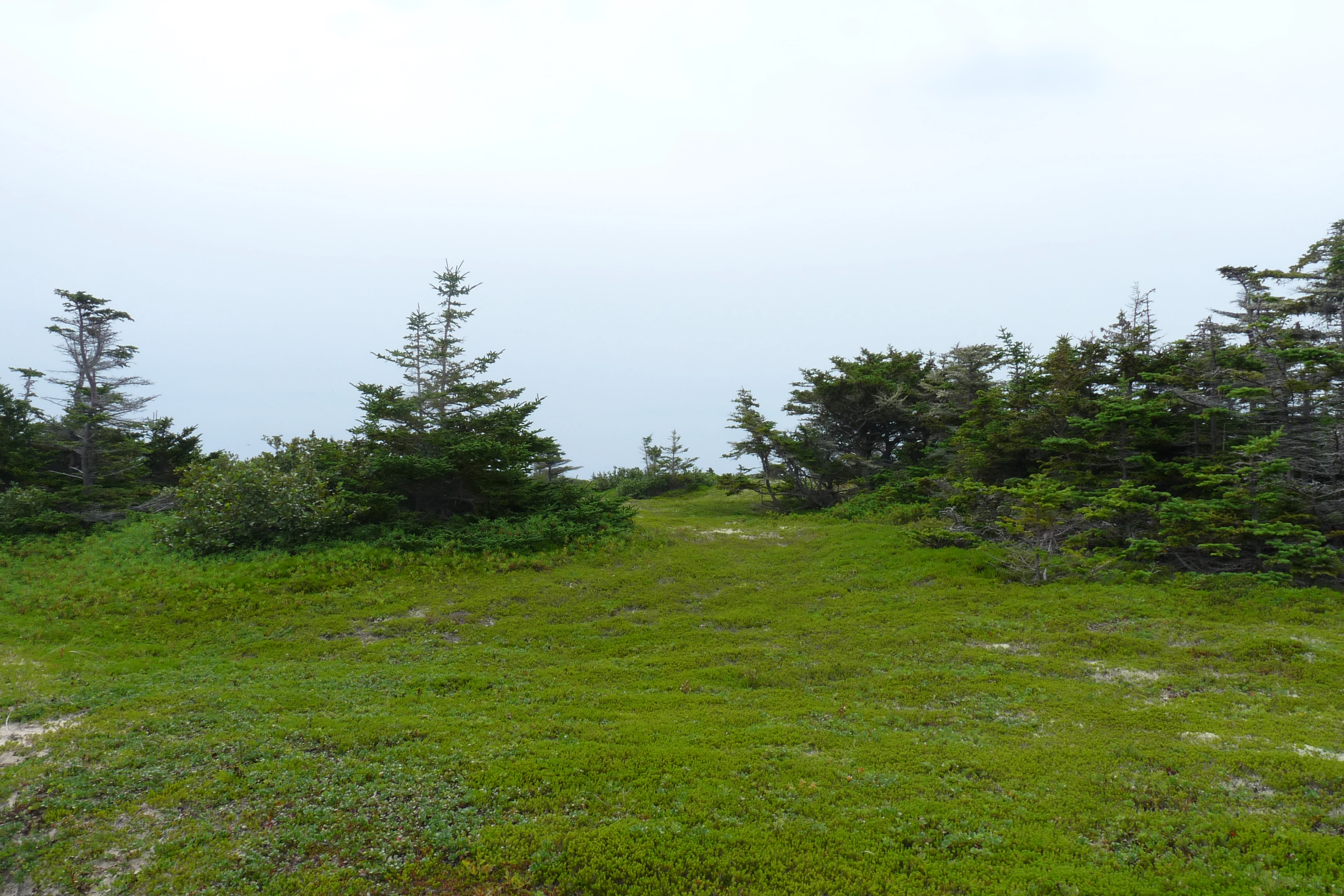
A wide shot of a grassy field with low green ground cover and scattered small conifer trees under a grey overcast sky.
Stunted conifers and ground cover plants at Pointe-de-l'Est National Wildlife Area.

Pointe-de-l'Est National Wildlife Area history and protected-area timeline

The Magdalen Islands carry deep human history stretching back several millennia. The oldest artifacts found on the archipelago date from the Late Paleoindian and Maritime Archaic periods, between roughly 8,500 and 2,500 years ago, with continued artifact evidence through the Woodland period up to about 500 years ago. The archipelago appears to have been used mainly seasonally, in part due to the absence of large terrestrial mammals that would have supported year-round occupation. Indigenous groups, including the Mi'kmaq, visited the islands in summer for walrus, seals, seabird colonies, and ochre, naming them "Memquit" or "Mewquit," later "Menagoesenog."

European contact began on June 25, 1534, when Jacques Cartier recorded sightings of the Bird Rocks, Brion Island, and Grosse Île. From the sixteenth century onward, French, Portuguese, and Basque fishermen joined Indigenous hunters in seasonal use of the islands, drying cod and processing walrus and seal products along the shores. Permanent settlement only began in 1761, when Acadians from Prince Edward Island, Cape Breton, and the Chaleur Bay region established lasting fishing communities.

The idea for a national wildlife reserve at Pointe de l'Est emerged in 1968, when the Canadian Wildlife Service proposed protecting key habitats for migratory birds at the eastern tip of the Magdalen Islands. Between 1975 and 1977, the federal government acquired 23 land parcels in the area. The reserve was officially established on April 27, 1978. In 1992, a 62-hectare expansion consolidated its territory. A first management plan was published in 1986, followed by a second comprehensive plan in 2020.

Pointe-de-l'Est National Wildlife Area landscape and geographic character

The landscape of Pointe-de-l'Est is defined by a long, wind-shaped barrier spit at the edge of the Atlantic. The underlying geology is unusual: the Magdalen Islands are part of the Maritimes Basin, where ancient metasedimentary and volcanic rocks were lifted over thick salt domes. Erosion of those formations produced the sand and gravel that make up today's surface, and the persistent action of waves and wind continues to reshape the system.

Pointe de l'Est itself is essentially a coastal sand spit formed between Grosse Île and Île de la Grande Entrée. Its composition is dominated by littoral and dune sand, with smaller surface exposures of Permian sandstone and siltstone in the northeast. Most of the surrounding seafloor is composed of Quaternary sand tombolos.

The visible terrain transitions from open sandy beaches and active dunes to stabilized dune ridges, heaths, and two large lagoons. Clarke Bay is the larger, tide-influenced lagoon in the north, while the Étang de l'Est lies slightly inland and is flooded only during exceptionally high tides. To the south of Clarke Bay rises one of the most striking features of the site: a vast parabolic dune that ranks among the most important in North America, a textbook example of wind-driven dune migration and vegetation stabilization. The reserve is surrounded by salt marshes, freshwater marshes, and rolling stretches of dwarf conifer forest, producing a layered and visually rich coastal landscape.
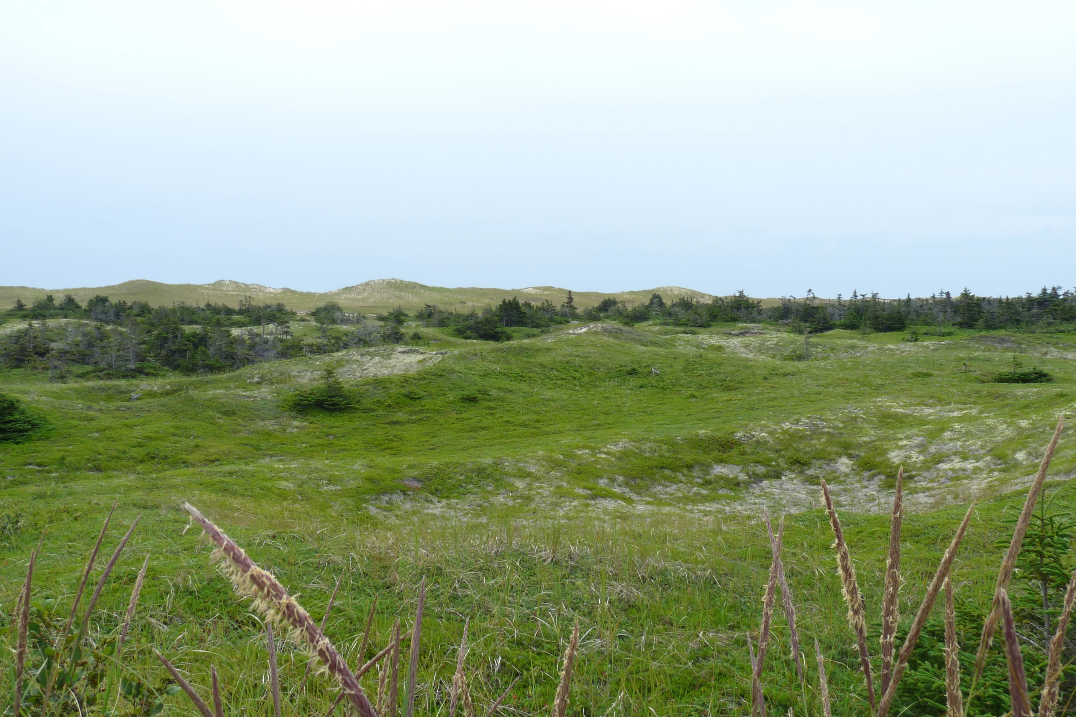
A wide landscape view of green grassy fields leading up to sandy dunes and a line of trees under a cloudy sky, with tall grass stalks in the foreground.
Rolling sandy dunes and green meadows with local flora in the Pointe de l'Est National Wildlife Area.

Pointe-de-l'Est National Wildlife Area ecosystems, habitats, and plant life

The natural environment of the Pointe-de-l'Est reserve is unusually diverse for such a small area. A 2019 inventory identified 191 vascular plant species, including 31 introduced species, two recognized as invasive, and four considered to be of precarious conservation status. The flora shifts in clear zones from open beach to dune to heathland to stunted forest and wetland.

Beach pioneer plants such as sea-rocket and sea sandwort colonize the upper shore, while American beachgrass dominates the foredune and dune crests. Inland-facing dune slopes host sea pea, Steller's wormwood, bayberry, and Baltic rush. Stable dunes develop into ericaceous heathlands dominated by black crowberry, purple crowberry, and bearberry, with common juniper, creeping juniper, lingonberry, lowbush blueberry, and broom crowberry adding structural diversity.

The most heavily stabilized dunes support a krummholz forest of white spruce and balsam fir, accompanied by paper birch, trembling aspen, and pin cherry. Wetlands add further ecological richness: intertidal salt marshes host glasswort, sea milkwort, and smooth cordgrass; salt meadows feature Baltic rush, saltmeadow cordgrass, and prairie cordgrass; freshwater marshes support yellow pond lily, bulrushes, broad-leaved cattail, blue flag iris, marsh trefoil, and Canada bluejoint. Sphagnum peatlands within the reserve shelter the tuberous grass pink orchid and carnivorous plants including purple pitcher plant and round-leaved sundew.
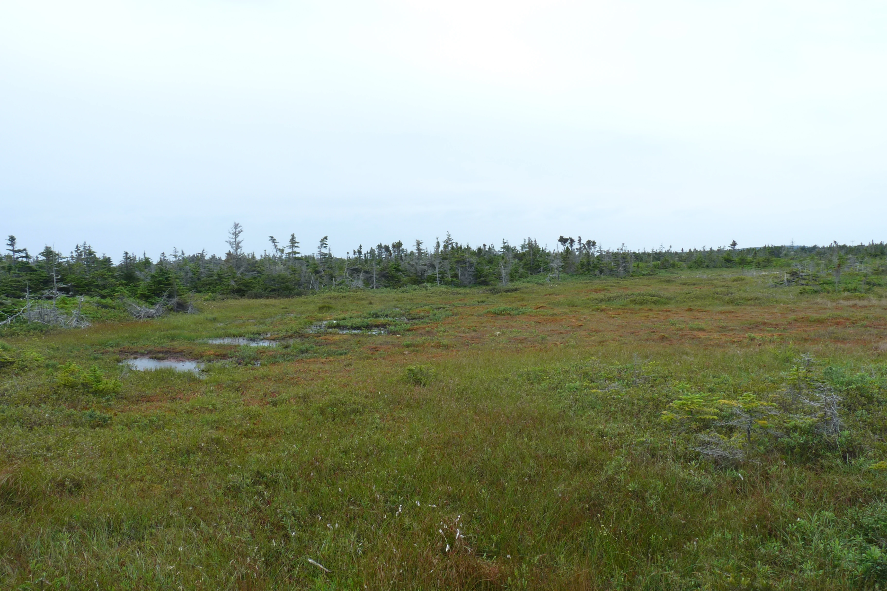
A wide view of a marshy wetland with low green and brown vegetation, small pools of water, and a line of trees in the distance under an overcast sky.
Marsh and shrub landscape within the Pointe de l'Est National Wildlife Area

Pointe-de-l'Est National Wildlife Area wildlife and species highlights

The Pointe-de-l'Est National Wildlife Area is a stronghold of avian diversity in eastern Canada. Approximately 215 bird species have been recorded on Pointe de l'Est between 1993 and 2012, and a 2007 Canadian Wildlife Service inventory documented 144 species. Savannah Sparrow, Palm Warbler, Vesper Sparrow, and White-throated Sparrow were observed at more than half of survey stations, while American Robin, Swamp Sparrow, American Crow, Wilson's Snipe, Sora, Great Black-backed Gull, Common Yellowthroat, Yellow-rumped Warbler, and Winter Wren were recorded at 30 to 50 percent of stations.

Northern Gannet and Double-crested Cormorant nest in colonies nearby, and large flocks of Cedar Waxwing and White-winged Crossbill are regularly recorded. Seven species, including Great Blue Heron, Great Black-backed Gull, Common Tern, American Crow, Common Raven, American Robin, and Savannah Sparrow, were detected on every survey day. Sixteen waterfowl species have been recorded in the ponds, with confirmed nesting for American Black Duck, Northern Pintail, Green-winged Teal, American Wigeon, and Ring-necked Duck. Twenty-three shorebird species have been documented in the area, and the reserve is a particularly important autumn staging ground for Black-bellied Plover and Sanderling.

The site supports significant breeding colonies of Common and Arctic Terns on a small islet in Étang le Flat Sand, where 351 nests were counted in 2007. A small Black-headed Gull colony of nine nests was documented nearby in 2014. Great Black-backed Gulls have nested on the spit repeatedly, and large numbers of Northern Gannets visit from the Bird Rocks colony about 32 km away.

Mammal diversity is modest but characteristic of island ecosystems. Roughly ten mammal species are found on the archipelago, including deer mouse, meadow vole, snowshoe hare, red squirrel, red fox, house mouse, and brown rat; only Myotis bats have been detected locally, and coyotes have been recorded on the islands since the 2000s. The red squirrel was introduced in 1975, and the snowshoe hare in 1994, following an unsuccessful nineteenth-century introduction. The green frog is present on the archipelago but has not been observed in the northern part containing the reserve. Three species protected under Canada's Species at Risk Act occur here: the Piping Plover, the Red-necked Grebe, and the Roseate Tern.
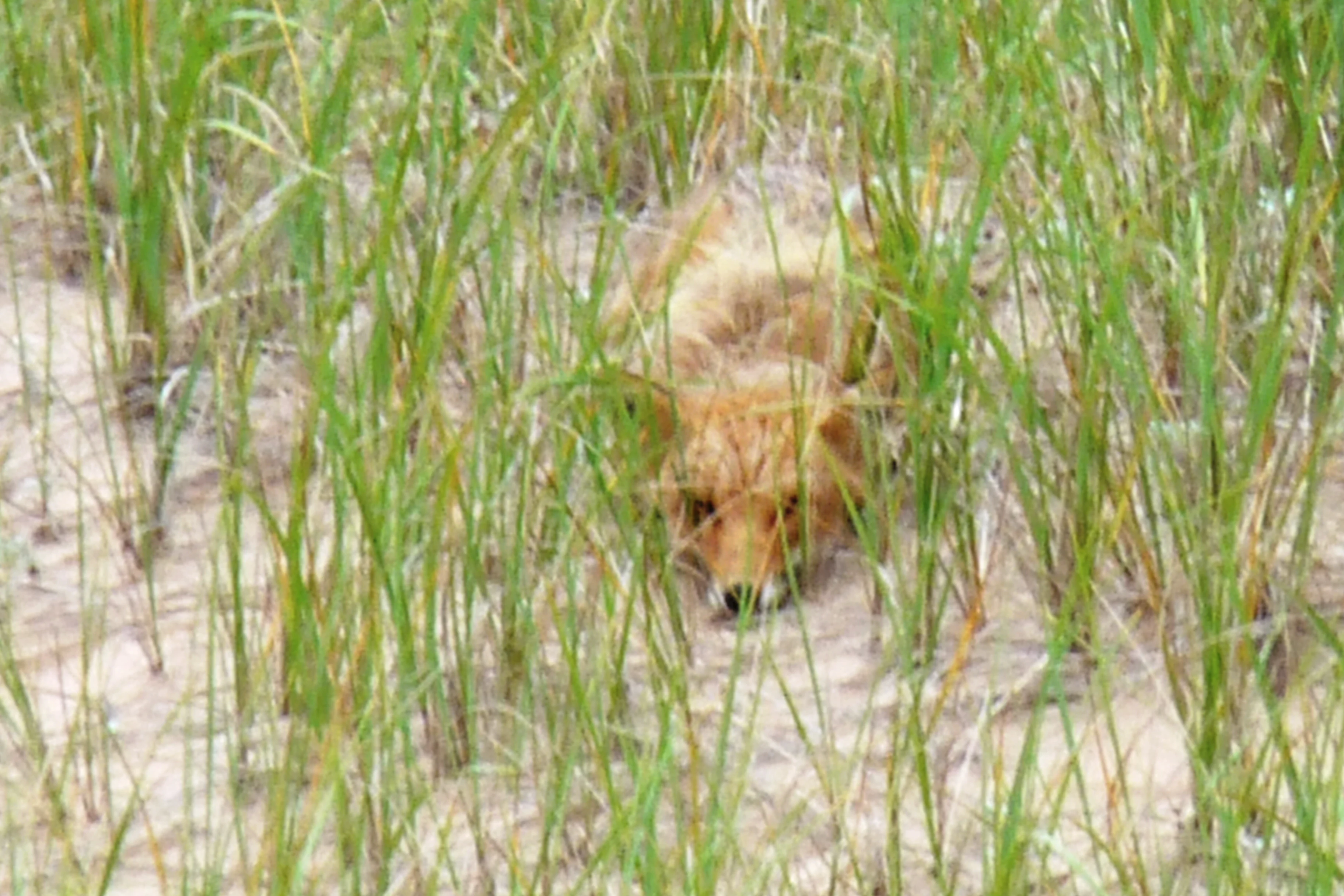
A red fox partially hidden in tall green grass growing on sandy dunes.
A red fox crouching in the tall grass of the dunes.

Pointe-de-l'Est National Wildlife Area conservation status and protection priorities

The Pointe-de-l'Est National Wildlife Area was established specifically to safeguard habitat for migratory birds and breeding species on the Magdalen Islands. It lies entirely within the Eastern Island Important Bird Area, reflecting its recognized national and international importance for avian conservation. Through legal protection under the National Wildlife Area framework and its overlap with the adjacent Pointe-de-l'Est Wildlife Refuge, the area forms one of the largest continuous stretches of protected coastal habitat in the Gulf of Saint Lawrence.

Three species protected under Canada's Species at Risk Act find refuge within the reserve: the Piping Plover, the Red-necked Grebe, and the Roseate Tern. The reserve also helps protect nesting colonies of Common and Arctic Terns, Great Black-backed Gulls, and several waterfowl species. Beyond its role for birds, the area conserves rare plant communities, including sphagnum peatlands with carnivorous plants, dune heathlands, and stunted boreal-maritime forest that are uncommon within Quebec.

The site also holds considerable geological and geomorphological value, including one of North America's most notable parabolic dunes. Through long-term monitoring, vegetation management to control invasive species, and the influence of two successive management plans (1986 and 2020), the reserve is managed as a model for balancing wildlife protection, public education, and limited regulated hunting of migratory game birds.

Pointe-de-l'Est National Wildlife Area cultural meaning and human context

The Magdalen Islands have long held cultural significance for Indigenous peoples, especially the Mi'kmaq, who visited seasonally for walrus, seal, seabirds, and red ochre before European contact. After Jacques Cartier's 1534 sighting of the archipelago, European fishers from France, Portugal, and the Basque Country used the islands for cod drying and marine mammal processing.

Permanent Acadian settlement only began in 1761, giving the islands a strong Acadian heritage that continues today in the local language, traditions, and identity of Les Îles-de-la-Madeleine. The reserve itself is closely tied to this cultural geography, and public education and guided tours are delivered by the local organization La Salicorne, reflecting a community-based approach to conservation outreach.

Top sights and standout views in Pointe-de-l'Est National Wildlife Area

The standout feature of Pointe-de-l'Est is its barrier-spit mosaic of dune, lagoon, beach, heath, and wetland habitats compressed into a single protected area. The reserve supports one of the largest parabolic dunes in North America and some of the most productive shorebird staging habitat in Atlantic Canada.

Other defining qualities include the Étang le Flat Sand tern colony, the diversity of breeding waterfowl and shorebirds, the exceptional floristic richness of its dune and peatland communities, and its accessibility to visitors through interpreted hiking trails and guided tours operated by a long-standing local partner organization.

Best time to visit Pointe-de-l'Est National Wildlife Area

Because of the Magdalen Islands' remarkably mild climate, with small seasonal temperature swings and relatively warm winters, visits are possible across much of the year. Late spring through early summer is widely considered ideal for birdwatching, as terns arrive to nest on the Étang le Flat Sand islet and many passerine species become most visible. Autumn brings peak shorebird migrations, when large numbers of Black-bellied Plover, Sanderling, and other limicolines use the beaches and lagoons as staging habitat. Summer offers the mildest weather for hiking the dune trails, while the area's quieter winter months can provide a peaceful, low-key visit for those drawn to the stark coastal scenery.


Monthly climate preview

Long-term temperature averages and monthly precipitation patterns across representative coordinates

Annual Climate Normals and Weather Rhythms for Réserve nationale de faune de la pointe de l'Est

Representative coordinates record measured multi-year temperature shifts alongside steady precipitation rates throughout the annual cycle at Réserve nationale de faune de la pointe de l'Est. Detailed monthly climate profiles provide complete statistical context for tracking long-term meteorological normals across the protected area.
Annual mean5 °C
-5 °C18 °C
Jan-4°
Feb-5°
Mar-3°
Apr
May
Jun10°
Jul16°
Aug18°
Sep15°
Oct10°
Nov
Dec
Warmest month
August

17.9 °C

Coolest month
February

-5.5 °C

Wettest month
December

4.6 mm/day

Driest month
May

3.2 mm/day

Park location guide

Geography guide, regional context, and park location map for Pointe-de-l'Est National Wildlife Area

Pointe-de-l'Est National Wildlife Area park geography, regions, and map view in Canada

Understand where Pointe-de-l'Est National Wildlife Area sits in Canada through a broader geographic reading of the surrounding landscape, nearby location context, and its mapped position within the national park landscape.

How Pointe-de-l'Est National Wildlife Area fits into Canada

Canada is a federal parliamentary constitutional monarchy spanning North America from the Atlantic to the Pacific and Arctic Oceans. With a population of over 41 million, it is officially bilingual in English and French at the federal level. The country gained independence from the United Kingdom through a gradual process culminating in 1982.

Wider geography shaping Pointe-de-l'Est National Wildlife Area in Canada

Canada occupies the northern portion of North America, sharing its longest international border with the United States. The country extends from the Atlantic Ocean to the Pacific Ocean and northward into the Arctic Ocean, giving it the longest coastline of any nation.

Map view of Pointe-de-l'Est National Wildlife Area

Use this park location map to pinpoint Pointe-de-l'Est National Wildlife Area in Canada, understand its exact geographic position, and read its mapped placement within the surrounding landscape more clearly.

Pigeon | © OpenStreetMap contributors

Location context for Pointe-de-l'Est National Wildlife Area

Quebec

Visualizing the sand dunes, barrier spits, and protected wetland habitats

Réserve nationale de faune de la pointe de l'Est Photos and Coastal Landscapes

Visual documentation reveals the expansive coastal dunes, barrier spits, and tidal lagoons that define the protected terrain of Réserve nationale de faune de la pointe de l'Est. Detailed photography provides an essential look at the shifting sand formations and critical shorebird habitats found across the Magdalen Islands.

A wide shot of a grassy field with low green ground cover and scattered small conifer trees under a grey overcast sky.

A wide landscape view of sand dunes with green grasses under a blue sky with white clouds.

A wide landscape view of green grassy fields leading up to sandy dunes and a line of trees under a cloudy sky, with tall grass stalks in the foreground.

A wide view of a marshy wetland with low green and brown vegetation, small pools of water, and a line of trees in the distance under an overcast sky.

A red fox partially hidden in tall green grass growing on sandy dunes.

A wide view of sand dunes covered with sparse green grass, leading to a flat green wetland and a body of water under a cloudy sky.

Park atlas

Compare nearby coastal reserves, marine habitats, and regional protected landscapes across the surrounding region

Other Parks Near Réserve nationale de faune de la pointe de l'Est and Surrounding Protected Areas

Browse protected areas and coastal reserves situated near Réserve nationale de faune de la pointe de l'Est to compare regional habitats and adjacent coastal terrain. Extending your geographic comparison across surrounding landscapes reveals broader patterns in island conservation and regional park geography.
National parkNova Scotia
About 98 km away#1 closest

Southeast

Cape Breton Highlands National Park: Mapped Protected Landscape in Nova Scotia

Discover its national park geography and natural terrain.

Uncover the protected landscape identity of Cape Breton Highlands National Park, a national park situated in Nova Scotia. This atlas-focused content details its mapped boundaries, regional geographic context, and natural terrain. It serves as a definitive resource for understanding the park's protected-area status and its contribution to the mapped natural landscapes of the region.

Area
949 km²
Established
1936
IUCN
II
Visitors
277.2K annual
Wildlife reserveFrance
About 107 km away#2 closest

Southeast

Réserve nationale de faune de l'Île-Saint-Paul Wildlife Reserve and Regional Geography

Mapping the protected landscapes of France

The Réserve nationale de faune de l'Île-Saint-Paul provides a focused look at isolated terrain and coastal environmental protection. As a designated wildlife reserve in France, it offers a distinct opportunity to study boundary-driven conservation and regional geography through a mapping perspective that highlights its remote natural character.

Established
2025
Relief
Lowland
Climate
Temperate
Access
Access unknown
Wildlife reserveNova Scotia
About 138 km away#3 closest

South

Sea Wolf Island National Wildlife Area: Protected Sandstone Cliffs and Seabird Sanctuary

Coastal maritime geography and nesting habitats in Nova Scotia

Sea Wolf Island National Wildlife Area constitutes a remote sandstone sanctuary in the Gulf of St. Lawrence. Characterized by steep, eroded cliff faces and isolated terrain, this Canadian protected area remains a significant site for colonial seabird nesting, specifically supporting populations of Great Cormorants and Razorbills within the Atlantic marine ecosystem.

Area
0.76 km²
Established
1982
IUCN
Ia
National parkPrince Edward Island
About 156 km away#4 closest

Southwest

Prince Edward Island National Park: A Mapped Protected Landscape within Canada's Maritime Region

Discover its geographic context and natural terrain.

Prince Edward Island National Park offers a distinct protected area for exploration within the Canadian Maritimes. As a national park, it represents a commitment to preserving specific natural landscapes and their geographic characteristics. This resource provides insight into its mapped boundaries, regional setting on Prince Edward Island, and its contribution to the broader atlas of protected lands.

Area
27 km²
Established
1937
IUCN
II
Relief
Lowland
Wildlife reserveNova Scotia
About 197 km away#5 closest

Southeast

Réserve nationale de faune du Lac-Big Glace Bay: Coastal Geography and Protected Land Map

Wildlife reserve and coastal sanctuary in Nova Scotia

This protected area centers on a brackish coastal lagoon and a dynamic barrier beach system on the Atlantic coast of Nova Scotia. The reserve provides a critical migratory stopover for waterfowl, with terrain that transitions from exposed sandy shores to regenerated coastal forests on reclaimed land, offering a unique example of maritime ecological restoration.

Area
3.9 km²
Established
2022
IUCN
IV
Relief
Lowland
National parkPrince Edward Island
About 212 km away#6 closest

Southwest

Pituamkek National Park Reserve: Prince Edward Island National Park Atlas Exploration

Mapped protected area and regional geographic context.

Pituamkek National Park Reserve offers a unique opportunity for atlas-driven discovery, focusing on its protected status as a national park on Prince Edward Island. The page details the park's geographic setting and its role within the broader landscape context of Canada. Explore its specific mapped boundaries and understand its contribution to the network of protected natural areas, providing essential data for geographic research and landscape analysis.

Area
30 km²
Established
2024
IUCN
II
Relief
Lowland
National parkQuebec
About 239 km away#7 closest

Northwest

Forillon National Park: Quebec National Park Protected Landscape and Geography

Explore mapped park boundaries and regional terrain.

Forillon National Park represents a crucial component of Quebec's protected lands, offering a rich subject for geographic discovery and atlas exploration. This national park's specific landscape characteristics and mapped boundaries provide essential context for understanding its role within the wider regional geography of Canada. Dive into the mapped terrain and protected area details that make Forillon National Park a unique element in any natural landscape atlas.

Area
244 km²
Established
1970
IUCN
II
Visitors
164.1K annual
A horizontal watercolor painting showing a pale green and soft pink landscape with distant hills, a calm body of water, and a tree-lined shore.
Wildlife reserveNew Brunswick
About 242 km away#8 closest

Southwest

Réserve nationale de faune du Cap-Jourimain: Protected Coastal Wetlands and Wildlife Maps

Essential geographic context for a strategic New Brunswick wildlife reserve

Examine the mapped boundaries and complex ecosystem transitions of Réserve nationale de faune du Cap-Jourimain. This federally protected area in New Brunswick offers a distinct look at coastal marshlands, tidal flats, and island topography situated at the narrowest point of the Northumberland Strait.

Area
6.617 km²
Established
1980
IUCN
IV
Relief
Lowland

Common questions about visiting, size, designation, and location context for Pointe-de-l'Est National Wildlife Area

Pointe-de-l'Est National Wildlife Area FAQs for park facts, access, geography, and protected area context

Find quick answers about Pointe-de-l'Est National Wildlife Area, including protected-area facts, park geography, trail and visitor context, and how the park fits into its surrounding country and regional landscape.
MoriAtlas Explorer

Continue Your Protected Areas Search Across the Global Atlas

Deepen your exploration by continuing the structured search for national parks and protected areas worldwide. Utilize the comprehensive filtering capabilities to compare different conservation landscapes and refine your understanding of global park geography. Discover more about the distribution and characteristics of protected natural areas.

Global natural geography