
Mori Atlas logo
Protected areaPustynia Błędowska

A rare inland desert ecosystem featuring shifting dunes and unique thermophilic sand grasslands

Pustynia Błędowska: Investigating the Geography and Protected Sand Landscapes of Poland

Pustynia Błędowska represents the largest expanse of shifting sand within Poland, situated on the border between the Silesian and Olkusz Uplands. This protected area showcases a distinct anthropogenic landscape shaped by historical mining and wind erosion, creating a rare inland desert environment. Through detailed geographic mapping, observe the distinct sections divided by the Biała Przemsza river, the restoration of open dune habitats, and the ecological contrast between quartz sand sheets and surrounding pine forests.

inland sand desertdrifting sandsthermophilic sand grasslandsNatura 2000 siteanthropogenic landscapeSilesian Upland
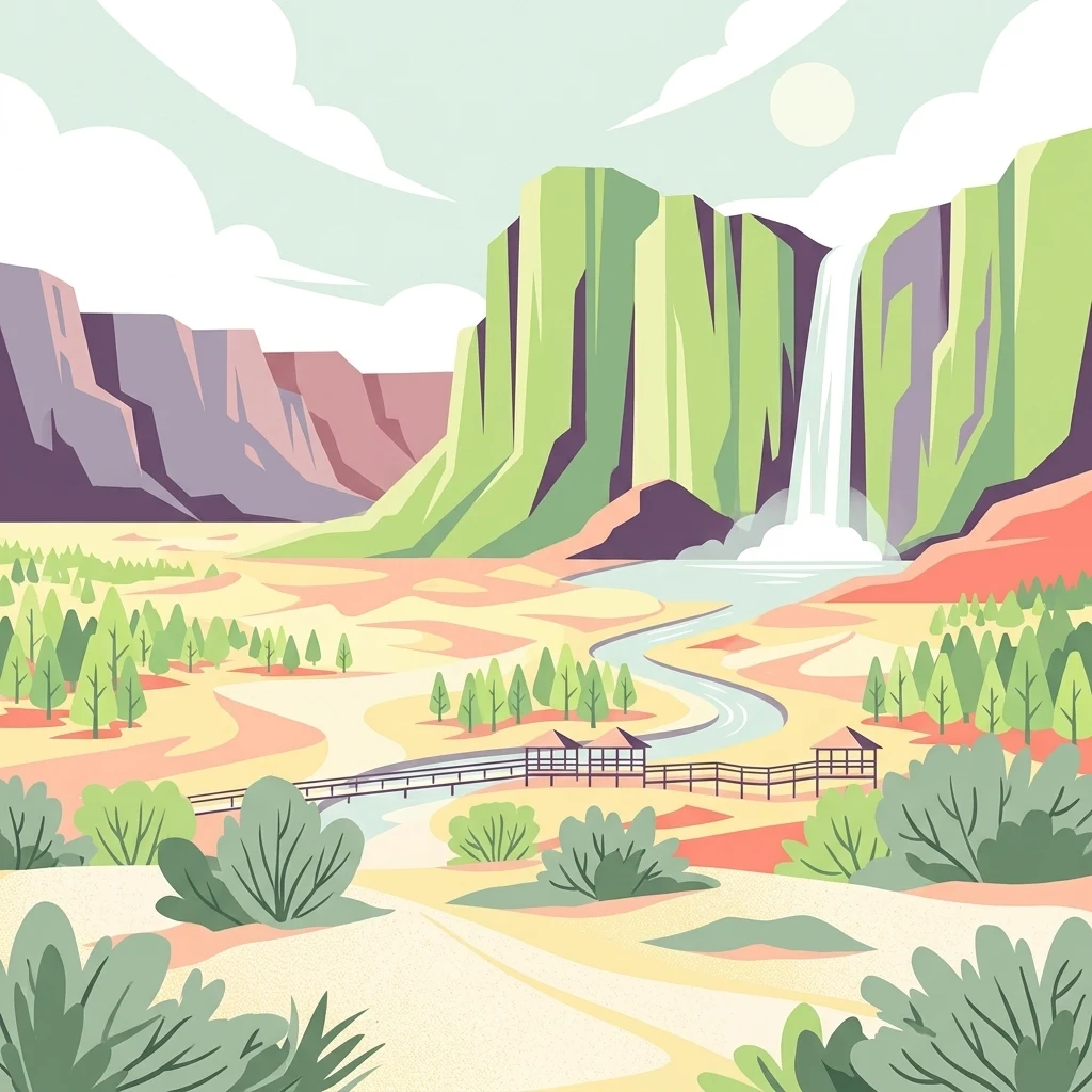
A colorful vector-style illustration of a desert basin featuring tall cliffs, a prominent waterfall cascading into a winding river, scattered trees, and a wooden pedestrian bridge in the foreground.

Pustynia Błędowska

Protected area

Park overview

Structured park overview, official facts, and landscape profile for Pustynia Błędowska

Pustynia Błędowska park facts, protected area profile, and essential visitor context

Review the core facts for Pustynia Błędowska, including designation, size, terrain, visitor scale, habitats, and operating context in one park-focused overview.

About Pustynia Błędowska

Pustynia Błędowska is an unusual inland sand landscape in southern Poland, located on the boundary of the Silesian and Olkusz Uplands. With an extent of about 33 km², it is by far the largest sand-dominated area in the country and one of very few places in Central Europe where shifting sands still form an active, dune-like surface. Its position right beside the Upper Silesian industrial agglomeration makes it a remarkable natural anomaly: an almost desert-like relief surrounded by industry, settlements, and forests.

The defining feature of the site is its blanket of fine quartz sand, on average between 17 and 20 metres thick, deposited during successive Pleistocene glaciations. Wind action shaped this loose material into shallow dunes, sand sheets, and ripple-marked surfaces, while the Biała Przemsza river carved a green corridor through the middle, dividing the desert into a smaller, more open northern section around the village of Chechło and a larger, more overgrown southern section.

Although it reads visually like a natural desert, Pustynia Błędowska is widely regarded as an anthropogenic landform. The surrounding terrain once supported dense forest, but centuries of clearance for silver and lead mining near Olkusz, accompanied by groundwater drawdown, opened up the sand surface to wind reworking, allowing the present barren landscape to form and spread. The legacy of this process is still visible in small fulgurites created by lightning strikes in the sand, in shell-shaped deflation patterns on the loose surfaces, and in scattered patches of drift sand reactivated during dry, windy weather.

Today the desert is part of the Natura 2000 network and is the focus of active habitat restoration. Plantations of pine, birch, and willow were established in the twentieth century to stabilize the sands, but large areas have since been cleared to bring back the open sand habitats that are unique in Poland.

Quick facts and research context for Pustynia Błędowska

Pustynia Błędowska sits in southern Poland on the border of the Silesian and Olkusz Uplands, between the district of Błędów in Dąbrowa Górnicza on the west and the rural commune of Klucze on the east. It lies in the Garb Tarnogórski mesoregion and is listed as a Site of Community Importance under the Natura 2000 network with the code PLH120014, formally protected for its inland dune and thermophilic sand grassland habitats.

The desert extends roughly 10 km in length and up to 4 km in width, with an average sand thickness of around 17 to 20 metres on the forested parts, and thicker accumulations farther east. About a third of the area still consists of shifting sand, while the remainder has been progressively colonized by planted pine and willow stands and is being actively cleared again to restore the open sand landscape.

Protection and recognition

Documented terrestrial protection history and Natura 2000 recognition records

Pustynia Błędowska Protection Status and International Recognition Data

Terrestrial protection status for Pustynia Błędowska establishes a formal conservation baseline initiated in 2004. Official records aggregate documented Natura 2000 designations to track international recognition and management scope across the protected landscape.

International recognition

Protection details

Protection scope
Terrestrial
Designated year
2004
Transboundary protection
No
Park context

Deeper park guide and search-rich context for Pustynia Błędowska

Pustynia Błędowska history, landscape, wildlife, and travel context

Explore Pustynia Błędowska through its history, landscape character, ecosystems, wildlife, conservation priorities, cultural context, and seasonal travel timing in a structured park guide built for atlas discovery and search intent.

Why Pustynia Błędowska stands out

Pustynia Błędowska is best known for being the only large inland sand desert in Poland, a striking, semi-arid-looking landscape of fine quartz sand lying directly next to one of Europe's most heavily industrialized regions. Its dramatic visual contrast between bare dune-like sand sheets and the surrounding forests, industrial chimneys, and towns is one of its defining features. The area is also renowned for its conservation value, with the inland drifting dunes with thermophilic sand grasslands recognized as a priority habitat type under the European Habitats Directive. These rare sand communities host specialized plants such as Corynephorus canescens, Spergula morisonii, and the local endemic Cochlearia polonica, alongside a distinctive insect fauna including sand tiger beetles and antlion larvae.
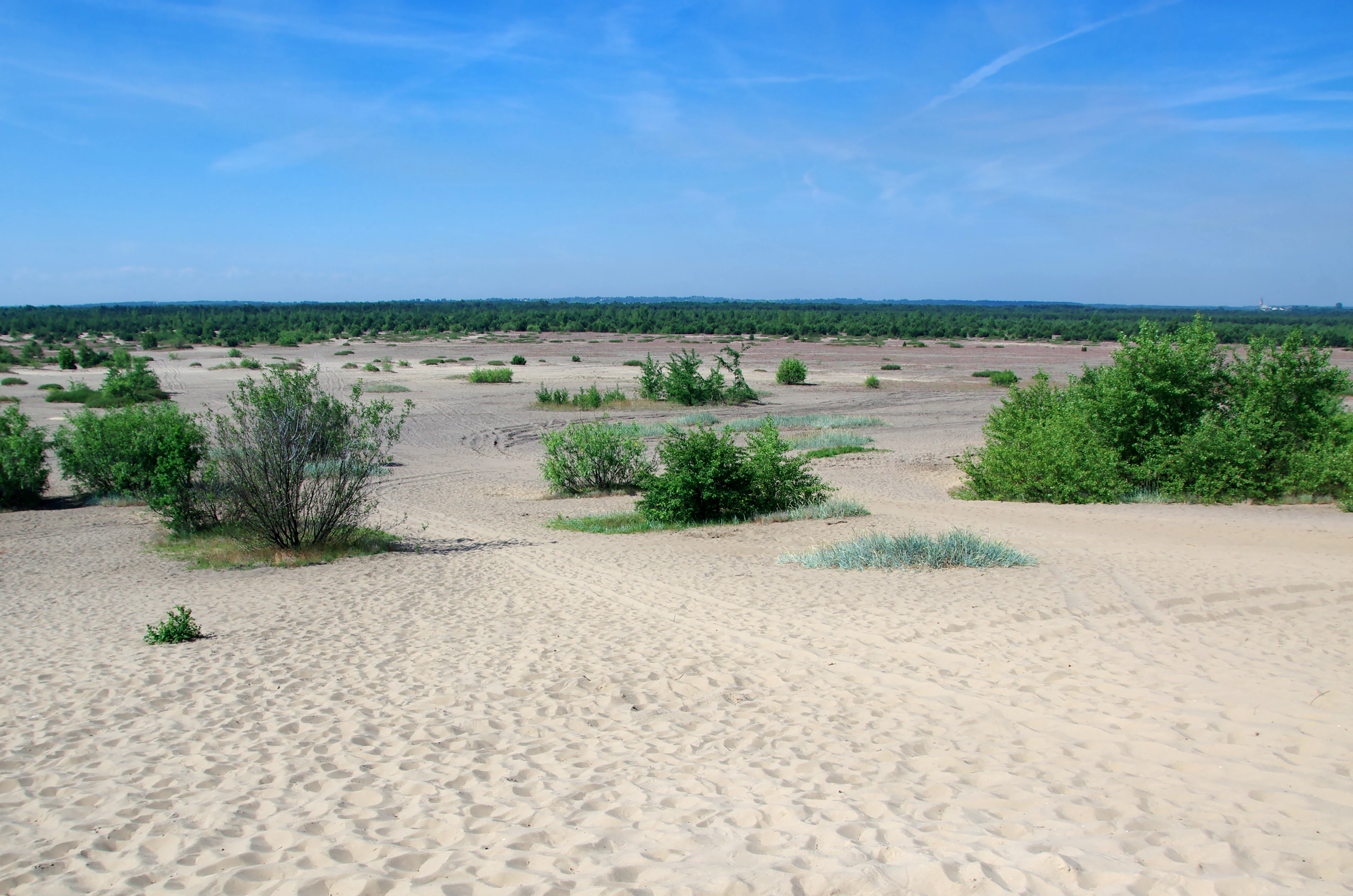
A wide angle view of an open sandy desert landscape featuring patches of low green shrubs and a distant tree line under a clear blue sky.
Wide view of the sandy terrain and desert landscape in Pustynia Błędowska.

Pustynia Błędowska history and protected-area timeline

The geological foundation of Pustynia Błędowska was laid during the Pleistocene, when successive glaciations washed sand and gravel into the broad valley where the desert now lies. For long stretches of time the area was shaped by wind and water under cold, open conditions, before being gradually recolonized by dense forest after the last ice age.

The transformation of these forests into a sand desert began around the thirteenth century, when expanding silver and lead mines around Olkusz demanded enormous quantities of timber for pit props and fuel. At the same time, falling groundwater levels associated with drainage and mining loosened the sandy soils. Together, deforestation and desiccation stripped the protective vegetation cover and exposed the underlying sands to wind erosion, allowing the desert to expand across an area that had previously been woodland.

In the early twentieth century the dry, open terrain attracted military use. During the First World War a Polish auxiliary infantry battalion trained on the sands before the Battle of Krzywopłoty. In the interwar period it served the Polish 5th Corps in Kraków for infantry and artillery exercises, and during the Second World War it became a training ground for the German Luftwaffe based at Udetfeld near Siewierz, including flight testing of V-1 flying bomb components. Military infrastructure from the period, including observation posts on the Dąbrówka hill near Chechło and on Czubatka in Klucze, remains a visible part of the present landscape.

In the 1930s the Błędowska desert was, together with the Ryczowska desert, Dziadowskie Morze, and the Starczynowska desert, considered as part of a much larger pseudo-region sometimes called the Wielka Pustynia Błędowska, spanning about 150 km². Large-scale sand extraction plans by forestry and mining companies in the early 1930s never materialized because of the outbreak of the Second World War.

During the 1950s and 1970s the open landscape began to shrink again. Parts of the desert were ploughed and planted with sharp-leaved willow and Scots pine, and industrial dust from the Upper Silesian conurbation, combined with rising groundwater levels, accelerated overgrowth. By the early twenty-first century the southern section had largely become forested, while the northern part, near Chechło, remained substantially open.

In 2004 the area received formal protection as a Natura 2000 site. A major restoration programme began in 2010 under the Silesian Landscape Parks team, and a multi-year Life+ project focused on preserving the sand grassland and inland dune habitats ran through 2014. The Błędów desert was temporarily closed to visitors in 2013 to allow habitat work to proceed and reopened to the public from summer 2014, with a new viewing platform called Róża Wiatrów added in 2018.

Pustynia Błędowska landscape and geographic character

The relief of Pustynia Błędowska is built on thick Pleistocene sand and gravel deposits lying on a gently undulating upland surface. Although the surrounding terrain belongs to the Silesian and Olkusz Uplands, the surface here is unusually flat and washed clean of finer material, with sand coloured in pale quartz tones and often scoured to a soft shine by wind.

Over much of the desert, low dunes and sand sheets give way to small deflation hollows and thin, wind-blown surface features such as ripple marks. Lightning strikes hitting the dry sand have melted it into fragile, glassy fulgurites buried within the layers. The Biała Przemsza river enters the area in the east and flows westward, cutting a green grassy corridor through the centre and breaking the desert into two visually distinct halves.

The northern section, near the village of Chechło and the Dąbrówka hill, is the most open and visibly dune-like, with larger bare sand patches and relatively little tree cover. The southern section is heavily overgrown, fringed to the south by extensive pine forest and by planted birch and pine stands, with only the eastern margins near Klucze and cleared restoration zones retaining visible sand surfaces. From elevated points such as Czubatka, the southern desert, the surrounding forest, and the industrial skyline of Dąbrowa Górnicza and the Huta Katowice steelworks all appear in a single view.
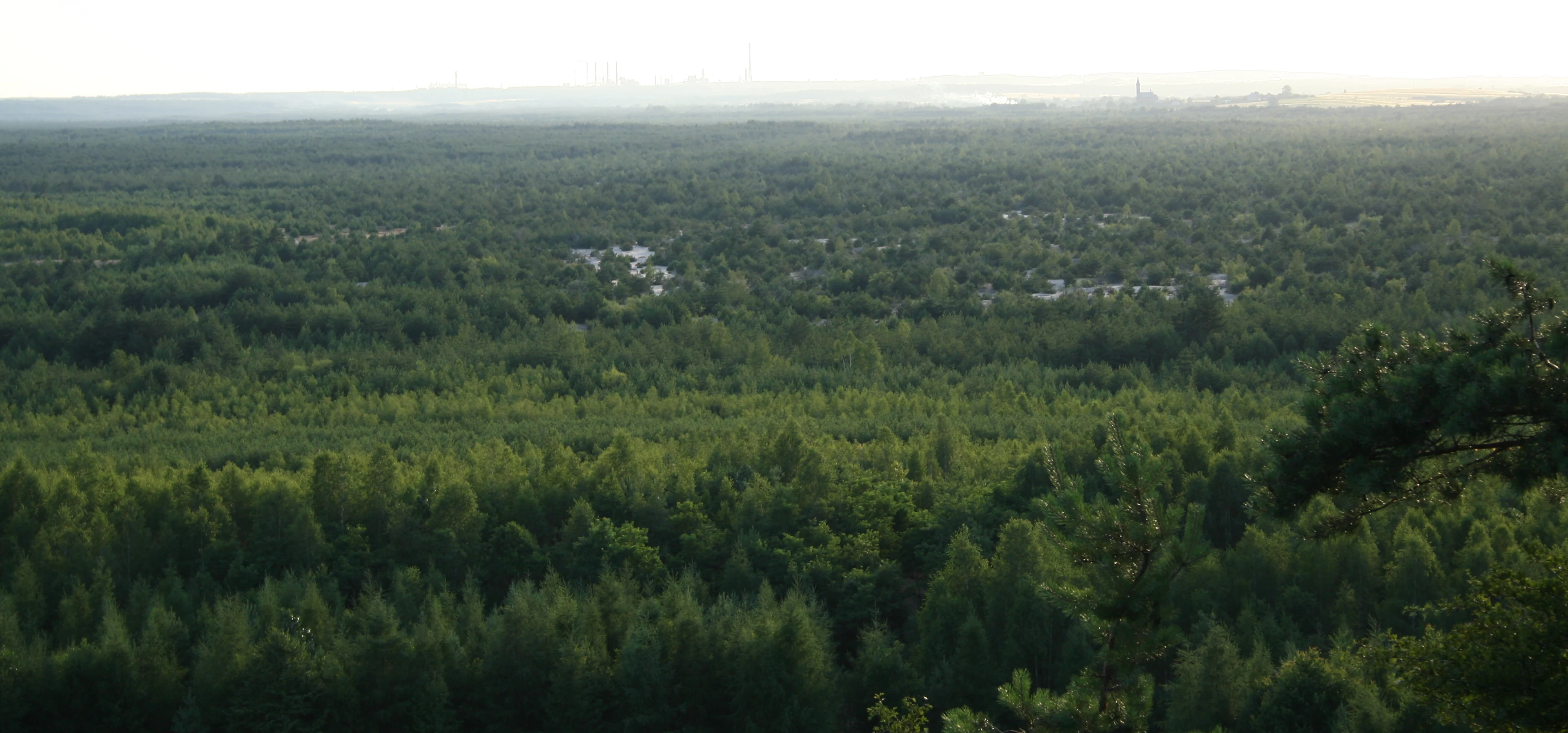
A wide, high-angle panoramic view overlooking a vast expanse of forest with desert sand patches visible in the distance under a hazy sky.
View of the Błędów Desert and surrounding landscape from Czubatka hill.

Pustynia Błędowska ecosystems, habitats, and plant life

The ecological identity of Pustynia Błędowska is built around inland, wind-formed sand habitats that are extremely rare in Central Europe. The site protects so-called inland dunes with thermophilic sand grasslands, a priority habitat type under the European Habitats Directive, alongside accompanying willow, poplar, alder, and ash floodplain galleries along the Biała Przemsza river corridor.

The sand grasslands support fewer than a hundred higher plant species in total, but many of these are highly specialized for life on loose, dry, nutrient-poor substrates. Typical species include grey hair-grass, spring spurrey, naked-stalked chroszcz, spring draba, marram-like sandgrass, sand sedge, and common bent. Among the rarer and protected plants are stemless carline thistle, baldaszkowy pomocnik, broad-leaved helleborine, and the local endemic Cochlearia polonica, which once grew along cold spring-fed stretches of the Biała Przemsza and is closely tied to clean, cold water issuing from sandy substrata.

Along the river edge, the sand grasslands give way to patches of willow-poplar-alder-ash floodplain woodland, providing a sharp contrast with the open sands and supporting a different set of flora and fauna. The combination of open sand, dune grassland, river valley woodland, and surrounding pine forest gives the site a notably varied ecological structure within a relatively compact area.

Pustynia Błędowska wildlife and species highlights

The wildlife of Pustynia Błędowska is dominated by invertebrates and birds, with the Biała Przemsza valley adding a freshwater component. Overall, around 150 bird species have been recorded in or around the area.

Open-sand specialists are among the most characteristic fauna of the site. Sand tiger beetles, predatory beetles coloured green or violet with white spots on their elytra, hunt across the loose sand, while antlion larvae dig characteristic funnel-shaped pits in which they trap ants. Reptiles such as the sand lizard, viviparous lizard, slow worm, grass snake, and occasional adder and smooth snake inhabit the warmer, drier stretches. Among amphibians, the burrowing toad is recorded on the site.

Birds of the dunes and grasslands include the woodlark and tawny pipit, with the ortolan also recorded, while historically the stone-curlew nested here as a steppe-desert relic. Aerial insectivores and woodland edge species, including honey buzzard, common kingfisher, black woodpecker, barred warbler, red-backed shrike, and European nightjar, are part of the broader avifauna. In and along the Biała Przemsza river, muskrats and beavers can be encountered on the banks, and the brook lamprey still occurs in the river itself.

Pustynia Błędowska conservation status and protection priorities

Pustynia Błędowska is recognized as a site of European conservation importance because it holds some of the best-preserved inland dune complexes and thermophilic sand grasslands in Poland and the region. In 2004 it was formally designated as a Site of Community Importance within the Natura 2000 network, with the code PLH120014, in recognition of the priority habitats it contains.

The main conservation challenge has been the gradual loss of open sand to forest succession. Twentieth-century afforestation with pine, birch, and willow, together with industrial dust deposition and rising groundwater levels, progressively closed the sand surface, especially in the southern part. Conservation projects since the early 2010s have focused on reversing this trend by clearing woody vegetation, controlling succession, and restoring the open character of the dunes.

A central milestone was the Life+ project "Active protection of priority sand habitats in the Błędowska Desert," which ran alongside the broader programme "Protection of the habitat mosaic in the Biała Przemsza river basin" coordinated by the Silesian Voivodeship Landscape Parks team. These efforts combined mechanical clearing of trees and scrub with grazing management and visitor infrastructure, culminating in the 2018 opening of the Róża Wiatrów viewing complex as a publicly accessible element of the conservation landscape.

Pustynia Błędowska cultural meaning and human context

Pustynia Błędowska carries a layered cultural identity rooted in mining, military history, and local folklore. The medieval silver and lead mines around Olkusz, which consumed vast quantities of timber from the surrounding forests, are directly tied to the formation of the desert itself, embedding the landscape in the long economic history of the Kraków-Silesian borderland.

The military heritage of the site spans multiple eras. Twentieth and early twenty-first century training activities have left visible traces across the desert, from First World War Legion exercises to interwar Polish infantry and artillery manoeuvres, German Luftwaffe training during the Second World War, and current use of the northern part of the desert by Polish airborne forces. Observation posts, communication towers, and shelters built during these periods are part of the visible material culture of the area.

In local legend, the desert is said to have originated from sand scattered by the devil in an attempt to bury the silver mines of Olkusz, a story that gives the otherwise bleak landscape a place in the imagined geography of the region. The desert has also entered Polish popular culture through cinema, including the film Faraon, and through music videos filmed on its sands.

Top sights and standout views in Pustynia Błędowska

Pustynia Błędowska is unique within Poland as the country's largest shifting-sand area, and it embodies the rare European combination of inland dune habitat and thermophilic sand grassland habitat protected under the Habitats Directive. Its visual contrasts, between pale open sand and surrounding pine forest, and between the desert floor and the looming industrial skyline of Dąbrowa Górnicza, are one of its most distinctive qualitative features.

The site combines a strong scientific profile, with endemic plants such as Cochlearia polonica, specialized sand-dwelling invertebrates, and a steppe-desert bird fauna historically including the stone-curlew, with a rich cultural and military history spanning more than a century. Conservation projects since 2010 have actively restored this open character, and infrastructure such as the Czubatka viewpoint, the Dąbrówka viewpoint, and the more recent Róża Wiatrów platform make the desert unusually accessible for a landscape of this kind.

Best time to visit Pustynia Błędowska

Pustynia Błędowska can be visited year-round, but late spring and early autumn tend to be the most rewarding periods. At these times temperatures are mild for walking across the open sand, the surrounding birch and pine stands are green but not yet fully shading viewpoints, and conditions for observing sand-specialist wildlife such as woodlarks, tawny pipits, and sand tiger beetles are favourable.

In high summer the sand surface can become very hot and dry, and brief dust-raising winds may still produce authentic desert-like visual effects, while winter brings quieter conditions, lower visitor numbers, and clearer views from the Czubatka viewpoint toward the surrounding forests and industrial skyline. Migrant and winter bird activity along the Biała Przemsza corridor adds a different seasonal character to the site outside the main spring-to-autumn window.

Monthly climate preview

Long-term representative point measurements tracking annual temperature and precipitation rhythm

Pustynia Błędowska Climate Normals and Measured Monthly Weather Patterns

Representative coordinates record measured monthly temperature swings from sub-zero winter minimums to warm summer maximums alongside varying daily precipitation rates. Analyzing the complete twelve-month climatology profile provides deeper insight into the localized environmental rhythm recorded at this location.
Annual mean8 °C
-4 °C20 °C
Jan-4°
Feb-2°
Mar
Apr
May13°
Jun17°
Jul20°
Aug19°
Sep14°
Oct
Nov
Dec-2°
Warmest month
July

19.6 °C

Coolest month
January

-3.7 °C

Wettest month
July

3 mm/day

Driest month
December

1.4 mm/day

Park location guide

Geography guide, regional context, and park location map for Pustynia Błędowska

Pustynia Błędowska park geography, regions, and map view in Poland

Understand where Pustynia Błędowska sits in Poland through a broader geographic reading of the surrounding landscape, nearby location context, and its mapped position within the national park landscape.

How Pustynia Błędowska fits into Poland

Poland, officially the Republic of Poland, is a Central European country spanning from the Baltic Sea in the north to the Carpathian Mountains in the south. It borders Germany, Czech Republic, Slovakia, Ukraine, Belarus, Lithuania, and Kaliningrad Oblast. The country has a temperate climate, diverse landscapes, and is known for its rich history, cultural heritage, and strong economic position within the EU.

Wider geography shaping Pustynia Błędowska in Poland

Poland occupies 312,696 km2 in Central Europe, extending from the Baltic Sea coast in the north to the Sudetes and Carpathian Mountains in the south. It borders Germany to the west, Czech Republic and Slovakia to the south, Ukraine and Belarus to the east, and Lithuania and Kaliningrad Oblast to the northeast. The landscape includes lowland plains, uplands, and mountain ranges.

Map view of Pustynia Błędowska

Use this park location map to pinpoint Pustynia Błędowska in Poland, understand its exact geographic position, and read its mapped placement within the surrounding landscape more clearly.

Pigeon | © OpenStreetMap contributors

Location context for Pustynia Błędowska

Małopolskie
Recorded earthquake history

Explore Historical Earthquake Records Associated with Pustynia Błędowska

Review the recorded seismic history around Pustynia Błędowska through a curated catalogue of historical events. This resource allows for the inspection of past earthquake activity in the region, providing data on epicentral distances and magnitude distributions for geographic study.

Pustynia Błędowska Earthquake History

Catalogued events

311 events

Strongest magnitude

Magnitude 4.6

Most recent event

Oct 4, 2023

This history includes earthquakes recorded inside the park or within 50 km of its borders

Examine shifting sand dunes, rare habitats, and open desert scenery across the upland terrain.

Visual Explorer and Landscape Photography of Pustynia Błędowska

Visual records reveal the vast expanses of quartz sand sheets and wind-sculpted inland dunes that define the Pustynia Błędowska landscape. Photographic documentation captures the striking contrast between pale open terrain and surrounding pine forests, illustrating the unique character of this protected European ecosystem.

A wide angle view of an open sandy desert landscape featuring patches of low green shrubs and a distant tree line under a clear blue sky.

A sandy landscape features wooden raised observation platforms and walkways with red roofs at Pustynia Błędowska.

A wide, high-angle panoramic view overlooking a vast expanse of forest with desert sand patches visible in the distance under a hazy sky.

Park atlas

Compare regional park geography, shifting sand ecosystems, and nearby protected areas.

Other Parks Near Pustynia Błędowska and Surrounding Protected Landscapes

Browsing other parks near Pustynia Błędowska reveals varied upland terrain and connected protected landscapes across the region. Expanding the geographic comparison highlights broader regional conservation patterns and surrounding natural habitats.
Nature reserveSilesian Voivodeship
2.9 km away#1 closest

North

Ostoja Środkowojurajska Nature Reserve: Protected Area Geography and Habitat Mapping

Regional karst terrain and protected beech forest mosaic

Analyze the geographic structure of Ostoja Środkowojurajska, a vital Natura 2000 site in the Silesian Voivodeship. This protected area features a unique concentration of inland dunes, rocky limestone outcrops, and multiple forest types. Explore the site to understand its role in regional conservation and its varied, karst-influenced physical geography.

Area
57.676 km²
Established
2009
Relief
Upland
Climate
Temperate
Protected areaSilesian Voivodeship
7.5 km away#2 closest

Southwest

Łąki w Sławkowie Protected Area: Silesian Voivodeship Landscape and Map Analysis

Mapping rare fen and meadow habitats in southern Poland

Łąki w Sławkowie is a crucial protected habitat area situated west of Sławków. Its landscape consists of four connected enclaves characterized by wet meadow communities and calcareous fens. This data-driven overview highlights the site's hydrological and ecological significance within the broader Silesian Voivodeship and Poland's Natura 2000 network.

Area
0.51 km²
Relief
Lowland
Scope
Terrestrial
Water
Minor water
Nature reserveLesser Poland Voivodeship
About 9.4 km away#3 closest

East

Rezerwat przyrody Michałowiec: Protected Forest and Biodiversity in Lesser Poland

A vital beech woodland and orchid habitat in the Polish Jura

Rezerwat przyrody Michałowiec preserves a significant fragment of fertile Carpathian beech forest within the limestone-rich Olkusz Upland. Covering 12 hectares, this nature reserve is a critical component of the regional conservation mosaic, protecting rare orchid populations and maintaining the ecological continuity of the broader Orlich Gniazdy Landscape Park terrain.

Area
0.121 km²
Established
1959
Relief
Upland
Scope
Terrestrial
A watercolor painting of a serene landscape showing a pond, green trees, and low hills in the background.
Nature reserveJaworzno
About 13 km away#4 closest

Southwest

Rezerwat przyrody Dolina Żabnika: Protected Stream Valley and Wetland Map in Jaworzno

A dense ecological sanctuary within the Silesian Highlands

Rezerwat przyrody Dolina Żabnika protects a rare concentration of aquatic and peat-forming habitats along the Żabnik stream. This nature reserve offers a distinct look at transitional bog ecosystems and pine forest integration in southern Poland, providing a mapped window into the complex drainage geography and preserved biodiversity of the Silesian Voivodeship.

Area
0.48 km²
Established
1996
Relief
Lowland
Climate
Temperate
Watercolor illustration showing green hills, scattered trees, and a light sky background
National parkLesser Poland Voivodeship
18 km away#5 closest

Southeast

Ojców National Park: Karst Geography and Protected Landscape Atlas Entry

Explore the mapped terrain and unique geology of this national park.

Ojców National Park, situated in Lesser Poland Voivodeship, offers a concentrated display of dramatic karst topography. This protected national park is renowned for its towering limestone cliffs, intricate ravines, and over 400 caves, showcasing a unique Jurassic geology. As a vital protected area, its mapped boundaries encompass distinctive rock formations like Hercules' Club and the historic Trail of the Eagles' Nests, providing rich context for landscape discovery and atlas exploration.

Area
21.46 km²
Established
1956
IUCN
II
Relief
Upland
Watercolor painting of limestone rock formations surrounded by trees and green hills, rendered in a soft, panoramic landscape style.
National parkLesser Poland Voivodeship
18 km away#6 closest

Southeast

Ojcowski Park Narodowy: A Geographic Guide to Poland's Compact Protected Landscape

Jurassic limestone formations and karst valleys in Lesser Poland

Ojcowski Park Narodowy occupies a unique place in the national park system of Poland, defined by its small footprint and high concentration of Jurassic geological features. The terrain includes vertical cliffs, ancient river valleys, and significant cave systems that provide critical habitats for bat populations. Use this mapping resource to understand the park's structural complexity, from its dry ravines to the historic cultural sites integrated into the limestone bedrock.

Area
21.46 km²
Established
1956
Visitors
400K annual
Relief
Upland
Watercolor painting of a pastoral landscape featuring soft, rolling hills, a line of trees, and muted earth tones, presented as a wide, horizontal strip.
Nature reserveLesser Poland Voivodeship
About 19 km away#7 closest

Southeast

Dolina Eliaszówki Nature Reserve: Protected Karst Valley and Forest Geography in Lesser Poland

A study of limestone outcrops and mature forest habitats in southern Poland

Dolina Eliaszówki Nature Reserve encompasses a deeply incised limestone valley characterized by diverse forest communities and complex karst geomorphology. The reserve protects an integrated network of rock outcrops, caves, and springs, framing historical monastic landmarks within a continuous protected forest corridor. It offers an essential view into the layered natural and cultural history of the Kraków-Częstochowa Upland.

Area
1.096 km²
Established
1989
Relief
Upland
Climate
Temperate
Watercolor painting of pale limestone rock formations with small cave openings and green vegetation on a soft, light background.
Nature reserveSilesian Voivodeship
19 km away#8 closest

North

Ostoja Kroczycka Nature Reserve: Geological Formations and Protected Habitat Mapping

Karst limestone landscapes in the Częstochowa Upland

A core component of the Natura 2000 network, Ostoja Kroczycka concentrates four dramatic limestone ranges into a single conservation landscape. The area combines vertical rock towers, subterranean hibernacula for bats, and fragmented forest patches, serving as a primary site for understanding the geological and ecological mosaic of the Polish upland region.

Area
13.912 km²
Established
2011
Relief
Upland
Climate
Temperate

Common questions about visiting, size, designation, and location context for Pustynia Błędowska

Pustynia Błędowska FAQs for park facts, access, geography, and protected area context

Find quick answers about Pustynia Błędowska, including protected-area facts, park geography, trail and visitor context, and how the park fits into its surrounding country and regional landscape.
MoriAtlas Explorer

Continue Your Protected Areas Search Across the Global Atlas

Deepen your exploration by continuing the structured search for national parks and protected areas worldwide. Utilize the comprehensive filtering capabilities to compare different conservation landscapes and refine your understanding of global park geography. Discover more about the distribution and characteristics of protected natural areas.

Global natural geography