
Mori Atlas logo
Protected landscapeRemutaka Forest Park

Mapping the forested ridgelines and river valleys of this significant lower North Island wilderness area.

Remutaka Forest Park: An Extensive Protected Landscape and Hill Country Reserve in the Wellington Region

Remutaka Forest Park represents a sprawling 22,000 hectare protected landscape that anchors the hill country between the Hutt Valley and the Wairarapa. This conservation reserve features deeply cut terrain, including the Catchpool and Ōrongorongo valleys, which serve as corridors for native bush regeneration and ecological restoration. The area provides a critical geographic connection within the Wellington Region, offering a complex network of ridgelines and river systems for those studying the natural heritage of the North Island.

hill country forestnative bushriver valleysrail trailmountain bikingtramping
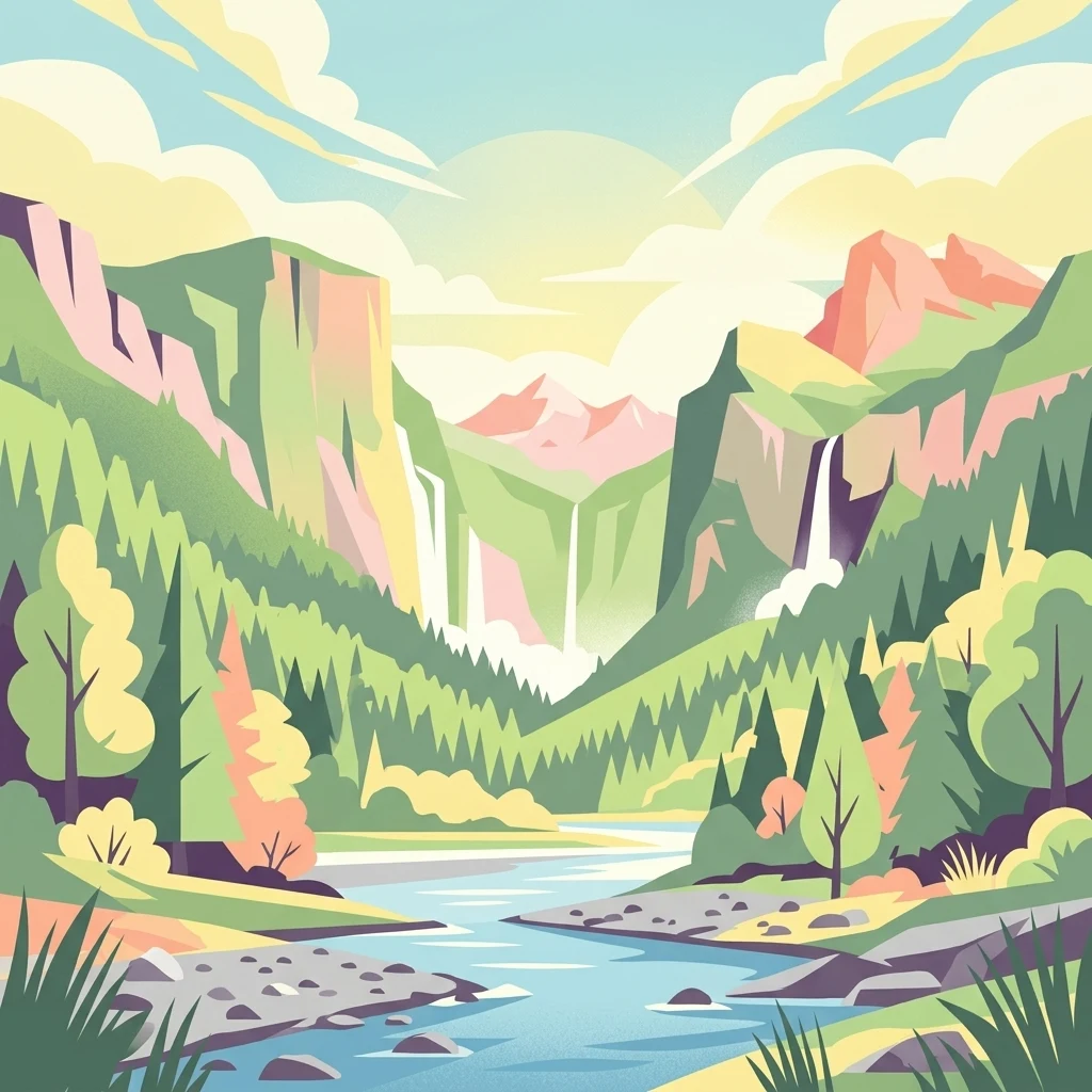
An illustration of a lush mountain valley featuring steep cliffs, cascading waterfalls, a winding river, and coniferous forests under a soft, light-filled sky.

Remutaka Forest Park

Protected landscape

Park overview

Structured park overview, official facts, and landscape profile for Remutaka Forest Park

Remutaka Forest Park park facts, protected area profile, and essential visitor context

Review the core facts for Remutaka Forest Park, including designation, size, terrain, visitor scale, habitats, and operating context in one park-focused overview.

About Remutaka Forest Park

Remutaka Forest Park sits in the southern North Island of New Zealand, occupying a substantial slice of the Remutaka Range that separates the Wellington and Hutt Valley region from the Wairarapa. Established in 1972 and managed by the Department of Conservation, the park spans roughly 22,000 hectares of forested ridge country, river valleys, and regenerating native bush. Despite its proximity to the urban edge of Wellington, much of the park retains a strong sense of remote hill country, supported by the low population density and rough terrain of the range.

The park's structure is defined by its valleys rather than its peaks. The Catchpool Valley, accessed south of Lower Hutt, anchors the western side of the park and contains the main visitor entrance, camping areas, and short walking tracks. To the east, the Ōrongorongo Valley forms a quieter, more remote corridor that reaches toward the Wellington south coast and is dotted with private back country huts. The northern boundary connects the park to the broader conservation landscape, meeting Pakuratahi Forest near the upper Hutt Valley and adjoining the Tararua Range, one of the major forest blocks of the lower North Island.

A defining feature of the park is the Remutaka Rail Trail, which follows an old rail corridor first opened in 1878 and decommissioned in 1955. The trail includes the historic Rimutaka Incline on the eastern side of the summit, and today the route serves as one of the most accessible multi-use recreation corridors in the region. It is heavily used by walkers and mountain bikers, with most visitors choosing to ride the gentler western approach from Upper Hutt, while cyclists and walkers can also access the incline from the Wairarapa side through Cross Creek near Featherston.

Beyond recreation, Remutaka Forest Park plays a meaningful conservation role. The Ōrongorongo Valley is one of only two known locations for a rare native fungus, and the park has become an important site for kiwi recovery in the lower North Island. A dedicated kiwi zone in the northern park, combined with volunteer-driven egg transfers and a dog exclusion zone, has allowed an originally small kiwi population to expand substantially. The combination of rail heritage, accessible bush valleys, and active ecological restoration gives the park a distinctive identity within New Zealand's protected area network.

Quick facts and research context for Remutaka Forest Park

Remutaka Forest Park covers approximately 22,000 hectares in the southern North Island of New Zealand, within the Remutaka Range between Lower Hutt and the Wairarapa. It is classified as an IUCN Category V protected landscape and has been administered by the New Zealand Department of Conservation since its establishment in 1972.

The reserve encompasses the Catchpool Valley and the Ōrongorongo Valley, and is adjacent to Pakuratahi Forest and the Tararua Range. It is a primary access point for the Remutaka Rail Trail, which follows the route of the former Rimutaka Incline railway originally opened in 1878, and supports active conservation programmes, including a successful North Island brown kiwi restoration project in the Turere catchment.

Protection and recognition

Examine the documented terrestrial protection scope and official recognition data for Remutaka Forest Park.

Remutaka Forest Park Protection Status and Conservation Recognition

Remutaka Forest Park holds a documented terrestrial protection status within its regional landscape. Structured records detail the established conservation scope and official administrative designations associated with the protected area.

Protection details

Protection scope
Terrestrial
Transboundary protection
No
Park context

Deeper park guide and search-rich context for Remutaka Forest Park

Remutaka Forest Park history, landscape, wildlife, and travel context

Explore Remutaka Forest Park through its history, landscape character, ecosystems, wildlife, conservation priorities, cultural context, and seasonal travel timing in a structured park guide built for atlas discovery and search intent.

Why Remutaka Forest Park stands out

Remutaka Forest Park is best known for its combination of accessible forested valleys close to Wellington and a strong outdoor recreation identity anchored by the Remutaka Rail Trail. The trail traces a historic railway route, including the steep Rimutaka Incline that once linked the Hutt Valley with the Wairarapa, and has become one of the park's defining features for walkers and mountain bikers. Equally important to the park's identity is its ecological restoration work, especially the rebuilding of a North Island brown kiwi population in the upper Turere catchment. The kiwi programme, which transfers eggs to incubation facilities and uses a dog exclusion zone to protect the birds, has grown from a small founding release to a thriving population. Together, the combination of rail heritage, river valley scenery, and active conservation work gives Remutaka Forest Park a distinctive place among New Zealand's hill country reserves.
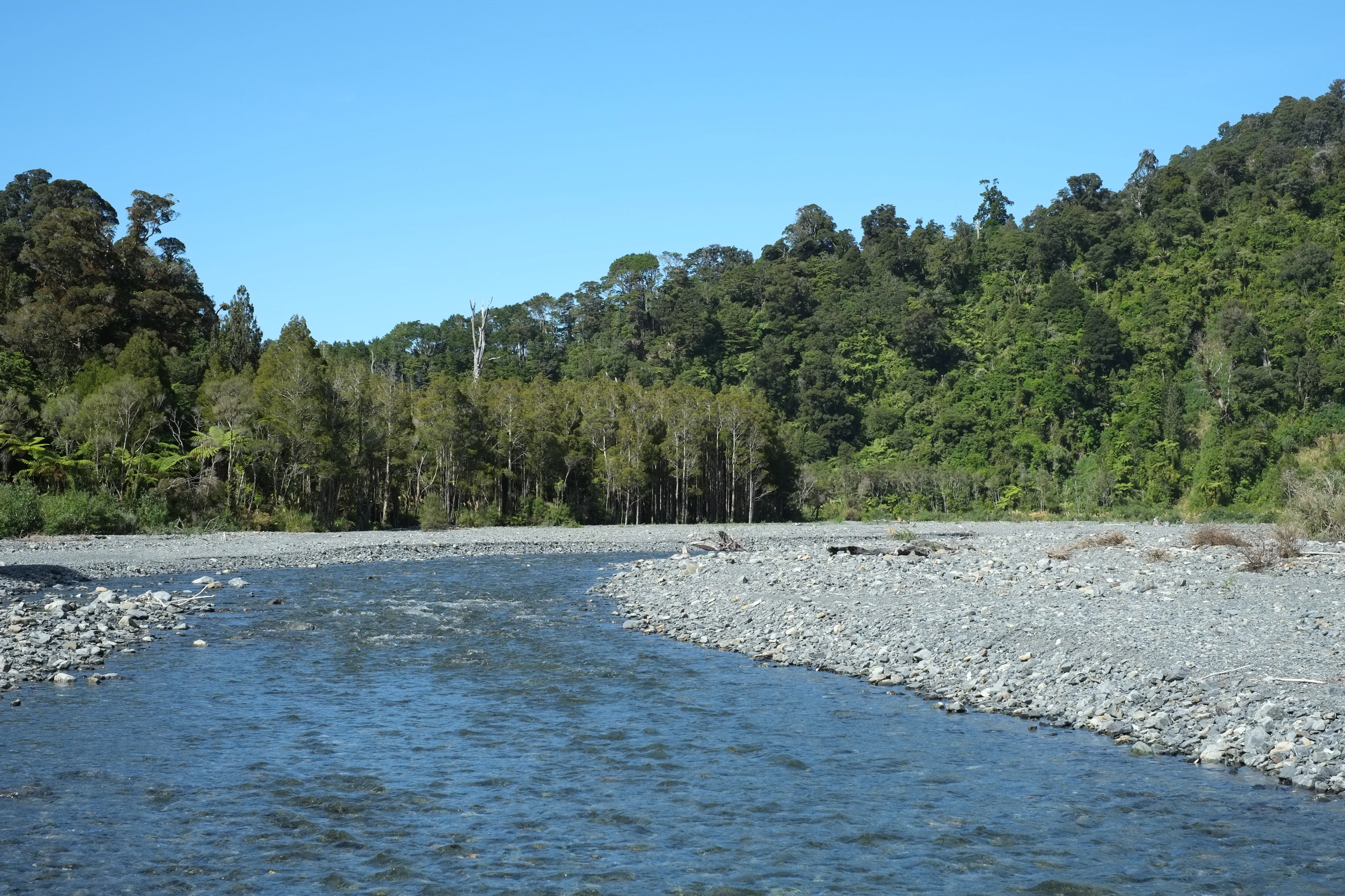
A wide, shallow river flowing over a gray, rocky riverbed, flanked by dense green native forest under a clear blue sky.
The Orongorongo River winding through the dense forest of Remutaka Forest Park.

Remutaka Forest Park history and protected-area timeline

Remutaka Forest Park was formally established in 1972 as one of the early forest parks in New Zealand, created to protect the forested hill country of the Remutaka Range between the Hutt Valley and the Wairarapa. From the beginning, the park was conceived as both a conservation reserve and a place for public recreation, reflecting a broader New Zealand approach of combining public access with landscape protection on state-owned forest land.

The park's history is strongly shaped by the railway that once crossed the range. The original rail line, opened in 1878, climbed the eastern side of the Remutaka Range using the distinctive Fell engine system on what became known as the Rimutaka Incline. The line was an important link between Wellington and the Wairarapa for nearly eighty years before being decommissioned in 1955, when a long road tunnel replaced the railway route. The corridor was later repurposed as the Remutaka Rail Trail, a walking and mountain biking route that has become a defining cultural and recreational feature of the park.

In 2017, the park's official name, together with the name of the surrounding range, was changed from Rimutaka to Remutaka as part of a treaty settlement with Rangitāne o Wairarapa and Rangitāne o Tamaki nui-ā-Rua. The change recognised the long-standing Māori name for the range, although the older spelling continues to appear in some legacy documents and online sources. The renaming marked an important step in acknowledging the indigenous heritage of the area and aligns the park's identity more closely with the original place name.

Remutaka Forest Park landscape and geographic character

The landscape of Remutaka Forest Park is dominated by the steep, bush-clad ridges of the Remutaka Range, which form a forested spine between the Hutt Valley and the Wairarapa. The terrain rises into rolling summits and falls away into deeply incised river valleys that shape both the scenery and the way visitors experience the park. The Catchpool Valley, on the western side, is one of the most visited landscape features, with a defined entrance area, short walking tracks through regenerating native bush, and access to the broader park interior.

The Ōrongorongo Valley forms the park's eastern backbone, extending toward the Wellington south coast through a quieter, more remote landscape. Its river corridor cuts a wide green path through the surrounding range, creating a sheltered environment of mixed broadleaf forest that gives the valley a distinctly different character from the higher ridges. The valley supports a network of private huts and back country access routes, in contrast to the more developed facilities found at Catchpool.

Above the valleys, the park's upland areas carry the legacy of past land use, with regenerating forest giving way to open scrub and patches of older growth. The combination of regenerating bush, river flats, steep ridges, and remote back country makes the park a varied environment, even though its overall elevation range remains moderate. The presence of deep track networks and old rail alignments, including the visible bench of the former Rimutaka Incline, adds a distinctive human-made layer to an otherwise natural landscape.

Remutaka Forest Park ecosystems, habitats, and plant life

Remutaka Forest Park protects a substantial block of hill country native forest in one of the most accessible parts of the North Island, making it ecologically important far beyond its size. The park's vegetation reflects a history of disturbance and recovery, with a mix of regenerating native broadleaf forest, patches of older podocarp and beech remnants, and areas of scrub where the forest is still re-establishing. The Catchpool Valley and the Ōrongorongo Valley together support rich understorey communities typical of warm temperate hill forest in the lower North Island.

The Ōrongorongo Valley in particular is recognised for hosting a population of a rare native fungus, Boletopsis nothofagi, an endangered species known from only a small number of locations in New Zealand. This specialisation gives the park a conservation significance that extends beyond its bird and plant communities, underlining the value of protecting intact valley systems as reservoirs for less visible biodiversity. The combination of forest continuity, moisture, and varied elevation supports complex fungal, plant, and invertebrate communities that are typical of healthy southern North Island hill forest.

Ecologically, the park also serves as a key connector within the wider Wellington conservation network. It borders Pakuratahi Forest and lies adjacent to the Tararua Range, two of the largest forest blocks in the lower North Island. Together, these areas form a broad mosaic of protected habitats that allow native species to move, disperse, and maintain viable populations across a significant regional landscape.

Remutaka Forest Park wildlife and species highlights

The wildlife profile of Remutaka Forest Park is anchored by its role as a refuge for native birdlife, most notably the North Island brown kiwi. A dedicated kiwi zone in the northern part of the park, around the Turere catchment, has become one of the park's defining conservation stories. A small founding population was established, and over time the programme has expanded the resident population substantially, growing from a handful of released birds to well over a hundred individuals based on acoustic monitoring. The success of the programme depends on active management, including volunteer transfers of kiwi eggs to specialist wildlife centres for incubation and early rearing.

Protection of the kiwi population is reinforced by a dog exclusion zone across the catchment, with defined areas where dogs are permitted only under tight conditions. This management approach reflects the broader recognition that dogs are one of the most serious threats to kiwi survival, and that habituated hill forest populations require deliberate protection to remain viable.

Beyond kiwi, the park's mature and regenerating native forest supports the wider bird community typical of Wellington hill country, including forest-dwelling species that benefit from the continuous canopy and remote interior valleys. The combination of restored kiwi populations, intact forest habitat, and active predator control gives Remutaka Forest Park an important role in maintaining native biodiversity at the edge of one of New Zealand's largest urban regions.

Remutaka Forest Park conservation status and protection priorities

Remutaka Forest Park represents an important piece of a wider conservation strategy for the lower North Island, where smaller hill ranges are increasingly fragmented by urban and rural land use. Although it is not classified as a strict nature reserve, its combined recreational and conservation purpose, aligned with its IUCN Category V status, allows it to balance biodiversity protection with public access, supporting native species recovery alongside community use. The park forms a critical ecological link between Pakuratahi Forest and the Tararua Range, helping to maintain habitat connectivity in a region where forest cover is otherwise patchy.

The park's conservation profile is strongly shaped by its rare species heritage. The Ōrongorongo Valley supports one of only two known populations of the endangered fungus Boletopsis nothofagi, highlighting the importance of protecting intact valley forest systems as reservoirs for less visible biodiversity. The kiwi recovery programme in the Turere catchment adds a high-profile conservation success story, demonstrating how carefully managed predator control, dog exclusion zones, and community-led egg transfer schemes can rebuild populations of New Zealand's most recognised native birds in a relatively short period.

At a broader level, the park's close proximity to Wellington gives it a particular conservation significance: it provides a large, accessible block of native habitat within easy reach of a major urban population, serving as both a refuge for wildlife and a place where the surrounding community can engage directly with restoration and protection work. This dual role, as a regional biodiversity resource and a lived-in conservation area, helps define the park's modern conservation value.

Remutaka Forest Park cultural meaning and human context

Remutaka Forest Park carries a layered cultural identity that reflects both the indigenous heritage of the Remutaka Range and the modern New Zealand story of forest recreation. The 2017 renaming of the park and the surrounding range, from Rimutaka to Remutaka, was carried out under a treaty settlement with Rangitāne o Wairarapa and Rangitāne o Tamaki nui-ā-Rua, formally restoring the original Māori place name and recognising the long-standing relationship between iwi and the land. This change is a meaningful marker of the park's place within New Zealand's broader process of honouring indigenous place names and acknowledging Māori cultural heritage in public landscapes.

The park also has a strong heritage of European settlement-era engineering and transport history. The original rail line across the range, opened in 1878, was a major feat of nineteenth-century engineering that connected Wellington to the Wairarapa via the steep Rimutaka Incline. Its decommissioning in 1955 and later transformation into the Remutaka Rail Trail reflects an evolving New Zealand attitude toward industrial heritage, in which old infrastructure is reinterpreted as a community recreational asset.

Today, the park sits at the cultural crossroads of regional identity: an outdoor destination deeply embedded in the daily life of Wellington and the Wairarapa, used by walkers, cyclists, hunters, and volunteer conservation groups. The combination of indigenous place-name recognition, transport heritage, and community-driven stewardship gives Remutaka Forest Park a rich and ongoing cultural character.

Top sights and standout views in Remutaka Forest Park

Among the strongest features of Remutaka Forest Park is the Remutaka Rail Trail, a converted nineteenth-century rail route that now serves as one of the lower North Island's most recognisable multi-use walking and cycling corridors, including the historic Rimutaka Incline on the Wairarapa side. Equally distinctive is the park's ecological restoration record, particularly the rebuilding of a thriving North Island brown kiwi population in the northern Turere catchment through a long-running egg transfer and predator-managed programme.

The park also offers contrasting valley experiences: the more accessible, family-friendly setting of the Catchpool Valley with its short walks and camping areas, and the quieter, more remote Ōrongorongo Valley, famous among back country users for its private hut network and as one of only two known homes of the rare native fungus Boletopsis nothofagi. Together, these features make the park stand out as a layered landscape of rail heritage, regenerating native bush, and active conservation work, all within easy reach of Wellington.

Best time to visit Remutaka Forest Park

Remutaka Forest Park can be visited year round, but the experience varies considerably with the seasons. Summer and early autumn generally offer the most comfortable conditions for walking and mountain biking, with warmer temperatures, longer daylight hours, and generally more settled weather across the Hutt Valley and Wairarapa sides. The rail trail is most enjoyable in these months, when the gradient is drier and the surrounding forest is at its greenest.

Spring brings fresh growth, flowering native understorey plants, and active birdlife, including increased kiwi calls at night, which can enhance wildlife-aware visitors' experience. Winter can be cooler, wetter, and shorter on daylight, but it also brings quieter conditions, sharper visibility on clear days, and a more solitary feel to the back country valleys. For those interested in multi-day tramps and hunting, shoulder seasons often offer a good balance of stable weather and fewer visitors, while summer weekends remain the busiest period on the rail trail and at Catchpool.
Monthly climate preview

Long-term representative temperature ranges and monthly precipitation patterns

Remutaka Forest Park Climate Normals and Annual Weather Rhythm Overview

Remutaka Forest Park records measured monthly temperature values alongside consistent precipitation averages across the representative coordinate dataset. Examining the complete twelve-month climate profile reveals broader long-term trends for this Wellington Region protected landscape.
Annual mean13 °C
10 °C17 °C
Jan17°
Feb17°
Mar16°
Apr14°
May12°
Jun11°
Jul10°
Aug10°
Sep11°
Oct12°
Nov13°
Dec15°
Warmest month
February

17 °C

Coolest month
July

9.7 °C

Wettest month
June

3.1 mm/day

Driest month
January

1.8 mm/day

Park location guide

Geography guide, regional context, and park location map for Remutaka Forest Park

Remutaka Forest Park park geography, regions, and map view in New Zealand

Understand where Remutaka Forest Park sits in New Zealand through a broader geographic reading of the surrounding landscape, nearby location context, and its mapped position within the national park landscape.

How Remutaka Forest Park fits into New Zealand

New Zealand is an island nation in the southwestern Pacific Ocean comprising two main islands and numerous smaller islands. Located east of Australia across the Tasman Sea, it features varied topography with the Southern Alps running along the South Island and volcanic terrain on the North Island. The country was settled by Maori people between 1280 and 1350, followed by European exploration beginning in 1642, and became a Dominion in 1907 before gaining full independence in 1947.

Wider geography shaping Remutaka Forest Park in New Zealand

New Zealand lies in the southwestern Pacific Ocean, east of Australia across the Tasman Sea. The country consists of two main islands, the North Island and South Island, plus over 600 smaller islands. The North Island features volcanic plateaus and hills while the South Island is dominated by the Southern Alps mountain range. The country has a long coastline and is surrounded by the Pacific Ocean.

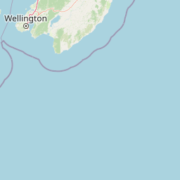
Map view of Remutaka Forest Park

Use this park location map to pinpoint Remutaka Forest Park in New Zealand, understand its exact geographic position, and read its mapped placement within the surrounding landscape more clearly.

Pigeon | © OpenStreetMap contributors

Location context for Remutaka Forest Park

Wellington Region

Visual reference of forested ridges, river valleys, and protected terrain

Remutaka Forest Park Photos and Landscape Scenery

Visual documentation of Remutaka Forest Park reveals the steep bush-clad ridgelines and incised river valleys defining the lower North Island reserve. Photographic records of the protected landscape highlight regenerating native bush, historic rail corridors, and remote conservation catchments.

A wide, shallow river flowing over a gray, rocky riverbed, flanked by dense green native forest under a clear blue sky.

A wide view of a densely forested valley under a clear blue sky, showing rolling hills covered in thick green vegetation.

Park atlas

Compare regional hill country reserves and connected conservation lands across the lower North Island

Explore Parks Near Remutaka Forest Park and Surrounding Protected Landscapes

Visitors exploring Remutaka Forest Park can continue browsing adjacent hill country reserves and connected conservation lands throughout the surrounding regional network. Expanding the search helps compare neighbouring forest habitats, river valleys, and protected terrain across the lower North Island.
Regional parkWellington Region
About 9.1 km away#1 closest

North

Wainuiomata Regional Park: Geography and Protected Area Atlas

River valley terrain in the Wellington Region

Wainuiomata Regional Park is a protected river valley setting featuring significant lowland native forest, historic water infrastructure, and restored wetland habitats. This landscape provides a critical link in the conservation geography of the Wellington Region, connecting to extensive forest remnants and supporting a variety of native ecosystems within the Wainuiomata catchment.

Relief
Mixed relief
Water
Major water bodies
Wildlife reserveWellington Region
About 11 km away#2 closest

North

Wainuiomata Water Collection Area: Protected Forest Terrain and Wellington Catchment Geography

Mapping the native forest canopy and river catchments of New Zealand.

The Wainuiomata Water Collection Area remains a vital conservation landscape, preserving deep river valleys and mature podocarp-broadleaf forest within the Wellington Region. This wildlife reserve functions as a major ecological hub, featuring continuous native bush that supports intensive predator control and species recovery efforts. Its geographic integrity provides a unique perspective on protected catchment management and pristine lowland wilderness in the southern North Island.

Water
Major water bodies
Nature reserveWellington
About 23 km away#3 closest

West

Te Kopahou Reserve: Nature Reserve Geography and Coastal Landscapes in Wellington

A rugged intersection of forested hills, ridgelines, and coastal cliffs.

Situated on the southern edge of Wellington, Te Kopahou Reserve offers a diverse protected landscape ranging from the summit of Hawkins Hill to the iconic red rocks of the Cook Strait shoreline. This nature reserve provides a critical geographic transition, hosting regenerating native bush, exposed ridgeline trails, and vital habitats for local wildlife, making it a prominent example of regional conservation land on the North Island of New Zealand.

Area
6 km²
Relief
Mountain
Climate
Temperate
Access
Easy access
Protected landscapeWellington Region
About 30 km away#4 closest

Northwest

Whitireia Park: Coastal Headland and Protected Landscape in the Wellington Region

Explore mapping of coastal terrain, forests, and harbour boundaries.

Whitireia Park is a prominent coastal reserve in the Wellington Region that balances deep Ngāti Toa cultural significance with a unique geological history shaped by centuries of earthquake uplift. The headland features open grasslands, remnant kohekohe forest, and ongoing wetland restoration that offers a layered view of New Zealand's natural and social history across its accessible harbour-edge geography.

Area
1.8 km²
Established
1976
Relief
Upland
Climate
Temperate
A horizontal watercolor painting showing a calm river winding through green banks with coniferous trees in the background, set against a soft, light-filled sky.
Nature reserveWellington Region
About 41 km away#5 closest

North

Hutt Water Collection Area: Protected Mountain Nature Reserve in the Wellington Region

Forested catchment geography and mountain wilderness

The Hutt Water Collection Area covers 8,900 hectares of steep ridge and valley terrain in the southern Tararua Range. This nature reserve serves as a essential water catchment for the Wellington Region, protecting a diverse environment of native forest, alpine tussock, and sub-alpine bogs. Explore the mapped geography of this critical protected landscape and its role as a sanctuary for rare plant species and native birds.

Area
89 km²
Established
1951
Relief
Mountain
Climate
Temperate
A soft watercolor painting of a rolling green landscape with distant hills and foreground vegetation on a plain white background.
Nature reserveWairarapa
About 59 km away#6 closest

Northeast

Fensham Reserve: Protected Lowland Forest Geography and Conservation Mapping in Wairarapa

An essential lowland sanctuary for ancient podocarp and swamp forest ecosystems

Fensham Reserve preserves 48 hectares of significant native forest in the southern North Island of New Zealand. This nature reserve provides essential landscape context for rare kahikatea and pukatea associations, while serving as a crucial wetland refuge for endangered species like the brown mudfish. The area remains a key reference point for understanding regional forest restoration and the protection of long-standing ecological fragments.

Area
0.48 km²
Established
1957
Relief
Lowland
Climate
Temperate
Marine protected areaMarlborough Region
About 64 km away#7 closest

Northwest

Long Island-Kokomohua Marine Reserve: Mapped Geography and Protected Reef Systems

Explore marine boundaries in the Marlborough Region

Located at the entrance to Queen Charlotte Sound, Long Island-Kokomohua Marine Reserve encompasses significant island and submerged reef features. This protected area serves as an essential site for understanding coastal ecosystem restoration, featuring varied terrain from shallow near-shore reefs to deeper rocky pinnacles that support diverse marine populations.

Area
6.19 km²
Established
1993
Relief
Lowland
Climate
Temperate
Protected landscapeNew Zealand
About 67 km away#8 closest

Northeast

Tararua Forest Park: Protected Landscape Geography and Mapped Natural Terrain

Defining the rugged mountain spine of New Zealand's southern North Island

Covering the core of the Tararua Range, this protected landscape represents a vital ecological corridor in New Zealand. The terrain offers a diverse gradient of native forests, steep river valleys, and windswept alpine ridges. It serves as a primary example of forest conservation and complex mountain geography within the island nation's larger network of protected lands.

Area
1,149.93 km²
Established
1954
Relief
Mountain
Climate
Temperate

Common questions about visiting, size, designation, and location context for Remutaka Forest Park

Remutaka Forest Park FAQs for park facts, access, geography, and protected area context

Find quick answers about Remutaka Forest Park, including protected-area facts, park geography, trail and visitor context, and how the park fits into its surrounding country and regional landscape.
MoriAtlas Explorer

Continue Your Protected Areas Search Across the Global Atlas

Deepen your exploration by continuing the structured search for national parks and protected areas worldwide. Utilize the comprehensive filtering capabilities to compare different conservation landscapes and refine your understanding of global park geography. Discover more about the distribution and characteristics of protected natural areas.

Global natural geography