Mori Atlas logo
Nature reserveReserva Ecológica Mache-Chindul

Mapping the ecological mosaic of Chocó rainforest and humid coastal mountain terrain

Reserva Ecológica Mache-Chindul: A Protected Coastal Forest Sanctuary in Esmeraldas, Ecuador

Reserva Ecológica Mache-Chindul represents a critical protected expanse within the Cordillera de la Costa of northwestern Ecuador. This vast nature reserve preserves an essential transition between lowland Chocó rainforests and elevated cloud forests sustained by persistent marine fog. Explore the mapped topography and ecological significance of this coastal mountain range, which serves as a vital refuge for rare large mammals and diverse avian species.

tropical forestChocó biomecloud forestlowland rainforestcoastal mountainswetland

Reserva Ecológica Mache-Chindul

Nature reserve

Park overview

Structured park overview, official facts, and landscape profile for Reserva Ecológica Mache-Chindul

Reserva Ecológica Mache-Chindul park facts, protected area profile, and essential visitor context

Review the core facts for Reserva Ecológica Mache-Chindul, including designation, size, terrain, visitor scale, habitats, and operating context in one park-focused overview.

About Reserva Ecológica Mache-Chindul

Reserva Ecológica Mache-Chindul is one of Ecuador's most important coastal protected areas, safeguarding a substantial block of lowland and premontane tropical forest on the country's northwestern Pacific slope. Located in the mountains of the same name, which represent the northern extension of the Cordillera de la Costa, the reserve lies just a short distance inland from the Pacific shoreline and extends across the Esmeraldas and Manabí provincial boundary.

The reserve was created in 1996 to protect some of the last remaining mature very humid tropical forests of the Ecuadorian coast, a habitat class that has been drastically reduced by logging, agriculture, and cattle ranching. Today the protected landscape is encircled by agricultural land, particularly sugarcane fields and pastures, making Mache-Chindul function as a critical ecological island of intact forest surrounded by human-modified terrain.

Ecologically, the reserve straddles an unusual transition between lowland Chocó rainforest, which extends along the lower slopes and foothills, and a higher-elevation zone where persistent marine fog creates conditions similar to Andean cloud forest. This elevational and climatic gradient, combined with the reserve's position within the broader Chocó biogeographic region, produces exceptionally high biodiversity. Studies within the Bilsa Biological Station alone have documented over 1,100 vascular plant species and more than 250 bird species.

The reserve's significance extends beyond its biodiversity. The Laguna de Cube, a 113-hectare wetland inside its boundaries, has been recognized internationally as a Ramsar site for its ecological value. Through the combination of state protection and private conservation initiatives such as Jatun Sacha's Bilsa Biological Station, Mache-Chindul plays a major role in regional conservation strategies focused on the Pacific Chocó, one of the world's most threatened biodiversity hotspots.

Quick facts and research context for Reserva Ecológica Mache-Chindul

The reserve was established by Ecuadorian government resolution on August 9, 1996, and is administered by the Ministry of the Environment. It is classified as a UICN Category Ia strict natural reserve and designated as an ecological reserve at the national level. The protected area encompasses over 119,000 hectares across the cantons of Quinindé, Muisne, and Pedernales, occupying part of Esmeraldas province and northern Manabí.

Within its boundaries lies the Laguna de Cube (113 hectares), recognized by UNESCO as a Ramsar wetland site in 2002. The reserve also contains the Bilsa Biological Station, a privately managed conservation area of roughly 3,000 hectares operated by the Jatun Sacha Foundation since 1994. The reserve sits within the Chocó biogeographic region, one of the most biodiverse hotspots on Earth.

Protection and recognition

Documented terrestrial conservation scope and official establishment records

Reserva Ecológica Mache-Chindul Protection Status and Designation History

Reserva Ecológica Mache-Chindul maintains a documented terrestrial protection scope established under formal designation history records from 2002. Structured conservation facts outline the official management framework and international recognition status associated with this protected landscape.

Protection details

Protection scope
Terrestrial
Designated year
2002
Transboundary protection
No
Park context

Deeper park guide and search-rich context for Reserva Ecológica Mache-Chindul

Reserva Ecológica Mache-Chindul history, landscape, wildlife, and travel context

Explore Reserva Ecológica Mache-Chindul through its history, landscape character, ecosystems, wildlife, conservation priorities, cultural context, and seasonal travel timing in a structured park guide built for atlas discovery and search intent.

Why Reserva Ecológica Mache-Chindul stands out

Mache-Chindul is best known for protecting a large, contiguous block of mature very humid tropical forest along Ecuador's northwestern coast, an ecosystem that has been heavily reduced elsewhere in the country. Its forests are exceptional because they combine Chocó lowland rainforest characteristics in the lower elevations with cloud forest conditions higher in the coastal range, where marine fog sustains humidity. This unusual ecological mosaic supports both Chocó endemics and species otherwise associated with Andean cloud forests far to the east. The reserve is also notable for sustaining rare large mammals such as the jaguar, giant anteater, and mantled howler monkey, along with a rich avifauna that includes globally threatened species like the scaly ground cuckoo and the long-wattled umbrella bird.
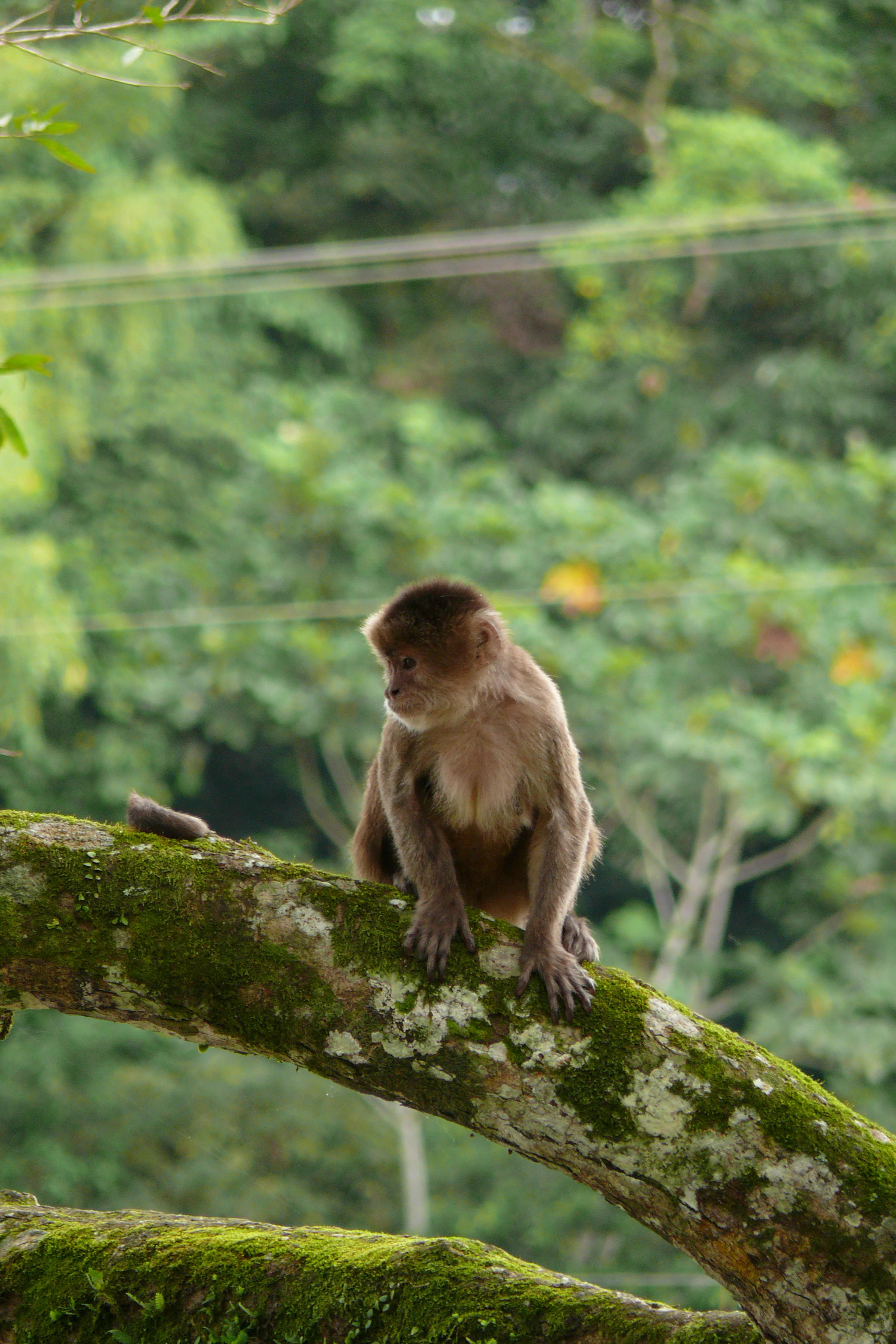
A brown white-fronted capuchin monkey sits on a thick moss-covered tree branch in a forest setting.
A white-fronted capuchin perched on a mossy branch within the reserve.

Reserva Ecológica Mache-Chindul history and protected-area timeline

The Reserva Ecológica Mache-Chindul was formally established as a state reserve on August 9, 1996, through Resolution No. 045, published in the country's official registry on September 19 of the same year. The reserve was created to protect the increasingly threatened coastal humid forests of northwestern Ecuador and was assigned the legal category of ecological reserve, one of the strictest protection categories in the Ecuadorian system.

The conservation story of the area predates the reserve itself. In 1994, the Fundación Jatun Sacha, an Ecuadorian conservation organization, had already established the privately run Bilsa Biological Station to protect approximately 3,000 hectares of mature forest in what would later become the heart of the reserve. This precedent of private conservation demonstrated the biological importance of the area and contributed to the political case for full state protection two years later.

In 2002, the international community recognized another part of the reserve's natural value when Laguna de Cube, a 113-hectare wetland within the reserve, was designated as a Ramsar site of international importance. Together these milestones have built a layered conservation history combining national legal protection, private scientific stewardship, and international wetland recognition.

Reserva Ecológica Mache-Chindul landscape and geographic character

The landscape of Mache-Chindul is defined by the mountains of the same name, which represent the northern extension of Ecuador's Cordillera de la Costa. The terrain rises from lowland areas near the Pacific coast to higher elevations within the coastal range, creating a transition from coastal plains and foothills into steep forested ridges. The reserve lies close to the shoreline, with the upper basin of the Bilsa River forming a central drainage feature just a few kilometers east of the small settlement of San José de Bilsa.

In the lower parts of the reserve and along the foothills, the vegetation resembles the classic humid tropical forest of the broader Chocó biome, with tall trees, dense undergrowth, and consistently high humidity. As elevation increases within the cordillera, the climate becomes even more humid, and persistent marine fog cloaks the upper forests, giving them the character of a low-elevation cloud forest. This fog layer creates an atmospheric landscape where silhouettes of trees fade into mist for much of the day.

Outside the reserve boundaries, the surrounding landscape is dominated by agriculture, particularly sugarcane cultivation and cattle pastures along the lowlands. These human-modified areas form a sharp contrast with the dense, tall-canopy forest preserved inside Mache-Chindul, highlighting the reserve's role as a forest refuge within an otherwise heavily altered coastal landscape.

Reserva Ecológica Mache-Chindul ecosystems, habitats, and plant life

The reserve protects one of the last extensive blocks of mature very humid tropical forest remaining on Ecuador's coast, alongside smaller areas of secondary forest and recovering vegetation. Its position within the Chocó biogeographic region gives it access to plant lineages typical of this globally important biodiversity hotspot, while its elevational gradient introduces cloud-forest conditions rarely found so close to the Pacific shoreline.

Floristic studies at the Bilsa Biological Station have cataloged more than 1,100 species of vascular plants, including both Chocó endemics and some species that have been described scientifically only recently. One distinctive structural feature of these forests is the scarcity of wind-dispersed trees and the dominance of hemiepiphyte climbers relative to more typical lianas. Common canopy species include Virola dixonii, Quararibea soegenii, Coussapoa eggersi, and Symphonia globulifera, reflecting the area's affinity with broadleaf tropical forests of the western Amazon and Chocó.

Although already reduced by the 1990s, some of the reserve's forests still contained large commercially valuable trees at the time of early surveys. Deforestation pressures have remained a constant threat in surrounding areas, making the mature forest within the reserve an increasingly important refuge for moisture-loving tree species, epiphytes, and the structural complexity that supports forest wildlife.

Reserva Ecológica Mache-Chindul wildlife and species highlights

The fauna of Mache-Chindul reflects the reserve's location within the Chocó and its role as a refuge for species that have become rare elsewhere on Ecuador's coast. Surveys at Cabeceras de Bilsa and the Bilsa Biological Station have documented a rich assemblage of mammals, including fruit bats typical of pristine forest such as the small fruit bat (Rhinophylla alethina), the hairy-faced bat (Mimon crenulatum), the naked-tailed armadillo (Cabassous centralis), and the brown-throated three-toed sloth (Bradypus variegatus).

Among larger mammals, the reserve holds significant populations of species that have become scarce in western Ecuador. The jaguar (Panthera onca), the giant anteater (Myrmecophaga tridactyla), the white-fronted capuchin (Cebus albifrons), and especially the mantled howler monkey (Alouatta palliata) all remain present within the reserve. The herpetofauna is similarly rich, with 17 anuran species and 21 reptile species recorded at Bilsa, including five Anolis species, two Tantilla snake species, ten Eleutherodactylus frogs, the black narrow-mouthed frog (Ctenophryne aterrima), and the poison frog Ameerega erythromos.

Bird diversity in the reserve is exceptionally high. More than 170 species were recorded in the 1991 surveys at Cabeceras de Bilsa, and more than 250 species have been documented at the broader Bilsa Biological Station, with additional unexplored areas likely holding further records. The reserve supports globally threatened and Chocó-endemic birds such as the scaly ground cuckoo (Neomorphus radiolosus) and the long-wattled umbrella bird (Cephalopterus penduliger). It also hosts Tumbesian endemics like the grey-backed hawk (Leucopternis occidentalis) and isolated populations of species typically associated with the Andes further east.

Reserva Ecológica Mache-Chindul conservation status and protection priorities

Reserva Ecológica Mache-Chindul is recognized as an IUCN Category Ia protected area, the strictest reserve classification, meaning it is managed primarily for scientific research, ecosystem preservation, and biodiversity protection, with minimal human interference. Its conservation importance lies partly in the simple fact that it preserves one of the few remaining large blocks of mature very humid tropical forest along the entire Ecuadorian coast, a habitat that has been severely fragmented outside protected boundaries.

The reserve also carries international wetland recognition through the Laguna de Cube Ramsar site, designated in 2002, and benefits from supplementary protection and research through the Bilsa Biological Station operated by the Jatun Sacha Foundation. Together these formal and private conservation frameworks have supported long-term scientific inventories of plants, bats, birds, amphibians, and reptiles, generating some of the best baseline biodiversity data for the country's northwestern coast.

Conservation challenges remain significant. The reserve is surrounded by expanding agricultural land, particularly sugarcane cultivation and cattle pastures, and access to the area is extremely difficult, with conditions worsening during the rainy season from January to June. These pressures place the reserve at the frontline of efforts to conserve the Chocó biome in Ecuador, one of the world's most threatened hotspots of biodiversity.

Top sights and standout views in Reserva Ecológica Mache-Chindul

The reserve's most distinctive quality is its preservation of an unusually large and ecologically varied block of coastal humid forest in a country where such forests have been heavily reduced. The combination of Chocó lowland rainforest in the foothills and cloud forest conditions higher in the coastal range, sustained by persistent marine fog, gives Mache-Chindul an ecological profile that is rare on the Pacific coast of South America.

Equally notable is the reserve's capacity to support emblematic and threatened wildlife: jaguars, giant anteaters, mantled howler monkeys, and more than 250 bird species, including Chocó endemics and Andean-affiliated species far from their typical range. The combination of strict national protection, the Bilsa Biological Station's private conservation work, and the Laguna de Cube Ramsar designation creates a layered conservation significance that extends well beyond Ecuador's borders.

Best time to visit Reserva Ecológica Mache-Chindul

Access to the reserve is heavily influenced by rainfall, with the rainy season between January and June sometimes making entrance difficult or impossible due to poor road and trail conditions. The drier months outside this period generally offer more reliable access, though conditions in such a wet environment never become truly dry, and visitors should be prepared for persistent humidity and the possibility of fog in higher elevations throughout the year.

For visitors interested in birdwatching, herpetology, or botanical exploration, the most favorable periods are those with less intense rainfall, when trails remain passable and forest observations are easier to make. Wildlife presence does not shift dramatically by season, but cooler and slightly drier months tend to improve conditions for longer field days and more comfortable exploration of this ecologically rich but logistically challenging landscape.
Monthly climate preview

Long-term temperature and precipitation records measured at a representative coordinate

Reserva Ecológica Mache-Chindul Climate Normals and Monthly Weather Statistics

Representative coordinates record consistent mean monthly temperatures alongside varying daily precipitation rates across the annual cycle at Reserva Ecológica Mache-Chindul. Examining the complete twelve-month climate normals provides deeper insight into measured temperature ranges and precipitation patterns.
Annual mean25 °C
25 °C26 °C
Jan25°
Feb25°
Mar26°
Apr25°
May25°
Jun25°
Jul25°
Aug25°
Sep25°
Oct25°
Nov25°
Dec25°
Warmest month
March

25.5 °C

Coolest month
July

24.6 °C

Wettest month
February

7.8 mm/day

Driest month
August

0.7 mm/day

Park location guide

Geography guide, regional context, and park location map for Reserva Ecológica Mache-Chindul

Reserva Ecológica Mache-Chindul park geography, regions, and map view in Ecuador

Understand where Reserva Ecológica Mache-Chindul sits in Ecuador through a broader geographic reading of the surrounding landscape, nearby location context, and its mapped position within the national park landscape.

How Reserva Ecológica Mache-Chindul fits into Ecuador

Ecuador is a presidential republic located in northwestern South America, with Quito as its capital and Guayaquil as its largest city. The country spans 283,561 km² and encompasses the Galápagos Islands, a volcanic archipelago famous for unique wildlife that helped shape Darwin's theory of evolution. Ecuador is a plurinational state with Spanish as the official language, though Kichwa and Shuar are recognized for indigenous peoples.

Wider geography shaping Reserva Ecológica Mache-Chindul in Ecuador

Ecuador is located in northwestern South America along the Pacific coast. It shares borders with Colombia to the north and Peru to the east and south. The country includes the Galápagos Islands, a volcanic archipelago in the Pacific Ocean approximately 1,000 km west of the mainland. The territory encompasses diverse terrain including the Amazon rainforest in the east, the Andean highlands in the center, and coastal plains along the Pacific.

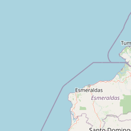
Map view of Reserva Ecológica Mache-Chindul

Use this park location map to pinpoint Reserva Ecológica Mache-Chindul in Ecuador, understand its exact geographic position, and read its mapped placement within the surrounding landscape more clearly.

Pigeon | © OpenStreetMap contributors

Location context for Reserva Ecológica Mache-Chindul

EsmeraldasManabí
Recorded earthquake history

Review the Recorded Earthquake History for Reserva Ecológica Mache-Chindul

Examine the historical catalogue of seismic activity associated with the location of Reserva Ecológica Mache-Chindul. This MoriAtlas collection tracks recorded events, providing accessible data on magnitudes and epicentre proximity for researchers and those interested in the seismic history of these coastal mountains.

Reserva Ecológica Mache-Chindul Earthquake History

Catalogued events

161 events

Strongest magnitude

Magnitude 7.8

Most recent event

Jun 16, 2026

This history includes earthquakes recorded inside the park or within 50 km of its borders

Visual reference for coastal mountain terrain, Chocó rainforest habitats, and misty cloud forest environments.

Reserva Ecológica Mache-Chindul Photos and Landscape Scenery

Visual documentation captures the rugged coastal mountain terrain, tall-canopy Chocó rainforests, and persistent marine fog layers that define the reserve. Examining these protected habitats provides clearer insight into the ecological characteristics of the Ecuadorian coastal range.

A brown white-fronted capuchin monkey sits on a thick moss-covered tree branch in a forest setting.

Park atlas

Compare regional park geography and connected protected landscapes along the Ecuadorian coast.

Explore Parks Near Reserva Ecológica Mache-Chindul and Surrounding Protected Areas

Browse other parks and protected areas near Reserva Ecológica Mache-Chindul to analyze regional terrain transitions, coastal mountain forests, and wildlife habitats. Comparing adjacent conservation zones reveals broader ecological patterns across the northwestern cordillera.
Wildlife reserveEsmeraldas
About 29 km away#1 closest

West

Refugio de Vida Silvestre Manglares Estuario Río Muisne Coastal Wildlife Reserve

Esmeraldas, Ecuador protected estuarine landscape

Discover the complex geography of Refugio de Vida Silvestre Manglares Estuario Río Muisne, a vital wildlife refuge protecting all six native mangrove species. This area spans a rich transition of marine and brackish waters, tidal flats, and forest stands that define the northwestern Pacific coastline of Ecuador.

Area
922.46 km²
Established
2003
Relief
Lowland
Access
Access unknown
Marine protected areaEsmeraldas
About 30 km away#2 closest

Northwest

Reserva marina Galera San Francisco: Geographic Overview of the Marine Protected Area

Coastal cliffs, marine habitats, and regional landscape context in Esmeraldas

Reserva marina Galera San Francisco offers a unique look at the integration of terrestrial and oceanic ecosystems. From the cliff-lined coast of Esmeraldas to the depths of the Pacific, this protected area features coral zones, complex estuary systems, and vital nesting grounds. Examine the spatial distribution of these marine features and the geological formations that shape this coastal boundary through our structured geographic atlas.

Area
546.886 km²
Established
2008
IUCN
VI
Relief
Mixed relief
A horizontal watercolor painting showing layers of rolling green hills, a pink-toned foreground meadow, and distant hazy mountain ridgelines against a light background.
National parkImbabura
76 km away#3 closest

East

Cotacachi Cayapas National Park: A Study of Andean and Chocó Protected Geographic Landscapes

Exploring the extreme vertical transition across the northern Ecuadorian Andes

Cotacachi Cayapas National Park stands as a vital protected area, linking high-altitude páramo around Volcán Cotacachi to the lowland forests of the Chocó. The park features the iconic Laguna de Cuicocha and a dramatic range of ecosystems that define its complex terrain. This resource offers a clear look at the park's boundaries, geological features, and the distinct ecological zones that make it a central pillar of northern Ecuadorian geography.

Area
2,609.61 km²
Established
1968
IUCN
II
Visitors
50.2K annual
Nature reserveEsmeraldas
99 km away#4 closest

Northeast

Reserva ecológica Manglares Cayapas-Mataje: Mapped Coastal Wetland and Protected Landscape

A vast estuarine and mangrove refuge in the Esmeraldas province of Ecuador.

The Reserva ecológica Manglares Cayapas-Mataje spans over 49,000 hectares of diverse coastal terrain, including tidal estuaries, guandales, and tropical lowland forests. As a Ramsar-recognized wetland, this reserve preserves critical connectivity between riverine basins and the Pacific Ocean, acting as a vital geographic anchor for Chocó endemic species and complex aquatic habitats within the Esmeraldas region.

Area
490.71 km²
Established
1995
Relief
Lowland
Climate
Tropical
A wide watercolor illustration showing a misty landscape with green trees in the midground and faint mountain peaks in the background.
Nature reserveEcuador
104 km away#5 closest

Southeast

Reserva Ecológica Los Illinizas: Geographic Atlas and Andean Protected Nature Reserve

Volcanic terrain and cloud forest ecosystems in central Ecuador

Spanning across the provinces of Cotopaxi, Pichincha, and Santo Domingo de los Tsáchilas, Reserva Ecológica Los Illinizas preserves a significant vertical gradient of Andean ecosystems. The reserve protects the western flanks of the Illiniza volcanoes, Quilotoa, and El Corazón, offering a detailed look at high-altitude biodiversity and the transition from rugged mountain peaks to lush western cloud forests.

Area
1,342.33 km²
Established
1996
IUCN
Ia
Relief
Mountain
Watercolor illustration showing a panoramic view of a wide valley with green hills, a small stream, and forested clusters, rendered in a light and airy style.
Nature reservePichincha
About 135 km away#6 closest

East

Reserva Geobotánica Pululahua: Protected Volcanic Caldera and Highland Ecosystems

A distinct geobotanical reserve in the Pichincha region of the Ecuadorian Andes.

Reserva Geobotánica Pululahua is a protected natural area centered on a massive, 12-kilometer-wide volcanic caldera. Its landscape features three prominent lava domes and a rare altitudinal gradient of vegetation, spanning from semi-dry mountain shrubland to dense cloud forest. This reserve serves as a critical study of volcanic geology and human-landscape interaction in the high Andes, offering a concentrated look at Ecuador's vertical ecological zonation.

Area
34.417 km²
Established
1966
Relief
Mountain
Climate
Subtropical
A pale, minimalist watercolor painting showing a wide, grassy field leading to distant, low mountain hills under a bright, light sky.
Wildlife reservePichincha
About 154 km away#7 closest

Southeast

Refugio de Vida Silvestre Pasochoa: Volcanic Crater and Andean Forest Protected Area

Geographic atlas of the Pichincha volcanic highlands

Located in the Pichincha province, Refugio de Vida Silvestre Pasochoa protects an essential highland habitat defined by its steep volcanic crater walls and dense bamboo stands. This area provides a scientific reference for inter-Andean vegetation, featuring a sharp contrast between forested inner slopes and surrounding agricultural landscapes. Map the ecological gradient of this protected refuge and explore its role within the broader northern Andean geographic context.

Area
9.799 km²
Established
1996
IUCN
Ib
Relief
Mountain
National parkCotopaxi Province
155 km away#8 closest

Southeast

Cotopaxi National Park: Ecuador's Mapped Protected Landscape and Regional Geography

Explore the geographic context of this national park.

Cotopaxi National Park represents a key protected landscape within Ecuador, located in Cotopaxi Province. This page facilitates detailed exploration of the park's mapped boundaries and its contribution to the regional geography. Understand the specific characteristics of this national park as part of a broader atlas of protected areas and natural terrains.

Area
333.93 km²
Established
1975
IUCN
II
Relief
Mountain

Common questions about visiting, size, designation, and location context for Reserva Ecológica Mache-Chindul

Reserva Ecológica Mache-Chindul FAQs for park facts, access, geography, and protected area context

Find quick answers about Reserva Ecológica Mache-Chindul, including protected-area facts, park geography, trail and visitor context, and how the park fits into its surrounding country and regional landscape.
MoriAtlas Explorer

Continue Your Protected Areas Search Across the Global Atlas

Deepen your exploration by continuing the structured search for national parks and protected areas worldwide. Utilize the comprehensive filtering capabilities to compare different conservation landscapes and refine your understanding of global park geography. Discover more about the distribution and characteristics of protected natural areas.

Global natural geography