
Why Manglares Churute Ecological Reserve stands out
Manglares Churute is best known for conserving one of the last extensive tracts of mangrove forest in the Gulf of Guayaquil, combined with forested coastal hills and a major freshwater lagoon system. The reserve stands out for the way it bundles together coastal mangrove ecosystems, estuarine channels, dry tropical forest, and humid fog-affected hill forests within a single protected area, creating an unusually rich habitat mosaic near Ecuador's largest city, Guayaquil. It is also recognized as a globally important site for birds, including Tumbesian endemic species, migratory shorebirds, and waterbirds such as roseate spoonbills, herons, and cormorants feeding in the shrimp-rich estuarine waters. The reserve additionally supports a notable population of mantled howler monkeys, crab-eating raccoons, two-toed sloths, and bottlenose dolphins in the mangrove channels, making it one of the most wildlife-rich protected landscapes in coastal Ecuador.
Manglares Churute Ecological Reserve history and protected-area timeline
Manglares Churute Ecological Reserve was officially created on July 26, 1979, through Interministerial Agreement No. 0322, which was published in the Official Registry on November 20, 1979. Its establishment responded to the need to protect three clearly defined areas: the Churute hills, the El Canclón lagoon, and the remaining mangrove forests of the Gulf of Guayaquil region. From its creation, the reserve was integrated into Ecuador's National System of Protected Areas and placed under the administration of the Ministry of the Environment.
Its recognition as an internationally important wetland followed relatively early in its history. The mangrove portion of the reserve became one of Ecuador's first sites inscribed under the Ramsar Convention, alongside the marine zone of Machalilla National Park, marking it as a benchmark for wetland protection in the country. Over the following decades, the reserve's legal framework was modified through additional Official Registry entries in 1988, 1992, and 2001, refining its boundaries and management provisions.
In more recent years, the reserve has benefited from collaborations involving CEDEGE, Ecuador's Ministry of the Environment, Fundación Natura, and international partners such as the Inter-American Development Bank. These collaborations supported the construction of an interpretation center, the creation of ecotourism trails, the provision of patrol equipment, the development of a red-crab study program, tourism planning, and a fire-control plan. Part of the reserve, notably Cerro Masvale, is also managed privately by the Andrade Ecological Foundation, adding a layer of mixed public and private conservation governance.
Manglares Churute Ecological Reserve landscape and geographic character
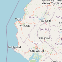
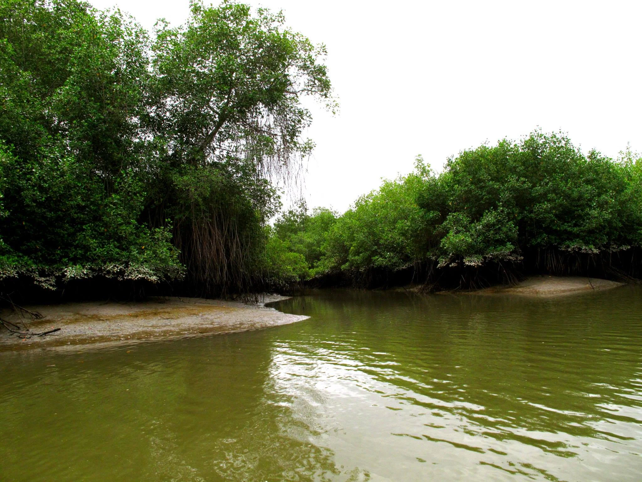
The landscape of Manglares Churute is shaped by the meeting of river and sea at the inner Gulf of Guayaquil. Rivers such as the Taura, Churute, Cañar, and Naranjal bring freshwater and sediment into a zone already influenced by marine tides, and over time these inputs have built an extensive web of tidal channels, mudflats, and mangrove islands. The mangrove portion of the reserve covers roughly 35,000 hectares, making it one of the most substantial mangrove complexes still intact in this part of Ecuador's coast.
Inland from the mangroves, the terrain rises into the Churute hill range, including the cerros of El Mate, Cimalón, Perequete Chico, Perequete Grande, Pancho Diablo, and Masvale. Cerro Masvale reaches about 1,000 meters in elevation. These higher areas are frequently wrapped in fog, supporting a humid bosque de garúa that contrasts dramatically with the drier lowlands. Between the mangroves and the hills lies the El Canclón lagoon and surrounding wetland complex, a freshwater basin that adds a third major landscape element to the reserve.
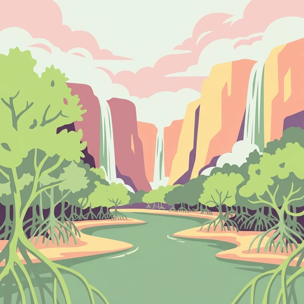
The combination produces a layered, visually striking environment: flat tidal mangroves, seasonally flooded wetlands and lagoons, dry lowland forests on lower slopes, and fog-shrouded forested summits above. The transitions between these zones, often occurring within just a few kilometers, are a defining part of the reserve's geographic identity.
Manglares Churute Ecological Reserve ecosystems, habitats, and plant life
Manglares Churute protects an unusual convergence of mangrove, dry forest, and humid forest ecosystems on Ecuador's coast. The mangrove system is the most extensive element, dominated by five species of mangrove and shaped by the daily mixing of saline and fresh water. Around the rivers and tidal channels, the vegetation forms dense root networks that shelter aquatic life and stabilize sediments, while the calmer waters support floating plants such as water lettuce, water hyacinth, and totora.
Away from the coast, the dry forests on the lower slopes host a suite of species adapted to seasonal drought, including trees from families such as Bignoniaceae, Caesalpinaceae, Fabaceae, Mimosaceae, Lauraceae, Rhizophoraceae, and Sapotaceae. Several endemic plants of the dry forest ecosystem, such as Eriotheca ruizii, Macranthisiphon longifolium, and Picramnia tumbesina (the latter found only on Cerro Masvale between 200 and 400 meters elevation), contribute to the botanical distinctiveness of the reserve.
The higher, fog-influenced slopes shift in character, becoming more humid forest ecosystems that can resemble the bosque de garúa typical of southwestern Ecuador's coastal mountains. Over 300 plant species have been documented across these varied environments, underlining how the reserve functions as an ecological bridge between marine, freshwater, dry-forest, and cloud-affected habitats within a relatively compact coastal area.
Manglares Churute Ecological Reserve wildlife and species highlights
Manglares Churute supports a rich and varied fauna thanks to its combination of mangrove, freshwater, dry forest, and humid forest habitats. Mammals recorded in the reserve number around 45 species. Mantled howler monkeys are still relatively common, alongside other characteristic Neotropical mammals such as crab-eating raccoons, Hoffmann's two-toed sloths, and robust-bodied squirrels. In the mangrove channels, bottlenose dolphins are also present, moving between the estuary's saline and freshwater zones.
The reserve is particularly important for birds, with more than 300 recorded species. It hosts a significant number of Tumbesian endemics and several globally threatened species, including the little woodstar hummingbird, the gray-backed hawk, and the ochre-bellied dove. Aquatic and migratory shorebirds rely heavily on the reserve, and it is home to the largest known population of the threatened horned screamer (Anhima cornuta) in Ecuador.
Waterbirds are especially visible along the lagoons and tidal flats, where roseate spoonbills, striated, snowy, and great blue herons, and neotropical cormorants feed in waters rich with shrimp. The reserve's higher parts even harbor some typically Andean bird species, reinforcing its role as a transition zone between coastal lowlands and montane avifaunas. The overall bird diversity and the presence of threatened and range-restricted species are key reasons the reserve is recognized internationally as an Important Bird Area and a Ramsar site.
Manglares Churute Ecological Reserve conservation status and protection priorities
Manglares Churute holds a central place in Ecuador's coastal conservation strategy. As a Ramsar site and part of Ecuador's National System of Protected Areas, it contributes to the protection of one of the country's most threatened wetland complexes and its remaining mangrove forests. The reserve's combination of estuarine mangroves, dry tropical forests, and humid hill forests gives it exceptional ecological value, since each of these habitats is individually under pressure from agriculture, shrimp farming, urban expansion, and logging elsewhere in the region.
The park is also globally significant for bird conservation. Its status as an Important Bird Area reflects the presence of Tumbesian endemics, threatened species such as the little woodstar, gray-backed hawk, ochre-bellied dove, and the Ecuadorian stronghold population of the horned screamer. Migratory shorebirds and waterbirds depend on its tidal flats and freshwater lagoons, particularly El Canclón, as stopover and wintering habitat.
Management involves a mix of public and private conservation actors. The Ministry of the Environment oversees the broader reserve, while the Andrade Ecological Foundation manages parts of Cerro Masvale privately, demonstrating a hybrid approach to habitat protection. Conservation projects supported by CEDEGE, Fundación Natura, and international funding institutions have strengthened infrastructure, ecological monitoring, ecotourism development, and fire control, reinforcing the reserve as a long-term refuge for coastal biodiversity.
Manglares Churute Ecological Reserve cultural meaning and human context
The Churute area has long been a working landscape where humans and ecosystems intersect. Within the reserve's boundaries, several rural communities maintain agricultural and livestock-producing activities, and these settlements are recognized as part of the reserve's internal land-use mosaic rather than being excluded from it. This pattern reflects a gradual relationship between conservation and traditional livelihoods in Ecuador's coastal lowlands.
Private conservation also plays a visible role. The presence of the Andrade Ecological Foundation managing Cerro Masvale shows how family- or foundation-driven stewardship can complement state-led protection in the same reserve. Educational and interpretive initiatives, supported through partnerships between CEDEGE, the Ministry of the Environment, and Fundación Natura, have added a community-oriented dimension to the reserve, turning it into a place where scientific study, training, and local awareness-building coexist alongside ecological protection.
Top sights and standout views in Manglares Churute Ecological Reserve
Manglares Churute stands out for the unusual way it concentrates mangrove, freshwater, dry forest, and fog-influenced humid forest ecosystems within a single coastal reserve. The mangrove channels and islands, fed by rivers such as the Taura, Churute, Cañar, and Naranjal, form one of the last large intact mangrove complexes of the Gulf of Guayaquil.
Among its most distinctive ecological features are El Canclón lagoon, a key Ramsar-associated wetland, and the fog-shrouded Churute hills, which shelter endemic plant species such as Picramnia tumbesina on Cerro Masvale. The reserve also hosts Ecuador's most important population of the horned screamer, more than 300 bird species, mantled howler monkeys, crab-eating raccoons, two-toed sloths, and bottlenose dolphins in the mangrove channels, making it a landscape of unusually high ecological density near one of Ecuador's largest cities.
Best time to visit Manglares Churute Ecological Reserve
Manglares Churute's climate is strongly seasonal, and this rhythm shapes the experience of the park. From January to April, the rainy season brings roughly 800 millimeters of precipitation on average, transforming the lagoons and mangrove channels, revitalizing the dry forests, and creating more abundant freshwater conditions in El Canclón. Birdwatching is particularly rewarding in this period because migratory waterbirds and breeding resident species are most active.
During the dry season, rainfall becomes scarce, the landscape turns more arid, water levels in lagoons and channels drop, and access to different parts of the reserve can vary. The dry months are well suited to calmer visits, with clearer skies and easier road access to the main entrance along the Boliche to Puerto Inca road. Both seasons offer different natural attractions, and visitors interested in bird diversity, mangrove scenery, or seasonal landscapes will find distinct experiences throughout the year.