
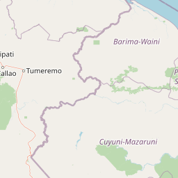
Streams
Park geography
Analyzing the mapped boundaries, regional land context, and internal natural terrain features.
Comprehensive Geographic and Environmental Profile for Reserva forestal de Imataca in Venezuela
The geography of Reserva forestal de Imataca encompasses a vast 38,219 square kilometer area across the states of Bolívar and Delta Amacuro. This profile documents the protected land distribution, identifying diverse terrain features including mountain ranges, tropical forest cover, and a complex network of river systems and streams found within the reserve boundaries.
Related tags
tropical forestforest reserveGuayana regionmountain rangeSierra de Imataca
A vast tropical forest reserve in northeastern Venezuela protecting the Sierra de Imataca and its rich river systems.
Imataca Forest Reserve
Imataca Forest Reserve is a large protected forest area in northeastern Venezuela, straddling parts of Bolívar State and Delta Amacuro State. The reserve covers the Sierra de Imataca, a low mountain range that rises above the surrounding Guayana region, together with extensive tracts of tropical forest drained by numerous rivers. The reserve is one of the most significant forest conservation areas in Venezuela, preserving a swath of tropical wilderness adjacent to the Guayana Esequiba zone to the north. Its landscape combines forested uplands, river valleys, and isolated hill formations such as the Cerros de La Chicharra and Dolomita, all set within a vast and largely undeveloped forested region of South America. Beyond its ecological value, Imataca is notable for the scale of its protected forest cover and for the conservation challenges it faces, particularly from mining activity. The reserve remains an important reference area in discussions about forest protection, indigenous territories, and natural resource use in Venezuela's Guayana region.
- Location
- Venezuela
- Park type
- Nature reserve
- Established
- 1961
- Area
- 38,219 km²
Location overview
Administrative location across Estado Bolívar and Estado Delta Amacuro in Venezuela
Geographic Overview and Regional Setting of Reserva forestal de Imataca
Reserva forestal de Imataca spans multiple administrative regions within Venezuela, specifically Estado Bolívar and Estado Delta Amacuro. Recorded location memberships outline the territorial setting and administrative jurisdiction for national park analysis.
- Countries
- Venezuela
- Regions
- Estado Bolívar, Estado Delta Amacuro
- Primary location
- Estado Bolívar
- Geographic setting
- Inland
Boundary and coordinates
Interactive spatial geometry, coordinate limits, and area metrics
Reserva forestal de Imataca Boundary Map and Extent Geography
Mapped boundary outlines provide visual spatial context for the protected area footprint. Associated geometric metrics detail calculated area measurements, coordinate limits, and regional spans.
- Boundary area
- 37,448.3 km²
- Boundary perimeter
- 1,937 km
- Northernmost point
- 8.6384° N
- Southernmost point
- 5.9627° N
- Easternmost point
- 59.8055° W
- Westernmost point
- 62.3782° W
- Geographic centre
- 7.5619° N, 61.1467° W
- North–south span
- 295.9 km
- East–west span
- 284.1 km
Terrain and natural features
Mountain relief profiles and recorded geographic features across the protected landscape
Terrain Classifications and Named Natural Features in Reserva forestal de Imataca
Reserva forestal de Imataca features a mountain relief classification encompassing diverse stored natural landforms. Recorded feature cards document individual names, types, and spatial relationships across the terrain.
Selected named natural features
Peaks
Cerro Ploto
Rivers
Caño Tacumarito
Streams
Río Katibuyense
Rivers
Río Neimara
Peaks
Cerro Imataca
Environmental setting
Tropical forest coverage, mountain relief, and major river networks
Environmental Setting and Classification of Reserva forestal de Imataca
Recorded landscape features, tropical habitat types, and relief classifications frame the physical setting of Reserva forestal de Imataca across seasonal cycles. Categorized environmental attributes link directly to corresponding atlas records for broader geographic exploration.
- Relief
- Mountain
- Climate
- Tropical
- Water
- Major water bodies
- Forest cover
- Mostly forested
- Seasonality
- Year-round
Landscape features
Mountains · Forest · Rivers
Habitat types
Tropical forest · Riverine habitat
Park atlas
Compare regional geography, tropical forest reserves, and connected wilderness areas.
Explore Parks Near Reserva forestal de Imataca and Surrounding Protected Landscapes
Visitors exploring Reserva forestal de Imataca can browse other protected areas across the surrounding Guayana region to compare diverse tropical forest terrain. Regional park comparisons reveal wider ecological patterns, watershed connections, and adjacent conservation zones.
National parkBolívar State
Park boundaries overlap#1 closest
Southwest

Canaima National Park: Detailed Geographic Atlas and Protected Landscape Overview
Explore mapped boundaries and natural terrain in Bolívar State.
Delve into the protected landscape of Canaima National Park, a significant natural area located in the expansive Bolívar State of Venezuela. This page provides a focused view on the park's geography, mapped terrain, and its position within the Guiana Highlands, offering critical context for understanding protected areas. Users can investigate the park's boundaries and its contribution to the regional geographic atlas, appreciating its distinct natural characteristics.
- Area
- 30,000 km²
- Established
- 1962
- IUCN
- II
- Visitors
- 100K annual

Protected areaBarima-Waini
About 27 km away#2 closest
Northeast

Shell Beach: Coastal Protected Area Geography and Barima-Waini Map Context
Atlantic shoreline nesting habitats and regional ecological boundaries.
Spanning 120 kilometers of Guyana's northern coast, Shell Beach represents a significant protected area dedicated to marine conservation. Its geography features a continuous chain of sandy beaches, offshore foraging waters, and adjacent coastal forest ecosystems, all managed through a community-based model within the Barima-Waini Region.
- Area
- 31.77 km²
- Established
- 2011
- IUCN
- VI
- Relief
- Lowland
National parkDelta Amacuro
55 km away#3 closest
North
Parque nacional Mariusa: A Detailed Geographic Study of Orinoco Delta Wetlands
Mapped tidal channels and protected wetland geography
Located in Delta Amacuro, Parque nacional Mariusa represents a key protected area where the Orinoco River meets the Atlantic. Its geography is defined by a dynamic system of caños, seasonally flooded rainforests, and mangrove forests that support high ecological complexity. This atlas entry provides an overview of the park boundaries and the physical terrain that shapes this critical Venezuelan protected landscape.
- Area
- 3,310 km²
- Established
- 1991
- IUCN
- II
- Water
- Water-dominated
National parkVenezuela
About 99 km away#4 closest
North
Mariusa National Park: Protected Orinoco Delta Wetlands and River Geography
A vast tidal river delta ecosystem in eastern Venezuela.
Mariusa National Park protects an essential segment of the Orinoco River Delta, characterized by its labyrinthine network of tidal channels and dense swamp forests. This protected area spans approximately 3,310 square kilometers of flooded landscape, where freshwater river systems interact with daily Atlantic tidal flows to maintain a globally significant wetland environment.
- Area
- 3,310 km²
- Established
- 1991
- Relief
- Lowland
- Climate
- Tropical
National parkMonagas
193 km away#5 closest
Northwest
Cueva del Guácharo National Park: Venezuela's Protected Natural Landscape
Mapping protected areas and natural terrain in Monagas.
Cueva del Guácharo National Park represents a distinct protected landscape within Venezuela's Monagas region. This entry provides essential context for understanding the park's geographic scope, mapped boundaries, and role as a national park. It is designed to facilitate detailed atlas exploration of protected natural areas and their regional landscape context, offering a foundation for understanding Venezuela's conservation geography.
- Area
- 627 km²
- Established
- 1975
- IUCN
- II
- Relief
- Mountain
National parkSucre State
198 km away#6 closest
Northwest
Turuépano National Park: National Park Protected Landscape and Geographic Context
Explore the mapped boundaries and natural terrain of Sucre State's national park.
Investigate Turuépano National Park, a protected national park situated within Sucre State, Venezuela. This entry provides detailed geographic context and information on its mapped protected-area boundaries, essential for understanding its role in the region's natural landscape atlas. Explore the specific terrain and protected land features that define this significant Venezuelan park.
- Area
- 726 km²
- Established
- 1991
- IUCN
- II
- Relief
- Lowland
National parkPotaro-Siparuni
199 km away#7 closest
Southeast
Kaieteur National Park: Iconic South American Waterfall and Protected Forest Landscape
Discover the unique geography and mapped boundaries of this Guiana Shield natural wonder.
Kaieteur National Park is a significant protected area in Guyana, celebrated globally for Kaieteur Falls, the world's largest single-drop waterfall by volume. This national park preserves over 242 square miles of untouched tropical rainforest, offering critical habitat for endemic species and a profound example of the Guiana Shield's ancient geological formations and diverse ecosystems. Its location deep within the Potaro-Siparuni Region underscores its role as a vital bastion of wilderness and a landmark in South American protected landscapes.
- Area
- 630 km²
- Established
- 1929
- IUCN
- II
- Relief
- Mixed relief
National parkSucre
226 km away#8 closest
Northwest
Península de Paria National Park: Venezuela's Protected Landscape Geography and Atlas Context
Explore mapped park boundaries and regional geographic setting.
Discover Península de Paria National Park, a vital protected area within the Sucre region of Venezuela. This page offers a detailed look at the park's geographic identity, focusing on its mapped boundaries and its significance as a national park for atlas-based exploration. Understand its landscape context and its contribution to Venezuela's network of protected lands, providing a clear geographic overview for researchers and explorers.
- Area
- 375 km²
- Established
- 1978
- IUCN
- II
- Relief
- Mountain
MoriAtlas Explorer
Continue Your Geographic Exploration of Reserva forestal de Imataca
Uncover the complex topography and protected landscape characteristics of Reserva forestal de Imataca through the MoriAtlas structured database. Trace the regional geography, river networks, and mountain formations that define this essential Venezuelan nature reserve and its surrounding wilderness areas.
Browse next
Global natural geography
Explore related park routes
Explore MoriAtlas Global ParksBrowse All MoriAtlas ParksGlobal Park Map DiscoveryMoriAtlas: Browse All CountriesBrowse All MoriAtlas ContinentsNational Park Environment AtlasGrand Canyon National Park AtlasYellowstone National Park AtlasYosemite National Park Atlas and GeographySerengeti National Park AtlasGalápagos National Park Protected LandscapeBanff National Park Geography and AtlasKruger National Park Atlas EntryUluṟu-Kata Tjuṯa National Park AtlasExplore Uluru-Kata Tjuta National Park GeographyPlitvice Lakes National Park AtlasFiordland National Park Protected LandscapeGreat Smoky Mountains National Park AtlasAfghanistan National Parks and Protected AreasAlbania National Parks and Protected AreasAlgeria National Parks and Protected AreasAmerican Samoa National Parks and Protected AreasAndorra National Parks and Protected AreasAngola National Parks and Protected AreasAntarctica National Parks and Protected AreasAntigua and Barbuda Park List