Mori Atlas logo
Nature reserveReserva natural El Corbalán

Mapping the arid Chaco Boreal terrain, conservation boundaries, and low-lying plains.

Reserva natural El Corbalán: Protected Dry Forest Geography in Tarija Department, Bolivia

Reserva natural El Corbalán serves as a vital private conservation area within the Gran Chaco of southeastern Bolivia. This protected landscape represents the distinct dry-forest ecosystems of the Chaco Boreal, featuring expansive low-lying plains, thorny scrublands, and seasonal xerophytic vegetation. The reserve plays a significant role in maintaining regional biodiversity, providing a managed habitat refuge that extends across the flat, undulating terrain near the border with Paraguay.

Chacodry forestGran Chacoprivate reserveChaco Borealwildlife refuge

Reserva natural El Corbalán

Nature reserve

Park overview

Structured park overview, official facts, and landscape profile for Reserva natural El Corbalán

Reserva natural El Corbalán park facts, protected area profile, and essential visitor context

Review the core facts for Reserva natural El Corbalán, including designation, size, terrain, visitor scale, habitats, and operating context in one park-focused overview.

About Reserva natural El Corbalán

Reserva natural El Corbalán is a privately protected natural area located in the heart of the Bolivian Chaco, in the southern part of the country. It is situated about 110 kilometers southeast of Villamontes, in the municipality of the same name, within the Gran Chaco Province of Tarija Department. The reserve's eastern edge lies close to the Paraguayan border, while its southern boundary follows Route 11, the road that links Tarija city with the Bolivia-Paraguay frontier.

The reserve spans approximately 47.78 square kilometers. Around 25 square kilometers are held under the formal legal designation of Reserva Privada del Patrimonio Natural (RPPN), and the remaining land is managed under parallel protection arrangements. The reserve is owned and managed by Protección del Medio Ambiente Tarija (PROMETA), a local environmental organization. It was created in 1996 and legally established in 2001, making it one of the earlier private conservation initiatives in the Bolivian Chaco.

Ecologically, El Corbalán lies within the Chaco Boreal biogeographic province, part of the broader Gran Chaco system that extends across Paraguay, Argentina, and Bolivia. The area reflects the classic character of the dry Chaco: a mix of thorny deciduous forest, xerophytic scrub, and open plains shaped by a strongly seasonal climate with high average temperatures around 23.5 degrees Celsius.

El Corbalán is valued less for dramatic scenery than for its role as a stronghold of regional biodiversity. It protects habitat for endangered Chaco species and contributes to the conservation of an ecoregion that has historically faced heavy pressure from agricultural expansion and land conversion. As a private reserve embedded in the wider Chaco landscape, it complements neighboring protected landscapes such as the Serranía del Aguaragüe and the Ibibobo area to the north.

Quick facts and research context for Reserva natural El Corbalán

El Corbalán is a private natural reserve covering roughly 47.78 square kilometers in the Gran Chaco region of southeastern Bolivia. Around half of its area is legally designated as a Reserva Privada del Patrimonio Natural, while the rest functions as additional protected land under the same management.

The reserve lies near Villamontes in the Gran Chaco Province of Tarija Department, at a low elevation of around 280 meters. It belongs to the Chaco Boreal biogeographic province and protects characteristic dry Chaco habitats and threatened regional fauna, managed locally by the NGO PROMETA.

Park context

Deeper park guide and search-rich context for Reserva natural El Corbalán

Reserva natural El Corbalán history, landscape, wildlife, and travel context

Explore Reserva natural El Corbalán through its history, landscape character, ecosystems, wildlife, conservation priorities, cultural context, and seasonal travel timing in a structured park guide built for atlas discovery and search intent.

Why Reserva natural El Corbalán stands out

El Corbalán is best known for protecting a representative sample of dry Chaco habitat and serving as a refuge for several threatened species typical of the region. The reserve is particularly associated with the conservation of the Chacoan peccary (chancho quimilero), a species once thought extinct and emblematic of the Gran Chaco. It also stands out for supporting other characteristic Chaco wildlife such as the Chaco caiman, giant anteater, white-lipped peccary, jaguar, and puma, alongside a documented herpetofauna including twenty amphibian and seventeen reptile species.

Reserva natural El Corbalán history and protected-area timeline

El Corbalán was established in 1996 as a private conservation initiative in the southern Bolivian Chaco. It was created under the ownership of Protección del Medio Ambiente Tarija (PROMETA), a Tarija-based environmental organization focused on regional biodiversity protection.

In 2001 the reserve received its formal legal designation, solidifying part of its territory under the Reserva Privada del Patrimonio Natural (RPPN) framework and ensuring the long-term protection of its core area. Since then it has functioned as one of the locally recognized private natural reserves in the Gran Chaco Province, contributing to conservation efforts in a region where habitat loss from agricultural expansion has been a long-standing concern.

Reserva natural El Corbalán landscape and geographic character

The landscape of El Corbalán is defined by the characteristic terrain of the dry Gran Chaco. The terrain is mostly flat to gently undulating lowland plain at around 280 meters elevation, shaped by a hot, seasonal climate and sparse vegetation cover.

The reserve's physical setting reflects the open character of the Chaco plain rather than any dramatic relief. Its eastern approach is marked by proximity to the Paraguayan border, and its southern boundary is anchored by Route 11, which connects Tarija with the international frontier crossing into Paraguay. Scattered thorny woodlands, dry scrub patches, and small clearings together define the visible landscape of the reserve.

Watercourses and seasonal wetlands are part of the broader Chaco mosaic but are secondary features compared to the dominant xerophytic vegetation that structures the scenery. The overall impression is of an expansive, hot, lowland environment typical of the Chaco Boreal rather than a mountainous or coastal landscape.

Reserva natural El Corbalán ecosystems, habitats, and plant life

El Corbalán protects a representative cross-section of dry Chaco ecosystems, including seasonally dry deciduous forest, thorny scrub, and open plains. The reserve falls within the Chaco Boreal biogeographic province, a region known for its xerophytic vegetation and extreme climatic seasonality.

Vegetation in the reserve is dominated by classic dry Chaco species, including soto trees, quebrachos, and locally known plazuela shrubs. Bromeliads such as carahuatas and columnar cacti like the ulala are common, alongside quebracho blanco and quebracho colorado, two of the most ecologically and historically significant tree species of the region.

Together, these plant communities define a habitat mosaic that supports specialist dry-forest wildlife and reflects the broader ecological identity of the Bolivian Chaco.

Reserva natural El Corbalán wildlife and species highlights

El Corbalán hosts an important community of Chaco fauna, including several species of conservation concern. The reserve is particularly notable for the presence of the Chacoan peccary (chancho quimilero), a species historically considered possibly extinct and now considered emblematic of the region.

Other large mammals recorded in the reserve include the giant anteater, armadillos, collared and white-lipped peccaries (antas and chancho tropero), tapir-like Chaco browsers, puma, and jaguar. The Chaco caiman, a regional subspecies of the broad-snouted caiman, also inhabits the reserve's wetlands and water bodies.

Birdlife includes Chaco species such as the matico, the ipacaa, the small white egret (garcita blanca), and the long-winged hawk (aguilucho alas largas). The reserve also supports a documented herpetofauna of around twenty amphibian species from four families and seventeen reptile species, including lizards, snakes, turtles, and crocodilians, indicating a diverse small-fauna community for a dry-forest reserve.

Reserva natural El Corbalán conservation status and protection priorities

As a private natural reserve holding formal Reserva Privada del Patrimonio Natural status, El Corbalán plays a targeted role in conserving Chaco biodiversity outside the national park system. Its importance lies in maintaining habitat for threatened and range-restricted species in a region where agricultural expansion and land conversion have historically reduced natural cover.

The reserve contributes specifically to the protection of the Chacoan peccary, the Chaco caiman, the giant anteater, the jaguar, and several other large mammals that depend on continuous dry-forest habitat. By combining legally protected RPPN land with adjacent managed land, the reserve extends conservation coverage beyond a single designated polygon.

Its management by the local NGO PROMETA links the reserve to broader regional environmental efforts in the Tarija Department, giving the area a grassroots conservation profile that complements larger public protected areas in the Bolivian Chaco.

Top sights and standout views in Reserva natural El Corbalán

Reserva natural El Corbalán stands out as a private conservation initiative embedded in the Gran Chaco, offering protection for one of South America's most distinctive dry-forest ecosystems at the country level. Its combination of RPPN-designated land and additional protected areas makes it a sizable private reserve for the region.

Among its strongest distinctions are the documented presence of the Chacoan peccary and the Chaco caiman, alongside a broad mammal, bird, and reptile community typical of the Chaco Boreal. Its location near the Paraguayan border and the Tarija-Paraguay road corridor gives it additional relevance as a conservation area in a heavily pressured frontier landscape.

Best time to visit Reserva natural El Corbalán

The Gran Chaco region has a strongly seasonal climate with high temperatures year-round, and the dry Chaco vegetation around El Corbalán responds visibly to the wet and dry periods. The cooler dry season generally offers easier travel conditions, while the wet season supports more active wildlife behavior, greener vegetation, and greater amphibian and reptile activity.

For visitors interested in dry-forest birdlife and mammals, the dry season typically concentrates wildlife around remaining water sources, while the wet season can provide lusher conditions and stronger insect and amphibian presence. Planning around these broad seasonal patterns, rather than specific dates, is the most useful approach for anyone considering a visit.
Monthly climate preview

Long-term monthly temperature and precipitation rhythm across representative coordinates

Reserva natural El Corbalán Climate Normals and Annual Weather Patterns

Historical averages for Reserva natural El Corbalán reveal a measured annual cycle of temperature variation and monthly precipitation shifts from 1991 to 2020. Examining the complete twelve-month dataset provides a detailed reference point for analyzing long-term climate behavior at this location.
Annual mean25 °C
20 °C29 °C
Jan29°
Feb28°
Mar27°
Apr25°
May22°
Jun20°
Jul20°
Aug23°
Sep26°
Oct29°
Nov29°
Dec29°
Warmest month
December

29.2 °C

Coolest month
July

20 °C

Wettest month
February

5.4 mm/day

Driest month
July

0.6 mm/day

Park location guide

Geography guide, regional context, and park location map for Reserva natural El Corbalán

Reserva natural El Corbalán park geography, regions, and map view in Bolivia

Understand where Reserva natural El Corbalán sits in Bolivia through a broader geographic reading of the surrounding landscape, nearby location context, and its mapped position within the national park landscape.

How Reserva natural El Corbalán fits into Bolivia

Bolivia, officially the Plurinational State of Bolivia, is a landlocked country in central South America. It features diverse geography including the Andean mountain range, Amazonian plains, Gran Chaco, and the Pantanal wetland. The country has a population of approximately 11.4 million and is administratively divided into nine departments, with La Paz as the seat of government and Sucre as the constitutional capital.

Wider geography shaping Reserva natural El Corbalán in Bolivia

Bolivia is located in central South America, bordered by Brazil to the north and east, Paraguay to the southeast, Argentina to the south, Chile to the southwest, and Peru to the west. The country is divided between a western Andean region and tropical lowlands to the east and north. It includes the Amazonian plain, Gran Chaco, temperate valleys, the high-altitude Altiplano plateau, and part of the Pantanal wetland along its eastern border.

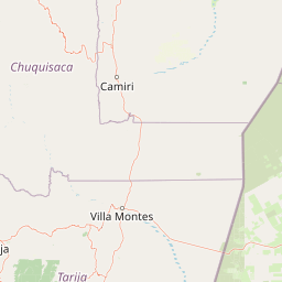
Map view of Reserva natural El Corbalán

Use this park location map to pinpoint Reserva natural El Corbalán in Bolivia, understand its exact geographic position, and read its mapped placement within the surrounding landscape more clearly.

Pigeon | © OpenStreetMap contributors

Location context for Reserva natural El Corbalán

Departamento de Tarija
Park atlas

Compare regional dry forest ecosystems and connected Chaco wildlife refuges.

Other Parks Near Reserva natural El Corbalán and Surrounding Protected Areas

Browsing other parks near Reserva natural El Corbalán reveals the broader ecological spread of the Gran Chaco lowlands. Comparing adjacent protected areas provides essential context on regional conservation corridors and dry-forest habitats.
Protected areaGran Chaco Province
About 118 km away#1 closest

West

Aguaragüe National Park and Integrated Management Natural Area: Bolivia's Easternmost Sub-Andean Protected Landscape

Explore its mapped mountain geography and ecological diversity.

Aguaragüe National Park and Integrated Management Natural Area is a crucial protected area in Bolivia's Gran Chaco Province, defined by the Serranía del Aguaragüe mountain range. This landscape offers a unique opportunity to explore a geographic transition zone where Southern Andean Yungas montane forests converge with Dry Chaco ecosystems. The park's protected boundaries encompass a rugged mountain backbone rising from the lowlands, representing a vital segment of Bolivia's Sub-Andean geography and protected natural areas.

Area
1,083.07 km²
Established
2000
IUCN
II
Relief
Mountain
Natural monumentSanta Cruz
About 164 km away#2 closest

Northwest

Monumento natural municipal Muela del Diablo: Protected Area Geography and Landscape Context

Regional mapping of the Chaco plain and serranías.

The Muela del Diablo natural monument serves as an essential ecological landmark, protecting key aquifer recharge zones within the Santa Cruz department. This summary focuses on the topography of the peak and its function within the Gran Chaco ecoregion, offering a detailed perspective on the site's environmental geography and historical landscape significance.

Area
50.99 km²
Established
2009
Relief
Mountain
Climate
Subtropical
A soft watercolor illustration of a river flowing through a lush landscape with gentle green hills in the distance.
Wildlife reserveTarija
About 197 km away#3 closest

West

Reserva nacional de flora y fauna de Tariquía: Atlas and Geographic Protected Area Overview

Montane cloud forest and subandean river valleys in Tarija

This wildlife reserve preserves the most intact stands of Yungas Tucumano-Boliviano forest in Bolivia. Featuring a dramatic vertical zonation from foothill selva to high-elevation pine woodlands, the area serves as a primary hub for ecological research and conservation in the rugged landscapes of Tarija near the Argentine border.

Area
2,468.7 km²
Established
1989
Relief
Mountain
Climate
Subtropical
National parkArgentina
About 226 km away#4 closest

Southwest

Baritú National Park National Park: Mapped Protected Landscapes in Argentina's Geography

Understand the natural terrain and geographic setting of this Argentinian park.

Baritú National Park represents a distinct national park entity within Argentina, crucial for understanding the country's protected landscapes and regional geography. This page provides specific atlas-level detail on its mapped boundaries and the surrounding natural terrain. Explore Baritú National Park as a key geographic feature contributing to the broader understanding of conservation areas across South America, grounded in factual, map-oriented discovery.

Area
720 km²
Established
1974
IUCN
II
Relief
Mountain
Watercolor illustration showing a pale green rural landscape with rolling hills, scattered trees, a winding path or stream, and small buildings in the distance
Biosphere reserveBolivia
About 252 km away#5 closest

West

Reserva Biológica de la Cordillera de Sama: Protected Mountain Landscapes of Southern Bolivia

High-Andean biosphere reserve featuring lagoons, dunes, and ancient pathways.

Reserva Biológica de la Cordillera de Sama encompasses a vast elevation range from dry inter-Andean valleys to the 4,700-meter peaks of the Cordillera Oriental. This reserve protects the endorheic Tajzara basin, where seasonal lagoons and sand dunes contrast with relict forests and steep mountain ravines. Its geography offers a complex mosaic of ecosystems, providing essential water sources and specialized habitat for endemic fauna within the southern Bolivian highlands.

Area
1,085 km²
Established
1991
Relief
Mountain
Climate
Alpine
A watercolor painting of a simplified, abstract landscape with rolling hills in shades of green, yellow, and muted pink against a white background.
Protected landscapeTarija
About 263 km away#6 closest

West

Parque natural y área de manejo integrado El Cardón: Geography and Protected Area Atlas

High-altitude puna landscapes and cactus diversity in Tarija, Bolivia.

Spanning the high-altitude plateaus of southern Bolivia, this protected area features a unique mosaic of arid terrain, specialized cactus ecosystems, and vital wildlife corridors. The landscape provides a deep look into the puna and pre-puna geography of the Tarija department, including significant archaeological sites and thriving populations of wild vicuñas within a dramatic, high-elevation Andean environment.

Area
300.56 km²
Established
2003
Relief
Mountain
Climate
Arid
Wildlife reserveTarija Department
About 269 km away#7 closest

West

Tajzara Wildlife Reserve: Geographic and Landscape Overview of the Tarija Basin

High-altitude wetlands and saline lagoons in the Bolivian Andes

Tajzara Wildlife Reserve stands as a critical high-altitude wetland complex within the Tarija Department. This protected landscape sustains life across saline lake beds, seasonal pools, and marshy margins, functioning as a vital refuge for migratory waders and flamingo populations in the harsh, arid climate of the Bolivian Altiplano.

Area
13 km²
Established
1999
Relief
Highland
Climate
Alpine
National parkChuquisaca Department
About 287 km away#8 closest

Northwest

Iñao National Park and Integrated Management Natural Area: Bolivia National Park and Protected Landscape

Explore the Serranía del Iñao's geography and conservation role.

Iñao National Park and Integrated Management Natural Area is a protected territory located within Chuquisaca Department, Bolivia, centered on the prominent Serranía del Iñao mountain range. This page offers detailed geographic context and an atlas perspective on the park's landscape, its role as a national park, and its contribution to regional conservation efforts in the Andean foothills.

Area
2,630.9 km²
Established
2004
IUCN
II
Scope
Terrestrial

Common questions about visiting, size, designation, and location context for Reserva natural El Corbalán

Reserva natural El Corbalán FAQs for park facts, access, geography, and protected area context

Find quick answers about Reserva natural El Corbalán, including protected-area facts, park geography, trail and visitor context, and how the park fits into its surrounding country and regional landscape.
MoriAtlas Explorer

Continue Your Protected Areas Search Across the Global Atlas

Deepen your exploration by continuing the structured search for national parks and protected areas worldwide. Utilize the comprehensive filtering capabilities to compare different conservation landscapes and refine your understanding of global park geography. Discover more about the distribution and characteristics of protected natural areas.

Global natural geography