
Mori Atlas logo
Nature reserveRéserve naturelle nationale du Pinail

Examining the ecological terrain of an historic millstone quarry turned nature reserve

Réserve naturelle nationale du Pinail: Mapping the Protected Heathland and Pond Mosaic of Nouvelle-Aquitaine

The Réserve naturelle nationale du Pinail stands as a distinct protected landscape within the Vienne department of Nouvelle-Aquitaine. This atlas entry details the geography of a plateau shaped by centuries of millstone quarrying, resulting in a dense network of three thousand water-filled depressions set amidst low-lying heather moorland. Visitors and researchers can trace the boundaries of this Ramsar wetland site to understand how its acidic ponds, peat-forming patches, and marly seepages sustain rare orchids and diverse breeding bird populations.

national nature reserveheathlandacidic pondsmillstone quarrieswetlandspeat-forming habitats
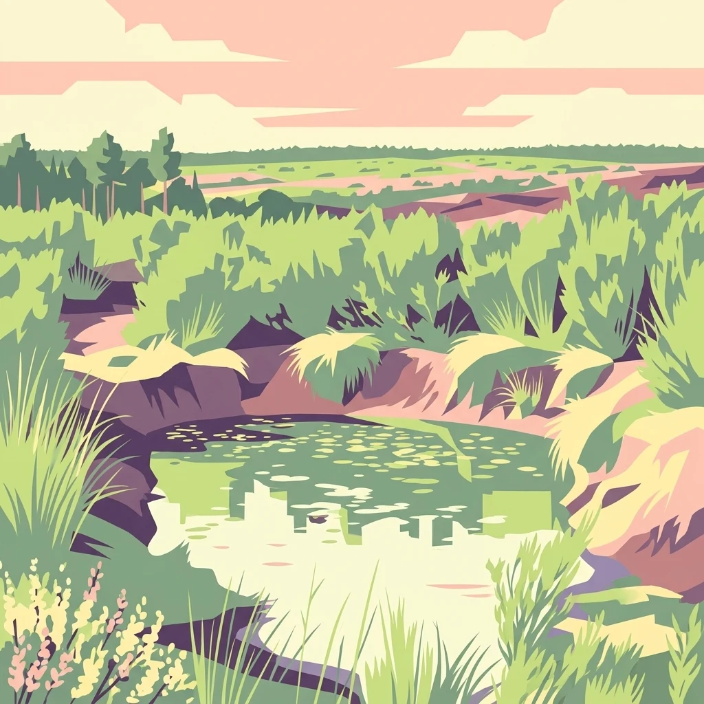
A graphic art illustration depicting a small, calm pond surrounded by dense green shrubbery and moorland vegetation, with a soft, warm-toned horizon in the distance.

Réserve naturelle nationale du Pinail

Nature reserve

Park overview

Structured park overview, official facts, and landscape profile for Réserve naturelle nationale du Pinail

Réserve naturelle nationale du Pinail park facts, protected area profile, and essential visitor context

Review the core facts for Réserve naturelle nationale du Pinail, including designation, size, terrain, visitor scale, habitats, and operating context in one park-focused overview.

About Réserve naturelle nationale du Pinail

The Réserve naturelle nationale du Pinail is a compact but ecologically dense protected area in west-central France. Created in 1980 and further recognised through international designations, it occupies a slice of plateau between the Vienne and Clain valleys, between Poitiers and Châtellerault, in the Nouvelle-Aquitaine region. Despite its modest surface, the reserve contains one of the densest networks of small acidic ponds in France, formed not by nature but by the long history of millstone extraction on the site.

The physical character of the reserve is unlike any typical French national park. The land is low-lying moorland rather than mountain or coast, dominated by a vast extent of heather, dwarf gorse, and purple moor grass, dotted with thousands of shallow depressions. Some of these former quarries have evolved over centuries into peat-forming pools, while others remain as open acidic water, supporting wetland plants and amphibians that would otherwise be vanishingly rare in the region.

Culturally, the site is a striking example of human-shaped landscape: a centuries-old industrial activity left a biological imprint that conservationists now treat as a heritage to be maintained. The manageability of such a small area, combined with the depth of ecological interest it contains, has made Pinail a flagship French case study in heathland and pond conservation.

Quick facts and research context for Réserve naturelle nationale du Pinail

Established on 30 January 1980 by ministerial decree, the Pinail reserve covers 135 hectares in the Vienne department and is part of the wider Moulière forest landscape north of Poitiers. The site is classified as a national nature reserve (UICN Category IV) and gained Ramsar wetland status in October 2021 across a broader 923-hectare managed zone.

It is a heathland-and-pond mosaic, with nearly three thousand water-filled extraction pits giving the plateau a distinctive lunar appearance. The site is managed by the association GEREPI and is freely accessible year-round, with guided walks offered seasonally.

Protection and recognition

Documented terrestrial protection scope, designation history, and administrative records

Réserve naturelle nationale du Pinail Protection Status and Designation Records

Terrestrial protection status and designation history for Réserve naturelle nationale du Pinail define the formal conservation scope established in 2021. Structured records detail the official protected area parameters and associated administrative framework without external assumptions.

Protection details

Protection scope
Terrestrial
Designated year
2021
Transboundary protection
No
WDPA ID
39779
Park context

Deeper park guide and search-rich context for Réserve naturelle nationale du Pinail

Réserve naturelle nationale du Pinail history, landscape, wildlife, and travel context

Explore Réserve naturelle nationale du Pinail through its history, landscape character, ecosystems, wildlife, conservation priorities, cultural context, and seasonal travel timing in a structured park guide built for atlas discovery and search intent.

Why Réserve naturelle nationale du Pinail stands out

The reserve is best known for its extraordinary concentration of small acidic ponds and pools, set in expansive heather and dwarf-gorse moorland. The ponds are not natural lakes but the legacy of medieval and early-modern millstone quarrying, making the site both a geological curiosity and a conservation priority. It is equally recognised for the rare and protected species that the pond-and-heath mosaic supports: fragile orchids, carnivorous plants such as round-leaved sundew and bladderworts, marbled and crested newts, white-clawed crayfish, and breeding populations of Montagu's harrier, short-toed snake eagle, and Dartford warbler. The site sits within the Moulière forest landscape, a historic woodland mosaic whose preservation has shaped the reserve's modern identity.
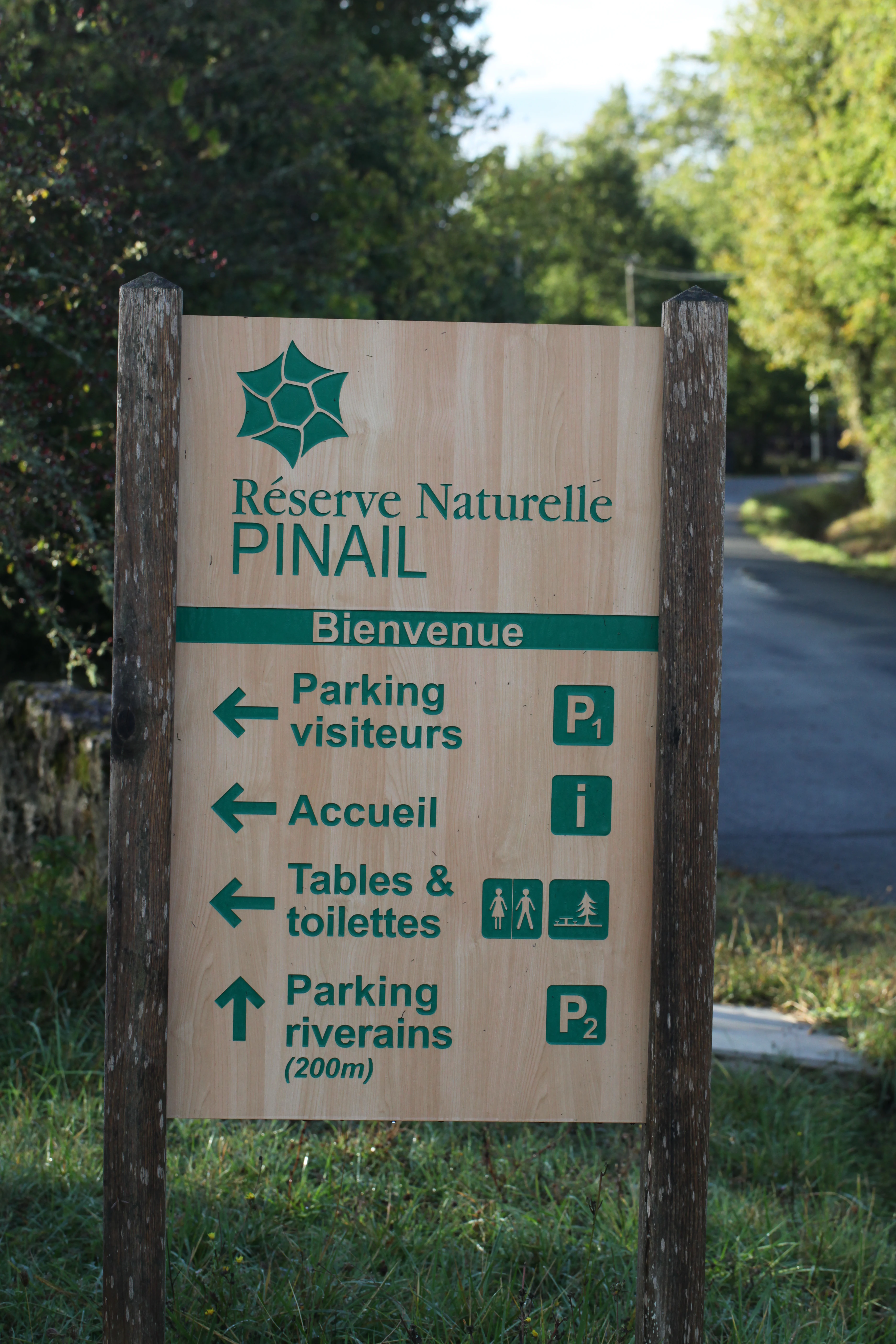
A wooden informational signpost for Réserve naturelle nationale du Pinail showing directions for visitors parking, reception, picnic tables, toilets, and residential parking.
Information signage at the entrance to Réserve naturelle nationale du Pinail.

Réserve naturelle nationale du Pinail history and protected-area timeline

The site's history stretches back to the end of the last glaciation, when oak and beech forests covered much of the Poitou region. Natural disturbances, alongside grazing by large herbivores, kept open grassland and heath patches within those forests, including on what is now the Pinail plateau. As mill-based grain processing expanded across medieval France, demand grew for hard, rough millstones; quarrying of millstone-quality rock on the Pinail began and continued for centuries.

Millstones from Pinail were transported by flat-bottomed boats along local rivers, reaching customers within roughly 300 kilometres. Historians estimate that more than 20,000 extraction pits were opened across what is now the Moulière forest and the reserve, potentially making the site one of the largest open-air quarry complexes of its kind in the world. Quarrying declined at the end of the nineteenth century, leaving a deeply etched hummocky landscape.

Heathland vegetation survived the medieval period thanks to a 1692 royal ordinance aimed at rebuilding France's depleted forests to supply naval shipbuilding. Where the surrounding Moulière land was judged suitable for replanting, the chaotic, pond-filled Pinail area was instead handed to local communities as commons, with rights to graze, cut heather for fuel, fish, hunt, and continue extracting millstone. Grazing ended during the Second World War, and heather cutting was abandoned soon after.

The specific protected reserve was created around the area known as the "Moulières neuves," corresponding to the most recent quarrying phase. A ministerial decree of 30 January 1980 established the reserve on 135 hectares, and the management association GEREPI was later formed to coordinate its stewardship across five stakeholder groups. In October 2021, the broader Pinail zone of 923 hectares was inscribed on the Ramsar list of internationally important wetlands.

Réserve naturelle nationale du Pinail landscape and geographic character

The plateau on which the reserve sits rises gently above the converging valleys of the Vienne river and the Clain, forming a transitional landscape between the Moulière forest to the south and the river corridors to the north. Topography is broken into a complex hummocky pattern by the remaining quarry pits and spoil heaps, giving the terrain the appearence of a small, undulating heath.

The defining ground pattern is the network of roughly three thousand water-filled depressions, ranging in size from small puddles to substantial ponds. While the underlying plateau is relatively dry, these pits expose acidic seepages and locally waterlogged soils. Some former pits have developed into Sphagnum-dominated peat patches, where peat accumulates slowly in the still, acidic water.

Open heath covers most of the land between the pits. Bell heather, broom heather, and dwarf gorse create low mosaics of green, brown, and purple across the seasons. Marly seepage zones support slightly wetter vegetation: damp meadows and small sedge patches interrupting the otherwise dry upland character. Together, these elements make the site unusually diverse for such a compact area.
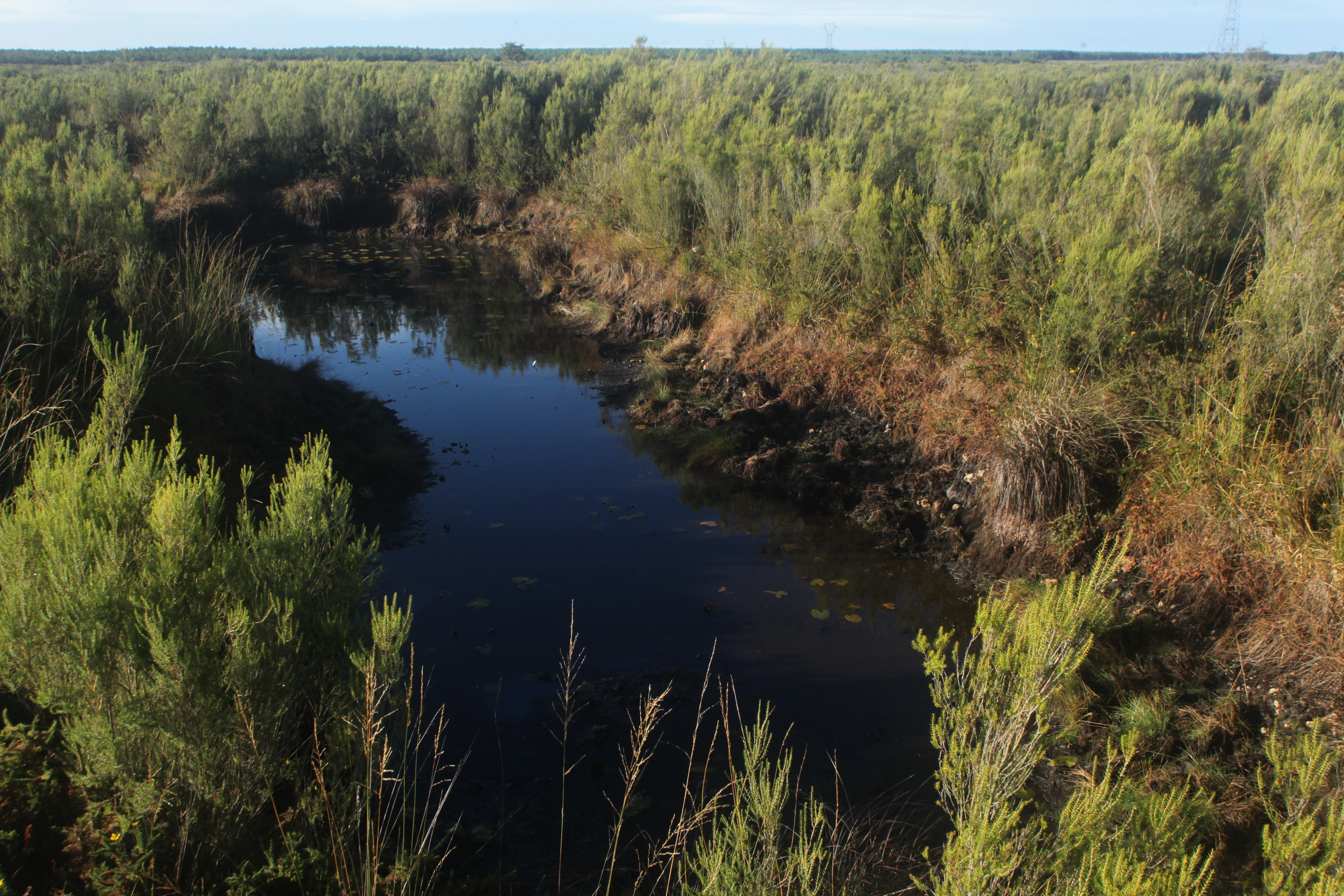
A small dark pond nested within dense green heath vegetation, typical of the landscape at Pinail National Nature Reserve.
A characteristic pond surrounded by moorland vegetation at Réserve naturelle nationale du Pinail.

Réserve naturelle nationale du Pinail ecosystems, habitats, and plant life

The reserve's ecological identity is built on three interacting habitats: acidic heath, acidic ponds and developing peat, and small calcareous marl seepages. This patchy combination is rare in modern French landscapes, where traditional land-use has tended to convert acidic heath either into pine plantation or improved pasture.

The heath component is dominated by heather species, dwarf gorse, and purple moor grass, the last forming dense tussocks that stabilise the soil between the pits. The pond network provides micro-habitats that vary by depth, age, and acidity, sustaining aquatic plants, amphibian larvae, and invertebrates that would not survive in more uniform surroundings. Marbled and crested newts occupy deeper ponds, while shallower and more temporary water supports different breeding communities.

Seepage areas along the Riveau stream bring calcareous conditions into an otherwise acidic system, creating small zones where plants more typical of base-rich wetlands can grow right next to Sphagnum peat. This chemical and structural variety, packed into 135 hectares, is the foundation of the reserve's biodiversity value.
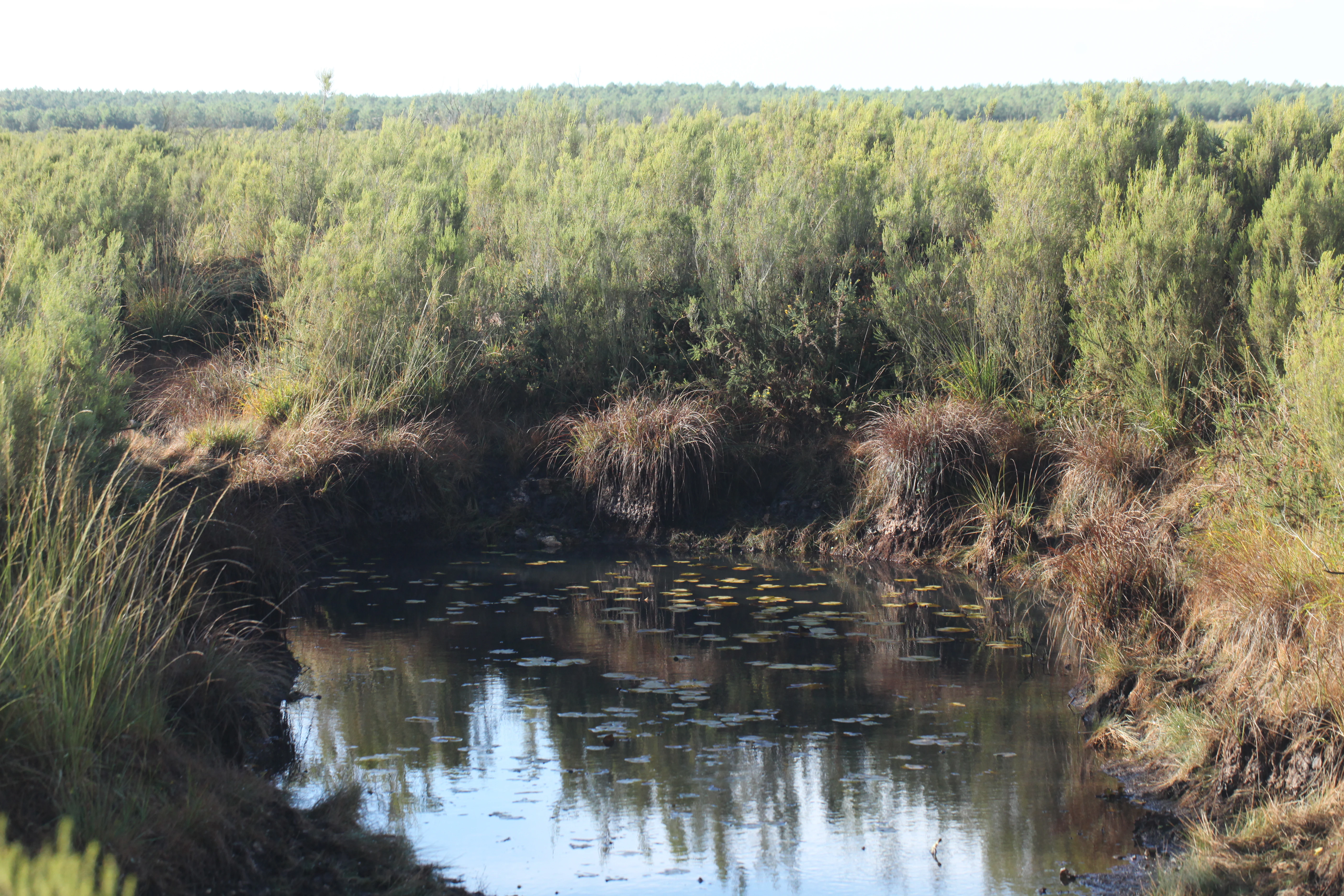
A small, dark-water pond surrounded by low shrubs and heath vegetation, typical of the Pinail nature reserve.
A small pond nestled within the heathland landscape of the Réserve naturelle nationale du Pinail.

Réserve naturelle nationale du Pinail wildlife and species highlights

Faunal interest at Pinail is especially rich in amphibians and invertebrates, with a notable bird presence given the open structure of the land. Forty-eight species of odonates (dragonflies and damselflies) have been recorded, including the rare white-tailed and large white-faced darter dragonflies, the mercury bluet damselfly, and the emperor dragonfly, whose larvae thrive in the acidic ponds.

Amphibians are central to the reserve's reputation. Both marbled newts and crested newts occur, and because their ranges overlap, they hybridise to produce the Blasius newt, whose males are sterile while females remain fertile. Grass snakes, particularly the viperine snake (which makes up roughly 60 percent of recorded snake observations), grass snakes, Aesculapian-type whip snakes, and asp vipers are also present.

Birds use the open heath as hunting and breeding habitat. Hobby falcons feed on the reserve's dragonflies, Montagu's harriers nest regularly, and short-toed snake eagles (the only breeding eagle species in the Vienne department) appear in the broader Moulière forest area. The Dartford warbler, an emblem of low Mediterranean-type heath, holds a breeding population here. Mammals include red deer, the water vole-affiliated amphibious vole, and European hare. A small, fragile population of white-clawed crayfish persists in some ponds, an important conservation success given the species' national decline.
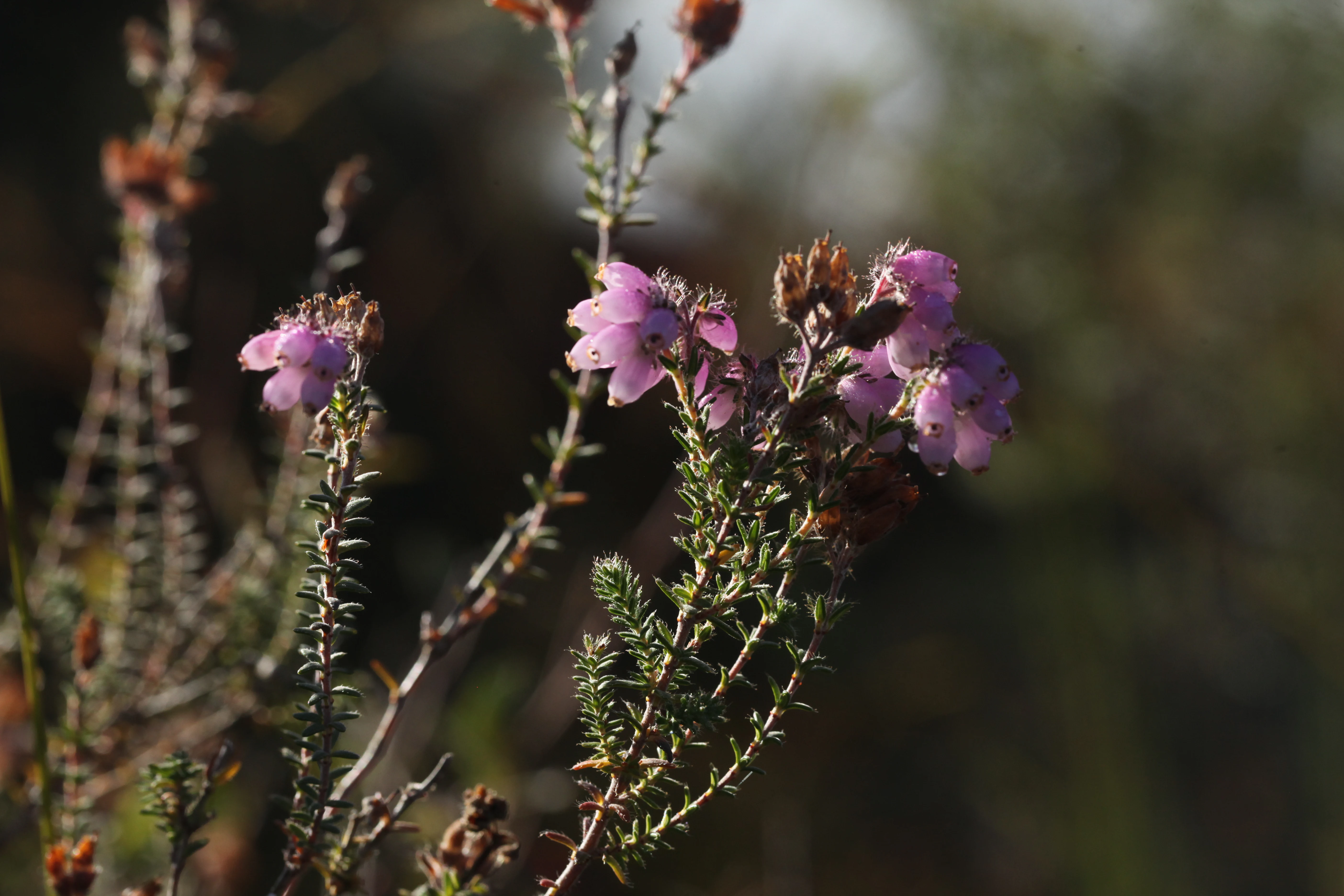
A close-up shot of small pink heather flowers on a slender green stem with a blurred, dark green background.
Close-up of heather blossoms in the Pinail National Nature Reserve.

Réserve naturelle nationale du Pinail conservation status and protection priorities

Conservation at Pinail centres on preserving the active equilibrium between quarry-derived ponds, open heath, and acidic peat-forming mires. Because nearly every feature of the reserve is the legacy of human activity, the management approach is active, not passive: without intervention, natural forest succession would close the heath and erase the visible history of the land.

GEREPI coordinates cutting of heather, controlled burning of small plots under firefighter supervision, and targeted grazing with hardy sheep breeds, supplemented by Poitevin goats, to keep the heath open and structurally diverse. These measures create a mosaic of vegetation ages that supports the widest possible range of species. Old heather cut from the site is reused in traditional crafts, including palisades and heather brooms.

On top of national nature reserve status, the broader Pinail area was recognised as a Ramsar wetland site in October 2021, and the site is integrated into the Natura 2000 ecological network. White-clawed crayfish, the rare summer lady's-tresses orchid, pillwort, round-leaved sundew, and Blasius newt populations anchor specific protection actions. Year-round monitoring by GEREPI, together with the LPO Vienne for birds, supports ongoing research and University of Poitiers student work.

Réserve naturelle nationale du Pinail cultural meaning and human context

Pinail sits within a long Poitevin landscape of commons, where rural communities historically held collective use-rights over heath and pond. The 1692 management framework, which gave locals the right to graze, cut heather, fish, hunt, and continue limited quarrying, has shaped regional identity as much as ecology. Heather-based crafts and traditional broom-making still form part of the local cultural vocabulary.

The presence of loges en bruyère (traditional heather-roofed outbuildings) in the broader area links the reserve visually and culturally to pre-industrial rural building techniques. Quarry heritage is also part of the story: the estimated 20,000 extraction pits reflect a once-thriving rural industry that connected the Pinail plateau to grain mills across west-central France.
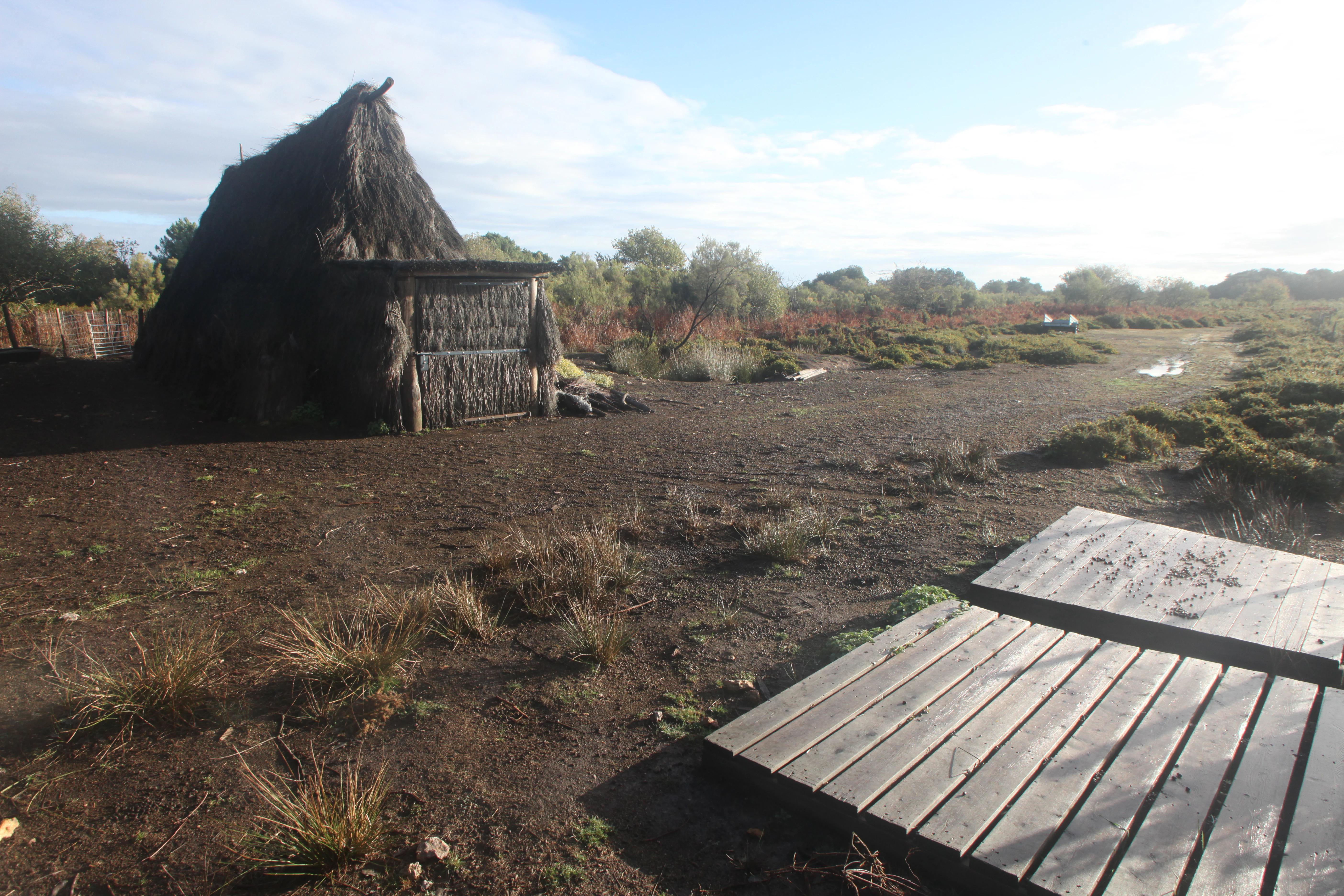
A rustic, dark, thatched-roof hut sits on the left of an open, marshy landscape; a wooden boardwalk platform is in the foreground, with low-lying brush and heather in the background under a cloudy sky.
A rustic thatched-roof structure stands in the heathland of the Pinail National Nature Reserve.

Top sights and standout views in Réserve naturelle nationale du Pinail

The reserve's single most striking aspect is its pond-and-heath topography: roughly 3,000 small acidic ponds nestled in extensive heather moorland, an unusual sight in modern France and a key reason the site carries both French national and international Ramsar protection.

Equally notable is the high concentration of protected species in a small area: nationally protected orchids including the summer lady's-tresses, carnivorous sundews and bladderworts, the Blasius newt hybrid complex, white-clawed crayfish, and breeding populations of Montagu's harrier, short-toed snake eagle, and Dartford warbler. The layered history, from medieval millstone quarry to 1692 royal ordinance to 1980 nature reserve, adds cultural depth to a strongly ecological site.
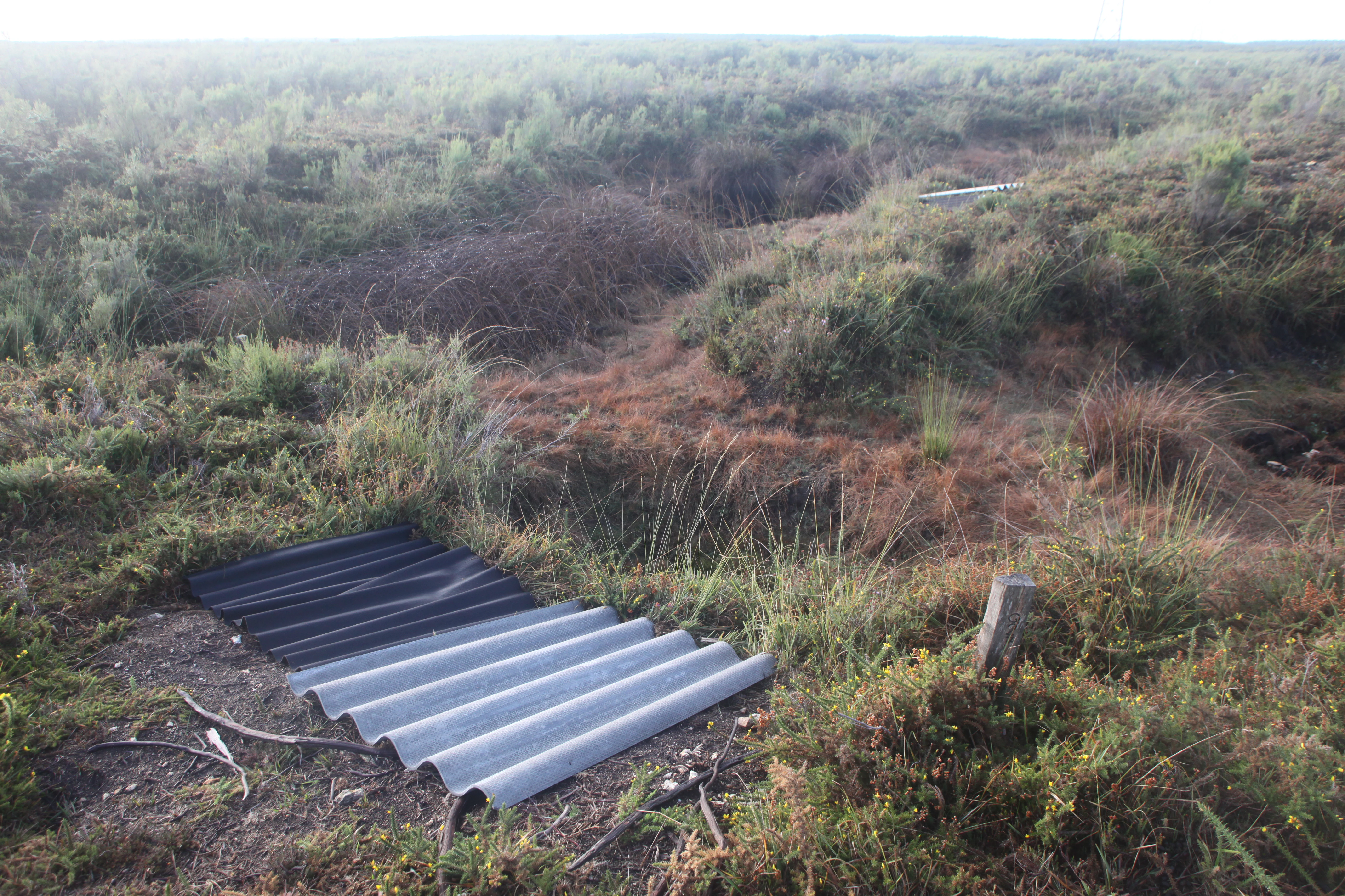
A wide view of a low-lying heather moor landscape with patches of vegetation and small ponds, featuring corrugated roofing sheets lying on the ground in the foreground.
A view of the moors in Réserve naturelle nationale du Pinail, featuring research or monitoring materials placed on the ground.

Best time to visit Réserve naturelle nationale du Pinail

Pinail's heathland character changes markedly with the seasons. Late spring and early summer bring the strongest displays of wetland and heath flowers, including heather in bloom, and are typically when orchids and dragonflies are at their most visible. High summer offers the warmest conditions for amphibian and reptile observation around the ponds.

Autumn lends the heather landscape deep browns and golds, with calmer insect and reptile activity but good bird observation as breeding populations disperse. Winters are mild in the Vienne department, though the open plateau can be wet and cold, making it less comfortable for walking. Guided walks are concentrated in the summer months; in other seasons the site is freely accessible but quieter.
Monthly climate preview

Long term temperature and precipitation averages recorded at a representative coordinate

Réserve naturelle nationale du Pinail Climate Normals and Monthly Weather Patterns

Measured NASA POWER climatology data reveals the annual temperature range and daily precipitation rates recorded across twelve distinct months at a representative point within Réserve naturelle nationale du Pinail. Reviewing the complete monthly profile provides deeper analytical insight into long term thermal rhythms and multi month moisture distribution.
Annual mean12 °C
4 °C21 °C
Jan
Feb
Mar
Apr10°
May14°
Jun18°
Jul21°
Aug21°
Sep17°
Oct13°
Nov
Dec
Warmest month
August

20.8 °C

Coolest month
January

4 °C

Wettest month
November

2.7 mm/day

Driest month
August

1.7 mm/day

Park location guide

Geography guide, regional context, and park location map for Réserve naturelle nationale du Pinail

Réserve naturelle nationale du Pinail park geography, regions, and map view in France

Understand where Réserve naturelle nationale du Pinail sits in France through a broader geographic reading of the surrounding landscape, nearby location context, and its mapped position within the national park landscape.

How Réserve naturelle nationale du Pinail fits into France

France is a unitary semi-presidential republic and one of the world's largest economies. It borders Belgium, Luxembourg, Germany, Switzerland, Italy, Monaco, Andorra, and Spain, with a maritime border to the United Kingdom. The country is known for its cultural influence, art, cuisine, and political history spanning centuries.

Wider geography shaping Réserve naturelle nationale du Pinail in France

France is located in Western Europe. Metropolitan France extends from the Rhine to the Atlantic Ocean and from the Mediterranean Sea to the English Channel and North Sea. The country borders Belgium, Luxembourg, Germany, Switzerland, Italy, Monaco, Andorra, Spain, and has a maritime border with the United Kingdom.

Map view of Réserve naturelle nationale du Pinail

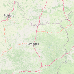
Use this park location map to pinpoint Réserve naturelle nationale du Pinail in France, understand its exact geographic position, and read its mapped placement within the surrounding landscape more clearly.

Pigeon | © OpenStreetMap contributors

Location context for Réserve naturelle nationale du Pinail

Nouvelle-Aquitaine

Visual reference of acidic ponds, heather moorland, and protected plateau terrain

Réserve naturelle nationale du Pinail Photos and Mapped Landscape Scenery

Photographic records capture the unusual topography of thousands of water-filled quarry depressions set within open heather and dwarf gorse moorland. Visual exploration reveals the protected habitats, marly seepages, and distinctive wetland character defining this plateau environment.

A wooden informational signpost for Réserve naturelle nationale du Pinail showing directions for visitors parking, reception, picnic tables, toilets, and residential parking.

Close-up of a flowering gorse shrub with small, bright yellow blossoms and sharp, needle-like green and brown foliage.

A small dark pond nested within dense green heath vegetation, typical of the landscape at Pinail National Nature Reserve.

A small, dark-water pond surrounded by low shrubs and heath vegetation, typical of the Pinail nature reserve.

A close-up shot of small pink heather flowers on a slender green stem with a blurred, dark green background.

A large, circular stone millstone with moss growth standing upright in a wooded area in the Pinail nature reserve.

A rustic, dark, thatched-roof hut sits on the left of an open, marshy landscape; a wooden boardwalk platform is in the foreground, with low-lying brush and heather in the background under a cloudy sky.

A wide view of a low-lying heather moor landscape with patches of vegetation and small ponds, featuring corrugated roofing sheets lying on the ground in the foreground.

A panoramic view of an open moorland landscape featuring a small pond in the foreground and low-lying shrubs under a cloudy sky.

Park atlas

Compare nearby regional reserves, wetland habitats, and protected landscapes across west-central France.

Parks Near Réserve naturelle nationale du Pinail and Surrounding Protected Areas

Browsing other protected areas near Réserve naturelle nationale du Pinail reveals connected wetland ecosystems and lowland heath habitats across the surrounding Vienne department. Examining adjacent regional reserves provides broader geographic context for comparing specialized aquatic and moorland terrain.
A soft watercolor painting of a serene natural landscape with rolling hills, a calm body of water, and forested ridges under a pastel sky.
Nature reserveFrance
About 5.4 km away#1 closest

Northwest

Réserve naturelle régionale du site de Saint-Cyr: Wetland Geography and Protected Landscapes

Mapping a 39-hectare wetland refuge along the Clain river in France.

Located in the Vienne department, this regional nature reserve provides a critical link for waterbirds moving between the Loire valley and the Atlantic coast. The landscape features a mosaic of ponds, small islands, and alluvial forests that highlight the successful transition from former industrial quarry land into a biodiverse wetland ecosystem.

Watercolor painting of a winding river flowing through a grassy plain, with soft green hills in the distance and a large rock in the foreground.
Nature reserveCentre-Val de Loire
About 37 km away#2 closest

East

Réserve naturelle régionale du Bois des Roches: Geographic Overview and Protected Area Atlas

Limestone cliffs and archaeological landscapes in Centre-Val de Loire

Situated in the Indre department of France, this nature reserve is defined by its south-facing limestone cliffs and diverse ecological layers. Beyond its role as a sanctuary for bat colonies and thermophilic flora, the site reveals a deep history of Upper Paleolithic human occupation. MoriAtlas provides a comprehensive geographic look at this protected landscape and its structural role within the broader Brenne ecological context.

Area
0.122 km²
Established
1997
IUCN
IV
Relief
Upland
Nature reserveCentre-Val de Loire
About 53 km away#3 closest

East

Réserve naturelle régionale des terres et étangs de Brenne, Massé, Foucault Geographic Details

A managed wetland landscape in the Centre-Val de Loire

Analyze the terrain of the Réserve naturelle régionale des terres et étangs de Brenne, Massé, Foucault. This reserve showcases a dense network of freshwater ponds and diverse plant communities, including rare species like the marsh gentian, across a finely textured wetland environment in central France.

Area
3.19 km²
Established
2014
IUCN
IV
Relief
Lowland
Nature reserveCentre-Val de Loire
About 53 km away#4 closest

Northwest

Marais de Taligny Regional Nature Reserve: A Protected Wetland in Centre-Val de Loire

Alluvial valley geography and restored marshland habitats

Spanning the Négron valley, this regional nature reserve serves as an vital sanctuary for alkaline fen formations and diverse aquatic species. The site provides a detailed look at the intersection of riverine drainage, alluvial woodland, and the successful ecological restoration of historical French wetland landscapes.

Area
0.354 km²
Established
2014
IUCN
IV
Relief
Lowland
Nature reserveNouvelle-Aquitaine
About 66 km away#5 closest

Northwest

Réserve naturelle régionale de la vallée du Pressoir: Protected Limestone Valley and Geoheritage

A rare natural and cultural mosaic in Nouvelle-Aquitaine

Trace the boundaries and natural features of the Réserve naturelle régionale de la vallée du Pressoir. This protected site in the Deux-Sèvres department is defined by thin calcareous soils, the historic Pommiers cascade, and fossil-rich limestone outcrops that form an unusual geoheritage landscape.

Area
0.56 km²
Established
2025
IUCN
IV
Visitors
10K annual
Nature reservePays de la Loire
About 67 km away#6 closest

Northwest

Réserve naturelle régionale Champagne de Méron: Geographic and Protected Area Overview

A regional nature reserve within the Maine-et-Loire department.

Located in the heart of the Anjou countryside, Réserve naturelle régionale Champagne de Méron represents a strategic effort to safeguard biodiversity within western France. Covering 146 hectares, this protected area illustrates the intersection of modern conservation goals and historic rural landscapes, offering a clear view of how regional authorities manage and restore fragmented natural habitats.

Area
1.461 km²
Established
2023
IUCN
IV
Scope
Terrestrial
Nature reserveNouvelle-Aquitaine
About 67 km away#7 closest

Northwest

Réserve naturelle nationale du Toarcien: Protected Jurassic Stratotype and Geological Map

A vital paleontological heritage site in the Nouvelle-Aquitaine region

As the smallest national nature reserve in France, Réserve naturelle nationale du Toarcien provides a concentrated, scientifically essential view of Jurassic marine sediments. The protected quarries preserve ammonite-rich strata and complex geological unconformities, serving as the international definition for the Toarcian geological stage within the Thouet valley landscape.

Area
0.006 km²
Established
1987
IUCN
III
Relief
Lowland
Nature reserveDeux-Sèvres
About 72 km away#8 closest

West

Réserve naturelle régionale du bocage des Antonins: Protected Landscape and Geographic Atlas

Detailed ecological mapping of the Gâtine armoricaine countryside

The Réserve naturelle régionale du bocage des Antonins occupies a distinct space in the Deux-Sèvres department. This protected area serves as a repository for the traditional bocage countryside, featuring a complex arrangement of pollarded trees, wet meadows, and the historic étang des Forges. The site offers a significant look at the structural history of rural western France through its preserved environmental matrix.

Area
0.226 km²
Established
2015
IUCN
IV
Relief
Lowland

Common questions about visiting, size, designation, and location context for Réserve naturelle nationale du Pinail

Réserve naturelle nationale du Pinail FAQs for park facts, access, geography, and protected area context

Find quick answers about Réserve naturelle nationale du Pinail, including protected-area facts, park geography, trail and visitor context, and how the park fits into its surrounding country and regional landscape.
MoriAtlas Explorer

Continue Your Protected Areas Search Across the Global Atlas

Deepen your exploration by continuing the structured search for national parks and protected areas worldwide. Utilize the comprehensive filtering capabilities to compare different conservation landscapes and refine your understanding of global park geography. Discover more about the distribution and characteristics of protected natural areas.

Global natural geography