Mori Atlas logo
Nature reserveRéserve naturelle nationale du Toarcien

A rare paleontological window into the Early Jurassic within the rural Thouet valley of Nouvelle-Aquitaine

Réserve naturelle nationale du Toarcien: Global Geological Stratotype and Protected Jurassic Landscape

The Réserve naturelle nationale du Toarcien stands as a globally significant protected area, safeguarding the international reference outcrop for the Toarcian stage of the Early Jurassic. Situated across two former open-pit quarries near Thouars, this compact reserve documents vital geological history through rich fossiliferous marine sedimentary formations. Over 80 species of ammonites alongside diverse marine organisms reveal 34 distinct biostratigraphic horizons, offering an unparalleled look at millions of years of earth history.

geological reservestratotypejurassictoarcianfossilsammonites

Réserve naturelle nationale du Toarcien

Nature reserve

Park overview

Structured park overview, official facts, and landscape profile for Toarcien National Nature Reserve

Toarcien National Nature Reserve park facts, protected area profile, and essential visitor context

Review the core facts for Toarcien National Nature Reserve, including designation, size, terrain, visitor scale, habitats, and operating context in one park-focused overview.

About Toarcien National Nature Reserve

The Toarcien National Nature Reserve is a compact but internationally significant geological protected area in the Thouet valley, just west of Thouars in the Deux-Sèvres department. Although it covers only about 0.61 hectares, it is officially the smallest national nature reserve in France, and its size is a direct reflection of its precise scientific purpose: the protection of two former quarries, the Groies quarry and the Hauts-Côteaux quarry, which together expose the global stratotype of the Toarcian stage of the lower Jurassic.

The Toarcian takes its name from the nearby town of Thouars, romanized historically as Toarcium. In 1849, the French geologist Alcide Dessalines d'Orbigny used one of these quarries, near the Rigollier farm between the villages of Vrines and Pompois in the commune of Sainte-Verge, as the reference section for defining the stage in stratigraphy. The definition was refined by Eugène Eudes-Deslongchamps in the later nineteenth century, then by Jules Welsch, and in 1962 by Jean Gabilly, who introduced the system of horizons based on the distribution of ammonite faunas that remains a foundation of Jurassic biostratigraphy.

Beyond its primary role for the Toarcian, the reserve offers a remarkable cross-section of regional geological history. At site number 2, visitors and researchers can observe three successive stages of the Jurassic, an angular unconformity between the Upper Cretaceous (represented by Cenomanian clays) and the Middle Jurassic (Aalénien), and another unconformity where Mio-Quaternary alluvial deposits of the upper Thouet terrace rest on the Cretaceous. The reserve is administered under a decree of 23 November 1987, with day-to-day management entrusted by convention to the Communauté de Communes du Thouarsais.

Quick facts and research context for Toarcien National Nature Reserve

The Toarcien National Nature Reserve is a geological national nature reserve in the Deux-Sèvres department of western France, near Thouars. Created by decree on 23 November 1987 and managed by the Communauté de Communes du Thouarsais, it covers 0.61 hectares, making it the smallest national nature reserve in France. The reserve's defining role is the protection of the stratotype of the Toarcian stage of the lower Jurassic.

Protection and recognition

Documented terrestrial protection framework, management scope, and verified designation records

Protection Status and International Recognition for Réserve naturelle nationale du Toarcien

Terrestrial protection status, management scope, and official designation details for Réserve naturelle nationale du Toarcien remain fully documented within the global protected area registry. Verified administrative records provide structured insight into the legal framework governing this conservation landscape.

Protection details

Protection scope
Terrestrial
Transboundary protection
No
WDPA ID
39801
Park context

Deeper park guide and search-rich context for Toarcien National Nature Reserve

Toarcien National Nature Reserve history, landscape, wildlife, and travel context

Explore Toarcien National Nature Reserve through its history, landscape character, ecosystems, wildlife, conservation priorities, cultural context, and seasonal travel timing in a structured park guide built for atlas discovery and search intent.

Why Toarcien National Nature Reserve stands out

The reserve is best known for housing the stratotype of the Toarcian, a globally referenced geological stage of the Early Jurassic. This single, tightly defined locality anchors the international definition of the Toarcian, first established by Alcide d'Orbigny in 1849 and later refined by Eugène Eudes-Deslongchamps, Jules Welsch, and Jean Gabilly. The exposures also allow the Toarcian to be divided into 34 ammonite-based horizons, each representing roughly 260,000 years, giving the site an outsized importance in stratigraphy and paleontology despite its very small footprint.

Toarcien National Nature Reserve history and protected-area timeline

The scientific history of the site reaches back to the mid-nineteenth century, when Alcide Dessalines d'Orbigny used a quarry near the Rigollier farm in Sainte-Verge, between the villages of Vrines and Pompois, to establish the Toarcian as a formal stage of the geological time scale in 1849. The definition of the stage at this locality was subsequently refined in the late nineteenth century by Eugène Eudes-Deslongchamps and later by Jules Welsch.

A decisive twentieth-century contribution came in 1962, when Jean Gabilly used the exposures to subdivide the Toarcian into a hierarchy of horizons based on changes in ammonite faunas, a system still used today in Jurassic stratigraphy. The significance of the site, combined with growing concern for the conservation of geologically important outcrops, led to the creation of the national nature reserve by decree on 23 November 1987, formalizing long-standing scientific protections of the quarry faces and their fossils. Since then, management has been delegated by convention to the Communauté de Communes du Thouarsais, which oversees interpretation, conservation, and public education at the site.

Toarcien National Nature Reserve landscape and geographic character

The reserve's landscape is small-scale but geologically dramatic, set within the gentle valley of the Thouet river west of Thouars. The protected area consists of two former open-pit quarries a few hundred meters apart. The first lies at the locality known as les Groies, and the second, roughly 500 meters to the south, at les Hauts-Côteaux. Together they expose a sequence of Jurassic sediments, including ferruginous sandstones, oolitic bioclastic limestones, and marly limestones alternating with marls, totaling only a few meters of vertical section.

The Hauts-Côteaux quarry is the more complete exposure and shows, from base to top, ferruginous sandstones and sandy limestones with bivalves, gastropods, and belemnites as well as abundant worm burrows; about 1.20 meters of bioclastic limestones with ferruginous ooliths that are extraordinarily rich in fossil debris and ammonites, representing the lower and middle Toarcian; and roughly 6.90 meters of clayey limestones alternating with marls containing pelagic fossils such as ammonites, nautili, and belemnites, spanning the upper middle Toarcian into the lower Aalénien. The combination of the open quarry faces and the encompassing rural landscape of the Thouet valley gives the reserve its distinctive character as a working scientific window into a Jurassic seafloor.

Toarcien National Nature Reserve ecosystems, habitats, and plant life

Ecologically, the reserve is primarily a geological and paleontological site rather than a habitat-focused protected area, and its nature is defined by the fossil record rather than by living ecosystems. The protected formations document a marine sedimentary environment from the Early Jurassic, when what is now western France lay beneath a shallow sea. The exposed rocks preserve rich assemblages of marine organisms, including more than 80 species of ammonites, alongside foraminifera, ostracods, bivalves (lamellibranchs), gastropods, belemnites, and nautili.

The surrounding landscape is part of the rural Thouet valley, with exposures of Jurassic, Cretaceous, and Mio-Quaternary sediments that together illustrate long-term changes in sea level, sedimentation, and tectonic uplift in this part of the Nouvelle-Aquitaine region. The angular unconformity between the Cenomanian clays of the Upper Cretaceous and the Aalénien limestones of the Middle Jurassic, and the unconformity beneath the upper terrace alluvium of the Thouet, make the reserve an unusually compact showcase of regional geological evolution.

Toarcien National Nature Reserve wildlife and species highlights

The reserve's "wildlife" is overwhelmingly paleontological rather than biological. Its principal faunal interest lies in the abundance and diversity of Jurassic marine fossils, especially ammonites, of which more than 80 species have been recorded in the Toarcian strata of the reserve. Ammonites are joined by foraminifera, ostracods, bivalves, gastropods, belemnites, and the rarer nautili.

Because ammonites evolved rapidly, their successive appearances and disappearances serve as finely resolved biostratigraphic markers. Each of the 34 horizons recognized in the Toarcian section is characterized by one or several diagnostic ammonite species, providing an unusually detailed biostratigraphic framework for a single small site. The fossils of the Hauts-Côteaux and Groies quarries are therefore the reserve's living, if deeply ancient, "wildlife," and they remain the focus of scientific study and public interpretation.

Toarcien National Nature Reserve conservation status and protection priorities

From a conservation perspective, the reserve is unusual in that its principal value is the long-term protection of a globally designated geological reference section, rather than a particular habitat or species assemblage. The 1987 decree explicitly prohibits any form of damage to the quarry face, the mineral substances, and the fossils of the reserve, ensuring that the stratotype remains accessible and intact for future generations of geologists and paleontologists.

The protected area also conserves a remarkable concentration of stratigraphic features in a very small footprint: three successive Jurassic stages, major unconformities linking the Jurassic, the Upper Cretaceous, and the Mio-Quaternary alluvial terraces of the Thouet, and a dense fossil record rich enough to anchor the international definition of an entire geological stage. By safeguarding these elements in situ, the reserve preserves not only French scientific heritage but a reference point of global importance for the geological time scale.

Toarcien National Nature Reserve cultural meaning and human context

The reserve's cultural identity is tightly bound to the town of Thouars, from which the Toarcian geological stage takes its name, and to the long French tradition of stratigraphic research that began with Alcide d'Orbigny in the mid-nineteenth century. The quarries at les Groies and les Hauts-Côteaux, in the commune of Sainte-Verge, are inseparable from the history of geology in the Thouarsais area, a region that has been central to European Jurassic stratigraphy for more than 170 years.

Interpretation panels and numbered poles at the quarry site mark the different strata and explain the geological succession to visitors, linking the local industrial past of small limestone quarries to a present-day role as a teaching and heritage site. Management by the Communauté de Communes du Thouarsais reflects this local cultural stewardship and the integration of the reserve into the regional identity of the Thouet valley.

Top sights and standout views in Toarcien National Nature Reserve

The Toarcien reserve's standout quality is the global stratotype of the Toarcian, protected in an area almost unbelievably small by national-reserve standards. Highlights include the exposures at the Groies and Hauts-Côteaux quarries, a Toarcian section rich in more than 80 ammonite species, the 34 ammonite-based horizons defined by Jean Gabilly in 1962, and the rare opportunity to walk across three successive Jurassic stages and major regional unconformities within a single hectare-scale site.

Best time to visit Toarcien National Nature Reserve

Because the reserve's principal interest is its permanent rock exposures and fossils rather than seasonal scenery, it can be informative year-round for visitors interested in geology. Spring and autumn typically offer the most comfortable conditions for walking between the two quarries and reading the interpretation panels along the quarry faces, while the open exposures make features of the stratotype visible regardless of season. Researchers and classrooms often favour periods when the rock surfaces are dry, since the fossil-bearing layers and the unconformities are then easiest to observe in detail.
Monthly climate preview

Long-term temperature ranges and monthly precipitation averages for the protected landscape

Réserve naturelle nationale du Toarcien Climate Normals and Annual Weather Patterns

Historical climate measurements across the representative coordinate outline annual temperature swings and precipitation rhythms at Réserve naturelle nationale du Toarcien. Detailed monthly averages provide deeper context for studying long-term environmental conditions across the protected area.
Annual mean12 °C
4 °C20 °C
Jan
Feb
Mar
Apr10°
May14°
Jun18°
Jul20°
Aug20°
Sep17°
Oct12°
Nov
Dec
Warmest month
August

20 °C

Coolest month
January

4.3 °C

Wettest month
November

2.6 mm/day

Driest month
August

1.5 mm/day

Park location guide

Geography guide, regional context, and park location map for Toarcien National Nature Reserve

Toarcien National Nature Reserve park geography, regions, and map view in France

Understand where Toarcien National Nature Reserve sits in France through a broader geographic reading of the surrounding landscape, nearby location context, and its mapped position within the national park landscape.

How Toarcien National Nature Reserve fits into France

France is a unitary semi-presidential republic and one of the world's largest economies. It borders Belgium, Luxembourg, Germany, Switzerland, Italy, Monaco, Andorra, and Spain, with a maritime border to the United Kingdom. The country is known for its cultural influence, art, cuisine, and political history spanning centuries.

Wider geography shaping Toarcien National Nature Reserve in France

France is located in Western Europe. Metropolitan France extends from the Rhine to the Atlantic Ocean and from the Mediterranean Sea to the English Channel and North Sea. The country borders Belgium, Luxembourg, Germany, Switzerland, Italy, Monaco, Andorra, Spain, and has a maritime border with the United Kingdom.

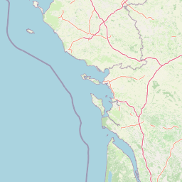
Map view of Toarcien National Nature Reserve

Use this park location map to pinpoint Toarcien National Nature Reserve in France, understand its exact geographic position, and read its mapped placement within the surrounding landscape more clearly.

Pigeon | © OpenStreetMap contributors

Location context for Toarcien National Nature Reserve

Nouvelle-Aquitaine
Park atlas

Compare regional protected landscapes and geological reserves across western France

Exploring Parks Near Réserve naturelle nationale du Toarcien and Surrounding Protected Areas

Visitors exploring Réserve naturelle nationale du Toarcien can browse adjacent natural reserves and regional protected landscapes to examine wider geological formations. Comparing surrounding protected areas provides essential context on the regional diversity of French natural heritage.
Nature reserveNouvelle-Aquitaine
About 3 km away#1 closest

South

Réserve naturelle régionale de la vallée du Pressoir: Protected Limestone Valley and Geoheritage

A rare natural and cultural mosaic in Nouvelle-Aquitaine

Trace the boundaries and natural features of the Réserve naturelle régionale de la vallée du Pressoir. This protected site in the Deux-Sèvres department is defined by thin calcareous soils, the historic Pommiers cascade, and fossil-rich limestone outcrops that form an unusual geoheritage landscape.

Area
0.56 km²
Established
2025
IUCN
IV
Visitors
10K annual
Nature reservePays de la Loire
About 16 km away#2 closest

Northeast

Réserve naturelle régionale Champagne de Méron: Geographic and Protected Area Overview

A regional nature reserve within the Maine-et-Loire department.

Located in the heart of the Anjou countryside, Réserve naturelle régionale Champagne de Méron represents a strategic effort to safeguard biodiversity within western France. Covering 146 hectares, this protected area illustrates the intersection of modern conservation goals and historic rural landscapes, offering a clear view of how regional authorities manage and restore fragmented natural habitats.

Area
1.461 km²
Established
2023
IUCN
IV
Scope
Terrestrial
Nature reserveCentre-Val de Loire
About 36 km away#3 closest

Northeast

Marais de Taligny Regional Nature Reserve: A Protected Wetland in Centre-Val de Loire

Alluvial valley geography and restored marshland habitats

Spanning the Négron valley, this regional nature reserve serves as an vital sanctuary for alkaline fen formations and diverse aquatic species. The site provides a detailed look at the intersection of riverine drainage, alluvial woodland, and the successful ecological restoration of historical French wetland landscapes.

Area
0.354 km²
Established
2014
IUCN
IV
Relief
Lowland
A soft watercolor illustration featuring a calm pond in the foreground, with reeds on the right and a distant treeline and rolling hills in the background.
Nature reservePays de la Loire
About 36 km away#4 closest

North

Réserve naturelle régionale des étang et boisements de Joreau: Protected Area Atlas Profile

Wetland and woodland mosaic in the Pays de la Loire region.

This profile examines the 92-hectare Réserve naturelle régionale des étang et boisements de Joreau, a protected area in the Maine-et-Loire department. The site features a specialized composition of freshwater ponds and mature woodlands, reflecting the traditional riverine landscapes found throughout the broader Loire Valley regional geography.

Area
0.92 km²
Established
2015
IUCN
IV
Nature reservePays de la Loire
About 55 km away#5 closest

Northwest

Réserve naturelle régionale de Basses-Brosses et Chevalleries: Protected Area Mapping

A dense bocage landscape in the Pays de la Loire region

This regional nature reserve protects a well-preserved mosaic of meadows, cultivated plots, and wooded hedgerows across 90 hectares. The site serves as a vital ecological anchor in the Maine-et-Loire department, maintaining traditional land patterns and diverse species habitats that define the historic rural character of the Anjou countryside.

Area
0.9 km²
Established
2012
IUCN
IV
Nature reserveDeux-Sèvres
About 55 km away#6 closest

South

Réserve naturelle régionale du bocage des Antonins: Protected Landscape and Geographic Atlas

Detailed ecological mapping of the Gâtine armoricaine countryside

The Réserve naturelle régionale du bocage des Antonins occupies a distinct space in the Deux-Sèvres department. This protected area serves as a repository for the traditional bocage countryside, featuring a complex arrangement of pollarded trees, wet meadows, and the historic étang des Forges. The site offers a significant look at the structural history of rural western France through its preserved environmental matrix.

Area
0.226 km²
Established
2015
IUCN
IV
Relief
Lowland
A soft watercolor painting of a serene natural landscape with rolling hills, a calm body of water, and forested ridges under a pastel sky.
Nature reserveFrance
About 62 km away#7 closest

Southeast

Réserve naturelle régionale du site de Saint-Cyr: Wetland Geography and Protected Landscapes

Mapping a 39-hectare wetland refuge along the Clain river in France.

Located in the Vienne department, this regional nature reserve provides a critical link for waterbirds moving between the Loire valley and the Atlantic coast. The landscape features a mosaic of ponds, small islands, and alluvial forests that highlight the successful transition from former industrial quarry land into a biodiverse wetland ecosystem.

A soft watercolor painting of a calm pond surrounded by green grasses, shrubs, and rolling hills in the background.
Nature reserveNouvelle-Aquitaine
About 67 km away#8 closest

Southeast

Réserve naturelle nationale du Pinail: Protected Pond and Heathland Mosaic in Nouvelle-Aquitaine

Mapped geography of a unique French nature reserve

Located in the Nouvelle-Aquitaine region, Réserve naturelle nationale du Pinail preserves a rare cultural-ecological landscape. The site features an extraordinary concentration of three thousand small acidic ponds created by medieval millstone quarrying, now surrounded by protected heather and dwarf gorse heathland. This structured overview highlights the terrain, habitat connectivity, and regional importance of this internationally recognized Ramsar wetland site.

Area
1.35 km²
Established
1980
IUCN
IV
Relief
Lowland

Common questions about visiting, size, designation, and location context for Toarcien National Nature Reserve

Toarcien National Nature Reserve FAQs for park facts, access, geography, and protected area context

Find quick answers about Toarcien National Nature Reserve, including protected-area facts, park geography, trail and visitor context, and how the park fits into its surrounding country and regional landscape.
MoriAtlas Explorer

Continue Your Protected Areas Search Across the Global Atlas

Deepen your exploration by continuing the structured search for national parks and protected areas worldwide. Utilize the comprehensive filtering capabilities to compare different conservation landscapes and refine your understanding of global park geography. Discover more about the distribution and characteristics of protected natural areas.

Global natural geography