
Mori Atlas logo
Nature reserveRéserve naturelle régionale de la pointe Saint-Gildas

Understanding the landscape and estuarine boundaries of the Pointe Saint-Gildas headland

Réserve naturelle régionale de la pointe Saint-Gildas: Coastal Protected Area Geography

The Réserve naturelle régionale de la pointe Saint-Gildas protects a distinct coastal environment at the interface where the Loire estuary meets the Atlantic Ocean in the Pays de la Loire region of western France. Spanning a compact peninsula in Préfailles, this protected area serves as an ecologically strategic site within the national heritage framework. The geography highlights the dynamic interaction between riverine outflows and marine tides, defining the narrow headland terrain found at the mouth of the Loire.

regional nature reservecoastal headlandLoire estuaryAtlantic coastPays de la LoireLoire-Atlantique
A flat vector illustration of a coastal landscape featuring tall sea stacks rising from the ocean, sandy beaches, cliffs, and pine trees under a warm sunset sky.

Réserve naturelle régionale de la pointe Saint-Gildas

Nature reserve

Park overview

Structured park overview, official facts, and landscape profile for Réserve naturelle régionale de la pointe Saint-Gildas

Réserve naturelle régionale de la pointe Saint-Gildas park facts, protected area profile, and essential visitor context

Review the core facts for Réserve naturelle régionale de la pointe Saint-Gildas, including designation, size, terrain, visitor scale, habitats, and operating context in one park-focused overview.

About Réserve naturelle régionale de la pointe Saint-Gildas

The Réserve naturelle régionale de la pointe Saint-Gildas is one of France's many regional nature reserves, a category of protected area established under French regional environmental policy. Unlike large national parks or national nature reserves, regional nature reserves are typically compact sites designated and managed at the level of the région, often with strong involvement from local municipalities. The pointe Saint-Gildas reserve reflects this profile: it is small in scale, locally administered, and focused on preserving a specific coastal environment rather than a vast landscape.

The reserve lies on the Atlantic coast of western France, within the Pays de la Loire region. Geographically, it is positioned on the northern side of the mouth of the Loire river, on the commune of Préfailles in Loire-Atlantique. The Pointe Saint-Gildas itself is a pronounced headland that extends into the estuary's outer reaches, creating a transitional zone where marine and estuarine conditions blend. This makes the area ecologically interesting even though its overall footprint is limited.

As a regional nature reserve created in 2014, the site sits within a structured French framework of protected-area designation. It is recorded in international databases, including the World Database on Protected Areas under the identifier 555597223, and is recognized through France's national natural heritage inventory. The site's IUCN Category IV classification indicates that it is managed primarily for the protection of species, habitats, and specific landscape features, rather than as a wilderness or ecosystem-level protection zone.

Quick facts and research context for Réserve naturelle régionale de la pointe Saint-Gildas

The Réserve naturelle régionale de la pointe Saint-Gildas is situated in the Loire-Atlantique department of the Pays de la Loire region, on the commune of Préfailles. It covers an area of approximately 11.5 hectares at the tip of the Pointe Saint-Gildas peninsula. The reserve was officially created on 14 April 2014 by deliberation of the Regional Council of Pays de la Loire, and is managed by the Mairie de Préfailles. It is classified as a regional nature reserve, corresponding to IUCN Category IV, a designation used for areas requiring active management to protect habitats and species.

Protection and recognition

Review documented conservation management scope and official protected area records.

Protection Status and International Recognition Data for Réserve naturelle régionale de la pointe Saint-Gildas

Documented protection records for Réserve naturelle régionale de la pointe Saint-Gildas outline its established conservation scope and management parameters. Verified database entries provide transparent insight into official protected area designations without speculative claims.

Protection details

Protection scope
Mixed
Transboundary protection
No
WDPA ID
555597223
Park context

Deeper park guide and search-rich context for Réserve naturelle régionale de la pointe Saint-Gildas

Réserve naturelle régionale de la pointe Saint-Gildas history, landscape, wildlife, and travel context

Explore Réserve naturelle régionale de la pointe Saint-Gildas through its history, landscape character, ecosystems, wildlife, conservation priorities, cultural context, and seasonal travel timing in a structured park guide built for atlas discovery and search intent.

Why Réserve naturelle régionale de la pointe Saint-Gildas stands out

The reserve is known primarily for protecting a fragment of coastal habitat at the tip of the Pointe Saint-Gildas, where Atlantic and estuarine influences converge. Its defining characteristic is its geographic position: a narrow headland where the Loire estuary meets the open Atlantic, making it a small but ecologically strategic site along the French Atlantic coast.
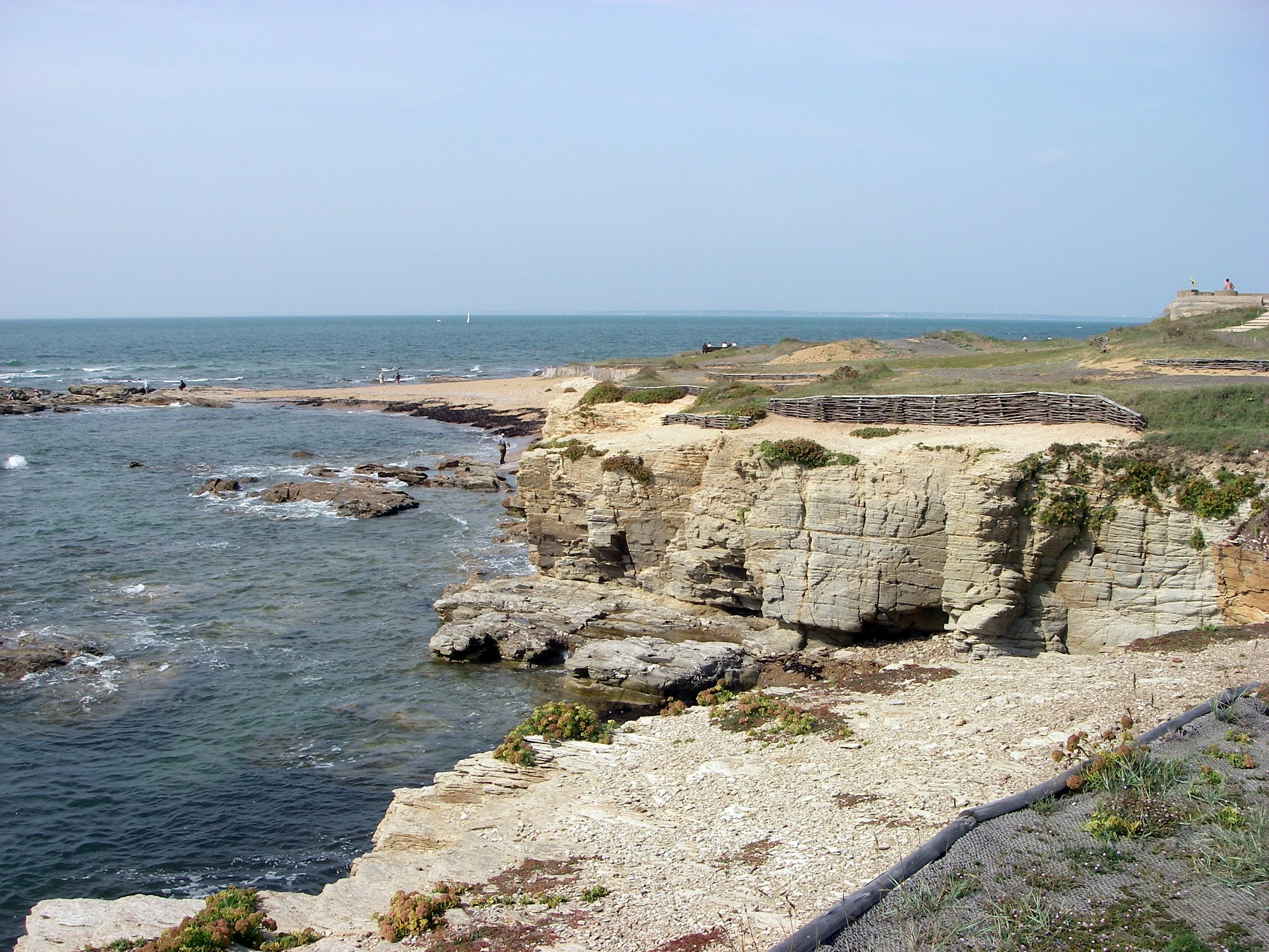
A wide view of a rocky coastline with light-colored cliffs meeting the sea, featuring a low wooden fence structure on the headland.
Coastal view of the rocky cliffs and shoreline at the Pointe Saint-Gildas nature reserve.

Réserve naturelle régionale de la pointe Saint-Gildas history and protected-area timeline

The Réserve naturelle régionale de la pointe Saint-Gildas was formally established on 14 April 2014, following a deliberation of the Regional Council of Pays de la Loire. Its creation reflects the French system of regional nature reserves, which allows regional authorities to designate protected sites of local ecological, landscape, or educational interest.

Administration of the reserve was entrusted to the Mairie de Préfailles, the commune where the reserve sits. This municipal management model is characteristic of many small French regional nature reserves, where the local town hall plays a central role in day-to-day stewardship, coordination with regional authorities, and oversight of the reserve's perimeter.

Beyond its creation date and administrative structure, the public documentation available does not provide a detailed narrative of earlier land use, prior protection efforts, or specific milestones leading to its designation. As a result, the historical record for this site remains limited to its formal establishment and institutional framework.

Réserve naturelle régionale de la pointe Saint-Gildas landscape and geographic character

The landscape of the Réserve naturelle régionale de la pointe Saint-Gildas is defined by its position at the extremity of a coastal peninsula in Loire-Atlantique. The Pointe Saint-Gildas extends outward toward the mouth of the Loire, where the great river meets the Atlantic Ocean. This setting produces a distinctive headland environment shaped by tidal influence, marine exposure, and estuarine dynamics.

Although the reserve itself covers only about 11.5 hectares, its geography places it at a focal point along the Pays de la Loire coast. The terrain combines coastal exposure with the transitional character of an estuarine tip, where freshwater outflow from the Loire interacts with saltwater conditions from the Atlantic. This makes the site visually and ecologically representative of the outer-estuary landscape of western France.

Réserve naturelle régionale de la pointe Saint-Gildas conservation status and protection priorities

The reserve's conservation significance lies in its role as a protected site at the interface between the Loire estuary and the Atlantic Ocean. By securing a portion of the Pointe Saint-Gildas under regional nature reserve status, French regional authorities have formally recognized the ecological and landscape value of this coastal tip.

Its IUCN Category IV designation indicates that the site is managed with a focus on preserving specific habitats, species, or geomorphological features rather than a full ecosystem process. The reserve's inclusion in national and international databases, including France's Inventaire national du patrimoine naturel and the World Database on Protected Areas, reflects its formal place within France's broader network of protected natural areas.

Réserve naturelle régionale de la pointe Saint-Gildas cultural meaning and human context

The reserve is closely tied to the commune of Préfailles, which serves as its administering authority. This reflects the broader French tradition of embedding small protected natural areas into everyday municipal life, with local communities playing a direct role in stewardship. The headland itself, Pointe Saint-Gildas, has a longstanding identity as a recognizable coastal landmark along the northern bank of the Loire's mouth.

Top sights and standout views in Réserve naturelle régionale de la pointe Saint-Gildas

The reserve's most distinctive feature is its geographic position at the very tip of the Pointe Saint-Gildas, where the Loire estuary intersects with the open Atlantic. Despite its small size of roughly 11.5 hectares, it gains ecological significance from this strategic location.

Its formal recognition through French regional nature reserve status, IUCN Category IV classification, and inclusion in national and international protected-area databases underscore its official conservation standing.

Best time to visit Réserve naturelle régionale de la pointe Saint-Gildas

Public source material does not provide specific seasonal guidance for the reserve. As a coastal site at the mouth of the Loire, its character would broadly reflect the temperate maritime climate of the Pays de la Loire, with mild conditions influenced by the Atlantic. Visitors interested in coastal scenery may find periods of stable weather particularly suitable, though no specific seasonal details are documented in available sources.
Monthly climate preview

Long-term annual temperature ranges and monthly precipitation patterns for the protected coastal coordinate

Réserve naturelle régionale de la pointe Saint-Gildas Climate and Temperature Normals

Representative coordinate records show average monthly temperatures ranging from 8.37 °C to 18.79 °C alongside varying daily precipitation levels across the twelve-month climatology period. Examining the complete monthly climate dataset provides detailed insight into long-term thermal rhythms and moisture distribution at this protected coastal terrain.
Annual mean13 °C
8 °C19 °C
Jan
Feb
Mar10°
Apr11°
May14°
Jun17°
Jul18°
Aug19°
Sep17°
Oct15°
Nov12°
Dec10°
Warmest month
August

18.8 °C

Coolest month
February

8.4 °C

Wettest month
November

2.9 mm/day

Driest month
July

1.2 mm/day

Park location guide

Geography guide, regional context, and park location map for Réserve naturelle régionale de la pointe Saint-Gildas

Réserve naturelle régionale de la pointe Saint-Gildas park geography, regions, and map view in France

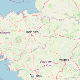
Understand where Réserve naturelle régionale de la pointe Saint-Gildas sits in France through a broader geographic reading of the surrounding landscape, nearby location context, and its mapped position within the national park landscape.

How Réserve naturelle régionale de la pointe Saint-Gildas fits into France

France is a unitary semi-presidential republic and one of the world's largest economies. It borders Belgium, Luxembourg, Germany, Switzerland, Italy, Monaco, Andorra, and Spain, with a maritime border to the United Kingdom. The country is known for its cultural influence, art, cuisine, and political history spanning centuries.

Wider geography shaping Réserve naturelle régionale de la pointe Saint-Gildas in France

France is located in Western Europe. Metropolitan France extends from the Rhine to the Atlantic Ocean and from the Mediterranean Sea to the English Channel and North Sea. The country borders Belgium, Luxembourg, Germany, Switzerland, Italy, Monaco, Andorra, Spain, and has a maritime border with the United Kingdom.

Map view of Réserve naturelle régionale de la pointe Saint-Gildas

Use this park location map to pinpoint Réserve naturelle régionale de la pointe Saint-Gildas in France, understand its exact geographic position, and read its mapped placement within the surrounding landscape more clearly.

Pigeon | © OpenStreetMap contributors

Location context for Réserve naturelle régionale de la pointe Saint-Gildas

Pays de la Loire

Explore photographic records of the protected headland, estuarine terrain, and Atlantic shorelines.

Visualizing Réserve naturelle régionale de la pointe Saint-Gildas: Landscapes, Scenery, and Coastal Habitats

Photographic collections reveal the rugged coastal terrain, marine exposure, and estuarine habitats defining Réserve naturelle régionale de la pointe Saint-Gildas. Visual research into protected headland environments provides deeper insight into the unique geography where the Loire meets the Atlantic Ocean.

A wide view of a rocky coastline with light-colored cliffs meeting the sea, featuring a low wooden fence structure on the headland.

Park atlas

Compare coastal landscapes and regional nature reserves across western France.

Explore Parks Near Réserve naturelle régionale de la pointe Saint-Gildas and Surrounding Protected Areas

Browsing other protected areas near Réserve naturelle régionale de la pointe Saint-Gildas reveals connected coastal habitats and estuarine geography along the Atlantic margin. Extending geographic comparison across Pays de la Loire broadens understanding of regional conservation networks and coastal reserves.
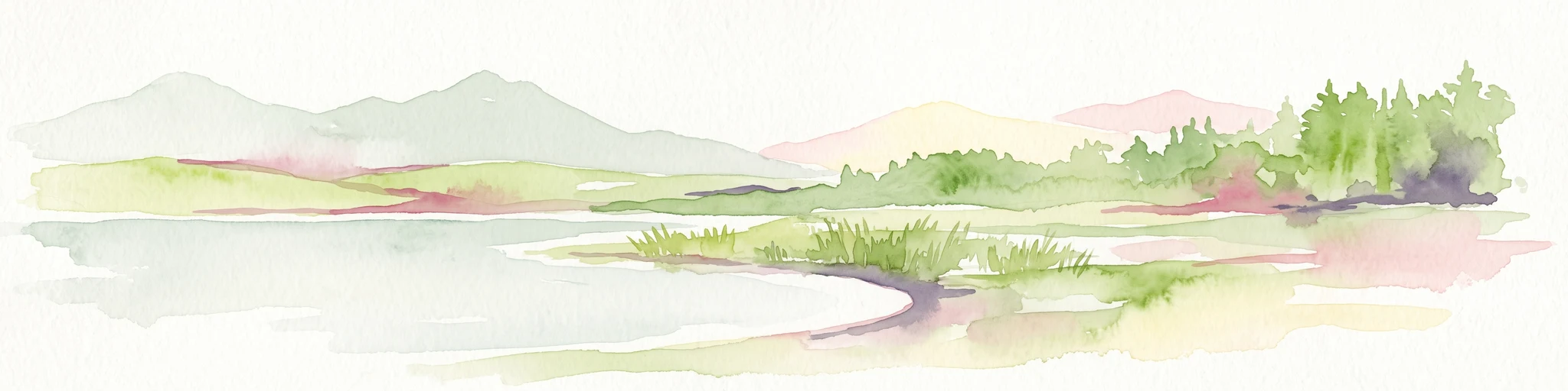
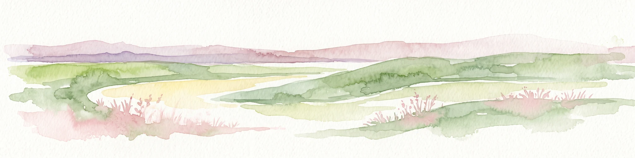
Watercolor painting of a coastal polder landscape with green grassy mounds, light yellow flat areas, and soft purple hills in the distance.
Nature reservePays de la Loire
About 22 km away#1 closest

South

Réserve naturelle régionale du polder de Sébastopol: Coastal Wetland and Polder Geography

Protected coastal landscape on the Île de Noirmoutier.

This 133-hectare nature reserve in the Pays de la Loire region encompasses a distinctive 19th-century drainage landscape. The area features a long, narrow geometry of brackish ponds and salt-influenced terrain that provides essential stopover and breeding habitats for coastal waterbirds along the Vendée shoreline.

Area
1.33 km²
Established
2008
IUCN
IV
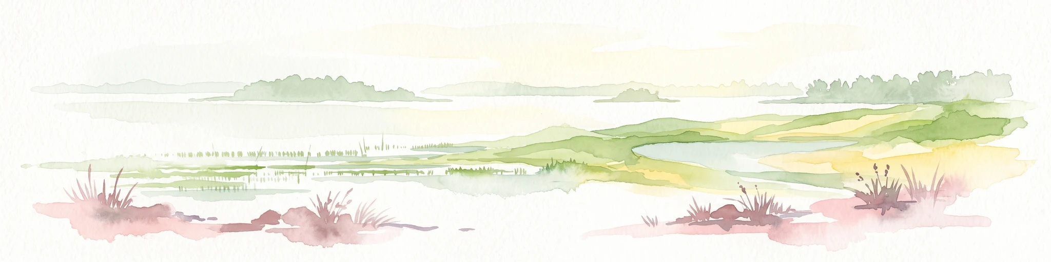
A soft watercolor illustration depicting a serene wetland scene with a calm body of water, grassy marshland, and distant rolling hills under a pale sky.
Nature reservePays de la Loire
About 26 km away#2 closest

North

Réserve naturelle régionale du marais de Brière: Protected Wetland Geography in Western France

A vital conservation mosaic of reedbeds, canals, and flooded meadows.

Located in the Pays de la Loire region, this protected area preserves the distinctive Grande Brière marshland landscape. The reserve manages a complex network of channels, islands, and damp meadows, providing essential habitat for migratory waterbirds and wetland wildlife. It represents a significant effort to maintain the ecological integrity of inland marsh complexes through structured regional conservation.

Area
8.36 km²
Established
2012
IUCN
IV
Nature reserveRomania
About 30 km away#3 closest

Southeast

Réserve naturelle régionale des marais du Bout de Sac: Protected Marsh Geography

Coastal wetland habitat and protected marshland terrain

The Réserve naturelle régionale des marais du Bout de Sac represents 187.1 hectares of preserved wetland habitat. Its landscape includes reclaimed polders, wet meadows, and a network of tidal channels. This site offers significant value for understanding the ecological structure of coastal marshlands and their role as habitats for waterbird populations near the Atlantic interface.

Established
2025
Relief
Lowland
Water
Water-dominated
Nature reserveLoire-Atlantique
About 39 km away#4 closest

North

Réserve naturelle régionale de l'étang du pont de fer: Protected Wetlands of Loire-Atlantique

Coastal freshwater pond, wooded buffers, and wetland connectivity.

This regional nature reserve encompasses a sizeable freshwater pond and surrounding marshes, serving as a vital link in the chain of wetlands between the Vilaine estuary and the Guérande region. Its distinctive landscape, defined by floating sedge islets and dense alder woodland, supports a high density of avifauna and rare plant species. As a key component of the protected terrain in Loire-Atlantique, the reserve offers insight into coastal wetland ecosystems and their function as biodiversity corridors in western France.

Area
0.626 km²
Established
2008
IUCN
IV
Relief
Lowland
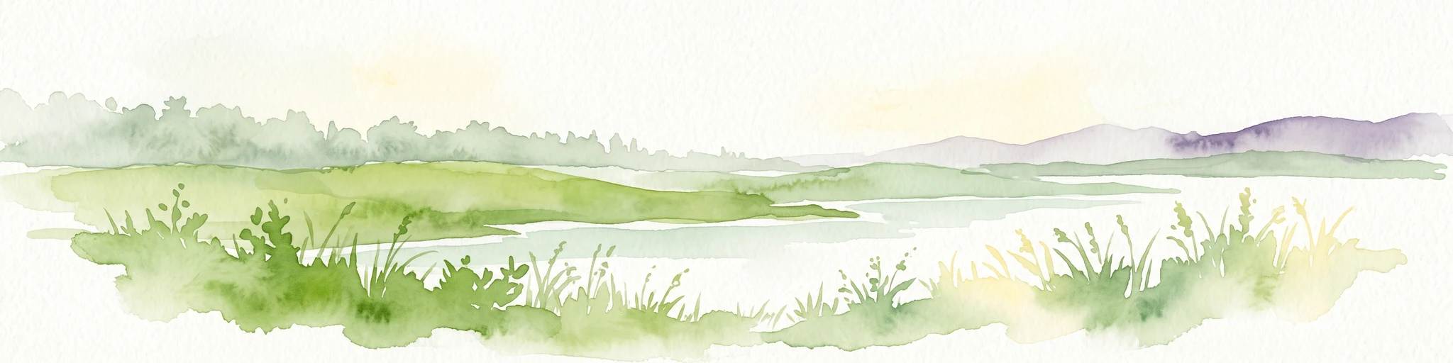
A watercolor painting showing a soft, panoramic view of a coastal wetland with small islands in the distance and grassy foreground dunes.
Regional parkBretagne
About 47 km away#5 closest

Northwest

Parc naturel régional du Golfe du Morbihan: Coastal Landscape and Marine Park Geography

Protected maritime territory and island geography in Bretagne

Covering over 80,000 hectares of combined land and marine space, Parc naturel régional du Golfe du Morbihan offers a unique view into the intersection of Atlantic coastal heritage and environmental conservation. Learn about the park's structural role in the Bretagne region through its intricate network of inlets, peninsulas, and marshland habitats that define its distinctive maritime character.

Area
642 km²
Established
2014
IUCN
V
Nature reservePays de la Loire
About 57 km away#6 closest

East

Réserve naturelle régionale du bocage humide des Cailleries: Protected Landscape and Regional Map

Wet bocage and oak woodland in the Lake Grand-Lieu watershed

Covering roughly 18 hectares, this protected area features a fine-textured mosaic of woody hedgerows, wet meadows, and multiple small ponds. The site acts as a functional refuge for varied flora and fauna, illustrating the traditional Atlantic landscape character within western France through its structured management of meadows and pond systems.

Area
0.182 km²
Established
2012
IUCN
IV
Relief
Lowland
Nature reservePays de la Loire
About 60 km away#7 closest

East

Réserve naturelle régionale de la tourbière de Logné: Protected Wetland Landscape Map

A rare peatland refuge in the Pays de la Loire administrative region

Located on the outskirts of Nantes, the Réserve naturelle régionale de la tourbière de Logné protects a delicate raised bog system. This atlas entry provides a detailed look at the basin terrain, its surrounding hills, and the wetland connectivity that supports its status as a critical botanical and invertebrate sanctuary within the Erdre valley.

Area
0.706 km²
Established
2011
IUCN
IV
Nature reservePays de la Loire
About 83 km away#8 closest

East

Réserve naturelle régionale de la ferme de la Chauffetière: Geographic and Landscape Atlas

Protected nature reserve in the Pays de la Loire region

Spanning 30 hectares, the Réserve naturelle régionale de la ferme de la Chauffetière showcases the authentic Mauges bocage landscape. Its varied terrain includes humid valleys, dry calcareous slopes, and agricultural plateaus, providing essential habitat for amphibians, rare orchids, and saproxylic insects within a living, working farm environment.

Area
0.3 km²
Established
2008
IUCN
IV
Relief
Upland

Common questions about visiting, size, designation, and location context for Réserve naturelle régionale de la pointe Saint-Gildas

Réserve naturelle régionale de la pointe Saint-Gildas FAQs for park facts, access, geography, and protected area context

Find quick answers about Réserve naturelle régionale de la pointe Saint-Gildas, including protected-area facts, park geography, trail and visitor context, and how the park fits into its surrounding country and regional landscape.
MoriAtlas Explorer

Continue Your Protected Areas Search Across the Global Atlas

Deepen your exploration by continuing the structured search for national parks and protected areas worldwide. Utilize the comprehensive filtering capabilities to compare different conservation landscapes and refine your understanding of global park geography. Discover more about the distribution and characteristics of protected natural areas.

Global natural geography