
Mori Atlas logo
Nature reserveRéserve naturelle régionale de l'étang de Haute-Jarrie

A vital migratory stopover and diverse wetland ecosystem on the Plateau de Champagnier

Réserve naturelle régionale de l'étang de Haute-Jarrie: Protected Wetlands and Glacial Landscapes in Isère

(Réserve naturelle régionale de l'étang de Haute-Jarrie (RNR74))

The Réserve naturelle régionale de l'étang de Haute-Jarrie represents a unique protected landscape in the Isère department of France. Spanning approximately 11 hectares on the Plateau de Champagnier, this regional nature reserve encompasses a significant glacial pond surrounded by a mosaic of reedbeds, wet meadows, and woodland patches. It serves as an essential migratory stopover for numerous bird species and provides a dense sanctuary for amphibians, dragonflies, and various wetland flora.

wetlandpondreedbedregional nature reservewet meadowbirdwatching
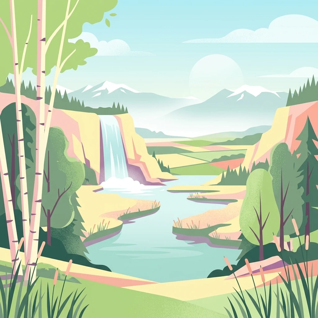
A flat-style digital illustration of a scenic valley with a pond, a waterfall cascading over cliffs, birch trees in the foreground, and distant snow-capped mountains.

Réserve naturelle régionale de l'étang de Haute-Jarrie

Nature reserve

Park overview

Structured park overview, official facts, and landscape profile for Réserve naturelle régionale de l'étang de Haute-Jarrie

Réserve naturelle régionale de l'étang de Haute-Jarrie park facts, protected area profile, and essential visitor context

Review the core facts for Réserve naturelle régionale de l'étang de Haute-Jarrie, including designation, size, terrain, visitor scale, habitats, and operating context in one park-focused overview.

About Réserve naturelle régionale de l'étang de Haute-Jarrie

The Réserve naturelle régionale de l'étang de Haute-Jarrie is a regional-level protected area in the Auvergne-Rhône-Alpes region of southeastern France. It lies on the Plateau de Champagnier, in the commune of Jarrie, just outside Grenoble in the Isère department. Though modest in size at roughly 11 hectares, it concentrates a remarkable variety of aquatic and wetland habitats around a single glacial pond, making it one of the most biodiversity-dense small reserves in the region.

The pond itself originated at the end of the last glaciation, when retreating glaciers left depressions that filled with water. Around it, the reserve protects a mosaic of reedbeds, wet meadows, and wooded patches, all part of a hydrological system that is small in scale but ecologically critical. The surrounding protection perimeter extends the area under regulated management to 21 hectares and helps buffer the core habitats from adjacent land uses in this peri-urban setting.

What defines Haute-Jarrie today is its combination of ecological richness and proximity to a major urban center. It serves simultaneously as a refuge for sensitive wetland species, a stopover for migratory birds following the Grésivaudan corridor, and an outdoor classroom where residents of the Grenoble metropolitan area can engage with nature close to home. The reserve's identity is tied as much to its accessibility as to its biological inventory: a place where dragonflies, herons, amphibians, and rare plants coexist within walking distance of a large city.

Quick facts and research context for Réserve naturelle régionale de l'étang de Haute-Jarrie

Located in Isère on the Plateau de Champagnier near Grenoble at approximately 378 meters elevation, the Réserve naturelle régionale de l'étang de Haute-Jarrie covers about 11 hectares of pond, reedbed, wet meadow, and woodland habitats, with an additional 21-hectare protection perimeter established in 2013. It was formally classified as a regional nature reserve on 25 September 2008 after an earlier voluntary reserve designation in 1984. The site is IUCN Management Category IV and is administered by Grenoble Alpes Métropole. Its flora includes at least 250 taxa and its bird list exceeds 180 species, underscoring the unusually high biological richness concentrated within a very small area.

Protection and recognition

Explore documented terrestrial protection metrics, designation history, and administrative scope.

Réserve naturelle régionale de l'étang de Haute-Jarrie Protection Status and Designation Records

Terrestrial protection records for Réserve naturelle régionale de l'étang de Haute-Jarrie outline the established designation timeline and management framework from 2008. Documented protection status details provide verified conservation context without incorporating unverified international recognition sources.

Protection details

Protection scope
Terrestrial
Designated year
2008
Transboundary protection
No
WDPA ID
555514331
Buffer area
0.21 km²
Park context

Deeper park guide and search-rich context for Réserve naturelle régionale de l'étang de Haute-Jarrie

Réserve naturelle régionale de l'étang de Haute-Jarrie history, landscape, wildlife, and travel context

Explore Réserve naturelle régionale de l'étang de Haute-Jarrie through its history, landscape character, ecosystems, wildlife, conservation priorities, cultural context, and seasonal travel timing in a structured park guide built for atlas discovery and search intent.

Why Réserve naturelle régionale de l'étang de Haute-Jarrie stands out

Haute-Jarrie is best known for the combination of a glacial pond and surrounding marshland that supports a remarkably rich avifauna, more than 180 recorded bird species, on just a few hectares on the edge of the Grenoble metropolitan area. The reserve is also recognized for its historic importance for dragonflies, including the formerly notable Lestes dryas population, and for its long-running role as a migratory stopover along the Grésivaudan valley.
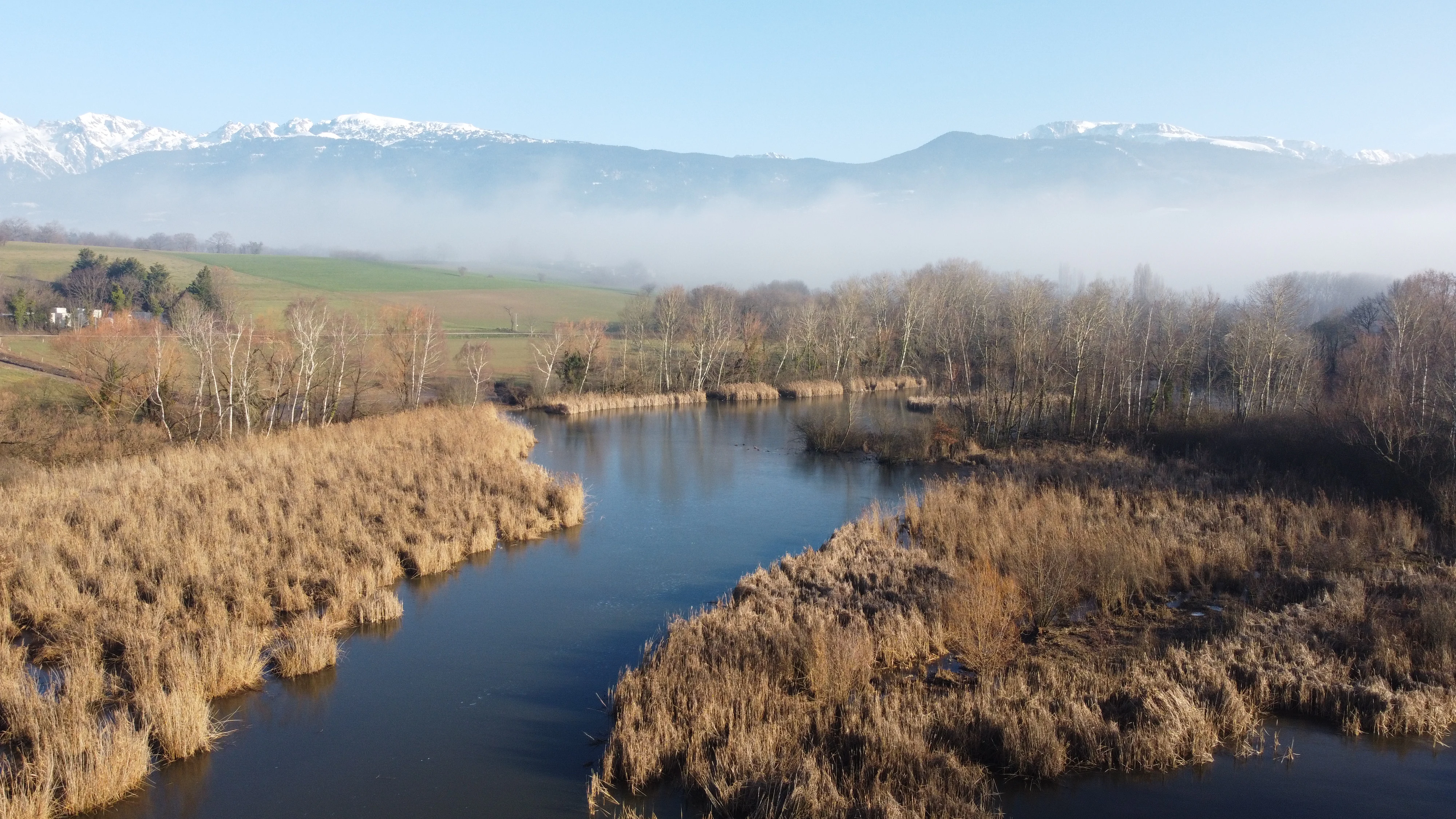
An aerial view of a calm pond surrounded by dense brown reed beds, with low-lying mist and snow-covered mountains visible in the distance under a clear sky.
The wetlands and reed beds of the étang de Haute-Jarrie with the snow-capped Alps in the background.

Réserve naturelle régionale de l'étang de Haute-Jarrie history and protected-area timeline

The pond of Haute-Jarrie was formed at the end of the last glaciation when retreating glaciers carved the depressions that would later fill with water. From the Middle Ages onward, the pond was used for fishing, while the surrounding meadows were grazed and mown for animal bedding, a traditional use that maintained the open wetland character of the site.

During the twentieth century, the pond fell out of regular use and began to fill in, while part of the area was even used as an informal dumping ground. Concerned naturalists in the 1970s began calling for its protection, and in 1972 the commune of Jarrie introduced the first usage restrictions. A more formal protection followed on 2 July 1984 with the creation of a voluntary nature reserve, providing the legal basis for habitat management.

In 2008, the site was upgraded to the status of a regional nature reserve, and in 2013 an additional protection perimeter was established to reinforce the conservation of the surrounding wetlands. Since 1 January 2019, the reserve has been managed by Grenoble Alpes Métropole, which oversees the ten-year management plan running from 2020 to 2029.

Réserve naturelle régionale de l'étang de Haute-Jarrie landscape and geographic character

The reserve occupies a small portion of the Plateau de Champagnier, a relatively flat upland surface at about 378 meters elevation that sits between the river valleys around Grenoble. The defining feature of the landscape is the glacial pond itself, a shallow body of water framed by a mosaic of reedbed, wet meadow, and woodland patches.

The terrain is gentle and the relief is subdued compared with the steep Alpine valleys nearby, which gives the site a calm, open character. Despite its small size, the reserve's position on the plateau places it above the more industrialized and densely populated valley floor of the Romanche, while still remaining close to the Grésivaudan to the north. This combination of an upland plateau setting and proximity to the wider valley system shapes the site's hydrology, its exposure to wind, and its role in the regional ecological network.

The surrounding plateau landscape is a mix of agricultural land, scattered woodland, and small rural settlements, with the pond and its wetlands forming a distinct green pocket within that broader agricultural mosaic.
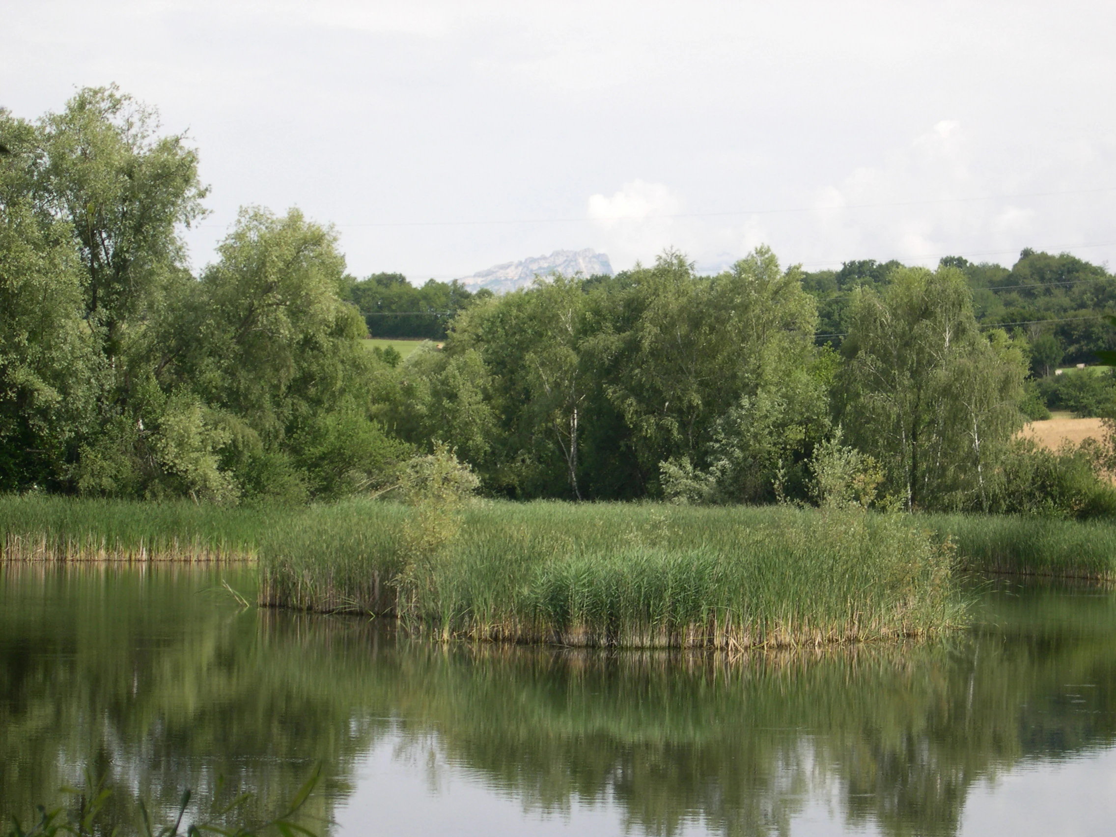
A calm, still pond featuring a small island covered in tall reeds in the center, surrounded by trees under a soft, overcast sky.
The pond at Réserve naturelle régionale de l'étang de Haute-Jarrie, showing surrounding reed beds and forest foliage.

Réserve naturelle régionale de l'étang de Haute-Jarrie ecosystems, habitats, and plant life

Ecologically, the reserve is defined by its wetland habitats and the tight interaction between water levels, vegetation, and fauna. The pond is bordered by extensive reedbeds, beyond which lie wet meadows and patches of woodland. Together these habitats support a flora of at least 250 taxa, including notable species such as the common bladderwort and yellow meadow-rue. Some historically documented species, including the officinal gratiole and marsh germander, have not been recently re-observed, illustrating the dynamic nature of the flora.

The site's small size is offset by the diversity of microhabitats and the proximity of complementary environments in the surrounding area. The reserve is positioned along the Grésivaudan axis, a major valley corridor, which gives it particular importance as a stepping stone within a wider network of wetland and riverside habitats in the northern Alps.

Although the reserve is tiny in absolute terms, the structure of its habitats, open water, emergent vegetation, wet grassland, woodland edge, creates an unusually varied ecological footprint that supports many different groups of species across multiple seasons.
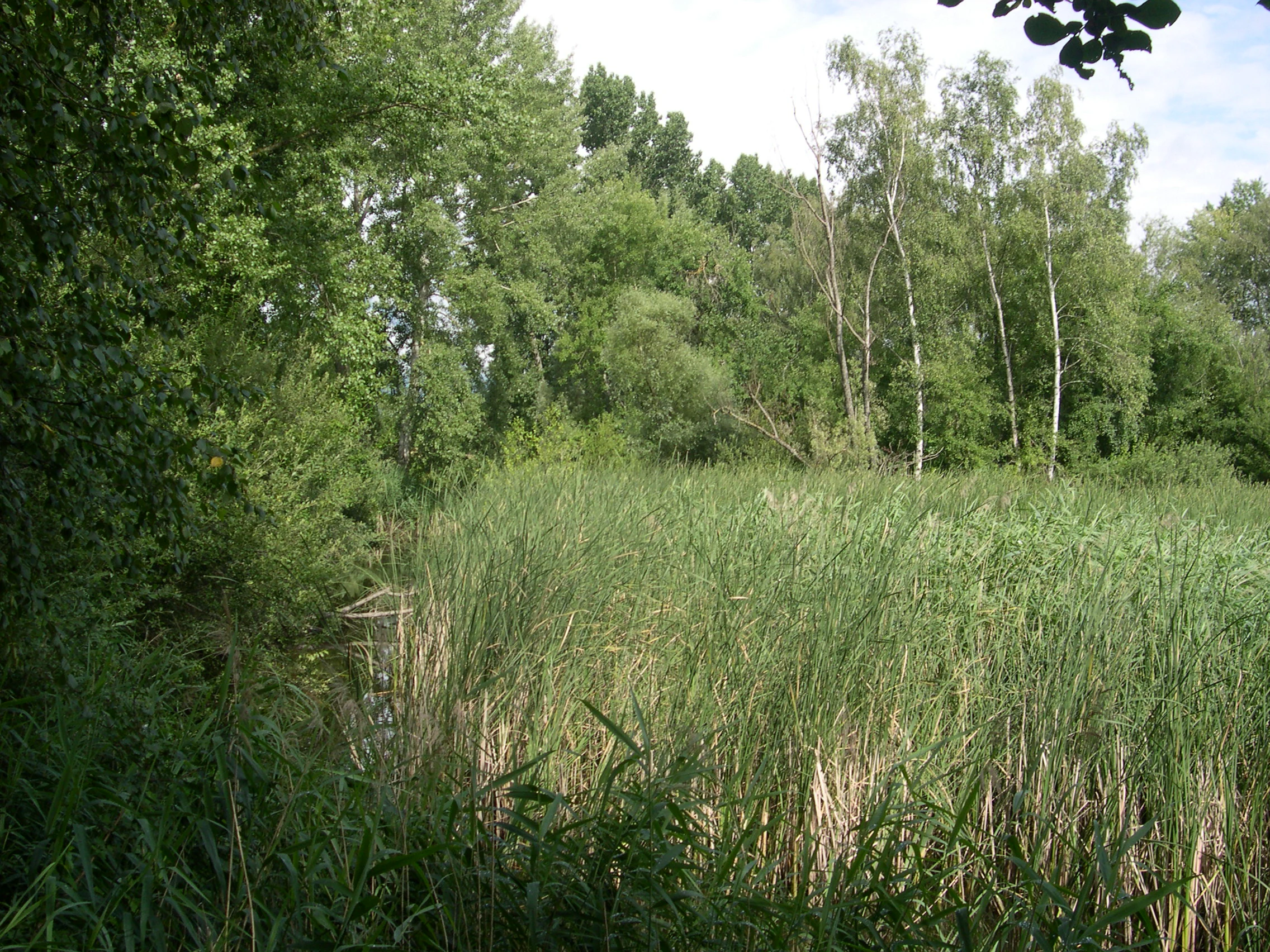
A wide view of a lush green reed bed field with a forest of deciduous trees in the background under a daylight sky.
A dense reed bed bordering the wetlands at the Réserve naturelle régionale de l'étang de Haute-Jarrie.

Réserve naturelle régionale de l'étang de Haute-Jarrie wildlife and species highlights

Haute-Jarrie is particularly notable for its birdlife. Early inventories in 2005 recorded some 54 species, but the current site list exceeds 180 species, reflecting both improved monitoring and the value of the reserve along a major migratory route. Species recorded include the purple heron, the little bittern, the Eurasian bittern's smaller relative known locally as blongios nain, and reed-dwelling warblers such as the Eurasian reed warbler and the great reed warbler. Migratory visitors also include the European pied flycatcher, the Eurasian wryneck, the willow warbler, and the garganey.

The reserve also supports five amphibian species, including the common toad, and nine reptile species, among them the viperine snake and, more recently, the European pond turtle, whose presence was confirmed in the reserve in recent monitoring work. The pond and its reedbed margins have historically been known for their dragonfly populations, although the loss of a small pool that once hosted a significant population of Lestes dryas illustrates the vulnerability of the site.

Together, these animal communities give the reserve an unusually high density of recorded species for an area of only a few hectares, and they form the core reason for its protection.

Réserve naturelle régionale de l'étang de Haute-Jarrie conservation status and protection priorities

From a conservation perspective, the reserve matters because it safeguards a small but exceptionally rich wetland complex in a peri-urban setting where pressures on land and water are strong. The protection perimeter, added in 2013, was designed specifically to shield the sensitive peripheral wetlands from surrounding land use, acknowledging that the hydrosystem is as important as the pond itself.

The site faces several identified threats: the gradual infilling of the pond, reduced water supply and declining water quality, the establishment of invasive species, land-use pressure in the surrounding area, the impact of high visitor numbers, and the longer-term effects of climate change on the hydrological balance. The 2020-2029 management plan, drawn up by Grenoble Alpes Métropole and validated by the regional scientific council for natural heritage, sets out how these pressures are addressed through regulated uses, habitat monitoring, and renewed public infrastructure.

Réserve naturelle régionale de l'étang de Haute-Jarrie cultural meaning and human context

The pond has a long history of human use that predates modern conservation. From the Middle Ages through the twentieth century, it supported fishing and was surrounded by meadows that were traditionally grazed and mown for livestock bedding, a use that helped maintain the open wetland structure that the reserve now protects. The site's transition from a working rural pond to a protected natural area reflects a broader regional shift in how Alpine wetlands are valued, from utilitarian resources to places of ecological and educational importance. Today the site also serves as a place for environmental education and nature discovery for residents of the Grenoble metropolitan area, giving it a renewed cultural role close to the city.

Top sights and standout views in Réserve naturelle régionale de l'étang de Haute-Jarrie

A core area of about 11 hectares of pond, reedbed, and wetland habitat within a 21-hectare protection perimeter; more than 180 recorded bird species on a site of just a few hectares; a flora of at least 250 taxa, including rare wetland plants; notable populations of amphibians and reptiles, including the European pond turtle; and an accessible location on the Plateau de Champagnier near Grenoble, with observation pontoons and interpretation panels that make it a practical outdoor classroom for the metropolitan area.

Best time to visit Réserve naturelle régionale de l'étang de Haute-Jarrie

The reserve is open to the public year-round, though only part of the site is accessible. Spring and early summer tend to be the most rewarding seasons for visits, when the reedbeds are alive with warblers and dragonflies are active around the pond, and migratory birds pass through along the Grésivaudan corridor. Autumn can also offer quiet conditions for observing waterbirds and enjoying the wetland landscapes in calmer weather, while winter visits allow closer approach to species that gather on and around the unfrozen pond. Visitors should expect some paths to be restricted in order to protect sensitive habitats, especially during sensitive breeding periods.

Monthly climate preview

Long-term monthly climate patterns and temperature averages recorded at representative coordinates

Annual Temperature and Precipitation Normals for Réserve Naturelle Régionale de l'Étang de Haute-Jarrie

Representative coordinate measurements reveal long-term temperature ranges and precipitation rates spanning twelve distinct months at Réserve naturelle régionale de l'étang de Haute-Jarrie. Detailed monthly breakdowns provide deeper analytical insight into multi-year meteorological averages across the protected elevation zone.
Annual mean8 °C
-1 °C17 °C
Jan-1°
Feb
Mar
Apr
May11°
Jun15°
Jul17°
Aug17°
Sep13°
Oct
Nov
Dec
Warmest month
August

16.9 °C

Coolest month
January

-0.8 °C

Wettest month
November

3.3 mm/day

Driest month
August

1.8 mm/day

Park location guide

Geography guide, regional context, and park location map for Réserve naturelle régionale de l'étang de Haute-Jarrie

Réserve naturelle régionale de l'étang de Haute-Jarrie park geography, regions, and map view in France

Understand where Réserve naturelle régionale de l'étang de Haute-Jarrie sits in France through a broader geographic reading of the surrounding landscape, nearby location context, and its mapped position within the national park landscape.

How Réserve naturelle régionale de l'étang de Haute-Jarrie fits into France

France is a unitary semi-presidential republic and one of the world's largest economies. It borders Belgium, Luxembourg, Germany, Switzerland, Italy, Monaco, Andorra, and Spain, with a maritime border to the United Kingdom. The country is known for its cultural influence, art, cuisine, and political history spanning centuries.

Wider geography shaping Réserve naturelle régionale de l'étang de Haute-Jarrie in France

France is located in Western Europe. Metropolitan France extends from the Rhine to the Atlantic Ocean and from the Mediterranean Sea to the English Channel and North Sea. The country borders Belgium, Luxembourg, Germany, Switzerland, Italy, Monaco, Andorra, Spain, and has a maritime border with the United Kingdom.

Map view of Réserve naturelle régionale de l'étang de Haute-Jarrie

Use this park location map to pinpoint Réserve naturelle régionale de l'étang de Haute-Jarrie in France, understand its exact geographic position, and read its mapped placement within the surrounding landscape more clearly.

Pigeon | © OpenStreetMap contributors

Location context for Réserve naturelle régionale de l'étang de Haute-Jarrie

Isère
Recorded earthquake history

View Recorded Seismic History Near Réserve naturelle régionale de l'étang de Haute-Jarrie

Explore an organized catalogue of recorded earthquake events associated with the geographic coordinates of this nature reserve. This data collection by MoriAtlas allows for the examination of historical seismic activity near the wetlands of the Isère department without providing hazard assessments.

Réserve naturelle régionale de l'étang de Haute-Jarrie Earthquake History

Catalogued events

27 events

Strongest magnitude

Magnitude 4.4

Most recent event

May 6, 2025

This history includes earthquakes recorded inside the park or within 50 km of its borders

Visual reference of glacial pond habitats, reedbeds, and protected wetland terrain

Réserve naturelle régionale de l'étang de Haute-Jarrie Photos and Landscape Scenery

Visual documentation captures the glacial pond, surrounding reedbeds, and wet meadow habitats defining the protected reserve landscape. Examining these field photographs reveals the distinct ecological character and open terrain features of the plateau environment.

An aerial view of a calm pond surrounded by dense brown reed beds, with low-lying mist and snow-covered mountains visible in the distance under a clear sky.

A wooden observation deck with educational interpretive signage looking out over a calm pond surrounded by wetlands and trees on a sunny day.

A calm, still pond featuring a small island covered in tall reeds in the center, surrounded by trees under a soft, overcast sky.

A wide view of a lush green reed bed field with a forest of deciduous trees in the background under a daylight sky.

Park atlas

Compare adjacent wetland habitats and protected landscapes across the surrounding region

Parks Near Réserve naturelle régionale de l'étang de Haute-Jarrie and Regional Reserves

Browsing other protected areas near Réserve naturelle régionale de l'étang de Haute-Jarrie reveals broader ecological networks and diverse regional wetland formations. Comparing adjacent natural reserves helps contextualize local glacial pond habitats within the wider geography of Isère.
A soft watercolor painting depicting a winding river through a lush green valley with distant hills in the background.
Nature reserveAuvergne-Rhône-Alpes
About 3.5 km away#1 closest

Southwest

Réserve naturelle régionale des Isles du Drac: Braided River Landscape and Regional Map Context

A vital riverine conservation corridor in the Auvergne-Rhône-Alpes region of France

The Réserve naturelle régionale des Isles du Drac occupies an expansive alluvial floodplain where the river transitions into a braided system. This reserve preserves dynamic gravel bars and woodland habitats that support exceptional biodiversity within the northern Alpine landscape. It offers a detailed look at how riverine corridors persist alongside significant hydroelectric and industrial infrastructure in the Grenoble area.

Area
8.048 km²
Established
2009
IUCN
IV
Relief
Lowland
Watercolor illustration showing mountains, a winding river, and pine trees in a landscape
National parkFrance
24 km away#2 closest

Southeast

Écrins National Park: Alpine Glaciated Terrain and Protected Landscape Details

Mapped boundaries and regional geography of a major French National Park.

Delve into Écrins National Park, a defining national park within the French Alps. This page provides a comprehensive overview of its protected landscape, focusing on its dramatic glaciated terrain, significant peaks such as the Barre des Écrins, and its position within the regional geographic context. Explore the mapped extent and understand the unique alpine environment of this protected area.

Area
925 km²
Established
1973
IUCN
II
Visitors
800K annual
A soft watercolor illustration featuring rolling green hills, a winding path, and distant mountain ridges in a muted, painterly style.
Nature reserveFrance
33 km away#3 closest

Southeast

Réserve naturelle nationale de la haute vallée du Béranger: Mountain Protected Area Map

Tracing the alpine terrain and torrent corridors in the French Alps.

Covering roughly 84 hectares in the Isère region, this nature reserve integrates traditional pastoral landscapes with steep-sided forest slopes and rocky alpine ridges. It functions as a key protective buffer for the larger Écrins National Park, preserving a representative slice of southern French Alpine geography within a single, cohesive valley setting.

Area
0.84 km²
Established
1974
Relief
Mountain
Climate
Alpine
A watercolor illustration showing a soft, panoramic view of a calm lake surrounded by gentle, rolling green mountains.
Nature reserveAuvergne-Rhône-Alpes
46 km away#4 closest

North

Réserve naturelle régionale du lac d'Aiguebelette: Protected Lake and Forest Geography

Regional nature reserve landscape in the Savoie Prealps

This protected area encompasses the glacial basin of Lake Aiguebelette and the forested slopes of the Montagne de l'Épine. Discover a terrain defined by the contrast between deep mountain water and upland ridgelines, representing a critical habitat and species management zone within the Auvergne-Rhône-Alpes region.

Area
8.442 km²
Established
2015
IUCN
IV
Relief
Mountain
A watercolor illustration of a landscape with purple and pink layered mountain peaks in the background and soft green trees in the foreground, set against a plain white background.
Nature reserveAuvergne-Rhône-Alpes
46 km away#5 closest

Southeast

Réserve naturelle nationale de la haute vallée du Vénéon: Alpine Geography and Protected Boundaries

High-altitude mountain terrain in the French Alps

The Réserve naturelle nationale de la haute vallée du Vénéon occupies 61 hectares of striking alpine terrain near the hamlet of La Bérarde. Its landscape of steep slopes and glacial deposits functions as a key protected buffer zone, supporting diverse flora and fauna within the broader mountainous geography of the Auvergne-Rhône-Alpes region.

Area
0.61 km²
Established
1974
IUCN
IV
A watercolor painting of a river valley with soft green trees, rolling hills, and distant mountains under a light sky.
Nature reserveProvence-Alpes-Côte d'Azur
About 52 km away#6 closest

Southeast

Réserve naturelle nationale de la haute vallée de la Séveraisse: Protected Alpine Corridor

High-mountain riverine landscape and buffer zone in Hautes-Alpes

This nature reserve encompasses a 4-kilometer stretch of the upper Séveraisse valley, focusing on alluvial riverbed habitat and peripheral mountain terrain. Located in the French Alps, the reserve provides a protected transition zone characterized by its narrow, U-shaped valley floor and steep rocky inclines, offering a key geographic link to the wider Écrins ecosystem.

Area
1.55 km²
Established
1974
IUCN
IV
A soft watercolor painting depicting a wide river flowing through a lush green landscape with distant rolling purple hills in the background.
Nature reserveAuvergne-Rhône-Alpes
About 55 km away#7 closest

North

Rhône du Pont de Groslée à Murs-et-Gélignieux: Alluvial Nature Reserve & River Geography

Protected riparian habitat in Auvergne-Rhône-Alpes, France.

Analyze the complex fluvial dynamics of the Rhône du Pont de Groslée à Murs-et-Gélignieux nature reserve. This site features a well-preserved landscape of alder and ash floodplain forests, isolated side channels, and marshy meadows that provide an essential ecological corridor through the Rhône river valley.

Area
21.05 km²
Relief
Lowland
Scope
Terrestrial
Water
Water-dominated
A watercolor painting of a soft, rolling landscape with green hills, light forest cover, and wild grasses in the foreground, rendered in a light, atmospheric style.
Nature reserveAuvergne-Rhône-Alpes
About 67 km away#8 closest

Southwest

Réserve naturelle régionale de la grotte des Sadoux: Protected Cave and Forested Hills

Regional Nature Reserve in the Drôme department of France

The Réserve naturelle régionale de la grotte des Sadoux encompasses a 30-hectare forested coteau above the Courance valley. This site is defined by its subterranean karstic gallery and surrounding woodland edge, creating a focused conservation landscape for threatened bat species within the Auvergne-Rhône-Alpes region.

Area
0.3 km²
Established
2010
IUCN
IV
Relief
Upland

Common questions about visiting, size, designation, and location context for Réserve naturelle régionale de l'étang de Haute-Jarrie

Réserve naturelle régionale de l'étang de Haute-Jarrie FAQs for park facts, access, geography, and protected area context

Find quick answers about Réserve naturelle régionale de l'étang de Haute-Jarrie, including protected-area facts, park geography, trail and visitor context, and how the park fits into its surrounding country and regional landscape.
MoriAtlas Explorer

Continue Your Protected Areas Search Across the Global Atlas

Deepen your exploration by continuing the structured search for national parks and protected areas worldwide. Utilize the comprehensive filtering capabilities to compare different conservation landscapes and refine your understanding of global park geography. Discover more about the distribution and characteristics of protected natural areas.

Global natural geography