
Mori Atlas logo
Nature reserveRéserve naturelle nationale de la haute vallée du Vénéon

A high-altitude buffer zone and glacial terrain within the French Alps mountain range

Réserve naturelle nationale de la haute vallée du Vénéon: Protected Mountain Landscapes and Regional Geography

Located in the Auvergne-Rhône-Alpes region, the Réserve naturelle nationale de la haute vallée du Vénéon serves as a vital ecological buffer for the surrounding alpine environment. This protected landscape is defined by its rugged slopes, glacial moraines, and rocky outcrops situated at the confluence of the Vénéon river and Étançons torrent. Its geographic framework provides essential habitat protection while anchoring the natural character of the high Oisans mountains.

alpine valleyhigh mountainsbuffer zoneglacial morainesscree slopesrocky habitats
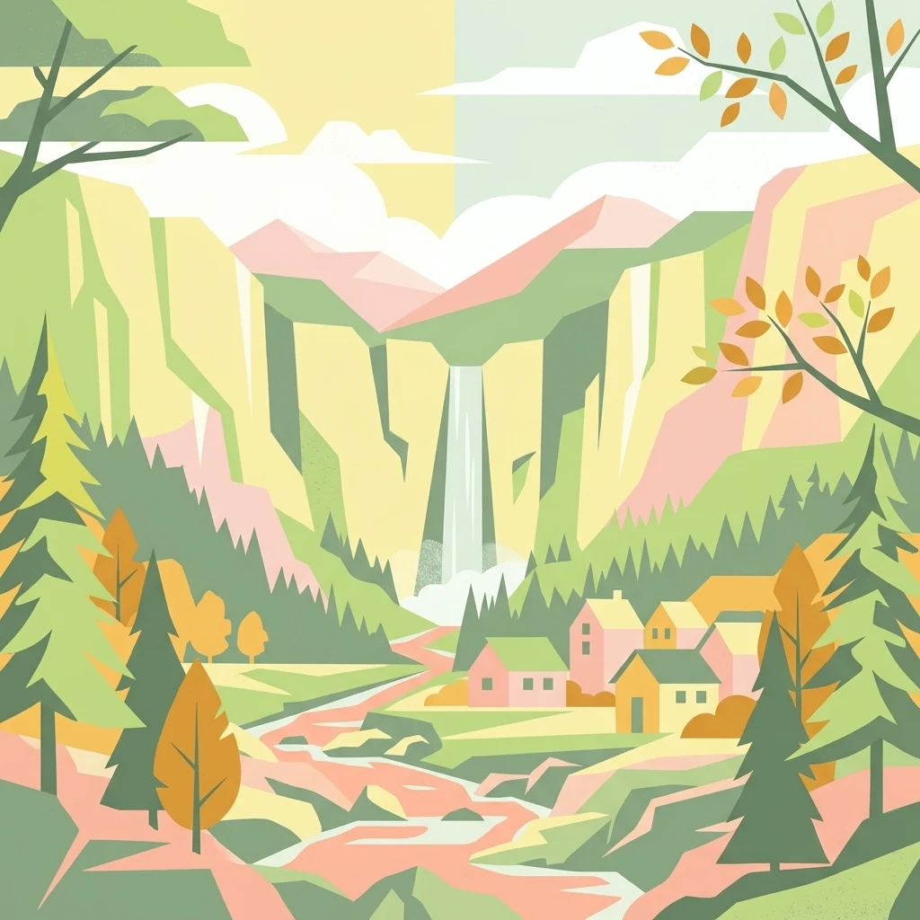
A stylized vector illustration of an alpine valley featuring steep rock cliffs, a waterfall, a flowing river, pine trees, and a small cluster of houses.

Réserve naturelle nationale de la haute vallée du Vénéon

Nature reserve

Park overview

Structured park overview, official facts, and landscape profile for Haute Vallée du Vénéon National Nature Reserve

Haute Vallée du Vénéon National Nature Reserve park facts, protected area profile, and essential visitor context

Review the core facts for Haute Vallée du Vénéon National Nature Reserve, including designation, size, terrain, visitor scale, habitats, and operating context in one park-focused overview.

About Haute Vallée du Vénéon National Nature Reserve

The Haute Vallée du Vénéon National Nature Reserve is a compact but ecologically significant protected area in the French Alps. Sitting at the head of the Vénéon valley in the commune of Saint-Christophe-en-Oisans, the reserve occupies a strategic position directly adjoining Écrins National Park. Its 61 hectares of rocky slopes, glacial moraines, and scree fields span a transitional belt between the intensively protected core zone of Écrins and the broader alpine landscape of the Oisans.

The site sits beneath the Tête de la Maye and at the meeting point of the Vénéon river and the Étançons torrent, a dramatic stretch of valley framed by high peaks and steep walls. Despite its small size, the reserve contains a remarkable concentration of alpine habitats. South-facing slopes, locally called adrets, dominate the terrain, giving the site a noticeably sunny and dry character in contrast to the colder, shaded flanks found elsewhere in the valley.

Functionally, the reserve is not designed as a standalone wilderness area, but as a protective extension of the Écrins National Park. It was conceived alongside several sister reserves in the Béranger, Séveraisse, and Saint-Pierre valleys, together forming a network of small national nature reserves that buffer the edges of the larger Écrins core. This makes the Haute Vallée du Vénéon Reserve an important piece of France's wider strategy for managing human activity, grazing pressure, and habitat disturbance around high-mountain national parks.

For visitors, the reserve's value lies as much in its setting as in its biological record. It surrounds the upper approaches to La Bérarde, one of the most celebrated mountaineering hubs in the French Alps, and serves as a classic high-alpine landscape where glacially shaped terrain meets rugged mountain terrain.

Quick facts and research context for Haute Vallée du Vénéon National Nature Reserve

The Haute Vallée du Vénéon National Nature Reserve lies in the Isère department of southeastern France, within the Auvergne-Rhône-Alpes region. Its territory occupies part of the commune of Saint-Christophe-en-Oisans in the upper Vénéon valley, adjacent to the Écrins National Park near the hamlet of La Bérarde.

The reserve covers about 61 hectares of south-facing alpine terrain dominated by rocks, scree, and glacial moraines. It was created on 15 May 1974 by decree and reclassified on 21 June 2011, with management assigned to the Écrins National Park. The site is registered under IUCN Category IV and is part of France's national network of Réserves Naturelles Nationales.

Protection and recognition

Review documented protection status, management scope, and international recognition records.

Protection Status and International Recognition for Réserve naturelle nationale de la haute vallée du Vénéon

Examine documented protection status, management scope, and international recognition for Réserve naturelle nationale de la haute vallée du Vénéon through verified database records. Access structured conservation entries to understand regional protection frameworks and official administrative classifications.

Protection details

WDPA ID
106700
Park context

Deeper park guide and search-rich context for Haute Vallée du Vénéon National Nature Reserve

Haute Vallée du Vénéon National Nature Reserve history, landscape, wildlife, and travel context

Explore Haute Vallée du Vénéon National Nature Reserve through its history, landscape character, ecosystems, wildlife, conservation priorities, cultural context, and seasonal travel timing in a structured park guide built for atlas discovery and search intent.

Why Haute Vallée du Vénéon National Nature Reserve stands out

The reserve is best known as a designated buffer zone protecting the approaches to Écrins National Park in the high Oisans mountains. Its territory frames the iconic hamlet of La Bérarde, a well-known base for alpine mountaineering and high-altitude exploration in the French Alps. It is also valued for the distinct combination of rocky outcrops, glacial moraines, and steep south-facing slopes that it shelters. This mosaic of alpine substrates supports specialized plants such as Alpine clematis, hairy primrose, and bird's-eye primrose, alongside characteristic high-mountain wildlife including chamois, Alpine ibex, marmots, and rock thrushes.
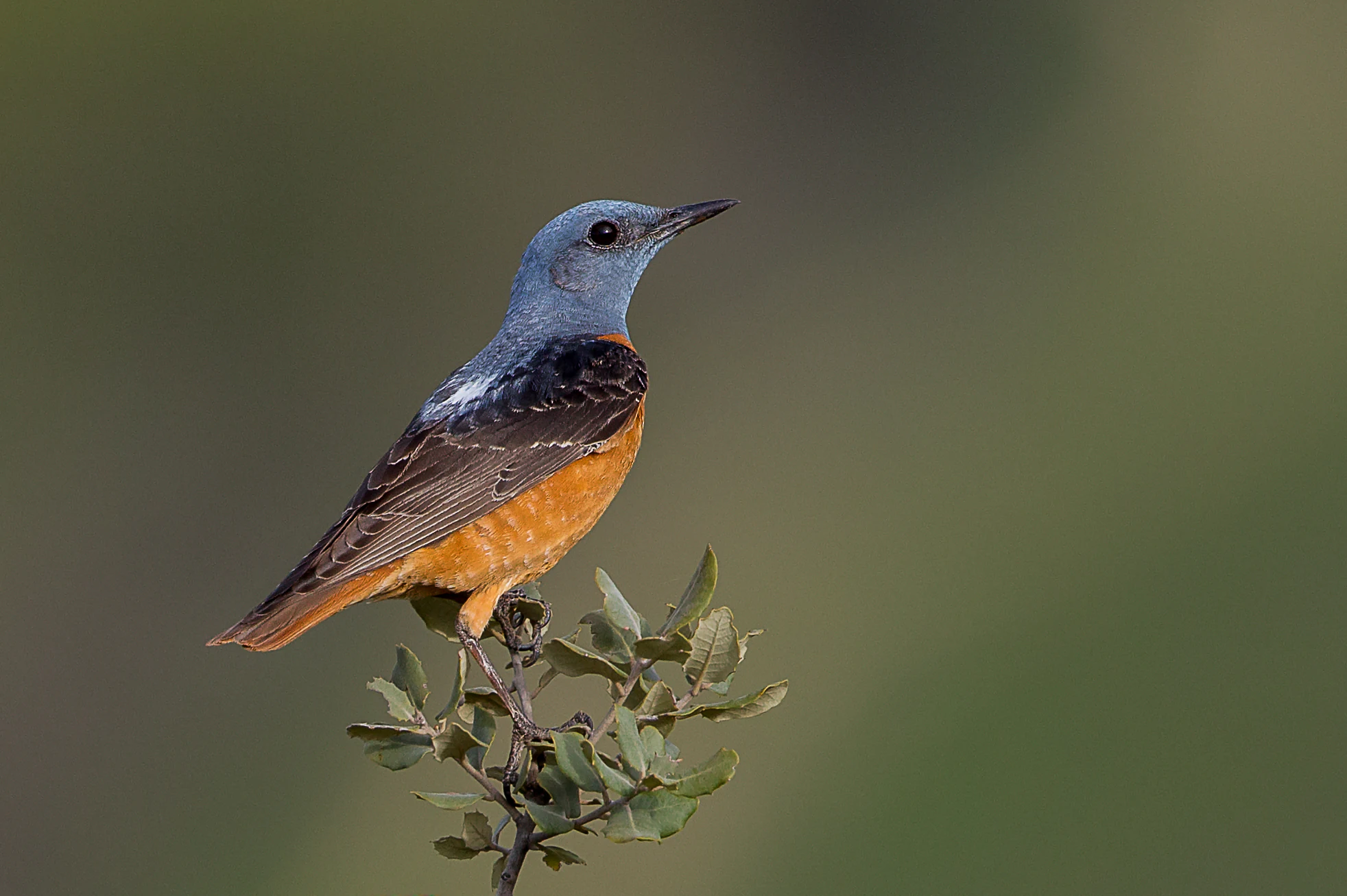
A male rufous-tailed rock thrush with a blue-grey head and bright orange underparts perched on a small shrub against a blurred green background.
A male rufous-tailed rock thrush perched on a small branch within the nature reserve.

Haute Vallée du Vénéon National Nature Reserve history and protected-area timeline

The Haute Vallée du Vénéon National Nature Reserve was established by decree on 15 May 1974, as part of a coordinated effort to create buffer zones around the Écrins National Park. It was created simultaneously with three other small alpine reserves in the high valleys of Béranger, Séveraisse, and Saint-Pierre, each serving as a transitional protection area adjoining the larger national park.

The original 1974 decree classified lands contiguous to the Écrins National Park as national nature reserves, extending conservation oversight to areas lying just outside the core park boundary. The reserve's status was later refreshed through a reclassification decree dated 21 June 2011, confirming its continuing role within France's national nature reserve network. A prefectural decree in 2012 further strengthened the site's protection by establishing a perimeter of protection around it.

Throughout its history, the reserve has been administered directly by the Écrins National Park rather than by a separate structure, integrating its management with that of the larger protected landscape.

Haute Vallée du Vénéon National Nature Reserve landscape and geographic character

The reserve's landscape is defined by the rugged upper Vénéon valley, one of the most striking high-mountain settings in the Oisans. The terrain is shaped by glacial activity, with prominent moraines and extensive scree slopes forming much of the surface. Bedrock outcrops and cliffs interrupt these loose deposits, especially around the slopes rising above the valley floor.

The dominant peak overlooking the reserve is the Tête de la Maye, which sits at the confluence of the Vénéon river and the Étançons torrent. This junction of two heavily glaciated valleys creates an enclosed, dramatic amphitheater of stone. The slopes facing the reserve are primarily south-facing adrets, giving them a relatively sunny exposure that contrasts with the colder north-facing ubac slopes on the opposite side of the valley.

Near the reserve's lower edge is the hamlet of La Bérarde, ringed by the rocky terrain of the protected area. Although the reserve itself is small, its landscape character is strongly representative of the high Écrins environment: steep mountain walls, eroded glacial deposits, and a sparse alpine vegetation cover adapted to thin, well-drained soils.

Haute Vallée du Vénéon National Nature Reserve ecosystems, habitats, and plant life

The ecological character of the Haute Vallée du Vénéon reserve reflects its location at the transition between valley-floor subalpine habitat and true high-alpine terrain. The predominant substrate types, rock, scree, and moraine, support an unusual mosaic of pioneer plant communities and dry grassland adapted to thin mountain soils. South-facing slopes favor warmth-loving plants and create microhabitats where alpine species typical of sunny exposures can thrive.

Around 50 plant species have been documented in the reserve, a significant diversity given its small surface. Notable species include the Alpine clematis (Clematis alpina), the hairy primrose (Primula hirsuta), and the bird's-eye primrose (Primula farinosa), the last of which contributes vivid color to alpine meadows in early summer.

The reserve's combination of rocky shelters, open moraine, and cliffs creates ideal nesting and foraging conditions for alpine birds, while the scree and grassland support small mammal populations. Although the reserve is compact, it covers a strong cross-section of ecological zones typical of the upper Oisans.

Haute Vallée du Vénéon National Nature Reserve wildlife and species highlights

The Haute Vallée du Vénéon reserve supports a characteristic set of high-alpine mammals adapted to steep, rocky terrain. Chamois are among the most frequently encountered large mammals, moving easily across the cliffs and scree fields. Alpine ibex also inhabit the area, using the reserve's rockier outcrops as escape terrain and viewing platforms. The mountain hare (Lepus timidus) and the Alpine marmot are also present, the marmots typically occupying open slopes and meadow patches between rock formations.

The avifauna of the reserve numbers around 50 species, including several breeding birds of particular note. The rock thrush, the black grouse (Tétras lyre), and the alpine swift (Martinet à ventre blanc) are all recorded as nesting within or near the protected area, reflecting the diversity of habitats the small reserve provides. Raptors and other high-mountain bird species also make use of the rocky cliffs as hunting perches and breeding sites.

The reserve's small size makes it less a wildlife sanctuary in the conventional sense, and more a refuge where high-alpine species can persist in close proximity to long-established human mountain activity around La Bérarde. This proximity gives the area added ecological value as a living interface between wild alpine fauna and traditional alpine land use.

Haute Vallée du Vénéon National Nature Reserve conservation status and protection priorities

The principal conservation significance of the Haute Vallée du Vénéon reserve lies in its role as a buffer zone for the Écrins National Park, one of the largest and most ecologically important national parks in the French Alps. By formally protecting land contiguous to the core park, the reserve extends ecological oversight across an additional zone of sensitive alpine habitat.

The site contributes to the preservation of high-alpine flora and fauna, especially steep-slope and moraine communities that are particularly vulnerable to disturbance, trampling, and erosion. Protection here helps maintain the ecological continuity between the intensively managed core of the Écrins and the surrounding mountain landscape.

Because the reserve is managed directly by the Écrins National Park, conservation actions such as monitoring, trail management, and habitat protection are aligned with the broader management plan of the larger protected area. The reserve's IUCN Category IV designation places it within the international framework of habitat and species management areas, reinforcing its role as a site where targeted conservation interventions complement the wider Écrins conservation strategy.

Haute Vallée du Vénéon National Nature Reserve cultural meaning and human context

The Haute Vallée du Vénéon reserve sits within a region long shaped by traditional Alpine culture, particularly the seasonal rhythms of valley-based mountain communities. The hamlet of La Bérarde, around which the reserve is anchored, has served for generations as a base for shepherds, travelers, and mountaineers exploring the high Écrins.

La Bérarde is recognized as one of the historic cradles of French alpine mountaineering, known as the "capital of the Oisans" and a starting point for ascents of many of the Écrins' most demanding peaks. Although the reserve itself is primarily focused on natural heritage, its territory overlaps with landscapes that hold deep meaning for the local cultural identity of the Oisans, where high-mountain livelihoods and Alpine sports traditions have long coexisted.

Top sights and standout views in Haute Vallée du Vénéon National Nature Reserve

The reserve's defining highlights include the dramatic setting beneath the Tête de la Maye and the convergence of the Vénéon river with the Étançons torrent. These features give the protected area a striking topographic signature that mirrors the larger Écrins landscape.

It is also notable for being one of four small national nature reserves created in 1974 to serve as buffer zones for Écrins National Park. Its position directly above La Bérarde ties it to one of the most celebrated mountaineering hubs in the Alps.

The combination of rocky habitats, glacial moraines, and south-facing alpine slopes supports a rich and varied flora and fauna for a site of just 61 hectares, including Alpine clematis, bird's-eye primrose, chamois, ibex, and rock thrush.

Best time to visit Haute Vallée du Vénéon National Nature Reserve

The reserve sits at high elevation in the Oisans mountains, so the timing of any visit has a strong influence on conditions. Late spring and early summer, generally from late May through July, is when alpine meadows and slopes come alive with flowering species such as the bird's-eye primrose, and snow cover retreats from most accessible slopes.

Summer, from around mid-July to early September, is the period when the upper Vénéon valley is most accessible on foot, the hamlet of La Bérarde becomes a hub for hikers and mountaineers, and conditions for observing mammals such as marmots and chamois are favorable. By late summer, the high-altitude avifauna is in full breeding activity, with rock thrushes and other species active around rocky habitat.

Late autumn can bring early snow to the valley, while winter sees the reserve largely under snow and difficult to access. The reserve's strict protection status also means that visitors should expect to experience it primarily from surrounding trails rather than through intensive on-site activity.

Monthly climate preview

Long term temperature and precipitation patterns across representative high altitude terrain

Réserve naturelle nationale de la haute vallée du Vénéon Climate Normals

Representative coordinate records show sustained subzero winter averages alongside moderate summer peaks across the protected area. Reviewing the complete monthly sequence provides deeper insight into long term temperature rhythms and precipitation distribution.
Annual mean2 °C
-7 °C12 °C
Jan-7°
Feb-7°
Mar-3°
Apr
May
Jun10°
Jul12°
Aug12°
Sep
Oct
Nov-2°
Dec-6°
Warmest month
August

12.4 °C

Coolest month
January

-7.1 °C

Wettest month
November

3 mm/day

Driest month
March

1.9 mm/day

Park location guide

Geography guide, regional context, and park location map for Haute Vallée du Vénéon National Nature Reserve

Haute Vallée du Vénéon National Nature Reserve park geography, regions, and map view in France

Understand where Haute Vallée du Vénéon National Nature Reserve sits in France through a broader geographic reading of the surrounding landscape, nearby location context, and its mapped position within the national park landscape.

How Haute Vallée du Vénéon National Nature Reserve fits into France

France is a unitary semi-presidential republic and one of the world's largest economies. It borders Belgium, Luxembourg, Germany, Switzerland, Italy, Monaco, Andorra, and Spain, with a maritime border to the United Kingdom. The country is known for its cultural influence, art, cuisine, and political history spanning centuries.

Wider geography shaping Haute Vallée du Vénéon National Nature Reserve in France

France is located in Western Europe. Metropolitan France extends from the Rhine to the Atlantic Ocean and from the Mediterranean Sea to the English Channel and North Sea. The country borders Belgium, Luxembourg, Germany, Switzerland, Italy, Monaco, Andorra, Spain, and has a maritime border with the United Kingdom.

Map view of Haute Vallée du Vénéon National Nature Reserve

Use this park location map to pinpoint Haute Vallée du Vénéon National Nature Reserve in France, understand its exact geographic position, and read its mapped placement within the surrounding landscape more clearly.

Pigeon | © OpenStreetMap contributors

Location context for Haute Vallée du Vénéon National Nature Reserve

Auvergne-Rhône-Alpes
Natural feature types

Explore Geographic Features of the Réserve naturelle nationale de la haute vallée du Vénéon

Analyze the landforms, rocky outcrops, and glacial features identified within the MoriAtlas database for this protected area. Understand the landscape context of the high Vénéon valley through this specialized collection of natural features and terrain identifiers.
Recorded earthquake history

Examine the Earthquake History of Réserve naturelle nationale de la haute vallée du Vénéon

Review a detailed catalogue of seismic events recorded in the vicinity of this protected alpine landscape. This MoriAtlas resource allows for the inspection of historical earthquake data, including magnitudes and epicentre proximity, for the high-altitude terrain surrounding the Vénéon valley.

Réserve naturelle nationale de la haute vallée du Vénéon Earthquake History

Catalogued events

66 events

Strongest magnitude

Magnitude 5

Most recent event

Apr 7, 2014

This history includes earthquakes recorded inside the park or within 50 km of its borders

Visual exploration of rocky alpine terrain, glacial moraines, and high-mountain habitats

Réserve naturelle nationale de la haute vallée du Vénéon Photos and Landscape Scenery

High-resolution imagery reveals the rugged topography, scree slopes, and glacial convergence defining the Réserve naturelle nationale de la haute vallée du Vénéon landscape. Visual documentation provides direct insight into the protected environment, specialized alpine flora, and dramatic valley terrain surrounding La Bérarde.

A male rufous-tailed rock thrush with a blue-grey head and bright orange underparts perched on a small shrub against a blurred green background.

A high-angle view of the small village of La Bérarde, featuring stone buildings with grey roofs, set among golden autumn trees and rugged alpine terrain with a flowing river nearby.

Park atlas

Compare surrounding regional geography and connected alpine protected landscapes

Other Protected Areas and Parks Near Réserve naturelle nationale de la haute vallée du Vénéon

Visitors exploring Réserve naturelle nationale de la haute vallée du Vénéon can continue comparing nearby national parks and protected areas across the surrounding mountain region. Broadening the geographic scope reveals how adjacent glacial valleys and alpine habitats connect within the wider French mountain ecosystem.
Watercolor illustration showing mountains, a winding river, and pine trees in a landscape
National parkFrance
Park boundaries overlap#1 closest

South

Écrins National Park: Alpine Glaciated Terrain and Protected Landscape Details

Mapped boundaries and regional geography of a major French National Park.

Delve into Écrins National Park, a defining national park within the French Alps. This page provides a comprehensive overview of its protected landscape, focusing on its dramatic glaciated terrain, significant peaks such as the Barre des Écrins, and its position within the regional geographic context. Explore the mapped extent and understand the unique alpine environment of this protected area.

Area
925 km²
Established
1973
IUCN
II
Visitors
800K annual
A watercolor painting of a river valley with soft green trees, rolling hills, and distant mountains under a light sky.
Nature reserveProvence-Alpes-Côte d'Azur
About 12 km away#2 closest

South

Réserve naturelle nationale de la haute vallée de la Séveraisse: Protected Alpine Corridor

High-mountain riverine landscape and buffer zone in Hautes-Alpes

This nature reserve encompasses a 4-kilometer stretch of the upper Séveraisse valley, focusing on alluvial riverbed habitat and peripheral mountain terrain. Located in the French Alps, the reserve provides a protected transition zone characterized by its narrow, U-shaped valley floor and steep rocky inclines, offering a key geographic link to the wider Écrins ecosystem.

Area
1.55 km²
Established
1974
IUCN
IV
A soft watercolor illustration featuring rolling green hills, a winding path, and distant mountain ridges in a muted, painterly style.
Nature reserveFrance
17 km away#3 closest

West

Réserve naturelle nationale de la haute vallée du Béranger: Mountain Protected Area Map

Tracing the alpine terrain and torrent corridors in the French Alps.

Covering roughly 84 hectares in the Isère region, this nature reserve integrates traditional pastoral landscapes with steep-sided forest slopes and rocky alpine ridges. It functions as a key protective buffer for the larger Écrins National Park, preserving a representative slice of southern French Alpine geography within a single, cohesive valley setting.

Area
0.84 km²
Established
1974
Relief
Mountain
Climate
Alpine
A watercolor painting on a white background showing a landscape with rolling green hills, a small lake, and distant mountain ridges in shades of pink, purple, and green.
Nature reserveProvence-Alpes-Côte d'Azur
About 20 km away#4 closest

East

Réserve naturelle régionale des Partias: Alpine Geography and Protected Nature Reserve Data

High-altitude mountain terrain in the southern French Alps

Covering slopes west of Briançon, Réserve naturelle régionale des Partias protects a layered alpine environment ranging from forested basins to rocky crests. This atlas entry provides a detailed geographic overview of the protected area, focusing on its distinctive mountain lakes, diverse soil substrates, and essential role in conserving alpine ecosystems.

Area
8.018 km²
Established
2009
IUCN
IV
Relief
Mountain
Watercolor painting depicting mountains, a river, and trees under a light sky
National parkSavoie
42 km away#5 closest

Northeast

Vanoise National Park: Explore France's Original National Park in the Savoie Alps

Mapped Alpine geography, glacial terrain, and protected landscape.

Vanoise National Park is France's pioneering national park, a protected landscape of immense alpine beauty situated in the Savoie department. Renowned for its dramatic glacial terrain, over 100 peaks above 3,000 meters, and the iconic Alpine ibex, this park offers a profound geographic context. Explore its mapped boundaries and discover the unique atlas-level insights into France's mountainous protected areas and their ecological significance.

Area
534 km²
Established
1963
IUCN
II
Relief
Mountain
A pale, soft watercolor illustration showing a horizontal landscape of a pond and wetlands bordered by trees, with faint mountain silhouettes in the distance.
Nature reserveIsère
46 km away#6 closest

Northwest

Réserve naturelle régionale de l'étang de Haute-Jarrie, Isère Protected Wetland Landscape

Regional nature reserve and migratory bird sanctuary

Situated on the Plateau de Champagnier in Isère, this regional nature reserve offers a concentrated example of glacial pond ecology and wetland biodiversity. Covering 11 hectares, it acts as a critical stopover within the Grésivaudan valley migratory corridor. This protected site features diverse habitats, including reedbeds and wet meadows, that support hundreds of recorded bird species and a variety of dragonflies and amphibians, making it a significant area for ecological study.

Area
0.11 km²
Established
2008
IUCN
IV
Relief
Upland
A soft watercolor painting depicting a winding river through a lush green valley with distant hills in the background.
Nature reserveAuvergne-Rhône-Alpes
About 48 km away#7 closest

West

Réserve naturelle régionale des Isles du Drac: Braided River Landscape and Regional Map Context

A vital riverine conservation corridor in the Auvergne-Rhône-Alpes region of France

The Réserve naturelle régionale des Isles du Drac occupies an expansive alluvial floodplain where the river transitions into a braided system. This reserve preserves dynamic gravel bars and woodland habitats that support exceptional biodiversity within the northern Alpine landscape. It offers a detailed look at how riverine corridors persist alongside significant hydroelectric and industrial infrastructure in the Grenoble area.

Area
8.048 km²
Established
2009
IUCN
IV
Relief
Lowland
A horizontal watercolor painting showing a soft alpine meadow with a stream running through it, framed by distant rolling mountains and patches of trees.
Regional parkPiemonte
About 68 km away#8 closest

East

Pian del Re Regional Park: Geography and Alpine Protected Landscapes in Piemonte

Glacial springs, peat bogs, and Monviso mountain terrain

Pian del Re is a significant regional park situated in the upper Po Valley of the Cottian Alps. Known for its high-altitude plateau, the area marks the origin of the Po River and hosts sensitive wetland habitats. The landscape is defined by the sharp relief of the Monviso group and a complex network of glacial meltwater, providing a distinct study in alpine ecology and mountain geography.

Relief
Mountain
Climate
Alpine
Access
Moderate access
Scope
Terrestrial

Common questions about visiting, size, designation, and location context for Haute Vallée du Vénéon National Nature Reserve

Haute Vallée du Vénéon National Nature Reserve FAQs for park facts, access, geography, and protected area context

Find quick answers about Haute Vallée du Vénéon National Nature Reserve, including protected-area facts, park geography, trail and visitor context, and how the park fits into its surrounding country and regional landscape.
MoriAtlas Explorer

Continue Your Protected Areas Search Across the Global Atlas

Deepen your exploration by continuing the structured search for national parks and protected areas worldwide. Utilize the comprehensive filtering capabilities to compare different conservation landscapes and refine your understanding of global park geography. Discover more about the distribution and characteristics of protected natural areas.

Global natural geography