Mori Atlas logo
Nature reserveRéserve naturelle régionale de l'étang de Saint-Bonnet

Examining the ecological mosaic of reedbeds, wet woodlands, and open ponds within the Isère department.

Réserve naturelle régionale de l'étang de Saint-Bonnet: A Protected Wetland Landscape in Auvergne-Rhône-Alpes

(Réserve naturelle régionale de l'étang de Saint-Bonnet (RNR76))

The Réserve naturelle régionale de l'étang de Saint-Bonnet is a significant protected wetland mosaic located in the Auvergne-Rhône-Alpes region of France. This geography focuses on a fourteen-hectare pond bordered by reedbeds, wet meadows, and woodlands, serving as a critical refuge for heron species and amphibians. The site offers a clear view into lowland wetland conservation, contrasting with the surrounding metropolitan urban fringe.

wetlandpondreedbedregional nature reserveheronsbirdwatching

Réserve naturelle régionale de l'étang de Saint-Bonnet

Nature reserve

Park overview

Structured park overview, official facts, and landscape profile for Réserve naturelle régionale de l'étang de Saint-Bonnet

Réserve naturelle régionale de l'étang de Saint-Bonnet park facts, protected area profile, and essential visitor context

Review the core facts for Réserve naturelle régionale de l'étang de Saint-Bonnet, including designation, size, terrain, visitor scale, habitats, and operating context in one park-focused overview.

About Réserve naturelle régionale de l'étang de Saint-Bonnet

The Réserve naturelle régionale de l'étang de Saint-Bonnet is a small but ecologically valuable wetland reserve in southeastern France, located in the Isère department of the Auvergne-Rhône-Alpes region. It straddles the communes of Vaulx-Milieu and Villefontaine, along the Lyon-Voiron axis where urbanization is intense. Within this densely populated setting, the reserve preserves a striking contrast of open water, reed-fringed shoreline, wet woodland, and meadows, providing habitat for wildlife that has otherwise largely disappeared from the surrounding countryside.

The reserve's identity is shaped above all by the étang de Saint-Bonnet, a pond of about 14 hectares that anchors the site. Around this water body, reedbeds, marshy ground, and periodically flooded grassland give way to wooded edges, creating a layered ecotone that supports a wide range of species. The protected area covers about 51 hectares in total, making it compact by regional nature reserve standards but rich in habitat diversity for its size.

What makes the Étang de Saint-Bonnet particularly significant is its role as a biodiversity refuge in a peri-urban landscape. The reserve has been recognized for hosting around one hundred bird species, with the heron family especially prominent. Wading birds such as the Black-crowned Night Heron, Grey Heron, Purple Heron, Little Bittern, and the elusive Eurasian Bittern all use the site, turning the pond into a focal point for local birdwatching and ecological monitoring.

Beyond birds, the reserve protects a distinctive assemblage of aquatic flora, amphibians, reptiles, and invertebrates, and it provides a venue for educational and nature-based activities. A marked path of about 2.5 kilometers runs around the pond, offering a low-impact way for visitors to experience the wetland. As a whole, the site illustrates how a relatively small area, when carefully managed, can deliver disproportionate conservation, educational, and landscape value in a heavily developed region.

Quick facts and research context for Réserve naturelle régionale de l'étang de Saint-Bonnet

The Réserve naturelle régionale de l'étang de Saint-Bonnet lies in the Auvergne-Rhône-Alpes region, in the Isère department, on the communes of Vaulx-Milieu and Villefontaine. It is a regional nature reserve (réserve naturelle régionale), classified in 1987 as a voluntary nature reserve and redesignated under its current status in December 2012. IUCN management category is IV.

The reserve covers roughly 51 hectares and is centered on the étang de Saint-Bonnet, a pond of about 14 hectares, bordered by reedbeds, woodland, and wet meadows. It is administered by the Communauté d'agglomération Porte de l'Isère and is recognized for a bird community of about one hundred species, with herons as a highlight, alongside notable amphibians and reptile populations.

Protection and recognition

Documented protection history and terrestrial conservation designation metrics

Réserve naturelle régionale de l'étang de Saint-Bonnet Protection Status

Terrestrial protected area designation records establish the conservation history of Réserve naturelle régionale de l'étang de Saint-Bonnet since 2012. Official database tracking outlines baseline protection status without international recognition overlays.

Protection details

Protection scope
Terrestrial
Designated year
2012
Transboundary protection
No
WDPA ID
555514338
Park context

Deeper park guide and search-rich context for Réserve naturelle régionale de l'étang de Saint-Bonnet

Réserve naturelle régionale de l'étang de Saint-Bonnet history, landscape, wildlife, and travel context

Explore Réserve naturelle régionale de l'étang de Saint-Bonnet through its history, landscape character, ecosystems, wildlife, conservation priorities, cultural context, and seasonal travel timing in a structured park guide built for atlas discovery and search intent.

Why Réserve naturelle régionale de l'étang de Saint-Bonnet stands out

The reserve is best known for its pond-centered wetland mosaic and its rich heron community, which includes species such as the Black-crowned Night Heron, Grey Heron, Purple Heron, Little Bittern, and Eurasian Bittern. Its compact size, surrounded by reedbeds, wet woodland, and meadows, gives it an outsized ornithological value relative to its footprint. It is also notable as a rare intact wetland in a heavily urbanized corridor between Lyon and Voiron, offering a refuge for amphibians such as palmate and alpine newts and for the European pond turtle. The combination of accessibility for local residents and ecological richness makes it a frequently highlighted example of small-scale wetland conservation in Isère.
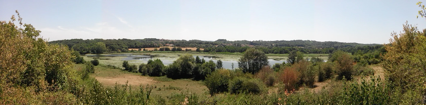
Panoramic landscape view of a central pond surrounded by trees, wetlands, and rolling hills under a bright sky.
A panoramic view of the pond and surrounding wetlands at Réserve naturelle régionale de l'étang de Saint-Bonnet.

Réserve naturelle régionale de l'étang de Saint-Bonnet history and protected-area timeline

The site now known as the Réserve naturelle régionale de l'étang de Saint-Bonnet was first given formal protection in 1987, when it was classified as a réserve naturelle volontaire on 17 April of that year. This earlier status laid the groundwork for ongoing conservation of the pond and its surrounding habitats, but the voluntary framework was later replaced by a stronger designation.

On 16 December 2012, the site was redesignated as a regional nature reserve, a status that brought it under the formal protection regime administered at the regional level in France. Since the redesignation, the reserve has been managed by the Communauté d'agglomération Porte de l'Isère, the intermunicipal authority responsible for environmental management in this part of Isère. The transition from voluntary to regional reserve marks the main administrative and legal turning point in the site's modern history.

Réserve naturelle régionale de l'étang de Saint-Bonnet landscape and geographic character

The landscape of the reserve is dominated by a single visible feature: the étang de Saint-Bonnet, a still water body of roughly 14 hectares set in a shallow basin. The pond's surface is framed by dense reedbeds that blur the line between water and land, giving the site a soft, marshy edge rather than a sharply defined shoreline. These reedbelts transition outward into wet meadows and small clearings, which then give way to wooded patches of varying composition.

The result is a layered wetland mosaic in which water, emergent vegetation, grassland, and woodland each occupy distinct but interconnected zones. Despite the reserve being situated very close to towns and transport corridors, this compact landscape conveys a strong sense of natural seclusion when viewed from within, with the surrounding urban sprawl largely hidden behind vegetation and terrain. The visual character is distinctly lowland, with flat to gently undulating ground rather than dramatic relief.

Beyond the pond itself, the broader setting of the reserve reflects the transitional geography between the Lyon urban region and the piedmont landscapes leading toward Voiron. This peri-urban context shapes how water, vegetation, and human infrastructure interact around the protected site.

Réserve naturelle régionale de l'étang de Saint-Bonnet ecosystems, habitats, and plant life

Ecologically, the reserve functions as a wetland complex, with the open water of the étang de Saint-Bonnet surrounded by reedbeds, damp meadows, and wet woodland. This mosaic creates a range of microhabitats, from submerged aquatic vegetation along the pond margins to seasonally flooded grassland and shaded forest edges. The combination of habitats supports a notably diverse community for such a small area.

The flora includes several species considered characteristic of healthy lowland wetlands. Notable aquatic and marsh plants include the marine naiad (Najas marina), celery-leaved buttercup (Ranunculus sceleratus), and marsh fern (Thelypteris palustris), suggesting good water quality and intact hydrological conditions in parts of the reserve.

Vegetation patterns reinforce the wetland character: reedbeds dominate the immediate shoreline, while wet grassland and wooded areas occupy the periphery. This structure makes the reserve particularly valuable for species that depend on transitions between water, open ground, and dense cover.

Réserve naturelle régionale de l'étang de Saint-Bonnet wildlife and species highlights

The wildlife of the reserve is dominated by birds, with the local avifauna numbering roughly one hundred species according to the protected-area documentation. The pond and its reedbeds attract a notable concentration of herons and related species, including the Black-crowned Night Heron, Grey Heron, Purple Heron, Little Bittern, and the more secretive Eurasian Bittern. These wading birds depend on the combination of open water, shallow margins, and dense reed cover that the reserve provides.

Beyond the herons, the reserve supports a healthy amphibian population. Species such as the Palmate Newt and the Alpine Newt are present, finding suitable breeding and refuge habitat in the pond and surrounding wet margins. Reptiles are represented by the European Pond Turtle, which uses the warmer, sunlit sections of water and bank. Among invertebrates, butterflies such as the Map (Robert-le-Diable) have been recorded, reflecting the presence of well-structured woodland and meadow edges.

Taken together, this assemblage marks the site as an unusually rich faunal pocket in an otherwise heavily developed area, and explains why a reserve of just over fifty hectares can play a meaningful role in regional wetland biodiversity conservation.

Réserve naturelle régionale de l'étang de Saint-Bonnet conservation status and protection priorities

From a conservation perspective, the reserve matters less for its size than for what it represents within its landscape: an intact wetland refuge in the urban-peri-urban corridor between Lyon and Voiron. The protection of roughly 51 hectares around the étang de Saint-Bonnet preserves habitats, particularly freshwater and marsh ecosystems, that have become rare across much of lowland Isère and the broader Lyon region.

The site's IUCN management category is IV, indicating a recognized protected area with active habitat and species management objectives. The reserve is registered in international and national inventories, including the World Database on Protected Areas, and is part of France's network of regional nature reserves. Its designation as a regional reserve in 2012 strengthened its legal protection compared with its earlier voluntary reserve status.

Ecologically, the reserve serves as a refuge for vulnerable wetland species groups: fish-eating and prey-stalking herons, amphibians that depend on clean standing water, and reptiles such as the European Pond Turtle. The maintenance of reedbeds, wet woodland, and unpolluted open water under formal protection gives the reserve tangible conservation value well beyond the local scale.

Réserve naturelle régionale de l'étang de Saint-Bonnet cultural meaning and human context

The reserve does not have a prominently documented cultural or indigenous heritage dimension in the available sources. Its significance is primarily ecological rather than cultural-historical, and no meaningful local narratives, traditional land uses, or built-heritage elements are described alongside it.

The site's value in human terms is more closely tied to its role as a nearby natural area for residents of Vaulx-Milieu, Villefontaine, and the wider Porte de l'Isère agglomeration, rather than to any distinct cultural tradition.

Top sights and standout views in Réserve naturelle régionale de l'étang de Saint-Bonnet

The Étang de Saint-Bonnet reserve stands out for combining a substantial heron-rich avifauna with compact, well-structured wetland habitats, all within easy reach of major urban centers. A 2.5-kilometer walking path makes the site accessible without the need for specialist equipment, supporting its role as a popular local site for nature observation and informal education.

Its blend of reedbeds, water, wet meadows, and woodland creates strong habitat layering in a very small area, while its protected status since the late 1980s reflects sustained recognition of its ecological value.

Best time to visit Réserve naturelle régionale de l'étang de Saint-Bonnet

The reserve's character is shaped by wetland and birdlife dynamics, so timing a visit around the bird season tends to bring the most rewarding experience. Late spring and early summer are typically the most active period for many of the heron species and for amphibians in and around the pond, when reedbeds are in full growth and water levels support breeding activity.

Autumn and winter can also be worthwhile, as some waterbird presence continues and the open landscapes around the pond make observation easier than during the densest summer vegetation. The mild lowland climate of the Isère valley means the reserve is generally accessible across much of the year, though individual seasonal access rules are managed locally and should be checked before visiting.
Monthly climate preview

Long-term monthly temperature and precipitation data recorded at a representative park coordinate

Climate Normals and Annual Temperature Rhythm for Réserve naturelle régionale de l'étang de Saint-Bonnet

Historical climate records from 1991 to 2000 trace a measured annual cycle of temperature variation and steady precipitation across the protected terrain. Examining the complete monthly baseline profile reveals detailed long-term averages for thermal ranges and daily precipitation patterns.
Annual mean11 °C
2 °C20 °C
Jan
Feb
Mar
Apr10°
May14°
Jun18°
Jul20°
Aug20°
Sep16°
Oct11°
Nov
Dec
Warmest month
July

20.4 °C

Coolest month
January

1.5 °C

Wettest month
November

2.9 mm/day

Driest month
March

1.6 mm/day

Park location guide

Geography guide, regional context, and park location map for Réserve naturelle régionale de l'étang de Saint-Bonnet

Réserve naturelle régionale de l'étang de Saint-Bonnet park geography, regions, and map view in France

Understand where Réserve naturelle régionale de l'étang de Saint-Bonnet sits in France through a broader geographic reading of the surrounding landscape, nearby location context, and its mapped position within the national park landscape.

How Réserve naturelle régionale de l'étang de Saint-Bonnet fits into France

France is a unitary semi-presidential republic and one of the world's largest economies. It borders Belgium, Luxembourg, Germany, Switzerland, Italy, Monaco, Andorra, and Spain, with a maritime border to the United Kingdom. The country is known for its cultural influence, art, cuisine, and political history spanning centuries.

Wider geography shaping Réserve naturelle régionale de l'étang de Saint-Bonnet in France

France is located in Western Europe. Metropolitan France extends from the Rhine to the Atlantic Ocean and from the Mediterranean Sea to the English Channel and North Sea. The country borders Belgium, Luxembourg, Germany, Switzerland, Italy, Monaco, Andorra, Spain, and has a maritime border with the United Kingdom.

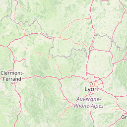
Map view of Réserve naturelle régionale de l'étang de Saint-Bonnet

Use this park location map to pinpoint Réserve naturelle régionale de l'étang de Saint-Bonnet in France, understand its exact geographic position, and read its mapped placement within the surrounding landscape more clearly.

Pigeon | © OpenStreetMap contributors

Location context for Réserve naturelle régionale de l'étang de Saint-Bonnet

Auvergne-Rhône-Alpes

Visualizing the wetland habitats, reedbeds, and protected landscapes of the reserve

Réserve naturelle régionale de l'étang de Saint-Bonnet Photos and Scenery

Visual documentation captures the central pond, dense reedbeds, and wet woodlands that define the protected area character. Examining these habitat photographs reveals the distinct wetland mosaic and lowland terrain found within the Isère department.

Panoramic landscape view of a central pond surrounded by trees, wetlands, and rolling hills under a bright sky.

Park atlas

Compare surrounding wetland habitats, regional reserves, and nearby protected landscapes

Parks Near Réserve Naturelle Régionale de l'Étang de Saint-Bonnet and Regional Protected Areas

Browse other protected areas and regional reserves located near Réserve naturelle régionale de l'étang de Saint-Bonnet. Comparing adjacent wetland habitats and lowland geography provides broader context for regional conservation corridors.
Nature reserveAuvergne-Rhône-Alpes
About 26 km away#1 closest

Northeast

Réserve naturelle régionale des étangs de Mépieu: Atlas and Geographic Protected Area Overview

Wetlands, peatlands, and dry grasslands in northern Isère

The Réserve naturelle régionale des étangs de Mépieu offers a striking study in ecological contrast. This protected landscape contains a dense mosaic of five ponds and marshy terrain set directly against sun-exposed dry grasslands and heathland slopes. The site serves as a vital corridor for migratory birds and rare flora within the rolling countryside of the Auvergne-Rhône-Alpes region.

Area
1.618 km²
Established
2008
IUCN
IV
Relief
Lowland
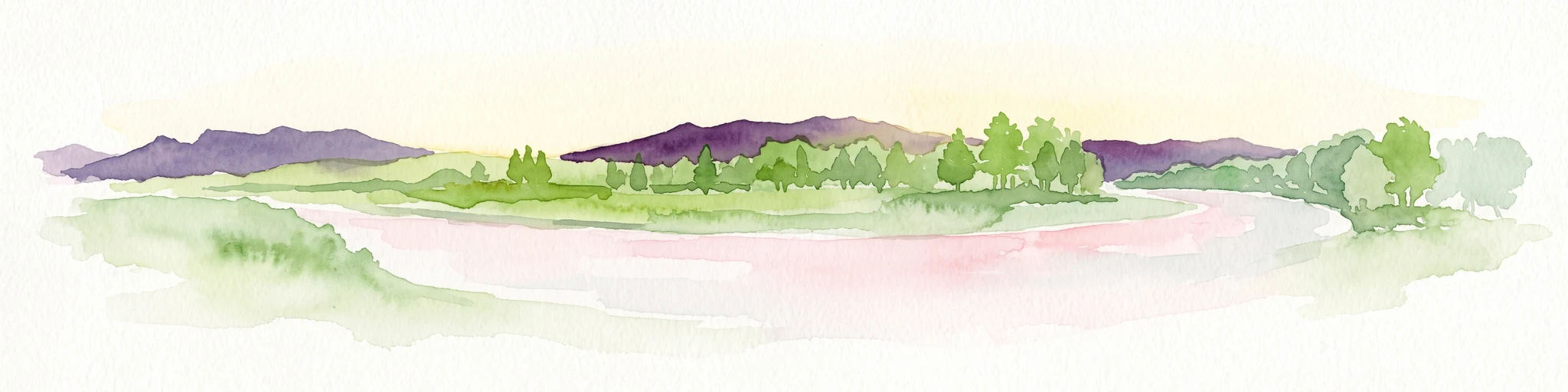
A soft watercolor painting depicting a wide river flowing through a lush green landscape with distant rolling purple hills in the background.
Nature reserveAuvergne-Rhône-Alpes
About 35 km away#2 closest

East

Rhône du Pont de Groslée à Murs-et-Gélignieux: Alluvial Nature Reserve & River Geography

Protected riparian habitat in Auvergne-Rhône-Alpes, France.

Analyze the complex fluvial dynamics of the Rhône du Pont de Groslée à Murs-et-Gélignieux nature reserve. This site features a well-preserved landscape of alder and ash floodplain forests, isolated side channels, and marshy meadows that provide an essential ecological corridor through the Rhône river valley.

Area
21.05 km²
Relief
Lowland
Scope
Terrestrial
Water
Water-dominated
Nature reserveAuvergne-Rhône-Alpes
About 43 km away#3 closest

Northwest

Réserve naturelle régionale de la mine du Verdy: A Subterranean Protected Area in France

Mapping the ecological geography of the Monts du Lyonnais.

The Réserve naturelle régionale de la mine du Verdy stands as France's smallest nature reserve, protecting an intricate network of abandoned mining galleries beneath the surface of the Monts du Lyonnais. This site serves as a crucial underground sanctuary for diverse bat species and cave-dwelling invertebrates, showcasing how repurposed industrial landscapes can harbor significant biodiversity within the Auvergne-Rhône-Alpes region.

Area
0.001 km²
Established
1990
IUCN
IV
Relief
Upland
A watercolor illustration showing a soft, panoramic view of a calm lake surrounded by gentle, rolling green mountains.
Nature reserveAuvergne-Rhône-Alpes
About 47 km away#4 closest

East

Réserve naturelle régionale du lac d'Aiguebelette: Protected Lake and Forest Geography

Regional nature reserve landscape in the Savoie Prealps

This protected area encompasses the glacial basin of Lake Aiguebelette and the forested slopes of the Montagne de l'Épine. Discover a terrain defined by the contrast between deep mountain water and upland ridgelines, representing a critical habitat and species management zone within the Auvergne-Rhône-Alpes region.

Area
8.442 km²
Established
2015
IUCN
IV
Relief
Mountain
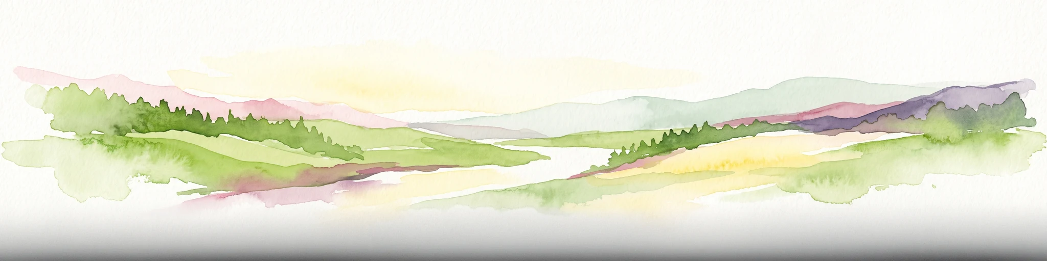
A soft, panoramic watercolor illustration of rolling hills, mountains, and trees in pastel shades of green, yellow, and pink.
Nature reserveAuvergne-Rhône-Alpes
About 66 km away#5 closest

North

Réserve naturelle nationale de la grotte de Hautecourt: Jura Mountain Cave Geography

Protected subterranean landscapes in the Ain department of France.

This nature reserve protects a complex underground environment characterized by a vertical 36-meter cave system and rich invertebrate biodiversity. Located on the flank of Mont Rosset in the Auvergne-Rhône-Alpes region, the area provides a crucial habitat that balances delicate subterranean passages with surface limestone ridges and dry grassland ecosystems.

Area
0.102 km²
Established
1980
IUCN
IV
A pale, soft watercolor illustration showing a horizontal landscape of a pond and wetlands bordered by trees, with faint mountain silhouettes in the distance.
Nature reserveIsère
About 70 km away#6 closest

Southeast

Réserve naturelle régionale de l'étang de Haute-Jarrie, Isère Protected Wetland Landscape

Regional nature reserve and migratory bird sanctuary

Situated on the Plateau de Champagnier in Isère, this regional nature reserve offers a concentrated example of glacial pond ecology and wetland biodiversity. Covering 11 hectares, it acts as a critical stopover within the Grésivaudan valley migratory corridor. This protected site features diverse habitats, including reedbeds and wet meadows, that support hundreds of recorded bird species and a variety of dragonflies and amphibians, making it a significant area for ecological study.

Area
0.11 km²
Established
2008
IUCN
IV
Relief
Upland
A soft watercolor painting depicting a winding river through a lush green valley with distant hills in the background.
Nature reserveAuvergne-Rhône-Alpes
About 71 km away#7 closest

Southeast

Réserve naturelle régionale des Isles du Drac: Braided River Landscape and Regional Map Context

A vital riverine conservation corridor in the Auvergne-Rhône-Alpes region of France

The Réserve naturelle régionale des Isles du Drac occupies an expansive alluvial floodplain where the river transitions into a braided system. This reserve preserves dynamic gravel bars and woodland habitats that support exceptional biodiversity within the northern Alpine landscape. It offers a detailed look at how riverine corridors persist alongside significant hydroelectric and industrial infrastructure in the Grenoble area.

Area
8.048 km²
Established
2009
IUCN
IV
Relief
Lowland
A horizontal watercolor painting showing a soft, stylized river winding through green hills and forests.
Regional parkAuvergne-Rhône-Alpes
About 72 km away#8 closest

West

Réserve naturelle régionale des gorges de la Loire: Landscape and Protected Area Geography

Regional nature reserve in the Auvergne-Rhône-Alpes landscape.

The Réserve naturelle régionale des gorges de la Loire protects a rugged stretch of the Loire River valley in the eastern Massif Central. Discover the geographic mosaic of rocky outcrops, shrubby heaths, and woodland slopes that define this protected area, and see how the terrain shapes its distinct biodiversity and river corridor boundaries.

Area
3.55 km²
Established
1988
IUCN
IV
Relief
Upland

Common questions about visiting, size, designation, and location context for Réserve naturelle régionale de l'étang de Saint-Bonnet

Réserve naturelle régionale de l'étang de Saint-Bonnet FAQs for park facts, access, geography, and protected area context

Find quick answers about Réserve naturelle régionale de l'étang de Saint-Bonnet, including protected-area facts, park geography, trail and visitor context, and how the park fits into its surrounding country and regional landscape.
MoriAtlas Explorer

Continue Your Protected Areas Search Across the Global Atlas

Deepen your exploration by continuing the structured search for national parks and protected areas worldwide. Utilize the comprehensive filtering capabilities to compare different conservation landscapes and refine your understanding of global park geography. Discover more about the distribution and characteristics of protected natural areas.

Global natural geography