Mori Atlas logo
Nature reserveRéserve naturelle régionale du marais de Bonnefont

Analyzing the ecological mosaic of the largest reedbed in the Lot department within Occitanie.

Réserve naturelle régionale du marais de Bonnefont: Mapped Landscape and Protected Wetland Atlas

The Réserve naturelle régionale du marais de Bonnefont stands as a critical wetland refuge within the dry limestone plateaus of the Causses du Quercy in southwestern France. Spanning approximately 42 hectares, this regional nature reserve protects a rare hydrological system characterized by extensive reedbeds and marshland habitats that contrast sharply with the surrounding karst terrain. This atlas entry provides a detailed look at the protected boundaries and landscape structure of this unique ecological site in the Occitanie region.

wetland reservereedbedregional nature reserveCausses du QuercymarshlandLot department

Réserve naturelle régionale du marais de Bonnefont

Nature reserve

Park overview

Structured park overview, official facts, and landscape profile for Réserve naturelle régionale du marais de Bonnefont

Réserve naturelle régionale du marais de Bonnefont park facts, protected area profile, and essential visitor context

Review the core facts for Réserve naturelle régionale du marais de Bonnefont, including designation, size, terrain, visitor scale, habitats, and operating context in one park-focused overview.

About Réserve naturelle régionale du marais de Bonnefont

The Réserve naturelle régionale du marais de Bonnefont is a French regional nature reserve dedicated to the protection of wetland habitats embedded in the Causses du Quercy, one of the most distinctive karst landscapes in southwestern France. Despite covering only about 42 hectares, the reserve concentrates ecological value disproportionate to its footprint because it hosts the largest reedbed in the Lot department, a habitat type that is scarce in this predominantly dry, limestone-dominated region.

Located on the commune of Mayrinac-Lentour, within the perimeter of the Parc naturel régional des Causses du Quercy, Bonnefont benefits from a wider regional policy that links habitat conservation, landscape management, and public education. The reserve is administered by the Communauté de communes du Pays de Padirac, which ensures day-to-day stewardship, monitoring, and the operation of visitor infrastructure.

The site illustrates how even very small protected areas can carry significant conservation weight when they safeguard habitats that are uncommon locally. The reedbed at Bonnefont functions as a refugium for wetland flora and fauna in a region where surface water is mostly drained through karst systems, making the reserve a key node in the broader ecological network of the Quercy. Its accessible elevated walkway extends the reserve's value beyond pure conservation, turning it into a teaching landscape where visitors can directly experience a marshland ecosystem that would otherwise remain hidden behind dense reed growth and saturated soils.

In the wider context of French regional nature reserves, Bonnefont exemplifies the role of these smaller protected areas: geographically focused, biologically specific, and tightly connected to local governance through intercommunal authorities. Its creation in 2011 reflected a recognition that the Quercy's natural heritage is not limited to its dramatic canyon and plateau scenery but also encompasses the quieter, water-rich habitats that depend on careful protection.

Quick facts and research context for Réserve naturelle régionale du marais de Bonnefont

The Réserve naturelle régionale du marais de Bonnefont was formally created by deliberation on 10 February 2011, giving it the status of a regional nature reserve under the French protected-area framework. Covering approximately 42 hectares on the commune of Mayrinac-Lentour in the Lot department, it is administratively managed by the Communauté de communes du Pays de Padirac, the local intercommunal authority that oversees the reserve in coordination with the broader Parc naturel régional des Causses du Quercy.

The site is recorded in the World Database on Protected Areas under the WDPA identifier 555514323 and is categorized as an IUCN Category IV protected landscape, reflecting its emphasis on active conservation of habitats and species within a defined area. Its defining ecological feature is the presence of the largest reedbed in the Lot department, making it a focal point for wetland conservation in a region otherwise dominated by dry Causses landscapes.

Protection and recognition

Documented terrestrial protection scope, designation history, and administrative records

Protection Status and International Recognition for Réserve naturelle régionale du marais de Bonnefont

Terrestrial protection status, management scope, and official records are documented for Réserve naturelle régionale du marais de Bonnefont. Verified registry data provides clear insight into the protected landscape without asserting unverified conservation outcomes or external recognition designations.

Protection details

Protection scope
Terrestrial
Transboundary protection
No
WDPA ID
555514323
Park context

Deeper park guide and search-rich context for Réserve naturelle régionale du marais de Bonnefont

Réserve naturelle régionale du marais de Bonnefont history, landscape, wildlife, and travel context

Explore Réserve naturelle régionale du marais de Bonnefont through its history, landscape character, ecosystems, wildlife, conservation priorities, cultural context, and seasonal travel timing in a structured park guide built for atlas discovery and search intent.

Why Réserve naturelle régionale du marais de Bonnefont stands out

Bonnefont is best known for sheltering the largest reedbed of the Lot department, an unusually extensive wetland formation in a region characterized by dry limestone plateaus, karst terrain, and open Causses landscapes. The presence of such a sizeable roselière within the Parc naturel régional des Causses du Quercy gives the reserve a distinct ecological identity and makes it a reference site for marshland, reedbed, and wetland-edge habitats in southwestern Quercy. Visitors and naturalists associate the site with calm wetland scenery, waterbirds, and the contrast between water-loving vegetation and the surrounding dry Causses. The reserve is also recognized for its educational infrastructure, particularly a 1.8-kilometer raised boardwalk that makes a sensitive marshland ecosystem approachable without disrupting it.

Réserve naturelle régionale du marais de Bonnefont history and protected-area timeline

The Réserve naturelle régionale du marais de Bonnefont was formally established by a regional deliberation on 10 February 2011, acquiring the status of a regional nature reserve under French environmental law. Its creation reflected growing awareness of the need to protect wetland habitats in the Lot department, where the typical landscape of Causses and karst plateaus leaves little room for extensive roselières and marsh ecosystems.

The reserve was placed under the administrative responsibility of the Communauté de communes du Pays de Padirac, an intercommunal structure that already played a coordinating role in local land-use and environmental policy within the Parc naturel régional des Causses du Quercy. The choice of a regional nature reserve designation, rather than a national one, was consistent with the scale and local-management philosophy of the site: small enough for careful local stewardship, but ecologically distinctive enough to warrant formal protection.

Since its classement, the reserve has been integrated into the broader inventory of French protected areas, including the World Database on Protected Areas record under identifier 555514323, and it functions as a regional reference point for wetland conservation and public environmental education within the Quercy.

Réserve naturelle régionale du marais de Bonnefont landscape and geographic character

The landscape of Bonnefont is defined by a striking contrast between water and stone, a transition that is rare in the Lot department. At its core lies a sizable reedbed, the largest in the department, where dense stands of reeds and associated marsh vegetation colonize saturated ground and open water. Around this wetland core, the terrain transitions into the characteristic scenery of the Causses du Quercy: dry limestone plateaus, sparse woodland, and pastoral open ground shaped by centuries of agro-pastoral use.

The reserve is small, roughly 42 hectares, but its visual and ecological footprint is amplified by the unusualness of a true marshland in this setting. Surface water that in most of the Causses disappears quickly into karst conduits is here retained long enough to support emergent vegetation, muddy substrates, and the gradual margins typical of large roselières. This makes Bonnefont look and feel distinctly different from the surrounding countryside, even though it sits firmly within the Parc naturel régional des Causses du Quercy.

The gently flowing topography of the marsh edge, combined with the surrounding dry plateau, gives the site a layered landscape structure: open marsh, reedbed fringes, wet meadows, and dry Causses. Together these zones form a compact but visually eloquent example of how hydrology, vegetation, and geology can vary across very short distances in the Quercy.

Réserve naturelle régionale du marais de Bonnefont ecosystems, habitats, and plant life

Ecologically, Bonnefont revolves around its reedbed and the mosaic of wetland habitats that frame it. A roselière of this scale, set within an otherwise dry karst region, supports a community of plants and animals adapted to saturated soils, fluctuating water levels, and dense emergent vegetation. The surrounding zone of wet meadows and marsh edges expands the ecological gradient, providing habitat for species that require transitional conditions between open water and drier ground.

Although the reserve sits inside the Parc naturel régional des Causses du Quercy, whose broader biodiversity is shaped by limestone grasslands, juniper scrub, and rupicolous species, Bonnefont contributes a fundamentally different ecological register. The marsh acts as a local hotspot for wetland-associated flora and fauna, complementing the dryland character of the surrounding Causses and adding ecological richness to the regional protected-area network.

The site's location within a regional nature park also means that its ecological management is framed by wider objectives: maintaining water quality and hydrological function, limiting invasive species that could colonize disturbed marsh edges, and supporting the continuity of wetland habitats fragmented across the Quercy landscape.

Réserve naturelle régionale du marais de Bonnefont wildlife and species highlights

Wildlife at Bonnefont reflects the dual identity of a marshland set within a Causses landscape. The reedbed and adjacent wet habitats provide shelter and foraging resources for waterbirds and other wetland-associated fauna, while the drier margins and surrounding plateau support more typical Quercy species. The reserve therefore functions as a contact zone where wetland wildlife meets dryland wildlife, increasing its biological interest beyond what the small surface area might suggest.

The 1.8-kilometer elevated boardwalk that traverses the reserve is designed to allow observation of this wildlife without disturbing it, suggesting that birds, in particular, are a central focus of the visitor experience. Marshland reserves of this type in southern France typically support rich communities of passerines, wetland birds, and seasonal migrants, and Bonnefont is positioned to play a similar role within the Lot department.

At the same time, the surrounding Causses offer habitat for reptiles, small mammals, and pollinator communities associated with dry grasslands and scrub, meaning that the reserve's effective wildlife value extends beyond its formal perimeter into the broader Parc naturel régional des Causses du Quercy.

Réserve naturelle régionale du marais de Bonnefont conservation status and protection priorities

The reserve's main conservation significance lies in protecting the largest reedbed of the Lot department, an exceptional feature in a region where wetlands are scarce and where surface water typically drains rapidly into karst systems. By safeguarding this habitat under a regional nature reserve status, the site ensures that a representative example of roselière ecology persists in an otherwise dry landscape, with all the hydrological and biological functions such habitats provide.

Classified under IUCN Category IV, Bonnefont is recognized as a protected area where active management is central to maintaining habitats, species, and landscape features. Its IUCN status aligns the reserve with international frameworks for monitoring the effectiveness of protected-area networks, and its inclusion in the World Database on Protected Areas under identifier 555514323 confirms its standing within the global inventory of formally protected sites.

Management responsibility lies with the Communauté de communes du Pays de Padirac, which integrates the reserve into local land-use planning, public education, and ecological monitoring. The reserve also benefits from being embedded in the Parc naturel régional des Causses du Quercy, allowing conservation actions at Bonnefont to complement broader regional goals for biodiversity, water resources, and landscape continuity across the Quercy plateau.

Réserve naturelle régionale du marais de Bonnefont cultural meaning and human context

Bonnefont lies within the Parc naturel régional des Causses du Quercy, a region whose cultural identity is closely tied to its dry limestone plateaus, traditional agro-pastoralism, and the karst topography that has shaped rural life for centuries. The reserve's marshland stands apart from this dominant cultural imagery, yet it is part of the same landscape mosaic: local communities have long navigated the tensions between dry uplands and pockets of wet ground, with traditional land use adapting to the constraints of Causses terrain.

The presence of a public educational boardwalk reflects a broader movement in French regional nature reserves to engage residents and visitors with local natural heritage. At Bonnefont, this translates the reserve's ecological role into a cultural and pedagogical asset for the commune of Mayrinac-Lentour and the wider Pays de Padirac area, embedding the wetland in the regional sense of place rather than treating it as a purely ecological outpost.

Top sights and standout views in Réserve naturelle régionale du marais de Bonnefont

Bonnefont stands out as the largest reedbed in the Lot department, an exceptional wetland refuge in a region defined by dry Causses and karst formations. The compact 42-hectare reserve combines habitat protection, ecological monitoring, and public engagement through a 1.8-kilometer elevated walkway that opens the marshland to visitors without compromising its sensitivity.

Equally important is the reserve's institutional integration, with management by the Communauté de communes du Pays de Padirac and embedding within the Parc naturel régional des Causses du Quercy. This dual anchoring ensures that the site's ecological value feeds directly into broader regional strategies for biodiversity, water resources, and environmental education across the Quercy.

Best time to visit Réserve naturelle régionale du marais de Bonnefont

The reedbed character of Bonnefont means that the site is most rewarding when water levels are stable and emergent vegetation is well developed, typically during the late spring and summer months when reeds reach their full height and the wetland community is most active. Spring visits can also be attractive for bird activity, while calmer autumn conditions often offer softer light and a quieter atmosphere along the boardwalk.

Because the reserve is small and centered on a single ecological feature, its seasonal appeal tends to follow the rhythm of the marsh itself rather than dramatic landscape change. Visitors interested in contrast between the wetland and the surrounding Causses may also favor periods when the dry plateau is at its most austere, highlighting the unusual character of the marsh as a green and water-rich enclave within the broader Quercy landscape.

Monthly climate preview

Long-term representative point measurements tracking monthly temperature ranges and daily precipitation patterns

Annual Temperature and Precipitation Normals for Réserve naturelle régionale du marais de Bonnefont

Representative coordinate records for Réserve naturelle régionale du marais de Bonnefont document measured annual temperature variations and monthly precipitation rates from 1991 to 2020. Detailed twelve-month climate normals provide a complete statistical profile of long-term weather patterns across the protected area.
Annual mean11 °C
3 °C20 °C
Jan
Feb
Mar
Apr10°
May14°
Jun18°
Jul20°
Aug20°
Sep16°
Oct12°
Nov
Dec
Warmest month
August

20.5 °C

Coolest month
January

3 °C

Wettest month
November

3.2 mm/day

Driest month
July

1.9 mm/day

Park location guide

Geography guide, regional context, and park location map for Réserve naturelle régionale du marais de Bonnefont

Réserve naturelle régionale du marais de Bonnefont park geography, regions, and map view in France

Understand where Réserve naturelle régionale du marais de Bonnefont sits in France through a broader geographic reading of the surrounding landscape, nearby location context, and its mapped position within the national park landscape.

How Réserve naturelle régionale du marais de Bonnefont fits into France

France is a unitary semi-presidential republic and one of the world's largest economies. It borders Belgium, Luxembourg, Germany, Switzerland, Italy, Monaco, Andorra, and Spain, with a maritime border to the United Kingdom. The country is known for its cultural influence, art, cuisine, and political history spanning centuries.

Wider geography shaping Réserve naturelle régionale du marais de Bonnefont in France

France is located in Western Europe. Metropolitan France extends from the Rhine to the Atlantic Ocean and from the Mediterranean Sea to the English Channel and North Sea. The country borders Belgium, Luxembourg, Germany, Switzerland, Italy, Monaco, Andorra, Spain, and has a maritime border with the United Kingdom.

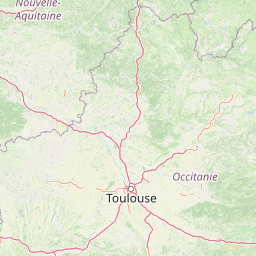
Map view of Réserve naturelle régionale du marais de Bonnefont

Use this park location map to pinpoint Réserve naturelle régionale du marais de Bonnefont in France, understand its exact geographic position, and read its mapped placement within the surrounding landscape more clearly.

Pigeon | © OpenStreetMap contributors

Location context for Réserve naturelle régionale du marais de Bonnefont

Occitanie
Park atlas

Discover related protected areas and regional conservation landscapes

Exploring Parks Near Réserve naturelle régionale du marais de Bonnefont

Comparing protected areas near Réserve naturelle régionale du marais de Bonnefont reveals diverse wetland habitats and limestone plateaus. Broadening the regional park search connects specialized marshland reserves with broader protected landscapes.
A soft, horizontal watercolor painting depicting a gentle, rolling landscape with green hills, sparse trees, and a hazy background in pale green and pink tones.
Regional parkOccitanie
Mapped location lies within the park boundary#1 closest

South

Parc naturel régional des Causses du Quercy: Protected Karst Plateaus and River Valleys

Geographic atlas of the Causses du Quercy karst landscapes

An essential look at the geography of Parc naturel régional des Causses du Quercy. This protected area in Occitanie features an expansive network of limestone plateaus and carved river gorges. Learn about the karst terrain, sedimentary history, and the natural boundaries that define this French regional park and internationally recognized geopark.

Area
1,855 km²
Established
1999
IUCN
V
Protected areaLot
About 16 km away#2 closest

Northwest

Vallée de la Dordogne quercynoise: Regional Protected Area and River Valley Geography

A detailed geographic study of limestone slopes and riparian corridors in the Lot department.

Spanning 5,567 hectares across the Lot department, this protected area preserves the ecological integrity of the Dordogne river. The region is marked by its transition from narrow, hill-enclosed upstream stretches to broader floodplain zones, creating a complex habitat mosaic of alluvial meadows, travertine springs, and rocky chasmophytic slopes that support important European biodiversity.

Area
55.67 km²
Established
2007
Relief
Upland
Climate
Temperate
Watercolor painting depicting a soft green landscape with rolling hills, riverbank vegetation, and a central waterway.
Nature reserveNouvelle-Aquitaine
About 36 km away#3 closest

Northeast

Réserve naturelle régionale des gorges de la Maronne et Tours de Merle: Protected Gorge Geography

Mapping the Maronne river basin and medieval towers in Nouvelle-Aquitaine

This protected area captures the distinct vertical relief of the Maronne river valley. The landscape profile includes steep rocky outcrops, narrow riparian corridors, and the historic site of the Tours de Merle. Exploring this regional reserve offers an understanding of how northern Massif Central ecosystems and medieval stone structures coexist within a protected framework in the heart of the Corrèze region.

Area
2.059 km²
Established
2025
IUCN
IV
Relief
Upland
A soft, light-toned watercolor painting showing rolling green hills and valley slopes under a pale sky.
Nature reserveOccitanie
About 60 km away#4 closest

East

Réserve naturelle régionale des coteaux du Fel, A Protected Landscape in Occitanie, France

Regional nature reserve in the Aveyron department.

Located along the Lot valley, the Réserve naturelle régionale des coteaux du Fel preserves a mosaic of sun-drenched oak and chestnut woodlands, heathlands, and historic meadows. This nature reserve provides a critical study of small-area conservation and dryland habitat management within the rural landscape of Occitanie. Use this resource to understand the park's terrain, mapped boundaries, and its ecological importance in the northern Aveyron region.

Area
123.38 km²
Established
2011
IUCN
IV
A soft watercolor painting of a wide, gently rolling landscape with green fields, forested hills in the distance, and native vegetation in the foreground.
Nature reserveHaute-Vienne
About 91 km away#5 closest

North

Lande de la Flotte et du Cluzeau: Geological Landscapes of Haute-Vienne, France

Nature reserve featuring rare serpentinite heathland habitats

Lande de la Flotte et du Cluzeau preserves a rare type of serpentine heathland on the Limousin plateau. By protecting stony outcrops that contrast with the local forest and farmland, this reserve maintains a significant botanical environment within Haute-Vienne, reflecting the complex metamorphic history of the region.

Area
132 km²
Established
1993
IUCN
IV
Watercolor painting of a soft, hazy mountain landscape with rolling green fields and a distant forest, set against a light, warm, pale background.
Nature reserveAuvergne-Rhône-Alpes
About 93 km away#6 closest

Northeast

Réserve naturelle régionale des tourbières du Jolan et de la Gazelle: Geographic Overview

A vital wetland protected area in the Auvergne volcanic highlands.

Located in the Cantal department, the Réserve naturelle régionale des tourbières du Jolan et de la Gazelle features a unique collection of peatland habitats, trembling mires, and acidic grasslands. This area sits within the broader volcanic terrain of the Parc naturel régional des Volcans d'Auvergne, offering a protected catchment for diverse marshland flora and fauna.

Area
1.558 km²
Established
2018
IUCN
IV
Relief
Highland
A horizontal watercolor illustration depicting a soft landscape with rolling hills, a body of water in the foreground, and pine trees on the right side.
Nature reserveNouvelle-Aquitaine
About 94 km away#7 closest

North

Réserve naturelle régionale de la haute vallée de la Vézère: Protected Highland Geography

Wetland ecosystems of the Corrèze and Plateau de Millevaches.

Representing a vital network of peatland and bog systems, this nature reserve in the Nouvelle-Aquitaine region preserves essential highland habitats. Its scattered parcels illustrate the complex wetland geography of the Massif Central, offering a focused look at how protected boundaries safeguard specialized ecosystems within the upper Vézère river catchment area.

Area
1.963 km²
Established
2015
IUCN
IV
Relief
Lowland
Nature reserveNouvelle-Aquitaine
About 114 km away#8 closest

Northwest

Vallée de la Nizonne Nature Reserve: Mapped Geography and Protected Wetland Landscapes

A critical river corridor and Natura 2000 conservation zone in Nouvelle-Aquitaine.

Discover the geographic structure of the Vallée de la Nizonne, a protected area shaped by the flow of the Nizonne and Lizonne rivers. This landscape mosaic features peatlands, wet meadows, and alluvial forests that serve as a refuge for rare species. Gain insight into the regional terrain and conservation boundaries that define this important French wetland corridor.

Area
33.91 km²
Established
2016
Relief
Upland
Climate
Temperate

Common questions about visiting, size, designation, and location context for Réserve naturelle régionale du marais de Bonnefont

Réserve naturelle régionale du marais de Bonnefont FAQs for park facts, access, geography, and protected area context

Find quick answers about Réserve naturelle régionale du marais de Bonnefont, including protected-area facts, park geography, trail and visitor context, and how the park fits into its surrounding country and regional landscape.
MoriAtlas Explorer

Continue Your Protected Areas Search Across the Global Atlas

Deepen your exploration by continuing the structured search for national parks and protected areas worldwide. Utilize the comprehensive filtering capabilities to compare different conservation landscapes and refine your understanding of global park geography. Discover more about the distribution and characteristics of protected natural areas.

Global natural geography