
Mori Atlas logo
Nature reserveRéserve naturelle régionale du Ried de Sélestat, l'Ill*Wald

A vast protected landscape of floodplain woodlands and river networks in the French Grand Ried.

Réserve naturelle régionale du Ried de Sélestat, l'Ill*Wald: Alluvial Forest and Wetland Geography

The Réserve naturelle régionale du Ried de Sélestat, l'Ill*Wald protects one of the largest continuous alluvial forest systems in France. Located in the Bas-Rhin department, this complex mosaic of oak, ash, and alder woodland, interspersed with phreatic springs and wet meadows, offers a unique opportunity to study the hydrology of the Alsatian plain. Explore the mapped boundaries of this expansive floodplain reserve to understand the interplay between its stable groundwater springs and the seasonal flooding cycles of the Ill river system.

alluvial forestfloodplainwetlandsriver networkRegional Nature ReserveAlsace
A digital illustration showing a meandering river flowing through a green meadow, with trees on both sides and mountains with a waterfall in the distance.

Réserve naturelle régionale du Ried de Sélestat, l'Ill*Wald

Nature reserve

Park overview

Structured park overview, official facts, and landscape profile for Réserve naturelle régionale du Ried de Sélestat, l'Ill*Wald

Réserve naturelle régionale du Ried de Sélestat, l'Ill*Wald park facts, protected area profile, and essential visitor context

Review the core facts for Réserve naturelle régionale du Ried de Sélestat, l'Ill*Wald, including designation, size, terrain, visitor scale, habitats, and operating context in one park-focused overview.

About Réserve naturelle régionale du Ried de Sélestat, l'Ill*Wald

The Réserve naturelle régionale du Ried de Sélestat, l'Ill*Wald lies in the heart of the Alsatian plain, roughly midway between the Vosges massif and the Rhine, and occupies almost half of the municipal territory of Sélestat. Its location is unusual within Alsace: here the plain narrows while the Grand Ried widens, producing a historically flood-prone and thinly populated zone known locally as the Landgraben, which has helped preserve a rich natural landscape close to a sizable town.

At its core is the Illwald, a rare example of a large, continuous alluvial forest dominated by pedunculate oak, common ash, and alder, with sycamore, field maple, hazel, dogwood, and spindle scattered through the understory. The forest is naturally selected by flooding: where the phreatic aquifer is closest to the surface, only alder, bird cherry, currant, and blackcurrant survive, producing the characteristic alder-ash swamp woodland that is recognized as a priority habitat at the European level. Wet meadows, sedge beds, reedbeds, and tall-herb fen communities further diversify the reserve into more than 30 distinct habitat types.

Hydrology is the defining force of the site. The Ill runs through the reserve and splits into numerous distributaries, complemented by phreatic resurgences fed by the shallow groundwater layer. More than 130 km of rivers and ditches cross the landscape, and every winter seasonal floods from the Ill and rising groundwater submerge much of the floodplain. Western watercourses are predominantly diffuse Ill branches with variable temperature and sediment load; eastern watercourses are fed by cold, clear phreatic water with temperatures that remain near 9 to 14 degrees Celsius year-round. Human interventions in the 19th and early 20th centuries, including drainage and the channelization of the Ill, have left lasting marks on this system and continue to shape management priorities.

Ecologically, the Ill*Wald supports fallow deer introduced in the 19th century by the Rohan family, which now form what is considered France's most important truly wild herd, along with European beaver working the riverbanks. Birdlife is exceptionally rich for an inland floodplain site, with 141 recorded species, and amphibians, reptiles, and dragonflies are well represented. Since 2014, an interpretation trail called "L'Ill aux trésors" has helped connect the public to this complex and dynamic landscape, complementing the reserve's long-standing conservation and pedagogical mission.

Quick facts and research context for Réserve naturelle régionale du Ried de Sélestat, l'Ill*Wald

The Réserve naturelle régionale du Ried de Sélestat, l'Ill*Wald is a regional nature reserve (RNR) in the Grand Est region of northeastern France, on the commune of Sélestat in Bas-Rhin. Designated in 1995 as a voluntary reserve and reclassified in February 2013 as a regional reserve for a renewable 25-year term, the protected area covers approximately 1,855 hectares, ranking it among the five largest RNRs in France. It lies at an elevation between 166 and 170 meters, marking the natural boundary between Bas-Rhin and Haut-Rhin on the Alsatian plain.

The reserve protects a major alluvial forest, the Illwald, which is crossed by the Ill river and a dense network of distributaries and phreatic streams. It preserves a mosaic of more than 30 habitats, including alder-ash forest, wet meadows, reedbeds, tall-herb fen, and aquatic communities, and supports notable species such as fallow deer, European beaver, and 141 recorded bird species.

Protection and recognition

Documented terrestrial protection scope, designation year, and management records

Protection Status and Designation History for Réserve naturelle régionale du Ried de Sélestat, l'Ill*Wald

Terrestrial protection status, designation history, and administrative management scope for Réserve naturelle régionale du Ried de Sélestat, l'Ill*Wald define its documented framework. Official records establish the designated baseline established in 2013 alongside registered database identifiers.

Protection details

Protection scope
Terrestrial
Designated year
2013
Transboundary protection
No
WDPA ID
106729
Park context

Deeper park guide and search-rich context for Réserve naturelle régionale du Ried de Sélestat, l'Ill*Wald

Réserve naturelle régionale du Ried de Sélestat, l'Ill*Wald history, landscape, wildlife, and travel context

Explore Réserve naturelle régionale du Ried de Sélestat, l'Ill*Wald through its history, landscape character, ecosystems, wildlife, conservation priorities, cultural context, and seasonal travel timing in a structured park guide built for atlas discovery and search intent.

Why Réserve naturelle régionale du Ried de Sélestat, l'Ill*Wald stands out

The Ill*Wald is particularly known for being one of the largest alluvial floodplain forests in France, set within the broader Grand Ried wetland landscape of Alsace. Its combination of oak, ash, and alder woodland with a dense and constantly shifting river network gives it a striking landscape identity, shaped each year by winter flooding from the Ill and its tributaries. The reserve is also renowned for its phreatic springs, whose remarkably stable water temperature sustains a unique aquatic environment distinct from the main river. Wildlife-wise, it harbors what is considered France's largest wild population of fallow deer, alongside European beaver, a rich birdlife of 141 species, and 32 dragonfly species, making it a focal point for floodplain ecology in northeastern France.
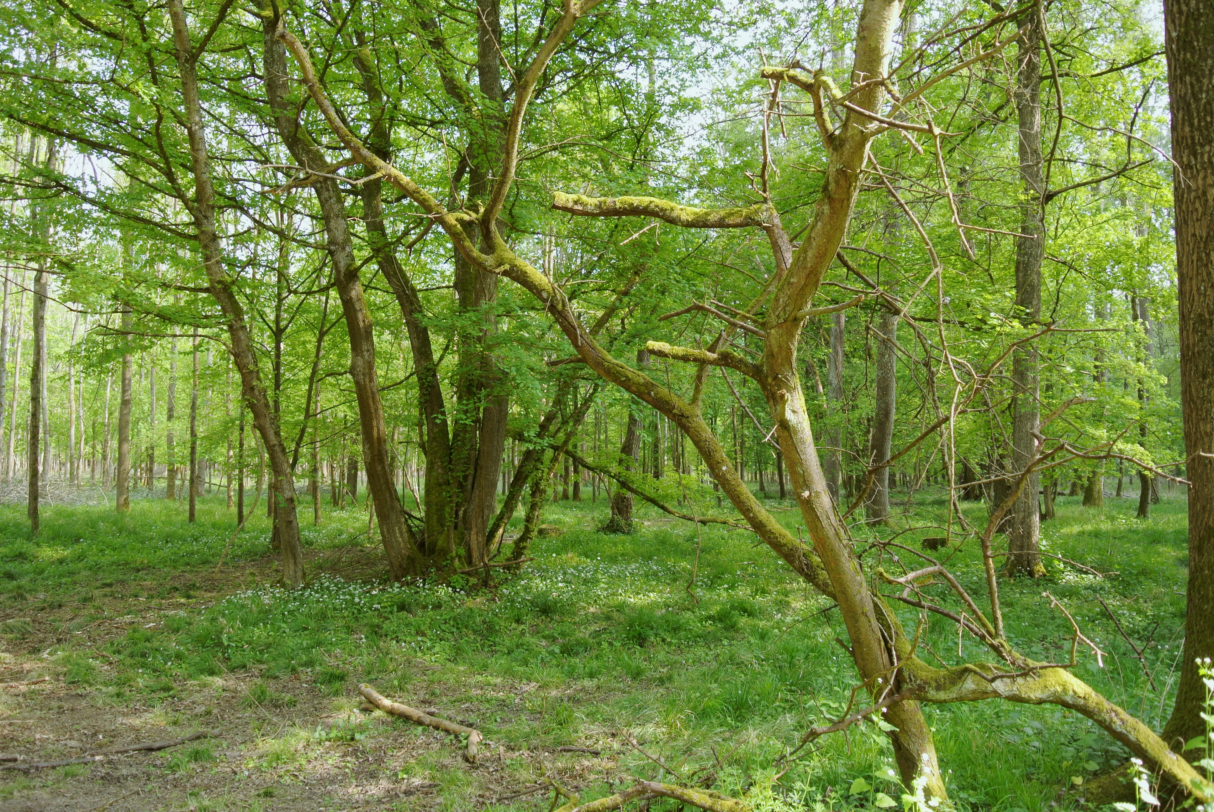
A view into a lush green forest with tall deciduous trees, moss-covered branches, and a ground layer of low vegetation in the Illwald natural reserve.
The alluvial forest landscape of the Illwald natural reserve, showing lush green foliage and temperate vegetation.

Réserve naturelle régionale du Ried de Sélestat, l'Ill*Wald history and protected-area timeline

The territory of the present reserve, like the rest of the Grand Ried, was historically dominated by vast marshes. Only during the medieval period did permanent agricultural exploitation take hold, gradually shaping the semi-bocage landscape of meadows, canals, woodland, and hedgerows that still characterizes the area. For centuries, the floods of the Illwald and the cultivated land around Sélestat were closely intertwined: seasonal inundations formed part of the town's natural defenses, while hay and timber from meadows and forest supported the local economy.

The post-war spread of maize cultivation in the second half of the 20th century profoundly disrupted this balance, contributing to the loss of reedbeds, herb-rich pastures, and hedgerows across the Ried. At Sélestat, conservation concerns emerged in 1989 with the reconversion of former maize fields back into herb-rich grasslands. On 13 March 1995, at the initiative of the municipality and with the agreement of 93 landowners, the Réserve naturelle volontaire de l'Illwald was officially created, gathering some 2,000 hectares of land, including 1,500 hectares of continuous forest and 500 hectares of wet meadows.

In February 2013, the voluntary reserve was upgraded to the status of a regional nature reserve (Réserve naturelle régionale) for a renewable 25-year term. The reclassification followed a request from the city of Sélestat and gathered the support of more than 80 private landowners, cementing the Ill*Wald's long-term role in protecting one of France's most notable alluvial floodplain forests.

Réserve naturelle régionale du Ried de Sélestat, l'Ill*Wald landscape and geographic character

The Ill*Wald occupies a wide, flat stretch of the Alsatian Rhine graben, where the plain narrows and the Grand Ried broadens. Elevations are unusually uniform, sitting between roughly 166 and 170 meters above sea level. The reserve takes the shape of an irregular triangle covering nearly the entire southeastern half of the Sélestat commune, bordered to the northwest by the town's built-up area and crossed by a departmental road that links Sélestat to the Rhine plain.

Geologically, the area belongs to the Rhine graben, a vast tectonic trench sunk during the Eocene and filled during the Oligocene and Quaternary with marine, lacustrine, and fluvial deposits. The Illwald's substrate is dominated by Holocene alluvial sands and silts, occasionally interrupted by gravelly deposits, with no calcareous component. This soft, flood-derived material, combined with the shallow groundwater, produces the unstable, waterlogged soils that shape both forest composition and meadow patterns.

The defining visual impression of the reserve is one of alternating woodland, wet meadow, marsh, and open water. Dense alluvial forest borders an intricate web of channels and ditches, including the well-known Oberriedgraben, the Grosschluth, and the Schiffwasser. Pebble banks surface in some of the excavated channels, while reedbeds, tall-herb fens, and isolated willows along the ditches break the forest canopy. In winter, the rising Ill and rising groundwater transform much of this mosaic into a temporary shallow lake before the waters slowly recede.
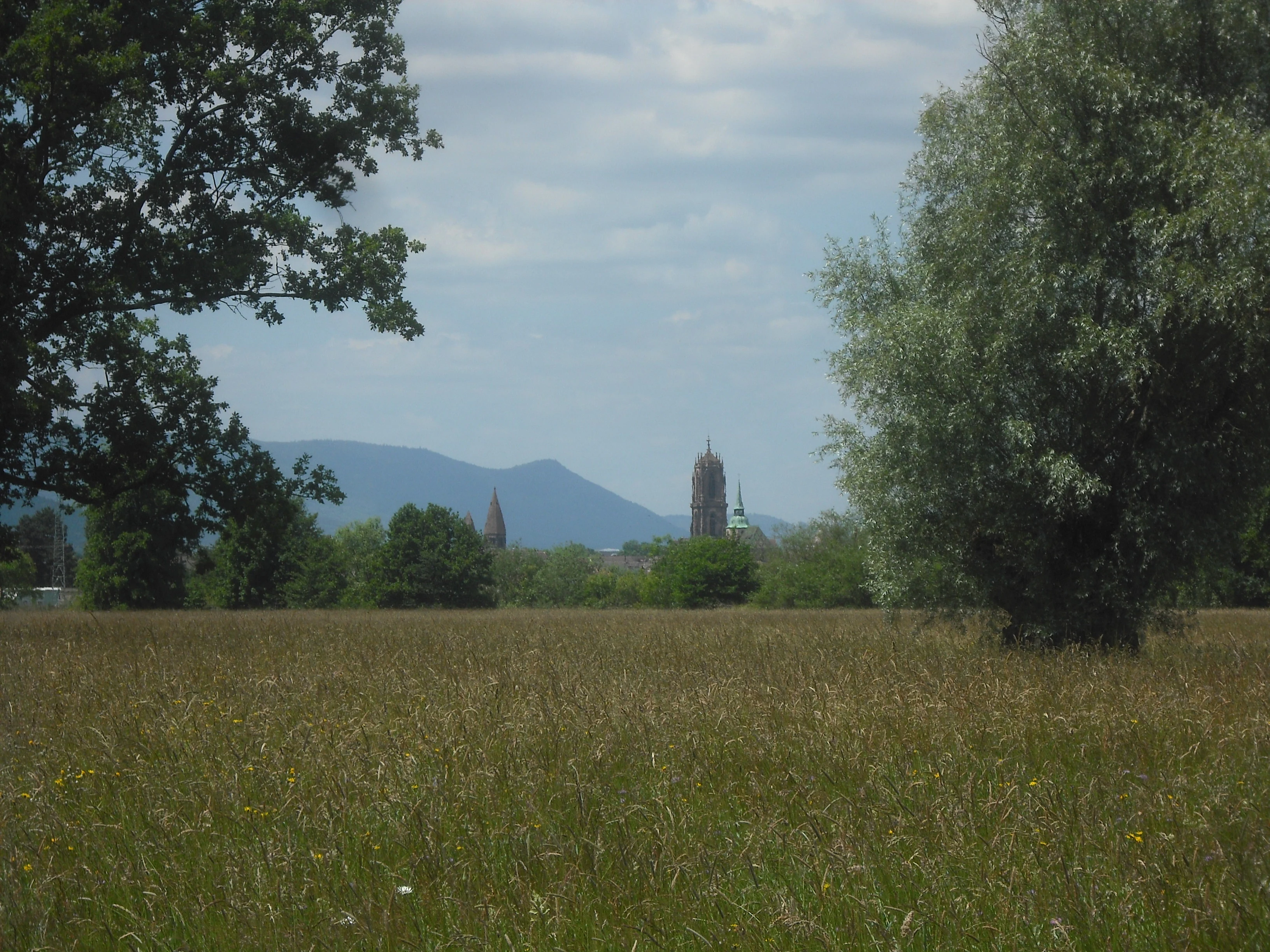
A wide view of a large grassy field under a cloudy sky, with trees framing the left and right sides and the distant silhouette of a church steeple and mountains in the background.
A view across the grassy fields of the Ried de Sélestat toward the town of Sélestat in the distance.

Réserve naturelle régionale du Ried de Sélestat, l'Ill*Wald ecosystems, habitats, and plant life

The Ill*Wald safeguards a remarkable mosaic of more than 30 habitat types, ranging from alluvial forest and meadows to marshlands and aquatic environments. This habitat richness reflects the tight interplay between river flooding, groundwater conditions, and the legacy of long-standing human land use in the Grand Ried.

In the forest, the wettest zones are dominated by alder, with ash, oak, and elm taking over where soils are slightly drier. More than 35 species of trees and shrubs have been recorded in the Illwald, surpassing the diversity of nearby Vosges forests, though slightly below that of the Rhine-side forest on the Île de Rhinau. The shrub layer includes hazel, dogwood, hawthorn, guelder rose, blackthorn, and spindle, while the herb layer features large sedges, meadowsweet, wild garlic, and yellow false buttercup, alongside the invasive Himalayan balsam. The understory is also home to more than 80 species of higher fungi.

Open habitats cover a wide ecological gradient. Dry meadows, very local in the reserve, can host upright brome and orchids, while moderately moist meadows feature autumn crocus and tall oat-grass; moister ones are marked by meadow brome, Yorkshire fog, and abundant meadowsweet; the wettest meadows support meadow foxtail, tubular water-dropwort, and marsh ragwort. Reedbeds, sedge beds, and tall-herb fens add a further layer of botanical diversity, supported by rare species such as purple small-reed, marsh fern, marsh ragwort, and various protected plants. Aquatic habitats range from cold, clear phreatic streams rich in pondweed species to nutrient-laden branches of the Ill covered in duckweed and water crowfoot.
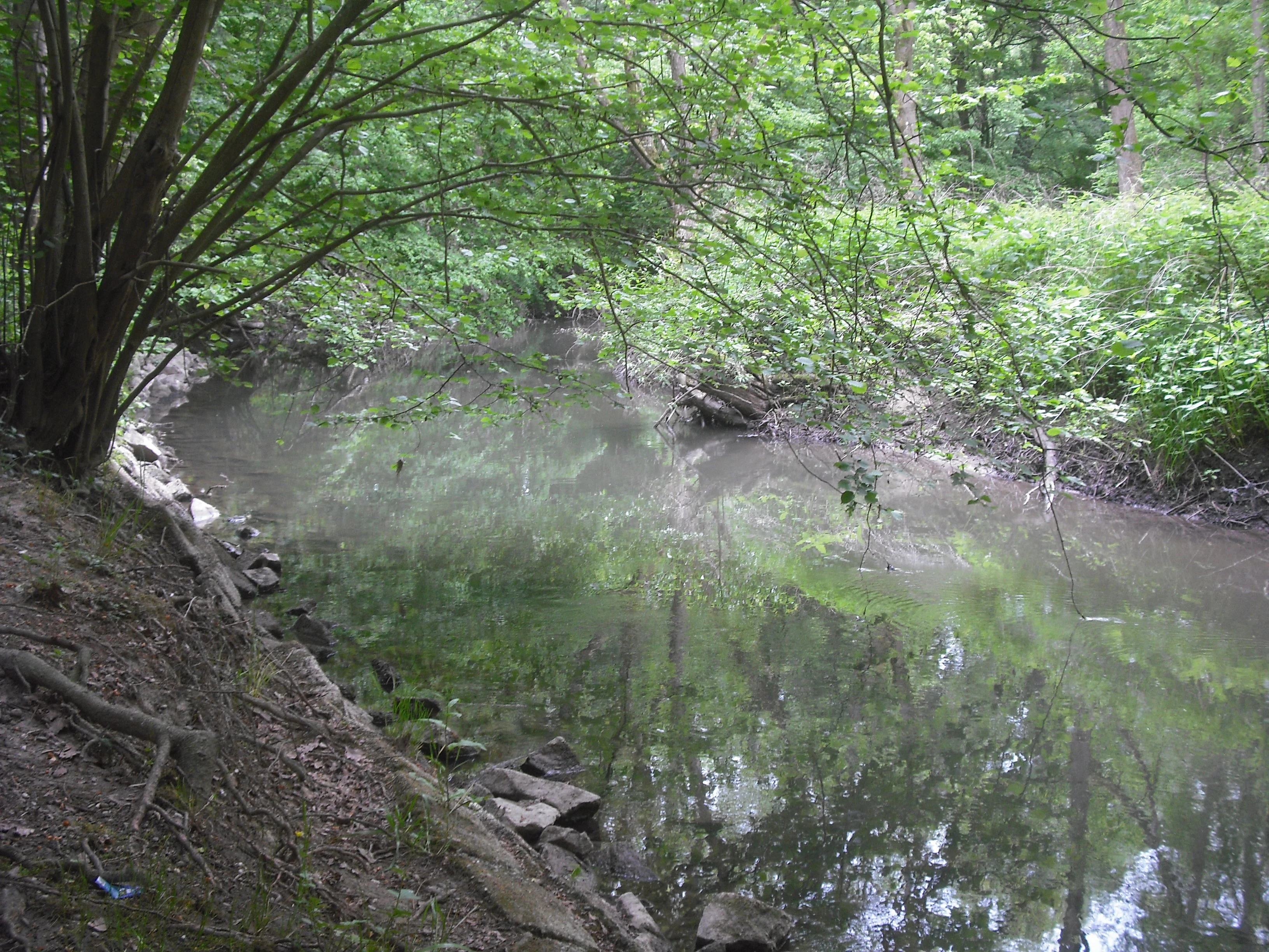
A calm, narrow stream winding through a dense, green forest with overhanging branches and mossy banks.
The Schiffwasser stream flowing through the lush, alluvial Illwald forest.

Réserve naturelle régionale du Ried de Sélestat, l'Ill*Wald wildlife and species highlights

The reserve is especially notable for two flagship mammal species. The fallow deer herd, introduced in the 19th century by the Rohan family, has become fully wild and is believed to be the most important truly wild fallow deer population in France, with around 300 individuals recorded in 2019. The European beaver is also established along the Ill's branches and the quieter watercourses, where its dam- and lodge-building leaves a visible mark on the riparian landscape.

Birdlife is particularly rich, with 141 species recorded across the reserve, including waders and wetland raptors such as the Eurasian curlew and the marsh harrier. The mosaic of reedbeds, wet meadows, and alluvial woodland provides both breeding grounds and seasonal stop-over habitat. Amphibians and reptiles are represented by 14 species, among them the yellow-bellied toad, a species of conservation interest. Dragonflies are exceptionally diverse for an inland site, with 32 recorded species, reflecting the range of water temperatures and flow conditions across the reserve's streams and stagnant water bodies.
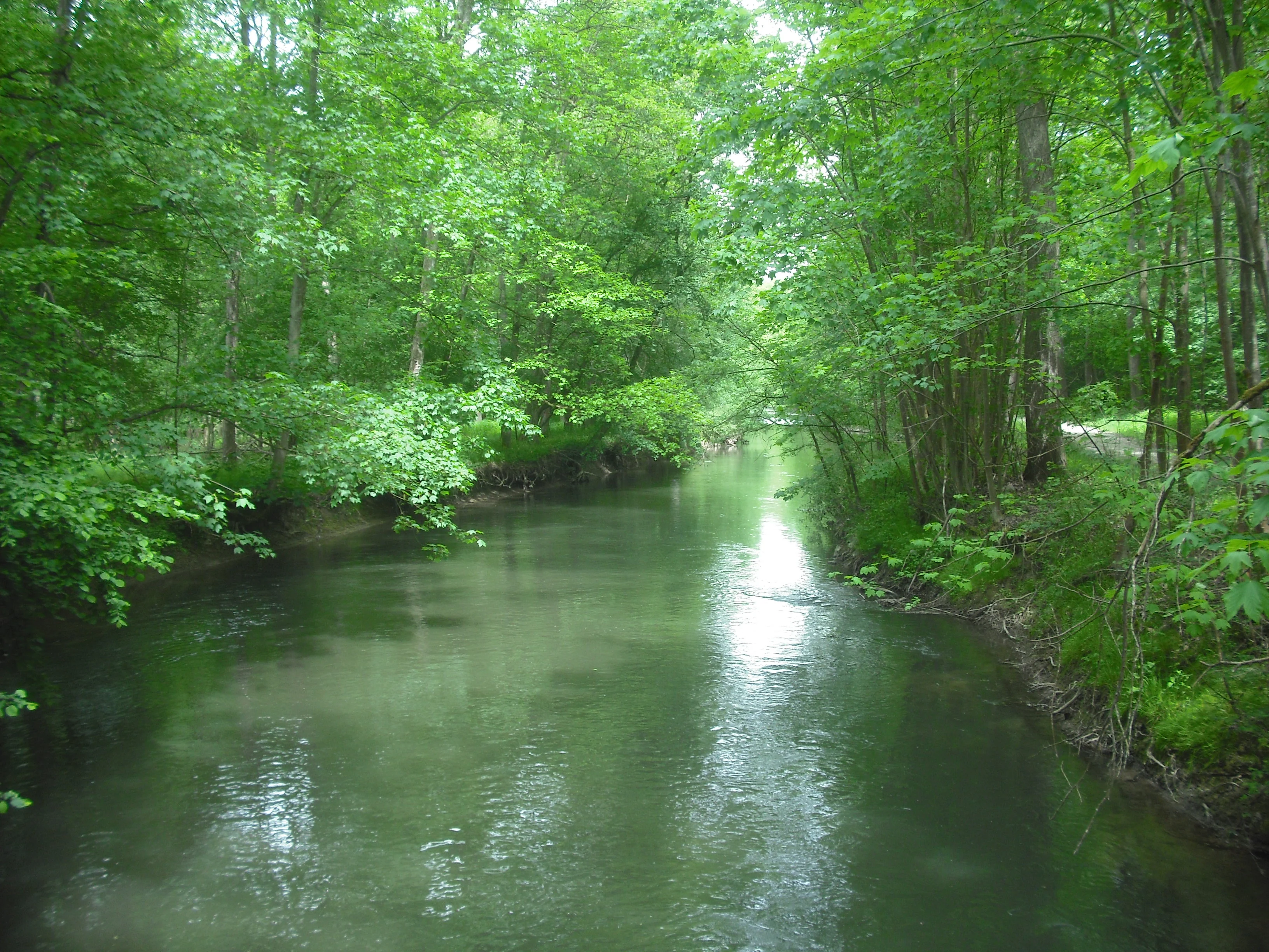
A slow-moving stream winds through a dense green forest, with trees lining both banks and sunlight reflecting off the water surface.
The Oberriedgraben stream flowing through the lush Illwald alluvial forest.

Réserve naturelle régionale du Ried de Sélestat, l'Ill*Wald conservation status and protection priorities

The Ill*Wald plays a key role in conserving the Grand Ried floodplain, one of the most distinctive wetland landscapes of the Upper Rhine. By protecting a continuous block of alluvial forest together with associated meadows, reedbeds, marshes, and aquatic habitats, the reserve sustains functional ecological processes, including seasonal flooding, groundwater-surface water exchange, and natural river dynamics that much of the surrounding plain has lost.

Beyond habitat protection, the reserve preserves a large set of species and habitats of European and national importance. The alder-ash swamp woodland is classified as a priority habitat at the European level, while a range of protected plant species, including meadow small-reed, meadow grape-fern, and several rare graminoids and legumes, find refuge in the meadows and fens. The reserve also hosts one of France's most significant truly wild fallow deer populations, a unique conservation inheritance.

Management responsibility sits with the commune of Sélestat, working in close partnership with the regional council, neighboring municipalities, and more than 80 private landowners. Addressing the long-term impacts of historical channelization and drainage, particularly on the phreatic system, is a central conservation concern, complemented by work to control invasive species such as Himalayan balsam and to maintain the open meadow habitats that depend on traditional wet-mowing practices.

Réserve naturelle régionale du Ried de Sélestat, l'Ill*Wald cultural meaning and human context

The Ill*Wald is deeply intertwined with the history of Sélestat. For centuries, the fluctuating rhythm of the Ill shaped both the town's defenses and its economy: seasonal floods helped shield the medieval settlement, while the surrounding meadows and the Illwald provided hay and timber. The name itself reflects this cultural layering, since "wald" denotes forest and "Ill" the river in regional usage, and "ried" comes from the Old Alemannic word for reeds, underscoring the long coexistence of human communities and wetland ecosystems.

The asterisk in Ill*Wald is a deliberate symbolic choice, representing the close interactions between water, marsh, meadow, and forest, as well as the strong human imprint on the site including past drainage, channelization, and changes in agricultural practice. After the Second World War, the spread of maize cultivation transformed much of the Ried, and the reserve's creation in 1995 marked a marked shift back toward valuing traditional grasslands and the historic links between the town and its floodplain.
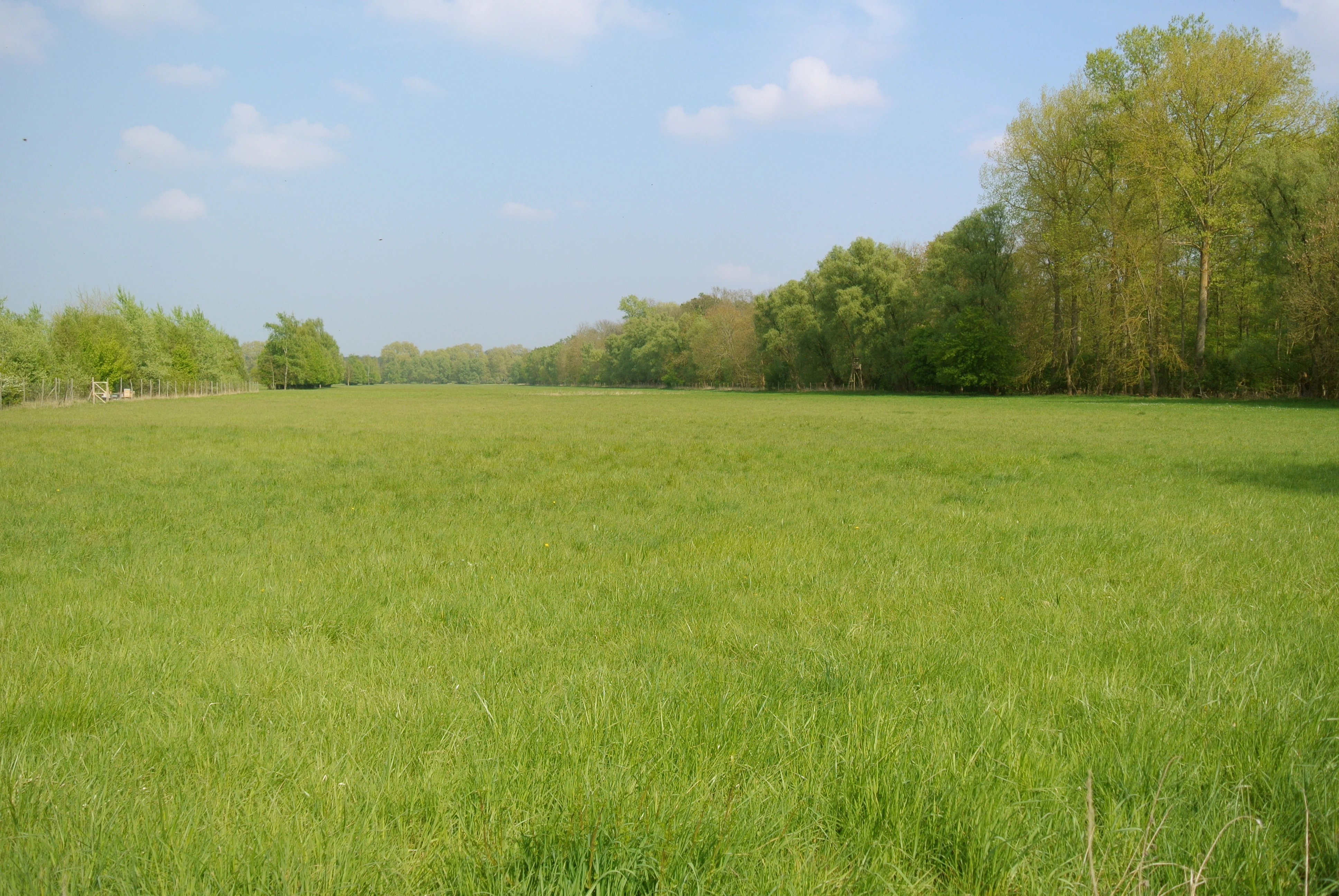
A wide, green grassy field under a pale blue sky, with a line of trees in the background.
A wide view of a grassy prairie bordered by deciduous trees within the Illwald natural reserve.

Top sights and standout views in Réserve naturelle régionale du Ried de Sélestat, l'Ill*Wald

The Ill*Wald's standout qualities begin with its sheer scale: among the five largest regional nature reserves in France, it protects a vast and rare continuous block of alluvial forest in the heart of Alsace. Its habitat mosaic of more than 30 distinct types, from alder-ash swamp woodland to wet meadows, reedbeds, and phreatic streams, gives it an unusually rich ecological identity.

Equally distinctive is its wildlife heritage, in particular the long-established wild fallow deer herd, a thriving beaver population, a bird checklist of 141 species, and a remarkable 32 dragonfly species. The dynamic interplay between the Ill's branches and the cold, stable phreatic springs creates a hydrological landscape that is both visually striking and scientifically important, while the reserve's accessibility from Sélestat and its interpretation trail "L'Ill aux trésors" make it a notable example of a floodplain protected area closely tied to the urban and cultural life of a neighboring town.
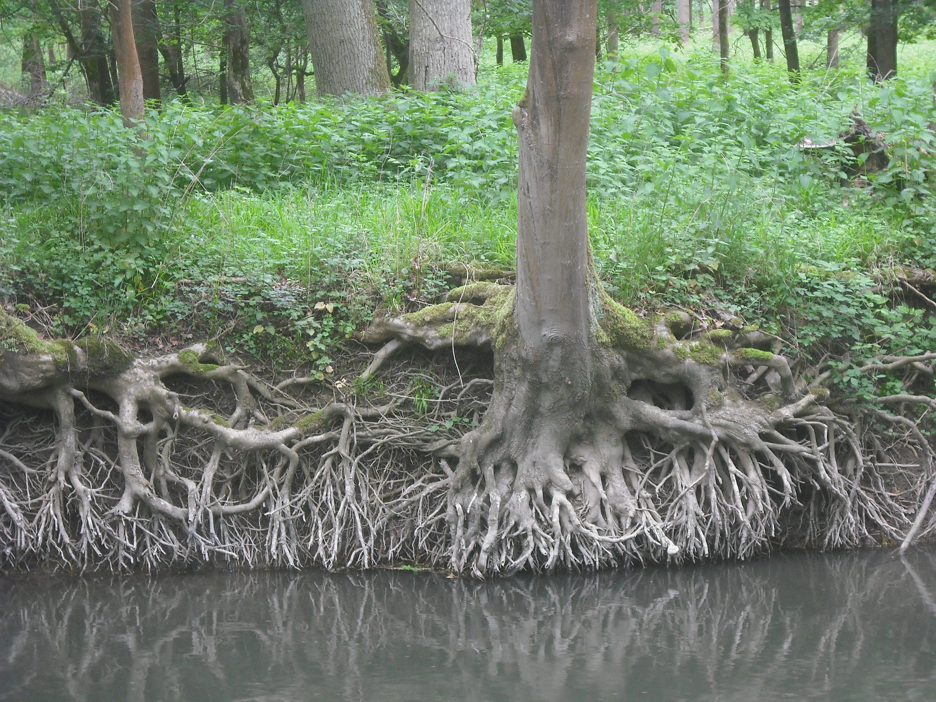
A close-up view of exposed tree roots overhanging a quiet, slow-moving stream in a dense, green forest setting.
Exposed tree roots along the banks of the Oberriedgraben stream in the Illwald forest.

Best time to visit Réserve naturelle régionale du Ried de Sélestat, l'Ill*Wald

The character of the Ill*Wald shifts dramatically with the seasons, and the timing of a visit strongly influences what visitors experience. In winter and early spring, the Ill and its tributaries swell, and large portions of the Ried, including forest edges and meadows, are regularly inundated. These annual floods are essential to the floodplain's ecology but can also limit access to some paths, so visiting in this period requires flexible expectations and attention to water levels.

Late spring and early summer offer a particularly rewarding combination of conditions, with high water levels gradually receding, lush vegetation at its most expressive, meadows coming into flower, and active birdlife alongside the start of the dragonfly season. Late summer and autumn allow quieter exploration of the forest interior and the many small channels, when the rich fungal flora of the Illwald becomes more visible. Throughout the year, fog and low cloud are frequent in the Rhine graben, lending the reserve a soft and atmospheric quality, while the stable phreatic springs keep some watercourses remarkably cold even in midsummer.

Monthly climate preview

Long-term temperature and precipitation normals sampled across twelve distinct months

Réserve naturelle régionale du Ried de Sélestat, l'Ill*Wald climate and monthly weather profile

Measured NASA POWER climatology records indicate distinct annual temperature ranges and steady precipitation rates across the protected representative coordinate point. Reviewing the complete monthly profile provides deeper insight into long-term meteorological patterns and thermal variation.
Annual mean10 °C
0 °C20 °C
Jan
Feb
Mar
Apr
May14°
Jun18°
Jul20°
Aug19°
Sep15°
Oct10°
Nov
Dec
Warmest month
July

19.6 °C

Coolest month
January

0.1 °C

Wettest month
May

3 mm/day

Driest month
February

1.7 mm/day

Park location guide

Geography guide, regional context, and park location map for Réserve naturelle régionale du Ried de Sélestat, l'Ill*Wald

Réserve naturelle régionale du Ried de Sélestat, l'Ill*Wald park geography, regions, and map view in France

Understand where Réserve naturelle régionale du Ried de Sélestat, l'Ill*Wald sits in France through a broader geographic reading of the surrounding landscape, nearby location context, and its mapped position within the national park landscape.

How Réserve naturelle régionale du Ried de Sélestat, l'Ill*Wald fits into France

France is a unitary semi-presidential republic and one of the world's largest economies. It borders Belgium, Luxembourg, Germany, Switzerland, Italy, Monaco, Andorra, and Spain, with a maritime border to the United Kingdom. The country is known for its cultural influence, art, cuisine, and political history spanning centuries.

Wider geography shaping Réserve naturelle régionale du Ried de Sélestat, l'Ill*Wald in France

France is located in Western Europe. Metropolitan France extends from the Rhine to the Atlantic Ocean and from the Mediterranean Sea to the English Channel and North Sea. The country borders Belgium, Luxembourg, Germany, Switzerland, Italy, Monaco, Andorra, Spain, and has a maritime border with the United Kingdom.

Map view of Réserve naturelle régionale du Ried de Sélestat, l'Ill*Wald

Use this park location map to pinpoint Réserve naturelle régionale du Ried de Sélestat, l'Ill*Wald in France, understand its exact geographic position, and read its mapped placement within the surrounding landscape more clearly.

Pigeon | © OpenStreetMap contributors

Location context for Réserve naturelle régionale du Ried de Sélestat, l'Ill*Wald

Bas-RhinGrand Est

Visual exploration of alluvial forests, wetland habitats, and river networks across Alsace

Réserve naturelle régionale du Ried de Sélestat, l'Ill*Wald Photos and Landscape Scenery

Visual records capture the dense mosaics of oak, ash, and alder woodland alongside the intricate waterways of the Grand Ried. Examining these protected landscapes reveals the terrain, flood channels, and diverse habitats defining this Alsatian nature reserve.

A view into a lush green forest with tall deciduous trees, moss-covered branches, and a ground layer of low vegetation in the Illwald natural reserve.

A front-facing view of a narrow, green metal suspension footbridge anchored by large turnbuckles, leading into a dense green forest.

A wide view of a large grassy field under a cloudy sky, with trees framing the left and right sides and the distant silhouette of a church steeple and mountains in the background.

A calm, narrow stream winding through a dense, green forest with overhanging branches and mossy banks.

A slow-moving stream winds through a dense green forest, with trees lining both banks and sunlight reflecting off the water surface.

A calm, brown river flowing through a green, tree-lined landscape under an overcast sky.

A wide, green grassy field under a pale blue sky, with a line of trees in the background.

A close-up view of exposed tree roots overhanging a quiet, slow-moving stream in a dense, green forest setting.

A calm, narrow stream or pond surrounded by dense, lush green deciduous forest with overhanging branches.

A small gravel and pebble bank situated in a shallow, flowing stream, surrounded by green riparian forest vegetation.

Park atlas

Compare surrounding protected landscapes and regional wetland reserves

Parks Near Réserve naturelle régionale du Ried de Sélestat, l'Ill*Wald

Browsing other protected areas near Réserve naturelle régionale du Ried de Sélestat, l'Ill*Wald reveals wider regional ecosystems, alluvial floodplains, and river networks. Extending the map-based comparison uncovers connected conservation terrain across the Alsatian plain and nearby river basins.
Nature reserveGrand Est
About 28 km away#1 closest

North

Réserve naturelle régionale des collines sèches du Bischenberg, de l'Immerschenberg et du Holiesel: Geography and Protected Status

Preserving unique limestone hill ensembles and relict oak habitats in Grand Est

Covering 97.2 hectares, this protected area spans three distinct sites including the Bischenberg, Immerschenberg, and Holiesel hills. The reserve maintains a critical refuge for species-rich calcareous grasslands and pubescent oak forests, providing a rare example of Mediterranean-influenced habitat at the edge of the Alsace plain and the Vosges foothills.

Area
0.972 km²
Established
2024
IUCN
IV
Relief
Upland
Nature reserveBas-Rhin
About 29 km away#2 closest

Northeast

Réserve naturelle nationale de la forêt d'Erstein Protected Alluvial Forest and Rhine Landscape

A historic nature reserve in the Bas-Rhin floodplain of northeastern France.

The Réserve naturelle nationale de la forêt d'Erstein serves as a vital reference for the dynamic Rhine floodplain forest ecosystems of the Alsace plain. Characterized by its dense canopy of oaks and ashes, the reserve preserves a unique mosaic of groundwater-fed channels, reedbeds, and alluvial terraces that support high levels of biodiversity within a narrow protected perimeter.

Area
1.796 km²
Established
1989
IUCN
IV
Relief
Lowland
Nature reserveGrand Est
About 31 km away#3 closest

South

Réserve naturelle régionale de la forêt de Mequillet Le Hardtwald Geographic Atlas and Map

Protected dry forest and steppe habitat in Grand Est

Situated on the elevated terraces of the Rhine floodplain, this nature reserve protects 249 hectares of distinct dry woodland and open clearings. The landscape offers a rare example of continental flora and saproxylic beetle habitats, set within the broader agricultural context of the Alsace plain. This record provides a comprehensive view of the park boundaries and ecological geography found within this significant French conservation area.

Area
2.49 km²
Established
2012
IUCN
IV
Relief
Lowland
Nature reserveGrand Est
About 33 km away#4 closest

Southwest

Réserve naturelle nationale du Tanet-Gazon du Faing: Grand Est Protected Landscape Map

High-altitude heathlands and glacial granite ridges

The Réserve naturelle nationale du Tanet-Gazon du Faing protects a critical upland mosaic in the Vosges massif, defined by its subarctic-style flora, sprawling peat bogs, and rugged granite boulder fields. This high-elevation geography provides essential habitat for montane species and offers a clear example of post-glacial landscape development across the Grand Est region.

Area
5.05 km²
Established
1988
IUCN
IV
Relief
Mountain
Nature reserveGrand Est
About 36 km away#5 closest

Southwest

Réserve naturelle régionale des collines de Rouffach: Protected Hills and Dry Grasslands

A Mediterranean-influenced nature reserve in the Alsace foothills.

Located in the Grand Est region, this reserve preserves Bollenberg and Strangenberg hills through a mosaic of downy oak woodland and xerobrometum grasslands. The site functions as a botanical refuge where limestone geology creates an exceptionally warm, arid environment rare for northeastern France.

Area
0.44 km²
Established
2013
IUCN
IV
Nature reserveGrand Est
About 40 km away#6 closest

South

Réserve naturelle régionale de l'Eiblen et l'Illfeld: Alsace Floodplain Protected Area

Geographic context of regional alluvial habitats in Haut-Rhin

Located in the Alsace plain, this nature reserve preserves a rare cross-section of original river floodplain geography. The area provides a critical look at alluvial ecosystems and sediment-rich lowland terrain that defines the historical character of the Upper Rhine plain within France.

Area
0.66 km²
Established
1992
A wide panoramic watercolor illustration showing a green landscape with rolling hills, a line of trees, and foreground grass.
Protected landscapeBaden-Württemberg
About 42 km away#7 closest

Southeast

Östliches Hexental: Protected Landscape and Regional Geographic Context in Baden-Württemberg

Black Forest valley mosaic and protected meadow systems

Located in the Breisgau-Hochschwarzwald district, Östliches Hexental forms a vital protected landscape of approximately 526 hectares. The region showcases a traditional Black Forest valley structure, defined by riparian gallery forests, orchard meadows, and small field hedges that provide essential habitat connectivity between the High Black Forest and the Markgräfler Hügelland.

Area
5.264 km²
Established
2008
IUCN
V
A watercolor painting showing a wide panoramic view of green rolling hills and mountain ridges under a soft light.
Nature reserveGrand Est
About 45 km away#8 closest

Southwest

Réserve naturelle régionale des hautes-chaumes du Rothenbach: Protected Geography in the Vosges

A regional nature reserve in Grand Est, France.

This protected area provides a representative profile of the high Vosges mountains, spanning elevations from 900 to 1,300 metres. The terrain is characterized by an open mosaic of primary and secondary grasslands, known as chaumes, along with acidic heathlands and subalpine forests. Managed to preserve its fragile biodiversity, the site offers a deep look into the regional geography and the historical land use patterns that define the crests of Alsace.

Area
0.942 km²
Established
2008
IUCN
IV
Relief
Mountain

Common questions about visiting, size, designation, and location context for Réserve naturelle régionale du Ried de Sélestat, l'Ill*Wald

Réserve naturelle régionale du Ried de Sélestat, l'Ill*Wald FAQs for park facts, access, geography, and protected area context

Find quick answers about Réserve naturelle régionale du Ried de Sélestat, l'Ill*Wald, including protected-area facts, park geography, trail and visitor context, and how the park fits into its surrounding country and regional landscape.
MoriAtlas Explorer

Continue Your Protected Areas Search Across the Global Atlas

Deepen your exploration by continuing the structured search for national parks and protected areas worldwide. Utilize the comprehensive filtering capabilities to compare different conservation landscapes and refine your understanding of global park geography. Discover more about the distribution and characteristics of protected natural areas.

Global natural geography