
Mori Atlas logo
Nature reserveRettbergsaue

Examining the alluvial geography, riparian forest habitats, and riverine boundaries of this protected Rhine island.

Rettbergsaue Nature Reserve: A Protected Floodplain Island in the Upper Rhine Valley of Hesse

(Naturschutzgebiet Rettbergsaue bei Wiesbaden)

Rettbergsaue is a significant natural river island situated within the Upper Rhine, marking a distinct boundary within the state of Hesse. This protected nature reserve features a rare, surviving hardwood floodplain forest that spans the island, flanked by the dynamic main channel of the Rhine and the sheltered Wachsbleicharm. Its 68 hectares support a rich intersection of alluvial meadows, sandy riverbanks, and woodland, providing a critical corridor for regional avian species and riparian wildlife.

Rhine islandriver islandfloodplain foresthardwood alluvial forestnature reserveNatura 2000
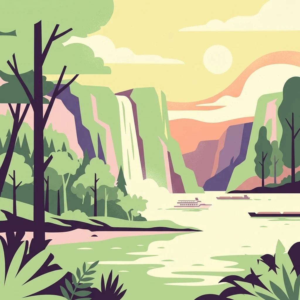
A colorful flat design illustration showing a river flowing through a valley with steep cliffs, a waterfall in the background, green trees on the banks, and boats on the water under a sunny sky.

Rettbergsaue

Nature reserve

Park overview

Structured park overview, official facts, and landscape profile for Rettbergsaue

Rettbergsaue park facts, protected area profile, and essential visitor context

Review the core facts for Rettbergsaue, including designation, size, terrain, visitor scale, habitats, and operating context in one park-focused overview.

About Rettbergsaue

Rettbergsaue is a natural river island in the Upper Rhine, part of the city of Wiesbaden in the German federal state of Hesse but closely tied in geography and ecology to the surrounding Rhine valley between Mainz, Wiesbaden, and the Rheingau. The island lies in the main channel of the Rhine, separated from the southern bank by a quieter side arm, the Wachsbleicharm, whose course follows the historic Hesse / Rhineland-Palatinate state border. With a length of about 3.1 kilometers and an area of roughly 68 hectares, it ranks among the larger unobstructed islands of the German Rhine.

The defining character of Rettbergsaue is its ecological richness. Although small in absolute terms, the island supports a compressed cross-section of Upper Rhine floodplain habitats: remnant hardwood floodplain forest, softwood pioneer areas, shrub and herbaceous edges, alluvial meadows, shoreline pioneer vegetation, and naturally disturbed sand and mud banks along the river. This habitat mosaic has made the island a focus of conservation policy for decades, and nearly 90 percent of its surface is formally protected, while a smaller portion continues to be used for agriculture.

As a landscape and cultural feature, Rettbergsaue also plays a clear role in the regional identity of Wiesbaden. It lies directly across the Rhine from Biebrich Palace, anchors an important crossing point of the Schiersteiner Bridge, and historically hosted leisure facilities that have evolved into a family-oriented day-use area. Today, the island is widely understood as a hybrid site: a working example of Rhine floodplain conservation and, at the same time, a readily accessible green and blue space for residents of Wiesbaden, Biebrich, and Schierstein.

Quick facts and research context for Rettbergsaue

Rettbergsaue is a natural inland island of the Upper Rhine, administratively belonging to the city of Wiesbaden in Hesse, though the southern side arm forms the border with Rhineland-Palatinate. The island is about 3.1 kilometers long, up to 400 meters wide, and covers roughly 68 hectares, with its highest point reaching approximately 85 meters above sea level.

A nature reserve was formally designated on the island in 1978, covering about 52.6 hectares and later extended to around 67.8 hectares in 1984. Since 2001, the surrounding waters and habitats have also been included in a larger European Habitats Directive (FFH) area as part of the Natura 2000 network, and the island lies within the EU bird protection area known as Inselrhein.

Protection and recognition

Documented 1978 designation timeline and management scope records

Rettbergsaue Protection Status and Terrestrial Conservation History

Rettbergsaue holds a documented terrestrial protection status established in 1978 for regional conservation oversight. Official records compile the designation history and management scope without external international recognition sources.

Protection details

Protection scope
Terrestrial
Designated year
1978
Transboundary protection
No
Park context

Deeper park guide and search-rich context for Rettbergsaue

Rettbergsaue history, landscape, wildlife, and travel context

Explore Rettbergsaue through its history, landscape character, ecosystems, wildlife, conservation priorities, cultural context, and seasonal travel timing in a structured park guide built for atlas discovery and search intent.

Why Rettbergsaue stands out

Rettbergsaue is best known for its surviving patch of hardwood floodplain forest along the Upper Rhine, a habitat type that has been almost entirely lost elsewhere in the German Rhine valley. The island combines alluvial woodland dominated by ash, elm, sycamore, Norway maple, and pedunculate oak with open meadows, shoreline pioneer vegetation, and riparian zones that together support an unusually rich bird community for such a small area. The island is also notable as a long-established bird sanctuary, with documented breeding pairs of Black Kite, Red Kite, and a suite of smaller woodland and farmland species such as Common Nightingale, Bluethroat, Red-backed Shrike, and several woodpecker species. This combination of protected forest structure, riverine island setting, and overlapping national and European conservation designations makes it a key reference site for Rhine floodplain ecology in the Wiesbaden area.
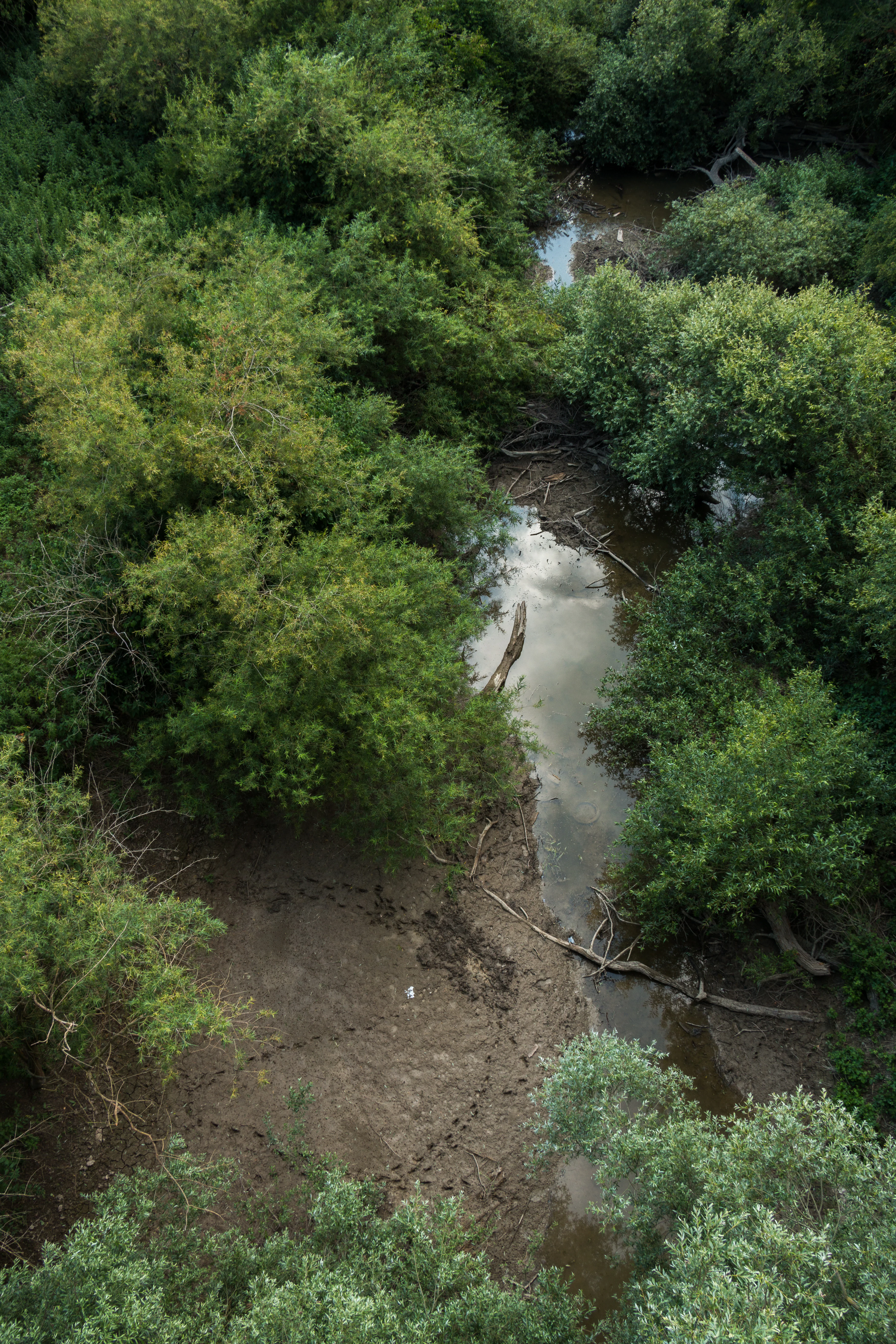
High-angle view of a narrow stream winding through a dense green floodplain forest, with muddy banks showing numerous animal tracks and fallen branches.
High-angle view of a winding stream through the floodplain forest of Rettbergsaue, featuring muddy banks with animal tracks.

Rettbergsaue history and protected-area timeline

Rettbergsaue is a river-built island formed after the last cold period, when the Rhine deposited layers of sand and clay in this stretch of the Upper Rhine valley. For centuries the island existed as two separate landforms, the Biebricher Wörth and the Schiersteiner Wörth. The western section, which was called Karthäuser-Aue in the late Middle Ages, was purchased in 1832 by Carl von Rettberg, a Nassau officer and adjutant to the duke, from whom the island takes its present name. Rettberg attempted livestock and horse breeding there, but financial difficulties forced him to return the property to the Duchy of Nassau only a few years later.

In the early twentieth century, the island developed into a recreational venue. In 1914 the Schiersteiner Strandbad opened at the western end near two former side arms of the Rhine, and in 1921 the Biebricher Strandbad was added along the northern bank. Both bathing facilities were closed in 1962 because the Rhine had become heavily polluted, but the open spaces were redesigned as day-use leisure grounds. A pivotal moment came in the early 1970s, when plans called for a major recreation and tourism development on the island, including holiday apartments, a riding stable, sports facilities, seminar buildings, walking trails, and even a cable car link to Biebrich, as well as a power plant. The 1978 designation of the island as a nature reserve effectively ended those plans and shifted its trajectory toward conservation.

Subsequent decades saw further protection measures. The original nature reserve was enlarged in 1984, and in 2001 an FFH (Habitats Directive) site was added around the island as part of the European Natura 2000 network. In 2009 the local branch of the German Federal Agency for Technical Relief (THW) dredged a channel in the side arm to remove accumulated silt and odors and help restore the bathing landscape. Between 2013 and 2025, public access via the historic stairway from the Schiersteiner Bridge was interrupted by the construction of a new bridge; a barrier-free access route was reopened in 2025.

Rettbergsaue landscape and geographic character

Rettbergsaue is a flat, low-lying river island shaped by post-glacial sediment deposition rather than bedrock geology. Fine Rhine sediments, primarily sand and clay, form its base, and its highest point reaches only about 85 meters above sea level. The island stretches for roughly 3.1 kilometers in a north-south direction, with a maximum width of about 400 meters, giving it an elongated, lozenge-like profile typical of Upper Rhine alluvial islands.

Hydrologically, the island sits between two very different water bodies. To the north runs the main navigable channel of the Rhine, carrying the dominant flow and most of the river traffic. To the south lies the quieter Wachsbleicharm, a side channel whose calmer, slower waters have historically defined the state border between Hesse and Rhineland-Palatinate. The contrast between the strong northern current and the sheltered southern side arm is a key part of what makes the island ecologically distinctive: dynamic main-channel conditions on one side, more stable sheltered habitats on the other.

The visible surface combines forested stretches, open meadows, sandy shores, and reworked riverbanks. Areas of active erosion and deposition along the main channel create open sand and gravel habitats, while more stable zones support closed woodland canopies. Linear infrastructure, especially the Schiersteiner Bridge and the adjacent federal motorway A 643, crosses the island but does not dominate its character, and the protected areas retain a distinctly natural, river-driven appearance.
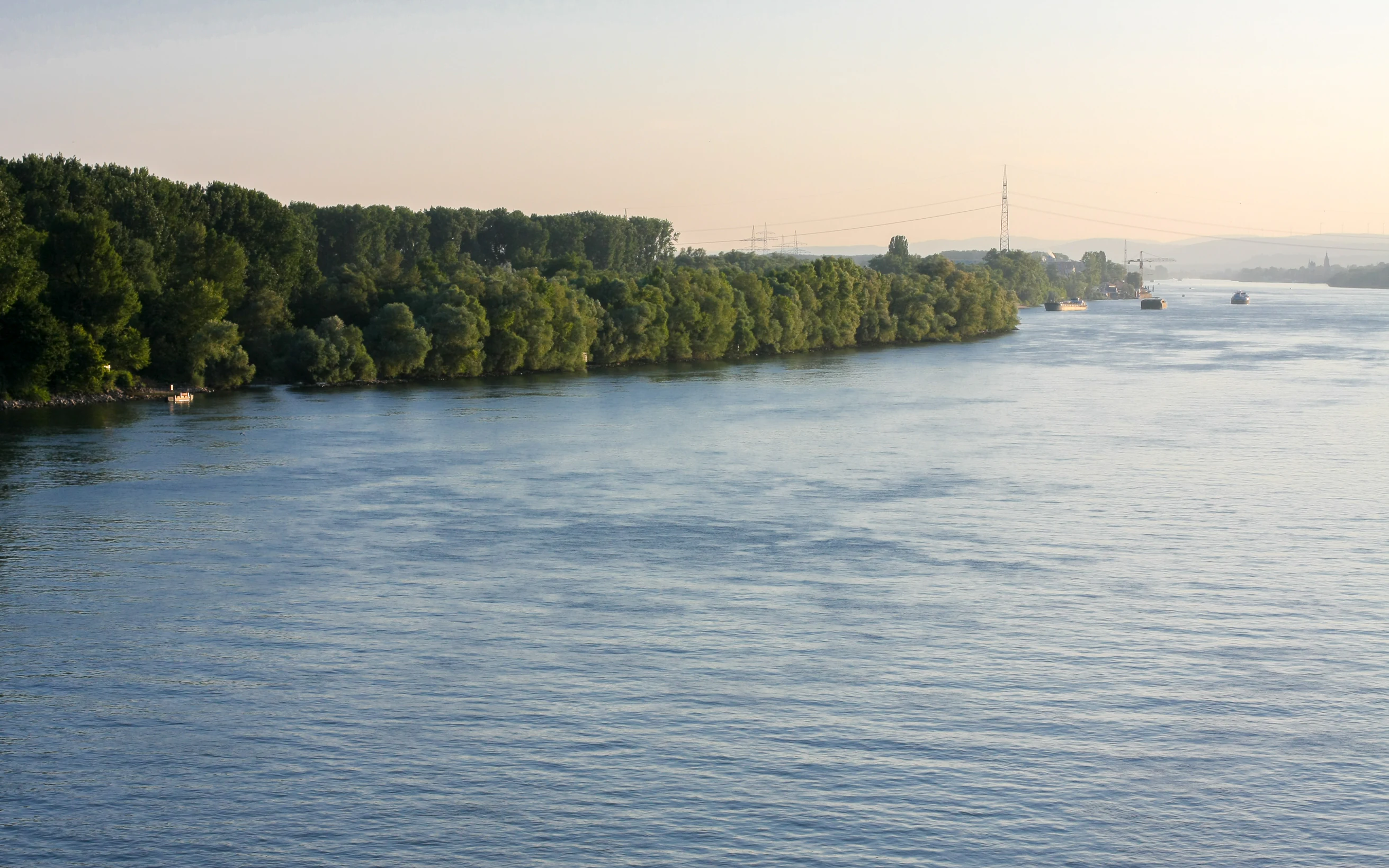
A wide river with a dense line of green trees along the left bank and a hazy horizon in the distance with distant ships.
The Rhine river flowing past the tree-lined banks of Rettbergsaue.

Rettbergsaue ecosystems, habitats, and plant life

Ecologically, Rettbergsaue belongs to the category of Upper Rhine floodplain habitats that have become rare in central Europe. The island preserves both a functioning softwood pioneer zone and a much rarer remnant of hardwood floodplain forest, an assemblage once widespread along the Rhine and now confined to a handful of protected sites. The woodland is dominated by ash, elm, sycamore, Norway maple, and pedunculate oak, with a structurally rich understory shaped by seasonal flooding.

Around and between the wooded areas, the island sustains a mosaic of open habitats. Auewiesen, or floodplain meadows, occupy flatter sections; shrub and herbaceous edges line the woodland margins; pioneer and flood meadows colonize freshly exposed sediments; nitrophilous tall-herb communities thrive on nutrient-rich deposits; and the shoreline includes both soft pioneer vegetation and dynamic sand and mud communities that change with each flood event. Together, these habitats support a broad range of invertebrates, plants, and mammals typical of large European lowland rivers, and form a continuous gradient from aquatic to fully terrestrial environments.

The protected designation of the area reflects this habitat diversity. The nature reserve Rettbergsaue bei Wiesbaden was established to safeguard the island as a breeding and resting site for threatened bird species and as a refuge for the endangered hardwood floodplain community, while the surrounding FFH area was drawn more broadly to encompass the full range of riverine, woodland, meadow, and shoreline habitats associated with the site.

Rettbergsaue wildlife and species highlights

Birds are the most prominent and best-documented wildlife group on Rettbergsaue. In the late 1990s, surveys recorded nineteen occupied Black Kite nests on the island, marking it as an unusually important breeding ground for this species in the region. The wider bird community spans raptors, woodland birds, and open-country species, and includes Red Kite, European Honey Buzzard, Common Kingfisher, Red-backed Shrike, Wood Lark, Common Nightingale, Bluethroat, Common Redstart, and Grey-headed, Middle, and Lesser Spotted Woodpeckers.

Beyond birds, the island supports typical Rhine floodplain mammals such as wild boar, whose activity is visible in tracks and rooting signs along the woodland edges, and Grey Herons, which feed along the shallows and roost in the taller trees. The combination of closed canopy, open meadows, dynamic shorelines, and shallow side arms creates a varied vertical and horizontal structure that sustains a wide food web, from aquatic invertebrates in the side channel to raptors hunting over the meadows and woodland birds nesting in mature trees.

The role of the island as a refuge for these species is recognized at both national and European levels. Its inclusion in the EU bird protection area Inselrhein, which extends from Mainz downstream toward Lorch, places Rettbergsaue within one of the most important continuous bird corridors along the middle and upper Rhine.

Rettbergsaue conservation status and protection priorities

Conservation is the central organizing principle of how Rettbergsaue is managed today. In 1978 the island was designated as the nature reserve Rettbergsaue bei Wiesbaden, covering 52.6 hectares and making it the oldest formally protected site within the current list of nature reserves of the city of Wiesbaden. The reserve's purpose was explicit: to protect the island as a breeding and resting habitat for threatened bird species and to safeguard the surviving patch of hardwood floodplain forest, a vegetation type that had become exceptionally rare along the Rhine.

In 1984 the reserve's area was expanded to 67.78 hectares, extending protection closer to the full footprint of the island. A second layer of protection came in July 2001, when an FFH (Habitats Directive) site of about 71 hectares was designated around the island and integrated into the Natura 2000 network. This designation acknowledges the full habitat mosaic, including softwood and hardwood floodplain forest, shrub edges, floodplain meadows, herbaceous fringes, shoreline and drift-line biotopes, pioneer and floodplain grasslands, nitrophilous tall-herb communities, and newly formed sediment habitats.

Rettbergsaue is also embedded in larger conservation networks that extend well beyond the island itself. It forms part of the FFH area Wanderfischgebiete im Rhein, a 1,269-hectare site covering migratory fish habitats along the river from the Kühkopf through the Inselrhein to Bacharach in the Middle Rhine valley. It is likewise included in the EU bird protection area Inselrhein, which runs from Mainz downstream toward Lorch. Together, these designations make the island a small but high-value component of one of the more strictly protected stretches of the German Rhine.

Rettbergsaue cultural meaning and human context

Rettbergsaue's cultural significance is closely tied to the city of Wiesbaden and especially to its riverside districts of Biebrich and Schierstein. The island sits directly opposite Biebrich Palace, one of the most prominent historical residences in the region, and historically formed part of the visual foreground of this Baroque and Classical palace setting. The combination of palace, river, and wooded island has long shaped the image of this stretch of the Rhine.

In the early twentieth century the island became an everyday recreational landmark for local residents. The opening of the Schiersteiner Strandbad in 1914 and the Biebrich Strandbad in 1921 turned the island into a popular bathing destination at a time when many urban dwellers did not travel far for leisure. Even after these facilities were closed in 1962, the island retained its role as a nearby outdoor space, with sand areas, playgrounds, sports fields, and grill areas that continue to be used by families from Wiesbaden.

The name itself reflects this layered history. The western part of the island, formerly known as Karthäuser-Aue after Carthusian religious influence in the late Middle Ages, took its current name Rettbergsaue from Carl von Rettberg, a Nassau officer who acquired it in 1832. The seasonal passenger ferry Tamara, connecting Schierstein, the island, and Biebrich, is a continuing element of this regional leisure culture and remains a recognizable local tradition each summer.

Top sights and standout views in Rettbergsaue

Rettbergsaue stands out for the unusual combination of features it packs into a small area: a sizeable natural Rhine island, a remnant hardwood floodplain forest, a robust population of breeding raptors and songbirds, and a formal cascade of conservation designations culminating in Natura 2000 status. Its accessibility from Wiesbaden, Biebrich, and Schierstein makes it a working example of how riverine nature protection and everyday public recreation can coexist along the Rhine.

The island's ecological profile is shaped by its position between the main Rhine channel and the calmer Wachsbleicharm. This dual exposure produces a gradient from dynamic, disturbed shoreline habitats to stable alluvial woodland, supporting very different species communities within a short distance. The historical role of the island, from late medieval Carthusian associations through nineteenth-century private ownership to early twentieth-century bathing culture, adds a human dimension that complements its ecological importance.

Best time to visit Rettbergsaue

The character of Rettbergsaue shifts meaningfully with the seasons, although many of its core qualities, in particular woodland structure, can be appreciated year-round. Spring and early summer are the strongest periods for birdwatching, when breeding activity intensifies and species such as Black Kite, Red Kite, and various woodland songbirds are most visible across the meadows and forest edges. Floodplain vegetation, including herbaceous fringes and meadow plants, also peaks in late spring and early summer.

Summer brings the liveliest public experience of the island. Family-oriented leisure areas are in full use, the playground and beach-like spaces attract local visitors, and the seasonal passenger ferry Tamara operates between Biebrich, Schierstein, and the island. Late summer and early autumn tend to be quieter and more conducive to focused nature observation. Winter visits offer a different appeal: bare trees make the forest structure and birdlife easier to observe, and the river landscape takes on a more austere, sculptural quality, though visitors should be aware that high water events and bridge construction phases have historically influenced access.


Monthly climate preview

Long-term temperature and precipitation trends sampled across annual cycles in Hesse

Rettbergsaue Climate Normals and Measured Monthly Temperature Patterns

Historical climate records for Rettbergsaue track measured monthly temperature swings from sub-freezing winter lows to warm summer highs alongside steady daily precipitation rates. Examining the full twelve-month profile provides complete context on long-term regional averages and representative coordinate data.
Annual mean9 °C
0 °C20 °C
Jan
Feb
Mar
Apr
May13°
Jun17°
Jul20°
Aug19°
Sep15°
Oct
Nov
Dec
Warmest month
July

19.6 °C

Coolest month
January

-0.1 °C

Wettest month
July

2.2 mm/day

Driest month
April

1.5 mm/day

Park location guide

Geography guide, regional context, and park location map for Rettbergsaue

Rettbergsaue park geography, regions, and map view in Germany

Understand where Rettbergsaue sits in Germany through a broader geographic reading of the surrounding landscape, nearby location context, and its mapped position within the national park landscape.

How Rettbergsaue fits into Germany

Germany is a federal republic in Western and Central Europe with a population of over 83 million across sixteen constituent states. It is Europe's largest economy by nominal GDP and a major global exporter and importer. The capital is Berlin, and the country borders Denmark, Poland, Czech Republic, Austria, Switzerland, France, Luxembourg, Belgium, and the Netherlands.

Wider geography shaping Rettbergsaue in Germany

Germany is located in Western and Central Europe, spanning 357,022 km². It borders Denmark to the north, Poland and the Czech Republic to the east, Austria and Switzerland to the south, and France, Luxembourg, Belgium, and the Netherlands to the west. The country has coastlines on the Baltic Sea and North Sea to the north, with the Alps located in the southern region.

Map view of Rettbergsaue

Use this park location map to pinpoint Rettbergsaue in Germany, understand its exact geographic position, and read its mapped placement within the surrounding landscape more clearly.

Pigeon | © OpenStreetMap contributors

Location context for Rettbergsaue

Hesse

Visualizing the floodplain forest habitats and protected river island terrain

Rettbergsaue Photos and Landscape Scenery Across the Upper Rhine

Visual documentation captures the rare hardwood floodplain forest and dynamic shoreline environments that define Rettbergsaue. Examining these field photographs reveals the distinctive protected island topography situated between the main Rhine channel and the calm southern side arm.

High-angle view of a narrow stream winding through a dense green floodplain forest, with muddy banks showing numerous animal tracks and fallen branches.

A wide river with shimmering water flows alongside a dense green tree-lined bank, where a white passenger ferry is docked at a small pier with distant hills in the background.

A wide river with a dense line of green trees along the left bank and a hazy horizon in the distance with distant ships.

Park atlas

Compare connected riverine landscapes and regional nature reserves across the Upper Rhine valley

Explore Other Parks Near Rettbergsaue and Protected Areas in the Surrounding Region

Continue browsing adjacent protected areas and river island habitats connected to the Upper Rhine ecosystem. Comparing these nearby nature reserves provides a broader geographic perspective on floodplain forest conservation.
A watercolor painting showing a soft, atmospheric landscape with a river flowing through green hills and gentle, misty mountains.
Nature reserveRhineland-Palatinate
Mapped location lies within the park boundary#1 closest

Southeast

Inselrhein Nature Reserve, Rhineland-Palatinate: A Geographic and Protected-Area Atlas

River islands, floodplain forests, and Upper Rhine wetlands

Inselrhein features a chain of natural river islands and side channels forming a critical wetland habitat. The terrain transition from soft-wood to hardwood forest communities creates a layered landscape. Examine the protected boundaries and geographic significance of this river corridor between Mainz and Bingen, documented within the Rhineland-Palatinate atlas.

Relief
Lowland
Climate
Temperate
Access
Easy access
Scope
Terrestrial
Watercolor painting of a misty river landscape with green trees, reeds, and soft hills in the background.
Nature reserveHesse
About 3.6 km away#2 closest

West

Niederwallufer Bucht Nature Reserve: Rhine Floodplain Landscape and Geographic Context

Protected riparian habitat in the state of Hesse

Niederwallufer Bucht represents a key example of a conserved Rhine riverbank environment. This nature reserve protects a delicate mix of soft-wood forests, sheltered backwater bays, and riparian meadows. By maintaining these wetlands against the backdrop of the heavily settled Rheingau, the site provides a vital node of ecological continuity and a clear look at floodplain terrain within central Germany.

Area
0.13 km²
Established
2000
IUCN
IV
A soft watercolor painting of a forest landscape with slender trees, green grass, and distant rolling hills against a pale, warm sky.
Nature reserveRhineland-Palatinate
About 4.3 km away#3 closest

Southwest

Lennebergwald Nature Reserve: Mapped Geography and Protected Forest Landscapes in Germany

Rhineland-Palatinate woodland and dry forest ecosystem analysis

Analyze the Lennebergwald nature reserve through its geological and ecological profile. This protected area in Rhineland-Palatinate showcases a rare inland sand forest structure, linking together pine and oak stands with vital dry grassland habitats that form a critical ecological mosaic in central Germany.

Area
8 km²
Established
1996
Relief
Lowland
Climate
Temperate
A watercolor illustration of a landscape with green meadows, flowering bushes, and distant rolling hills on a white background.
Nature reserveHesse
About 8.2 km away#4 closest

North

Rabengrund von Wiesbaden: Mapping Protected Landscapes and Habitats in Hesse

Nature reserve and FFH site in the Taunus foothills

Rabengrund von Wiesbaden serves as a distinct protected valley system characterized by a compact coexistence of acid grasslands, reedbeds, and orchid-rich meadows. Managed as both a nature reserve and a Natura 2000 site, this area provides a rare window into the historical cultural landscape of the Taunus region. The site offers essential insight into small-scale habitat diversity near the urban core of the Hessian state capital.

Area
0.791 km²
Established
1988
IUCN
IV
Relief
Upland
A horizontal watercolor illustration of a natural valley scene, featuring an open meadow in the foreground, forest edges in the midground, and rolling hills in the background.
Nature reserveHesse
About 8.3 km away#5 closest

Northwest

Rechtebachtal bei Georgenborn Nature Reserve: Geographic Profile and Protected Landscape

A mapped stream valley ecosystem in the Hesse Taunus foothills

The Rechtebachtal bei Georgenborn nature reserve protects a two-part valley corridor along the Rechtebach stream near Georgenborn and Martinsthal. This site preserves rare habitat mosaics of meadows and woodland that characterize the transitional zone between the Taunus highlands and the Rhine valley, offering a distinct study in regional conservation geography.

Area
0.185 km²
Established
1989
IUCN
IV
Relief
Upland
A horizontal watercolor painting of a river landscape with lush green trees, grasses, and a winding waterway under a soft light.
Nature reserveHessen
About 8.8 km away#6 closest

West

Mariannenaue Nature Reserve: Protected River Island Geography and Landscape Atlas

Rhine river island and floodplain forest in Hessen, Germany.

Mariannenaue serves as a prominent example of a protected inland island in the Upper Rhine. Its geography encompasses a complex mix of veteran floodplain forest, still-water habitats, and centuries-old vineyard cultivation. This detail page provides insights into the park boundaries, the surrounding riverine terrain, and the ecological network that connects this site to the broader Rheingau landscape.

Area
1.96 km²
Established
1972
Relief
Lowland
Climate
Temperate
Nature reserveRhineland-Palatinate
About 9 km away#7 closest

South

Wiesen am Layenhof, Ober-Olmer Wald Nature Reserve: Mapped Landscapes of Rhineland-Palatinate

Protecting a delicate balance of beech woodland and rare dry grassland ecosystems.

Spanning 533 hectares near Mainz, this nature reserve serves as a critical refuge for biodiversity, characterized by its interlocking habitat types including oak-beech forests and orchid-rich dry swards. The geography is shaped by small seasonal pools and a network of pathways that provide access to the protected terrain, offering a clear view of how woodland and meadow habitats interact within the landscape of Rhineland-Palatinate.

Area
5.33 km²
Established
2017
Relief
Lowland
Scope
Terrestrial
A horizontal watercolor illustration of a natural landscape featuring a small body of water or pond in the foreground, surrounded by grassy banks, low hills in the distance, and soft-colored vegetation.
Nature reserveRhineland-Palatinate
About 10 km away#8 closest

Southwest

Sandgrube am Weilersberg Nature Reserve and Protected Landscape Map

Rhineland-Palatinate, Germany protected area

Sandgrube am Weilersberg is a protected nature reserve in Rhineland-Palatinate, Germany, known for its compact mosaic of calcareous sand slopes and wet meadows. Part of the Natura 2000 network, the site preserves rare steppe flora and wetland ecosystems that emerged following former sand extraction. The terrain supports significant entomological, botanical, and bryological diversity maintained through active grazing.

Area
0.095 km²
Established
1986
Relief
Lowland
Climate
Temperate

Common questions about visiting, size, designation, and location context for Rettbergsaue

Rettbergsaue FAQs for park facts, access, geography, and protected area context

Find quick answers about Rettbergsaue, including protected-area facts, park geography, trail and visitor context, and how the park fits into its surrounding country and regional landscape.
MoriAtlas Explorer

Continue Your Protected Areas Search Across the Global Atlas

Deepen your exploration by continuing the structured search for national parks and protected areas worldwide. Utilize the comprehensive filtering capabilities to compare different conservation landscapes and refine your understanding of global park geography. Discover more about the distribution and characteristics of protected natural areas.

Global natural geography