
Mori Atlas logo
Nature reserveRhône du Pont de Groslée à Murs-et-Gélignieux

Discover the riverine geography, floodplain forests, and islands of this vital French nature reserve.

Rhône du Pont de Groslée à Murs-et-Gélignieux: Mapping the Alluvial Protected Landscape

Rhône du Pont de Groslée à Murs-et-Gélignieux forms a distinctive riparian corridor along the Rhône river, characterized by an intricate network of forested islands, side channels, and alluvial wetlands. This nature reserve serves as a critical refuge for wetland biodiversity within the heavily modified landscape of the Auvergne-Rhône-Alpes region, preserving natural river dynamics and rare floodplain habitats.

alluvial habitatsriparian forestrhone riverriver islandsside channelswetlands
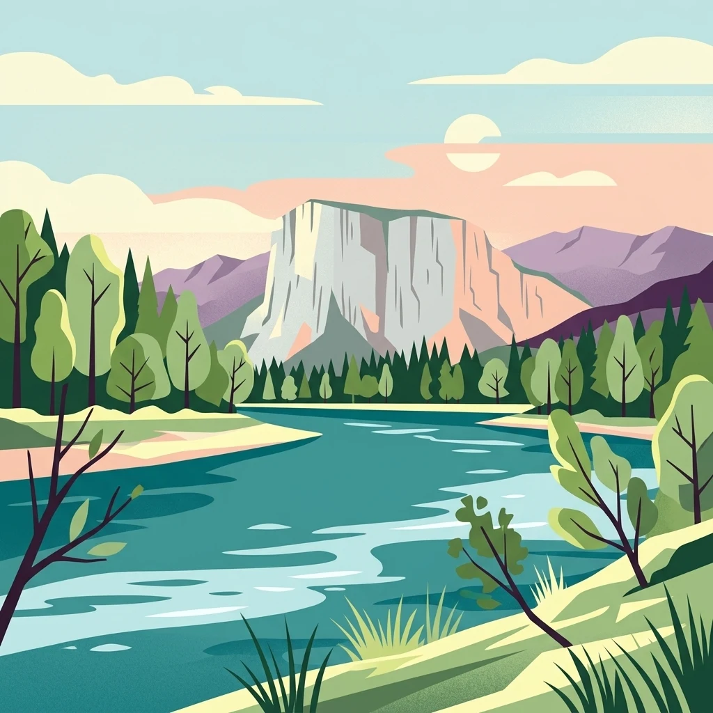
A graphic illustration of a wide river flowing through a lush green valley toward a large, steep-faced mountain under a soft-colored sky.

Rhône du Pont de Groslée à Murs-et-Gélignieux

Nature reserve

Park overview

Structured park overview, official facts, and landscape profile for Rhone from Pont de Groslee to Murs-et-Gélignieux

Rhone from Pont de Groslee to Murs-et-Gélignieux park facts, protected area profile, and essential visitor context

Review the core facts for Rhone from Pont de Groslee to Murs-et-Gélignieux, including designation, size, terrain, visitor scale, habitats, and operating context in one park-focused overview.

About Rhone from Pont de Groslee to Murs-et-Gélignieux

The Rhône from Pont de Groslée to Murs-et-Gélignieux describes a vital natural corridor along the Rhône river in southeastern France, where the river passes through a triangle of departments: Ain, Savoie, and Isère. Classified as a ZNIEFF type I area, the site recognizes the natural value of this stretch of the Rhône and authorizes specific attention to its habitats, flora, and fauna. The description of the site draws attention to its alluvial character, formed by the interplay of flowing water, sediment deposition, and recurring flooding that historically shaped the river valley.

At the heart of the site’s identity are the lônes, which are former channels of the Rhône that were gradually cut off but still sometimes reconnect to the main river during high water periods. Together with the main channel, forested islands, gravel bars, and lateral marshes, they create a diversity of habitats within a relatively contained geographic area. This mosaic supports a wide spectrum of species, from aquatic invertebrates and fish to wetland birds and large riparian mammals.

The protected status of the area reflects more than just local natural interest. The site incorporates the Réserve naturelle des Iles du Haut-Rhône and is integrated into the Natura 2000 network through the site FR8201748, aligning it with broader European priorities for the conservation of alluvial river systems. Its position between engineered stretches of the Rhône gives it particular importance, serving as one of the places where the river retains something closer to its natural dynamic patterns and associated biodiversity.

Quick facts and research context for Rhone from Pont de Groslee to Murs-et-Gélignieux

The Rhône from Pont de Groslée to Murs-et-Gélignieux is a ZNIEFF type I natural site covering roughly 2,105 hectares across parts of the Ain, Savoie, and Isère departments in eastern France. The area follows the Rhône river between the Pont de Groslée and the village of Murs-et-Gélignieux, encompassing islands, side channels, riparian forest, and associated wetlands nearby Saint-Genix-sur-Guiers. It overlaps with the Nature Reserve of the Iles du Haut-Rhône and the Natura 2000 site FR8201748, reflecting its significance for habitat and species conservation at regional and European scales.

Protection and recognition

Terrestrial protected area designation and official conservation scope details

Rhône du Pont de Groslée à Murs-et-Gélignieux Protection Status and Recognition

Terrestrial conservation records for Rhône du Pont de Groslée à Murs-et-Gélignieux outline documented protection measures and management frameworks. Structured data details the formal designation parameters and international recognition sources associated with the landscape.

Protection details

Protection scope
Terrestrial
Transboundary protection
No
Park context

Deeper park guide and search-rich context for Rhone from Pont de Groslee to Murs-et-Gélignieux

Rhone from Pont de Groslee to Murs-et-Gélignieux history, landscape, wildlife, and travel context

Explore Rhone from Pont de Groslee to Murs-et-Gélignieux through its history, landscape character, ecosystems, wildlife, conservation priorities, cultural context, and seasonal travel timing in a structured park guide built for atlas discovery and search intent.

Why Rhone from Pont de Groslee to Murs-et-Gélignieux stands out

The site is best known for its large, well-preserved alluvial system along an otherwise engineered stretch of the Rhône. It stands out for the combination of active river channels, abandoned side arms known locally as lônes, forested islands, and wet meadows that together support rich biodiversity. It also carries ecological weight because it includes the Réserve naturelle des Iles du Haut-Rhône, a formally protected reserve within a ZNIEFF framework.
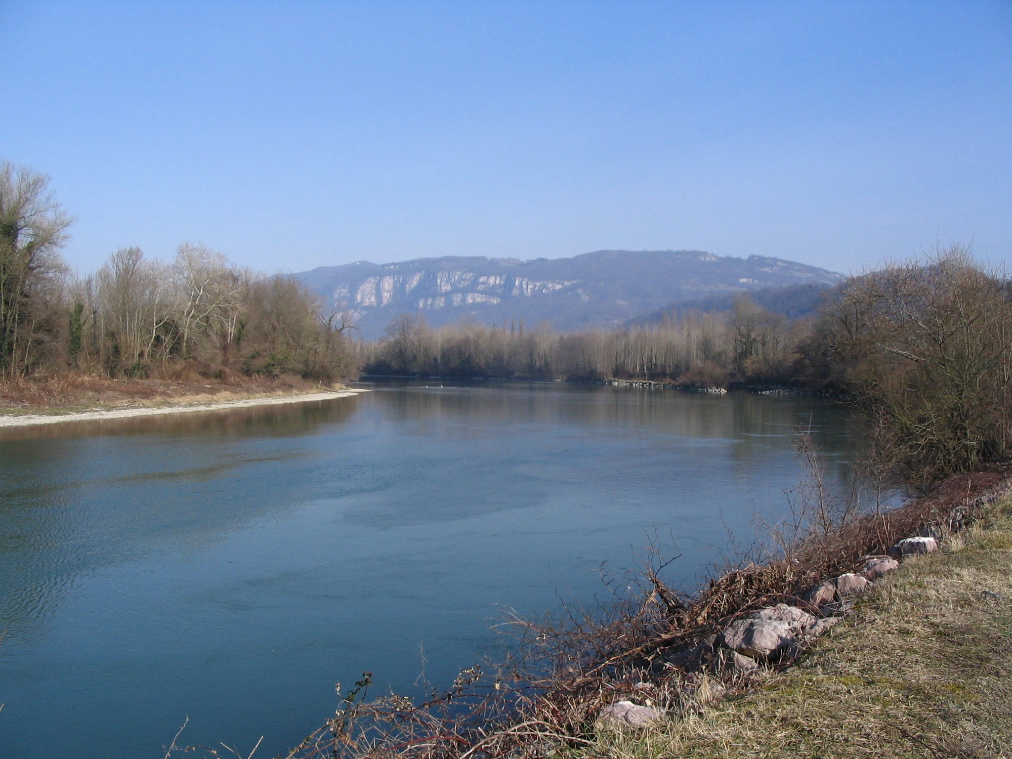
A wide view of the Rhone River with forested banks under a clear blue sky, with a mountain ridgeline visible in the background.
The Rhône river winding through the alluvial landscape of the Rhône du Pont de Groslée à Murs-et-Gélignieux.

Rhone from Pont de Groslee to Murs-et-Gélignieux history and protected-area timeline

The formal recognition of the area as a ZNIEFF type I site reflects a process of inventorying and classifying natural environments of ecological interest in France. Its regional identifier, 01230002, places it within the network of zones identified for their flora, fauna, and habitat value at the regional level.

An important development in the area’s conservation history was the creation of the Réserve naturelle des Iles du Haut-Rhône, which provides a stronger level of protection for the core islands and their surroundings within the broader ZNIEFF. The site’s integration into the Natura 2000 network as FR8201748 further anchored it within European conservation policy, recognizing the alluvial systems of the upper Rhône as habitats of community interest.

Rhone from Pont de Groslee to Murs-et-Gélignieux landscape and geographic character

The landscape is fundamentally shaped by the Rhône and its alluvial dynamics. The main river channel runs through the middle of the site, flanked by a network of side channels, or lônes, which are relic routes of the river that were abandoned as the main course shifted over time. Some of these side channels still maintain a connection to the Rhône during periods of high flow, while others have become more isolated, developing into still-water ponds and marshy corridors.

Forested islands punctuate the river, creating layered environments of gravel banks, pioneer vegetation, shrubby thickets, and mature floodplain forest. Along the edges of these islands and the riverbanks, the alluvial forest forms a continuous green corridor dominated by alder and ash, with a denser understory adapted to seasonal flooding. Beyond the wooded zones, wet meadows and marshy depressions add horizontal diversity to the landscape, giving the overall scene a distinctly riverine character within a wider valley that has otherwise been heavily modified by human activity.

Rhone from Pont de Groslee to Murs-et-Gélignieux ecosystems, habitats, and plant life

The ecological character of the site is defined by its alluvial habitats. The most widespread forest type is the riparian woodland, or ripisylve, made up primarily of alder and ash, which thrives in soils periodically refreshed by sediment-laden floodwaters. These forests form shaded corridors along the river and its side channels, and they contribute to bank stabilization, nutrient cycling, and habitat continuity across the floodplain.

Wetlands form the second major ecological component. The side channels, oxbows, and back-marsh areas support diverse aquatic and semi-aquatic vegetation, including submerged plants, floating-leaved species such as yellow water-lilies, and emergent plants adapted to variable water levels. The combination of still water, slow-flowing channels, and seasonal flooding creates a variety of microhabitats supporting a wide range of invertebrates, fish, amphibians, and birds. Together, these habitats make the area an important node for alluvial and wetland biodiversity along the upper Rhône.

Rhone from Pont de Groslee to Murs-et-Gélignieux wildlife and species highlights

The site supports a varied fauna shaped by the mosaic of aquatic, wetland, and floodplain forest habitats. Among mammals, the European beaver is one of the most notable species, benefiting from the availability of slow-moving water, wooded banks, and relatively undisturbed shoreline. Whiskered bat is also recorded as a protected species of significance.

The birdlife is particularly rich. The site hosts species such as little egret, night heron, purple heron, common kingfisher, black kite, Eurasian hobby, and great reed warbler, along with reed bunting, shoveler, gadwall, pochard, tufted duck, goosander, little ringed plover, common sandpiper, and spotted crake. These species reflect the value of the area for both nesting and feeding along the river, the islands, and the surrounding marshes.

Fish diversity is similarly notable, with species such as northern pike, burbot, three-spined stickleback, weather loach, bitterling, and grayling recorded. The European pond turtle is also present, and the rare snail Anisus vorticulus has been documented from several stations within the site, underscoring the conservation importance of small, often overlooked aquatic species in the broader alluvial ecosystem.

Rhone from Pont de Groslee to Murs-et-Gélignieux conservation status and protection priorities

From a conservation standpoint, the site represents one of the more significant remnants of natural alluvial habitat along the upper Rhône. Its classification as a ZNIEFF type I area is a formal recognition of its role in protecting regionally important flora and fauna. The presence of the Réserve naturelle des Iles du Haut-Rhône within its boundaries adds a higher level of protection for the core island habitats, while its inclusion in the Natura 2000 network as FR8201748 ties it into pan-European efforts to safeguard alluvial river systems.

The conservation value of the site stems from the interaction between its mosaic of habitats and the connectivity it provides along the river. The combination of relatively undisturbed islands, functioning lônes, riparian forest, and connected wetlands offers refuge and movement corridors for species that have lost habitat elsewhere along the heavily engineered Rhône. This makes the area particularly important for the long-term survival of species such as the European beaver, the European pond turtle, and specialized wetland birds and plants that depend on dynamic alluvial conditions.

Rhone from Pont de Groslee to Murs-et-Gélignieux cultural meaning and human context

The cultural dimension of the site is modest but meaningful. The area lies within a region historically shaped by the Rhône as a transportation route, a source of energy, and a boundary between regions and communities. Towns such as Saint-Genix-sur-Guiers grew along the river and reflect this long relationship between human settlement and waterway. The site today captures a portion of the Rhône valley where natural processes still play a visible role alongside this older human history.

Top sights and standout views in Rhone from Pont de Groslee to Murs-et-Gélignieux

Key highlights of the Rhône from Pont de Groslée to Murs-et-Gélignieux include its extensive alluvial forest of alder and ash, its network of side channels and forested islands, and the formal protection provided by the Réserve naturelle des Iles du Haut-Rhône. The site is notable for the presence of European beaver, purple heron, common kingfisher, European pond turtle, and a wide array of wetland-dependent plants. Its combined ZNIEFF, Nature Reserve, and Natura 2000 status make it an important reference point for conservation of dynamic river landscapes in the Rhône valley.

Best time to visit Rhone from Pont de Groslee to Murs-et-Gélignieux

Spring and early summer are often the most rewarding periods to experience the Rhône in this area, when elevated water levels and active vegetation give the floodplain forests and side channels their fullest character, and when bird activity along the river and around the marshes is at its peak. Late summer and early autumn can also be productive, with lower water levels exposing gravel banks and concentrating wildlife in remaining wet zones. In winter, the area can still hold waterfowl and other species, though access and visibility may be more limited depending on conditions.
Monthly climate preview

Long-term representative temperature and precipitation rhythms across twelve recorded monthly cycles

Rhône du Pont de Groslée à Murs-et-Gélignieux Climate Normals and Annual Weather Patterns

Temperature and precipitation data compiled from representative coordinates illustrate measurable thermal shifts and steady moisture distribution across monthly cycles in Rhône du Pont de Groslée à Murs-et-Gélignieux. Complete monthly climate profiles provide deeper analytical comparison for historical meteorological conditions at this protected elevation.
Annual mean10 °C
1 °C19 °C
Jan
Feb
Mar
Apr
May13°
Jun17°
Jul19°
Aug19°
Sep15°
Oct11°
Nov
Dec
Warmest month
July

19.4 °C

Coolest month
January

0.9 °C

Wettest month
November

3.3 mm/day

Driest month
March

2.2 mm/day

Park location guide

Geography guide, regional context, and park location map for Rhone from Pont de Groslee to Murs-et-Gélignieux

Rhone from Pont de Groslee to Murs-et-Gélignieux park geography, regions, and map view in France

Understand where Rhone from Pont de Groslee to Murs-et-Gélignieux sits in France through a broader geographic reading of the surrounding landscape, nearby location context, and its mapped position within the national park landscape.

How Rhone from Pont de Groslee to Murs-et-Gélignieux fits into France

France is a unitary semi-presidential republic and one of the world's largest economies. It borders Belgium, Luxembourg, Germany, Switzerland, Italy, Monaco, Andorra, and Spain, with a maritime border to the United Kingdom. The country is known for its cultural influence, art, cuisine, and political history spanning centuries.

Wider geography shaping Rhone from Pont de Groslee to Murs-et-Gélignieux in France

France is located in Western Europe. Metropolitan France extends from the Rhine to the Atlantic Ocean and from the Mediterranean Sea to the English Channel and North Sea. The country borders Belgium, Luxembourg, Germany, Switzerland, Italy, Monaco, Andorra, Spain, and has a maritime border with the United Kingdom.

Map view of Rhone from Pont de Groslee to Murs-et-Gélignieux

Use this park location map to pinpoint Rhone from Pont de Groslee to Murs-et-Gélignieux in France, understand its exact geographic position, and read its mapped placement within the surrounding landscape more clearly.

Pigeon | © OpenStreetMap contributors

Location context for Rhone from Pont de Groslee to Murs-et-Gélignieux

Auvergne-Rhône-Alpes

Visualizing alluvial forests, river islands, and protected riparian habitats

Rhône du Pont de Groslée à Murs-et-Gélignieux Landscape and Scenery Photography

Visual documentation reveals the intricate network of active river channels, side arms, and mature floodplain woodlands defining this protected stretch of the Rhône valley. Studying these habitats through detailed field imagery provides clear context on riverine geomorphology, wetland diversity, and riparian conservation.

A wide view of the Rhone River with forested banks under a clear blue sky, with a mountain ridgeline visible in the background.

A wide panoramic view of a river confluence with clear blue water, a gravel bank in the center, and green trees along the banks under a clear blue sky.

Park atlas

Compare adjacent river corridors and regional protected areas in the surrounding valley

Parks Near Rhône du Pont de Groslée à Murs-et-Gélignieux and Related Protected Landscapes

Browsing other parks near Rhône du Pont de Groslée à Murs-et-Gélignieux reveals connected riparian corridors and alluvial habitats across the surrounding river basin. Examining adjacent protected areas provides broader geographic context for regional river dynamics and wetland conservation.
A watercolor illustration showing a soft, panoramic view of a calm lake surrounded by gentle, rolling green mountains.
Nature reserveAuvergne-Rhône-Alpes
About 13 km away#1 closest

Southeast

Réserve naturelle régionale du lac d'Aiguebelette: Protected Lake and Forest Geography

Regional nature reserve landscape in the Savoie Prealps

This protected area encompasses the glacial basin of Lake Aiguebelette and the forested slopes of the Montagne de l'Épine. Discover a terrain defined by the contrast between deep mountain water and upland ridgelines, representing a critical habitat and species management zone within the Auvergne-Rhône-Alpes region.

Area
8.442 km²
Established
2015
IUCN
IV
Relief
Mountain
Nature reserveAuvergne-Rhône-Alpes
About 20 km away#2 closest

Northwest

Réserve naturelle régionale des étangs de Mépieu: Atlas and Geographic Protected Area Overview

Wetlands, peatlands, and dry grasslands in northern Isère

The Réserve naturelle régionale des étangs de Mépieu offers a striking study in ecological contrast. This protected landscape contains a dense mosaic of five ponds and marshy terrain set directly against sun-exposed dry grasslands and heathland slopes. The site serves as a vital corridor for migratory birds and rare flora within the rolling countryside of the Auvergne-Rhône-Alpes region.

Area
1.618 km²
Established
2008
IUCN
IV
Relief
Lowland
A soft watercolor painting of a wetland landscape featuring a central pond, surrounding reeds, and distant rolling hills in pale green and pink hues.
Nature reserveAuvergne-Rhône-Alpes
About 35 km away#3 closest

West

Réserve naturelle régionale de l'étang de Saint-Bonnet: Wetland Atlas and Map Discovery

Examining protected wetland geography in the Isère department

This protected area centers on the étang de Saint-Bonnet, a wetland habitat defined by dense reedbeds and pond-centered ecosystems. It provides a distinct example of nature conservation situated between major urban corridors, showcasing how amphibians and diverse bird communities thrive within a small, managed lowland basin.

Area
0.514 km²
Established
1987
IUCN
IV
Relief
Lowland
A horizontal watercolor painting depicting a gentle mountain silhouette behind a forested shoreline sloping toward the water.
Nature reserveFrance
About 52 km away#4 closest

Northeast

Roc de Chère Nature Reserve: Mapping the Botanical Diversity and Geological Features of Haute-Savoie

A protected alpine promontory bordering Lake Annecy

Roc de Chère stands as a distinct geological landmark where limestone and sandstone soils create sharp microclimate contrasts. This protected reserve provides a critical habitat for diverse plant species and rare dragonflies within a small, defined area of the French Alps. The site acts as a key element of the Lake Annecy landscape, offering insight into the post-glacial environmental history of the Savoie region through its protected cliffs and hollows.

Area
0.69 km²
Established
1977
Relief
Mountain
Climate
Temperate
A pale, soft watercolor illustration showing a horizontal landscape of a pond and wetlands bordered by trees, with faint mountain silhouettes in the distance.
Nature reserveIsère
About 55 km away#5 closest

South

Réserve naturelle régionale de l'étang de Haute-Jarrie, Isère Protected Wetland Landscape

Regional nature reserve and migratory bird sanctuary

Situated on the Plateau de Champagnier in Isère, this regional nature reserve offers a concentrated example of glacial pond ecology and wetland biodiversity. Covering 11 hectares, it acts as a critical stopover within the Grésivaudan valley migratory corridor. This protected site features diverse habitats, including reedbeds and wet meadows, that support hundreds of recorded bird species and a variety of dragonflies and amphibians, making it a significant area for ecological study.

Area
0.11 km²
Established
2008
IUCN
IV
Relief
Upland
A soft watercolor painting depicting a winding river through a lush green valley with distant hills in the background.
Nature reserveAuvergne-Rhône-Alpes
About 57 km away#6 closest

South

Réserve naturelle régionale des Isles du Drac: Braided River Landscape and Regional Map Context

A vital riverine conservation corridor in the Auvergne-Rhône-Alpes region of France

The Réserve naturelle régionale des Isles du Drac occupies an expansive alluvial floodplain where the river transitions into a braided system. This reserve preserves dynamic gravel bars and woodland habitats that support exceptional biodiversity within the northern Alpine landscape. It offers a detailed look at how riverine corridors persist alongside significant hydroelectric and industrial infrastructure in the Grenoble area.

Area
8.048 km²
Established
2009
IUCN
IV
Relief
Lowland
A soft, light watercolor painting of a winding river flowing through a gentle, rolling landscape with trees and distant hills against a pale, warm sky.
Nature reserveAuvergne-Rhône-Alpes
About 63 km away#7 closest

North

Réserve naturelle régionale de la galerie du Pont-des-Pierres Regional Nature Reserve

Protected gorge landscapes and underground habitats in France

An essential record of the Réserve naturelle régionale de la galerie du Pont-des-Pierres, detailing its critical role in safeguarding cliff and underground habitats within the Valserine gorges. This protected land in the Ain department represents a vital ecological intersection of geological features and specialized faunal refuges.

Area
0.093 km²
Established
2009
IUCN
IV
Relief
Mountain
A soft, panoramic watercolor illustration of rolling hills, mountains, and trees in pastel shades of green, yellow, and pink.
Nature reserveAuvergne-Rhône-Alpes
About 65 km away#8 closest

North

Réserve naturelle nationale de la grotte de Hautecourt: Jura Mountain Cave Geography

Protected subterranean landscapes in the Ain department of France.

This nature reserve protects a complex underground environment characterized by a vertical 36-meter cave system and rich invertebrate biodiversity. Located on the flank of Mont Rosset in the Auvergne-Rhône-Alpes region, the area provides a crucial habitat that balances delicate subterranean passages with surface limestone ridges and dry grassland ecosystems.

Area
0.102 km²
Established
1980
IUCN
IV

Common questions about visiting, size, designation, and location context for Rhone from Pont de Groslee to Murs-et-Gélignieux

Rhone from Pont de Groslee to Murs-et-Gélignieux FAQs for park facts, access, geography, and protected area context

Find quick answers about Rhone from Pont de Groslee to Murs-et-Gélignieux, including protected-area facts, park geography, trail and visitor context, and how the park fits into its surrounding country and regional landscape.
MoriAtlas Explorer

Continue Your Protected Areas Search Across the Global Atlas

Deepen your exploration by continuing the structured search for national parks and protected areas worldwide. Utilize the comprehensive filtering capabilities to compare different conservation landscapes and refine your understanding of global park geography. Discover more about the distribution and characteristics of protected natural areas.

Global natural geography