Mori Atlas logo
National parkRiding Mountain National Park

Discover the protected landscape boundaries and regional context of this Manitoba national park.

Riding Mountain National Park: Manitoba National Park Atlas and Mapped Geography

Riding Mountain National Park stands as a significant protected area within Manitoba, Canada. This national park offers a distinct geographic identity, serving as a key entry point for exploring mapped natural landscapes and understanding regional conservation patterns. The focus here is on the park's mapped boundaries, its role as a protected landscape, and its placement within the broader geography of Manitoba, providing a foundation for structured atlas-style discovery.

Boreal ForestPrairie TransitionBiosphere ReserveUNESCOFirst Nations HeritageHistoric Sites

Riding Mountain National Park

National park

Park overview

Structured park overview, official facts, and landscape profile for Riding Mountain National Park

Riding Mountain National Park park facts, protected area profile, and essential visitor context
Review the core facts for Riding Mountain National Park, including designation, size, terrain, visitor scale, habitats, and operating context in one park-focused overview.

About Riding Mountain National Park

Riding Mountain National Park represents a unique ecological intersection in central Canada, where the boreal forest reaches southward into the prairie region and creates a mosaic of habitats found nowhere else in the country at this latitude. The park sits atop the Manitoba Escarpment, a geological formation that creates the dramatic elevation change visible for kilometers in every direction. The forested landscape stands in sharp contrast to the agricultural fields that surround the park boundary, making it a conspicuous island of wilderness that has been protected since the early twentieth century. The park was Manitoba's first national park and one of the earliest in western Canada, established to preserve this ecological transition zone where different forest types and grassland ecosystems meet. Visitors enter through the historic East Gate registration complex, a National Historic Site recognized for its distinctiverustic architectural design. The park's central hub is Wasagaming, a townsite established at Clear Lake as the primary visitor amenities area.

Quick facts and research context for Riding Mountain National Park

Riding Mountain National Park occupies 2,969 square kilometers in southwestern Manitoba, making it one of the larger national parks in Canada's prairie provinces. The park rises dramatically from the surrounding prairie farmland along the Manitoba Escarpment, with elevations ranging from about 335 meters to over 730 meters. Clear Lake, the largest lake in the park, features water from underground springs rather than streams. The park was designated a UNESCO Biosphere Reserve in 1986, recognizing its ecological significance. The park contains over 400 kilometers of trails and receives approximately 336,000 visitors annually.

Park context

Deeper park guide and search-rich context for Riding Mountain National Park

Riding Mountain National Park history, landscape, wildlife, and travel context
Explore Riding Mountain National Park through its history, landscape character, ecosystems, wildlife, conservation priorities, cultural context, and seasonal travel timing in a structured park guide built for atlas discovery and search intent.

Why Riding Mountain National Park stands out

Riding Mountain is best known for the dramatic contrast between its forested uplands and the surrounding prairie farmland, a landscape that rises abruptly from the flat agricultural plains of Manitoba. The park protects one of the largest populations of black bears in North America and is home to a reintroduced bison herd at Lake Audy. The convergence of three major ecosystems grassland, boreal forest, and eastern deciduous forest within a single protected area makes it ecologically distinctive. The park also carries significant cultural heritage as the site where Archibald Belaney, known as Grey Owl, one of Canada's earliest conservationists, worked with beavers in the early 1930s.

Riding Mountain National Park history and protected-area timeline

The history of Riding Mountain National Park spans thousands of years of Indigenous habitation followed by European exploration and eventual protected area establishment. For several thousand years, the region was home to the Cree, Assiniboines, and later the Ojibwe, with the Keeseekoowenin Ojibway First Nation specifically living around what is now Wasagaming and Clear Lake. A Hudson's Bay Company trading post was established on Lake Dauphin in 1741, and the region became part of the fur trade network with Pierre de la Verendrye exploring the area in the eighteenth century. The land was designated as a timber reserve in 1895, with formal protection coming through the Dominion Forest Reserve Acts of 1906 and 1911. Following a community meeting in 1927 advocating for national park status, the forest reserve was officially declared a national park on May 30, 1933, opening to visitors later that summer. The 1930s saw significant infrastructure development through Depression-era relief programs, with many rustic log buildings still standing today. In 1936, the Keeseekoowenin Ojibway Band was forcibly removed from the park, an action that led to land claims that were eventually resolved in the 1990s and 2000s. The park also served as a World War II prisoner-of-war labour camp from 1943 to 1945. In recent decades, the park has strengthened its relationship with Indigenous nations through formal agreements and the Riding Mountain Forum.

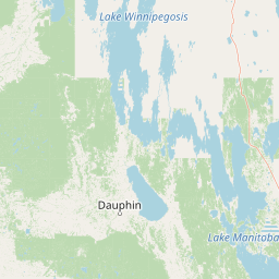
Riding Mountain National Park landscape and geographic character

The landscape of Riding Mountain National Park is defined by its position on the Manitoba Escarpment, which rises sharply from the surrounding prairie farmland to create a prominent elevated plateau. The highest point in the region reaches over 730 meters above sea level, providing sweeping views in all directions. The park is bordered by the Manitoba Escarpment to the east, with the Valley River and Wilson River marking the northern boundary and a valley to the west. The Saskatchewan Plain lies further to the west. Several streams originate from the park's lakes, with Clear Lake being fed by underground springs rather than surface inflow. The landscape features a mix of rolling terrain, forested hills, and numerous lakes and wetlands scattered throughout the upland area.

Riding Mountain National Park ecosystems, habitats, and plant life

The ecological significance of Riding Mountain lies in its position at the convergence of three distinct ecosystems: grassland, upland boreal forest, and eastern deciduous forest. This ecological blending creates a diversity of habitats within a relatively compact area. The boreal forest component features coniferous species including white spruce, jack pine, black spruce, and tamarack, while the deciduous element includes bur oak, American elm, and Manitoba maple. The park contains 669 documented plant species, including many wildflowers unique to the region. The climate is cool and moist compared to the surrounding prairie, with annual rainfall between 40 and 50 centimeters. The higher elevation and numerous lakes and wetlands create conditions that support this unique ecological blend, which attracted scientific interest as early as Henry Youle Hind's exploration in 1858.

Riding Mountain National Park wildlife and species highlights

Riding Mountain National Park supports remarkable wildlife diversity, including one of the largest populations of black bears in North America. The park is home to approximately sixty mammal species, including elk, moose, white-tailed deer, coyotes, timber wolves, lynx, beavers, porcupines, and snowshoe hares. The Lake Audy Bison Enclosure maintains a herd of about forty bison that were reintroduced from Alberta in 1931. Birdlife is abundant with 233 species documented in the park, including common loons and Canada geese on Clear Lake. The freshwater lakes support fish species including walleye, whitefish, perch, and limited populations of rainbow and brook trout in some deeper lakes. This wildlife diversity reflects the park's position at the ecological crossroads of multiple habitat types.

Riding Mountain National Park conservation status and protection priorities

Riding Mountain National Park holds significant conservation importance as Manitoba's first national park and as a UNESCO Biosphere Reserve designated in 1986. The park protects the unique ecological transition zone where prairie, boreal forest, and deciduous forest converge, representing an ecosystem type found nowhere else at this latitude in Canada. The biosphere reserve encompasses approximately 15,000 square kilometers with the national park serving as the core protected area. Conservation efforts focus on predator and ungulate population research, endangered species protection, invasive species management, water basin studies, fire reintroduction programs, and grassland ecology. The park's management emphasizes wilderness conservation while limiting commercial development, with any construction subject to environmental impact assessment. Partnership with Indigenous nations through the Riding Mountain Forum represents an important aspect of contemporary conservation stewardship.

Riding Mountain National Park cultural meaning and human context

The cultural landscape of Riding Mountain National Park is deeply connected to Indigenous peoples who have inhabited the region for thousands of years. The park sits within Treaty 2 Territory and has been home to the Cree, Assiniboines, and particularly the Ojibwe, whose descendants still live in the area today. The Keeseekoowenin Ojibway First Nation has a significant historical connection to the land around Wasagaming and Clear Lake, where they hunted, fished, and used the area for traditional practices including the buffalo chase and pemmican production. The forced removal of the Keeseekoowenin Band from the park in 1936 represents a dark chapter that was later addressed through land claim settlements in the 1990s and 2000s. The park also holds significance from the European exploration period, with the fur trade and early scientific expeditions documented in the historical record.

Top sights and standout views in Riding Mountain National Park

The dramatic elevation change from prairie to forested upland creates one of the most visually distinctive landscapes in Manitoba. Clear Lake offers swimming, boating, and the Clear Lake Golf Course along its shores. The historic East Gate registration complex represents significant Canadian architectural heritage. Over 400 kilometers of trails support hiking, cycling, and cross-country skiing. The Lake Audy Bison Enclosure provides wildlife viewing opportunities. The park's three-ecosystem convergence creates exceptional ecological diversity. The legacy of Grey Owl connects the park to Canada's conservation history.

Best time to visit Riding Mountain National Park

The best time to visit Riding Mountain depends on the experience sought. Summer months offer full access to trails, swimming in the lakes, camping, and the warmest temperatures, with July averaging 16.5 degrees Celsius. Fall brings spectacular forest color changes as the deciduous trees turn, and wildlife viewing can be particularly rewarding. Winter transforms the landscape for cross-country skiing and ice fishing on Clear Lake, though snow accumulation varies significantly with elevation, from 25 centimeters at lower altitudes to over 127 centimeters at higher elevations. Spring offers emerging vegetation and migratory bird returns. The park's continental climate means cold winters with temperatures averaging -19.7 degrees Celsius in January. Most rainfall occurs between April and October, with June being the wettest month.

Park location guide

Geography guide, regional context, and park location map for Riding Mountain National Park

Riding Mountain National Park park geography, regions, and map view in Canada
Understand where Riding Mountain National Park sits in Canada through a broader geographic reading of the surrounding landscape, nearby location context, and its mapped position within the national park landscape.

How Riding Mountain National Park fits into Canada

Canada is a federal parliamentary constitutional monarchy spanning North America from the Atlantic to the Pacific and Arctic Oceans. With a population of over 41 million, it is officially bilingual in English and French at the federal level. The country gained independence from the United Kingdom through a gradual process culminating in 1982.

Wider geography shaping Riding Mountain National Park in Canada

Canada occupies the northern portion of North America, sharing its longest international border with the United States. The country extends from the Atlantic Ocean to the Pacific Ocean and northward into the Arctic Ocean, giving it the longest coastline of any nation.

Map view of Riding Mountain National Park

Use this park location map to pinpoint Riding Mountain National Park in Canada, understand its exact geographic position, and read its mapped placement within the surrounding landscape more clearly.

Pigeon | © OpenStreetMap contributors

Location context for Riding Mountain National Park

Manitoba
Park atlas

Explore adjacent conservation landscapes, trace regional park geography, and compare protected areas across the Manitoba Escarpment.

Discover Other National Parks and Protected Areas Near Riding Mountain National Park
Explore national parks and protected areas geographically close to Riding Mountain National Park, examining regions with similar boreal forest, prairie, and escarpment landscapes. Compare their conservation profiles, trace ecological transitions across regional geography, and deepen your understanding of diverse protected areas.
National parkNorth Dakota

Theodore Roosevelt National Park: Mapped Protected Landscape in North Dakota

Explore the geography and protected natural boundaries.

Theodore Roosevelt National Park represents a distinct protected landscape within North Dakota, offering a valuable entry point for exploring its unique geographic setting. This page provides a concentrated view of the park's mapped boundaries and its contribution to regional natural context. It is designed for users seeking detailed atlas-level information and a clear understanding of the park's protected-area status and geographic significance within the United States.

Area
285.08 km²
Established
1978
IUCN
II
Visitors
668.7K annual
National parkSaskatchewan

Prince Albert National Park: Saskatchewan National Park and Protected Area Geography

Mapped Landscape Boundaries and Regional Natural Terrain Context

Prince Albert National Park represents a distinct national park entity within Saskatchewan, vital for understanding regional geography and protected landscapes. This page offers detailed insights into its mapped boundaries and the surrounding natural terrain. It is designed to help users comprehend the park's specific protected area identity and its contribution to the broader geographic atlas of Canada's natural spaces.

Area
3,874 km²
Established
1927
IUCN
II
Visitors
287.4K annual
National parkSaskatchewan

Grasslands National Park: Saskatchewan Protected Landscape Atlas

Discover its mapped boundaries and regional geographic context.

Grasslands National Park represents a vital component of protected lands in Saskatchewan, Canada, offering rich opportunities for atlas-based geographic exploration. This detail page provides specific insights into the park's mapped boundaries, its natural terrain, and its role as a national park within the broader regional geography. Understand how this protected landscape fits into the larger atlas of Canadian conservation areas and discover its unique geographic identity.

Area
907 km²
Established
1981
IUCN
II
Visitors
19.7K annual
National parkMinnesota

Voyageurs National Park: Minnesota's Mapped Protected Landscape and Geography

Explore the atlas context and mapped park boundaries of Voyageurs National Park.

Voyageurs National Park in Minnesota is a key protected area offering rich geographic discovery. As a designated National Park, it provides a unique lens through which to study regional landscapes and mapped natural terrain. Users can delve into its protected boundaries and understand its specific identity within the broader Minnesota geography, making it a vital point for atlas-focused exploration.

Area
883 km²
Established
1975
IUCN
II
Visitors
239.7K annual
National parkSouth Dakota

Badlands National Park: South Dakota's Premier National Park for Atlas Exploration

Explore mapped terrain and protected landscape boundaries.

Badlands National Park stands as a key protected area within the geography of South Dakota, offering a distinct natural landscape for detailed atlas exploration. This National Park's unique terrain and mapped boundaries provide crucial context for understanding regional geography and conservation landscapes. Engage with structured information that highlights the park's geographic identity, making it an essential destination for those seeking to map and comprehend protected natural areas.

Area
982.4 km²
Established
1939
IUCN
II
Visitors
1M annual
National parkCuster County

Wind Cave National Park: A National Park with Distinct Protected Landscape and Geographic Identity

Explore the mapped terrain and regional context of this US protected area.

Wind Cave National Park represents a key protected area within Custer County, offering users a deep dive into its unique geography and landscape characteristics. As a designated national park in the United States, its mapped boundaries provide crucial context for understanding its ecological and geological significance. This MoriAtlas entry facilitates detailed exploration, focusing on the protected land's identity and its role within the wider regional geography and natural landscape.

Area
136.97 km²
Established
1903
IUCN
II
Visitors
489.4K annual
National parkKeweenaw County

Isle Royale National Park: Protected Landscape Atlas and Geographic Context

Explore mapped boundaries and natural terrain of this national park.

Isle Royale National Park offers a distinct opportunity for understanding protected landscapes through detailed map exploration. As a national park within Keweenaw County, its geographic identity and mapped boundaries provide valuable context for regional geography and atlas-based discovery. Investigate the natural terrain and protected land features that define this unique area, contributing to a richer comprehension of the surrounding protected areas.

Area
2,314 km²
Established
1940
IUCN
Ib
Visitors
29K annual
National parkManitoba

Wapusk National Park: Manitoba National Park Protected Landscape & Geographic Exploration

Mapped park boundaries and regional landscape context in Manitoba.

Delve into Wapusk National Park, a federally protected area in Manitoba designed for geographic exploration and atlas-based discovery. Understand its specific role as a national park, examining its mapped boundaries and the unique natural landscape it preserves within the broader regional geography of Manitoba. This park serves as a key data point for comprehending Canada's network of protected lands and their geographical significance.

Area
11,475 km²
Established
1996
IUCN
II
Visitors
82 annual

Common questions about visiting, size, designation, and location context for Riding Mountain National Park

Riding Mountain National Park FAQs for park facts, access, geography, and protected area context
Find quick answers about Riding Mountain National Park, including protected-area facts, park geography, trail and visitor context, and how the park fits into its surrounding country and regional landscape.
MoriAtlas Explorer

Continue Your Protected Areas Search Across the Global Atlas

Deepen your exploration by continuing the structured search for national parks and protected areas worldwide. Utilize the comprehensive filtering capabilities to compare different conservation landscapes and refine your understanding of global park geography. Discover more about the distribution and characteristics of protected natural areas.

Global natural geography