


Mori Atlas logo
Protected areaRingkøbing Fjord og Nymindestrømmen

Understanding the mapped geography of brackish lagoons, salt meadows, and dune systems.

Ringkøbing Fjord og Nymindestrømmen: An Essential Danish Coastal Protected Landscape

(Natura 2000-område nr. 69 Ringkøbing Fjord og Nymindestrømmen)

Ringkøbing Fjord og Nymindestrømmen encompasses a complex mosaic of brackish lagoons, riparian river deltas, and expansive coastal dunes along the Danish west coast. This protected area stands as a significant regional landmark for wetland conservation, integrating diverse habitats from freshwater lakes to saline marshes. Its geography serves as a vital environmental intersection between the Skjern Å river system and the shifting landscapes of the Jutland shoreline.

brackish lagoonfjord landscapesalt meadowscoastal dunesriver deltawetland conservation
A flat-design, stylized illustration showing a calm body of water with a single windsurfer under a soft sunset sky, with grassy shores and rolling hills in the background.

Ringkøbing Fjord og Nymindestrømmen

Protected area

Park overview

Structured park overview, official facts, and landscape profile for Ringkøbing Fjord og Nymindestrømmen

Ringkøbing Fjord og Nymindestrømmen park facts, protected area profile, and essential visitor context

Review the core facts for Ringkøbing Fjord og Nymindestrømmen, including designation, size, terrain, visitor scale, habitats, and operating context in one park-focused overview.

About Ringkøbing Fjord og Nymindestrømmen

Ringkøbing Fjord og Nymindestrømmen is a large, multi-layered coastal protected area on the western coast of Jutland, Denmark, embedded in a long national tradition of wetland conservation. It combines a broad brackish lagoon, an extensive system of surrounding salt meadows and dunes, the freshwater lake chain of Nymindestrømmen, and the river delta of Skjern Å. Together these elements produce one of the most ecologically distinctive coastal landscapes in Denmark and a focal point of European waterbird conservation.

At a landscape level, the area is defined by the contrast between open, shallow fjord water and the surrounding mosaic of meadows, dunes, and small wetland basins. The tip of the fjord is formed by the peninsula of Tipperne, a low-lying promontory that hosts extensive meadows, shallow lakes, and the four small Sjap lakes, along with the larger lake Værnsande. The island of Klægbanken, largely covered in common reed, lies on the eastern side of the fjord and gives the protected area one of its classic reed-bed habitats. Toward the southwest, the dune areas of Store- and Lille Mjøl and Bjålum Klit form a sandy fringe that links the lagoon system to the wider dune belt of the Danish west coast.

Hydrologically, the area is shaped by both freshwater and marine influences. Until 1911, Nymindestrømmen functioned as the principal natural outflow of Ringkøbing Fjord and the Skjern Å system. After the Hvide Sande sluice was opened in 1931, the historic channel silted up and gradually transformed into the alkaline freshwater-lagoon complex seen today. Five basins make up Nymindestrømmen: the two southern basins are classified as nutrient-rich lakes, while the three northern basins are lagoons that periodically receive saltwater intrusions from the fjord. This mixing creates one of the area's most ecologically interesting features, blending freshwater vegetation such as quillwort and various pondweed species with more salt-tolerant aquatic plants.

Ecologically, Ringkøbing Fjord og Nymindestrømmen is most appreciated for its birdlife. The protected site supports breeding populations of species such as bittern, spoonbill, marsh harrier, spotted crake, avocet, common redshank, ruff, black tern, sandwich tern, common tern, and short-eared owl. Migratory species use the area in large numbers, including mute swan, whooper swan, tundra swan, pink-footed goose, greylag goose, barnacle goose, dark-bellied brent goose, common shelduck, Eurasian wigeon, common teal, northern pintail, northern shoveler, common goldeneye, and greater merganser. Raptors such as white-tailed eagle, hen harrier, osprey, and peregrine falcon also use the area, while common coot, lapwing, and bar-tailed godwit appear among the regular visitors. The presence of a small but variable spoonbill breeding colony on the island of Høje Sande, near the Skjern Å delta, is one of the most distinctive features of the site's ornithological profile.

Fauna beyond birds also benefits from the protected status. The otter is among the mammal species listed for the site, and the waters support fish species of conservation interest, including sea lamprey, river lamprey, allis shad, twaite shad, and Atlantic salmon. The aquatic plant life of Nymindestrømmen includes several pondweed species, narrow-leaved water-starwort, and bladderwort, with red-listed species such as the reddish pondweed recorded in the southern basins. The area's combination of dune, lagoon, meadow, river delta, reed bed, and shallow lake habitats makes it a microcosm of the broader Jutland west-coast ecosystem.

Quick facts and research context for Ringkøbing Fjord og Nymindestrømmen

Ringkøbing Fjord og Nymindestrømmen is a designated Natura 2000 site in west-central Jutland, Denmark, spanning roughly 27,684 hectares across Ringkøbing-Skjern and Varde municipalities. Of this total, about 21,800 hectares are open fjord water, with the remaining land consisting of salt meadows, dunes, river delta, and freshwater lake systems. The site is protected under three overlapping international frameworks: the EU Natura 2000 network as both a habitat area and bird protection area, and the Ramsar Convention on Wetlands.

The protected landscape combines the brackish waters of Ringkøbing Fjord, the Skjern Å river delta, the dune-fringed Nymindestrømmen outflow system, and the meadow-and-lagoon peninsula of Tipperne. The area is noted for its high bird diversity, including breeding spoonbills and migratory swans and geese, as well as mammal species such as the otter and fish species including sea lamprey, river lamprey, twaite shad, and Atlantic salmon.

Protection and recognition

Examining documented protection scope, management frameworks, and international recognition sources.

Ringkøbing Fjord og Nymindestrømmen Protection Status and Natura 2000 Recognition

Ringkøbing Fjord og Nymindestrømmen holds mixed protection status supported by verified Natura 2000 recognition records. Structured administrative facts provide clear insight into official conservation designations and management boundaries.
Park context

Deeper park guide and search-rich context for Ringkøbing Fjord og Nymindestrømmen

Ringkøbing Fjord og Nymindestrømmen history, landscape, wildlife, and travel context

Explore Ringkøbing Fjord og Nymindestrømmen through its history, landscape character, ecosystems, wildlife, conservation priorities, cultural context, and seasonal travel timing in a structured park guide built for atlas discovery and search intent.

Why Ringkøbing Fjord og Nymindestrømmen stands out

Ringkøbing Fjord og Nymindestrømmen is best known as a vast, shallow brackish lagoon system on the Danish west coast, recognised internationally for its importance to migratory and breeding waterbirds. The fjord's southern two-thirds, bounded by the line between Ringkøbing and Hvide Sande, form the heart of the protected area, encircled by salt meadows, dune systems, and reed-fringed islands such as Klægbanken and Høje Sande. The site is also closely associated with the delta of Skjern Å, one of Denmark's largest river outlets, and with Nymindestrømmen, a historic former fjord outflow that has evolved into an unusual alkaline freshwater-lagoon complex. Together these features create a layered coastal wetland of lagoons, dunes, meadows, and shallow lakes, making the area a classic example of Danish west-coast fjord ecology and one of the most important stopover sites for waterfowl in northern Europe.
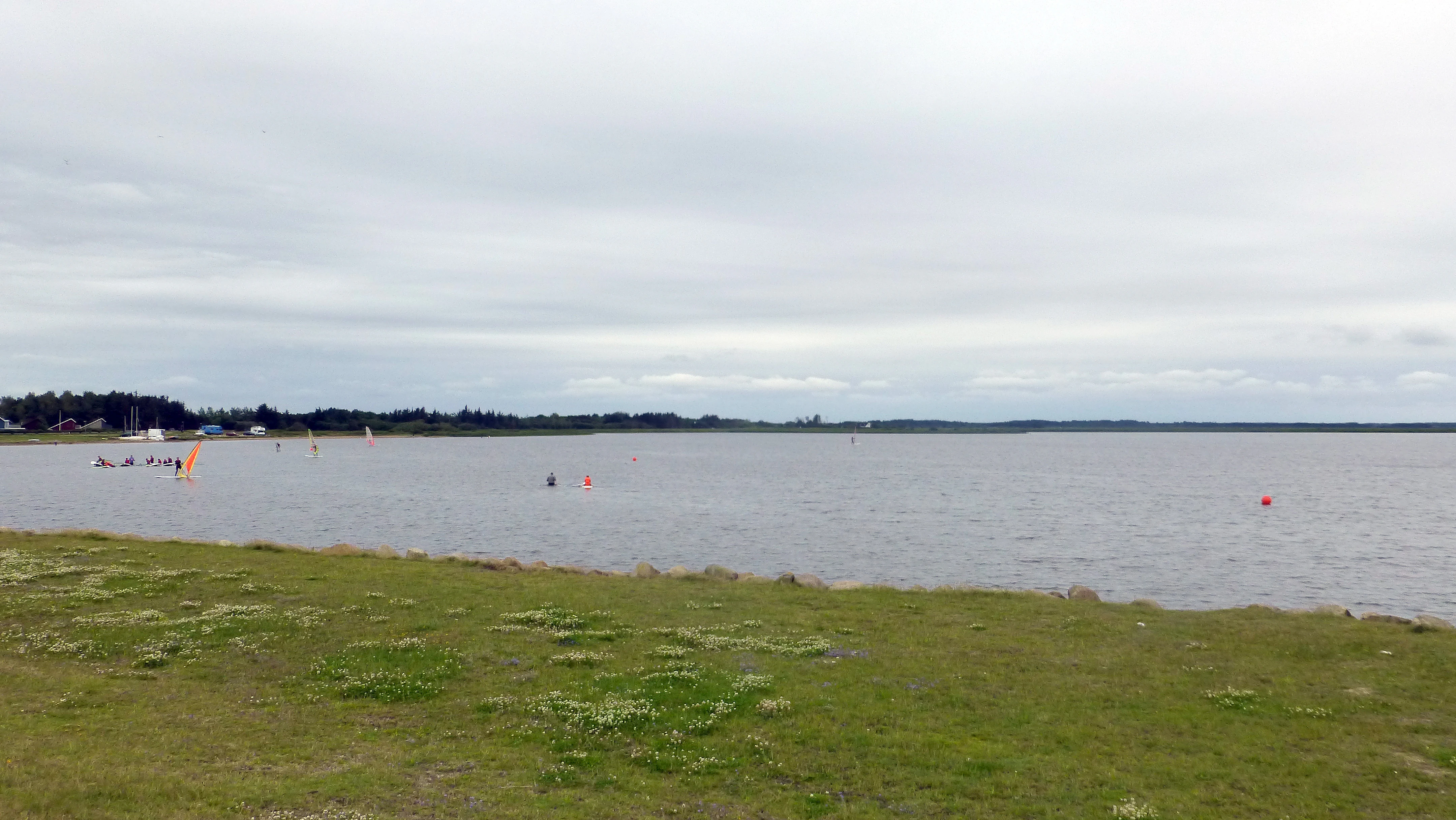
A wide view across the calm, grey waters of Ringkøbing Fjord with grassy marshland in the foreground and a distant tree-lined shoreline under a cloudy sky.
View of the Ringkøbing Fjord coastline at Bork Havn.

Ringkøbing Fjord og Nymindestrømmen history and protected-area timeline

The protection history of Ringkøbing Fjord og Nymindestrømmen stretches back more than 250 years, reflecting the long importance of the area as a wetland and waterbird site. As early as 1768, the Danish state acquired the northern portion of the Tipperne peninsula, which was formally protected in 1898. In 1947, the Nymindestrømmen area south of Nymindegab was protected, recognising both its ecological value and its historic role as a former fjord outlet.

The modern framework began in 1985, when the entire Ringkøbing Fjord was protected to secure its combined natural values. The protection order was revised in 1996, expanding and clarifying the protected territory to a total of roughly 29,100 hectares, of which about 827 hectares consist of land areas. The protection covers fjord water, salt meadows, dunes, river delta, and connected land habitats, forming a continuous buffer around the lagoon.

In the early twenty-first century, the area was brought into the European Natura 2000 network as habitat area H62 and bird protection area F43, and it was also recognised as a Ramsar site of international importance. The Natura 2000 management plan for the site was adopted in 2011, after which the municipal councils of Ringkøbing-Skjern and Varde, together with the Danish Nature Agency, prepared binding action plans for its implementation. The plan continues to be coordinated with the water management plan for the Ringkøbing Fjord hydrological catchment, ensuring that the wetland's freshwater and marine influences are managed as an integrated system. Much of the land within the site remains state-owned, particularly around the Skjern Å outlet, Tipperne, and Nymindestrømmen, which has helped support a stable long-term conservation regime.

Ringkøbing Fjord og Nymindestrømmen landscape and geographic character

The landscape of Ringkøbing Fjord og Nymindestrømmen is defined by the broad, shallow basin of Ringkøbing Fjord and the contrasting natural zones that surround it. The fjord itself is a low-lying, shallow brackish lagoon, marked by extensive tidal flats, sandy banks, and areas of reed bed. Because much of the fjord is only a few metres deep, it is highly responsive to wind, weather, and seasonal inflow, giving the open water a constantly changing character.

Surrounding the lagoon is a layered mosaic of natural habitats. Salt meadows fringe much of the shoreline, creating continuous belts of grassy wetland that gradually grade into wet meadows and small lakes. Toward the south and southwest, the flat coastal land rises into a dune landscape that includes the dune systems of Store- and Lille Mjøl and Bjålum Klit. These dunes distinguish the site's southern shoreline and connect the protected area to the broader dune belt of the Jutland west coast.

Where the Skjern Å meets the fjord, the protected zone includes a substantial river delta, the largest freshwater input to the lagoon system. This delta adds riparian and freshwater wetland habitats to the otherwise brackish and saline landscape. On the eastern side of the peninsula of Tipperne, shallow tidal flats extend outward, while the southwestern side features the larger dune areas. The freshwater-lagoon complex of Nymindestrømmen, formed from the historic southern outflow of the fjord, introduces yet another landscape element, with five connected basins transitioning from nutrient-rich freshwater to saline lagoon.

Ringkøbing Fjord og Nymindestrømmen ecosystems, habitats, and plant life

The natural character of Ringkøbing Fjord og Nymindestrømmen is built around four overlapping habitat systems. The first is the open brackish lagoon itself, including its submerged and tidal sand flats. The second is the surrounding belt of salt meadows, wet heaths, and acidic dry grasslands, which dominate the land portions of the site. The third is the dune system along the southwestern coast, including embryo dunes, white dunes, grey dunes, dune heaths, sea buckthorn dune thickets, grey crowberry dunes, and dune slack habitats. The fourth is the mosaic of freshwater and lagoon habitats centred on Nymindestrømmen and the lakes of Værnengene and Tipperne.

The habitat type inventory covers a remarkable range for a single protected area, including estuarine mouths, lagoons, beaches, embryo and shifting dunes, stable white and grey dunes, dune heaths, sea buckthorn and grey crowberry dune thickets, dune slacks, hard-water oligo-mesotrophic lakes, nutrient-rich lakes, dystrophic lakes, watercourses, wet and dry heaths, species-rich acidic grasslands, periodically wet meadows, peat hollows, and rich fens. This habitat diversity is one of the principal strengths of the site, allowing very different ecological communities to exist within a relatively small geographic area.

Vegetation patterns reflect this habitat complexity. The aquatic flora of Nymindestrømmen combines northern freshwater species such as quillwort with salt-tolerant pondweeds, while the reed-covered island of Klægbanken supports extensive stands of common reed across much of its surface. The dune heaths, wet heaths, and species-rich grasslands on the surrounding land contribute additional floristic diversity, including several plant species of conservation interest found in the dune slack and fen systems.

Ringkøbing Fjord og Nymindestrømmen wildlife and species highlights

Wildlife is the single most prominent conservation theme of Ringkøbing Fjord og Nymindestrømmen. The site supports a rich and internationally recognised bird community, both as a breeding area and as a stopover and wintering ground for migratory waterbirds. Among regularly nesting species, the area is notable for bittern, spoonbill, marsh harrier, spotted crake, avocet, common redshank, ruff, black tern, common tern, sandwich tern, and short-eared owl. The presence of spoonbills on the small island of Høje Sande, near the Skjern Å delta, is one of the area's most distinctive wildlife features.

Migratory waterbirds use the fjord at very large seasonal scales. The site hosts several species of swans, including mute, whooper, and tundra swan, as well as major flocks of pink-footed, greylag, barnacle, and dark-bellied brent geese. Ducks are well represented, with common shelduck, Eurasian wigeon, common teal, northern pintail, northern shoveler, common goldeneye, and greater merganser among the species recorded. The site also supports raptors such as white-tailed eagle, hen harrier, osprey, and peregrine falcon, along with waders including common coot, lapwing, Eurasian golden plover, common redshank, and bar-tailed godwit.

Fish and mammal fauna add further ecological value. The waters are home to sea lamprey, river lampret, allis shad, twaite shad, and Atlantic salmon, a combination rarely matched in Danish coastal waters. The otter is also recorded in the protected area, reflecting the integrity of the wider wetland and river delta habitat network. Aquatic plants in the Nymindestrømmen system include several pondweed species, narrow-leaved water-starwort, and bladderwort, with red-listed species such as reddish pondweed recorded in the southern basins.

Ringkøbing Fjord og Nymindestrømmen conservation status and protection priorities

Ringkøbing Fjord og Nymindestrømmen is one of Denmark's most important conservation designations, recognised under three international frameworks simultaneously: the EU Natura 2000 network as habitat area H62 and bird protection area F43, the Ramsar Convention on Wetlands of International Importance, and the Danish national nature protection order. The layered recognition gives the site a particularly strong legal and institutional basis for preserving its brackish lagoon, salt meadow, dune, river delta, and freshwater lake habitats.

The conservation significance of the area lies in its combination of habitat diversity, hydrological variety, and importance to waterbirds. Few Danish protected areas integrate such a wide range of priority habitats, including estuarine mouths, lagoons, dune systems, dune slacks, wet and dry heaths, acidic grasslands, and rich fens. The overlapping impact of freshwater, brackish, and marine influences, especially around Nymindestrømmen and the Skjern Å delta, creates ecological transitions that are unusually valuable for conservation.

Management responsibility is shared between the Danish state and the municipalities of Ringkøbing-Skjern and Varde. Much of the most ecologically important land, including the Skjern Å delta, Tipperne, and Nymindestrømmen, is state-owned, which has supported continuity of conservation policy over more than two centuries. The Natura 2000 plan adopted in 2011 is implemented through binding municipal action plans and coordinated with the wider water management plan for the Ringkøbing Fjord catchment, ensuring that water quality, hydrology, and habitat management are integrated across both freshwater and marine systems.

Ringkøbing Fjord og Nymindestrømmen cultural meaning and human context

The cultural context of Ringkøbing Fjord og Nymindestrømmen is closely linked to the long historical relationship between the people of western Jutland and this stretch of coast. The fjord has long been a working landscape defined by fishing, navigation, reed cutting, grazing of salt meadows, and the management of waterways between fjord and sea. The transformation of Nymindestrømmen from an active fjord outlet to a quieter freshwater-lagoon system, after the construction of the Hvide Sande sluice in 1931, represents a defining moment in this human interaction with the landscape.

Early state involvement in conservation, beginning with the acquisition of part of Tipperne in 1768, is one of the oldest examples of state-led nature protection in Denmark, and the area has long been a touchstone for the country's modern environmental movement. The combination of protected status, Ramsar recognition, and Natura 2000 designation reflects both the ecological significance of the site and its long-standing role in Danish ideas about wetland stewardship.

Top sights and standout views in Ringkøbing Fjord og Nymindestrømmen

Ringkøbing Fjord og Nymindestrømmen stands out for the unusual concentration of internationally protected habitat types within a single area: a large shallow brackish lagoon, salt meadows, an extensive dune belt, the Skjern Å river delta, and the freshwater-lagoon chain of Nymindestrømmen. The site is one of Denmark's most important breeding and wintering grounds for waterbirds, with spoonbills nesting on the island of Høje Sande alongside bitterns, marsh harriers, and breeding waders, and major seasonal gatherings of swans, geese, and ducks.

The protected area represents a multi-century tradition of Danish conservation, from the early protection of Tipperne in the eighteenth century to its current status as a Natura 2000 and Ramsar site. The combination of three overlapping international designations, a long-standing national protection order dating to 1985 and revised in 1996, and extensive state ownership makes it one of the most strongly protected wetland complexes in Denmark.

Best time to visit Ringkøbing Fjord og Nymindestrømmen

As a tidal, wetland-rich protected area, Ringkøbing Fjord og Nymindestrømmen changes significantly with the seasons, and the time of year strongly shapes what visitors can experience. Spring and early summer are the most rewarding periods for breeding waterbirds, when species such as spoonbills, avocets, marsh harriers, and terns are active around Tipperne, Nymindestrømmen, and the Skjern Å delta. Migratory peaks occur during the spring and autumn movements, when large flocks of geese, swans, and waders use the fjord as a staging area.

Winter brings significant populations of migratory swans, geese, and ducks, offering some of the most dramatic bird concentrations, especially along the salt meadows and open water. Summer conditions are typically mild across the Danish west coast, while autumn highlights the shift in atmosphere across the dune and meadow landscapes. Because the protected area includes active wetlands and bird-sensitive zones, visitors should plan around quiet observation areas and seasonal access guidance.
Monthly climate preview

Long-term representative measurements of temperature and precipitation across twelve months

Ringkøbing Fjord og Nymindestrømmen Climate Normals and Annual Temperature Rhythm

Historical climate data for Ringkøbing Fjord og Nymindestrømmen records average monthly temperatures peaking in summer alongside varying precipitation levels throughout the year. Reviewing the complete monthly profile provides deeper analytical insight into long-term meteorological patterns at this representative coordinate.
Annual mean9 °C
2 °C17 °C
Jan
Feb
Mar
Apr
May11°
Jun14°
Jul17°
Aug17°
Sep15°
Oct11°
Nov
Dec
Warmest month
August

17.2 °C

Coolest month
February

2.3 °C

Wettest month
October

3.3 mm/day

Driest month
April

1.5 mm/day

Park location guide

Geography guide, regional context, and park location map for Ringkøbing Fjord og Nymindestrømmen

Ringkøbing Fjord og Nymindestrømmen park geography, regions, and map view in Denmark

Understand where Ringkøbing Fjord og Nymindestrømmen sits in Denmark through a broader geographic reading of the surrounding landscape, nearby location context, and its mapped position within the national park landscape.

How Ringkøbing Fjord og Nymindestrømmen fits into Denmark

Denmark is a constitutional monarchy and Nordic country in Northern Europe. It is the southernmost of the Scandinavian countries, bordering Germany to the south, Norway to the north, and Sweden to the southwest. The country consists of the Jutland peninsula and an archipelago of islands, with Copenhagen as its capital and largest city. Denmark has a population of over 6 million and is characterized by flat, arable land, sandy coasts, and a temperate climate.

Wider geography shaping Ringkøbing Fjord og Nymindestrømmen in Denmark

Denmark occupies the Jutland peninsula and roughly 406 islands in Northern Europe. It is situated between the North Sea to the west and the Baltic Sea to the east. The country borders Germany to the south and is connected to Sweden via the Øresund Bridge. Denmark is predominantly flat terrain with low elevation, the highest point being Møllehøj at 170.86 meters.

Map view of Ringkøbing Fjord og Nymindestrømmen

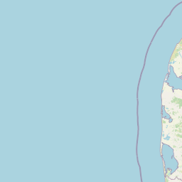
Use this park location map to pinpoint Ringkøbing Fjord og Nymindestrømmen in Denmark, understand its exact geographic position, and read its mapped placement within the surrounding landscape more clearly.

Pigeon | © OpenStreetMap contributors

Location context for Ringkøbing Fjord og Nymindestrømmen

Region Midtjylland
Recorded earthquake history

Explore Historical Earthquake Records for Ringkøbing Fjord og Nymindestrømmen

Examine the historical catalogue of seismic events associated by proximity with the diverse landscapes of Ringkøbing Fjord og Nymindestrømmen. MoriAtlas provides a clear, structured overview of recorded seismic activity to help you understand the regional history surrounding this significant Danish wetland.

Ringkøbing Fjord og Nymindestrømmen Earthquake History

Catalogued events

1 event

Strongest magnitude

Magnitude 3.8

Most recent event

Sep 16, 2018

This history includes earthquakes recorded inside the park or within 50 km of its borders

Visual reference collection showcasing coastal lagoons, salt meadows, and shifting dunes.

Ringkøbing Fjord og Nymindestrømmen Photos and Protected Landscape Scenery

Visual records reveal the complex topography of brackish lagoons, tidal flats, and coastal dunes across the protected wetlands. Examining photographic evidence helps clarify the ecological character and terrain variations defining the Danish west coast reserve.

A wide view across the calm, grey waters of Ringkøbing Fjord with grassy marshland in the foreground and a distant tree-lined shoreline under a cloudy sky.

Park atlas

Compare coastal lagoons, dune belts, and regional wetland landscapes

Parks Near Ringkøbing Fjord og Nymindestrømmen and Related Protected Areas

Browsing other parks near Ringkøbing Fjord og Nymindestrømmen reveals interconnected coastal ecosystems and protected wetland habitats across the surrounding region. Comparing these regional conservation areas provides valuable geographic context for understanding Danish west coast landscapes.
Protected areaRegion Midtjylland
3.5 km away#1 closest

East

Lønborg Hede Protected Area: Heathland Geography and Mire Ecosystems in Denmark

Detailed landscape analysis of a unique Central Jutland nature reserve

Lønborg Hede is a distinctive protected area featuring a rare micro-topographic gradient where inland dune heath rises 15 meters above wet bog and mire environments. This site provides a concentrated look at western Jutland's historical heathland character, featuring a mosaic of nutrient-poor aquatic habitats and diverse ground-nesting bird environments across 350 hectares.

Area
3.53 km²
Established
1970
Relief
Lowland
Scope
Terrestrial
Nature reserveRegion Midtjylland
About 10 km away#2 closest

East

Natura 2000-område nr. 68 Skjern Å: Protected Riverine Geography and Valley Landscapes

A central Jutland nature reserve featuring glacial valley systems

Explore the geographic boundary and habitat diversity of Natura 2000-område nr. 68 Skjern Å. This protected landscape preserves the vital connection between freshwater river channels, raised bogs, and open heathland, serving as a landmark for regional river management and biodiversity conservation in western Denmark.

Area
25.8 km²
Established
2011
Protected areaRegion Midtjylland
12 km away#3 closest

North

Kimmelkær Landkanal: Mapped Protected Area and Regional Geography in Midtjylland

A rare aquatic habitat within the Ringkøbing Fjord water system.

Focusing on a narrow canal corridor, Kimmelkær Landkanal serves as a vital protected area for threatened aquatic species. Its geography is characterized by soft sandy sediments and a distinct parallel channel structure, connecting small watercourses to the larger wetland ecosystems of the Stadil Fjord catchment area.

Area
0.03 km²
Established
2011
Relief
Lowland
Scope
Terrestrial
Protected areaDenmark
About 12 km away#4 closest

North

Natura 2000 area no. 66 Stadil Fjord og Vest Stadil Fjord Coastal Wetland Complex

Protected lagoon and dune landscape in western Jutland, Denmark.

Natura 2000 area no. 66 Stadil Fjord og Vest Stadil Fjord comprises a significant coastal lagoon system, encompassing shallow brackish waters, reed beds, and surrounding dune heaths. This protected area supports a high degree of botanical diversity and provides essential habitat for various bird species, serving as a primary example of Denmark's complex hydrological and coastal geography.

Area
69.03 km²
Relief
Lowland
Climate
Temperate
Access
Easy access
A soft watercolor illustration showing a hazy coastal landscape with green dunes, rolling hills, and a calm water surface against a white background.
Protected landscapeDenmark
About 13 km away#5 closest

South

Naturpark Vesterhavet: Geography and Protected Boundaries of the Danish West Coast

Coastal dune, heath, and wetland landscapes in West Jutland

Naturpark Vesterhavet serves as a critical coastal nature park along the North Sea, stretching between Blåvandshuk and Nymindegab. The park integrates a distinct series of parallel landforms, including active dunes, coniferous plantations, expansive heathlands, and the significant restored wetlands of Filsø. This protected landscape acts as a primary hub for coastal conservation, mapping the intersection of avian habitats and classic West Jutland terrain.

Area
225 km²
Established
2015
Relief
Lowland
Climate
Temperate
Nature reserveCentral Denmark Region
13 km away#6 closest

East

Borris Hede Nature Reserve: Mapping the Protected Heathland of the Central Denmark Region

Glacial plains, wetland mosaics, and habitat conservation zones

Borris Hede encompasses a massive stretch of sandy outwash plain in central-western Denmark. This nature reserve serves as a vital habitat mosaic, ranging from dry and wet heath to bogs and riparian stream corridors. By preserving these open terrain characteristics, the site supports specialized birdlife and maintains one of the most distinctive geological and biological landscapes within the Danish geography.

Area
47.78 km²
Established
1903
Relief
Lowland
Climate
Temperate
National parkDenmark
17 km away#7 closest

South

Wadden Sea National Park: Denmark's Premier Tidal Wetland and Migratory Bird Sanctuary

Mapped boundaries and unique protected landscape exploration.

Wadden Sea National Park is a vast national park encompassing the Danish portion of the Wadden Sea, a globally significant tidal wetland. Recognized for its critical role in bird migration, hosting millions of birds annually, it features a distinctive landscape of tidal flats, salt marshes, coastal dunes, and barrier islands. This protected area offers a unique lens through which to explore dynamic coastal geography, intertidal ecosystems, and the conservation of a World Heritage Site.

Area
1,466 km²
Established
2010
IUCN
II
Relief
Lowland
Nature reserveRegion Midtjylland
19 km away#8 closest

North

Husby Sø og Nørresø Nature Reserve: Protected Wetland Landscape in Region Midtjylland

Coastal plain geography and shallow lake habitat mapping

Situated in the coastal landscape of Region Midtjylland, Husby Sø og Nørresø represents a critical nature reserve defined by two interconnected shallow lakes. The protected area features extensive reedswamp margins, bog vegetation, and a human-modified marine foreland, hosting high aquatic plant diversity that remains central to the region's conservation identity.

Area
3.52 km²
Established
2011
Relief
Lowland
Climate
Temperate

Common questions about visiting, size, designation, and location context for Ringkøbing Fjord og Nymindestrømmen

Ringkøbing Fjord og Nymindestrømmen FAQs for park facts, access, geography, and protected area context

Find quick answers about Ringkøbing Fjord og Nymindestrømmen, including protected-area facts, park geography, trail and visitor context, and how the park fits into its surrounding country and regional landscape.
MoriAtlas Explorer

Continue Your Protected Areas Search Across the Global Atlas

Deepen your exploration by continuing the structured search for national parks and protected areas worldwide. Utilize the comprehensive filtering capabilities to compare different conservation landscapes and refine your understanding of global park geography. Discover more about the distribution and characteristics of protected natural areas.

Global natural geography