
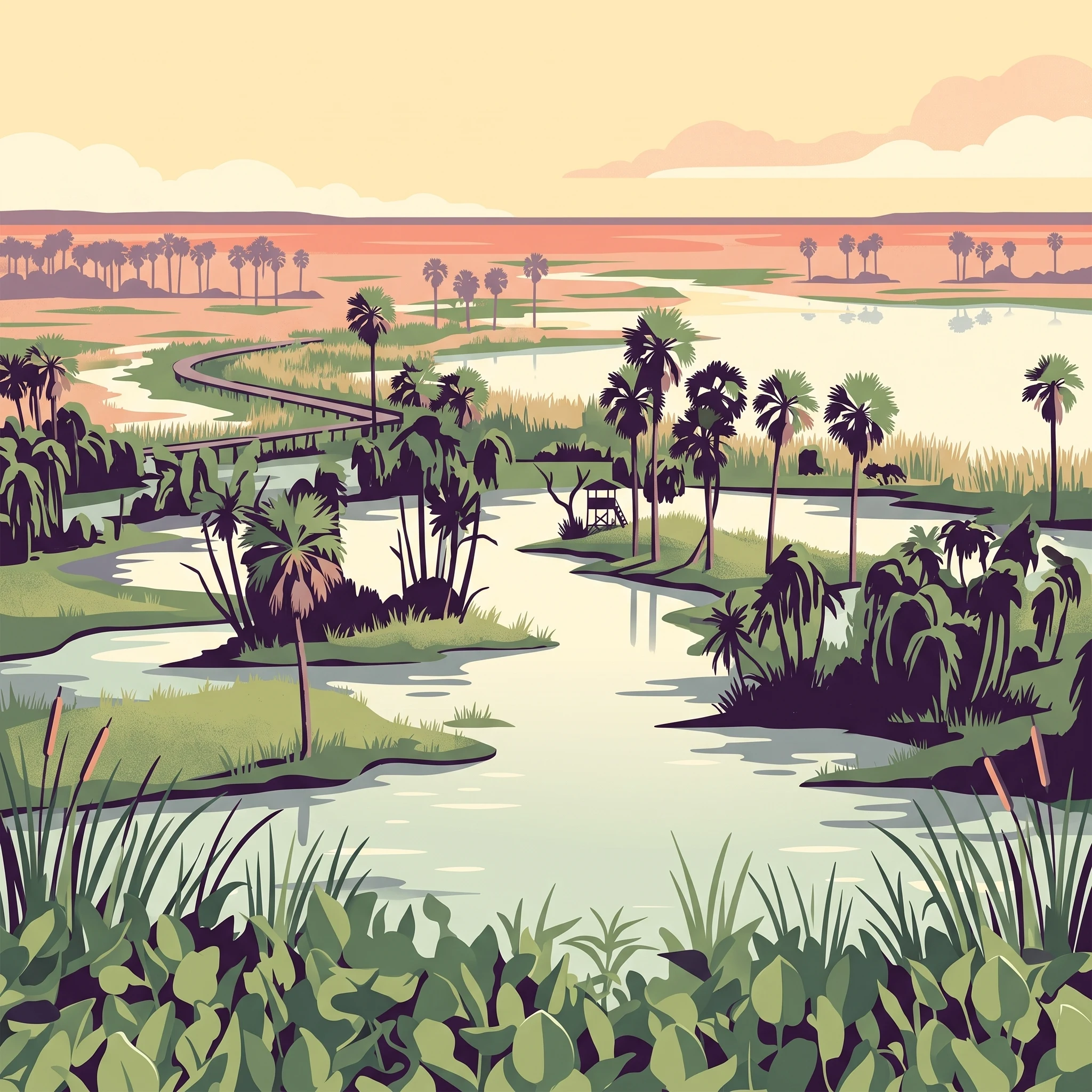
Trip Timing
When to visit Río Pilcomayo National Park: The best times to go
Deciding on the best time to visit Río Pilcomayo National Park requires balancing the desire for temperate, dry weather against the park’s fundamental identity as a dynamic, water-dependent wetland ecosystem. The most reliable window for a visit occurs during the cooler months of June, July, and August. During this period, the Humid Chaco landscape experiences its lowest precipitation, which typically leads to more accessible trails and improved opportunities for viewing wildlife as they congregate near receding water sources. This timeframe is generally considered the most comfortable for long-distance hiking through the savanna and reed-dominated paths, as average daily maximums become far more manageable compared to the intense heat peaks observed later in the year.
Understanding the Hydrological Trade-off
While the winter months offer relief from high humidity and heat, the very nature of the park means that conditions are never static. The Humid Chaco ecoregion is defined by the seasonal pulse of the Pilcomayo River and associated floodplains. Visitors choosing the drier, cooler months may find that some areas of the park exhibit significantly lower water levels compared to the rest of the year. This shift can be a double-edged sword: while it reduces the reach of some aquatic pathways, it simultaneously concentrates wildlife in the remaining permanent marshes and lakes, such as the areas around Laguna Blanca. Conversely, traveling during the warmer, wetter months brings a lush, green landscape and higher water levels that transform the park into a vibrant, interconnected network of lagoons, though this comes with the trade-off of high heat, increased humidity, and potentially restricted access to flooded paths.
Temperature and Daylight Dynamics
Planning your trip involves weighing these environmental factors against your personal comfort levels. The park experiences a marked temperature range, with daily highs frequently exceeding 35 degrees Celsius in the height of the summer months, accompanied by higher precipitation and intense humidity. This heat, combined with the often-significant wind, plays a major role in how the park feels on the ground. When choosing when to visit Río Pilcomayo National Park, consider whether your priority is observing migratory bird activity or enduring the sub-tropical conditions of the warmer season. The cooler, clearer air of mid-winter provides a more stable baseline for planning, whereas the remainder of the year demands flexibility, as the park’s character shifts with every increase in rainfall and temperature. Because these patterns serve as long-term climatic normals rather than daily forecasts, visitors should remain prepared for sudden changes in weather regardless of the season selected.
Seasonal Comparison
Best months to visit Río Pilcomayo National Park based on traveler priorities
Balancing Climate Comfort and Wetland Dynamics
Visitors planning a trip to this park often weigh the benefits of milder temperatures against the seasonal fluctuations of the Humid Chaco ecosystem. The months of June, July, and August represent a distinct period for those prioritizing manageable heat. During this winter window, average daily temperatures remain at their lowest, providing a comfortable environment for walking the trails and observing wildlife near the lakeshores. However, this period coincides with the region's driest weather, which leads to lower water levels in the marshes and interconnected waterways. While this often concentrates wildlife around remaining water sources, it also changes the character of the wetlands compared to the expansive, flooded scenes observed in wetter months.
The Transitional Months of Spring and Autumn
For travelers who prefer moderate temperatures without the peak dryness of mid-winter, the transitional months offer a different set of conditions. September and October act as a bridge from the cool winter to the intense heat of late spring and summer. During this time, temperatures begin to climb, often reaching high maximums that may limit extended midday outdoor activity. This period can be rewarding for those wishing to observe bird life as temperatures rise, provided they are prepared for the increasing intensity of the sun.
Similarly, April and May represent an autumnal transition. These months typically see the humidity levels begin to rise and the extreme heat of the summer months subside. This period is often favoured by visitors who want to avoid the coldest nighttime temperatures of July while still enjoying a respite from the peak humidity and rainfall typical of the summer season.
Navigating the Summer Heat and Precipitation
From November through March, the park experiences its warmest conditions, characterized by higher humidity and more frequent precipitation. These months are often better suited for those whose primary interest is experiencing the park at the peak of its hydrologic cycle. The increased rainfall supports the lush growth of the savanna and maintains the higher water levels that define the Humid Chaco landscape. The trade-off is significant, as visitors must contend with average maximum temperatures that frequently exceed 35 degrees Celsius and higher levels of relative humidity. This period requires careful planning regarding timing of daily activities to avoid the most intense sun exposure. Those choosing to visit during these months should anticipate that weather patterns are highly dynamic, and while the landscape may be at its most vibrant, the intensity of the climate necessitates a more measured pace of exploration.
Climate Conditions
Annual Weather and Climate Patterns at Río Pilcomayo National Park
The climate at this national park is defined by a subtropical pattern that creates sharp contrasts between the humid, high-sunlight months and the cooler, more stable winter period. These long-term normals, recorded at an elevation of approximately 77 meters, reveal a rhythm dominated by significant fluctuations in both precipitation and temperature, which directly influence how the landscape functions throughout the year. It is important to note that these values represent historical climate trends over three decades and do not function as daily weather forecasts or local guarantees for specific areas of the park.
Temperature Ranges and Thermal Shifts
The park experiences a distinct thermal arc that transitions from intense summer heat to a temperate winter. Mean temperatures peak during the summer months of December and January, where averages often hover near 28 degrees Celsius, though daily maximums during this period can regularly climb toward 39 degrees Celsius. This sustained warmth is accompanied by high humidity levels, often approaching 70 percent, which can increase the perceived intensity of the sun. As the year progresses into the winter window of June and July, the mean temperature drops to its annual minimums, averaging between 16 and 17 degrees Celsius. During these colder months, overnight temperatures can fall toward single digits, occasionally dipping as low as 3 degrees Celsius, providing a stark contrast to the oppressive heat of the summer season.
Rainfall Dynamics and Seasonal Humidity
Rainfall is not distributed evenly across the year and acts as the primary driver for the park's wetland cycles. The summer months, particularly November through February, represent the peak of the wetter period, with rainfall measurements consistently ranging between 4 and 6 millimeters per day on average. This regular precipitation sustains the interconnected lakes and marshes that define the Humid Chaco ecoregion. Conversely, the dry season,most pronounced from July to August,sees a dramatic reduction in rainfall, with averages dropping to approximately 1.2 to 1.4 millimeters per day. This reduction in moisture coincides with the lowest humidity readings of the year, which typically bottom out in September. This drier phase is crucial for the recession of floodwaters, which alters the visibility of wildlife and the accessibility of low-lying terrain.
Wind, Daylight, and Environmental Exposure
The amount of available daylight and wind activity creates secondary shifts in how the park environment feels. Daylight hours are longest from November through January, reaching over 13 hours daily, which extends the window for morning and evening wildlife observation. As the sun moves south in the winter, daylight shrinks to roughly 10.5 hours by June. Interestingly, the wind profile shifts alongside these seasonal changes. Wind speeds tend to be lowest during the peak heat of late summer, hovering around 3.4 to 3.5 meters per second. As the cooler, drier weather arrives in late winter, wind speeds increase, peaking around 4.5 meters per second in August and September. These winds can exacerbate the feeling of lower temperatures during the winter and may impact the surface conditions of the park's various lakes and reed beds.
Seasonal dynamics
Understanding the dry and wet seasons at Río Pilcomayo National Park
Defining the dry and wet phases of the Humid Chaco
Rather than conforming to a strict four-season cycle, the local environment of this park is primarily shaped by the rhythm of precipitation and water level fluctuations. The annual cycle effectively splits into two core phases: a cool, dry period that governs the winter months, and a warmer, more humid period that spans the late spring and summer months. These phases are not merely calendar shifts but represent a fundamental transformation of the landscape, affecting how the wetlands function and how water collects across the plains.
The cool, dry winter window
The dry season typically establishes itself from June through August, representing the period of lowest rainfall and clearest skies. During these months, the park undergoes a noticeable environmental change as the high water levels from the previous cycle begin to recede. The cooler temperatures, which often drop to their lowest points during this window, provide a stabilizing effect on the climate. For the visitor, this phase is characterized by more manageable conditions, as the reduced humidity levels often make the heat less intense, even if the air remains crisp. This period is critical for the maintenance of the park trails and accessibility, as lower water levels allow for a different type of exploration compared to the rest of the year. The savanna landscape, particularly the tall Caranday palms, stands out sharply against the grasslands during this time, providing an ideal, if somewhat austere, backdrop for observing the park's resident wildlife, including the elusive jaguar and various birds that rely on the remaining, more concentrated water bodies.
The transition to the wet season
The transition periods are essentially bridge months that carry the park from its driest state to the peak of the humid season. As September and October progress, the temperature begins to climb, and humidity follows, signaling an approaching shift in the landscape. While these months still offer relatively dry conditions compared to the end of the year, they are marked by a gradual increase in moisture that heralds the return of more active wetland dynamics. By November and December, the precipitation increases significantly, and the park enters its peak warm, wet phase. This part of the year is characterized by higher temperatures and increased humidity, which drive the rapid growth of aquatic vegetation and fill the lagoons and marshes. The park ecosystem thrives during this time, as the elevated water levels create extensive corridors for wildlife to move through the riparian forests and floodplains. Travelers moving through these months should expect a much denser, more active environment where the heat is more present and the landscape is consistently saturated, reflecting the true nature of the Humid Chaco floodplain.
Visitor Experience
What visiting Río Pilcomayo National Park is like throughout the year
Navigating the seasonal wetland landscapes
The experience of visiting this park is dictated by the pulse of the Pilcomayo River and the surrounding marshes. During the cooler, drier months from June to August, the receding water levels create a specific set of exploration conditions. As the marshlands retreat, the park's network of interpretive trails and boardwalks becomes more accessible, allowing visitors to walk through areas that are otherwise partially submerged. The Caranday wax palm savannas, a signature visual feature of the region, appear particularly distinct against the drier, exposed grasslands during this period. For those interested in terrestrial wildlife, this window offers a higher probability of spotting ground-dwelling mammals such as peccaries or the elusive maned wolf, which roam the drying lowland areas with less obstruction from high water.
Observing wildlife throughout the year
Wildlife viewing dynamics shift significantly as the seasons transition between wet and dry phases. The yacare caiman and broad-snouted caiman are frequently encountered near the permanent water bodies, such as the 700-hectare Laguna Blanca. During the warmer, wetter months from November to March, when water levels are elevated, these reptiles are often seen basking along the water edges or moving through deeper channels, making them easier to spot from the observation platforms. Conversely, in the drier winter months, they may congregate in the remaining permanent pools as surrounding marshes shrink, which can also provide excellent observation opportunities for those visiting the lake zones. Birdwatching remains a consistent activity, though the species composition changes with the cycle of the wetlands. The presence of migratory waterfowl is particularly notable in the lagoons, where storks, herons, and the distinctive roseate spoonbills frequent the aquatic habitats. Because these habitats are highly sensitive to rainfall, visitors should expect different levels of water coverage, which directly influences where specific aquatic bird species choose to congregate each year.
Timing for accessibility and environmental comfort
The ability to traverse the park effectively depends on the interplay between humidity and physical site conditions. Higher humidity and increased rainfall during the summer months often result in more challenging walking conditions on soft terrain. While this period supports the lush, vibrant growth of the riparian forests and aquatic vegetation, it also necessitates more robust preparation for heat and dampness. Visitors focusing on the interpretive trails should prioritize the winter months, when lower average maximum temperatures and reduced precipitation make extended time in the field more manageable. The park's varied habitats, ranging from dense riparian forests to open grasslands, offer different experiential qualities depending on the season, but the primary takeaway for any itinerary is that the park's accessibility and its internal water-based ecosystems function as two sides of the same environmental coin. Always check with the local park administration for the most current trail conditions before arriving, as localized flooding can occur outside of typical seasonal patterns.
Visitor Priorities
Optimizing Your Visit to Rio Pilcomayo National Park by Travel Priority
Planning for Mild Temperatures and Walking Conditions
If your primary goal is to spend long days on your feet exploring the network of interpretive trails and boardwalks, the period from June through August offers the most sustainable climate. During these winter months, daily mean temperatures hover comfortably between 16 and 19 degrees Celsius, a significant departure from the sweltering heat common during the summer months. This temperature range is particularly advantageous for hiking through the savanna and riparian forest sections of the park, where shade can be intermittent. The trade-off for these moderate temperatures is that the park is at its driest state. While this makes trails easy to navigate, it also means that the wetland habitats are at their lowest levels, which may reduce the abundance of aquatic birds and other wildlife that congregate in higher densities when water levels are more expansive.
Prioritizing Clear Visibility and Wetland Landscapes
For travelers who prioritize seeing the full extent of the park's flooded landscapes, the transition from the rainy season into the early dry season is essential. The months of September and October often retain enough residual water from the previous rainy period to keep the creeks and marshes full, yet the intensity of the mid-summer heat has not yet reached its peak. If you seek to photograph the reflective surfaces of Laguna Blanca or observe the full saturation of the Humid Chaco floodplain, these months provide a balanced landscape. The compromise here is higher humidity and rising temperatures compared to the winter months, meaning you will need to manage higher heat stress if you plan on extended walking. Because these months act as a bridge, weather patterns can be more variable, with occasional late-season showers potentially affecting trail conditions or mud levels.
Navigating High Heat and Wildlife Activity Cycles
Those specifically interested in wildlife observation, such as spotting the yacare caiman or diverse waterfowl species, often weigh the trade-off of extreme heat against higher water levels. November through March brings the heaviest rainfall, resulting in expanded wetlands that support significant wildlife activity. However, this period coincides with some of the highest daily temperatures, frequently exceeding 38 degrees Celsius, and high humidity levels that can make midday exertion physically taxing. If you choose this period, you are prioritizing the health of the ecosystem and the visibility of aquatic animals over physical comfort. The main compromise is the necessity to limit outdoor activity to the very early morning or late afternoon to avoid the most intense sun, as well as being prepared for the potential of short-term trail closures due to localized flooding or heavy rainfall events that can occur without significant warning.
Access and Logistics
Seasonal access and trip planning at Río Pilcomayo National Park
Access and Transit Considerations for Visitors
Reaching this national park requires advance planning, as the area is located in a remote part of northeastern Formosa Province. The primary gateway for travelers is the Formosa International Airport. From the capital city of Formosa, the most common transit route involves driving north on RP-2 for approximately 140 kilometers, a journey typically taking about two hours. The primary public entry point, known as Estero Poi, is accessed through the town of Laguna Blanca. As road conditions and transit services can be affected by weather events and general maintenance, travelers should verify the current status of provincial roads and local access routes with regional transportation authorities or the park office before finalizing travel arrangements.
The Impact of Seasonality on Park Movement
Physical accessibility within the park is inextricably linked to the seasonal water levels of the Pilcomayo River and the associated wetland dynamics. During the wetter months, heavy precipitation can lead to localized flooding or the saturation of low-lying trail sections. While this landscape transformation is part of the park's natural cycle, it occasionally necessitates temporary closures or restricted access to specific boardwalks and trails to ensure visitor safety and resource protection. Conversely, the dry winter months typically provide more stable ground conditions, allowing for broader navigation across the diverse savanna and forest ecosystems. However, because these physical conditions are not static and depend on annual rainfall patterns, you must consult the official park authority website or visitor center for current trail status updates and any active advisories regarding park entry prior to your departure.
Preparing for a Self-Directed Visit
As you develop your itinerary, recognize that facilities within the park are designed to respect the protected status of the Humid Chaco ecoregion. The park provides infrastructure such as observation platforms, including the notable Laguna Blanca platform, and interpretive trails intended for wildlife viewing. Because there is no guarantee of specific services, equipment availability, or consistent shuttle access, visitors should arrive prepared for a self-sufficient experience. Always verify if the visitor center or specific entry points have adjusted hours during your planned travel period. Additionally, confirm current regulations regarding site permits, designated visitor zones, or any temporary restrictions that may be in effect due to wildlife conservation efforts or maintenance projects. Engaging with official channels is the only way to obtain reliable information about the current state of park services and to avoid travel delays or site access frustrations caused by changing environmental or operational conditions.
Safety and Preparation
Seasonal weather conditions and safety preparations in Rio Pilcomayo National Park
Navigating seasonal weather extremes
Preparation for a visit to the park requires recognizing the sharp shift between the dry, cooler winter months and the humid, high-heat summer. During the winter period from June to August, daily temperatures can dip significantly, particularly during the early mornings and evenings. While mid-day temperatures remain mild, the transition from high heat to cooler night-time lows is a notable feature of the Chaco environment. Visitors planning for this season should prepare for these fluctuations by utilizing layered clothing that can be adjusted as the sun rises and sets.
Conversely, the summer months from November to March bring persistent heat, often exceeding 35 degrees Celsius, accompanied by high humidity. During this period, the environmental stress is primarily related to heat and moisture. Regardless of the month, the park's low-lying terrain and exposure to the sun in open areas like the palm savannas necessitate proactive sun management. There is little natural shade across the vast grasslands, making it essential to rely on personal protective measures such as wide-brimmed hats and appropriate clothing that covers exposed skin. Always verify current weather forecasts for the Formosa Province area immediately before your departure, as conditions can shift rapidly.
Preparing for changing wetland terrain
The park's safety profile is deeply linked to the seasonal water levels of the Pilcomayo River and the resulting expansion or contraction of the marshlands. During the wetter months, trails that are easily passable in July may become submerged or inaccessible due to high water levels. Preparation for this entails a flexible approach to your planned itinerary. Avoid venturing onto paths that show signs of recent flooding or have been marked with warning signage by park staff.
Because the terrain consists largely of soft, sediment-rich soil, even minor rainfall can turn trails into muddy, uneven surfaces. Sturdy, enclosed footwear is a necessity for navigating these environments, as the ground condition is rarely uniform across the park's diverse habitats. Please observe all posted route guidance, as the park’s boardwalks and trails are designed to keep visitors in stable areas. If you find a trail appears compromised by standing water, do not attempt to bypass the area. Instead, consult with on-site rangers or official park communications to confirm which sectors of the park remain open for safe passage. Always prioritize official alerts over personal assumptions about route accessibility, as site conditions change in response to recent rainfall events rather than set seasonal dates.
Final Planning
How to choose the right time to visit Río Pilcomayo National Park
Balancing Personal Preferences with Environmental Realities
Choosing when to visit this Humid Chaco landscape requires a candid assessment of what you hope to prioritize. Because the park is defined by its dynamic floodplain, the timing of your trip serves as a selection between two distinct environmental states. If your primary goal is comfortable movement and access to the park's network of interpretive trails, the mid-year window from June to August remains the most reliable. During these months, lower precipitation reduces the likelihood of flooded paths, and the cooler, drier air creates an environment where extended exploration is physically manageable. This period offers the highest predictability for seeing the characteristic savanna landscapes where palms stand out against the dry grass.
Interpreting the Trade-offs of a Seasonal Trip
Conversely, choosing to visit during the warmer, wetter months from November to March introduces a different set of conditions that fundamentally change the experience. While the humidity and higher temperatures can be challenging, this season is when the park's wetland systems reach their full, active potential. Those interested in the aquatic biodiversity, including the caiman populations and the diverse array of waterfowl that inhabit the Laguna Blanca area, will find the park in its most vibrant state during these months. The trade-off here is not just in comfort but in accessibility, as the rising water levels can shift the physical geography of the trails, potentially limiting access to certain areas that were open during the winter.
Final Steps for Your Travel Decisions
Ultimately, there is no single month that satisfies every visitor objective. You must decide whether you value the ease of dry-land hiking or the density of wildlife activity in a saturated, wetland environment. If you prefer moderate conditions with lower humidity, the transition periods of April to May or September to October offer a middle ground, though these months are characterized by less consistent weather patterns. Regardless of which window you choose, recognize that the provided climate data represents long-term averages rather than daily forecasts. Before finalizing your travel dates, verify the current trail status, road conditions, and any specific park advisories with official authorities to ensure your expectations align with the actual state of the Humid Chaco at the time of your arrival.