
Mori Atlas logo
Nature reserveRéserve naturelle nationale du rocher de la Jaquette

Mapping the cliff-side habitats, entomological diversity, and rocky terrain of this Massif Central refuge.

Réserve naturelle nationale du rocher de la Jaquette: Volcanic Protected Landscapes in Puy-de-Dôme

Réserve naturelle nationale du rocher de la Jaquette preserves a rare mosaic of cliffs, scree, and dry grasslands on the edge of the Cézallier volcanic plateau. This protected area in Puy-de-Dôme serves as a crucial refuge where mountain and Mediterranean species coexist within a compact, foehn-influenced landscape. Researchers and visitors can trace the reserve's crescent-shaped boundaries across the Rentières valley, identifying the distinct ecological corridors that support raptor populations and butterfly colonies.

national nature reservevolcanic landscapecliffs and screedry grasslandheathlandbutterfly habitat
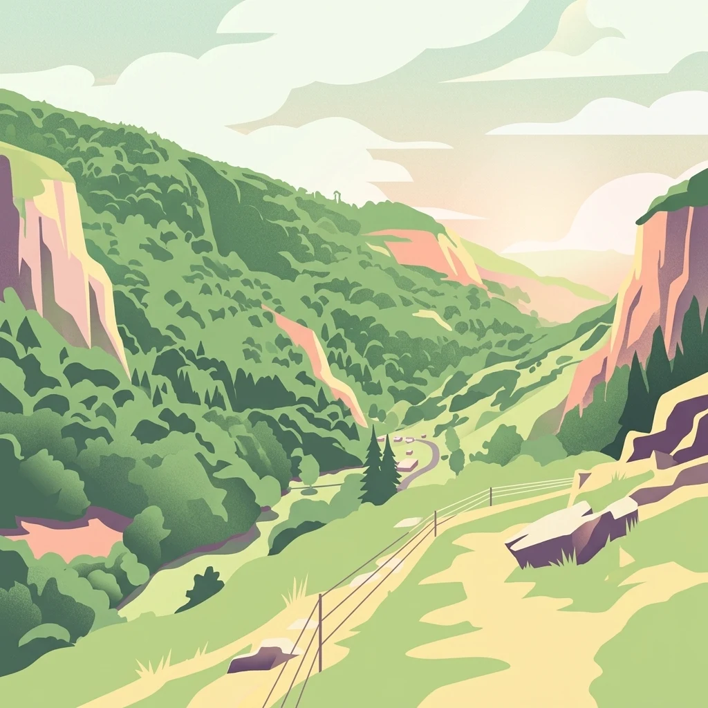
A stylized digital illustration of a green, forested valley framed by high, steep, rocky cliffs under a soft sunset sky.

Réserve naturelle nationale du rocher de la Jaquette

Nature reserve

Park overview

Structured park overview, official facts, and landscape profile for Rocher de la Jaquette National Nature Reserve

Rocher de la Jaquette National Nature Reserve park facts, protected area profile, and essential visitor context

Review the core facts for Rocher de la Jaquette National Nature Reserve, including designation, size, terrain, visitor scale, habitats, and operating context in one park-focused overview.

About Rocher de la Jaquette National Nature Reserve

The Rocher de la Jaquette National Nature Reserve is a compact protected area in the heart of the Massif Central, occupying the south and east slopes of a striking volcanic rocky outcrop in the Auvergne region. Although it covers only a few dozen hectares, the reserve is ecologically dense, combining cliffs, scree slopes, dry grasslands, meadows, heathland, and forest into a small but highly varied mosaic of habitats. The site lies on the edge of the Cézallier plateau, overlooking the Rentières valley, and belongs administratively to the commune of Mazoires in the Puy-de-Dôme department.

The reserve sits within the landscape of the Parc naturel régional des Volcans d'Auvergne, and its character is shaped strongly by the underlying volcanic geology of the region. Rocky outcrops, accidented terrain, and a southern aspect give it a warm, dry microclimate reinforced by foehn-type air flows rising from the valley. As a result, the environment is unusually favorable for species that normally would not be expected to overlap, with montane and Mediterranean butterflies and plants occurring together on the same slopes.

Originally created in 1976 specifically to protect the eagle owl, then a very threatened species in France, the reserve's identity has progressively shifted toward a national-level entomological importance. Today, it is appreciated above all for its richness in butterflies, moths, grasshoppers, beetles, and spiders, alongside breeding populations of several large raptors that find refuge on its cliffs. Its compactness makes it a textbook example of how a very small protected area can punch far above its size when ecological conditions line up.

Quick facts and research context for Rocher de la Jaquette National Nature Reserve

The Rocher de la Jaquette reserve is a French national nature reserve covering roughly 36 hectares within the Parc naturel régional des Volcans d'Auvergne. Created by decree on 18 October 1976, it lies in the commune of Mazoires in the Puy-de-Dôme department, on the southern edge of the Cézallier plateau above the Rentières valley. It was originally established to protect the eagle owl and is now recognized primarily for its exceptional insect diversity as well as its breeding raptors. The reserve is managed today by the Parc naturel régional des Volcans d'Auvergne. Its IUCN category is IV (habitat and species protection).

Protection and recognition

Examine documented terrestrial protection records and official conservation designations

Protection Status and International Recognition for Réserve naturelle nationale du rocher de la Jaquette

Terrestrial protection records for Réserve naturelle nationale du rocher de la Jaquette detail the official conservation scope and administrative standing. Atlas data compiles baseline protected area entries to trace international recognition metrics without external assumptions.

Protection details

Protection scope
Terrestrial
Transboundary protection
No
WDPA ID
39775
Park context

Deeper park guide and search-rich context for Rocher de la Jaquette National Nature Reserve

Rocher de la Jaquette National Nature Reserve history, landscape, wildlife, and travel context

Explore Rocher de la Jaquette National Nature Reserve through its history, landscape character, ecosystems, wildlife, conservation priorities, cultural context, and seasonal travel timing in a structured park guide built for atlas discovery and search intent.

Why Rocher de la Jaquette National Nature Reserve stands out

The reserve is especially known for its extraordinary butterfly fauna, with more than 110 butterfly species documented, representing roughly three quarters of the species recorded in the entire Puy-de-Dôme department. Because the site stands at a meeting point between the volcanic plateau and the valley, both mountainous and Mediterranean butterfly species coexist there. It is also recognized for protecting the breeding habitat of three large raptors: the eagle owl (the species for which the reserve was originally created), the booted eagle, and the peregrine falcon. These qualities make even a very small reserve nationally important for entomology and for raptor conservation.
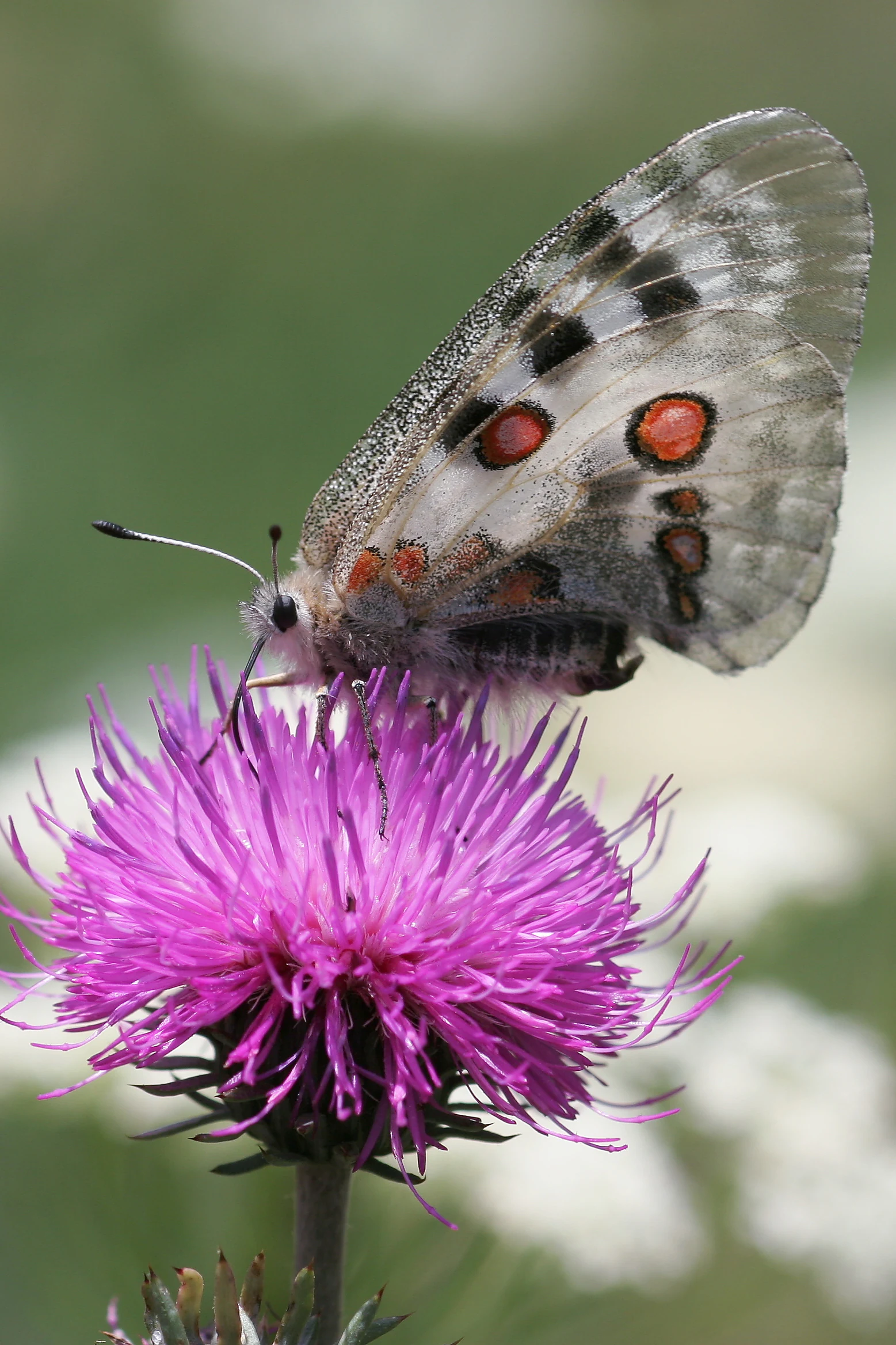
A close-up shot of an Apollo butterfly with translucent, spotted wings perched on a vibrant purple, spiky flower.
An Apollo butterfly feeding on a purple flower, a species representative of the reserve's entomological richness.

Rocher de la Jaquette National Nature Reserve history and protected-area timeline

The Rocher de la Jaquette reserve was formally created by ministerial decree on 18 October 1976, registered as national nature reserve number 34. Its original purpose was the protection of the eagle owl, which was then considered highly threatened in France and in need of secure breeding habitat away from human disturbance.

Over the subsequent decades, scientific inventories revealed that the reserve's main significance lay less in raptors alone than in its exceptional entomological diversity. Surveys documented more than 110 butterfly species on the site, together with dozens of moth, grasshopper, beetle, and spider species, while raptor monitoring confirmed regular breeding by eagle owls as well as booted eagles and peregrine falcons.

Initially, the Société pour l'Étude et la Protection de la Nature dans le Massif Central (SEPNMC), which was also the landowner, managed the reserve. Management was later transferred to the Parc naturel régional des Volcans d'Auvergne, which continues to coordinate conservation work on the site. From the mid-2000s onward, in response to progressive habitat closure after the abandonment of past sheep grazing, the managers reintroduced targeted sheep grazing with a local breeder using the hardy Rava breed and supplemented this with manual cutting to keep parts of the slope open.

Rocher de la Jaquette National Nature Reserve landscape and geographic character

The reserve's landscape is defined by a prominent rocky outcrop, the Rocher de la Jaquette itself, whose south and east flanks constitute the core of the protected area. The site's territory forms a crescent about 800 meters long that wraps around these cliffs, climbing from the valley floor of the Rentières up toward the plateau.

Geologically, the area belongs to the volcanic landscapes of the Cézallier, the western extension of the broader volcanic chain of the Massif Central. The accidented terrain combines rocky bars and cliffs, scree and rubble slopes, dry rocky grasslands, denser meadows and heathland, and patches of woodland, all within a very small surface area. The combination of steep, south-facing slopes and air rising from the deeper valley produces a notably warm and dry microclimate for the region, characteristic of foehn effects.

From above, the reserve offers panoramic views over the volcanic plateau, while the cliffs themselves act as a sheltered amphitheater that traps warmth. This unusual topography is central to the reserve's identity, making it visually distinctive against the smoother surrounding plateau and creating the conditions for its remarkable mix of habitats.
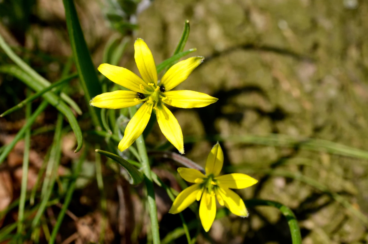
Two yellow star-shaped flowers with bright petals and green stems captured in a macro shot.
A close up view of Gagea lutea, or yellow star of Bethlehem, blooming in the reserve.

Rocher de la Jaquette National Nature Reserve ecosystems, habitats, and plant life

Despite its very small size, the reserve concentrates an exceptional diversity of habitats. Cliffs and scree slopes alternate with dry rocky grasslands and warmer meadows, while upland heathland and woodland fragments appear elsewhere on the slopes. This juxtaposition of seemingly contrasting environments within a few hectares of terrain is one of the defining features of the site.

The botanical richness is correspondingly high. Inventories have recorded more than 380 plant species on the site, including roughly 195 vascular plant taxa. Among them are nationally protected species such as the bug orchid (Orchis punaise) and the yellow gagea (Gagée jaune). The reserve also supports a rich bryophyte community with around 88 moss species, reinforcing the importance of humid microhabitats on the cliffs and rocky slopes.

Because of its warm microclimate, the site acts as a meeting point between flora and fauna of mountain affinity and flora and fauna of more southerly, Mediterranean affinity. This ecological crossroads effect is one of the most interesting features of the reserve from a biogeographical perspective, giving it a much richer profile than its small size alone would suggest.
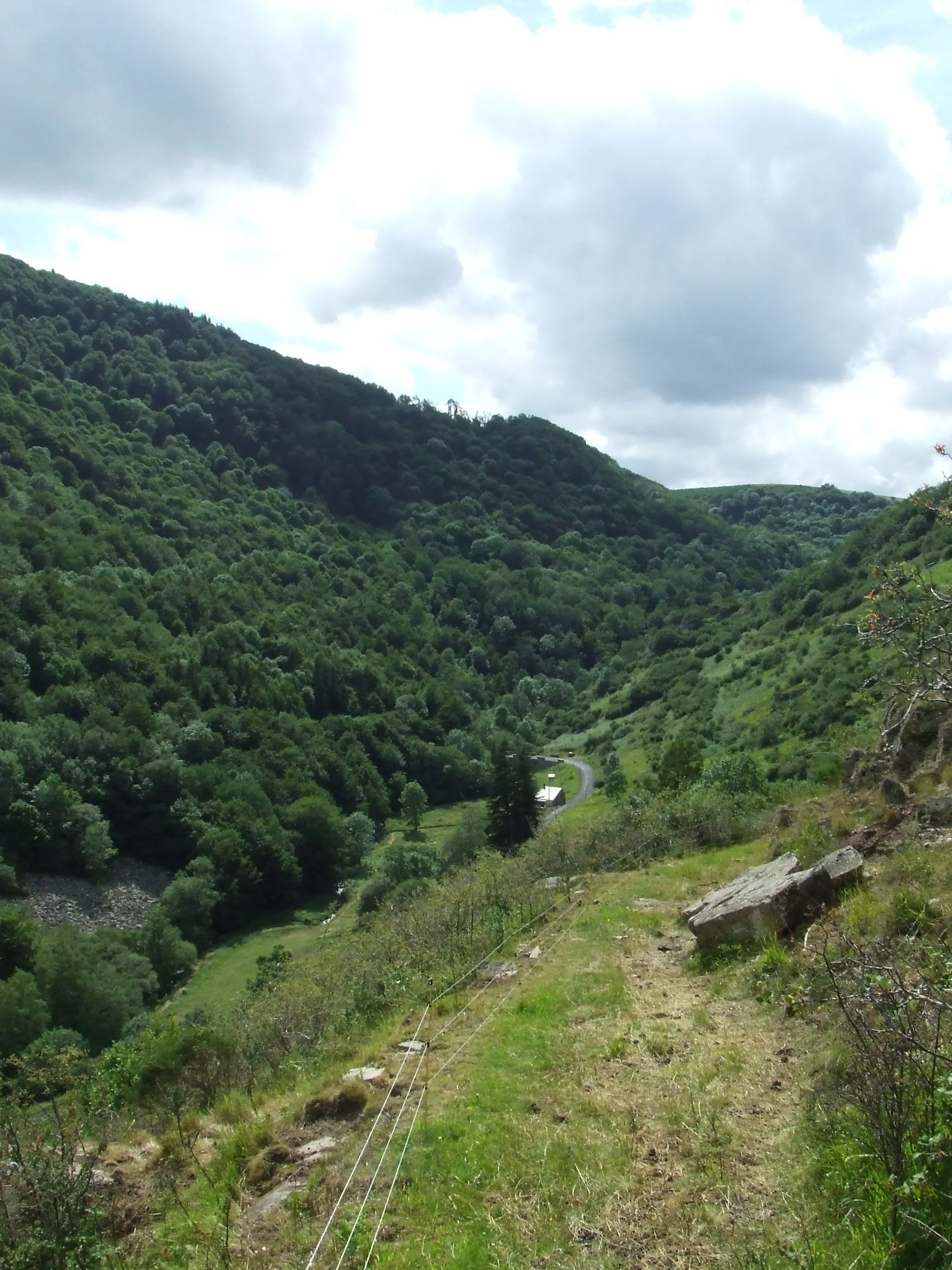
A downward perspective of a lush green valley filled with dense forest, seen from a grassy hillside with a visible wire fence and small rocky outcrops in the foreground.
A view looking down from the rocky heights over the forested valley of the Réserve naturelle nationale du rocher de la Jaquette.

Rocher de la Jaquette National Nature Reserve wildlife and species highlights

The reserve's wildlife is dominated by insects and birds, both of which benefit from the unusual climatic and habitat combination. Butterflies are the most celebrated group, with more than 110 species recorded, including four species protected at the national level: the Apollo, the Semi-Apollo, the Large Blue, and the Reverdin's Blue (or related damier species), as well as at least 44 noctuid moth species, around 40 grasshopper and cricket species, 178 beetle species, and 126 spider species.

The reserve is also a recognized breeding site for several large raptors that depend on its quiet cliffs. The eagle owl, historically the principal reason for the reserve's creation, continues to nest on the site. The booted eagle and the peregrine falcon also breed on the reserve's cliffs, benefiting from the inaccessibility of the rocky terrain. Over 80 bird species have been observed in total, of which around 45 are believed to breed locally.

Insects are central to the food web and to the reserve's conservation importance. The mosaic of dry grasslands, warm rocky slopes, and sheltered valleys provides habitat for both montane and Mediterranean insect species that would otherwise be unlikely to occur together, making the reserve a small but particularly rich entomological refuge within the Massif Central.

Rocher de la Jaquette National Nature Reserve conservation status and protection priorities

The Rocher de la Jaquette reserve is nationally significant for conservation because it preserves, in a very confined space, a habitat mosaic and a microclimate combination that would otherwise hardly survive in the surrounding landscape. Its principal conservation value lies in entomological diversity, with about three quarters of the butterfly species known in the Puy-de-Dôme recorded on a few dozen hectares.

A key conservation challenge is the gradual closing of open habitats. Up until the 1950s, the gentler parcels were grazed by a flock of around one hundred sheep, which maintained a mosaic of open vegetation. After pastoral use was abandoned, the area progressively became colonized first by heathland and then by hazel and blackthorn scrub, threatening the open rocky grasslands and heathland that drive much of the site's biodiversity.

To address this threat, the managers reintroduced targeted sheep grazing in 2004, working with a local farmer using the hardy Rava breed. Because grazing alone is not always sufficient, the management plan also includes periodic manual cutting of denser scrub. These combined interventions aim to restore and maintain the open habitat mosaic essential for butterflies, moths, and insects, and indirectly for the raptors that depend on the cliff habitats above.

Rocher de la Jaquette National Nature Reserve cultural meaning and human context

The reserve lies in a rural part of the Cézallier, a sparsely populated volcanic highland in the Auvergne where traditional pastoral farming has shaped open landscapes for centuries. Until the 1950s, sheep farming structured local land use on the slopes below the Rocher de la Jaquette, and the abandonment of this activity is itself part of the recent social history of the area.

Today, the site is linked administratively to the broad cultural and natural project of the Parc naturel régional des Volcans d'Auvergne, an institution that plays a central role in preserving the identity of the Massif Central's volcanic landscapes. The reintroduction of grazing with the local Rava breed reflects an effort to reconnect conservation with traditional regional agricultural practices rather than imposing purely technical interventions.

Top sights and standout views in Rocher de la Jaquette National Nature Reserve

The Rocher de la Jaquette reserve stands out as one of the richest insect sites in central France, with more than 110 butterfly species on a tiny volcanic cliff habitat, four nationally protected butterfly species including the Apollo, and a remarkable overlap between mountain and Mediterranean fauna.

The reserve also safeguards breeding populations of the eagle owl, the booted eagle, and the peregrine falcon on its undisturbed cliffs. Together, these qualities make it a small but nationally valuable refuge within the Parc naturel régional des Volcans d'Auvergne.

Best time to visit Rocher de la Jaquette National Nature Reserve

Late spring and early summer are the most rewarding periods to experience the reserve character, with flowering rock vegetation and peak butterfly activity on the warm south-facing slopes. Breeding raptors are present on the cliffs during the warmer months, while the contrast between cliff habitats and plateau becomes most visible when temperatures rise and foehn-driven warmth is most pronounced. Winter visits are possible but generally offer quieter conditions with less visible insect and bird activity.
Monthly climate preview

Long-term representative point measurements for annual temperature and precipitation cycles

Réserve naturelle nationale du rocher de la Jaquette Climate Normals and Temperature Rhythms

Representative coordinates record sustained thermal variation alongside consistent monthly precipitation patterns across the elevation profile. Analyzing the complete twelve-month climatology dataset reveals detailed long-term averages for this protected terrain.
Annual mean9 °C
0 °C18 °C
Jan
Feb
Mar
Apr
May11°
Jun15°
Jul18°
Aug18°
Sep13°
Oct
Nov
Dec
Warmest month
August

17.9 °C

Coolest month
January

0.4 °C

Wettest month
May

2.7 mm/day

Driest month
March

1.4 mm/day

Park location guide

Geography guide, regional context, and park location map for Rocher de la Jaquette National Nature Reserve

Rocher de la Jaquette National Nature Reserve park geography, regions, and map view in France

Understand where Rocher de la Jaquette National Nature Reserve sits in France through a broader geographic reading of the surrounding landscape, nearby location context, and its mapped position within the national park landscape.

How Rocher de la Jaquette National Nature Reserve fits into France

France is a unitary semi-presidential republic and one of the world's largest economies. It borders Belgium, Luxembourg, Germany, Switzerland, Italy, Monaco, Andorra, and Spain, with a maritime border to the United Kingdom. The country is known for its cultural influence, art, cuisine, and political history spanning centuries.

Wider geography shaping Rocher de la Jaquette National Nature Reserve in France

France is located in Western Europe. Metropolitan France extends from the Rhine to the Atlantic Ocean and from the Mediterranean Sea to the English Channel and North Sea. The country borders Belgium, Luxembourg, Germany, Switzerland, Italy, Monaco, Andorra, Spain, and has a maritime border with the United Kingdom.

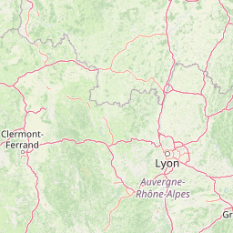
Map view of Rocher de la Jaquette National Nature Reserve

Use this park location map to pinpoint Rocher de la Jaquette National Nature Reserve in France, understand its exact geographic position, and read its mapped placement within the surrounding landscape more clearly.

Pigeon | © OpenStreetMap contributors

Location context for Rocher de la Jaquette National Nature Reserve

Puy-de-Dôme

Visual exploration of volcanic cliffs, rocky outcrops, and diverse protected habitats.

Réserve naturelle nationale du rocher de la Jaquette Photos and Volcanic Landscape Scenery

Protected area photography reveals the rugged volcanic terrain, steep limestone cliffs, and varied habitats defining Réserve naturelle nationale du rocher de la Jaquette. Visual reference documentation highlights the unique topography and ecological character of this Cézallier refuge.

A close-up shot of an Apollo butterfly with translucent, spotted wings perched on a vibrant purple, spiky flower.

Close-up portrait of a Eurasian eagle-owl showing its striking orange eye, feathered ear tufts, and patterned brown and gray plumage against a blurred natural background.

Two yellow star-shaped flowers with bright petals and green stems captured in a macro shot.

A downward perspective of a lush green valley filled with dense forest, seen from a grassy hillside with a visible wire fence and small rocky outcrops in the foreground.

Park atlas

Compare regional volcanic landscapes, rocky outcrops, and protected habitats across central France.

Parks Near Réserve Naturelle Nationale Du Rocher De La Jaquette and Surrounding Protected Areas

Visitors exploring Réserve naturelle nationale du rocher de la Jaquette can browse nearby protected areas and volcanic terrain throughout the surrounding region. Expanding the geographic comparison reveals connected regional park networks, rugged terrain types, and similar conservation landscapes across the Massif Central.
Watercolor painting of a soft, hazy mountain landscape with rolling green fields and a distant forest, set against a light, warm, pale background.
Nature reserveAuvergne-Rhône-Alpes
About 25 km away#1 closest

Southwest

Réserve naturelle régionale des tourbières du Jolan et de la Gazelle: Geographic Overview

A vital wetland protected area in the Auvergne volcanic highlands.

Located in the Cantal department, the Réserve naturelle régionale des tourbières du Jolan et de la Gazelle features a unique collection of peatland habitats, trembling mires, and acidic grasslands. This area sits within the broader volcanic terrain of the Parc naturel régional des Volcans d'Auvergne, offering a protected catchment for diverse marshland flora and fauna.

Area
1.558 km²
Established
2018
IUCN
IV
Relief
Highland
A soft watercolor painting of a wide, rolling landscape with green hills, pale mountain silhouettes in the background, and a faint reddish-brown foreground, presented on a white background.
Natural monumentAuvergne-Rhône-Alpes
About 27 km away#2 closest

North

Chaîne des Puys - faille de Limagne: Mapping Volcanic and Tectonic Protected Landscapes

Geological exploration of the Auvergne-Rhône-Alpes volcanic chain

Spanning a rhythmic skyline of roughly eighty volcanoes, the Chaîne des Puys - faille de Limagne represents a premier site for studying continental rifting and volcanic landforms. This protected monument offers a clear view into the interplay between the ancient mountain basement, the massive Limagne fault, and the resulting volcanic edifices that define the regional identity of the Auvergne-Rhône-Alpes area.

Area
242.23 km²
Established
2018
Relief
Mountain
Climate
Temperate
Nature reserveAuvergne-Rhône-Alpes
About 32 km away#3 closest

North

Réserve naturelle régionale du Puy de Marmant: Volcanic Geography and Protected Terrain

Regional nature reserve in the Auvergne-Rhône-Alpes landscape.

This protected site preserves a prominent volcanic hill and its surrounding dry grasslands within the Limagne basin. The reserve serves as an ecologically significant island, maintaining specialized thermophilous plants and rare geological formations composed of basalt and peperite. It remains an essential reference for understanding the volcanic heritage and unique botanical diversity of the Puy-de-Dôme department.

Area
0.203 km²
Established
1985
IUCN
IV
Relief
Upland
Nature reservePuy-de-Dôme
About 51 km away#4 closest

North

Réserve naturelle régionale des cheires et grottes de Volvic: Volcanic Landscapes and Bat Habitats

A regional nature reserve within the Puy-de-Dôme volcanic terrain

This protected area captures the geological signature of the Puy de la Nugère, where trachy-andésite lava flows form a stark surface landscape known as cheires. Beneath these flows, an extensive network of abandoned quarries provides stable cavities for diverse bat species, creating a dual-layered ecological site within the Chaîne des Puys.

Area
0.613 km²
Established
2014
IUCN
IV
Visitors
100K annual
Nature reserveAuvergne-Rhône-Alpes
About 57 km away#5 closest

East

Réserve naturelle régionale du lac de Malaguet: Regional Nature Reserve and Wetland Atlas

Mapped protected landscapes in Haute-Loire, Auvergne-Rhône-Alpes

This protected area centers on a 14th-century artificial lake that now functions as a rich ecological sanctuary. Explore the confluence of medieval water infrastructure, riparian forests, and meadow zones that support diverse upland fauna. The site offers a clear example of long-term landscape transformation from industrial utility to a protected biodiversity refuge within the eastern Massif Central.

Area
0.542 km²
Established
2014
IUCN
IV
Relief
Upland
A soft watercolor painting of a rolling landscape with green fields, distant purple hills, and patches of yellow and pink vegetation.
Nature reserveAuvergne-Rhône-Alpes
About 67 km away#6 closest

East

Réserve naturelle régionale des Jasseries de Colleigne Protected Area and Landscape Atlas

High-altitude moorlands and glacial geography in the Monts du Forez

This regional nature reserve provides a critical look at the Hautes Chaumes du Forez, an upland plateau in the Massif Central characterized by open grasslands and peat bogs. The site serves as a vital case study for the conservation of rare montane habitats maintained through traditional pastoral farming practices. Map the glacial Chorsin valley and explore the diverse botanical landscape contained within these protected high-altitude boundaries.

Area
2.85 km²
Established
1985
IUCN
IV
Relief
Mountain
A horizontal watercolor illustration depicting a soft landscape with rolling hills, a body of water in the foreground, and pine trees on the right side.
Nature reserveNouvelle-Aquitaine
About 81 km away#7 closest

West

Réserve naturelle régionale de la haute vallée de la Vézère: Protected Highland Geography

Wetland ecosystems of the Corrèze and Plateau de Millevaches.

Representing a vital network of peatland and bog systems, this nature reserve in the Nouvelle-Aquitaine region preserves essential highland habitats. Its scattered parcels illustrate the complex wetland geography of the Massif Central, offering a focused look at how protected boundaries safeguard specialized ecosystems within the upper Vézère river catchment area.

Area
1.963 km²
Established
2015
IUCN
IV
Relief
Lowland
Watercolor painting depicting a soft green landscape with rolling hills, riverbank vegetation, and a central waterway.
Nature reserveNouvelle-Aquitaine
About 82 km away#8 closest

Southwest

Réserve naturelle régionale des gorges de la Maronne et Tours de Merle: Protected Gorge Geography

Mapping the Maronne river basin and medieval towers in Nouvelle-Aquitaine

This protected area captures the distinct vertical relief of the Maronne river valley. The landscape profile includes steep rocky outcrops, narrow riparian corridors, and the historic site of the Tours de Merle. Exploring this regional reserve offers an understanding of how northern Massif Central ecosystems and medieval stone structures coexist within a protected framework in the heart of the Corrèze region.

Area
2.059 km²
Established
2025
IUCN
IV
Relief
Upland

Common questions about visiting, size, designation, and location context for Rocher de la Jaquette National Nature Reserve

Rocher de la Jaquette National Nature Reserve FAQs for park facts, access, geography, and protected area context

Find quick answers about Rocher de la Jaquette National Nature Reserve, including protected-area facts, park geography, trail and visitor context, and how the park fits into its surrounding country and regional landscape.
MoriAtlas Explorer

Continue Your Protected Areas Search Across the Global Atlas

Deepen your exploration by continuing the structured search for national parks and protected areas worldwide. Utilize the comprehensive filtering capabilities to compare different conservation landscapes and refine your understanding of global park geography. Discover more about the distribution and characteristics of protected natural areas.

Global natural geography