
Mori Atlas logo
Natural monumentRoudnička a Datlík

A managed mosaic of fishponds and rare fen meadows in the East Bohemian lowland geography.

Roudnička a Datlík Natural Monument and Protected Wetland Landscape in Královéhradecký kraj

(Přírodní památka Roudnička a Datlík)

The Roudnička a Datlík natural monument serves as an essential biodiversity refuge located on the southern outskirts of Hradec Králové. This protected area features a distinctive landscape of traditional fishponds and ash-alder floodplain woodlands, balanced by calcareous fen meadows. The site functions as a vital wetland corridor within the Královéhradecký region, providing habitat for rare species including the Vertigo angustior snail and diverse amphibian populations.

wetlandfishpondsfen meadowsreedbedsash-alder floodplain forestNatura 2000
A flat vector illustration showing a winding path leading toward a pond and a cascading waterfall between large, colorful mountain cliffs, surrounded by trees and wildflowers.

Roudnička a Datlík

Natural monument

Park overview

Structured park overview, official facts, and landscape profile for Roudnička a Datlík

Roudnička a Datlík park facts, protected area profile, and essential visitor context

Review the core facts for Roudnička a Datlík, including designation, size, terrain, visitor scale, habitats, and operating context in one park-focused overview.

About Roudnička a Datlík

Roudnička a Datlík is a compact but ecologically significant wetland reserve on the southern edge of Hradec Králové, in the eastern part of Bohemia. Although it is only about 30 hectares in size, it brings together an unusually varied set of lowland wetland habitats around the historic Roudnička and Datlík fishponds. These two ponds, first created in 1469 on land donated to the city by King George of Poděbrady, form the hydrological backbone of the site. Around them lie a ring of reedbeds in the littoral zone, tall-sedge transition communities, calcareous fen meadows, and patches of ash-aller floodplain forest, all embedded in a matrix of intensive farmland and suburban housing.

The reserve's identity is closely tied to the Natura 2000 site Slatinná louka u Roudničky, which was designated primarily because of the rare land snail Vertigo angustior that inhabits the tussock sedge stands between the two ponds. The combination of protected meadows, reedbeds, fishponds, and brook-side alder forest creates a refuge for many protected and endangered plant and animal species, including orchids, amphibians, waterbirds, butterflies, and the protected weatherfish Misgurnus fossilis. The site also functions as a local biocenter within the surrounding agricultural and densely populated landscape.

Conservation management is active and ongoing. Some meadows are mown with biomass removal, others are grazed by sheep, and certain patches are periodically grazed by horses; invasive plants such as Himalayan balsam and Japanese knotweed are mechanically and chemically removed, and the planned removal of non-native poplar and spruce monocultures aims to restore more natural habitat structure. The ponds are managed for semi-intensive fish culture by Městské lesy Hradec Králové, and although this contributes to eutrophication, regulated stocking limits and the exclusion of herbivorous fish are intended to preserve biodiversity. For residents of southern Hradec Králové, the area also serves as one of the most accessible green spaces for walking, birdwatching, and relaxation just outside the city.

Quick facts and research context for Roudnička a Datlík

Roudnička a Datlík is a Czech přírodní památka (natural monument) first designated in 1988 and re-declared in 2006, covering roughly 29.7 hectares plus an 8.15-hectare buffer zone on the outskirts of Hradec Králové. The reserve protects two fishponds, Roudnička and Datlík, together with surrounding reedbeds, fen meadows, tall sedge stands, and ash-alder floodplain forest, and overlaps with the Natura 2000 site Slatinná louka u Roudničky. It lies in the warm lowland climate of the Východolabská tabule at about 240 to 250 meters elevation and is managed as an IUCN Category IV protected area with active mowing, grazing, and invasive species control.

Protection and recognition

Examine the verified terrestrial boundaries and international recognition records.

Roudnička a Datlík Protection Status and Documented Conservation Scope

Roudnička a Datlík maintains a documented terrestrial protection status with structured data covering regional management frameworks. Analytical records provide clear insight into official designation parameters and conservation boundaries.

Protection details

Protection scope
Terrestrial
Transboundary protection
No
Buffer area
0.08 km²
Park context

Deeper park guide and search-rich context for Roudnička a Datlík

Roudnička a Datlík history, landscape, wildlife, and travel context

Explore Roudnička a Datlík through its history, landscape character, ecosystems, wildlife, conservation priorities, cultural context, and seasonal travel timing in a structured park guide built for atlas discovery and search intent.

Why Roudnička a Datlík stands out

Roudnička a Datlík is best known as one of the few surviving complexes of calcareous fen meadows and fishpond wetlands in the immediate vicinity of a larger Czech city. Its signature features include tussock-forming sedge stands with the rare snail Vertigo angustior, bezkolencové (purple moor-grass) meadows harboring orchids such as Dactylorhiza majalis, and a rich amphibian and waterbird fauna sustained by well-vegetated fishpond margins. The reserve is also notable as a small but intensively managed Natura 2000 site embedded in a heavily cultivated and urbanized lowland landscape.
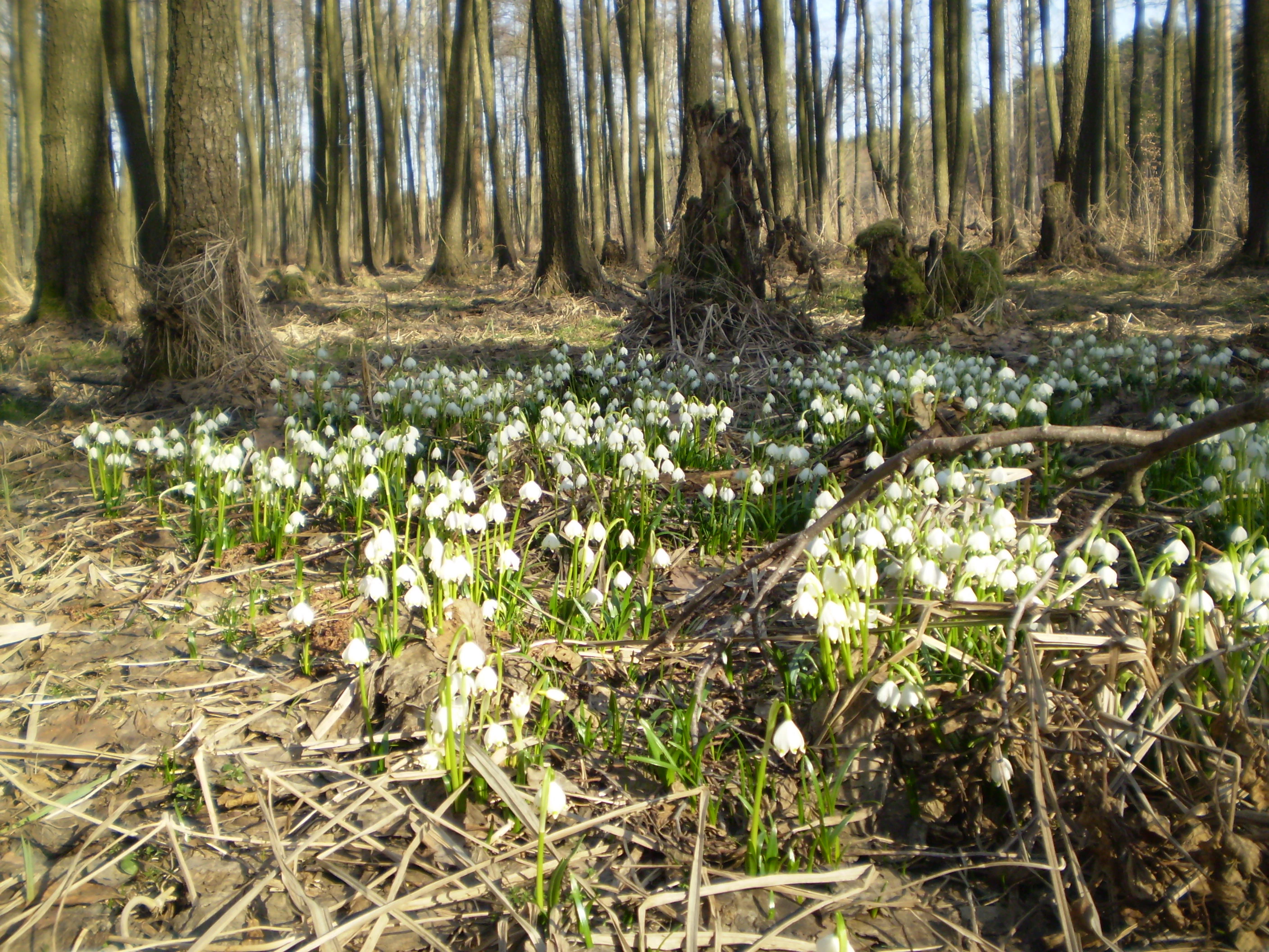
A dense cluster of small white spring snowflake flowers growing in a wooded area with dry leaves and tree trunks in the background.
A patch of spring snowflakes blooming on the forest floor in Roudnička a Datlík.

Roudnička a Datlík history and protected-area timeline

The two fishponds at the heart of the reserve, Roudnička and Datlík, have a long artificial history. They were originally constructed in 1469 on land that King George of Poděbrady (Jiří z Poděbrad) donated to the city of Hradec Králové. The ponds were subsequently drained in the first half of the nineteenth century during a wave of land reclamation, but later restored in 1897 to 1898. A year after the restoration, a new forester's lodge (hájovna) was built near the Datlík pond and remains in use to this day. In 1914, fish-holding and spawning ponds (sádky and třecí rybníčky) were constructed below the dam of Datlík for the production of fish stock; these structures are still present, though they have gradually become overgrown.

The surrounding meadows were traditionally managed by hand mowing, but this practice slowly declined through the twentieth century until active management essentially ceased at its end. Regular mowing under an approved management plan was finally reinstated in 2006. The site itself was first legally protected in 1988 as a chráněný přírodní výtvor (protected natural creation), later reclassified as a přírodní památka (natural monument), and re-declared in 2006 to resolve cadastral inconsistencies. Major habitat works followed: the Datlík pond was dredged in 2002, the Roudnička pond in 2005, both substantially restoring their ecological condition. Today the ponds and surrounding land are managed by Městské lesy Hradec Králové (the municipal forestry company).

Roudnička a Datlík landscape and geographic character

The reserve sits on a flat lowland stretch of the East Bohemian Table (Východolabská tabule), specifically the Královéhradecká kotlina basin, at elevations of roughly 240 to 250 meters. Most of the area lies on alluvial meadow soils developed over sandy to loamy Holocene river deposits, with chernozem-like and gley soils, and some cambisols on calcareous claystones and marlstones of Upper Cretaceous age, at the edges. Geomorphologically, the visible relief is gentle and dominated by the fishpond basins, their dams, and the surrounding floodplain.

Two fishponds, Roudnička on the west and Datlík on the east, define the spatial structure of the site, linked by a corridor of wet meadows and tussock sedge stands. Their dams are locally prominent: the road along the Roudnička dam marks the western boundary, while the Datlík dam and the adjacent Cikán pond dam bound the site to the east. The eastern edge transitions into the larger urban forest complex of Hradec Králové (Městské lesy Hradec Králové), while the southern flank sits directly against Roudnička village and other suburban development, and the northern edge borders intensively farmed fields. The landscape impression is therefore one of an intimate wetland mosaic tightly framed by human structures.
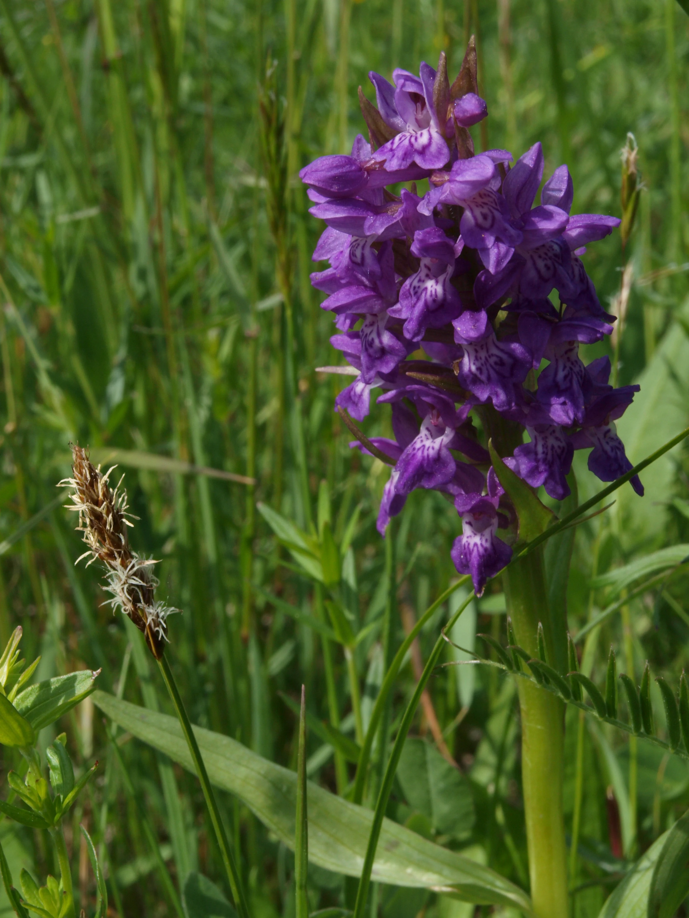
A close-up shot of a purple broad leaved marsh orchid blooming in a lush green grassy field.
A broad leaved marsh orchid (Dactylorhiza majalis) blooming in the wetland meadows of Roudnička a Datlík.

Roudnička a Datlík ecosystems, habitats, and plant life

The reserve encompasses a layered mosaic of lowland wetland habitats. Eutrophic reedbeds of common reed (Phragmites australis), cattails (Typha), and reed sweet-grass (Glyceria maxima) cover about 30 percent of the area along the littoral zones of both ponds. Between reed and meadow lie tall-sedge communities (M1.7) with tussock-forming species such as Carex appropinquata and Carex elata, which build raised hummocks, or bulty, above the water level. These tussocks are structurally and ecologically among the most important features of the site.

A further 15 percent consists of continental floodplain meadows, called bezkolencové louky after their dominant purple moor-grass (Molinia caerulea). These calcareous fen meadows harbor rare plants such as the orchid Dactylorhiza majalis, Allium angulosum, Carex davalliana, Succisa pratensis, Serratula tinctoria, Selinum carvifolia, and the late-summer bloomer Colchicum autumnale. Along the brooks, ash-alder floodplain woodland (L2.2) supports a striking spring flora of Leucojum vernum, Anemone nemorosa, Gagea lutea, Pulmonaria obscura, and Trollius altissimus. Aquatic vegetation in the ponds is limited due to fish stocking, but persists in the old spawning ponds, where Utricularia australis, Lemna trisulca, and Ceratophyllum demersum still grow.
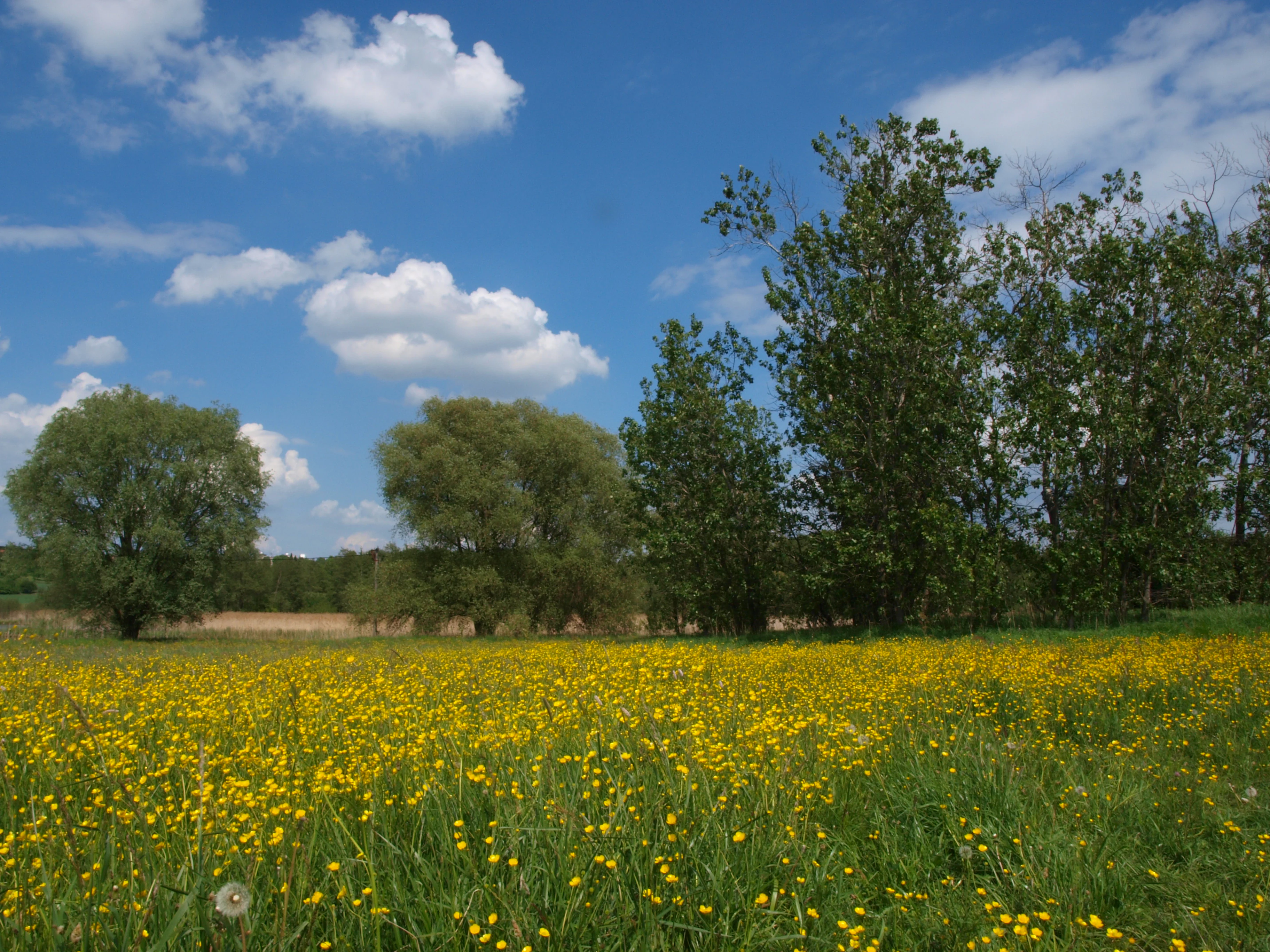
A meadow filled with yellow wildflowers under a blue sky with white clouds, bordered by trees on the right and left.
A flowering meadow at the Roudnička a Datlík Natural Monument.

Roudnička a Datlík wildlife and species highlights

The wetland habitats support a diverse and partly threatened fauna. The most famous resident is the rare land snail Vertigo angustior, which lives in the tussock sedge between the two ponds and was the primary reason for the Natura 2000 designation; another endangered snail, Perforatella bidentata, occurs alongside it. Mussels such as Anodonta cygnea persist in the ponds. Beetle fauna includes rare jewel beetles, longhorn beetles, and reed-dwelling leaf beetles, and around 62 butterfly species have been recorded, including the very rare Orthotaelia sparganella and Drepana curvatula, as well as the rare yarrow pug Eupithecia millefoliata and the bee Hylaeus pectoralis.

Wetland margins and meadows are rich in breeding and migrating vertebrates. Amphibians include critically endangered Pelobates fuscus, Hyla arborea, Bufo bufo, Bufo viridis, the green frog Rana kl. esculenta, and the alpine newt Ichthyosaura alpestris. The protected weatherfish Misgurnus fossilis reproduces in the Roudnička pond and its inflow. Nesting birds include the marsh harrier Circus aeruginosus and the grebes Podiceps cristatus and Tachybaptus ruficollis, while migration brings Phalacrocorax carbo, Anas clypeata, Anas strepera, Anas crecca, Circus cyaneus, Egretta alba, and Actitis hypoleucos, with Alcedo atthis regularly feeding at the ponds. In 2002 and 2003, the bittern Botaurus stellaris nested in the reedbeds. Reptiles include Zootoca vivipara and Natrix natrix, and bat detectors have recorded Myotis daubentonii and Nyctalus noctula above the ponds.
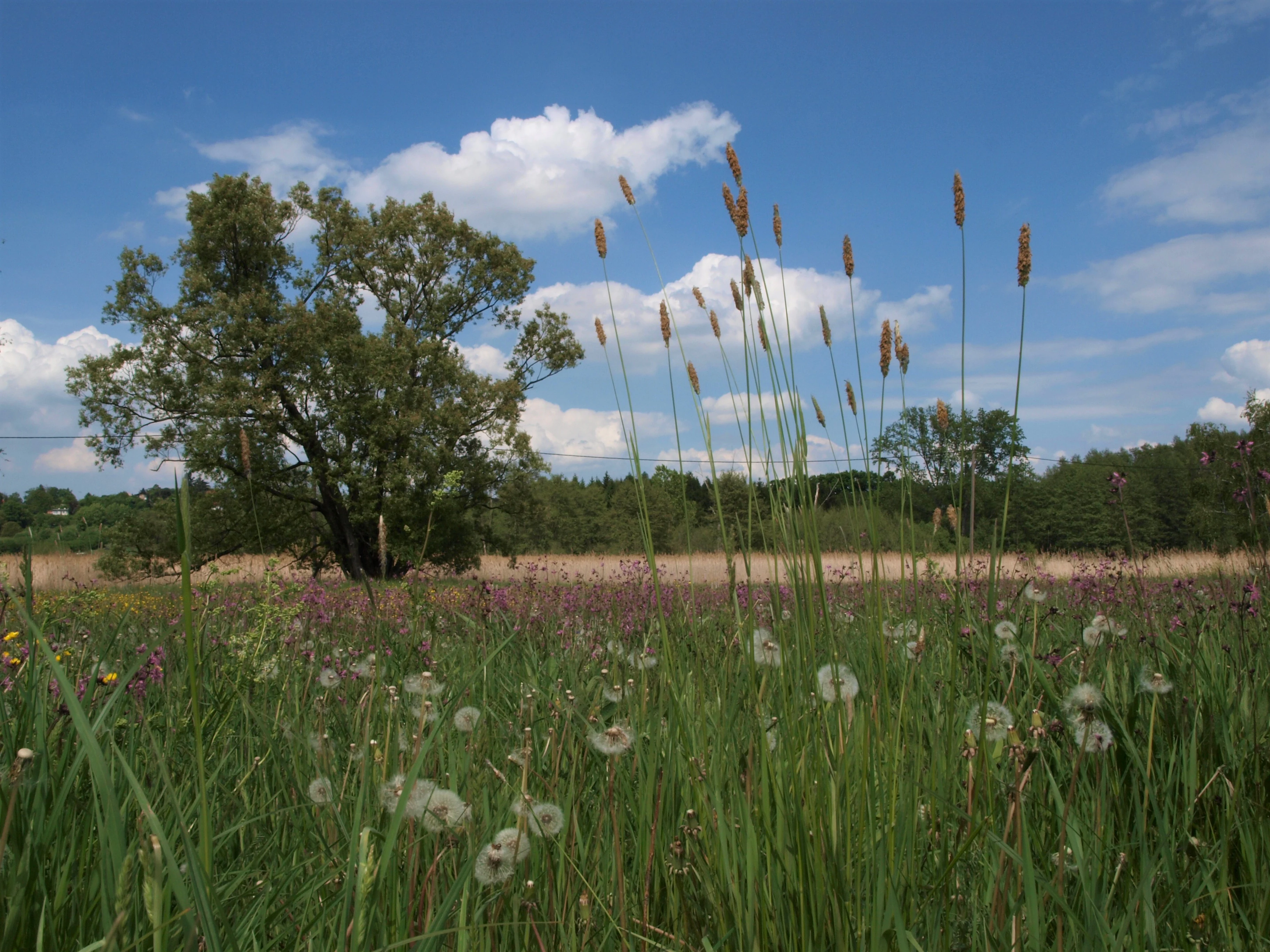
A low angle view of a lush green meadow filled with wildflowers and tall grasses under a blue sky with white clouds, featuring a large deciduous tree in the background.
A wet meadow landscape at the Roudnička and Datlík natural monument.

Roudnička a Datlík conservation status and protection priorities

Roudnička a Datlík is protected primarily because it conserves a small but unusually complete set of lowland wetland habitats in a landscape where they have otherwise been largely destroyed. The official IUCN classification is Category IV (Habitat/Species Management Area), meaning the central goal is to maintain habitat conditions for characteristic species and communities through targeted human intervention. The reserve is also part of the Natura 2000 network via the European site Slatinná louka u Roudničky, designated for mollusks and the fen meadow habitat type.

Active management is essential, because ongoing threats include drying out by drainage, eutrophication from semi-intensive fish farming, reed encroachment into abandoned meadows, and the spread of invasive plants. Management measures include rotational mowing of meadows with biomass removal, grazing by sheep and occasionally horses, mechanical and chemical control of Himalayan balsam and Japanese knotweed, planned removal of non-native poplar and spruce plantations, and detailed fish stocking regulations that ban fertilization, restrict supplementary feeding to 2,000 kilograms per hectare per year, and aim to exclude herbivorous species such as grass carp and silver carp while keeping total fish biomass below 1,000 kilograms per hectare. Pond harvesting is limited to a single autumn window. The estimated budget for managing the site under the current plan (2015 to 2024) is around 913,000 Czech crowns.

Roudnička a Datlík cultural meaning and human context

Culturally, the site is tied to several centuries of human management of both water and grassland. The ponds themselves were created in the medieval period as part of a fish-farming tradition introduced to Bohemia from monastic lands, and their repeated cycle of construction, drainage in the nineteenth century, and restoration at the end of that century reflects broader shifts in rural Bohamian land use, from artisanal fish cultivation to large-scale drainage and back to ecological restoration. The hay meadows around them were once the focus of regular hand-mowing by local farmers, a labor-intensive practice now partially revived as a conservation tool, while old forester's lodges and fish-holding structures still mark the cultural landscape. Today the area functions as a beloved suburban green space for residents of Hradec Králové's southern neighborhoods, where themed educational trails such as the Vodnická stezka and the Planetární stezka tie the natural monument into local recreation and learning.
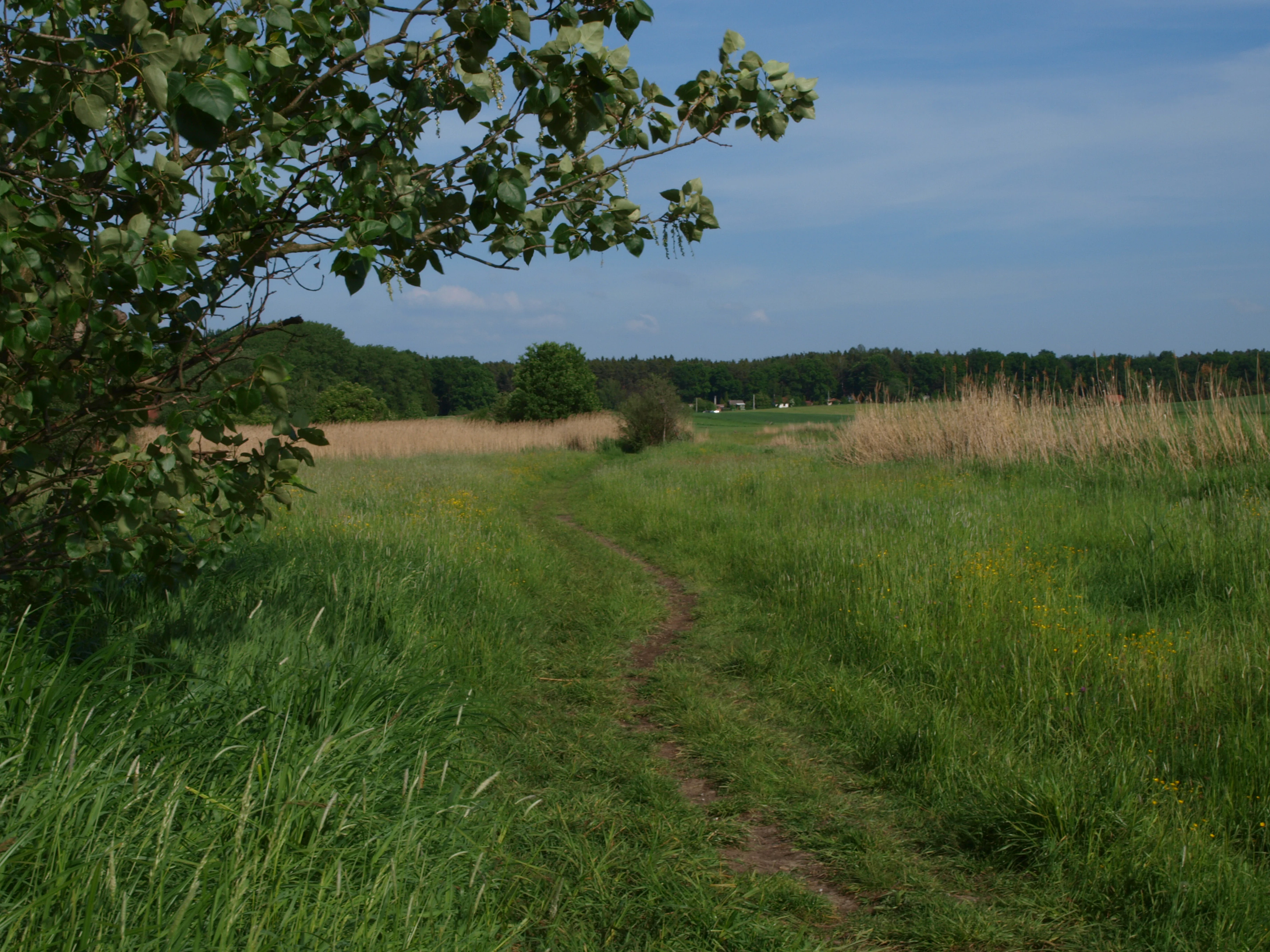
A narrow dirt path leads through green grassy wet meadows toward a line of trees and distant fields under a blue sky.
A dirt path winding through the wet meadow landscape of the Roudnička a Datlík natural monument.

Top sights and standout views in Roudnička a Datlík

Key highlights of Roudnička a Datlík include the rare tussock sedge stands with Vertigo angustior, the bezkolencové calcareous fen meadows with orchids, the historically significant Roudnička and Datlík fishponds, and the ash-alder floodplain woodland with a rich spring flora. The reserve is also notable for its accessibility, sitting just minutes from the southern suburbs of Hradec Králové yet sheltering amphibians, waterbirds, and a remarkable 62 recorded butterfly species in the middle of an intensively farmed lowland. Active conservation measures, from rotational mowing to invasive-species removal, make it a working example of small-scale wetland management in central Europe.
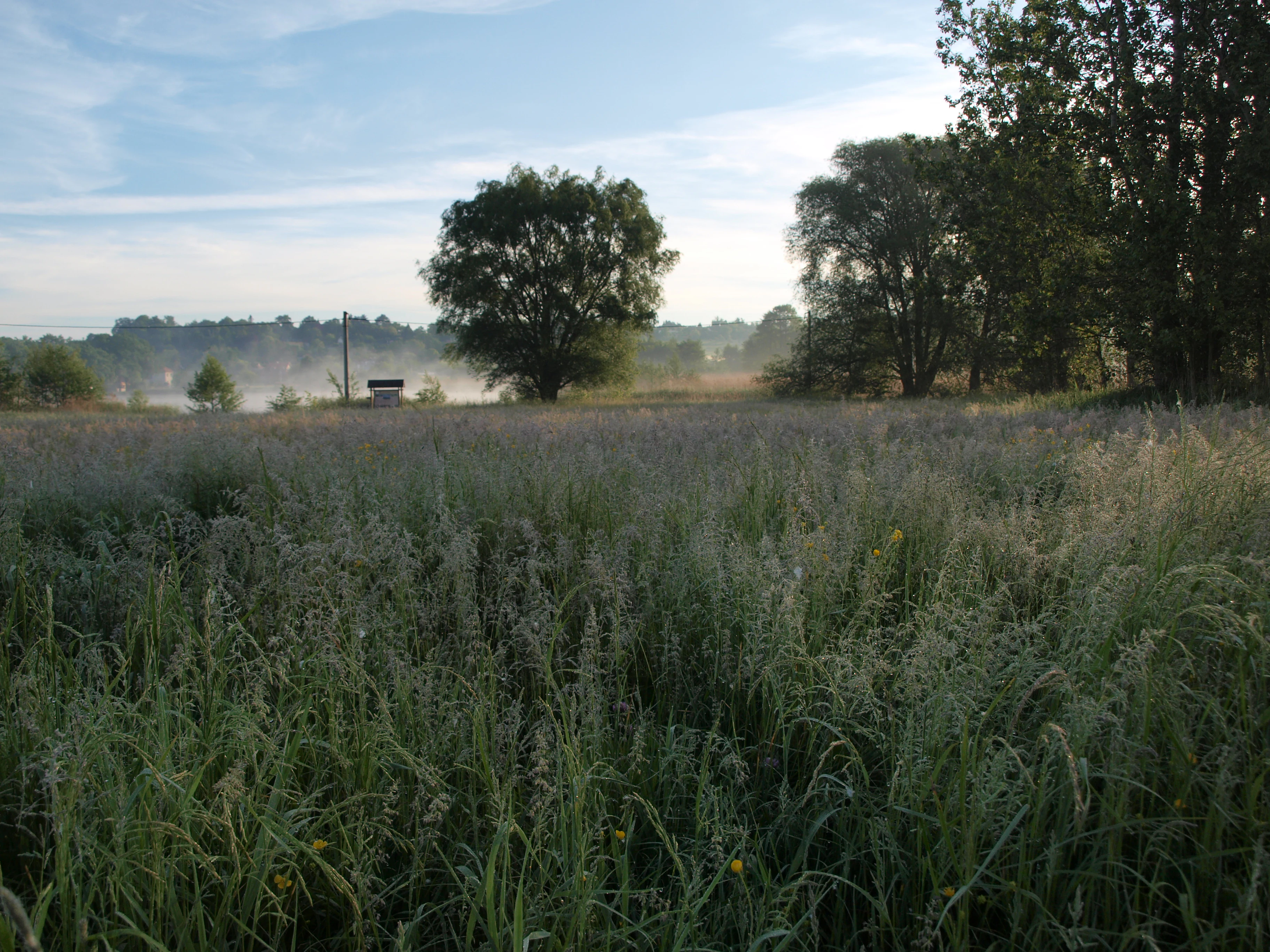
A wide view of a tall, dew-covered meadow in the foreground under a light morning mist, with scattered trees and a hint of a pond in the distance.
A misty morning scene over the wet meadows at Roudnička a Datlík Natural Monument.

Best time to visit Roudnička a Datlík

Late spring is often the most rewarding season for visiting, when the ash-alder floodplain woodland displays its characteristic spring flora of snowflakes, wood anemones, yellow star-of-Bethlehem, lungwort, and globeflowers, and the bezkolencové meadows are beginning their growing season. Early summer, around the May to June turning point, is the recommended mowing window for the meadows, so visits during this period catch the meadows at peak flowering, including the orchid Dactylorhiza majalis. Late summer and early autumn draw waterbirds as migration intensifies, with the regulated fishery harvest beginning in mid-August; on the other hand, wet meadows and reedbeds retain their green character well into autumn, when Colchicum autumnale adds a brief secondary bloom to the sward. Winters are short, mild, and drier, and the deciduous floodplain forest takes on a more open, walkable appearance along the dams.

Monthly climate preview

Track monthly precipitation averages and multi-year temperature cycles for this protected landscape

Roudnička a Datlík climate normals and long-term temperature patterns

Historical climate records for Roudnička a Datlík illustrate a measured annual rhythm of low winter minimums and warm summer maximums alongside steady daily precipitation rates. Analyzing these representative coordinate normals provides valuable context for understanding local temperature variations across the protected area.
Annual mean8 °C
-3 °C20 °C
Jan-3°
Feb-1°
Mar
Apr
May13°
Jun17°
Jul20°
Aug19°
Sep14°
Oct
Nov
Dec-1°
Warmest month
July

19.6 °C

Coolest month
January

-2.8 °C

Wettest month
July

2.8 mm/day

Driest month
April

1.2 mm/day

Park location guide

Geography guide, regional context, and park location map for Roudnička a Datlík

Roudnička a Datlík park geography, regions, and map view in Czechia

Understand where Roudnička a Datlík sits in Czechia through a broader geographic reading of the surrounding landscape, nearby location context, and its mapped position within the national park landscape.

How Roudnička a Datlík fits into Czechia

Czech Republic is a landlocked Central European country with a population of approximately 10.9 million people. The nation was established as an independent state on January 1, 1993, following the dissolution of Czechoslovakia. Its capital and largest city is Prague, with other major urban centers including Brno, Ostrava, Plzeň, and Liberec.

Wider geography shaping Roudnička a Datlík in Czechia

The Czech Republic is a landlocked country in Central Europe. It is bordered by Germany to the west, Austria to the south, Poland to the northeast, and Slovakia to the southeast. The landscape is predominantly hilly, with the territory covering 78,871 square kilometers.

Map view of Roudnička a Datlík

Use this park location map to pinpoint Roudnička a Datlík in Czechia, understand its exact geographic position, and read its mapped placement within the surrounding landscape more clearly.

Pigeon | © OpenStreetMap contributors

Location context for Roudnička a Datlík

Královéhradecký kraj

Visual exploration of fishponds, fen meadows, and lowland habitats

Roudnička a Datlík Photos and Protected Wetland Landscapes

Photographic records reveal the distinct mosaic of fishponds, calcareous fen meadows, and ash-alder woodlands defining the protected environment of Roudnička a Datlík. Visual documentation provides clear insight into the delicate lowland habitats, wetland terrain, and diverse ecological features shaping the reserve.

A dense cluster of small white spring snowflake flowers growing in a wooded area with dry leaves and tree trunks in the background.

A great crested grebe swimming on the surface of calm water, leaving a small wake behind it.

A close-up shot of a purple broad leaved marsh orchid blooming in a lush green grassy field.

A meadow filled with yellow wildflowers under a blue sky with white clouds, bordered by trees on the right and left.

A low angle view of a lush green meadow filled with wildflowers and tall grasses under a blue sky with white clouds, featuring a large deciduous tree in the background.

A small, dark-watered stream flows through a leafless deciduous forest with brown ground cover, indicative of early spring.

A narrow dirt path leads through green grassy wet meadows toward a line of trees and distant fields under a blue sky.

A wide view of a tall, dew-covered meadow in the foreground under a light morning mist, with scattered trees and a hint of a pond in the distance.

A wide view of a calm pond with tall dry reeds and grasses in the foreground on the right; the background features a grassy shoreline with distant trees and a few small buildings.

A group of slender deciduous trees standing in a green meadow with a clear blue sky above.

A wide angle view of the Roudnička pond with dry reeds in the foreground and a line of deciduous trees reflected on the water surface.

A small rectangular nursery pond with dark water, surrounded by low wooden fencing and dry reeds, reflecting bare trees in the background during late winter.

Park atlas

Compare adjacent wetland reserves, fen meadows, and lowland conservation habitats.

Parks Near Roudnička a Datlík and Protected Areas in the Surrounding Region

Browse other protected areas near Roudnička a Datlík to compare regional wetland reserves and lowland habitats. Examining adjacent conservation landscapes provides valuable context for regional biodiversity patterns.
Watercolor painting of a landscape featuring soft green hills, coniferous trees, and low-lying wetland vegetation in shades of pink and green.
Nature reserveKrálovéhradecký kraj
About 2.4 km away#1 closest

Northeast

Na Plachtě 3 Nature Reserve: Mapped Protected Landscapes in the Královéhradecký kraj

Explore the diverse sandy habitats and protected terrain of this Czech natural monument

Na Plachtě 3 represents a critical protected enclave in the Královéhradecký kraj, characterized by its mosaic of dry heaths, open sand patches, and peat meadows. This lowland site provides essential hibernation grounds for amphibians and invertebrates, maintaining a rich biological profile that contrasts with the urban-adjacent geography of Hradec Králové. Analyze its protected boundaries, geological history, and early successional landscape character through detailed mapping.

Area
0.17 km²
Established
2012
IUCN
IV
Relief
Lowland
A horizontal watercolor illustration depicting a soft, rolling landscape with clusters of green trees against a pale, light-colored background.
Nature reserveCzechia
About 2.4 km away#2 closest

Northeast

Na Plachtě Nature Reserve: Mapped Wetlands and Conservation Geography in Czechia

Urban-edge wetland mosaic with ponds and peat meadows

Located in eastern Bohemia, the Na Plachtě nature reserve encompasses a 39-hectare landscape of ponds, marshland, and sandy patches. This important Natura 2000 protected area offers a deep look into specialized amphibian and insect habitats, maintained through active management and community-led conservation efforts.

Area
0.388 km²
Established
2013
Scope
Terrestrial
Water
Major water bodies
Natural monumentKrálovéhradecký kraj
About 18 km away#3 closest

North

Vražba Natural Monument: Botanical Geography and Protected Lands in Královéhradecký Kraj

A rare habitat for critically endangered Central European flora.

Vražba is a specialized protected area located in the Královéhradecký region, designated primarily to stabilize populations of the critically endangered ladybells. Its landscape consists of managed woodland edges and semi-open grassland patches, creating a highly specific environment for rare botanical communities. This site stands as a prime example of targeted habitat management within the broader Czech protected-area network.

Area
0.078 km²
Established
2011
IUCN
III
A soft watercolor illustration of a winding stream flowing through green meadows and trees with distant low hills in the background.
Natural monumentPardubice Region
About 23 km away#4 closest

Southwest

Meandry Struhy Natural Monument: A Case Study in Elbe Lowland Stream Geography

Riparian forests and winding stream channels in Pardubice Region.

Meandry Struhy stands as a significant natural monument in the Pardubice Region, protecting the unique geomorphology of a freely meandering stream. The area provides a rare look at undisturbed riparian galleries, floodplain forests, and vital nesting habitats for lowland bird species. This protected landscape offers a clear view into the ecological processes of the Elbe lowlands, where natural watercourse behavior continues to shape the local environment.

Area
0.402 km²
Established
1980
IUCN
IV
Relief
Lowland
An illustrative style digital painting of a tranquil park scene with a lake in the foreground, a path along the bank, and mountains in the distance, depicted with a muted, pastel-toned color palette.
Protected landscapeChrudim District
About 28 km away#5 closest

Southwest

Přírodní park Heřmanův Městec: Geographic Profile and Protected Landscape Boundaries

Tracing the elevation transitions of the Chrudim District foothills

This protected landscape in the Chrudim District merges man-made baroque vistas with natural oak woodlands. The park terrain rises over 100 metres from water-side flats to forested ridges, providing a distinct study in regional geology and calcareous soil habitats that support rare beetle and bat populations.

Area
3.41 km²
Established
1996
Relief
Mixed relief
Climate
Temperate
Natural monumentKrálovéhradecký kraj
About 29 km away#6 closest

Northwest

Veselský háj Natural Monument: Geographic Boundaries and Protected Landscape Context

Lowland forest and wetland mosaic in the Czech Republic

Veselský háj stands as a key natural monument in the Královéhradecký kraj region; characterized by its well-preserved oak-hornbeam woodland and diverse botanical assemblages. The site offers a window into the structure of Bohemian lowland ecosystems, where rare species like the Siberian iris and violet helleborine thrive within a matrix of ancient forest and open water. Explore the boundaries and topographic features of this significant protected terrain.

Area
442.71 km²
Established
1998
IUCN
III
Relief
Lowland
Natural monumentKrálovéhradecký kraj
About 31 km away#7 closest

West

Víno Natural Monument: Mapped Protected Landscapes and Geographic Overview

Protected oak and hornbeam forest in eastern Bohemia

Víno Natural Monument is a significant protected area within the Královéhradecký kraj region, focused on the conservation of century-old broadleaf woodland. This location preserves essential deadwood microhabitats and diverse plant species, offering a clear example of lowland forest ecology integrated into the cultivated landscape of eastern Bohemia.

Area
0.725 km²
Established
2013
IUCN
III
Relief
Lowland
A soft watercolor painting of a river landscape with rolling hills, grassy riverbanks, and light green vegetation under a pale sky.
Protected landscapePardubický kraj
About 40 km away#8 closest

Southwest

Přírodní park Doubrava Protected Landscape and River Valley Geography

A detailed map-based overview of the Doubrava River protected corridor in the Czech Republic.

Navigate the linear terrain of Přírodní park Doubrava, where natural riverine habitats meet industrial heritage in the Pardubický kraj. The area features a significant water tunnel, rocky banks, and a historic quarry-stone dam, creating an ecologically rich corridor that bridges the gap between the Bohemian-Moravian Highlands and the Iron Mountains.

Area
0.65 km²
Established
1998
Relief
Upland
Climate
Temperate

Common questions about visiting, size, designation, and location context for Roudnička a Datlík

Roudnička a Datlík FAQs for park facts, access, geography, and protected area context

Find quick answers about Roudnička a Datlík, including protected-area facts, park geography, trail and visitor context, and how the park fits into its surrounding country and regional landscape.
MoriAtlas Explorer

Continue Your Protected Areas Search Across the Global Atlas

Deepen your exploration by continuing the structured search for national parks and protected areas worldwide. Utilize the comprehensive filtering capabilities to compare different conservation landscapes and refine your understanding of global park geography. Discover more about the distribution and characteristics of protected natural areas.

Global natural geography