
Mori Atlas logo
Natural monumentRudice – Seč

Analyzing the Cretaceous sedimentary layers, mineral geodes, and recovering quarry ecosystems of the Drahanská vrchovina

Rudice – Seč Natural Monument: A Geological and Ecological Protected Area Atlas Map

(Přírodní památka Rudice – Seč)

Rudice – Seč represents a rare convergence of geological heritage and early-successional ecology within the Moravian Karst. This site features the only surface exposure of Lower Cretaceous Rudice layers, revealing complex sedimentary sequences, iron minerals, and silica geodes set within an abandoned quarry landscape. The terrain now supports mosaic habitats, including standing-water pools and pioneer-type vegetation, offering deep insights into the geomorphological development of the Rudice Plateau.

quarrygeological monumentLower CretaceousfossilsMoravian Karstkarst landscape
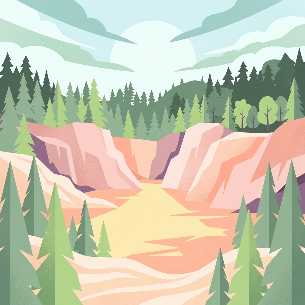
A stylized digital illustration of a quarry with light-colored rock faces surrounded by coniferous forest under a soft, pale sky.

Rudice – Seč

Natural monument

Park overview

Structured park overview, official facts, and landscape profile for Rudice, Seč

Rudice, Seč park facts, protected area profile, and essential visitor context

Review the core facts for Rudice, Seč, including designation, size, terrain, visitor scale, habitats, and operating context in one park-focused overview.

About Rudice, Seč

Rudice – Seč is a compact natural monument that combines geological heritage with recovering biological communities in a single site. It is located in the southwestern part of the village of Rudice, in the Blansko District of the South Moravian Region, and sits within the broader Moravian Karst Protected Landscape Area. The reserve was officially declared on 5 July 2022 by the Nature Conservation Agency of the Czech Republic, fulfilling long-standing calls to protect the unique geological section exposed by decades of quarrying.

At the heart of the reserve is the former quarry of Seč, which operated until 2018 as a small source of glass and foundry sands. Although industrial extraction has ceased, the quarry walls still expose a geological sequence that has no known equivalent elsewhere in the region. The Lower Cretaceous Rudice layers, formed as deep sinkhole fills in a karstic land surface, preserve evidence of tropical weathering and reveal the transition between iron-rich chemical sediments and overlying kaolinitic sands, sandstones, and clays. The protection targets for the site include these Rudice layers together with the oxidic iron ores, silica minerals, fossils, and the karstic depression morphology that hosts them.

Beyond its geology, Rudice – Seč is also an ecological refuge. The flooded quarry floor supports characteristic pond vegetation and provides habitat for a strong population of the fire-bellied toad along with several other amphibian species and reptiles. The exposed sand and clay surfaces have returned to a sparse, pioneer state that is now actively managed as part of the conservation objectives. The result is a small but unusually information-rich site where sedimentology, mineralogy, paleontology, and early-succession ecology meet within a working cultural landscape.

Quick facts and research context for Rudice, Seč

Rudice – Seč is a Czech přírodní památka (natural monument), IUCN Category III, declared on 5 July 2022 by the Nature Conservation Agency of the Czech Republic. It covers approximately 6.96 hectares in the cadastral territory of Rudice u Blanska, at an elevation of roughly 506 to 522 meters above sea level. The site lies within the Drahanská vrchovina, in the geomorphological subunit known as the Moravian Karst, and is fully contained within the Moravian Karst Protected Landscape Area in the Blansko District of the South Moravian Region.

Park context

Deeper park guide and search-rich context for Rudice, Seč

Rudice, Seč history, landscape, wildlife, and travel context

Explore Rudice, Seč through its history, landscape character, ecosystems, wildlife, conservation priorities, cultural context, and seasonal travel timing in a structured park guide built for atlas discovery and search intent.

Why Rudice, Seč stands out

Rudice, Seč is best known as the only surface exposure of the Rudice layers, a Lower Cretaceous sedimentary sequence that fills deep depressions in the underlying karstic relief. These depressions are interpreted as some of the oldest karstification features in the Moravian Karst, sometimes referred to as geological organ pipes. The layers contain iron-rich limonitic and hematitic concretions, kaolinitic quartz sands, and abundant siliceous geodes lined with rock crystal, milky quartz, and occasionally amethyst, chalcedony, or carnelian. They are also paleontologically valuable, yielding fossils of ammonites, sea urchins, bivalves, and sponges. The reserve is further recognized for the early-successional pond and sandy-substrate ecosystems that have developed inside the abandoned quarry floor.
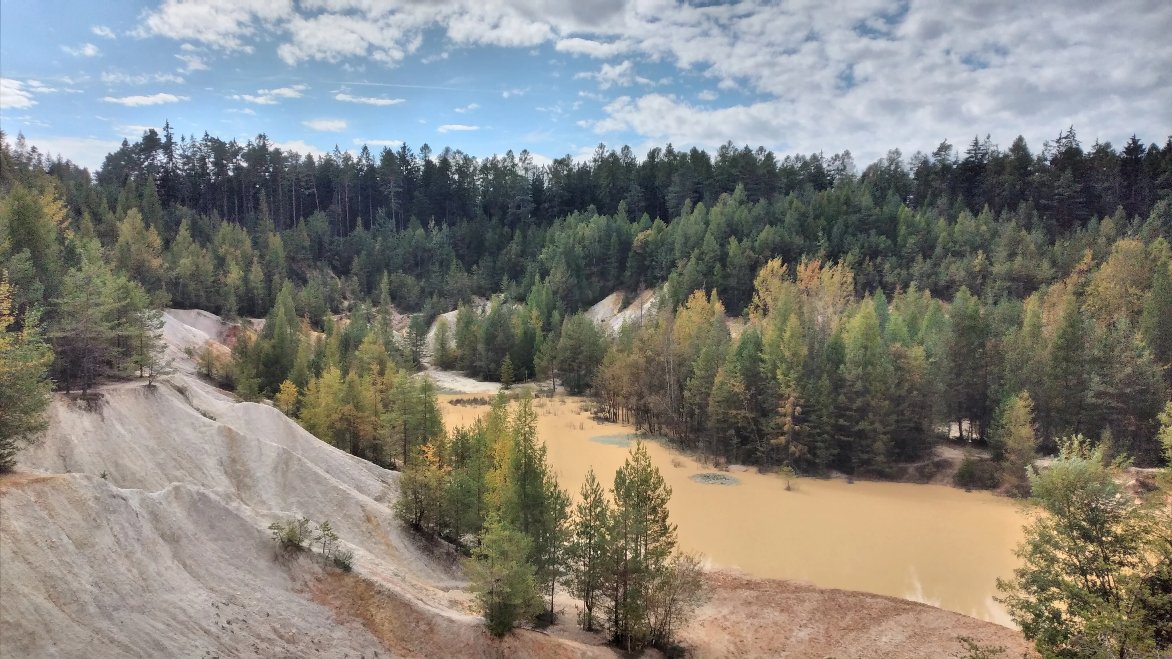
A high-angle view of a former quarry featuring a light-colored sandy basin and a shallow, murky pond surrounded by dense coniferous and deciduous forest under a partly cloudy sky.
The former kaolin quarry at Rudice, Seč, characterized by its unique sediment colors and surrounding forest.

Rudice, Seč history and protected-area timeline

Although formal protection dates only to 5 July 2022, the history of the Rudice – Seč site extends far back into the human use of the Moravian Karst. The iron ores embedded in the Cretaceous sediments were already exploited during the Hallstatt period, during the earlier Iron Age in central Europe, and continued to be worked in the Early Middle Ages. Mining for iron was therefore one of the earliest extractive uses of the locality.

In more recent centuries, the same area was turned into a sand quarry. Production focused on glass sands and foundry sands, with output used by the regional glass and metalworking industries. Quarrying was occasional rather than continuous during the final ten years before closure, and the operation finally shut down in 2018. Once extraction stopped, water accumulated in the quarry floor and the bare rock and sediment surfaces were left to natural succession.

The closure also exposed new conservation problems. The quarry pools and clearings became informal recreation sites, with illegal camping, motocross, and cyclocross activities damaging the recovering vegetation and walls. Collectors searching for geodes and children playing in the quarry also caused breaks and erosion of the exposed sections. In response, the Nature Conservation Agency of the Czech Republic declared the area a přírodní památka, or natural monument, in 2022, formally securing the geological formations, minerals, fossils, and the early-successional ecosystems for long-term protection.

Rudice, Seč landscape and geographic character

Rudice – Seč lies within the Drahanská vrchovina, a highland region carved into the northern edge of the Moravian Karst. Within the Czech geomorphological classification, the site belongs to the subunit of the Moravian Karst and to the smaller unit known as the Rudická plošina, or Rudice Plateau. The reserve sits between roughly 506 and 522 meters above sea level, on a gently elevated terrain typical of this part of the Moravian Karst.

The defining surface feature of the site is the quarry itself. The quarry walls cut through the Cretaceous sedimentary fill of deep karstic depressions and through the underlying carbonate rocks, exposing alternations of iron-rich horizons, kaolinitic quartz sands, sandstones, clays, and loess-like cover sediments. Small patches of Devonian limestone appear at the eastern edge of the quarry, marking the older karstic basement.

Inside the quarry, the landscape takes on a clearly anthropogenic but rapidly recovering character. The floor has been reshaped into a series of shallow standing-water pools, interspersed with bare sandy and clayey banks, debris cones, and partially vegetated slopes. The combination of exposed quarry walls, flooded depressions, and open mineral substrates gives the site a distinctive mosaic appearance unusual within the otherwise well-vegetated karst landscape.

Rudice, Seč ecosystems, habitats, and plant life

Although Rudice – Seč is small, it preserves two ecologically distinct habitats that are explicitly included in the conservation objectives. The first consists of the standing-water pools in the quarry floor, which support macrophyte vegetation typical of naturally eutrophic and mesotrophic waters. The management goal is to maintain early-successional stages of these communities across a defined share of the water surface.

The second habitat is a pioneer community developed on the sandy and shallow-soil surfaces of the former quarry floor. These are open, sparsely vegetated substrates colonized by grasses, mosses, and specialist plants adapted to nutrient-poor, mineral-rich exposed ground. The conservation plan seeks to maintain most of this habitat free of woody vegetation and a significant share free of herbaceous vegetation, in order to preserve the open, early-successional character.

The climate context for these ecosystems is moderately warm. In the Quitt climate classification, the area lies in unit MT10, with January temperatures around minus two to minus three degrees Celsius, July temperatures around seventeen to eighteen degrees Celsius, and annual precipitation of roughly 600 to 700 millimeters. About forty to fifty summer days and roughly 110 to 130 frost days occur each year, with snow cover persisting for fifty to sixty days annually.

Rudice, Seč wildlife and species highlights

Wildlife at Rudice – Seč is closely tied to the quarry pools and the surrounding mineral substrates. The most prominent species is the fire-bellied toad, which maintains a stable population of tens of individuals in the quarry and is one of the named subjects of protection for the site. The same pools support several other amphibians, including the smooth newt, the Alpine newt, the common toad, the European green toad, the European tree frog, the common frog, and the agile frog.

Reptiles are also part of the quarry fauna, with observations of the sand lizard, the slow worm, and the grass snake. Among birds and mammals, the raven and the red squirrel have been recorded in or around the protected area. Insect life in the quarry is diverse but largely opportunistic: occasional sightings include the violet oil beetle, the Old World swallowtail, small ground beetles such as Brachinus explodens and Cicindela sylvicola, the blister beetle Celidus humeralis, and flea beetles of the genus Longitarsus, with two species recorded locally. Together, these observations reflect a recovering but already structured community typical of disturbed mineral habitats in central European karst landscapes.

Rudice, Seč conservation status and protection priorities

Rudice – Seč was established to safeguard a unique combination of geological and biological values in a very small area. The principal conservation targets are the Rudice layers themselves, the oxidic iron ores found within them, the siliceous and iron-bearing mineral assemblages, the associated fossils, and the underlying karstic depression morphology. The aim is to preserve these features intact, without further excavation of the quarry floor or walls.

Beyond the geological protection, the reserve also explicitly protects two ecological subjects: the early-successional vegetation of the quarry pools and the pioneer plant communities of the exposed sandy and shallow soils. Defined target areas and vegetation thresholds are set for each, ensuring that the open character of the quarry floor is maintained rather than allowed to mature into scrub or woodland.

The site sits within the Moravian Karst Protected Landscape Area, which provides an additional layer of regional protection. This wider framework means that Rudice – Seč is not only a local geological monument but also a component of a larger conservation landscape that includes some of the most important karst systems in the Czech Republic.

Rudice, Seč cultural meaning and human context

The cultural context of Rudice – Seč is bound up with the long human exploitation of iron and mineral resources in the Moravian Karst. Hallstatt-period and Early Medieval iron mining in the area marks the quarry as one of the older continuously used extractive sites in the region, predating the industrial extraction of sands by many centuries. The later quarry, which operated until 2018, belongs to the broader Czech tradition of small, regionally focused sand pits that supplied local glassworks and foundries.

The current situation also reflects a more recent cultural shift. After closure, the site became a focus for informal recreation, including illegal camping, motocross, and geode collecting, prompting the formal protection of 2022. The reserve therefore stands at the intersection of industrial heritage, grassroots recreational use of the landscape, and modern nature conservation practice in the Czech Republic.

Top sights and standout views in Rudice, Seč

Rudice – Seč offers a rare compact combination of Lower Cretaceous sediments, karstic geomorphology, and recovering post-industrial ecosystems. Its most distinctive features are the only known surface exposure of the Rudice layers, the abundant geodes of rock crystal and milky quartz within the quarry sands, and the fire-bellied toad population supported by the flooded quarry floor. The site also stands out for its clearly defined conservation targets that preserve both geological heritage and pioneer ecosystems side by side.

Best time to visit Rudice, Seč

The most favorable conditions for visiting Rudice – Seč are typically in late spring and summer, when the quarry pools are biologically most active and the early-successional vegetation is at its most visible. Amphibians, including the protected fire-bellied toad, are easiest to observe around the ponds during warmer months. Cooler seasons still allow appreciation of the rock exposures and mineralogy, but biological interest is reduced, and snow or ice can limit safe access to the quarry floor. Because the reserve is a working protected site, any visit should minimize disturbance to the exposed sections and to the recovering vegetation.

Monthly climate preview

Long-term monthly temperature and precipitation rhythm across representative park coordinates

Rudice – Seč climate normals and average temperature patterns

Representative coordinates for Rudice – Seč record measurable shifts in mean temperature and daily precipitation across twelve distinct intervals. Detailed twelve-month climate normals provide complete statistical context for long-term regional weather patterns.
Annual mean8 °C
-4 °C19 °C
Jan-4°
Feb-2°
Mar
Apr
May13°
Jun17°
Jul19°
Aug19°
Sep14°
Oct
Nov
Dec-2°
Warmest month
July

19.3 °C

Coolest month
January

-3.7 °C

Wettest month
July

2.7 mm/day

Driest month
February

1.2 mm/day

Park location guide

Geography guide, regional context, and park location map for Rudice, Seč

Rudice, Seč park geography, regions, and map view in Czechia

Understand where Rudice, Seč sits in Czechia through a broader geographic reading of the surrounding landscape, nearby location context, and its mapped position within the national park landscape.

How Rudice, Seč fits into Czechia

Czech Republic is a landlocked Central European country with a population of approximately 10.9 million people. The nation was established as an independent state on January 1, 1993, following the dissolution of Czechoslovakia. Its capital and largest city is Prague, with other major urban centers including Brno, Ostrava, Plzeň, and Liberec.

Wider geography shaping Rudice, Seč in Czechia

The Czech Republic is a landlocked country in Central Europe. It is bordered by Germany to the west, Austria to the south, Poland to the northeast, and Slovakia to the southeast. The landscape is predominantly hilly, with the territory covering 78,871 square kilometers.

Map view of Rudice, Seč

Use this park location map to pinpoint Rudice, Seč in Czechia, understand its exact geographic position, and read its mapped placement within the surrounding landscape more clearly.

Pigeon | © OpenStreetMap contributors

Location context for Rudice, Seč

Jihomoravský kraj

Explore photographic records of exposed geological layers, quarry terrain, and recovering habitats.

Rudice – Seč Photos and Landscape Scenery: Visualizing the Protected Area

Visual documentation captures the distinctive topography, exposed mineral layers, and wetland micro-environments of Rudice – Seč. Examining high-resolution landscape photography provides deeper insight into the geological features and pioneer ecosystems preserved within the protected monument.

A high-angle view of a former quarry featuring a light-colored sandy basin and a shallow, murky pond surrounded by dense coniferous and deciduous forest under a partly cloudy sky.

Park atlas

Compare adjacent geological monuments and regional conservation areas in the Drahanská vrchovina highlands.

Explore Other Parks Near Rudice – Seč and Surrounding Protected Landscapes

Browsing other parks near Rudice – Seč provides immediate context on the surrounding karstic terrain and protected reserves. Comparing adjacent protected areas helps evaluate regional geological formations and natural habitats across the wider plateau.
Watercolor illustration of a karst landscape featuring hills, a lake, and cave-like rock formations with green vegetation
Protected landscapeSouth Moravian Region
About 6.2 km away#1 closest

South

Moravian Karst Protected Landscape: Detailed Geographic and Cave System Atlas

Mapped protected boundaries and karst phenomena in the South Moravian Region.

Moravian Karst, designated a Protected Landscape Area, offers a profound look into complex karst geology within the South Moravian Region. This entry within MoriAtlas facilitates a structured discovery of its approximately 92 square kilometers, featuring an intricate network of over 1,100 caves and gorges. Users can explore the mapped extent of this geological treasure, understand its relationship with the surrounding regional geography, and appreciate the unique formations sculpted by underground water systems, including the iconic Macocha Abyss.

Area
92 km²
IUCN
V
Scope
Terrestrial
Water
Minor water
A soft watercolor illustration depicting a panoramic view of rolling green hills, distant light purple mountain ridges, and a central valley stream.
Protected landscapeCzechia
About 10 km away#2 closest

Southeast

Přírodní park Říčky: Protected Landscape and Highland Geography in Czechia

Deep exploration of stream-carved valleys and karst-influenced terrain.

Přírodní park Říčky preserves a vital transitional environment within the Drahanská vrchovina highlands. This protected area integrates diverse ecosystems, including upland beech enclaves and orchid-rich wet meadows, tied together by a complex network of springs and streams that carve through the sedimentary and limestone geology of the region.

Area
30.05 km²
Established
1984
Relief
Upland
Climate
Temperate
Natural monumentJihomoravský kraj
About 12 km away#3 closest

Southwest

Soběšické rybníčky Natural Monument: A Detailed Geographic Atlas of the Jihomoravský kraj Forest Ponds

Mapping the protected wetland terrain and amphibian breeding landscapes of central Moravia.

Explore the geographic and conservation profile of Soběšické rybníčky, a protected forest monument in the Czech Republic. The site represents a vital wetland network that maintains stable amphibian populations within a dense, shaded valley setting of the Soběšice Highlands, offering a focused look at small-scale protected landscape management.

Area
0.012 km²
Established
1987
IUCN
IV
Relief
Upland
Nature reserveJihomoravský kraj
About 13 km away#4 closest

South

Velká Klajdovka Nature Reserve: Steppe and Forest-Steppe Landscape in Jihomoravský Kraj

Ecologically rich protected limestone slopes and terrain near Brno

Velká Klajdovka is a protected natural monument distinguished by its high-value thermophilic vegetation and complex soil structures. Located on the flank of the Hády massif, the reserve offers a unique study of forest-steppe mosaics, rare entomological diversity, and dry oak woodlands that thrive on the boundary of varied geological substrates.

Area
0.09 km²
Established
1988
IUCN
IV
Relief
Upland
A minimalist watercolor illustration showing rolling green hills and a few trees against a pale yellow and pink background.
Protected landscapeCzechia
About 15 km away#5 closest

Southwest

Přírodní park Baba: A Detailed Geographic Overview of this Czech Protected Landscape

Forested ridges and centuries-old oak woodland topography

Přírodní park Baba is a protected area in Czechia characterized by a continuous six-kilometer ridge rising above the surrounding urban landscape of Brno. This site is defined by its deep-rooted, century-old sessile oak stands and an intricate mosaic of meadows supporting rare orchid species and diverse avian life. Its geological foundation, composed of Paleozoic diorite, supports a resilient ecosystem that serves as a vital natural corridor between Brno and Kuřim.

Area
8.89 km²
Established
1990
Relief
Mountain
Climate
Temperate
A soft watercolor painting showing a rolling landscape with hills, scattered trees, and rocky outcrops, rendered in pastel greens and pinks.
Natural monumentBrno
About 15 km away#6 closest

Southwest

Medlánecká skalka Natural Monument: Mapped Protected Landscapes and Geography in Brno

A rare urban-adjacent steppe and rocky habitat site

Medlánecká skalka is a protected natural monument located in the Medlánky district of Brno, Czech Republic. Spanning a small but significant rocky slope, this site preserves thermophilous dry-grassland communities and essential habitats for rare flora like the Pulsatilla grandis. Its unique topography and skeletal soil composition make it an important geographic reference point for understanding steppe-like ecosystems in the South Moravian region.

Area
0.003 km²
Established
1999
IUCN
IV
Relief
Upland
A horizontal watercolor painting showing rolling green hills with small patches of trees under a soft, pale sky.
Natural monumentJihomoravský kraj
About 15 km away#7 closest

Southwest

Medlánecké kopce Natural Monument: Exploring Protected Steppe Habitats in Northern Brno

A rare mosaic of dry grasslands and rocky outcrops in Jihomoravský kraj

Medlánecké kopce preserves a critical landscape of thermophilic flora and insect communities on the edge of the Brno basin. The site is noted for its xerothermic vegetation, including the large-flowered pasqueflower, which thrives on its unique metabasite and loess soil composition. This protected area offers a look at how specialized steppe ecosystems persist within a heavily developed regional environment.

Area
0.118 km²
Established
1988
IUCN
IV
Relief
Upland
Natural monumentJihomoravský kraj
About 16 km away#8 closest

South

Velatická slepencová stráň: A Protected Natural Monument in South Moravia, Czech Republic

Mapping the rare steppe vegetation and conglomerate geology of Jihomoravský kraj.

Velatická slepencová stráň serves as a critical refuge for thermophilous steppe communities within the Jihomoravský kraj region. The site features distinctive conglomerate outcrops and a rich assembly of dry-grassland plants. This mapping resource provides a comprehensive geographic overview of the protected landscape and its specific ecological configuration.

Area
0.017 km²
Established
1951
IUCN
IV
Relief
Upland

Common questions about visiting, size, designation, and location context for Rudice, Seč

Rudice, Seč FAQs for park facts, access, geography, and protected area context

Find quick answers about Rudice, Seč, including protected-area facts, park geography, trail and visitor context, and how the park fits into its surrounding country and regional landscape.
MoriAtlas Explorer

Continue Your Protected Areas Search Across the Global Atlas

Deepen your exploration by continuing the structured search for national parks and protected areas worldwide. Utilize the comprehensive filtering capabilities to compare different conservation landscapes and refine your understanding of global park geography. Discover more about the distribution and characteristics of protected natural areas.

Global natural geography