Why Salikata National Park stands out
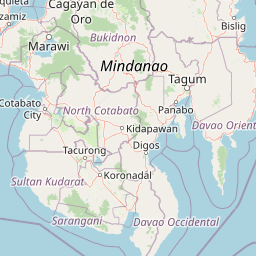
Salikata National Park is best known for its dramatic combination of waterfalls, river gorge landscapes, and dense tropical forest occupying the Gata River valley in the Mount Ragang foothills. The park protects a scenic stretch of rugged terrain where the Gata River has carved a deep valley through the forested slopes of the Piapayungan mountain range. Rocky cliffs and cascading waterfalls provide the most visually distinctive features, while the intact forest canopy represents increasingly rare old-growth forest in Lanao del Sur. The park's accessibility from Marawi and its proximity to the Cotabato provincial border make it a notable destination within the interior highlands of Mindanao.
Salikata National Park history and protected-area timeline
Salikata National Park was established on May 5, 1965, as part of a wave of national park designations across the Philippines during the mid-1960s. This period marked a systematic effort by the Philippine government to formally protect remaining forest areas and watershed zones across the archipelago. Lanao del Sur received particular attention with six national parks designated in the province during this same year, reflecting recognition of the ecological and watershed importance of the interior highland forests.
The park's declaration came at a time when Mindanao's interior forests remained substantially intact, before the accelerated logging and agricultural expansion that would later reduce forest cover across the island. By establishing formal protection for the Gata River valley and surrounding slopes, authorities aimed to preserve both the scenic qualities of the waterfalls and gorge areas and the watershed functions that support downstream agricultural communities. The designation under the national park category placed the area under the administration of what is now the Department of Environment and Natural Resources, establishing the institutional framework for ongoing management.
Salikata National Park landscape and geographic character
The landscape of Salikata National Park is defined by the deep valley carved by the Gata River as it descends from the higher elevations of the Mount Ragang range. Mount Ragang, also known as Piapayungan, rises prominently behind the protected area and contributes to the dramatic topography that characterizes the park. The river has cut a steep-sided gorge through the foothills, creating a landscape of rocky cliffs and cascading water features where the stream drops over rock formations.
Dense forest cover blankets the valley slopes and floor, with the canopy remaining relatively intact despite surrounding land use pressures in the broader region. The combination of steep terrain, permanent water flow, and continuous forest cover creates a landscape of considerable scenic variety within a relatively compact area. Waterfalls appear at multiple points along the Gata River as it traverses the park, with the rocky cliff faces providing the vertical drops that generate these features. The valley floor provides passage through the protected area, connecting the communities of Salaman and Mapantao along the river corridor.
Salikata National Park ecosystems, habitats, and plant life
The ecological character of Salikata National Park reflects its position within the Mindanao interior highlands, where moist tropical forest conditions prevail. The dense canopy documented in park descriptions indicates the presence of mature forest vegetation with typical species composition for the elevation zone. The Gata River provides permanent water flow through the protected area, supporting riparian ecosystems along its banks while also serving as a corridor for wildlife movement through the landscape.
The forest communities occupy an ecological transition zone between lowland and montane forest types, giving the area higher biodiversity value than might be expected from its modest elevation range alone. Watershed functions represent a key ecological service provided by the protected forest, with the park's vegetation trapping rainfall and regulating downstream water flow to communities in Lanao del Sur and into the Cotabato border regions. While detailed species inventories are not available in the source material, the intact forest cover supports birdlife and smaller mammals typical of Mindanao's interior forest environments.
Salikata National Park conservation status and protection priorities
Salikata National Park's protected landscape designation reflects its value as a watershed protection area and scenic natural environment within the developed agricultural landscape of Lanao del Sur. The IUCN Category V classification indicates that conservation objectives balance with sustainable resource use by local communities, recognizing the park's role in maintaining water quality and flow for downstream users. The forest cover within the protected area serves critical watershed functions that extend well beyond the park boundaries, with the Gata River providing irrigation and domestic water supplies for surrounding agricultural lands.
The park represents one of the remaining intact forest areas in Lanao del Sur province, where substantial forest loss has occurred since the 1960s establishment period. Maintaining the forest cover within the protected area helps preserve soil stability in the steep terrain, reduce erosion in the upper watershed, and sustain biodiversity in what would otherwise become a fully converted landscape. The 1965 establishment date places the park among the older protected areas in the Philippines, giving it legacy status within the national protected area system despite administrative gaps in formal boundary delineation.
Top sights and standout views in Salikata National Park
The most distinctive highlights of Salikata National Park include its cascading waterfalls that drop over rocky cliffs along the Gata River, the deep river gorge that cuts through forested foothills, and the dense tropical canopy that remains largely intact across the valley. The park's location in the Mount Ragang foothills provides dramatic mountain backdrop scenery while the proximity to Marawi City makes it accessible for visits from the nearest major population center. The Gata River valley corridor offers a natural transit route through the protected area, connecting barangay Salaman to Mapantao near the Cotabato provincial border.