
Mori Atlas logo
Protected landscapeSanta Fe National Forest

Mapping the dramatic elevation gradients, volcanic ranges, and wilderness boundaries of Northern New Mexico

Santa Fe National Forest: A Comprehensive Geographic Atlas of a New Mexico Protected Landscape

Santa Fe National Forest protects over 1.5 million acres of varied terrain across Northern New Mexico, stretching from the volcanic plateaus of the Jemez Mountains to the high alpine summits of the Sangre de Cristo range. This extensive protected landscape encompasses deep river canyons, large quaking aspen groves, and several designated wilderness areas such as the Pecos and Chama River Canyon. It serves as a vital ecological mosaic, bridging the rugged transition between high mountain peaks and desert foothills while preserving significant watershed and wildlife habitats.

Southwestern United StatesNew Mexiconational forestJemez MountainsSangre de Cristo MountainsPecos Wilderness
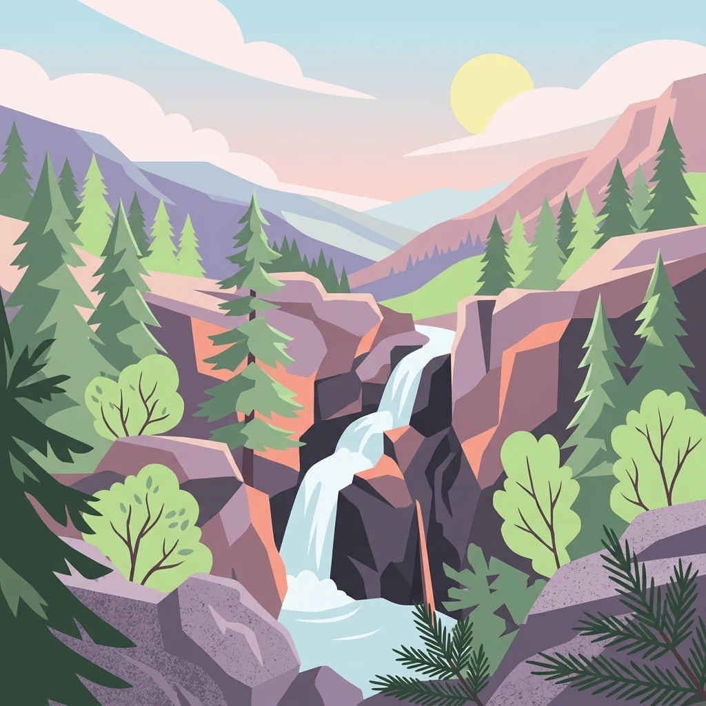
A vibrant graphic illustration showing a cascading waterfall flowing down a rocky canyon, surrounded by evergreen trees, with soft clouds and a warm sun in the background.

Santa Fe National Forest

Protected landscape

Park overview

Structured park overview, official facts, and landscape profile for Santa Fe National Forest

Santa Fe National Forest park facts, protected area profile, and essential visitor context

Review the core facts for Santa Fe National Forest, including designation, size, terrain, visitor scale, habitats, and operating context in one park-focused overview.

About Santa Fe National Forest

Santa Fe National Forest occupies a significant portion of north-central New Mexico, stretching across Rio Arriba, San Miguel, Sandoval, Santa Fe, Mora, and Los Alamos counties. Rather than forming a single contiguous block of public land, the forest is organized into a series of ranger districts that follow the major mountain ranges of the region. The Jemez, Coyote, and Cuba districts cover much of the Jemez Mountains, the Española district spans both the Jemez and Sangre de Cristo ranges, and the Pecos/Las Vegas district covers the eastern portion of the forest within the Sangre de Cristo Mountains.

The forest's setting is shaped by its strong vertical relief. At its lowest points, the land drops to around 5,300 feet along canyon bottoms, while the high country rises above 13,000 feet at Truchas Peak, located within the Pecos Wilderness. This gradient supports a wide range of vegetation types, from piñon-juniper woodland and lower montane forest at lower elevations to dense conifer stands and high-elevation spruce-fir forest near the summits. Between these extremes lie the broad aspen groves for which the forest has become especially well known.

In addition to its ecological diversity, Santa Fe National Forest plays an important connective role in the regional network of protected lands. Bandelier National Monument was created from a portion of the original forest in 1916, and additional wilderness areas, including the Dome Wilderness and the San Pedro Parks Wilderness, lie largely or entirely within the forest. The western Jemez Ranger District is adjacent to the Valles Caldera National Preserve, administered by the National Park Service, which preserves a large volcanic caldera landscape. Together, these neighboring units help define the broader protected landscape of north-central New Mexico.

The forest also serves significant recreation and cultural functions. It provides popular sites for hiking, camping, fishing, wildlife viewing, and scenic driving, and it supports traditional uses tied to the ranching and small communities scattered throughout its districts. Major points of interest include Jemez Falls, the Jemez Soda Dam on the Jemez River, Rio Chama canyon country, and the high country around Truchas Peak, as well as the Aspen Vista area near Santa Fe, where aspen viewing draws a seasonal peak in nature tourism.

Quick facts and research context for Santa Fe National Forest

Santa Fe National Forest is a U.S. national forest located in north-central New Mexico, with headquarters in the city of Santa Fe. It was established on July 1, 1915, through the merger of the former Jemez National Forest to the west and Pecos National Forest to the east, and today covers approximately 1,558,452 acres spread across seven counties. The forest is administered by the U.S. Forest Service and is divided into distinct ranger districts that align with major mountain ranges, including the Jemez Mountains and the Sangre de Cristo Mountains.

Protection and recognition

Examine official conservation status records and international recognition history.

Santa Fe National Forest Protection Status and Documented Designations

Santa Fe National Forest maintains documented protection status and designated conservation boundaries across its forested landscape. Structured records compile official protection parameters and international recognition frameworks for rigorous geographic analysis.

Protection details

Transboundary protection
No
Park context

Deeper park guide and search-rich context for Santa Fe National Forest

Santa Fe National Forest history, landscape, wildlife, and travel context

Explore Santa Fe National Forest through its history, landscape character, ecosystems, wildlife, conservation priorities, cultural context, and seasonal travel timing in a structured park guide built for atlas discovery and search intent.

Why Santa Fe National Forest stands out

Santa Fe National Forest is best known for the dramatic elevation range that it protects, stretching from its lower canyon rivers up to the high alpine country around Truchas Peak in the Pecos Wilderness. It is also recognized for its large, visible stands of quaking aspen that draw seasonal leaf-peeping visitors, its network of designated wilderness areas including the Pecos, Dome, and Chama River Canyon wildernesses, and its proximity to cultural landmarks such as Bandelier National Monument and the Valles Caldera National Preserve. The forest's combination of volcanic terrain in the Jemez Mountains, forested canyons along the Rio Chama and Pecos River, and the long spine of the Sangre de Cristo Mountains gives it a particularly diverse Southwestern mountain character within a single administrative unit.
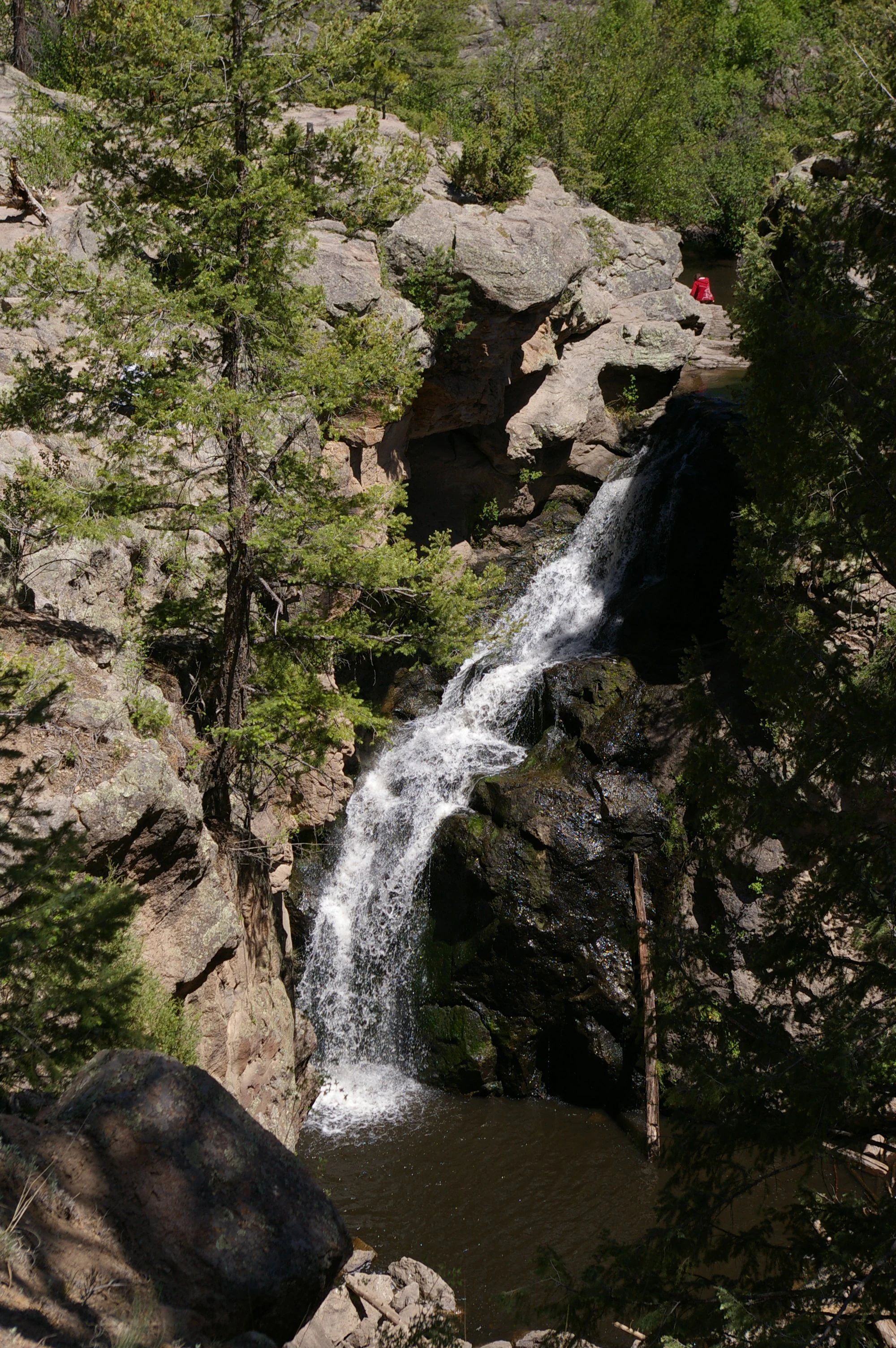
A vertical view of Jemez Falls dropping over dark rocky cliffs into a pool, framed by pine trees and rugged terrain.
A view of Jemez Falls cascading down into a rocky pool within the Santa Fe National Forest.

Santa Fe National Forest history and protected-area timeline

Santa Fe National Forest has its institutional origins in the late nineteenth and early twentieth century reserve system that preceded today's national forests. The Pecos/Las Vegas Ranger District, for instance, traces its history back to the Pecos River Forest Reserve, established in 1892, while the Jemez Ranger District began as the Jemez Forest Reserve in 1905. These early reserves laid the groundwork for the larger forest that would later be assembled.

The modern Santa Fe National Forest was formally created on July 1, 1915, when the U.S. Forest Service merged the Jemez National Forest, lying west of Santa Fe, with the Pecos National Forest, lying to the east, into a single administrative unit. This consolidation produced the broad east-west extent that still defines the forest today, with former divisions preserved in the names and locations of its ranger districts: the Jemez districts to the west and the Pecos/Las Vegas district to the east.

In 1916, the year after the forest was established, a portion of its land was used to create Bandelier National Monument, which protects ancient Puebloan cultural sites in the Pajarito Plateau region. Over time, additional land was added to Bandelier from former Los Alamos National Laboratory holdings and from the former Baca Ranch lands, further shaping the relationship between the national forest and the surrounding protected landscape. The forest's administrative framework, organized around several widely separated ranger districts, continues to reflect this layered history of reserve creation, consolidation, and later adjustment.

Santa Fe National Forest landscape and geographic character

The landscape of Santa Fe National Forest is defined by two major mountain systems in north-central New Mexico and the canyons and valleys that connect them. To the west, the Jemez Mountains form a volcanic landscape shaped by the collapsed Valles Caldera, with broad forested plateaus, deep canyons, geothermal features, and the Jemez River cutting through the range. Truchas Falls and other dramatic waterfalls, along with the Soda Dam on the Jemez River, are among the notable scenic features of this western portion of the forest.

To the east, the Sangre de Cristo Mountains rise sharply, providing some of the highest terrain in the state. The northern portion of the forest encompasses parts of the Rio Chama canyon system, while the eastern districts include the upper Pecos River valley and the high country around Truchas Peak. The crest of the Sangre de Cristo range, with its mixture of forested ridges, open alpine basins, and high peaks, gives the eastern districts a distinctly different character from the more rounded volcanic uplands of the Jemez.

Between these ranges, the Española Ranger District occupies a transitional setting that runs from the foothills west of Santa Fe out toward the town of Española and up into both the Jemez and Sangre de Cristo Mountains. This district includes long views across rolling country and provides scenic overlooks of some of the largest aspen groves in the region, particularly near Aspen Vista. The forest's districts together create a landscape mosaic of canyons, peaks, mesas, river corridors, and high alpine basins spread across hundreds of thousands of acres.

Santa Fe National Forest ecosystems, habitats, and plant life

The ecological identity of Santa Fe National Forest is shaped by its dramatic elevation gradient, which produces a layered mosaic of plant communities. At lower elevations, piñon and juniper woodland gives way to ponderosa pine and mixed conifer forest across the foothills and middle elevations. Higher up, dense stands of spruce and fir dominate the high country of the Sangre de Cristo Mountains and the upper Jemez Mountains. This stacking of vegetation types within a relatively compact geographic area is one of the forest's defining ecological features.

A particularly important component of the forest's natural character is its aspen cover. Large stands of quaking aspen are found across multiple districts, including the well-known groves visible from the Aspen Vista area above Santa Fe. These aspen communities contribute to seasonal change in the landscape, shifting from summer green to vivid gold during flavescence in autumn and drawing a notable spike in leaf-peeping tourism.

Rivers and streams play a major ecological role throughout the forest. The Jemez River, the Rio Chama, and the Pecos River each carve through forested canyons and support riparian habitats that contrast sharply with the surrounding uplands. Hot springs and the Soda Dam along the Jemez River introduce distinctive geothermal features into the forest's natural environment. Designated wilderness areas, including the Pecos Wilderness, Dome Wilderness, Chama River Canyon Wilderness, and San Pedro Parks Wilderness, protect large blocks of relatively undisturbed habitat that anchor the forest's broader biodiversity values.

Santa Fe National Forest wildlife and species highlights

Santa Fe National Forest supports a diverse range of wildlife typical of the Southern Rocky Mountains and the broader Southwestern mountain landscape. The mixture of conifer forest, aspen groves, high alpine basins, and riparian canyons provides habitat for species such as mule deer, elk, black bear, mountain lions, and wild turkey across its districts. The forest's elevation range, combined with adjoining wilderness areas, sustains year-round populations of both lowland and high-country species.

Birds are a particularly strong element of the forest's wildlife profile, with habitat for raptors such as golden eagles and various hawks, as well as seasonal and resident songbirds associated with aspen groves, mixed conifer forest, and river corridors. The Pecos River, Rio Chama, and Jemez River corridors support waterfowl, songbirds, and other riparian species, while the high country around Truchas Peak offers habitat for species adapted to alpine and subalpine conditions in the Sangre de Cristo range.

Wilderness areas within the forest, including the Pecos, Dome, Chama River Canyon, and San Pedro Parks wildernesses, serve as important refuge areas where wildlife populations can function with limited human disturbance. Large mammals continue to roam these protected zones, and the forest's connectivity to neighboring protected lands, including Bandelier National Monument and the Valles Caldera National Preserve, supports broader ecological movement and genetic exchange across the region.

Santa Fe National Forest conservation status and protection priorities

Santa Fe National Forest plays an important conservation role in north-central New Mexico by protecting large, ecologically diverse tracts of mountain landscape under federal management. The forest preserves continuous gradients of vegetation type and elevation that would be difficult to replicate in a single protected unit elsewhere in the Southwest, and it acts as a key connective landscape between Bandelier National Monument, the Valles Caldera National Preserve, and adjacent national forests such as the Carson National Forest.

Designated wilderness areas within the forest, including the Pecos Wilderness, Dome Wilderness, Chama River Canyon Wilderness, and San Pedro Parks Wilderness, represent the highest level of federal protection within the unit and preserve significant portions of the forest as areas where natural processes can operate with minimal infrastructure or development. The forest's reservoir of old-growth conifer forest, high-elevation aspen stands, and intact canyon ecosystems provides habitat resilience and contributes to broader watershed health for downstream communities.

From an institutional perspective, the forest reflects a long evolution of American forest policy, from the late nineteenth-century forest reserves through the creation of national forests in 1915 and the subsequent designation of wilderness. Its current management balances ecological protection, watershed stewardship, recreation, grazing, and cultural heritage, making it a working landscape of significance both regionally and nationally.

Santa Fe National Forest cultural meaning and human context

Santa Fe National Forest sits within a region of deep cultural and historical importance in the American Southwest. The forest's landscapes overlap with traditional lands of Puebloan and other Indigenous peoples and border communities such as Santa Fe, Española, Pecos, Jemez Springs, Cuba, and Coyote, many of which have long histories of ranching, small-scale agriculture, and resource use.

Adjacent and overlapping protected lands, particularly Bandelier National Monument, reflect the area's rich archaeological and cultural heritage associated with ancestral Puebloan settlement in the canyons and mesa country near the Jemez Mountains. The forest's proximity to these cultural sites means that public lands in the region are often experienced as part of a broader landscape of natural beauty and historic significance.

Top sights and standout views in Santa Fe National Forest

Santa Fe National Forest stands out for its combination of high-elevation alpine scenery, lower canyon country, and large aspen groves that produce one of the Southwest's most notable autumn displays. Key highlights include Truchas Peak and the surrounding Pecos Wilderness, the Jemez Falls and Soda Dam in the Jemez Mountains, the deep canyon country of the Rio Chama and Pecos River, and the aspen viewing areas of the Española Ranger District near the Aspen Vista area. The forest also offers access to several designated wilderness areas and sits at the heart of a broader protected landscape that includes Bandelier National Monument and the Valles Caldera National Preserve.

Best time to visit Santa Fe National Forest

Santa Fe National Forest offers dramatically different experiences depending on the season, largely because of its emphasis on elevation and vegetation. Summer, from roughly June through September, is the main season for high-country hiking, with cooler conditions at the upper elevations and wildflowers in the higher meadows; higher elevations remain cooler, and thunderstorms are common in late summer.

Autumn is the most visually distinctive period, especially across the Española and Pecos/Las Vegas districts, when the forest's large aspen stands turn gold and draw a wave of leaf-peeping visitors. Winter brings snow to the higher elevations, supporting cross-country skiing and snowshoeing in the Sangre de Cristo Mountains, while the lower canyons remain milder, and the quieter, snow-covered forests offer a quieter winter visit.
Monthly climate preview

Trace long-term temperature ranges and monthly precipitation patterns across representative terrain elevations.

Santa Fe National Forest Climate Normals and Annual Weather by Month

Representative coordinate records show mean temperatures ranging from sub-zero winter minimums to warm summer maximums alongside varying monthly precipitation rates. Detailed monthly climate profiles provide deeper analytical context for long-term meteorological trends across the protected landscape.
Annual mean11 °C
0 °C24 °C
Jan
Feb
Mar
Apr10°
May16°
Jun22°
Jul24°
Aug22°
Sep18°
Oct11°
Nov
Dec
Warmest month
July

23.6 °C

Coolest month
January

-0.4 °C

Wettest month
July

2 mm/day

Driest month
February

0.6 mm/day

Park location guide

Geography guide, regional context, and park location map for Santa Fe National Forest

Santa Fe National Forest park geography, regions, and map view in United States of America

Understand where Santa Fe National Forest sits in United States of America through a broader geographic reading of the surrounding landscape, nearby location context, and its mapped position within the national park landscape.

How Santa Fe National Forest fits into United States of America

The United States of America is a federal presidential republic and one of the world's largest countries by area and population. It consists of 50 states across a vast territory spanning multiple time zones, with its capital in Washington, D.C. and largest city in New York City. The nation has a diverse economy, influential political system, and significant cultural and military presence globally.

Wider geography shaping Santa Fe National Forest in United States of America

The United States occupies a vast territory in North America, bordered by Canada to the north and Mexico to the south. The 48 contiguous states stretch from the Atlantic to the Pacific Ocean, while Alaska occupies the northwestern region and Hawaii is an archipelago in the Pacific. The country encompasses diverse terrain including the Rocky Mountains, Appalachian Mountains, Great Plains, and extensive river systems.

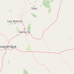
Map view of Santa Fe National Forest

Use this park location map to pinpoint Santa Fe National Forest in United States of America, understand its exact geographic position, and read its mapped placement within the surrounding landscape more clearly.

Pigeon | © OpenStreetMap contributors

Location context for Santa Fe National Forest

New Mexico
Natural feature types

Discover Geographic Features Across Santa Fe National Forest

Browse our structured collection of named natural landmarks associated with the diverse terrain of Santa Fe National Forest. This resource allows for targeted exploration of mountain ranges, river corridors, and protected forest areas throughout the Jemez and Sangre de Cristo regions in New Mexico.
Recorded earthquake history

Examine the Santa Fe National Forest Historical Earthquake Catalogue

Investigate recorded seismic events associated with the geography of Santa Fe National Forest. This structured dataset offers a view into historical earthquake records, including magnitudes and epicentre distances, to support geographic exploration of the region through the lens of documented seismic history.

Santa Fe National Forest Earthquake History

Catalogued events

25 events

Strongest magnitude

Magnitude 4.5

Most recent event

Jul 5, 2026

This history includes earthquakes recorded inside the park or within 50 km of its borders

Explore protected area views, alpine terrain, and deep canyon habitats across New Mexico

Santa Fe National Forest Photos and Scenery: Visualizing Mountain Landscapes

Visual documentation captures the diverse terrain, high alpine ridges, and sweeping conifer stands protected within Santa Fe National Forest. Photographic collections reveal the distinctive natural environments of the Jemez Mountains and Sangre de Cristo highlands.

A vertical view of Jemez Falls dropping over dark rocky cliffs into a pool, framed by pine trees and rugged terrain.

Park atlas

Discover connected protected landscapes and regional mountain environments across New Mexico

Other Protected Areas and Parks Near Santa Fe National Forest for Regional Comparison

Compare Santa Fe National Forest with surrounding protected areas in the Jemez and Sangre de Cristo mountains. Evaluating adjacent natural reserves provides broader context for southwestern forest ecosystems and volcanic terrain.
A pale, minimalist watercolor painting showing a horizontal landscape with a thin treeline in the midground and soft, blue-toned mountain peaks in the background against a white sky.
Wildlife reserveSandoval County
Park boundaries overlap#1 closest

West

Dome Wilderness: Volcanic Domes and Protected Forest Geography in Sandoval County

High-desert wilderness area in the Jemez Mountains

Dome Wilderness is a protected natural area in Sandoval County, New Mexico, defined by its exposed volcanic domes and dramatic post-fire recovery landscape. Sitting within the Santa Fe National Forest, the terrain preserves both natural geological features and significant prehistoric archaeological sites. Its unique visual character, shaped by the 1996 Dome Fire, contrasts open, fire-swept slopes with dense coniferous forest stands.

Area
21 km²
Established
1980
IUCN
Ib
Relief
Mountain
Protected landscapeSandoval County
About 0 km away#2 closest

West

Jemez National Recreation Area: Geography and Protected Land Map Overview

Exploring volcanic plateaus and river canyons in northern New Mexico

Jemez National Recreation Area represents a key protected landscape in Sandoval County, encompassing diverse forested uplands and steep volcanic canyons. The area serves as a focal point for understanding the geological legacy of the Jemez Mountains, providing a clear window into how river incision and ancient volcanic activity have shaped the regional terrain. Its proximity to national forest lands and the Valles Caldera system makes it a vital unit for geographic study and mapped landscape exploration.

Area
233.3 km²
Established
1993
Visitors
1.6M annual
Relief
Mountain
Watercolor painting of soft, layered mountain ranges behind green hills and patches of evergreen trees on a white background.
Protected landscapeColorado
58 km away#3 closest

North

Rio Grande National Forest: Atlas and Geographic Profile of a Southern Colorado Landscape

Watershed geography and Continental Divide terrain analysis.

Rio Grande National Forest represents an immense protected landscape encompassing diverse terrain from high desert steppe to rugged alpine peaks. This profile details the forest's hydrological significance as the source of the Rio Grande and its role as a massive ecological transition zone in the Mountain West. Examine the boundaries and mountain geography that define this critical protected area.

Area
7,500 km²
Established
1908
Relief
Mountain
Climate
Boreal
Protected landscapeColorado
58 km away#4 closest

Northwest

San Juan National Forest: Geographic Overview of a Major Southern Colorado Protected Landscape

Mapped terrain across the Southern San Juan Mountains

San Juan National Forest represents a massive protected landscape in western Colorado, defined by its rugged alpine peaks, dense conifer forests, and glacial valleys. This atlas entry details the forest boundary, its position along the Continental Divide, and the surrounding transition into the Colorado Plateau. It provides a structured look at the terrain that connects diverse ecosystems, from high-altitude tundra to expansive mesa country, within one of the largest national forests in the American West.

Area
7,603.42 km²
Established
1905
Relief
Mountain
Climate
Alpine
Watercolor painting of a green forest, calm water, and distant mountain silhouettes against a light sky.
Wildlife reserveNew Mexico
75 km away#5 closest

Northeast

Latir Peak Wilderness: Mapped Geography of the Sangre de Cristo Mountains

High-elevation wilderness reserves in northern New Mexico

Latir Peak Wilderness presents a distinct vertical landscape within the northern Sangre de Cristo Mountains. This protected area features a unique combination of high-altitude summits, rounded alpine mesas, and cold-water trout habitats. Mapped terrain includes the significant Lake Fork of Cabresto Creek drainage and dense conifer forests that define this 20,506-acre wilderness unit.

Area
82.98 km²
Established
1980
IUCN
Ib
Relief
Mountain
A minimalist watercolor painting depicting soft green rolling hills in the foreground and faded pink mountain ridges in the background on a white paper background.
Protected areaNew Mexico
83 km away#6 closest

South

Manzano Mountain Wilderness: Rugged Protected Landscapes in Central New Mexico

Canyon-scarred mountain geography and forest ecosystems.

Manzano Mountain Wilderness is a significant protected area defined by its deep, radiating canyons and compressed elevational ranges. From pinyon-juniper foothills to the spruce-fir heights of the crest, this landscape offers a detailed look at the varied natural terrain found within the Cibola National Forest in New Mexico.

Area
149.23 km²
Established
1978
IUCN
Ib
Relief
Mountain
A horizontal watercolor illustration of a wide, open prairie landscape featuring soft green hills, sparse shrubs, and grasses against a pale background.
Protected landscapeNew Mexico
87 km away#7 closest

East

Kiowa National Grassland: Protected Landscapes, Canyon Terrain, and Prairie Geography

Northeastern New Mexico shortgrass prairie and river canyon systems.

Kiowa National Grassland represents a distinctive protected landscape within the southwestern Great Plains, featuring a mix of rolling steppe, pinyon-juniper woodland, and the deep gorges of the Canadian River Canyon. This area offers significant insight into the regional geography of New Mexico, where historic Santa Fe Trail corridors and seasonal playa lakes define the local terrain and ecosystem.

Area
554.95 km²
Established
1960
Relief
Upland
Climate
Temperate
Watercolor painting of a serene mountain landscape featuring rolling hills, coniferous trees, and a lake in the foreground, rendered in light pastel tones.
Protected landscapeColorado
133 km away#8 closest

North

San Isabel National Forest: Geographic Overview and Protected Mountain Landscape Atlas

Central Colorado alpine terrain and designated wilderness areas

Spanning eleven counties in central Colorado, San Isabel National Forest serves as a cornerstone of the Southern Rocky Mountains. The forest landscape is dominated by the Sawatch and Sangre de Cristo ranges, offering a unique atlas of alpine tundra, dense coniferous forests, and high-altitude peaks that define the character of the region. This protected area provides a vital habitat and a vast, rugged environment characterized by volcanic formations like the Spanish Peaks and glacial geological features.

Area
4,533.42 km²
Established
1902
Relief
Mountain
Climate
Alpine

Common questions about visiting, size, designation, and location context for Santa Fe National Forest

Santa Fe National Forest FAQs for park facts, access, geography, and protected area context

Find quick answers about Santa Fe National Forest, including protected-area facts, park geography, trail and visitor context, and how the park fits into its surrounding country and regional landscape.
MoriAtlas Explorer

Continue Your Protected Areas Search Across the Global Atlas

Deepen your exploration by continuing the structured search for national parks and protected areas worldwide. Utilize the comprehensive filtering capabilities to compare different conservation landscapes and refine your understanding of global park geography. Discover more about the distribution and characteristics of protected natural areas.

Global natural geography