Mori Atlas logo
Protected landscapeSanta Lucia Protected Landscape

A historic protected area anchoring the drainage networks between the Cordillera Central and lowland Ilocos Sur.

Santa Lucia Protected Landscape: Mapping the Watershed Forests of the Ilocos Sur Foothills

The Santa Lucia Protected Landscape serves as a vital watershed forest reserve within the Ilocos Sur province, protecting the upper catchment areas that feed the Buaya River. Spanning the transition from the Cordillera Central foothills to the lowland agricultural plains of Salcedo, the area preserves critical riparian habitats and montane forest cover. This protected territory plays a fundamental role in local water security and ecological connectivity across northern Luzon.

protected landscapewatershed forest reserveCordillera Central foothillsIlocos Surlowland-upland transitionriparian habitat

Santa Lucia Protected Landscape

Protected landscape

Park overview

Structured park overview, official facts, and landscape profile for Santa Lucia Protected Landscape

Santa Lucia Protected Landscape park facts, protected area profile, and essential visitor context

Review the core facts for Santa Lucia Protected Landscape, including designation, size, terrain, visitor scale, habitats, and operating context in one park-focused overview.

About Santa Lucia Protected Landscape

The Santa Lucia Protected Landscape sits in a transitional zone where the western foothills of the Cordillera Central meet the lowland Ilocos region of northwestern Luzon. This geographic position gives the area a layered landscape character, with upland forest on the slopes above the north bank of the Buaya River, bordered by the lowlands of Salcedo's poblacion to the west and the surrounding barangays of Calangcuasan, Madarang, and Bago Creek to the north and east. Even though the protected area spans only about 174 hectares, its placement on the edge of a major mountain range makes it a critical ecological buffer between upland and lowland environments.

The park was historically managed as a watershed forest reserve, protecting the forested slopes that feed rivers and streams used by farming communities in the surrounding municipalities. Its origin as a watershed reserve, rather than purely as a wilderness park, has shaped both its management priorities and its relationship with nearby residents, who depend on the consistent flow of clean water for agriculture and daily use in the Ilocos farming landscape.

Today the area is integrated into the broader National Integrated Protected Areas System of the Philippines, and it remains notable for being a relatively compact protected area with a long institutional history. The surrounding region features roads that connect the park to the Manila North Road and to the city of Candon, situating the landscape within an active rural network of towns, farms, and barangays, while the core protected forest itself remains a relatively undisturbed green enclave on the edge of the Cordillera.

Quick facts and research context for Santa Lucia Protected Landscape

Santa Lucia Protected Landscape is a Category V protected landscape located in Ilocos Sur, on the western foothills of the Cordillera Central in northern Luzon, Philippines. Covering roughly 174 hectares in the barangay of Balidbid within the municipality of Salcedo, it functions primarily as a watershed forest reserve and is governed by the Department of Environment and Natural Resources. Originally proclaimed in 1938 as the Santa Lucia Watershed Forest Reserve, it was redesignated as a protected landscape in 2000, reflecting both its enduring hydrological importance and its place within the country's broader protected area framework.

Park context

Deeper park guide and search-rich context for Santa Lucia Protected Landscape

Santa Lucia Protected Landscape history, landscape, wildlife, and travel context

Explore Santa Lucia Protected Landscape through its history, landscape character, ecosystems, wildlife, conservation priorities, cultural context, and seasonal travel timing in a structured park guide built for atlas discovery and search intent.

Why Santa Lucia Protected Landscape stands out

The park is best known as a long-established watershed forest reserve that protects the headwaters and upper catchment feeding the Buaya River and surrounding lowland communities of Salcedo and nearby Santa Lucia. Its origins as one of the older proclaimed forest reserves in the Cordillera foothills, combined with its later incorporation into the modern Philippine protected area system, give it a distinctive identity as a small but historically significant watershed sanctuary on the western edge of northern Luzon.

Santa Lucia Protected Landscape history and protected-area timeline

The Santa Lucia Protected Landscape has a protection history that stretches back to the late 1930s, when it was originally established as the Santa Lucia Watershed Forest Reserve through Proclamation No. 333, signed by President Manuel Luis Quezon on October 18, 1938. The early designation reflected the recognition that the forested slopes above the Buaya River were critical to sustaining water supplies for the farming communities of the area, particularly those in the municipality of Santa Lucia, which at that time included the barangay of Balidbid where the reserve is located.

For decades the area functioned as a watershed reserve, and over time the surrounding administrative landscape shifted. The barangay of Balidbid became part of Salcedo (formerly known as Baugen), which is why the area is also referred to as the Salcedo Protected Landscape, even though the original name of the watershed reserve has been retained.

In 2000, the forest reserve was reestablished under a new framework when President Joseph Estrada signed Proclamation No. 296, formally designating it as a protected landscape under the National Integrated Protected Areas System on April 24, 2000. This transition marked the area's evolution from a strictly watershed-focused reserve into a broader protected landscape category that emphasizes both ecological protection and sustainable landscape use, bringing it into alignment with modern Philippine conservation policy while preserving its long-standing role as a source of water for the Ilocos Sur lowlands.

Santa Lucia Protected Landscape landscape and geographic character

The protected landscape occupies a compact stretch of terrain on the north bank of the Buaya River, where the lower slopes of the Cordillera Central descend toward the Ilocos lowlands. The area combines upland and foothill forest cover with the drainage corridors that channel water down to the Buaya River, creating a landscape where forested ridges, streams, and river frontage define the terrain.

To the north, the park borders the barangay of Calangcuasan, while the eastern boundary is formed by Madarang and Bago Creek. The south is defined by the Buaya River itself, and to the west the protected area transitions into the lowlands around Salcedo's poblacion. This compact geography places the forest reserve in a clear ecological gradient, from lowland settlement zones to higher montane slopes further east.

The Salcedo to Gregorio del Pilar Road passes along the park's southern edge, while the Santa Lucia to Salcedo Road connects the area to the main Manila North Road from the west, and the Candon to Galimuyod to Salcedo to del Pilar Road provides access from the northwest via the city of Candon. These corridors shape how the landscape is experienced today: a protected green pocket framed by river, road, and the broader Ilocos farming countryside.

Santa Lucia Protected Landscape ecosystems, habitats, and plant life

The natural character of the Santa Lucia Protected Landscape is defined primarily by its forested watershed, which captures rainfall from the western foothills of the Cordillera Central and channels it into the Buaya River. The vegetation reflects the transition zone between lowland Ilocos forests and higher elevation Cordillera forests, giving the area a mix of slope and ridge habitats that support both terrestrial and freshwater ecosystems.

Because the park was established as a watershed reserve, much of its ecological value lies in the integrity of its forest cover, which regulates water flow, reduces erosion on the steep Cordillera slopes, and maintains water quality for downstream users. The streams and tributaries that flow out of the protected area ultimately feed the agricultural landscapes of Salcedo and neighboring municipalities.

While the limited footprint of the area restricts it from hosting the broad altitudinal zonation seen in larger national parks, the protection of an intact forest block in this transitional landscape gives it disproportionate ecological importance. The combination of upland forest, riparian corridors along the Buaya River, and surrounding lowland farmland creates a mosaic where forest-dependent species can persist in close proximity to human settlement.

Santa Lucia Protected Landscape wildlife and species highlights

As a forested watershed reserve on the edge of the Cordillera Central, the Santa Lucia Protected Landscape provides habitat for species typical of the western Luzon foothills. The mix of slope forest, riverine edge along the Buaya River, and connection to larger forested tracts further up the mountain range supports birds, small mammals, reptiles, and amphibians adapted to both forest interior and forest-edge conditions.

The Buaya River corridor and its associated tributaries also create habitat for freshwater species and contribute to broader aquatic ecosystems in the Ilocos Sur lowlands. The park's role as a refuge for forest-dependent wildlife is closely tied to its status as a protected watershed, because the continued integrity of the forest cover directly affects both terrestrial habitat conditions and the health of downstream river systems.

Because the area is relatively small and intensively local in its conservation profile, it functions less as a showcase for charismatic megafauna and more as a stable, long-term refuge for the everyday forest and freshwater biodiversity of the western Cordillera foothills.

Santa Lucia Protected Landscape conservation status and protection priorities

The conservation significance of the Santa Lucia Protected Landscape lies in its enduring role as a protected watershed and in its unusual longevity within the Philippine protected area framework. Originally proclaimed in 1938, it is one of the older forest reserves in northern Luzon, with more than eight decades of formal protection history preceding its 2000 redesignation as a protected landscape under the National Integrated Protected Areas System.

Its value is fundamentally hydrological. By keeping the forested slopes above the Buaya River under protection, the area helps regulate seasonal water flow, supports groundwater recharge, and maintains the quality of water that downstream farming communities rely on. This watershed function is a central part of its conservation rationale and continues to guide how it is managed today.

From a broader ecological standpoint, the protected area also contributes to landscape connectivity in the western Cordillera foothills. Even though its area is modest, it sits at the interface between upland forests and the heavily cultivated Ilocos lowlands, making it a small but strategically placed component of the larger Cordillera forest mosaic and a key element in regional efforts to maintain forest cover in northwestern Luzon.

Santa Lucia Protected Landscape cultural meaning and human context

The cultural context of the Santa Lucia Protected Landscape is rooted in the rural agricultural communities of the Ilocos Sur lowlands and the foothills of the Cordillera Central. The park's watershed feeds the farms and settlements that have long occupied the valley below, and its original protection as a watershed reserve explicitly recognized that relationship between forest cover and downstream livelihoods.

The name itself reflects administrative history. The reserve was proclaimed in 1938 under the name Santa Lucia, when the area's barangay of Balidbid was still part of the municipality of Santa Lucia. After Balidbid became part of what is now Salcedo (historically Baugen), the alternative name Salcedo Protected Landscape came into use, illustrating how the park's identity is tied to the shifting municipal boundaries of the Ilocos region.

Beyond these administrative connections, the park is part of a wider Ilocos landscape shaped by generations of farming communities who have depended on the rivers originating in the Cordillera. The reserve represents a long-standing institutional recognition that protecting these upland forests is inseparable from sustaining the cultural and agricultural life of the lowland towns below.

Top sights and standout views in Santa Lucia Protected Landscape

The most distinctive qualities of the Santa Lucia Protected Landscape are its age as one of the older watershed reserves in northern Luzon and its compact but strategically placed position at the edge of the Cordillera Central. Its origins in 1938, followed by its 2000 redesignation under the modern protected area system, reflect an unusually continuous history of formal protection.

Its watershed role is the defining feature of the park. The protected forest above the Buaya River directly supports the agricultural communities and settlements of Salcedo and surrounding areas, tying ecological conservation to everyday water security for Ilocos Sur residents. This practical hydrological function, rather than dramatic scenery or rare charismatic species, gives the park its strongest conservation identity.

Best time to visit Santa Lucia Protected Landscape

As a small forested watershed reserve in the western foothills of the Cordillera Central, the Santa Lucia Protected Landscape shares the broader climatic patterns of Ilocos Sur, where the dry season typically runs from roughly November through May and the rainy season brings heavier precipitation from around June through October. Visiting during the drier months generally offers more comfortable conditions for outdoor activity along the Salcedo and Gregorio del Pilar Road corridors that frame the area's southern edge.

The greenest and most lush conditions in the forest and along the Buaya River tend to coincide with the later part of the rainy season and the early post-rainy months, when watershed flows are strongest and the surrounding countryside is at its most verdant. Bird activity and stream conditions often reflect these seasonal shifts. Visitors with a particular interest in watershed ecology, forest cover, and downstream river flow may find that period especially illustrative, while those who prefer easier road conditions and clearer skies may favor the drier months.
Monthly climate preview

Long-term temperature ranges and monthly precipitation averages for Santa Lucia Protected Landscape

Santa Lucia Protected Landscape Climate Normals and Annual Weather Patterns

Representative coordinate records show sustained annual temperature variations and shifting monthly precipitation totals across Santa Lucia Protected Landscape. Detailed month-by-month climate metrics provide deeper insight into long-term environmental patterns for this protected terrain.
Annual mean24 °C
22 °C26 °C
Jan22°
Feb23°
Mar24°
Apr26°
May26°
Jun25°
Jul25°
Aug24°
Sep24°
Oct24°
Nov24°
Dec23°
Warmest month
April

26.1 °C

Coolest month
January

22 °C

Wettest month
August

20.5 mm/day

Driest month
February

0.9 mm/day

Park location guide

Geography guide, regional context, and park location map for Santa Lucia Protected Landscape

Santa Lucia Protected Landscape park geography, regions, and map view in Philippines

Understand where Santa Lucia Protected Landscape sits in Philippines through a broader geographic reading of the surrounding landscape, nearby location context, and its mapped position within the national park landscape.

How Santa Lucia Protected Landscape fits into Philippines

The Philippines, officially the Republic of the Philippines, is an archipelagic nation in Southeast Asia comprising approximately 7,641 islands categorized into three main geographical divisions: Luzon, Visayas, and Mindanao. Located in the western Pacific Ocean, it shares maritime borders with Taiwan, Japan, Palau, Indonesia, Malaysia, Vietnam, and China. Manila serves as the capital city, while Quezon City is the most populated city, both within Metro Manila.

Wider geography shaping Santa Lucia Protected Landscape in Philippines

The Philippines is an archipelagic nation in Southeast Asia, positioned in the western Pacific Ocean. Its islands are bounded by the South China Sea to the west, Philippine Sea to the east, and Celebes Sea to the south. The country shares maritime borders with Taiwan to the north, Japan to the northeast, Palau to the east and southeast, Indonesia to the south, Malaysia to the southwest, Vietnam to the west, and China to the northwest.

Map view of Santa Lucia Protected Landscape

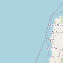
Use this park location map to pinpoint Santa Lucia Protected Landscape in Philippines, understand its exact geographic position, and read its mapped placement within the surrounding landscape more clearly.

Pigeon | © OpenStreetMap contributors

Location context for Santa Lucia Protected Landscape

Ilocos Sur
Park atlas

Compare regional forest reserves and connected foothill conservation landscapes

Explore Other Protected Areas and Parks Near Santa Lucia Protected Landscape

Browse neighboring protected areas and watershed reserves located across the surrounding Cordillera Central foothills. Expanding the geographic comparison reveals how similar regional forest habitats connect across the wider provincial terrain.
National parkIlocos Sur
About 38 km away#1 closest

North

Northern Luzon Heroes Hill National Park: Coastal Mountain Geography and Protected Landscape Identity

Discover the mapped terrain and forest boundaries of this Philippine national park.

Northern Luzon Heroes Hill National Park offers a detailed look at a unique protected landscape in the Philippines' Ilocos Sur region. Its dramatic coastal mountain geography, characterized by steep forested slopes and ravines, stands apart from the typical flat terrain of the area. This national park serves as a significant mapped natural area, preserving vital forest cover and providing insights into the region's ecological context and landscape diversity.

Area
13.16 km²
Established
1963
IUCN
V
Relief
Mixed relief
National parkPhilippines
About 43 km away#2 closest

Southeast

Mount Data National Park: Protected Montane Watershed and Philippine Mountain Geography

High elevation forest terrain and regional watershed context.

Located in the Cordillera Central, Mount Data National Park represents a historic protected area of the Philippines. Its montane ecosystems, ranging from pine forests to mossy oak stands, sustain vital downstream river systems while supporting unique biodiversity. This atlas entry provides geographic insights into its steep ridges, forested slopes, and the broader environmental significance of its high-elevation terrain.

Area
55.13 km²
Established
1936
Relief
Mountain
Scope
Terrestrial
National parkMountain Province
About 45 km away#3 closest

Southeast

Mount Data National Park: A Protected Highland Watershed in the Mountain Province

Analyzing the topography and mapped forest boundaries of the Cordillera Central

Mount Data National Park serves as a vital protected area in the northern Philippines, anchoring the headwaters of the Agno, Abra, and Rio Chico river systems. This highland site offers a distinct look at the ridge-focused geography of the Cordillera Central, characterized by high-elevation terrain and a long-standing contribution to scientific research on Philippine mammal diversity.

Area
33.52 km²
Established
1936
Relief
Mountain
Scope
Terrestrial
National parkCordillera Administrative Region
About 72 km away#4 closest

Northeast

Balbalasang, Balbalan National Park: Mapped Protected Area in Cordillera Administrative Region

Explore its national park geography and landscape context.

Balbalasang, Balbalan National Park offers a distinct protected landscape within the Philippines' Cordillera Administrative Region. This canonical detail page provides an atlas-driven perspective, focusing on the park's mapped boundaries and its regional geographic context. Users can delve into the specific terrain and natural features that define this national park, enhancing their understanding of its protected area status and its significance in landscape exploration.

Area
13.38 km²
Established
1972
IUCN
II
Relief
Mountain
Protected landscapeBenguet
About 79 km away#5 closest

South

Upper Agno River Basin Resource Reserve: Mapping the Benguet Watershed Protected Landscape

High-elevation forest, river catchment, and Cordillera peaks

Spanning from the Mount Data area to the Binga Dam, this reserve serves as a pivotal hydropower catchment and mountain sanctuary. Explore the geographic extent of these pine-clad slopes, mossy dwarf forests, and high-altitude grasslands that define the southern Cordillera landscape.

Area
775.61 km²
Established
1966
IUCN
VI
Relief
Mountain
Watercolor painting of a landscape with rolling hills, trees, distant mountains, and small structures
National parkAbra
About 98 km away#6 closest

North

Cassamata Hill National Park: Philippine National Park with Hilltop Views of Abra Valley

Mapped geography of the Abra River valley and surrounding mountain ranges.

Cassamata Hill National Park is a protected landscape in Abra, Philippines, notable for its summit viewpoints that capture the expansive Abra River valley and the imposing Cordillera Central and Ilocos mountain ranges. Visitors can explore the mapped terrain from this elevated vantage point, offering a comprehensive view of the regional geography, including the distinctive silhouette of Mount Banti Goolong, also known as the Sleeping Beauty. This national park provides crucial insight into the protected area's context within the broader Cordillera region.

Area
0.57 km²
Established
1974
IUCN
V
Relief
Upland
A soft, artistic watercolor illustration of a river winding through green rolling hills and mountain terrain.
Protected landscapePhilippines
About 99 km away#7 closest

South

Lower Agno Watershed Forest Reserve: Watershed Geography and Mountain Terrain in the Philippines

A vital river corridor and pine forest protected landscape

Explore the structured geography of the Lower Agno Watershed Forest Reserve, defined by its 34.59 kilometer river corridor and dense network of tributaries. From the Benguet pine forests of the Cordillera Central to the industrial landscape surrounding the San Roque Dam, this reserve serves as a complex model of water management, rugged mountain topography, and long term mining heritage in the Philippine highlands.

Area
393.04 km²
Established
1983
IUCN
V
Relief
Mountain
National parkNueva Vizcaya
About 115 km away#8 closest

Southeast

Bangan Hill National Park: A Protected Landscape within Nueva Vizcaya's Geography

Explore its mapped terrain and cultural significance.

Bangan Hill National Park is a crucial protected area nestled in Nueva Vizcaya, Philippines. This page details its specific geography, including its role as a distinct hill within the broader Cagayan Valley landscape. Users can explore the park's mapped boundaries, understand its role as a national park, and discover the surrounding mountain context of the Caraballo and Cordillera Central ranges. It offers a unique perspective on the region's natural and historical significance, serving as a focal point for protected landscape exploration.

Area
0.139 km²
Established
1995
IUCN
II
Relief
Mixed relief

Common questions about visiting, size, designation, and location context for Santa Lucia Protected Landscape

Santa Lucia Protected Landscape FAQs for park facts, access, geography, and protected area context

Find quick answers about Santa Lucia Protected Landscape, including protected-area facts, park geography, trail and visitor context, and how the park fits into its surrounding country and regional landscape.
MoriAtlas Explorer

Continue Your Protected Areas Search Across the Global Atlas

Deepen your exploration by continuing the structured search for national parks and protected areas worldwide. Utilize the comprehensive filtering capabilities to compare different conservation landscapes and refine your understanding of global park geography. Discover more about the distribution and characteristics of protected natural areas.

Global natural geography