
Why Sarangani Bay stands out
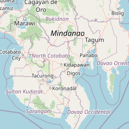
Sarangani Bay is best known as a large Mindanao embayment that combines a busy commercial port with formal protected-area status. Its association with General Santos, a city famous in the Philippines for fishing, shipping, and trade, gives the bay considerable economic identity, while its 2018 designation as a national park highlighted its value as a coastal and marine seascape requiring conservation attention. The bay is also recognized for the way it shapes regional geography, lending its name to the Province of Sarangani and framing the coastline for several municipalities along southern Mindanao. The convergence of urban port activity, municipal coastal communities, and protected seascape recognition defines the bay's distinct character.
Sarangani Bay history and protected-area timeline
Sarangani Bay has long functioned as a defining geographic feature of southern Mindanao, framing the coast where the city of General Santos and several surrounding municipalities developed. The bay's name became embedded in regional administration when the Province of Sarangani was created in 1992, deriving its name from the body of water itself and tying the bay directly to local political geography.
The most significant recent chapter in the bay's institutional history came in July 2018, when Republic Act No. 11038, known as the Expanded National Integrated Protected Areas System Act of 2018, was signed by President Rodrigo Duterte. Under this law, Sarangani Bay was declared a national park, placing it within the Philippines' formal protected-area framework. This designation recognized the bay as a protected seascape, marking a shift that emphasized conservation alongside the bay's established role in shipping and commerce.
The 2018 declaration reflects a broader Philippine effort to expand and modernize the country's system of protected areas, moving beyond terrestrial parks to include significant marine and coastal zones. For Sarangani Bay, this elevated its profile from a regionally important waterway to a nationally recognized conservation entity.
Sarangani Bay landscape and geographic character
Sarangani Bay is a coastal embayment on the southern tip of Mindanao, opening westward onto the Celebes Sea. It stretches roughly 33 kilometers in a north-south direction and reaches around 16 kilometers at its widest east-west extent, giving it the proportions of a substantial inlet rather than a small cove.
The surrounding coast combines urban and rural character. At the head of the bay sits General Santos, whose port infrastructure shapes the immediate shoreline and contributes to a busy maritime foreground. Away from the city, the bay's coast is bordered by municipalities such as Glan, Alabel, Maasim, and Malapatan, where the landscape transitions to smaller settlements, local coastlines, and the broader terrain of southern Mindanao.
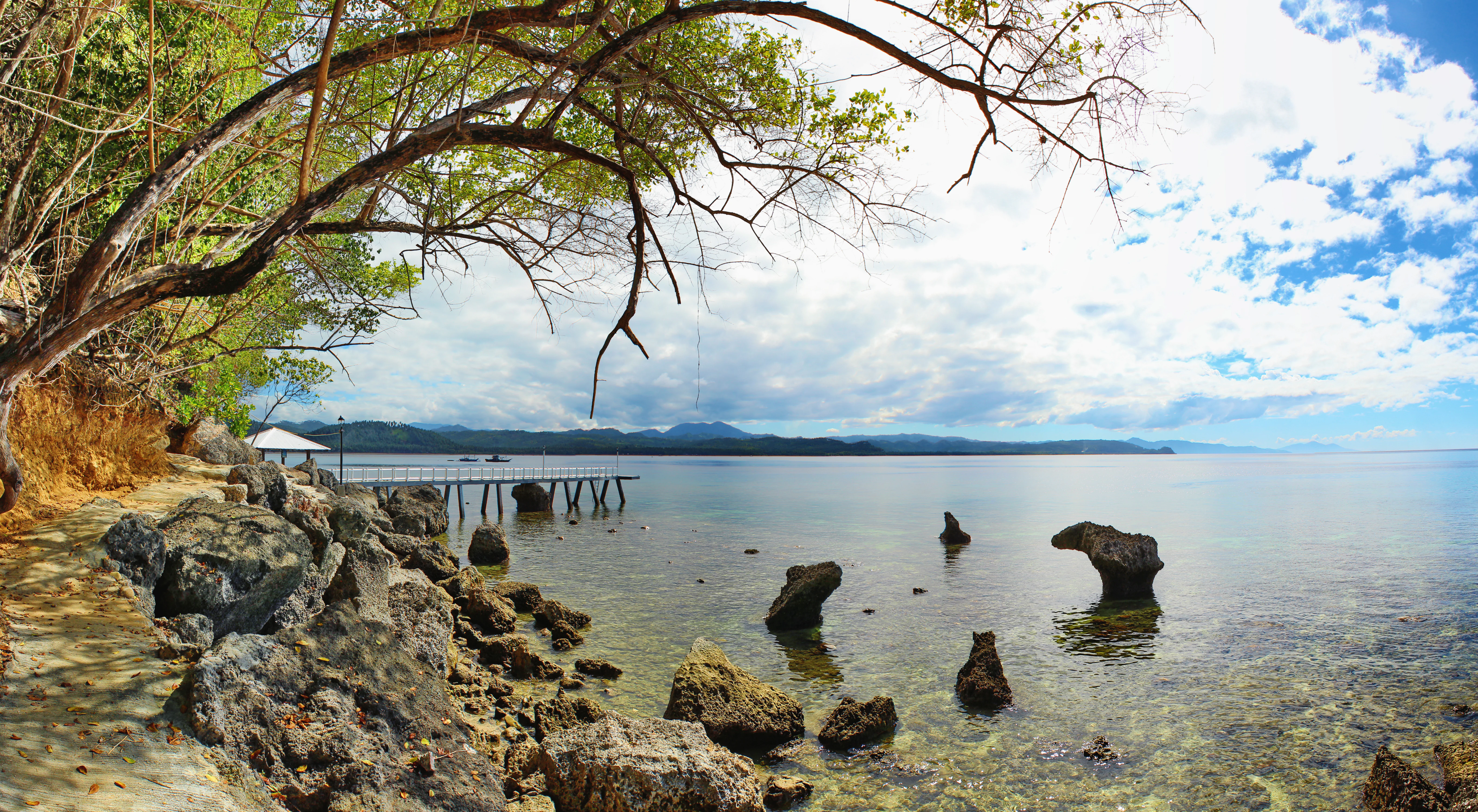
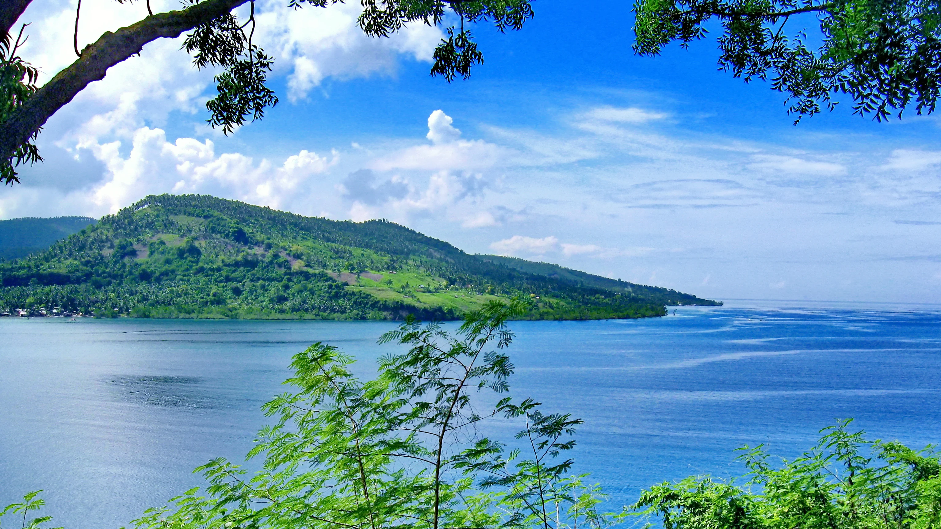
Views from the surrounding roads and elevated points reveal the open water of the bay meeting distant sky, with the Celebes Sea extending beyond the bay's mouth. The interplay between built port environment, municipal coastline, and open marine horizon gives Sarangani Bay a varied visual character, despite its relatively compact geographic scale.
Sarangani Bay ecosystems, habitats, and plant life
Sarangani Bay forms part of the marine and coastal environment of southern Mindanao, where the waters of the Celebes Sea meet Philippine coastline. The bay's designation as a protected seascape under the 2018 Expanded NIPAS Act signals recognition of its ecological value alongside its commercial use.
As a coastal inlet connected to the wider Pacific Ocean system through the Celebes Sea, the bay supports marine ecosystems typical of southern Philippine waters. The combination of busy port activity, nearby municipal coastlines, and protected-area status makes the bay a zone where marine habitats exist in close proximity to human settlement and industry.
The bay's protected seascape status reflects a national-level acknowledgment that southern Mindanao's coastal waters hold conservation significance worth formal preservation, even where active maritime economies continue to operate along the same shores.
Sarangani Bay conservation status and protection priorities
Sarangani Bay gained formal conservation recognition when it was declared a national park in July 2018 under Republic Act No. 11038, the Expanded National Integrated Protected Areas System Act of 2018. This legislation, signed by President Rodrigo Duterte, expanded and updated the Philippines' framework for protecting significant natural areas and explicitly included marine and coastal zones within its scope.
The inclusion of Sarangani Bay within this system reflects the national assessment that the bay's marine and coastal environments hold enough ecological value to merit protected status alongside long-standing terrestrial parks. By recognizing the bay as a protected seascape, the law acknowledged the ecological importance of southern Mindanao's coastal waters while still allowing continued human activity, particularly around the General Santos port area.
The conservation significance of the designation lies in its formal acknowledgment of the bay as more than just a working waterway. As a protected seascape, Sarangani Bay sits within the broader Philippine effort to safeguard representative marine ecosystems and coastal environments through a unified national system of protected areas.
Sarangani Bay cultural meaning and human context
Sarangani Bay has become woven into the administrative and regional identity of southern Mindanao, most visibly through the Province of Sarangani, which was created in 1992 and takes its name directly from the bay. This naming convention reflects how the body of water has long served as a geographic anchor for the surrounding communities and political units along the coast.
The bay's shoreline is shared by General Santos, one of the Philippines' major urban centers, as well as smaller municipalities such as Glan, Alabel, Maasim, and Malapatan. Each of these communities has a relationship with the bay shaped by fishing, local trade, or access to maritime routes, embedding the waterway into everyday economic life across the region.
The bay's 2018 designation as a national park also introduces a contemporary layer of cultural and political meaning, signaling national recognition of the bay's ecological value and tying it into broader Philippine conservation policy. Together, these layers of provincial identity, municipal life, and national policy reflect how thoroughly Sarangani Bay is integrated into the human geography of southern Mindanao.
Top sights and standout views in Sarangani Bay
Sarangani Bay stands out for the unusual combination of intensive maritime use and formal conservation status. The presence of General Santos and its port at the head of the bay gives the waterway a strong economic identity, while its 2018 inclusion in the national protected-area system gives it ecological recognition few busy Philippine bays share.
The bay's regional importance is reflected in the fact that the Province of Sarangani takes its name directly from the water. Its coastline frames multiple municipalities in southern Mindanao, and its connection to the Celebes Sea places it within larger Pacific Ocean circulation. Together, these traits make Sarangani Bay a notable example of a Philippine seascape where shipping, settlement, and protected-area status intersect.
Best time to visit Sarangani Bay
Sarangani Bay lies in southern Mindanao, a region characterized by a generally tropical climate. Because the bay is an active port and a protected seascape rather than a purely recreational site, seasonal conditions matter primarily for coastal scenery, boat activity, and ocean conditions rather than for dramatic seasonal ecological change.
Coastal views along the bay are typically most pleasant during periods of calmer seas, when the open water and distant horizons are most clearly visible from surrounding roads and viewpoints. Travelers interested in photography or scenic appreciation of the bay may prefer quieter marine conditions, while those focused on the working port character of General Santos may find that the bay's atmosphere is consistent year-round due to ongoing shipping activity.
Visitors planning to experience the bay should consider that conditions in southern Mindanao can vary with broader regional weather patterns. The bay's identity as both a working maritime zone and a protected seascape means that the visual and atmospheric experience is shaped as much by the steady presence of port activity as by seasonal weather.