Mori Atlas logo
State or regional parkSaymaluu-Tash State Nature Park

Discover the mapped boundaries and natural terrain of this state nature park in Central Asia.

Saymaluu-Tash State Nature Park: Protected Landscape and Geographic Context in Kyrgyzstan

Saymaluu-Tash State Nature Park represents a key protected landscape within Kyrgyzstan, offering a distinct geographic identity for atlas exploration. This page provides a focused view of the park's location, its mapped protected boundaries, and its integration into the broader regional geography of Central Asia. Understand the park's natural terrain and its significance as a state nature park within the diverse landscapes of Kyrgyzstan.

KyrgyzstanCentral AsiaProtected AreaNature ParkMountain Landscape

Saymaluu-Tash State Nature Park

State or regional park

Park overview

Structured park overview, official facts, and landscape profile for Saymaluu-Tash State Nature Park

Saymaluu-Tash State Nature Park park facts, protected area profile, and essential visitor context

Review the core facts for Saymaluu-Tash State Nature Park, including designation, size, terrain, visitor scale, habitats, and operating context in one park-focused overview.
Protection and recognition

Documenting the terrestrial scope and conservation boundary status within global databases

Saymaluu-Tash State Nature Park Protection Status and Designation Framework

Analyzing the formal designation status of Saymaluu-Tash State Nature Park reveals a dedicated terrestrial protection scope managed within national conservation frameworks. Verifying registered boundaries and protection levels provides essential geographic context for understanding how the remote mountain terrain is classified and preserved.

Protection details

Protection scope
Terrestrial
Transboundary protection
No
Monthly climate preview

Long-term temperature ranges and precipitation patterns across the protected coordinate

Saymaluu-Tash State Nature Park Climate Normals and Monthly Weather Records

Representative coordinates record sustained sub-zero winter temperatures alongside warm summer maximums and measured monthly precipitation norms. Reviewing the comprehensive twelve-month climatology reveals complete annual thermal and moisture cycles for the protected landscape.
Annual mean6 °C
-7 °C19 °C
Jan-7°
Feb-5°
Mar
Apr
May11°
Jun15°
Jul19°
Aug18°
Sep13°
Oct
Nov
Dec-5°
Warmest month
July

18.7 °C

Coolest month
January

-7.4 °C

Wettest month
April

1.5 mm/day

Driest month
September

0.3 mm/day

Park location guide

Geography guide, regional context, and park location map for Saymaluu-Tash State Nature Park

Saymaluu-Tash State Nature Park park geography, regions, and map view in Kyrgyzstan

Understand where Saymaluu-Tash State Nature Park sits in Kyrgyzstan through a broader geographic reading of the surrounding landscape, nearby location context, and its mapped position within the national park landscape.

How Saymaluu-Tash State Nature Park fits into Kyrgyzstan

Kyrgyzstan is a landlocked Central Asian country located in the Tian Shan and Pamir mountain ranges. With a population of approximately 7.4 million, it is bordered by Kazakhstan to the north, Uzbekistan to the west, Tajikistan to the south, and China to the east. The capital and largest city is Bishkek. Ethnic Kyrgyz make up the majority of the population, with significant Uzbek and Russian minorities. The country gained independence from the Soviet Union in 1991.

Wider geography shaping Saymaluu-Tash State Nature Park in Kyrgyzstan

Kyrgyzstan is located in Central Asia, situated in the Tian Shan and Pamir mountain ranges. It is landlocked, bordered by Kazakhstan to the north, Uzbekistan to the west, Tajikistan to the south, and China to the east and southeast. The capital Bishkek lies on the northern border with Kazakhstan.

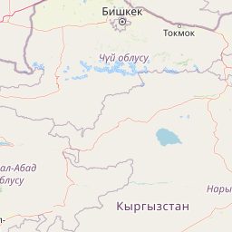
Map view of Saymaluu-Tash State Nature Park

Use this park location map to pinpoint Saymaluu-Tash State Nature Park in Kyrgyzstan, understand its exact geographic position, and read its mapped placement within the surrounding landscape more clearly.

Pigeon | © OpenStreetMap contributors
Park atlas

Explore the surrounding mountain landscapes and protected zones of Central Asia for geographic context and comparative park browsing.

Discover Other National Parks and Protected Areas Near Saymaluu-Tash State Nature Park in Kyrgyzstan

Discover other protected areas and national parks across Kyrgyzstan and the wider Central Asian mountain landscape, extending your journey beyond Saymaluu-Tash State Nature Park. Comparing these regional conservation sites offers vital geographic context, illustrating the distribution of protected zones and diverse terrain throughout this pivotal continental region.
State or regional parkKyrgyzstan
About 36 km away#1 closest

Northwest

Kan-Achuu Nature Park: Kyrgyzstan's State or Regional Protected Landscape

Explore mapped boundaries and regional geography in Central Asia.

Kan-Achuu Nature Park, a designated state or regional park in Kyrgyzstan, offers an opportunity for detailed geographic exploration. This protected area serves as a focal point for understanding the mapped landscape and natural terrain of Central Asia. Engage with its specific protected boundaries and its placement within the country's diverse geography, ideal for atlas-style discovery.

IUCN
II
State or regional parkKyrgyzstan
About 52 km away#2 closest

Southeast

Kara-Shoro State Nature Park: Protected Landscape and Geographic Atlas Context in Kyrgyzstan

Explore its mapped boundaries and regional protected area identity.

Kara-Shoro State Nature Park is a vital protected area situated within the mountainous geography of Kyrgyzstan. This park detail page facilitates a structured exploration of its specific landscape character, mapped terrain, and its significance as a state or regional park within the Central Asian atlas. Understand the park's protected nature and its role in the country's conservation landscape through detailed geographic context.

IUCN
II
Scope
Terrestrial
Nature reserveOsh Region
About 87 km away#3 closest

Southeast

Kulunata State Nature Reserve: Mapping Protected Juniper Forests and Mountain Terrain

Strictly protected nature reserve in the Osh Region of southern Kyrgyzstan

The Kulunata State Nature Reserve stands as a dedicated sanctuary for juniper-conifer woodlands in the Osh Region. Its status as an IUCN Category Ia site reflects a commitment to preserving the genetic diversity of high-altitude forest ecosystems across its two-cluster layout. This resource offers a clear view into its mountain boundaries and the vital role it plays in regional watershed health and landscape stability.

Area
245.1 km²
Established
2004
IUCN
Ia
Relief
Mountain
Nature reserveJalal-Abad Region
About 132 km away#4 closest

West

Ryazan-Say Botanical Zakaznik: Protected Botanical Landscapes in the Jalal-Abad Region

Nature reserve geography and relict plant conservation in Kyrgyzstan

Ryazan-Say Botanical Zakaznik is a concentrated nature reserve dedicated to the survival of rare, relict subtropical flora. The protected area encompasses a narrow, steep-walled gorge system that funnels moisture to sustain species like wild fig and pomegranate. This site provides a critical reference for studying how sheltered mountain canyons maintain ecological diversity within the wider landscape of western Kyrgyzstan.

Area
1.1 km²
Established
1987
IUCN
IV
Relief
Upland
Protected areaKyrgyzstan
About 156 km away#5 closest

Northwest

Alatay State Nature Park Protected Area: Mapped Landscape and Regional Geography

Explore the protected boundaries and geographic context of this Kyrgyz natural landscape.

Alatay State Nature Park is a designated protected area within Kyrgyzstan, contributing to the country's vast network of natural landscapes. This page provides detailed geographic information, emphasizing the park's mapped boundaries and its role within the broader regional context of the Tian Shan mountains. It serves as a crucial point for understanding the park's landscape identity and its atlas-level significance as a protected natural territory in Central Asia.

Access
Access unknown
State or regional parkKyrgyzstan
About 163 km away#6 closest

Southwest

Kyrgyz-Ata State Nature Park: Protected Landscape Atlas and Regional Geography

Discover the mapped terrain and protected area identity within Kyrgyzstan.

Delve into the protected landscape of Kyrgyz-Ata State Nature Park, a state or regional park located in Kyrgyzstan. This page highlights its geographic significance, mapped park boundaries, and its role within the country's natural terrain. Gain a deeper understanding of its protected area status and its context within the broader Central Asian geography.

State or regional parkKyrgyzstan
About 165 km away#7 closest

North

Ala-Archa Nature Park: Kyrgyzstan's State or Regional Protected Landscape Identity

Explore its mapped terrain and geographic context.

Investigate Ala-Archa Nature Park, a distinct protected area situated in the mountainous geography of Kyrgyzstan. This state or regional park offers valuable insight into the mapped natural landscapes and regional context of Central Asia. Understanding its boundaries and geographic character provides a foundation for deeper atlas-based exploration of Kyrgyzstan's protected lands.

Scope
Terrestrial
National parkKyrgyzstan
About 176 km away#8 closest

Northwest

Besh-Tash Nature Park National Park: Mapped Geography and Protected Landscape Identity

Explore the natural terrain and park boundaries in Kyrgyzstan.

Discover Besh-Tash Nature Park, a designated national park located within the mountainous terrain of Kyrgyzstan. This page focuses on its role as a protected landscape, providing insight into its mapped geographic context and regional significance. Understanding Besh-Tash Nature Park involves examining its natural setting and its contribution to conservation efforts in Central Asia, offering a factual atlas perspective for explorers.

Common questions about visiting, size, designation, and location context for Saymaluu-Tash State Nature Park

Saymaluu-Tash State Nature Park FAQs for park facts, access, geography, and protected area context

Find quick answers about Saymaluu-Tash State Nature Park, including protected-area facts, park geography, trail and visitor context, and how the park fits into its surrounding country and regional landscape.
MoriAtlas Explorer

Continue Your Protected Areas Search Across the Global Atlas

Deepen your exploration by continuing the structured search for national parks and protected areas worldwide. Utilize the comprehensive filtering capabilities to compare different conservation landscapes and refine your understanding of global park geography. Discover more about the distribution and characteristics of protected natural areas.

Global natural geography