
Mori Atlas logo
Nature reserveSchellenbergmoor

Understanding the mapped landscape boundaries and ecological corridors of this critical German moorland site.

Schellenbergmoor Nature Reserve: A Detailed Geographic Study of Bavarian Pre-Alpine Peatlands

(Naturschutzgebiet Schellenbergmoor)

Schellenbergmoor represents a vital component of the Bavarian pre-Alpine moorland network, serving as an ecologically significant nature reserve east of Lake Starnberg. The site preserves complex peat-forming processes and provides essential habitat connectivity within the regional Tölzer Moorachse corridor. By studying the terrain, watershed dynamics, and wetland characteristics of this protected area, observers can better understand the unique post-glacial geography of southern Germany.

peatlandbognature reserveNaturschutzgebietpre-Alpine landscapeLake Starnberg region
A stylized vector illustration of a valley featuring jagged mountains, a two-tiered waterfall, and evergreen trees in a meadow.

Schellenbergmoor

Nature reserve

Park overview

Structured park overview, official facts, and landscape profile for Schellenbergmoor

Schellenbergmoor park facts, protected area profile, and essential visitor context

Review the core facts for Schellenbergmoor, including designation, size, terrain, visitor scale, habitats, and operating context in one park-focused overview.

About Schellenbergmoor

Schellenbergmoor is a statutory nature reserve located in the gently rolling pre-Alpine landscape of Upper Bavaria, immediately east of Lake Starnberg. The reserve falls within the administrative area of the district of Bad Tölz-Wolfratshausen and spans parts of two municipalities, Eurasburg and Münsing, both closely associated with the southern Bavarian lake and moor country.

Ecologically, the site belongs to the broader system of pre-Alpine peatlands. The Bavarian pre-Alpine zone, lying between Munich and the rising edge of the Alps, hosts a distinctive suite of bogs, fens, and wet meadows shaped by Quaternary glaciation and subsequent peat accumulation. Schellenbergmoor is one of the sites that preserves a remnant of this habitat pattern, where acidic, waterlogged conditions have favored specialized flora and associated fauna rather than the more productive forest and agricultural land uses that dominate the surrounding region.

The reserve is relatively small, but its position directly east of one of Bavaria's largest lakes, combined with its integration into the Tölzer Moorachse, gives it a clear conservation role. The Tölzer Moorachse gathers multiple moor sites along a north-south corridor in the district, allowing coordinated management of peatland hydrology and habitat quality. Schellenbergmoor functions as one node within this broader wetland network.

In administrative geography, the reserve lies near a major transport corridor: the Bundesautobahn 95 runs to the east of the area, while Lake Starnberg lies to the west. Despite this proximity to infrastructure, the protected status established in 1987 has aimed to keep the moorland's hydrology and vegetation intact. Renaturation efforts have also been documented for the site, indicating ongoing work to restore peat-forming conditions that may have been altered by past drainage or land use.

Quick facts and research context for Schellenbergmoor

Protected area type: Naturschutzgebiet (statutory nature reserve) in Bavaria. Location: eastern shore area of Lake Starnberg, municipalities of Eurasburg and Münsing, district of Bad Tölz-Wolfratshausen, Upper Bavaria. Year of designation: 1987. Regional context: part of the Tölzer Moorachse, a corridor of connected moor sites in the pre-Alpine zone. Hydrology: drained westward to Lake Starnberg via the Grenzgraben and Kuglmühlbach, and eastward to the Loisach via the Schindergraben and Habichtgraben. Management focus: peatland conservation, with documented renaturation activity under Bavarian forestry and nature conservation programs.

Protection and recognition

Examine the official protection metrics, designated boundaries, and recorded international status.

Schellenbergmoor Protection Status and Documented Conservation Designations

Examine the verified protection status, management scope, and official records associated with Schellenbergmoor. Structured data outlines the documented designation history and administrative baseline without assuming unverified conservation outcomes.

Protection details

WDPA ID
82517
Park context

Deeper park guide and search-rich context for Schellenbergmoor

Schellenbergmoor history, landscape, wildlife, and travel context

Explore Schellenbergmoor through its history, landscape character, ecosystems, wildlife, conservation priorities, cultural context, and seasonal travel timing in a structured park guide built for atlas discovery and search intent.

Why Schellenbergmoor stands out

Schellenbergmoor is best known as a protected pre-Alpine peatland (moor) and as one of the constituent reserves of the Tölzer Moorachse, the chain of moor sites that runs through the landscape east of Lake Starnberg. The site represents the kind of small but ecologically significant raised and transitional bog habitat that has become increasingly rare in southern Germany's densely settled pre-Alpine lowlands.
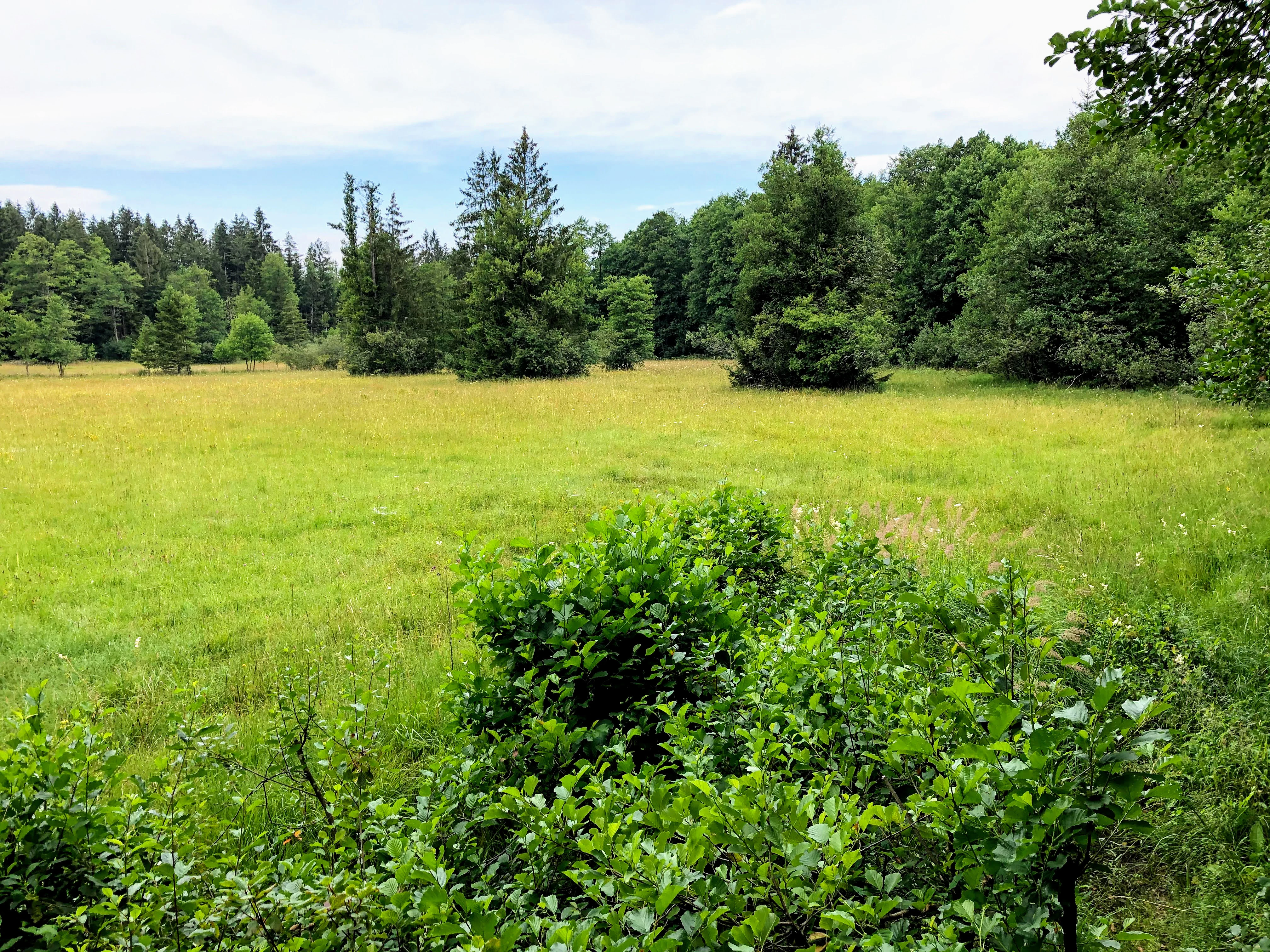
A wide, grassy meadow landscape featuring scattered spruce and deciduous trees under a light overcast sky.
A view of the open meadow and surrounding forest at Schellenbergmoor in Bavaria.

Schellenbergmoor history and protected-area timeline

Schellenbergmoor was placed under statutory nature protection in 1987, when it was officially designated as a Naturschutzgebiet under Bavarian nature conservation law. The designation formalized long-standing recognition of the site as part of the pre-Alpine peatland landscape east of Lake Starnberg.

The reserve sits within the Tölzer Moorachse initiative, a regional effort to connect and coordinate conservation across multiple moor sites in the Bad Tölz-Wolfratshausen district. More recently, renaturation work has been undertaken on the site, reflecting contemporary Bavarian nature conservation practice that increasingly emphasizes active restoration of degraded peatland hydrology rather than passive protection alone. Detailed historical milestones beyond these points are not documented in the available source material.

Schellenbergmoor landscape and geographic character

The landscape of Schellenbergmoor is shaped by its position in the Bavarian pre-Alpine hill and moorland zone, a transitional area between the moraine-rich lowlands south of Munich and the rising foothills of the Alps. Topographically, the area lies on the eastern side of the Starnberger See basin, on terrain that combines gentle swells and shallow depressions typical of formerly glaciated landscapes.

The defining surface feature is the peatland itself: a mosaic of bog and wet habitat where peat has accumulated over millennia under waterlogged, acidic conditions. Viewsheds include open moorland transitioning into the wooded surroundings typical of the region, with Lake Starnberg forming a major landscape anchor to the west. To the east, the route of the A95 autobahn marks a clear modern edge to the wider setting.

Drainage patterns are an essential part of the landscape: water moves westward toward Lake Starnberg via the Grenzgraben and the Kuglmühlbach (which originates within the reserve area), and eastward via the Schindergraben and Habichtgraben toward the Loisach river. These two opposing drainage directions reflect the subtle watershed character of the moorland and influence peat formation, vegetation, and the ecological dynamics of the site.

Schellenbergmoor ecosystems, habitats, and plant life

Schellenbergmoor represents a fragment of the pre-Alpine peatland ecosystem that once extended more broadly across this part of Bavaria. The site's ecological character is defined by waterlogged, nutrient-poor, acidic conditions that support bog-specific plant communities rather than the more productive mixed forests and meadows of the surrounding lowlands.

Within the regional context, the reserve belongs to a network of moor sites linked by the Tölzer Moorachse, which collectively aim to preserve the functional connectivity of peatland habitats. The site's hydrology, with water flowing both toward Lake Starnberg and toward the Loisach, supports peat-forming processes that are central to its ecological value. Renaturation efforts suggest that past drainage or land-use impacts are being addressed to restore more natural peat accumulation and water retention.

The surrounding landscape of mixed forest, small lakes, and agricultural land creates an ecological interface between the protected bog and more intensively used land, underlining the importance of the reserve as a refugium for peatland species in an otherwise heavily modified regional environment.

Schellenbergmoor wildlife and species highlights

The available source material does not provide specific information on the fauna of Schellenbergmoor, and detailed wildlife content cannot be responsibly generated from this source.

Schellenbergmoor conservation status and protection priorities

Schellenbergmoor's conservation significance lies primarily in its role as a protected peatland within the Bavarian pre-Alpine region, where intact moor ecosystems have become rare due to historical drainage and land-use change. Since 1987, the site has been formally protected as a Naturschutzgebiet, giving it the strongest level of statutory protection available for terrestrial nature reserves in Germany.

The reserve's integration into the Tölzer Moorachse gives it added conservation value, as it is not managed in isolation but as part of a chain of peatland sites designed to maintain habitat connectivity and coordinated hydrological management across the district. This corridor approach reflects the modern German conservation principle that fragmented small sites can collectively deliver more for biodiversity when treated as a network.

In addition to designation, the site has been the subject of renaturation work under Bavarian forestry and nature conservation programs. Such projects typically aim to rewet drained peatland, restore Sphagnum-dominated bog vegetation, and rebuild the carbon-storing and water-retention functions of the peat system, aligning Schellenbergmoor with broader European peatland conservation goals.

Schellenbergmoor cultural meaning and human context

The available source material does not provide meaningful cultural or human-context content beyond the administrative facts that the reserve spans the communities of Eurasburg and Münsing and is part of the regional peatland network. Detailed cultural content cannot be responsibly generated from this source.

Top sights and standout views in Schellenbergmoor

Compact nature reserve protecting pre-Alpine peatland on the eastern margin of Lake Starnberg. Designated in 1987 and integrated into the regional Tölzer Moorachse corridor of moor sites. Defines a transitional bog landscape between Starnberger See and the Loisach drainage system. Subject of active renaturation work to restore peat-forming hydrology. Located in the densely settled yet ecologically distinctive Bavarian pre-Alpine zone south of Munich.

Best time to visit Schellenbergmoor

The available source material does not provide meaningful seasonal or visit-timing guidance, and detailed best-time-to-visit content cannot be responsibly generated from this source.
Monthly climate preview

Long term monthly averages for temperature and precipitation rhythm in Bavaria

Schellenbergmoor Climate Normals and Measured Annual Temperature Patterns

Recorded baseline measurements for Schellenbergmoor show a wide thermal range alongside shifting monthly precipitation levels across the representative coordinate. Reviewing the complete twelve month profile provides deeper insight into the local climate normals and long term weather patterns.
Annual mean8 °C
-1 °C18 °C
Jan-1°
Feb
Mar
Apr
May13°
Jun16°
Jul18°
Aug18°
Sep13°
Oct
Nov
Dec
Warmest month
July

18 °C

Coolest month
January

-1.2 °C

Wettest month
June

4.6 mm/day

Driest month
February

2 mm/day

Park location guide

Geography guide, regional context, and park location map for Schellenbergmoor

Schellenbergmoor park geography, regions, and map view in Germany

Understand where Schellenbergmoor sits in Germany through a broader geographic reading of the surrounding landscape, nearby location context, and its mapped position within the national park landscape.

How Schellenbergmoor fits into Germany

Germany is a federal republic in Western and Central Europe with a population of over 83 million across sixteen constituent states. It is Europe's largest economy by nominal GDP and a major global exporter and importer. The capital is Berlin, and the country borders Denmark, Poland, Czech Republic, Austria, Switzerland, France, Luxembourg, Belgium, and the Netherlands.

Wider geography shaping Schellenbergmoor in Germany

Germany is located in Western and Central Europe, spanning 357,022 km². It borders Denmark to the north, Poland and the Czech Republic to the east, Austria and Switzerland to the south, and France, Luxembourg, Belgium, and the Netherlands to the west. The country has coastlines on the Baltic Sea and North Sea to the north, with the Alps located in the southern region.

Map view of Schellenbergmoor

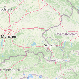
Use this park location map to pinpoint Schellenbergmoor in Germany, understand its exact geographic position, and read its mapped placement within the surrounding landscape more clearly.

Pigeon | © OpenStreetMap contributors

Location context for Schellenbergmoor

Bavaria

Visual reference guide showing the terrain, wetland habitats, and protected moorland character.

Schellenbergmoor Photos and Landscape Scenery: Protected Pre-Alpine Peatland Views

Visual documentation captures the rare pre-Alpine peatland vegetation and waterlogged terrain characteristic of Schellenbergmoor. Photographic records reveal the wetland mosaic and specialized bog habitats preserved within the Upper Bavaria regional reserve network.

A wide, grassy meadow landscape featuring scattered spruce and deciduous trees under a light overcast sky.

Park atlas

Compare adjacent pre-Alpine reserves and connected wetland landscapes across Upper Bavaria

Explore Parks Near Schellenbergmoor and Protected Areas in the Surrounding Region

Browse nearby national parks and protected areas sharing the distinctive pre-Alpine moorland terrain of Upper Bavaria. Compare adjacent peatland reserves to understand the regional conservation network stretching across the Lake Starnberg landscape.
A horizontal watercolor illustration showing a winding stream moving through a flat marshy landscape with scattered trees and distant rolling hills.
Nature reserveBavaria
About 45 km away#1 closest

North

Schwarzhölzl Nature Reserve: Protected Lowland Peatland and Forest Geography in Bavaria

Essential protected area map and habitat overview

Schwarzhölzl is a specialized nature reserve in Bavaria protecting a rare mosaic of peat birch forest, bog pines, and wet meadows. As an ecological remnant of the vast Dachauer Moos, this site provides a deep look into the lowland wetland terrain and the specific conservation landscape managed within the Munich green belt. Explore the mapped boundaries and structural geography of this significant protected lowland site.

Area
0.795 km²
Established
1994
Relief
Lowland
Climate
Temperate
Nature reserveBavaria
About 47 km away#2 closest

Southwest

Naturwald Kramer Nature Reserve: Protected Alpine Forest Boundaries in Bavaria

Mapping natural forest dynamics across the Ammergauer Alps

Naturwald Kramer represents a major forest protection zone in the Bavarian Alps. This area spans a rugged vertical mosaic of mountain mixed forests and snow heath pine woodlands on dolomite bedrock, providing essential insight into non-intervention forestry and diverse alpine mountain terrain.

Area
15.91 km²
Established
2020
IUCN
IV
A watercolor painting showing a panoramic view of soft mountain ridges and evergreen forests flanking a winding valley stream.
Nature reserveOberbayern
About 47 km away#3 closest

Southwest

Schachen und Reintal: A Protected Alpine Landscape in the Wetterstein Mountains

Geographic atlas and nature reserve mapping for Oberbayern

Spanning from the Zugspitzplatt to the rugged Jubiläumsgrat, Schachen und Reintal serves as a vital nature reserve in the Bavarian Alps. The area preserves a wide topographical gradient of limestone terrain, river-carved gorges, and pristine forests, providing an essential look at the protected high alpine geography of the Wetterstein range.

Area
39.636 km²
Established
1970
IUCN
IV
Nature reserveOberbayern
About 48 km away#4 closest

South

Naturwaldreservat Wettersteinwald: Protected Nature Reserve and Alpine Forest Geography

Oberbayern, Germany; subalpine forest conservation and limestone mountain terrain

Uncover the ecological structure of Naturwaldreservat Wettersteinwald, one of the oldest nature forest reserves in the Bavarian Alps. Located on steep Wetterstein limestone, the area encompasses a compact mosaic of spruce and stone pine, protecting essential habitat for rare saproxylic beetle species within its defined 42 hectare boundaries.

Area
0.426 km²
Established
1978
Relief
Mountain
Climate
Alpine
A horizontal watercolor painting showing a range of light-colored, jagged mountain peaks in the background with a green coniferous forest and a small body of water in the foreground.
Nature reserveTyrol
About 51 km away#5 closest

South

Arnspitze Group Nature Reserve: Mapped Limestone Ridge and Alpine Geography

A historic protected massif in the Austrian Tyrol.

The Arnspitze Group represents a vital limestone ridge ecosystem within the Northern Limestone Alps. This nature reserve, spanning the border region, displays significant karst formations and forested slopes. Gain insight into the ridge layout, summit heights, and the protected status that defines this essential Tyrolean mountain chain through detailed map-based discovery.

Area
12.5 km²
Established
1942
Relief
Mountain
Climate
Alpine
A pale, minimalist watercolor illustration of layered mountain silhouettes in the background and a green, forested foreground.
Nature reserveTyrol
About 77 km away#6 closest

Southeast

Kaiser Mountains Nature Reserve: Alpine Limestone Landscapes and Regional Geography in Tyrol

A comprehensive look at the Wilder Kaiser and Zahmer Kaiser ridges

The Kaiser Mountains stand as a monumental feature within the Northern Limestone Alps. This nature reserve offers a unique geographic profile, from sheer, pale Wetterstein limestone walls to broad alpine pastures and pine-covered ridges. Its radial drainage patterns and self-contained massif structure provide an essential case study for understanding the diverse mountain terrain that defines the heart of the Austrian Tyrol.

Area
102 km²
Established
1963
Relief
Mountain
Climate
Alpine
Watercolor illustration of a lush natural ravine with a small cascading waterfall, surrounded by green forest slopes and distant rolling hills.
Nature reserveBavaria
About 86 km away#7 closest

West

Rohrbachtobel im Wirlinger Forst Nature Reserve and Bavarian Pre-Alpine Forest Geography

Mapped protected gorge landscapes and molasse geology in the Oberallgäu district

Rohrbachtobel im Wirlinger Forst offers a unique look at small-scale protected landscapes in Germany. This nature reserve features a dramatic stream-cut gorge and serves as a natural habitat for diverse plant species, including European yew and multiple orchid varieties, within the wider context of the Bavarian pre-Alpine forest zone.

Area
0.14 km²
Established
1959
Relief
Upland
Scope
Terrestrial
A horizontal watercolor illustration depicting a soft, atmospheric landscape with marshy ground, scattered evergreen trees, and distant hills.
Nature reserveLandkreis Oberallgäu
About 88 km away#8 closest

West

Schönleitenmoos im Wierlinger Forst Protected Nature Reserve and Allgäu Bog Landscape

Raised bog geography on the Rhine-Danube watershed in Germany.

Schönleitenmoos im Wierlinger Forst is a compact nature reserve characterized by its well-preserved raised bog sequence and post-glacial origins. This site in the Oberallgäu district is essential for studying peatland vegetation zones and the rare occurrence of the rust-leaved alpine rose outside the high Alps, offering a detailed perspective on Bavarian landscape formation.

Area
0.23 km²
Established
1960

Common questions about visiting, size, designation, and location context for Schellenbergmoor

Schellenbergmoor FAQs for park facts, access, geography, and protected area context

Find quick answers about Schellenbergmoor, including protected-area facts, park geography, trail and visitor context, and how the park fits into its surrounding country and regional landscape.
MoriAtlas Explorer

Continue Your Protected Areas Search Across the Global Atlas

Deepen your exploration by continuing the structured search for national parks and protected areas worldwide. Utilize the comprehensive filtering capabilities to compare different conservation landscapes and refine your understanding of global park geography. Discover more about the distribution and characteristics of protected natural areas.

Global natural geography