
Mori Atlas logo
State or regional parkSetiu Wetlands State Park

Analyzing the interconnected river basins, lagoon systems, and diverse swamp forest habitats

Setiu Wetlands State Park: A Comprehensive Geographic Atlas of Terengganu Coastal Protected Landscapes

(Taman Negeri Setiu Wetlands)

Setiu Wetlands State Park encompasses 23,000 hectares of vital coastal terrain in Terengganu, forming the largest natural wetland system on the east coast of Peninsular Malaysia. The landscape showcases a rare confluence of nine distinct ecosystems, ranging from brackish lagoons and mangrove fringes to extensive Melaleuca swamp forests. This geographic analysis traces the hydrological connections between the Setiu, Chalok, and Merang river basins that sustain this complex mosaic of marine, estuarine, and freshwater environments.

wetlandscoastal lagoonmangrovespeat swampMelaleuca forestbrackish water
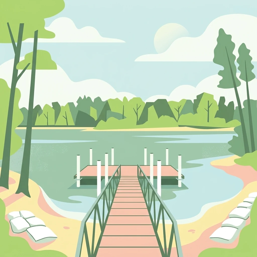
A digital illustration of a wooden pier reaching into calm water, surrounded by trees and a sandy shoreline under a light blue sky.

Setiu Wetlands State Park

State or regional park

Park overview

Structured park overview, official facts, and landscape profile for Setiu Wetlands State Park

Setiu Wetlands State Park park facts, protected area profile, and essential visitor context

Review the core facts for Setiu Wetlands State Park, including designation, size, terrain, visitor scale, habitats, and operating context in one park-focused overview.

About Setiu Wetlands State Park

Setiu Wetlands State Park is one of the most ecologically complex coastal protected areas in Malaysia. Set along the South China Sea in Terengganu, the wetland stretches roughly 26 km in length and reaches about 1.5 km at its widest section, forming a broad corridor of interconnected habitats from coastal lowlands inland toward the forested hills, including Mount Tebu. The park sits within the Setiu River basin and is part of a larger combined wetland network that links the Setiu, Chalok, Bari, and Merang rivers.

What makes Setiu unusual at a national level is the sheer range of ecosystems compressed into a single landscape. Within the 23,000 hectare wetland, sea, beach, mudflat, lagoon, estuary, river, sand islands, coastal forest, and mangrove forest all coexist. This is highlighted in conservation literature as a defining feature of the site: in Malaysia, only Setiu district offers all nine of these interconnected ecosystems in one place. The result is a landscape where freshwater, brackish, and saltwater environments blend, supporting rich transitions between terrestrial, estuarine, and marine habitats.

Beyond its ecological value, Setiu is a working landscape. Local communities along the lagoon are deeply involved in aquaculture, including brackish water cage culture, pond culture, pen culture, and oyster farming, and the lagoon is one of Malaysia's most important sources of grouper and oyster seed. Traditional food industries such as budu (fermented fish sauce), fish crackers, dried anchovies, and belacan (shrimp paste) are produced in surrounding villages, and small-scale boat building remains a local craft. Recognizing the importance of balancing these livelihoods with conservation, the Terengganu government designated the wetland as the state's first state park in 2018, formalizing protection while opening the door to structured ecotourism, research, and education.

Quick facts and research context for Setiu Wetlands State Park

Setiu Wetlands State Park lies in Setiu District, Terengganu, on the east coast of Peninsular Malaysia, less than an hour from the state capital Kuala Terengganu. The protected wetland covers approximately 23,000 hectares and forms part of the larger Setiu-Chalok-Bari-Merang basin wetland complex.

The park protects a chain of freshwater, brackish, and marine habitats along a 14 km lagoon system, including peat swamp, Melaleuca forest, mangroves, seagrass beds, sand islands, and sandy beaches. It is administered by the Terengganu State Park Management Council and has been listed as a state park since 2018.

Protection and recognition

Documented conservation scope, established year, and recognition details

Setiu Wetlands State Park Protection Status and Designation History

Setiu Wetlands State Park features a documented mixed protection status established in the year 2018. Structured records outline the official designation history and administrative scope without imported international recognition sources.

Protection details

Protection scope
Mixed
Designated year
2018
Transboundary protection
No
Park context

Deeper park guide and search-rich context for Setiu Wetlands State Park

Setiu Wetlands State Park history, landscape, wildlife, and travel context

Explore Setiu Wetlands State Park through its history, landscape character, ecosystems, wildlife, conservation priorities, cultural context, and seasonal travel timing in a structured park guide built for atlas discovery and search intent.

Why Setiu Wetlands State Park stands out

Setiu is best known as the largest natural wetland on the east coast of Peninsular Malaysia, and for being one of the very few places in the country where nine interconnected ecosystems meet in a single continuous landscape. It is particularly distinguished by its vast Gelam (Melaleuca) swamp forest, its 14 km brackish lagoon, and the unusual combination of mangrove, peat swamp, seagrass, and beach systems. The wetland is also recognized as a key nesting ground for endangered freshwater and marine turtles, including the painted terrapin and the green sea turtle, and as the only other known location for a large colony of the orchid Papilionanthe hookeriana. Its size, ecological diversity, and cultural link to coastal fishing communities give it a profile that stands out among Malaysia's coastal protected areas.
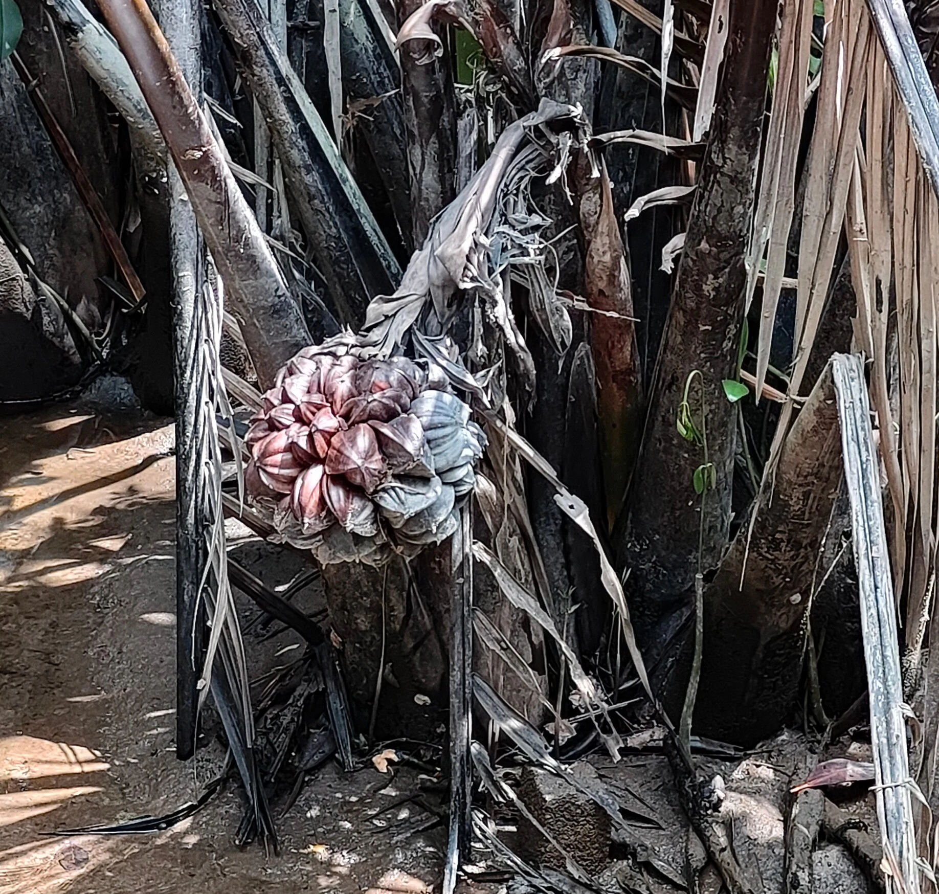
A close-up view of a mature, spherical, segmented Nipa palm fruit growing among dark, fibrous palm trunks and dried leaves.
The distinctive fruit of a Nipa palm, Nypa fruticans, found within the Setiu Wetlands.

Setiu Wetlands State Park history and protected-area timeline

For generations before formal protection, Setiu Wetlands functioned as a working coastal landscape relied on by local fishing and aquaculture communities. The lagoon served as a natural harbour for fishing boats, and surrounding villages built enduring industries around grouper, oysters, freshwater and saltwater fish, and traditional seafood products such as budu, belacan, and fish crackers. Wetland-dependent crafts using nipah and kercut grass also became part of the local economy and identity.

Scientific and conservation interest in the area developed strongly over the late twentieth and early twenty-first centuries. Between 1993 and 2003, WWF-Malaysia operated a Turtle and Marine Conservation Centre in the wetland in partnership with the Department of Fisheries. In July 2005, expanded WWF-Malaysia work began to support broader sustainable management of the site, integrating biodiversity protection, wise resource use, and community engagement. The Government of Terengganu subsequently announced its intention to gazette the wetland as the first state park in the state in 2015, citing the area's biological diversity, its environmental importance, and its potential for ecotourism.

An initial protected area of around 400 hectares marked the early phase of the state park development. On 10 May 2018, the Terengganu State Government officially declared Setiu Wetlands as the state's first state park, named Setiu Wetlands State Park, formalizing a long-term framework for conservation, research, and carefully managed public access to the wetland.

Setiu Wetlands State Park landscape and geographic character

The physical landscape of Setiu Wetlands is defined by its long, low-lying coastal corridor that runs inland from the South China Sea. Along the seaward edge, sandy beaches and exposed mudflats give way to a 14 km brackish lagoon bordered by sand islands and shifting sediment banks. Inland, the terrain transitions through estuarine mudflats, river floodplain, and increasingly vegetated swamp forest before rising gently into the forested hills of western Setiu, including Mount Tebu.

The wetland is shaped by the convergence of several river systems. The Setiu River basin forms the backbone of the landscape, joined by the Chalok, Bari, and Merang basins to create a continuous lagoon-and-river mosaic. This hydrological structure produces wide stretches of open water interspersed with narrow channels, sand flats, and forested islands. Patches of higher peat ground, waterlogged Gelam flats, and mangrove fringes add further topographic variety.

Throughout the wetland, vegetation strongly influences how the landscape reads visually. Open lagoon views alternate with dense mangrove walls, the ghostly pale trunks of Melaleuca swamp forest, nipa palm stands along tidal riverbanks, and sharper coastal forest edges near the sandy shoreline. The result is a layered coastal landscape where water, sediment, and forest are in constant visual and ecological dialogue.
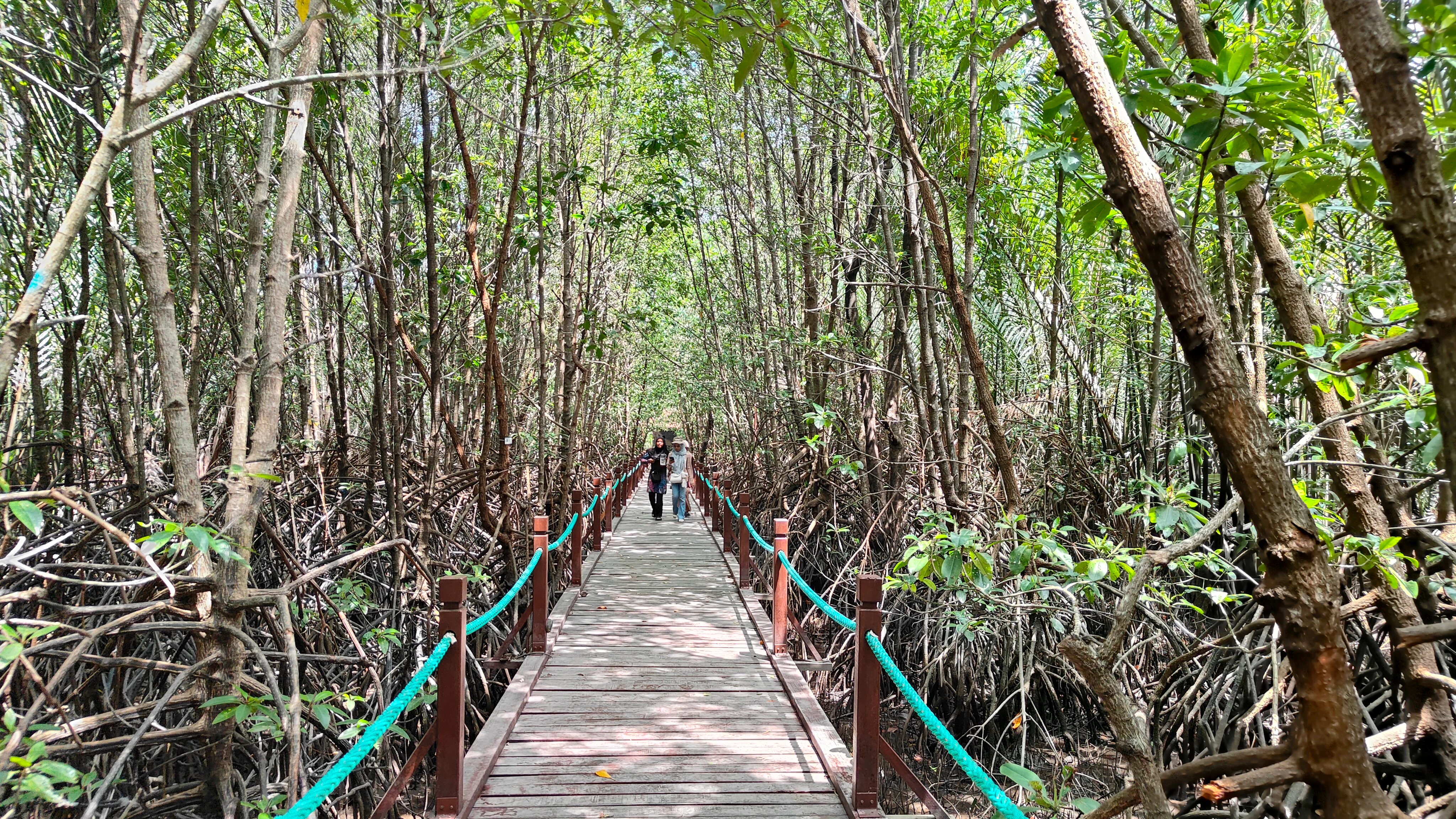
A narrow wooden boardwalk path stretches straight through a thick, lush green mangrove forest, with thin tree trunks surrounding the path and turquoise railings on both sides.
A wooden boardwalk winding through the dense mangrove forest at Setiu Wetlands State Park.

Setiu Wetlands State Park ecosystems, habitats, and plant life

Setiu Wetlands is notable as one of the most ecologically diverse wetland complexes in Peninsular Malaysia, packing an unusually high number of distinct habitat types into a single site. The vegetation layers include riparian forest along riverbanks, peat swamp, mixed mangrove forest, and stands dominated by individual mangrove genera such as Bruguiera, Rhizophora, Avicennia, and Lumnitzera. Above these saline and brackish systems, the lowland core of the wetland is dominated by Melaleuca, locally known as Gelam or paperbark tea-tree, a rare formation in Malaysia that gives the area a distinctive silvery-trunked swamp forest character.

Freshwater swamp forest and nipa palm forest widen the habitat range inland from the coast, while seagrass beds extend the ecological system into the shallow marine zone. The combination of these habitats creates broad ecological transitions, with mangroves grading into nipa fringe, nipa giving way to freshwater swamp, and freshwater swamp yielding to upland coastal forest. Such layered transitions are comparatively rare in Malaysian wetlands and are central to the area's ecological identity.

The connectivity between these systems gives Setiu particular importance for species that depend on multiple habitat types across a single life cycle. Freshwater, brackish, and saltwater influences overlap across short distances, allowing fish, reptiles, and invertebrates to exploit different environments without leaving the broader wetland. This functional connectivity is a defining part of the park's natural value and underpins its role as a regional biodiversity hotspot.
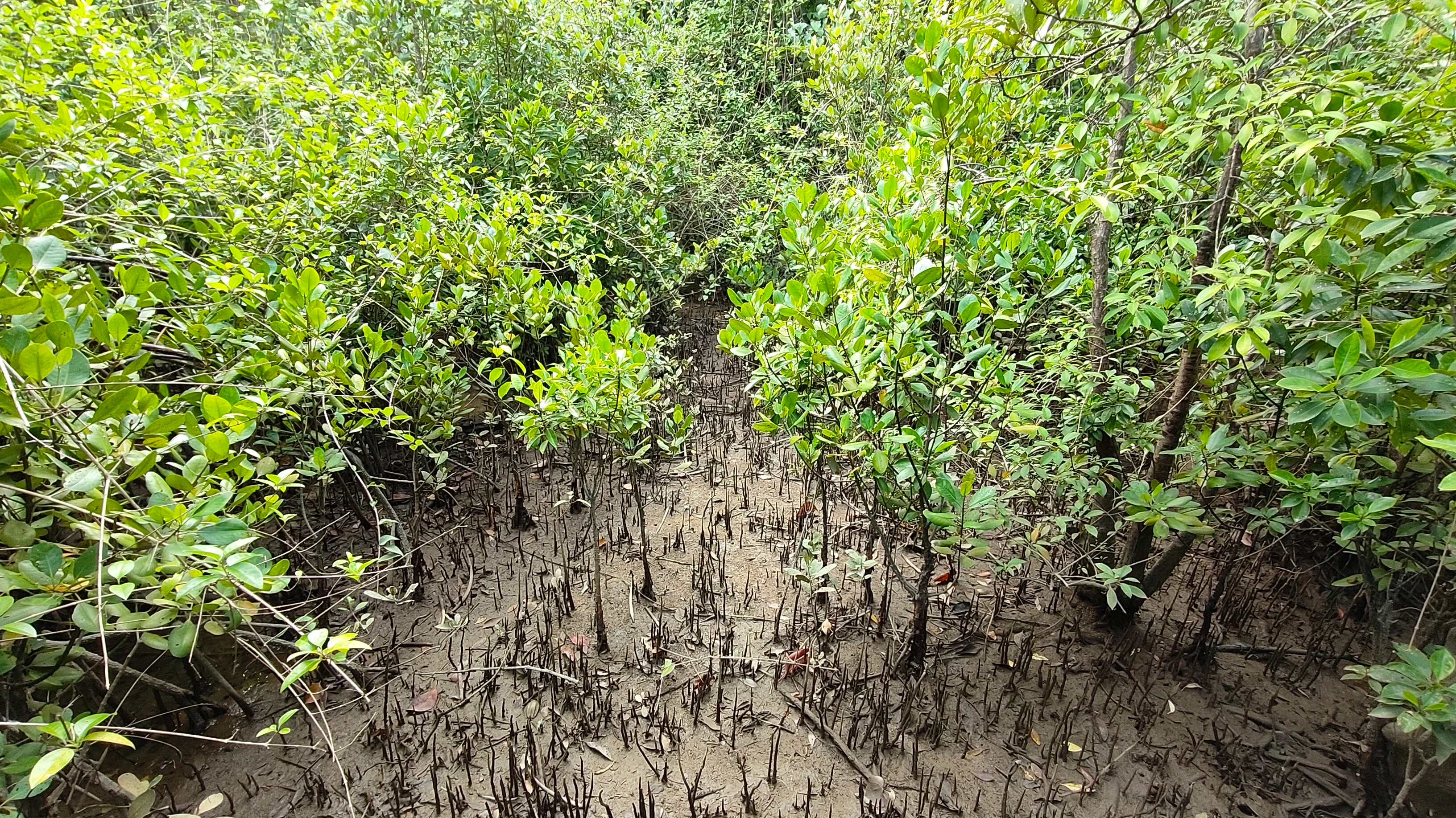
A close-up view of a mangrove forest with numerous dark, thin root structures, known as pneumatophores, rising from the muddy ground beneath bright green foliage.
Mangrove pneumatophores extending from the mud in a dense section of the Setiu Wetlands.

Setiu Wetlands State Park wildlife and species highlights

The wildlife profile of Setiu Wetlands reflects the unusual overlap of freshwater, brackish, and marine habitats that defines the site. Surveys have recorded 29 mammal species, 161 bird species, and 36 reptile and amphibian species within the wetland complex. Around 37 fish species have been identified, roughly half freshwater and the remainder saltwater species that enter the lagoon to reproduce, illustrating the strong tidal and seasonal connection between sea and river.

Setiu is particularly important for reptiles and marine turtles. The sandy riverbanks and sand islands along the Setiu River host key nesting populations of the endangered southern river terrapin (Batagur affinis) and the painted terrapin (Batagur borneoensis). The adjacent coastline is also an important landing site for green sea turtles (Chelonia mydas), and olive ridley turtles have been recorded on surrounding beaches. These turtle and terrapin populations have made Setiu a focal site for long-running turtle and marine conservation work.

Marine invertebrate life is similarly diverse, with annelids, nematodes, polychaetes, gastropods, bivalves such as clams, oysters, and mussels, and mangrove-associated crustaceans all well represented. The park is also botanically distinctive for wildlife in a broader sense: it is one of only two known locations for a large colony of the endangered orchid Papilionanthe hookeriana, and researchers have documented a new variety of the pitcher plant Nepenthes rafflesiana within its swamps.
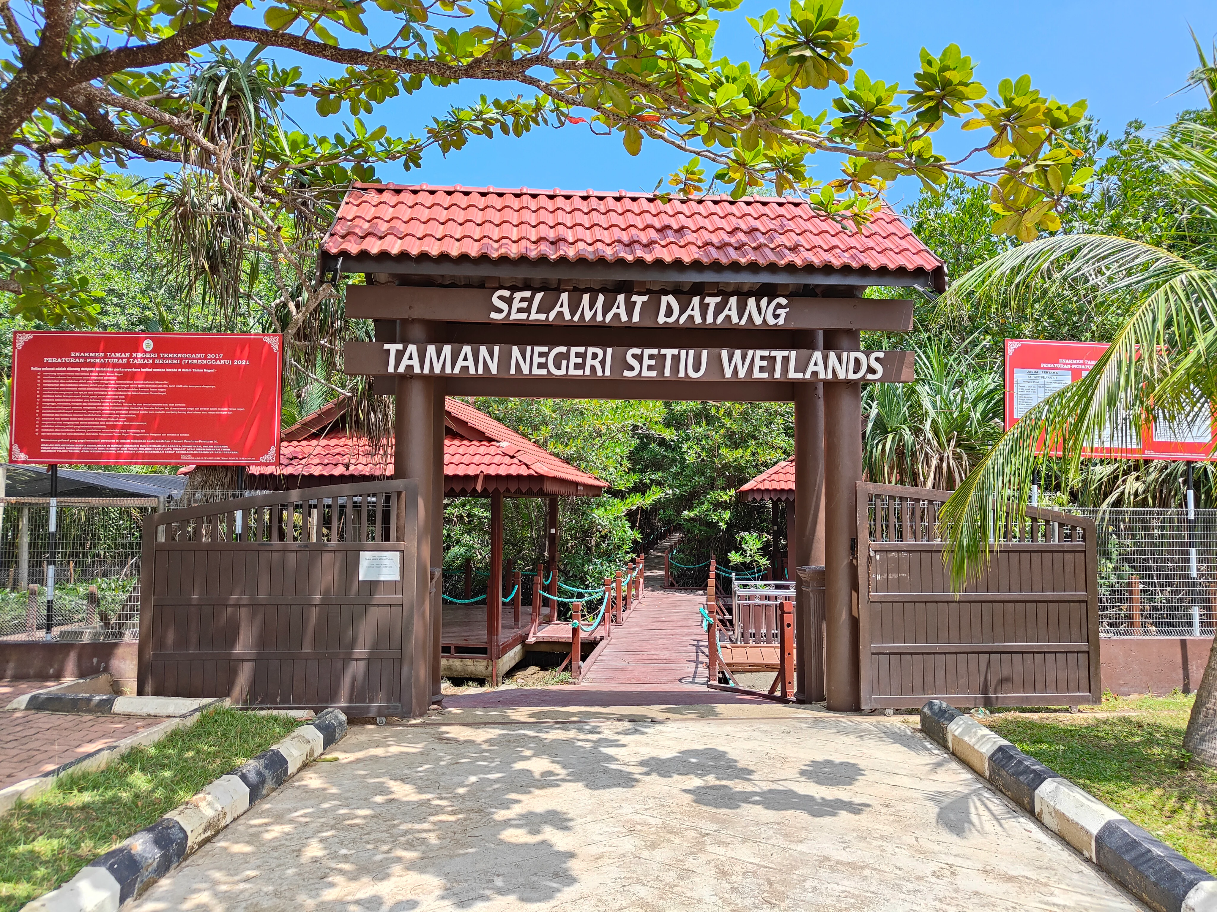
A brown wooden arched gate with a red tiled roof spans a path, featuring signage that reads Selamat Datang Taman Negeri Setiu Wetlands. Red information boards are visible on either side of the entrance gate, set against a backdrop of green trees.
The main entrance to Setiu Wetlands State Park in Terengganu, Malaysia.

Setiu Wetlands State Park conservation status and protection priorities

The conservation significance of Setiu Wetlands rests on its scale, its habitat diversity, and the strategic position it holds within the larger Setiu-Chalok-Bari-Merang basin wetland complex. As the largest natural wetland on the east coast of Peninsular Malaysia, it preserves a chain of freshwater, peat swamp, mangrove, lagoon, and marine habitats under a single protected designation, an unusual combination that gives the park substantial regional value for biodiversity conservation.

Several nationally and globally significant species are concentrated within the wetland, including the painted terrapin, southern river terrapin, and green sea turtle, all of which are endangered and depend on the area's sandbanks, sand islands, and sandy beaches for nesting. The presence of the orchid Papilionanthe hookeriana, otherwise restricted largely to the Kinta Valley in Perak, adds further conservation weight, as does the discovery of unique pitcher plant varieties in the swamp habitats.

Long-running conservation engagement has shaped the site's modern profile. WWF-Malaysia's Turtle and Marine Conservation Centre operated in the wetland between 1993 and 2003 in partnership with the Department of Fisheries, and a renewed project launched in July 2005 broadened the focus to sustainable wetland management, biodiversity protection, and community participation. The 2018 designation as Terengganu's first state park formalized this conservation direction, providing an institutional framework that integrates habitat protection, scientific research, and structured ecotourism while recognizing the continuing socio-economic importance of the wetland for surrounding communities.

Setiu Wetlands State Park cultural meaning and human context

Setiu Wetlands has long been central to the identity and livelihoods of the communities along the Setiu coastline. The lagoon functions as both an economic engine and a cultural anchor, supporting brackish water cage culture, pond culture, pen culture, and oyster farming, and serving as a natural harbour for fishing boats from villages surrounding the wetland.

Traditional food production is deeply tied to the landscape. Locally produced delicacies include budu (a fermented fish sauce distinctive to the east coast of Peninsular Malaysia), fish crackers, dried anchovies, and belacan (shrimp paste), along with fish-based dishes such as satar and fish balls. Small-scale boat building and the weaving of handicrafts from kercut grass and nipah palm reflect how wetland resources have shaped household and village economies for generations.

The cultural relationship with the wetland also shapes contemporary conservation thinking in the park. Local communities remain heavily dependent on fisheries and aquaculture, and efforts to develop the state park as an ecotourism destination, including wildlife cruises, guided beach patrols for nesting turtles and terrapins, and boardwalk experiences through the swamp forest, are framed not as a replacement of local culture but as a way to extend its economic and ecological future.

Top sights and standout views in Setiu Wetlands State Park

The Setiu Wetlands State Park stands out as the largest natural coastal wetland on the east coast of Peninsular Malaysia, encompassing roughly 23,000 hectares of interconnected freshwater, peat swamp, mangrove, lagoon, and marine habitats. Its 14 km brackish lagoon, backed by extensive Gelam swamp forest and fringed by mangroves, creates a landscape of unusual ecological density.

Among its most distinctive features are its role as a critical nesting ground for endangered painted terrapins, river terrapins, and green sea turtles, the presence of the rare orchid Papilionanthe hookeriana, and the unique convergence of nine connected ecosystems within a single district. Combined with a strong cultural heritage of fishing, aquaculture, and traditional craft, these qualities give Setiu a profile that bridges ecological conservation and lived local tradition.

Best time to visit Setiu Wetlands State Park

Setiu's tropical coastal climate gives it a relatively stable year-round character, but the seasons meaningfully shape the experience of the wetland. The drier months, generally from around March to September, tend to bring calmer lagoon conditions, clearer access along the beaches, and more predictable conditions for observing turtle landings and terrapin nesting activity along the riverbanks and sand islands.

The wetter monsoon months, often from November to February, bring heavier rainfall, higher lagoon levels, and rougher coastal conditions, which can limit some shoreline activities but also refresh the swamp forest and intensify the wetland's visual character. Birding, mangrove exploration along the boardwalk, and boat-based viewing of the lagoon can be rewarding across much of the year, while turtle and terrapin activity peaks tend to align with the warmer, drier part of the annual cycle.
Monthly climate preview

Long-term temperature ranges and monthly precipitation averages across representative park coordinates

Setiu Wetlands State Park Climate Normals and Annual Weather Patterns

Historical climate records from 1991 to 2020 outline sustained annual temperatures alongside distinct seasonal precipitation peaks at Setiu Wetlands State Park. Analyzing the full twelve-month profile reveals detailed long-term averages for average minimum and maximum temperatures across every month.
Annual mean25 °C
24 °C27 °C
Jan24°
Feb24°
Mar25°
Apr26°
May27°
Jun26°
Jul26°
Aug26°
Sep26°
Oct25°
Nov25°
Dec24°
Warmest month
May

26.5 °C

Coolest month
January

23.9 °C

Wettest month
November

18.6 mm/day

Driest month
February

2.9 mm/day

Park location guide

Geography guide, regional context, and park location map for Setiu Wetlands State Park

Setiu Wetlands State Park park geography, regions, and map view in Malaysia

Understand where Setiu Wetlands State Park sits in Malaysia through a broader geographic reading of the surrounding landscape, nearby location context, and its mapped position within the national park landscape.

How Setiu Wetlands State Park fits into Malaysia

Malaysia is a federal constitutional monarchy located in Southeast Asia. The country consists of 13 states and three federal territories, divided by the South China Sea into Peninsular Malaysia on the Indochinese Peninsula and East Malaysia on the island of Borneo. With a population of over 34 million, it achieved independence from Britain in 1957 and became a modern federation in 1963. The country is recognized for its multicultural population, tropical climate, and significant economic role in the region.

Wider geography shaping Setiu Wetlands State Park in Malaysia

Malaysia occupies a strategic position in Southeast Asia, split by the South China Sea into two distinct regions. Peninsular Malaysia lies on the Indochinese Peninsula, sharing a land border with Thailand to the north and maritime borders with Singapore, Vietnam, and Indonesia. East Malaysia occupies the northern portion of Borneo, sharing land borders with Brunei and Indonesia, and maritime borders with the Philippines and Vietnam. The country's terrain includes coastal plains, mountain ranges such as the Titiwangsa in the peninsula, and extensive tropical rainforests.

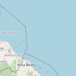
Map view of Setiu Wetlands State Park

Use this park location map to pinpoint Setiu Wetlands State Park in Malaysia, understand its exact geographic position, and read its mapped placement within the surrounding landscape more clearly.

Pigeon | © OpenStreetMap contributors

Location context for Setiu Wetlands State Park

Terengganu

Visualizing coastal lagoons, Melaleuca swamp forests, and interconnected marine habitats

Setiu Wetlands State Park Photos and Mapped Landscape Scenery

Visual records reveal the diverse terrain of Setiu Wetlands State Park, documenting brackish lagoons, tidal mudflats, and dense mangrove fringes. Examining these protected area photographs clarifies how nine distinct ecosystems converge within a single continuous coastal landscape.

A close-up view of a mature, spherical, segmented Nipa palm fruit growing among dark, fibrous palm trunks and dried leaves.

A panoramic photograph of a calm lagoon in Setiu Wetlands State Park, featuring a wooden jetty in the center extending into the water, with a dense forested shoreline in the background.

A narrow wooden boardwalk path stretches straight through a thick, lush green mangrove forest, with thin tree trunks surrounding the path and turquoise railings on both sides.

A close-up view of a mangrove forest with numerous dark, thin root structures, known as pneumatophores, rising from the muddy ground beneath bright green foliage.

A brown wooden arched gate with a red tiled roof spans a path, featuring signage that reads Selamat Datang Taman Negeri Setiu Wetlands. Red information boards are visible on either side of the entrance gate, set against a backdrop of green trees.

A close-up view looking down into a muddy mangrove habitat at a small dark red crab and a spiral snail shell partially submerged in shallow water.

Park atlas

Compare adjacent coastal landscapes and regional nature reserves

Explore Parks Near Setiu Wetlands State Park and Surrounding Protected Areas

Browse protected areas and national parks near Setiu Wetlands State Park to examine related coastal ecosystems and regional wetland corridors. Extending the geographical comparison provides broader context on the varied terrain, conservation landscapes, and habitat networks of the surrounding region.
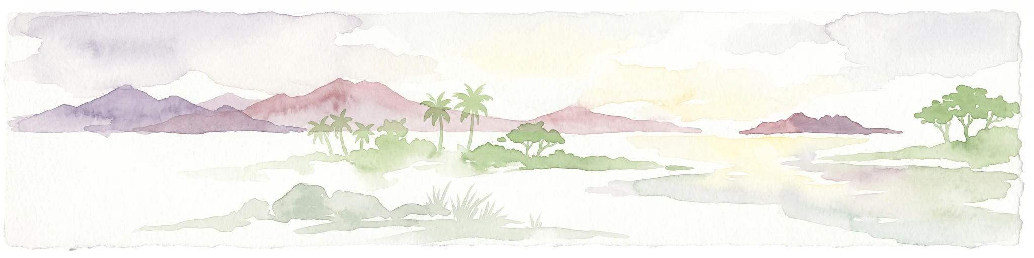
A watercolor painting showing a stylized, panoramic view of layered purple and pink mountains in the background with soft green forests and grassy plains in the foreground.
Marine protected areaTerengganu
About 22 km away#1 closest

Northeast

Lang Tengah Island Marine Protected Area: Geography, Reefs, and Island Terrain

A tranquil protected landscape in the Terengganu archipelago

Lang Tengah Island represents a significant marine protected area defined by its dense forested interior and surrounding coral reef ecosystems. Located within the Terengganu marine region, the island offers a unique study of protected coastal geography, seasonal turtle nesting grounds, and undisturbed tropical marine environments separated from more developed nearby archipelagos.

Area
1.3 km²
Relief
Lowland
Climate
Tropical
Access
Moderate access
An illustrative style image of a dramatic mountain valley featuring cliffs, two waterfalls, and a forested foreground at sunset.
Marine protected areaTerengganu
About 27 km away#2 closest

North

Perhentian Islands Marine Protected Area: Terengganu Coastal and Archipelago Geography

Mapped marine boundaries and tropical island terrain

An immersive look at the Perhentian Islands, a protected nine-island archipelago in the South China Sea. Analyze the distinct marine geography, from fringing coral reefs and shallow reef flats to the forested inland hills of Perhentian Besar and Perhentian Kecil. This overview provides spatial context for one of Malaysia's most recognizable marine environments, emphasizing the protected status of its surrounding waters and reef habitats.

Area
15.955 km²
Established
1994
Relief
Lowland
Climate
Tropical
A watercolor painting of a tropical island coastline with palm trees, green vegetation, rocks in the foreground, and distant purple mountains under a soft light.
Marine protected areaTerengganu
About 35 km away#3 closest

East

Redang Island Marine Protected Area: Coastal Terrain and Reef Ecosystems

Geographic atlas of the Terengganu island archipelago

Redang Island is a prominent marine protected area within the South China Sea, characterized by its forested interior, sheltered bays like Teluk Dalam, and expansive coral reef systems. As a key ecological site off the Terengganu coast, the island provides a unique study in island geography and marine conservation, offering detailed insights into the protected reef environments and coastal morphology of Peninsular Malaysia.

Area
24.2 km²
Relief
Upland
Climate
Tropical
Access
Moderate access
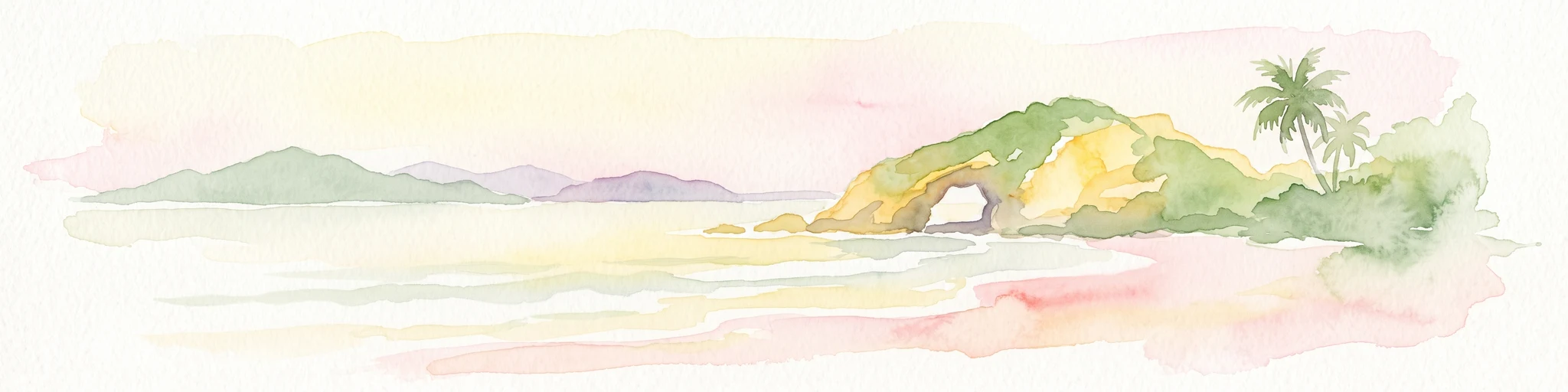
A soft-toned watercolor painting of a tropical island beach with a natural rock arch formation and palm trees.
Protected areaTerengganu
About 79 km away#4 closest

Southeast

Kapas Island: A Detailed Geographic Overview of the Protected Terengganu Coastal Landscape

Topography, Marine Protection Zones, and Island Geography

Kapas Island offers a focused look at the intersection of coastal geography and conservation management. This small archipelago features a tropical jungle core and protected sandy perimeters, providing a clear map of local reef health and coastal biodiversity in the Terengganu region of Malaysia.

Area
1.5 km²
Relief
Lowland
Climate
Tropical
Access
Easy access
National parkPahang
About 111 km away#5 closest

South

Taman Negara National Park: Pahang Protected Area with Mapped Boundaries for Geographic Discovery

Explore the unique landscape context within Pahang, Malaysia.

Delve into Taman Negara National Park, a significant protected area situated in Pahang, Malaysia. This detailed view highlights the park's mapped boundaries and its contribution to the regional geography. Understand the protected landscape and its place within the natural terrain of Peninsular Malaysia, essential for atlas-based geographic exploration.

Area
4,343 km²
Established
1938
IUCN
II
Relief
Mixed relief
Protected areaTerengganu
About 144 km away#6 closest

Southeast

Tenggol Island: A Geographic Overview of Terengganu's Protected Tropical Marine Landscape

Mapping reefs, forest interior, and regional maritime terrain

Tenggol Island stands as a distinct protected area off the coast of Terengganu, defined by its sharp 272-meter forested peak and complex underwater topography. This overview provides data on its coastal bays, rocky points, and fringing reef zones, offering a clear understanding of the island's unique position within the East Coast of Peninsular Malaysia's marine geography.

Area
2.62 km²
Relief
Upland
Climate
Tropical
Access
Moderate access
National parkNarathiwat Province
About 149 km away#7 closest

Northwest

Budo, Su-ngai Padi National Park: Protected Tropical Rainforest Geography

Explore mapped boundaries and mountain landscapes in Southern Thailand.

Budo, Su-ngai Padi National Park is a critical protected area safeguarding one of Thailand's last significant tracts of intact tropical rainforest. Situated within the rugged Budo mountain range of Narathiwat Province, its landscape is defined by dense evergreen forests, steep terrain, and numerous waterfalls. This national park offers substantial geographic context for understanding conservation landscapes and regional terrain in peninsular Thailand, serving as a valuable addition to any atlas exploration.

Area
341 km²
Established
1999
IUCN
II
Relief
Mountain
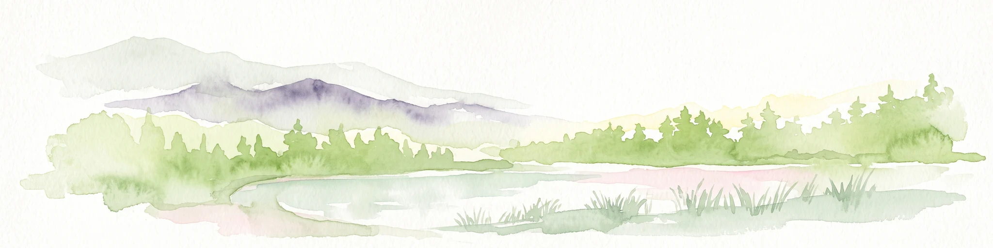
A watercolor painting showing a quiet lakeside scene with dense green forests in the background and soft, purplish mountains rising behind them.
State or regional parkPerak
About 152 km away#8 closest

West

Belum-Temengor: Ancient Rainforest Complex and Protected Landscape Geography in Perak

Mapping the forest ridges and lake archipelago of the northern Malay Peninsula

Spanning over 130 million years of ecological history, Belum-Temengor represents a massive, continuous block of tropical rainforest. The terrain transitions from high-altitude hill forests in the north to the flooded valleys and forested islands of Tasik Temengor. This complex serves as a vital water catchment and a sanctuary for diverse flora and fauna within the broader mountainous geography of the Perak region.

Area
1,175 km²
Established
2007
Relief
Mountain
Climate
Tropical

Common questions about visiting, size, designation, and location context for Setiu Wetlands State Park

Setiu Wetlands State Park FAQs for park facts, access, geography, and protected area context

Find quick answers about Setiu Wetlands State Park, including protected-area facts, park geography, trail and visitor context, and how the park fits into its surrounding country and regional landscape.
MoriAtlas Explorer

Continue Your Protected Areas Search Across the Global Atlas

Deepen your exploration by continuing the structured search for national parks and protected areas worldwide. Utilize the comprehensive filtering capabilities to compare different conservation landscapes and refine your understanding of global park geography. Discover more about the distribution and characteristics of protected natural areas.

Global natural geography