Mountain saddles
Browns Gap
792 m

A detailed look at terrain, elevation ranges, and physical geography across the park landscape.
Examine the technical geography and spatial dimensions of Shenandoah National Park, located within the state of Virginia. This structured profile maps the park across 811.176 square kilometers, featuring diverse mountain terrain, forested valleys, and peaks reaching a maximum elevation of 1235 meters. Explore recorded boundaries and primary physical features within this temperate forest ecosystem.
Mountain wilderness along Virginia's Blue Ridge
Shenandoah National Park preserves a dramatic stretch of Virginia's Blue Ridge Mountains, protecting a long and narrow corridor of forested ridgeline that runs approximately 105 miles from Front Royal in the northeast to Waynesboro in the southwest. The park sits astride the drainage divide between the Shenandoah River basin to the west and the James and Rappahannock River basins to the east, with local relief exceeding 3,000 feet in some locations. Nearly 40 percent of the park's 200,000-acre expanse has been designated as wilderness, offering some of the most extensive backcountry hiking and solitude opportunities in the eastern United States. Established in 1935 after a contentious period of land acquisition that displaced numerous mountain communities, the park represents both a remarkable conservation achievement and a complex chapter in regional history.
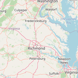
Regional and national placement within the United States of America
Interactive boundary geometry and derived area metrics
Explore recorded mountain relief and internal natural features.
Mountain saddles
792 m
Viewpoints
Streams
Streams
Viewpoints
Streams
Interpreting forest cover, mountain relief, and major water features
Mountains · Valleys · Hills · Forest · Rivers · Waterfalls · Volcano
Temperate broadleaf forest · Temperate coniferous forest · Riverine habitat
Mapped Protected Landscapes and Regional Context Around Shenandoah National Park
Southwest

High elevation ridge terrain in Nelson County, Virginia.
Priest Wilderness stands as a signature protected area in the Blue Ridge Mountains, defined by a dramatic 3,000 foot vertical gain and dense, mature hardwood forests. This documentation maps the rugged ridge and hollow topography that characterizes one of the most significant wilderness sections along the central Appalachian trail corridor.
West
Explore mountain ridges, river valleys, and wilderness corridors in Virginia.
Covering one of the largest public forest blocks in the eastern United States, George Washington and Jefferson National Forests offer a unique look at the central Appalachian mountain terrain. The area includes extensive wilderness tracts, the Appalachian Trail corridor, and significant geological landmarks like the Breaks gorge. Analyze the protected landscape boundaries and topographic features that define this major regional watershed and forest network.

West
Examining wilderness boundaries and mountain stream geography in Virginia
Located in western Virginia, Ramseys Draft Wilderness is a federal protected area characterized by its extreme vertical relief and rugged Appalachian topography. Spanning from the main crest of Shenandoah Mountain to the valley floor, this wilderness serves as a vital corridor for high-elevation forest ecosystems, native brook trout, and neotropical migrant birds.
Southwest
Protected cove hardwood forest in western Virginia
Rich Hole Wilderness represents a protected high quality forest landscape located within the James River Ranger District. This area spans steep, narrow hollows and high ridge crests, providing critical habitat and showcasing old growth timber specimens. Use this resource to understand the park terrain, drainage patterns, and its position within the broader Appalachian forest network of western Virginia.

Southwest
Geographic overview of mountain wildlands and boulder fields
Spanning over 8,900 acres, James River Face Wilderness serves as a vital protected area within the Appalachian mountain chain. The landscape contains steep creek drainages, vertical ridgelines, and significant geological formations such as the Devils Marbleyard, offering a comprehensive study of central Virginia's complex forest ecosystems and rugged mountain terrain.

West
Mapping West Virginia wilderness and mountain terrain
Monongahela National Forest protects nearly one million acres of the central Appalachian Mountains. This massive federally managed landscape is defined by the Allegheny Front, the highest peak in the Allegheny range at Spruce Knob, and iconic geological formations like Seneca Rocks. The region represents a vital intersection of climate, hydrology, and biodiversity in the eastern United States, housing eight distinct wilderness areas and complex high-altitude ecosystems.
Southwest
Remote wildlife reserve in western Virginia
Spanning over 9,000 acres, Rough Mountain Wilderness provides a rare example of undisturbed Appalachian forest. The area is characterized by consistently steep slopes, sharp ridgeline topography, and a deep sense of isolation within the George Washington and Jefferson National Forests of western Virginia.
West
Mapped terrain of summits, cliffs, and river corridors
Spruce Knob-Seneca Rocks National Recreation Area stands as a unique protected landscape in eastern West Virginia. This area connects the high-elevation spruce forests of Spruce Knob with the vertical quartzite cliffs of Seneca Rocks and the remote depths of Smoke Hole Canyon. It remains a primary example of Appalachian high-country geography, offering a dense concentration of distinct natural features within the Monongahela National Forest.
Delve deeper into the atlas context of Shenandoah National Park by examining its specific protected-area boundaries and regional geographic setting. Understanding this park's landscape and its place within Virginia's natural terrain provides valuable insight for structured geographic discovery. Continue your exploration of this significant US national park's mapped features.